
漢德百科全書 | 汉德百科全书
 国际城市
国际城市


 历史
历史
 重要港口
重要港口

Alexandria oder Alexandrien (altgriechisch Ἀλεξάνδρεια Alexándreia, nach Alexander dem Großen; arabisch الإسكندرية al-Iskandariyya; koptisch: Ⲣⲁⲕⲟϯ Rakoti bzw. ⲁⲗⲉⲝⲁⲛⲇⲣⲓⲁ Aleksandria) ist mit über fünf Millionen Einwohnern (Stand 2023) und einer Ausdehnung von 32 Kilometern entlang der Mittelmeerküste nach Kairo die zweitgrößte Stadt Ägyptens und die insgesamt größte ägyptische Stadt mit direktem Zugang zum Mittelmeer. Sie besitzt den größten Seehafen des Landes, an dem etwa 80 % des ägyptischen Außenhandels abgewickelt werden. Als bedeutender Industriestandort wird sie über Pipelines mit Erdöl und Erdgas aus Suez versorgt.
Alexandria wurde 331 v. Chr. vom Makedonen Alexander dem Großen an der Stelle der altägyptischen Siedlung Rhakotis gegründet und unter Ptolemaios II. zwischen 285 und 247 v. Chr. fertiggestellt. Die Stadt, Residenz der Ptolemäer, entwickelte sich rasch zu einem der wichtigsten Zentren der hellenistischen Welt sowie später des römischen und frühbyzantinischen Ägypten. Sie war nach dem Ende der Ptolemäer Hauptstadt der römischen Provinz Aegyptus, in der Spätantike dann der Dioecesis Aegypti. Das antike Alexandria war vor allem für seinen Leuchtturm (Pharos), eines der sieben Weltwunder der Antike, und für seine Große Bibliothek bekannt.
Nach der Islamischen Eroberung Ägyptens 641 n. Chr. und mit der Gründung von Kairo verlor die Stadt ihre Bedeutung. Anfang des 19. Jahrhunderts zu einem vom Hinterland abgeschnittenen Fischerdorf herabgesunken, gelang Alexandria dank dem Bau des Mahmudiyakanals und dem Aufblühen des lukrativen ägyptischen Baumwollhandels der Wieder-Aufstieg zu einem wichtigen internationalen Handelszentrum.
Im Hafen von Alexandria finden seit 1994 unterwasserarchäologische Untersuchungen statt, durch die neue Erkenntnisse zur Vorgängersiedlung Rhakotis und zur ptolemäischen Epoche gewonnen werden konnten.
亚历山大[1][2](阿拉伯语:الإسكندرية,罗马化:al-Iskandarīyah,发音:[al.ʔiskanˈdarijja];埃及阿拉伯语:اسكندرية,罗马化:Eskenderiyya,发音:[eskendeˈɾejjæ];希腊语:Ἀλεξάνδρεια,罗马化:Alexándreia;英语:Alexandria),又译亚历山太和亚历山大里亚,汉时称为乌迟散[3], 埃及第二大城市、亚历山大省省会,也是地中海沿岸最大城市,阿拉伯世界第四大城市及非洲第九大城市。其地理位置为北纬31°12',东经29°15',离开罗西北208千米。尼罗河多支的、现已干枯的入海口位于亚历山大东19千米处,古城克诺珀斯的遗迹就在那里。今天亚历山大有约334万居民。
亚历山大是按其奠基人亚历山大大帝命名的,它是托勒密王朝的首都,很快就成为古希腊文化中最大的城市。在西方古代史中其规模和财富仅次于罗马。虽然埃及的伊斯兰教统治者在奠定了开罗为埃及的新首都后亚历山大的地位不断下降。但在十九世纪末期,亚历山大跃升为世界主要的船运及交易中心之一,蓬勃的棉花业与连接红海和地中海地区的优越地理位置带给这个城市丰厚的利润。
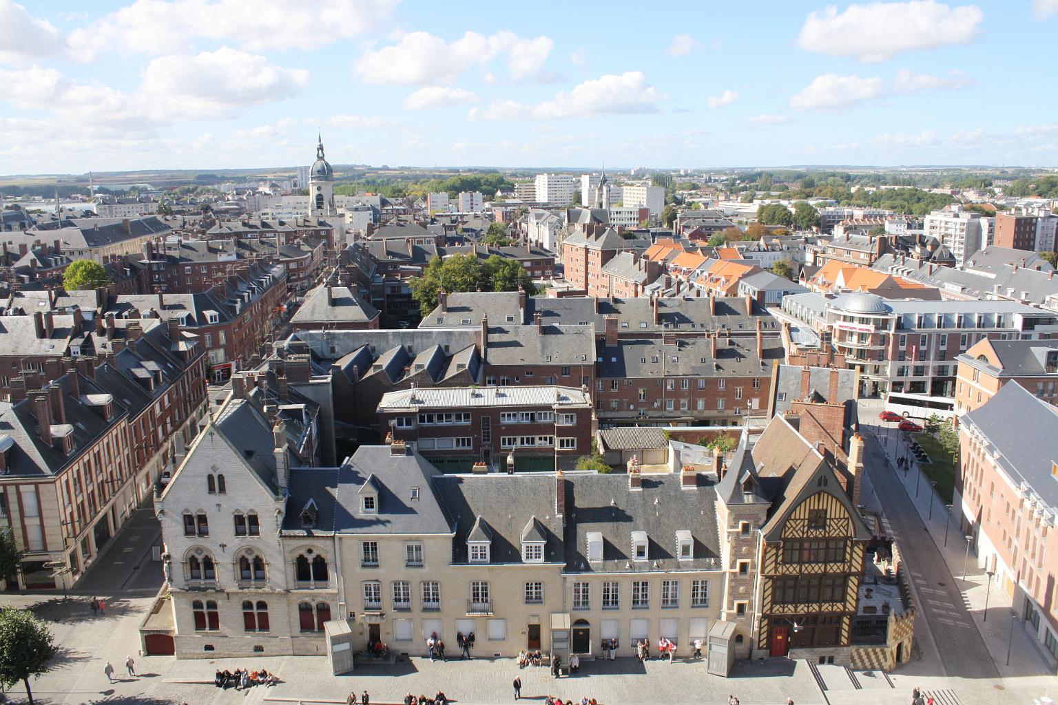
 上法兰西大区
 罗马人建立的城市

亚松森(西班牙语:Asunción,西班牙语发音:[asunˈsjon])是巴拉圭首都,人口约525,252人(2016年),位于南纬25.2667°,西经57.6667°。亚松森位于巴拉圭河左岸,是巴拉圭的主要港口和工业、文化中心,工业主要有食品工业、纺织工业和烟草工业。
Asunción [asunˈθi̯ɔn, lateinamerikanisch asunˈsi̯ɔn] ist die Hauptstadt und mit rund 525.000 Einwohnern (Stand 2016) zugleich größte Stadt des Staates Paraguay in Südamerika. Ihr Name (spanisch für Aufnahme, Himmelfahrt) steht für Mariä Himmelfahrt, ihr voller Name lautet La Muy Noble y Leal Ciudad de Nuestra Señora Santa Maria de la Asunción. Der Ballungsraum Asunción hat rund 1,9 Millionen Einwohner. Ihre Bezeichnung in der Landessprache Guaraní ist Paraguay (nicht zu verwechseln mit Paraguái, dem Landesnamen auf Guaraní).
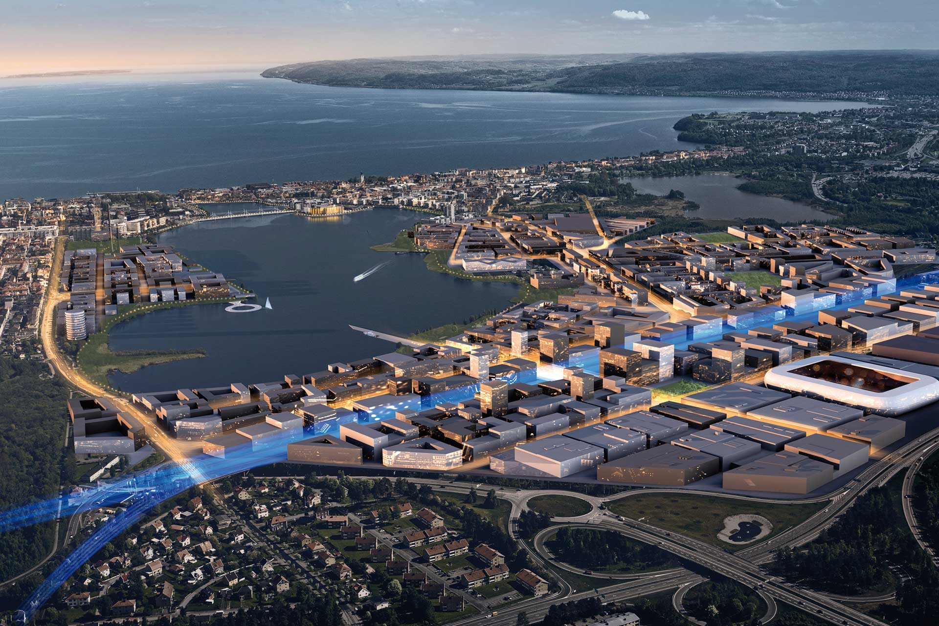
 假期和旅游
假期和旅游


Yantai, Stadt in der Provinz Shandong (Ostchina) und Hochseehafen im Norden der Halbinsel Shandong am Golf von Bo Hai. Die Wirtschaft ist geprägt vom Fischfang, der Nahrungsmittelverarbeitung sowie der Herstellung von Eisen, Stahl und Maschinen. Yantai wurde 1863 als Vertragshafen eröffnet. Durch das Abkommen von Yantai wurden 1876 viele zusätzliche chinesische Häfen für den Außenhandel geöffnet. Die Bedeutung der Stadt nahm nach 1898 ab, als Qingdao zum Hafen ausgebaut wurde. In den fünfziger Jahren wurde eine Eisenbahnverbindung nach Qingdao fertig gestellt. Die Einwohnerzahl beträgt etwa 1 681 000.(Quelle:http://de.encarta.msn.com/encyclopedia_761562616/Yantai.html)

 滑雪旅游
滑雪旅游
 犹他州
犹他州

Salt Lake City [ˌsɔːlt leɪ̯k ˈsɪɾi] ist die Hauptstadt des US-Bundesstaates Utah und mit 199.723 Einwohnern (Census 2020) auch die größte Stadt des Staates. Im Ballungsraum leben über 1,25 Millionen Menschen. Salt Lake City ist County Seat (Verwaltungssitz) des Salt Lake Countys.
Die Stadt wurde 1847 von Mormonen gegründet. Auch heute noch gilt die Stadt als Zentrum der Kirche Jesu Christi der Heiligen der Letzten Tage.
盐湖城(英语:Salt Lake City,或简称SLC、Salt Lake),是美国犹他州的首府和最大城市,以紧靠大盐湖而得名。
 建筑艺术
建筑艺术
 文化遗产
文化遗产


Yangzhou wird auch die Stadt der Kunst und des Salzes genannt. Es ist eine der attraktivsten Städte in Ostchina. Am besten lässt sich der Ort zu Fuß, mit dem Bus oder mit dem Fahrrad erkunden. Nur so lernt man das eigentliche Flair von Yangzhou kennen.
Geschichte der Stadt Yangzhou
Yangzhou (chinesisch 揚州市 / 扬州市, Pinyin Yángzhōu Shì) ist eine bezirksfreie Stadt in der chinesischen Provinz Jiangsu. Sie liegt am Fluss Jangtsekiang. Ihr Verwaltungsgebiet hat eine Fläche von 6.591 km² und knapp 4,5 Millionen Einwohner (Stand: Ende 2010).
Yangzhou liegt etwa 70 km von Nanjing entfernt. Früher war es ein wichtiger Knotenpunkt für den Salzhandel. Durch seine Position direkt am Kaiserkanal wurde es im Mittelalter zu einer sehr wohlhabenden und mächtigen Handelsstadt. Mit der Einführung der Eisenbahnlinien in China verlor es seine Bedeutung als wichtiger Handelsstandort. Marco Polo verbrachte hier (angeblich) mehrere Jahre als Statthalter für die Herrscher der Yuan-Dynastie.
Heute ist Yangzhou landesweit für die drei Gärten Shouxihu Gongyuan, Ge Yuan und He Yuan bekannt. Diese im klassischen Stil angelegten Gärten aus der Tang-Zeit ziehen die meisten Touristen aus dem eigenen Land an. Außerhalb von China ist Yangzhou in Japan sehr geachtet. Einer der wichtigsten Missionare des buddhistischen Glaubens in Japan war Jianzhen, ein Mönch aus dem Kloster Daming Si unweit der Stadtgrenze. Man sieht den japanischen Einfluss an drei großen Pagoden, die ein Geschenk aus Japan sind und den Baustil japanischer Pagoden widerspiegeln.
Die Stadt war vom 10. bis zum 14. Jahrhundert eine kulturelle Hochburg und viele bedeutende Dichter und Künstler der Zeit wirkten und lebten in der Stadt. Bekannt ist die Malerschule der Acht Exzentriker, von denen im Yangzhou-Museum Bilder zu sehen sind.
Kulturhistorisch von Bedeutung sind auch die erhaltenen islamischen Gräber aus der Song-Zeit am Ufer des Changjiang.
Der ehemalige Staatspräsident der Volksrepublik China Jiang Zemin wurde 1926 in Yangzhou geboren.
Yangzhou, formerly romanized as Yangchow, is a prefecture-level city in central Jiangsu Province, China. Sitting on the north bank of the Yangtze, it borders the provincial capital Nanjing to the southwest, Huai'an to the north, Yancheng to the northeast, Taizhou to the east, and Zhenjiang across the river to the south. Its population was 4,414,681 at the 2010 census and its urban area is home to 2,146,980 inhabitants, including three urban districts, currently in the agglomeration.
Historically, Yangzhou was one of the wealthiest cities in China, known at various periods for its great merchant families, poets, artists, and scholars. Its name (lit. "Rising Prefecture") refers to its former position as the capital of the ancient Yangzhou prefecture in imperial China.
Yangzhou (chinois simplifié : 扬州; chinois traditionnel : 揚州 ; pinyin : Yángzhōu) est une ville du centre de la province du Jiangsu en Chine. Elle se trouve sur le Yangzi Jiang (Yang Tse Kiang). Sa population était d'environ 2,1 millions d'habitants concernant la ville et 4,5 millions concernant son agglomération en 2010.
Yangzhou (in cinese 扬州; in pinyin Yángzhōu) è una città della Cina nella provincia dello Jiangsu.
In epoca medioevale ospitò una colonia mercantile italiana, come testimoniano gli appunti di Odorico da Pordenone ed il ritrovamento della tomba di Katerina Vilioni.
Yangzhóu (Chino simplificado: 扬|州, Chino tradicional: 揚|州, Pinyin: Yángzhōu; antiguas formas: Yang-chou , Yangchow; literalmente "prefectura creciente") Es una ciudad-prefectura situada en la provincia de Jiangsu central, en la República Popular de China. Ubicada en la orilla norteña del Yangtsé, bordea la capital provincial de Nankín al sudoeste, Huai'an al norte, Yancheng al noreste, Taizhou al este y Zhenjiang. Su población es de 4 460 000 y su superficie es de 6,638 kilómetros cuadrados. Su árbol es el Ginkgo biloba y sus flores son la Viburnum y la Paeonia lactiflora.2
Янчжо́у[2] (кит. трад. 揚州, упр. 扬州, пиньинь: Yángzhōu) — городской округ в провинции Цзянсу КНР, в 95 км к северо-востоку от Нанкина, находится недалеко от слияния Великого канала и реки Янцзы.
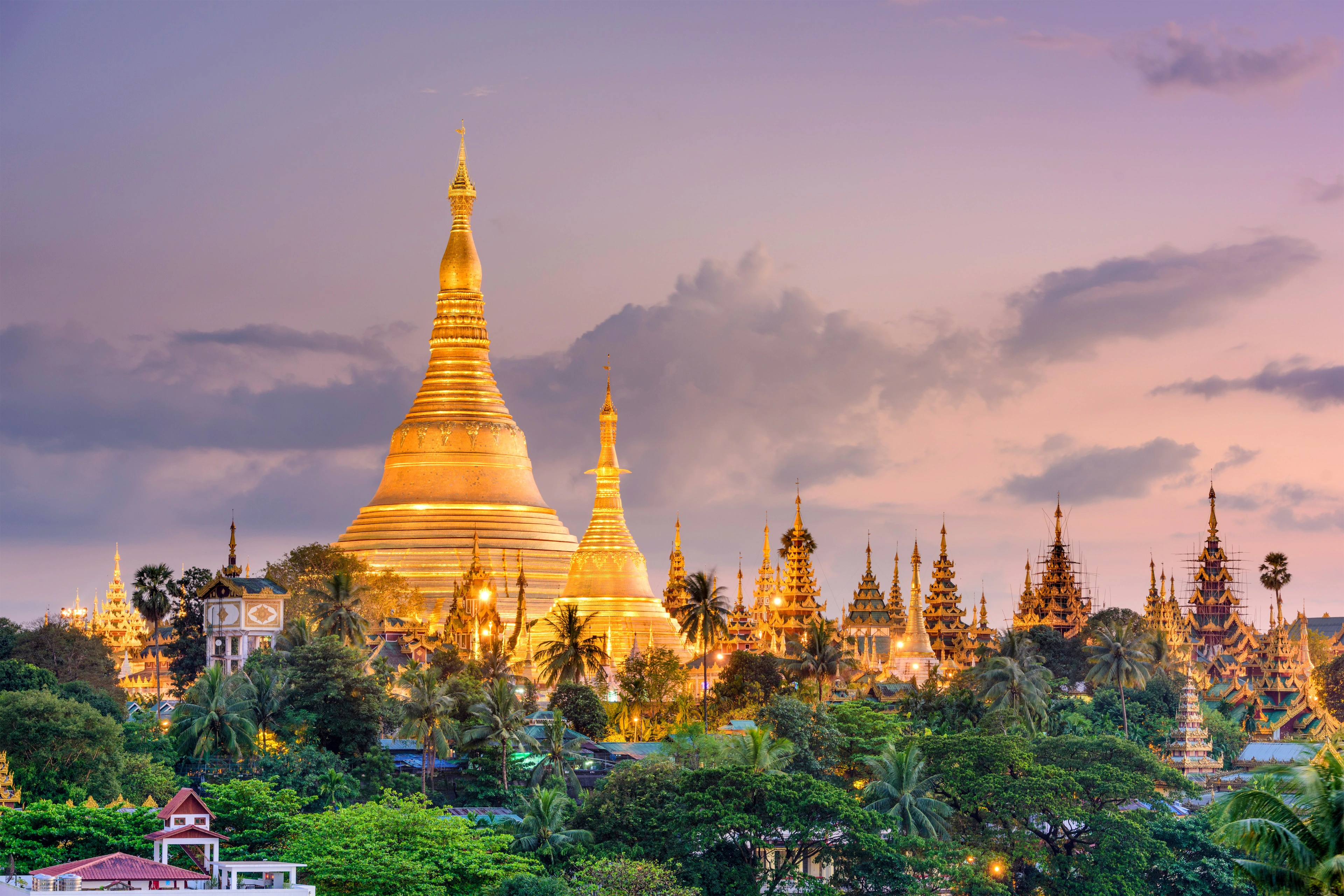
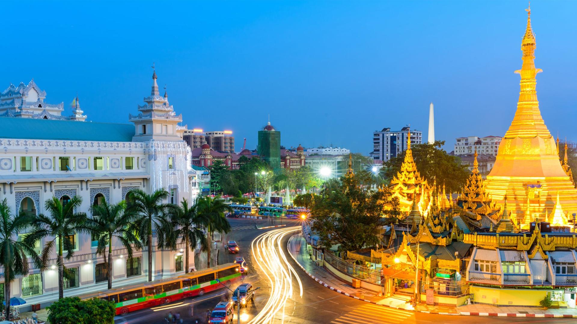
Yangon (pronunciation [jàɰ̃ɡòʊɰ̃ mjo̰], lit. 'End of Strife'), also known as Rangoon, is the capital of the Yangon Region and the largest city of Myanmar (also known as Burma). Yangon served as the capital of Myanmar until 2006, when the military government relocated the administrative functions to the purpose-built city of Naypyidaw [nèpjìdɔ̀] in central Myanmar.[3] With over 7 million people, Yangon is Myanmar's most populous city and its most important commercial centre.
Yangon boasts the largest number of colonial-era buildings in Southeast Asia,[4] and has a unique colonial-era urban core that is remarkably intact.[5] The colonial-era commercial core is centered around the Sule Pagoda, which is reputed to be over 2,000 years old.[6] The city is also home to the gilded Shwedagon Pagoda – Myanmar's most sacred Buddhist pagoda. The mausoleum of Bahadur Shah Zafar, the last Mughal Emperor is located in Yangon, where he had been exiled following the Indian Mutiny of 1857.
Yangon suffers from deeply inadequate infrastructure, especially compared to other major cities in Southeast Asia. Though many historic residential and commercial buildings have been renovated throughout central Yangon, most satellite towns that ring the city continue to be profoundly impoverished and lack basic infrastructure.[7]
Rangoun1 (en birman ရန်ကုန်, prononcé API : /jàɴɡòʊɴ mjo̰/) ou Rangoon2, officiellement renommée Yangon en 1989, est la capitale économique et la plus grande ville de la Birmanie (ou Myanmar) avec 4,5 millions d'habitants. Située sur le fleuve Yangon né de la confluence des rivières Bago (rivière) et Myitmaka, elle se trouve à trente kilomètres du golfe de Martaban, sur la mer d'Andaman.
Son nom birman Yangon est formé de yan (ရန္) et koun (ကုန္), qui signifient « ennemis » et « manquer de », respectivement. Le nom peut donc être traduit comme « fin de la discorde », « fin du conflit ». Rangoon/Rangoun, quant à lui, vient probablement de la mauvaise prononciation de Yangon de la part des Britanniques.
Rangoun fut la capitale de la Birmanie britannique, puis indépendante, à partir de 1853. En novembre 2005, la junte militaire au pouvoir a commencé à déplacer sa capitale à l'intérieur du pays, à Naypyidaw (Région de Mandalay). Naypyidaw est officiellement la nouvelle capitale depuis le 26 mars 20073.
Rangoun est la ville ayant le plus grand nombre d'édifices coloniaux de toute l'Asie du Sud-Est4. Des bureaux du gouvernement situés dans des immeubles coloniaux (la Cour suprême, la mairie, le marché Bogyoke, etc.) seront bientôt rénovés5. Mais après le coup d'État militaire du général Ne Win en 1962, Rangoun resta peu développée, par rapport aux autres grandes villes d'Asie du Sud-Est. Toutefois, le domaine de la construction voit un essor dû à l'investissement étranger (notamment de Singapour et de Chine). Beaucoup d'immeubles résidentiels et commerciaux ont été reconstruits ou modifiés au centre-ville et aux environs. Les « villes nouvelles » (မ္ရုိ့သစ္) et la région environnante restent pauvres.
Yangon (nota anche come Rangoon) è la più grande città della Birmania .
Rangún,2 nombre en español de Yangón o Yangôn (nombre oficial según las autoridades birmanas), es la ciudad más grande de Birmania, antigua capital del país hasta 2005, año en que fue sustituida por Naipyidó. Cuenta con una población estimada de 5.430.000 habitantes (2016). La ciudad se encuentra en las orillas del río Yangón, cerca del golfo de Martaban.
El término Yangón (en español, Rangún) proviene de las palabras birmanas yan y koun que significan “ciudad sin enemigos”.
En comparación con otras ciudades importantes del sudeste asiático, Rangún no está muy desarrollada aunque existe un auge en la construcción debido, sobre todo, a la influencia de la inversión privada, principalmente de la que procede de Singapur y China. En el centro de la ciudad y en el área metropolitana se han reconstruido y remodelado numerosos pisos y centros comerciales (conocidos como taik). Rangún posee el mayor número de edificios coloniales de la zona entre los que destacan las oficinas del gobierno, la Corte Suprema, el Ayuntamiento o el Hospital General, todos ellos restaurados o en proceso de restauración. Los barrios periféricos como Thaketa o las "nuevas ciudades" (myo-thit) son áreas pobres con un marcado carácter suburbial.
Янго́н[3], ранее — Рангу́н[4] (бирм. ရန်ကုန်, jàɴɡòʊɴ MLCTS: Rangun — Янгоун[5]) — крупнейший город и столица Мьянмы с 1989 по 2005 годы. До переименования в 1989 был известен под названием Рангун и являлся столицей Бирмы с момента обретения страной независимости в 1948 году. Население около 7 млн человек. Важнейший экономический, культурный и образовательный центр страны. Крупный транспортный узел. 6 ноября 2005 года резиденция правительства перенесена в Нейпьидо[6].
 普罗旺斯-阿尔卑斯-蓝色海岸

 宗教
宗教
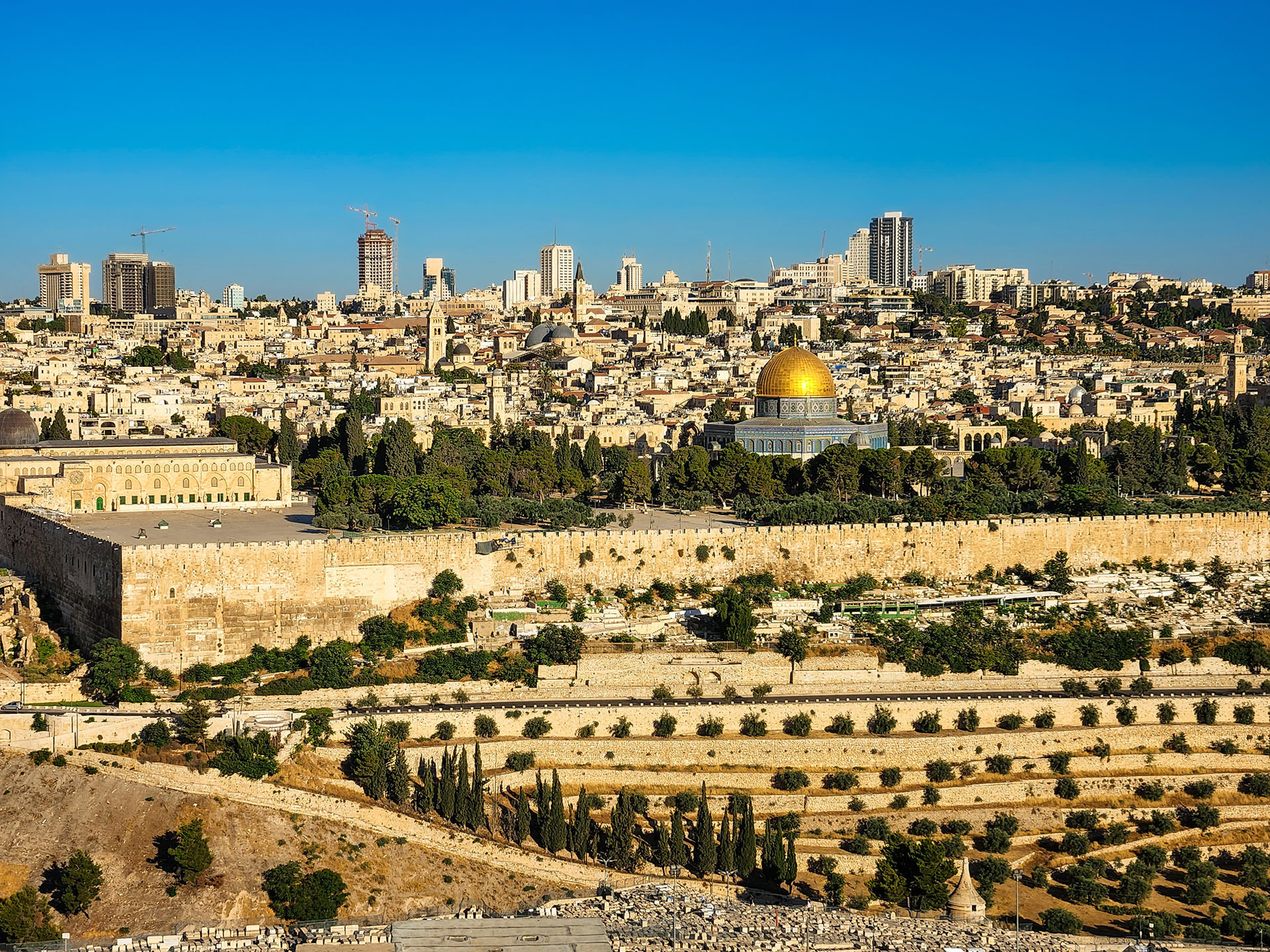

Jerusalem (hebräisch  ירושלים?/i, Jeruschalajim [jeʁuʃa'lajim]; arabisch القدس al-Quds ‚die Heilige‘; altgriechisch Ἱεροσόλυμα Hierosólyma [n. pl.], oder Ἰερουσαλήμ Ierousalḗm [f., indecl.]; lateinisch Hierosolyma [n. pl. oder f. sg.], Hierosolymae [f. pl.], Hierusalem oder Jerusalem [n., indecl.]) ist eine Stadt in den judäischen Bergen zwischen Mittelmeer und Totem Meer mit rund 882.000 Einwohnern.
In Jerusalem begegnen sich viele Kulturen der Antike und Moderne. Die Altstadt ist in das muslimische, jüdische, christliche und armenische Viertel gegliedert und von einer Mauer umgeben.
Der politische Status der Stadt ist international umstritten und Teil des Nahostkonflikts. Jerusalem wurde von Israel, das das gesamte Stadtgebiet kontrolliert, als seine Hauptstadt deklariert. Der Staat Palästina beansprucht Ost-Jerusalem als seine Hauptstadt. In Jerusalem befinden sich der Sitz des Staatspräsidenten, die Knesset und das Oberste Gericht als Teil des politischen Systems Israels, die 1918 gegründete Hebräische Universität sowie die Holocaustgedenkstätte Yad Vashem und der Israel National Cemetery. Ostjerusalem, das bedeutende religiöse Stätten des Judentums, Christentums und des Islam beherbergt, wird von gemäßigteren Palästinenser-Organisationen jedoch als Hauptstadt eines zukünftigen palästinensischen Staates beansprucht, während radikalere Palästinenser-Organisationen die gesamte Stadt als Hauptstadt fordern.
耶路撒冷(希伯来语: יְרוּשָׁלַיִם,拉丁化:Yerushaláyim;阿拉伯语: القُدس,拉丁化:al-Quds,汉译:古都斯或古德斯,意为“神圣的”;唐朝时期的景教徒曾根据叙利亚语“Ūrišlem”译作乌梨师敛[2][3])为以色列和巴勒斯坦境内的一座城市,位于地中海和死海之间,是古代巴勒斯坦中部的全球宗教重镇,也是完整保留人类信仰文明演进史的一个历史城市。耶路撒冷同时是犹太教、基督教和伊斯兰教三大亚伯拉罕宗教(或称“三大天启宗教”)的圣地。自公元前10世纪,所罗门王建成第一圣殿起,耶路撒冷一直是犹太教信仰的中心和最神圣的城市[4],昔日圣殿的遗迹西墙,仍是犹太教最神圣的所在。基督徒也相当重视耶路撒冷,因为根据《圣经》记载,耶稣在这里受难、埋葬、复活、升天。伊斯兰教亦将耶路撒冷列为麦加、麦地那之后的第三圣地,以纪念穆罕默德的夜行登霄[5],并在圣殿山上建造2座清真寺——阿克萨清真寺和圆顶清真寺来纪念这一事件。
自1967年第三次中东战争之后,以色列控制了全部的耶路撒冷地区,包括西耶路撒冷和东耶路撒冷,以及老城区。以色列和巴勒斯坦都声称耶路撒冷是他们的首都,因为以色列坚称这里是他们主要的政府机构,而巴勒斯坦则称预见这座城市是他们的政权所在地。不过,这两个声称在国际社会上都没有得到广泛的承认,认为该市的最终地位尚未确定,有待以色列和巴勒斯坦双方谈判决定。多数国家都将大使馆设在特拉维夫[6][7]。今天耶路撒冷仍然是以巴冲突的中心。以色列现行政区划上设耶路撒冷区,面积652平方公里,只有一个分区,即耶路撒冷分区。
2006年,耶路撒冷市区面积为126平方公里,人口约724,000人,这两项指标均居以色列和巴勒斯坦各城市之首[8][9][10]。
今天的耶路撒冷,是一个对比强烈的城市,不同文化、不同宗教、不同民族、社会不同阶层,同处一城;城市的东西两部分截然不同,发展水平悬殊。老城雅法门以西的西耶路撒冷(1967年以前属于以色列的市区)是现代以色列的核心地带(如果再继续向西数十公里,就是以特拉维夫为中心的“古什·但”区域),而老城及其东、北、南三面的东耶路撒冷(1967年后以色列占领的争议区域)则以巴勒斯坦人为主。最特别的地方是面积只有1平方公里,被一圈城墙所围绕的耶路撒冷老城[11],其中又分为4个宗教与种族聚居区:犹太区、基督徒区、亚美尼亚区和穆斯林区。耶路撒冷最重要的也引起重大争议的宗教圣地,均位于此处:犹太教的西墙和圣殿山、穆斯林的圆顶清真寺和阿克萨清真寺,以及基督徒的圣墓教堂和苦路。
エルサレムまたはイェルサレムは、イスラエルおよびパレスチナ自治区にある都市。
イスラエルはエルサレムが自国の「首都」であると宣言しているものの、国際連合など国際社会はこれを認めておらず[1][2]、イスラエルの首都はテルアビブであるとみなし[1][2]ている。したがって、イスラエルと国交を持つ諸国も、大使館や領事館はエルサレムでなくテルアビブに置いてきた。ただし、2017年になってアメリカ合衆国のドナルド・トランプ大統領はエルサレムをイスラエルの首都であると明言[1][2]。2018年5月、アメリカ大使館をテルアビブからエルサレムに移転させた[3]。
Jerusalem (/dʒəˈruːsələm/; Hebrew: יְרוּשָׁלַיִם Yerushaláyim; Arabic: القُدس al-Quds)[note 2] is a city in the Middle East, located on a plateau in the Judaean Mountains between the Mediterranean and the Dead Sea. It is one of the oldest cities in the world, and is considered holy to the three major Abrahamic religions—Judaism, Christianity, and Islam. Both Israel and the Palestinian Authority claim Jerusalem as their capital, as Israel maintains its primary governmental institutions there and the State of Palestine ultimately foresees it as its seat of power; however, neither claim is widely recognized internationally.[note 3][8]
During its long history, Jerusalem has been destroyed at least twice, besieged 23 times, attacked 52 times, and captured and recaptured 44 times.[9] The part of Jerusalem called the City of David was settled in the 4th millennium BCE.[10] Jerusalem was named as "Urusalim" on ancient Egyptian tablets, probably meaning "City of Shalem" after a Canaanite deity, during the Canaanite period (14th century BCE). During the Israelite period, significant construction activity in Jerusalem began in the 9th century BCE (Iron Age II), and in the 8th century the city developed into the religious and administrative center of the Kingdom of Judah.[11] In 1538, the city walls were rebuilt for a last time around Jerusalem under Suleiman the Magnificent. Today those walls define the Old City, which has been traditionally divided into four quarters—known since the early 19th century as the Armenian, Christian, Jewish, and Muslim Quarters.[12] The Old City became a World Heritage Site in 1981, and is on the List of World Heritage in Danger.[13] Since 1860 Jerusalem has grown far beyond the Old City's boundaries. In 2015, Jerusalem had a population of some 850,000 residents, comprising approximately 200,000 secular Jewish Israelis, 350,000 Haredi Jews and 300,000 Palestinians.[14][note 4] In 2011, the population numbered 801,000, of which Jews comprised 497,000 (62%), Muslims 281,000 (35%), Christians 14,000 (around 2%) and 9,000 (1%) were not classified by religion.[16]
According to the Bible, King David conquered the city from the Jebusites and established it as the capital of the united kingdom of Israel, and his son, King Solomon, commissioned the building of the First Temple.[note 5] These foundational events, straddling the dawn of the 1st millennium BCE, assumed central symbolic importance for the Jewish people.[18][19] The sobriquet of holy city (עיר הקודש, transliterated ‘ir haqodesh) was probably attached to Jerusalem in post-exilic times.[20][21][22] The holiness of Jerusalem in Christianity, conserved in the Septuagint[23] which Christians adopted as their own authority,[24] was reinforced by the New Testament account of Jesus's crucifixion there. In Sunni Islam, Jerusalem is the third-holiest city, after Mecca and Medina.[25][26] In Islamic tradition, in 610 CE it became the first qibla, the focal point for Muslim prayer (salat),[27] and Muhammad made his Night Journey there ten years later, ascending to heaven where he speaks to God, according to the Quran.[28][29] As a result, despite having an area of only 0.9 square kilometres (0.35 sq mi),[30] the Old City is home to many sites of seminal religious importance, among them the Temple Mount with its Western Wall, Dome of the Rock and al-Aqsa Mosque, and the Church of the Holy Sepulchre. Outside the Old City stands the Garden Tomb.
Today, the status of Jerusalem remains one of the core issues in the Israeli–Palestinian conflict. During the 1948 Arab–Israeli War, West Jerusalem was among the areas captured and later annexed by Israel while East Jerusalem, including the Old City, was captured and later annexed by Jordan. Israel captured East Jerusalem from Jordan during the 1967 Six-Day War and subsequently annexed it into Jerusalem, together with additional surrounding territory.[note 6] One of Israel's Basic Laws, the 1980 Jerusalem Law, refers to Jerusalem as the country's undivided capital. All branches of the Israeli government are located in Jerusalem, including the Knesset (Israel's parliament), the residences of the Prime Minister (Beit Aghion) and President (Beit HaNassi), and the Supreme Court. While the international community rejected the annexation as illegal and treats East Jerusalem as Palestinian territory occupied by Israel,[34][35][36][37] Israel has a stronger claim to sovereignty over West Jerusalem.[38][39]
Jérusalem /ʒe.ʁy.za.lɛm/ (ou Salem, également nommée Hiérosolyme ou Solyme en ancien français ; יְרוּשָׁלַיִם Yerushaláyim en hébreu [dénomination israélienne officielle] ; arabe : القدس al Quds ou اورشليم Ûrshalîm [dénomination israélienne officielle en arabe]) est une ville du Proche-Orient que les Israéliens ont érigée en capitale, que les Palestiniens souhaiteraient comme capitale et qui tient une place centrale dans les religions juive, chrétienne et musulmane.
La ville s’étend sur 126 km2 pour une population de 901 300 habitants en 20171. La ville, chef-lieu du district de Jérusalem, est cosmopolite : s'y mêlent de nombreuses religions, peuples, groupes socio-économiques. La partie nommée vieille ville, entourée de remparts, est constituée de deux quartiers à dominante arabe, dits quartier chrétien et quartier musulman, ainsi que d’un quartier à dominante arménienne et d’un quartier à dominante juive.
Gerusalemme (AFI: /ʤeruzaˈlɛmme/[2][3]; in ebraico: יְרוּשָׁלַיִם?, Yerushalayim, Yerushalaim e/o Yerushalaym ascolta[?·info]; in arabo: القُدس, al-Quds, "la (città) santa"[4], sempre in arabo: أُورْشَلِيم, Ūrshalīm, in greco Ιεροσόλυμα, Ierosólyma, in latino Hierosolyma o Ierusalem, per antonomasia è definita "La Città Eterna"[5]), capitale giudaica tra il X e il VI secolo a.C.[6], è la capitale contesa di Israele e città santa nell'Ebraismo, nel Cristianesimo e nell'Islam. Si trova sull'altopiano che separa la costa orientale del Mar Mediterraneo dal Mar Morto, a est di Tel Aviv, a sud di Ramallah, a ovest di Gerico e a nord di Betlemme.
La Città Vecchia e le sue mura, considerate patrimonio dell'umanità dall'UNESCO, racchiudono in meno di un chilometro quadrato molti luoghi di grande significato religioso come il Monte del Tempio, il Muro del pianto, la Basilica del Santo Sepolcro, la Cupola della Roccia e la Moschea al-Aqsa. Nel corso della sua storia Gerusalemme è stata distrutta e ricostruita due volte ed è stata assediata, conquistata e riconquistata in decine di occasioni.
La parte orientale di Gerusalemme è stata occupata[7] dallo Stato di Israele nel 1967, e nel 1980 il parlamento israeliano approvò una legge fondamentale (l'equivalente di un emendamento costituzionale) che proclamava unilateralmente "Gerusalemme, unita e indivisa [...]".[8] Il Consiglio di sicurezza delle Nazioni Unite nella risoluzione 478 ha definito la legge nulla e priva di validità[9], una violazione del diritto internazionale[10] e un serio ostacolo al raggiungimento della pace in Medio Oriente[11][12].
Jerusalén (en hebreo, יְרוּשָׁלַיִם Yerushaláyim (?·i); en árabe, القـُدْس al-Quds (?·i)) es la capital de Israel y su ciudad más grande y poblada, con 865 7004 residentes en un área de 125,1 kilómetros cuadrados.2 Los asentamientos más antiguos en Jerusalén son del V milenio a. C. y es una de las ciudades más antiguas del mundo.5 Jerusalén tiene un profundo significado religioso para el cristianismo, el judaísmo y el islam. Geográficamente, se sitúa en los montes de Judea, entre el mar Mediterráneo y la ribera norte del mar Muerto, y se ha extendido bastante más allá de los límites de la Ciudad Vieja.
El estatus de la parte oriental de la ciudad, conquistada en 1967 por Israel, se encuentra disputado, ya que en este sector —referido habitualmente como Jerusalén Este o Jerusalén Oriental, que incluye la Ciudad Vieja— es donde el Estado de Palestina pretende establecer su capital. Israel discute las reclamaciones palestinas y, tras la Guerra de los Seis Días, considera la ciudad como un todo unificado y un mismo municipio, declarándola como su capital "eterna e indivisible" mediante la Ley de Jerusalén en 1980. Esta anexión ha provocado un amplio rechazo en la comunidad internacional, materializado en la resolución 478 del Consejo de Seguridad de la ONU, que la consideró contraria al Derecho Internacional,6 y en señal de protesta por este acto unilateral los Estados miembros de las Naciones Unidas acabaron por trasladar sus embajadas a Tel Aviv, tal como pedía la resolución.
Jerusalén fue habitada por los jebuseos antes de la llegada de las tribus hebreas a Canaán a principios del siglo XIII a. C. Históricamente, y según la tradición, fue la antigua capital del Reino de Israel y del Reino de Judá, y siglos más tarde del reino franco de Jerusalén.7
La Ciudad Vieja de Jerusalén fue declarada Patrimonio de la Humanidad por la Unesco en 1981.
Иерусали́м (ивр. יְרוּשָׁלַיִם Йерушала́(й)им (audio) (инф.), араб. القُدس аль-К̣удс[комм. 1], أورشليم Ӯршалӣм (Ӯрушалӣм)[комм. 2], أورشليم القدس, Ӯршалӣм-аль-К̣удс[комм. 3] (audio) (инф.)) — столица Израиля[3][4][5][6][7], город на Ближнем Востоке. Расположен на плато в Иудейских горах на водоразделе между Средиземным и Мёртвым морями, на высоте 650—840 м над уровнем моря; климат средиземноморский, с жарким, сухим летом и мягкой, влажной зимой. Город является священным для трёх крупнейших авраамических религий — иудаизма, христианства и ислама. Населён представителями множества национальных, этнических и религиозных деноминаций; численность населения Иерусалима (без пригородов) составляет 865 721 жителей.
23 января 1950 года Кнессет (Израильский парламент) провозгласил Иерусалим столицей Государства Израиль[8]; с 1967 года в результате Шестидневной войны Израиль стал контролировать всю территорию города: как Западный Иерусалим, так и Восточный. В 1980 году Кнессет провозгласил Иерусалим единой и неделимой столицей Израиля[3][9]. Израильский суверенитет над восточной частью города[10] и статус всего Иерусалима как столицы Израиля не признаны значительной частью международного сообщества[11][12][13], которое относится к Восточному Иерусалиму как к палестинской территории, оккупированной Израилем[14][15][16][17]. Статус Иерусалима остаётся одной из центральных тем палестино-израильского конфликта.
Иерусалим является одним из древнейших городов мира: первые поселения датируются IV тысячелетием до н. э. В XI веке до н. э. город был занят евреями и провозглашён столицей Израильского царства, а с X века до н. э. — Иудейского. После распада Римской империи Иерусалим отошёл к Византии. С этого момента начинается христианизация города. C захватом в 639 году арабским халифом Умаром ибн Хаттабом город начинает приобретать мусульманский облик. В 1099—1187 и 1229—1244 годах Иерусалим был под властью