
Deutsch-Chinesische Enzyklopädie, 德汉百科
 Ningxia Huizu Zizhiqu-NX

 Geography

 Energy resource
 Anhui Sheng-AH
China
Gansu Sheng-GS
Henan Sheng-HA
Ningxia Huizu Zizhiqu-NX
Shaanxi Sheng-SN
Xinjiang Uygur Zizhiqu-XJ
Anhui Sheng-AH
China
Gansu Sheng-GS
Henan Sheng-HA
Ningxia Huizu Zizhiqu-NX
Shaanxi Sheng-SN
Xinjiang Uygur Zizhiqu-XJ


Ein Yardang (oder Jardang, gelegentlich auch Windhöcker) ist eine geomorphologische, tafelförmige Erosionsform in Lockersedimenten (überwiegend in flachgeschichteten lakustrinen Sedimenten).
Der Forschungsreisende Sven Hedin hat Yardangs erstmals 1903 benannt und beschrieben, als er die chinesische Wüste Lop Nor durchquerte. Das Wort Yardang leitete er aus dem uigurischen Wort Yar ab, das mit steiler Sandwall (engl.: ridge or steep bank) übersetzt werden kann.
 International cities
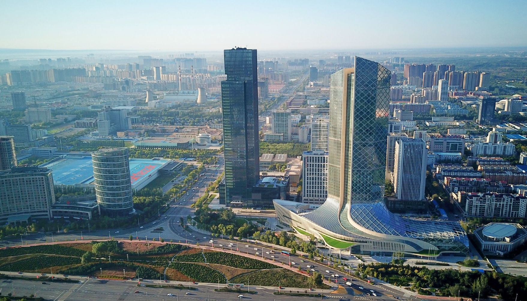
银川市,简称银,古称中兴路、兴庆府、怀远镇、宁夏省城,是中华人民共和国宁夏回族自治区首府,位于宁夏中北部。市境北接石嘴山市,东抵内蒙古自治区鄂尔多斯市,南达吴忠市,西界内蒙古自治区阿拉善盟。地处银川平原中部,西倚贺兰山,东靠鄂尔多斯高原。黄河由南向北流贯中部。全市总面积6,943平方千米,人口222.53万,回族为57.34万,市人民政府驻金凤区。银川是国家历史文化名城、中国·阿拉伯国家经贸论坛永久举办地,是全区军事、政治、经济、文化科研、交通和金融商业中心。
银川是中原民族开发较早的区域,历史上为西夏王朝首都兴庆府,自古有“塞上明珠”的说法,城西有著名的全国重点文物保护单位西夏王陵。市内拥有南关清真大寺、承天寺塔、海宝塔、西夏王陵、玉皇阁、鼓楼等名胜。
Yinchuan (Chinesisch:银川; Pinyin: Yínchuān) ist die Hauptstadt des Autonomen Gebietes Ningxia der Hui-Nationalität und war früher der Hauptstadt der westlichen Xia-Dynastie (1038-1227). Es liegt am Oberlauf des Gelben Flusses. Der Name der Stadt bedeutet Silberstrom. Es hat eine Fläche von 4467 qkm und ca. 1,2 Millionen Einwohner.
Yinchuan liegt in der Mitte der Ningxia-Tiefebene. Es ist geschützt im westen vor den Wüsten durch den hochen Helan Berg am Grenz mit der Innen Mongolei. Der Gelbe Fluß fließt durch Yinchuan von Südwesten nach Nordosten. Die durchschnittliche Höhe von Yinchuan ist 1100 Meter.
Yinchuan ist eine Multi-Nationalitäten Stadt einschließlich Han, Hui, Manchu, Mongolisch, und Chaoxian Völker. Unter ihnen die Hui-Nationalität macht 26,3 Prozent der Gesamtbevölkerung aus, und sie haben die traditionellen Lebensweise erhalten, die als andere ethnische Gruppe einmalig ist.
Sehenswürdigkeiten in der Stadt Yinchuan zählen der Sand-See und die Mausoleen der Könige der Westlichen Xia-Dynastie. Es gibt auch zwei Pagoden in Yinchuan, die eine der top "Acht Berühmte Sehenswürdigkeiten von Ningxia" sind. Eine ist die Haibao Pagode in der nördlichen Vorstadt und die andere ist die Chengtiansi Pagode im Westen.
Die lokalen islamischen Gerichte oder Snacks in Yinchuan ist sehr berühmt. Hotels verschiedener Kategorie sind verfügbar.(Quelle:http://www.chinareisedienst.de)
銀川市(ぎんせんし、簡体字: 银川市、英語: Yinchuan)は中華人民共和国寧夏回族自治区に位置する地級市。同自治区の首府である。市区は新城と旧城に分れ、新城は工業地区である。旧城は歴史遺跡が多く、国家歴史文化名城に指定されている。回族人口は10万人程度。寧夏大学が所在する。
Yinchuan is the capital of the Ningxia Hui Autonomous Region, People's Republic of China.[5] and historically it was the former capital of the Western Xia Empire of the Tanguts. It has an area of 8,874.61 km2 (3,426.51 sq mi) and a total population of 2.29 million.[3] Its built-up area is home to 1,487,561 inhabitants spread between three urban districts.[3] The name of the city literally means "silver river".
Facing the Yellow River in the east, Yinchuan enjoys beautiful natural scenery and favorable conditions for agriculture and has long earned the fame of a "River Side City in the Northwest" and "Home to Fish and Rice". Yinchuan is now the permanent site for China-Arab Expo which is an international platform for cultural and economic exchanges between China and Arab countries.
Yinchuan (chinois : 银川 ; pinyin : ) est le chef-lieu de la région autonome huí du Ningxia en Chine.
Yinchuan (in cinese tradizionale: 银川) è una città della Cina, capitale della regione autonoma di Ningxia.
Yinchuan léase Yinchuán (en chino:银川市 ,pinyin:Yínchuān shì) es la capital de la región autónoma de Ningxia ubicada al centro-norte de la República Popular China.
Yinchuan está situada a orillas del río Amarillo, en el extremo oeste de la Gran Muralla. Originalmente fue un condado en el siglo I a. C., convirtiéndose en la capital de la dinastía Xi Xia en el año 907 d. C. En 1227 pasó a estar bajo el control de la dinastía Yuan y después bajo el dominio de los Ming y los Qing. Hay evidencias de que allí murió Gengis Kan el 18 de agosto de 1227.
En 1928 se volvió la capital de la recién formada provincia de Ningxia. En 1954 cuando dicha demarcación fue abolida, la ciudad pasó a ser parte de la provincia de Gansu. Con el establecimiento de la región autónoma de Ningxia en 1958, Yinchuan otra vez se hizo capital. En gran medida sin industria, es el principal mercado agrícola y centro de distribución del área.
Иньчуа́нь (кит. упр. 银川, пиньинь Yínchuān, буквально: «Серебряный поток») — городской округ в Китае, место размещения властей Нинся-Хуэйского автономного района.
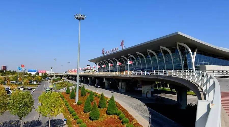
 Transport and traffic

银川市,简称银,古称兴庆府、中兴府、中兴路、怀远镇、饮汗城、宁夏镇城、宁夏省城,在西夏语中被称为伊尔盖(Rjur Kiej,意为“世界”“京师”[1]),中古蒙古和波斯史籍记载为额里合牙(Egrigaia)。是中华人民共和国宁夏回族自治区首府,位于宁夏中北部,“塞上江南”宁夏平原的中央,西倚贺兰山,东靠鄂尔多斯高原。黄河由南向北流贯中部,境内湖泊湿地众多,又被称为塞上湖城。
银川是古人类文明的发祥地之一,早在3.8-4万年前,水洞沟人就在此繁衍生息。银川是中原王朝开发较早的区域,秦始皇三十二年(公元前213年),大将蒙恬北击匈奴,将银川纳入秦朝。汉武帝元朔二年(前127年)春,大将卫青围歼盘踞于此的匈奴白羊王,在此将银川地区纳入汉朝版图。唐朝,银川先为怀远县,后为灵州“河外六镇”之一的怀远镇。1020年,李德明升怀远镇为兴州,迁都于此,经过李元昊的扩张建设,银川成为西夏王朝首都兴庆府约两个世纪。元朝时,银川为西夏中兴行省的省会。明朝在银川设置宁夏镇,为九边重镇之一,驻有宁夏镇总兵官、宁夏巡抚和宁夏镇守太监等高级官员。
银川市现辖三区两县一市,分别是兴庆区、金凤区、西夏区,永宁县、贺兰县,灵武市。全市总面积9025平方公里,全市汉族人口216.3万人,回族居民为67.3万人。银川是第二批国家历史文化名城,玉皇阁、鼓楼、南关清真大寺等名胜是城内的地标建筑。贺兰山下的贺兰山岩画、西夏王陵、拜寺口双塔和贺兰山国家森林公园人文和自然风光兼具。银川市境北接石嘴山市,东抵内蒙古自治区鄂尔多斯市,南达吴忠市,西界内蒙古自治区阿拉善盟。
银川市是西北地区重要中心城市、“一带一路”重要节点城市。中国·阿拉伯国家经贸论坛永久举办地,是全区军事、政治、经济、文化科研、交通和金融商业中心。近年来,银川市在新能源和绿色农业领域有了长足发展,依托贺兰山东麓葡萄酒产区,致力打造世界葡萄酒之都。银川市人民政府驻金凤区北京中路166号。

 Architecture
