
漢德百科全書 | 汉德百科全书
 Pakistan
 Afghanistan
Egypt
Albania
Algeria
Azerbaijan
Bahrain
Bangladesh
Benin
Brunei Darussalam
Burkina Faso
Côte d´Ivoire
Djibouti
Gabun
Gambia
Guinea
Guinea-Bissau
Guyana
Indonesia
Iraq
Iran
Yemen
Jordan
Cameroon
Kasachstan
Katar
Kyrgyzstan
Comoros
Kuwait
Libanon
Libya
Malaysia
Malediven
Mali
Morocco
Mauritania
Mosambik
Niger
Nigeria
Oman
Organisation of Islamic Cooperation
Pakistan
Palestine
Republic of the Sudan
Saudi Arabia
Senegal
Sierra Leone
Somalia
Suriname
Syria
Tajikistan
Togo
Tschad
Tunisia
Turkey
Turkmenistan
Uganda
Uzbekistan
United Arab Emirates
Afghanistan
Egypt
Albania
Algeria
Azerbaijan
Bahrain
Bangladesh
Benin
Brunei Darussalam
Burkina Faso
Côte d´Ivoire
Djibouti
Gabun
Gambia
Guinea
Guinea-Bissau
Guyana
Indonesia
Iraq
Iran
Yemen
Jordan
Cameroon
Kasachstan
Katar
Kyrgyzstan
Comoros
Kuwait
Libanon
Libya
Malaysia
Malediven
Mali
Morocco
Mauritania
Mosambik
Niger
Nigeria
Oman
Organisation of Islamic Cooperation
Pakistan
Palestine
Republic of the Sudan
Saudi Arabia
Senegal
Sierra Leone
Somalia
Suriname
Syria
Tajikistan
Togo
Tschad
Tunisia
Turkey
Turkmenistan
Uganda
Uzbekistan
United Arab Emirates
 Important International Organizations
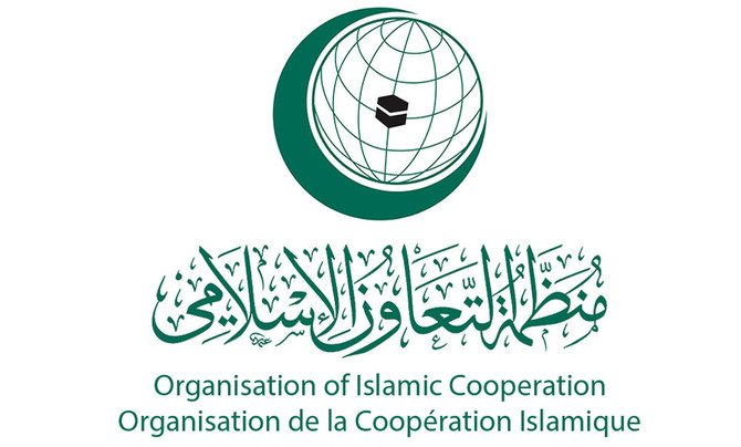
伊斯兰合作组织(阿拉伯语:منظمة التعاون الإسلامي;英语:Organisation of Islamic Cooperation;法语:Organisation de la coopération islamique)原名伊斯兰会议组织,是一个伊斯兰世界的政府间国际组织,为联合国大会观察员;该组织由遍及西亚(中东)、中亚、西非、北非、印度次大陆和东南亚的57个国家组成,覆盖的人口约为16亿。秘书处设在沙特阿拉伯王国的吉达市;现任秘书长是原沙特社会事务大臣Yousef Al-Othaimeen(从2016年开始)。
组织的宗旨是促进各成员国之间在经济、社会、文化和科学等方面的合作;努力消除种族隔离和种族歧视,反对一切形式的殖民主义;支持巴勒斯坦人民恢复民族权利和重返家园的斗争;支持穆斯林保障其尊严、独立和民族权利的斗争。
但要注意的是并非每个成员国是伊斯兰国家,如圭亚那、苏里南、莫桑比克、喀麦隆、乌干达和加蓬等国,伊斯兰反而是极少数人的信仰,阿尔巴尼亚则是唯一加入该组织的欧洲大陆的主权国家和联合国会员国,2011年脱离苏丹独立的南苏丹也在独立后脱离该组织的势力范围。
イスラム協力機構(イスラムきょうりょくきこう、アラビア語: منظمة التعاون الاسلامي、略称OIC; 英語: Organisation of Islamic Cooperation、略称OCI; フランス語: Organisation de la coopération Islamique)は、イスラム諸国をメンバーとして構成され、国際連合に対する常任代表を有する国際機構。公用語はアラビア語、英語、フランス語。かつてはイスラム諸国会議機構(منظمة المؤتمر الإسلامي、英語: Organisation of the Islamic Conference、フランス語: Organisation de la Conférence Islamique)という名称であったが、2011年6月にカザフスタンのアスタナでの会議で「イスラム協力機構」への変更と紋章が決定された[1]。
イスラム諸国の政治的協力、連帯を強化すること、イスラム諸国に対する抑圧に反対し、解放運動を支援することを目的とする。
加盟国はムスリム(イスラム教徒)が国民の多数を占める西アジア、北アフリカ、西アフリカ、東アフリカ、中央アジア、南アジア、東南アジアなどの57か国、オブザーバーが5ヵ国・8組織(国連など)からなり、世界13億人のムスリムの大部分を代表する。
加盟条件としては、国内でムスリムが大多数を占めることを必ずしも条件としているわけではなく、南アメリカのいくつかの国のようにマイノリティとしてある程度のムスリム人口を抱えているだけであっても、外相会議における審査で承認されればイスラム諸国のひとつとして機構に加盟することができる。イスラム教徒が多数派を占める国はほとんど参加しているが、イスラム教徒比率の高い国のうちエチオピア(30~50%)とタンザニア(約30%)が加盟していない。イスラム教徒人口の多い国で言えばインド(約1億5000万人)や中国(約2000万人)も加盟していない。逆にイスラム教徒比率の低い国ではガボン、ウガンダ、スリナム、ガイアナなどが加盟している(それぞれ10%未満)。
The Organisation of Islamic Cooperation (OIC; Arabic: منظمة التعاون الإسلامي; French: Organisation de la coopération islamique), formerly the Organisation of the Islamic Conference, is an international organization founded in 1969, consisting of 57 member states, with a collective population of over 1.8 billion as of 2015 with 53 countries being Muslim-majority countries. The organisation states that it is "the collective voice of the Muslim world" and works to "safeguard and protect the interests of the Muslim world in the spirit of promoting international peace and harmony".[1]
The OIC has permanent delegations to the United Nations and the European Union. The official languages of the OIC are Arabic, English, and French.
L’Organisation de la coopération islamique (OCI), en arabe : منظمة التعاون الإسلامي (Munaẓẓamat at-Taʿāwun al-islāmī), en anglais : Organisation of Islamic Cooperation (OIC), appelée jusqu'en 2011 Organisation de la conférence islamique (en arabe : منظمة المؤتمر الإسلامي, en anglais : Organisation of the Islamic Conference), est une organisation intergouvernementale créée le 25 septembre 1969. Son siège se situe à Djeddah en Arabie saoudite et elle possède une délégation permanente aux Nations unies.
Regroupant 57 États membres, sa vocation est de promouvoir la coopération dans les domaines économiques, sociaux, culturels et scientifiques (grâce notamment à la Banque islamique de développement), mais aussi la sauvegarde des lieux saints de l'islam ou encore le soutien au peuple palestinien. À l'échelle mondiale, il n'existe pas d'autre organisation confessionnelle dont les membres signataires soient des États.
Ses trois langues officielles sont l'arabe, l'anglais et le français2.
L'Organizzazione della cooperazione islamica (in arabo: منظمة التعاون الإسلامي, Munaẓẓamat al-taʿāwun al-islāmī; in inglese: Organization of the Islamic Cooperation, OIC; in francese: Organisation de la coopération islamique, OCI) è un'organizzazione internazionale con una delegazione permanente presso le Nazioni Unite. Rappresenta 56 Stati dell'Europa, Vicino Oriente, Medio Oriente, America meridionale, Africa, Asia centrale e del Subcontinente indiano.[1]
L'organizzazione, fondata a Rabat, in Marocco, il 25 settembre 1969 con il nome Organisation of the Islamic Conference, in arabo: منظمة المؤتمر الإسلامي, Munaẓẓamat al-muʾtamar al-islāmī; (FR) Organisation de la conférence islamique, mutato nell'attuale nel 2011.[2]
Ha come finalità la salvaguardia degli interessi e lo sviluppo delle popolazioni musulmane nel mondo.
Il 10 ottobre 1975 le è stato riconosciuto lo status di osservatore dell'Assemblea generale delle Nazioni Unite.
La Organización para la Cooperación Islámica (Árabe:منظمة التعاون الاسلامي); (Francés: Organisation de la Coopération Islamique); (Inglés: Organisation of Islamic Cooperation) es un organismo internacional que agrupa a los estados de confesión musulmana, creado en 1969 durante la Conferencia de Rabat y formalizada dos años después.
Su sede está en Yidda, ciudad costera de Arabia Saudí a orillas del Mar Rojo. Sus miembros son países con mayoría de población musulmana o con una comunidad significativa en ellos, con Estados miembros y observadores de África, Asia, Europa y América del Sur. El 28 de junio de 2011 se oficializó el cambio de nombre,1 anteriormente se llamó: Organización de la Conferencia Islámica (Árabe:منظمة المؤتمر الإسلامي); (Francés: Organisation de la Conférence Islamique); (Inglés:Organization of the Islamic Conference).
Sus acciones se circunscriben a la actividad colaborativa entre sus miembros, sobre todo en la lucha contra el imperialismo, el neocolonialismo y por la emancipación de Palestina. Históricamente se celebraron diversos congresos que contribuyeron con su desarrollo: Lahore (1974), La Meca (1981), Casablanca (1984), Kuwait (1987), Dakar (1991). Sus repercusiones son menores que las de la Liga Árabe.
Организация исламского сотрудничества (англ. Organisation of Islamic Cooperation (OIC), араб. منظمة التعاون الاسلامي) — международная организация исламских стран (до 2011 года называлась Организация Исламская конференция (ОИК).
 Financial
Egypt
Algeria
Indonesia
Iran
Kuwait
Libya
Pakistan
Saudi Arabia
Turkey
United Arab Emirates
Important International Organizations
Financial
Egypt
Algeria
Indonesia
Iran
Kuwait
Libya
Pakistan
Saudi Arabia
Turkey
United Arab Emirates
Important International Organizations
 International cities


Islamabad (Urdu اسلام آباد ‚Wohnsitz des Islam‘) ist die Hauptstadt Pakistans. Die erst in den 1960er Jahren gegründete Stadt hat heute 1.014.825 Einwohner.[1] Als geplante Stadt wurde sie an einer klimatisch äußerst vorteilhaften Stelle am Rande des Pothohar-Plateaus, unterhalb der Margalla-Hügel auf einem schachbrettartigen Grundriss angelegt. Islamabad gehört historisch zum Punjab, wurde aber 1970 aus der Provinz ausgegliedert und zu einem eigenständigen Hauptstadtterritorium.
伊斯蘭堡(乌尔都语:اسلام آباد,乌尔都语转写:Islāmābād)是巴基斯坦的首都,位於該國的伊斯兰堡首都区。伊斯兰堡在2011年有两百多万人口[4],并与紧邻着的城市拉瓦尔品第组成一个超過450万人口、位列全国第三的城市群[5]。自城市建立起来就吸引了来自全国的人口,使伊斯兰堡成为巴基斯坦最有世界性和高城市化率的城市。作为国家首都,巴基斯坦政府、巴基斯坦总统府(Aiwan-e-Sadr)驻地于此。巴基斯坦一座国家纪念碑也坐落于这里。伊斯兰堡也是大量外交官、政客和政府员工的接待处。伊斯兰堡的首都開發委員會(CDA)对该城市公共建设工程管理负责。
伊斯兰堡位于巴基斯坦东北的波特瓦尔高原上,海拔540米,属副热带湿润气候。在历史上,这个地区处于一个前往旁遮普和开伯尔-普什图的十字路口处,而马格拉关口则扮演前往两个地区的入口的角色[6]。伊斯兰堡修建于1960年代以取代当时的首都卡拉奇。现在伊斯兰堡是有秩序的国际城市,被认为是巴基斯坦最发达的城市,也被列为Gamma+级的全球城市[7]。南亚最大的清真寺[8]、世界第四大[9][10]的清真寺费萨尔清真寺坐落于伊斯兰堡。在伊斯兰堡有16所承认的大学,包括伊斯兰堡空军大学(AU)、巴基斯坦真纳大学(QAU)以及巴基斯坦国立科技大学(NUST),其中阿拉玛·伊克巴尔开放大学(AIOU)按校友人數排名是世界第四大学校。
イスラマバード(ウルドゥー語: اسلام آباد、英語: Islamabad)は、パキスタンの首都。イスラーマーバードとも呼ばれるが、日本では長母音を無視したイスラマバードの名で広く知られている。
南アジア有数の世界都市であり、2008年にはイギリスのシンクタンク「グローバリゼーションと世界都市研究ネットワーク」によって第3級世界都市と評価された[1]。1951年の人口は約9万4千人であったが[2]、2009年には約120万人となり[3][4]、パキスタンで10番目の人口の都市に成長した[5]。「ラーワルピンディー・イスラマバード都市圏」の人口は297万人(2011年)であり、世界第124位、パキスタン第3位の人口を有する都市圏を形成している[6]。名前は「イスラームの都市」の意味を持つ[7]。
Islamabad (/ɪsˈlɑːməˌbɑːd/; Urdu: اسلام آباد, Islāmābād) is the capital city of Pakistan, and is federally administered as part of the Islamabad Capital Territory. Islamabad is the ninth largest city in Pakistan, while the larger Islamabad-Rawalpindi metropolitan area is the country's fourth largest with a population of about 7.4 million.[5]
Built as a planned city in the 1960s to replace Karachi as Pakistan's capital, Islamabad is noted for its high standards of living,[8] safety,[9] and abundant greenery.[10] The city is the political seat of Pakistan and local government setup is run by the Islamabad Metropolitan Corporation, supported by the Capital Development Authority (CDA).
Islamabad is located in the Pothohar Plateau in the northeastern part of the country, between Rawalpindi District and the Margalla Hills National Park to the north. The region has historically been a part of the crossroads of Punjab and Khyber Pakhtunkhwa with the Margalla Pass acting as the gateway between the two regions.
Islamabad (en ourdou : اسلام آباد, Islāmābād, signifiant « la ville de l'Islam ») est une ville nouvelle et capitale du Pakistan. Située dans le nord du pays, à proximité de la frontière avec l'Inde, elle se trouve dans le Territoire fédéral d'Islamabad et jouxte la ville de Rawalpindi. En 2017, sa population s'établit à un million d'habitants, ce qui en fait la neuvième ville pakistanaise2. Devenue en 1967 la capitale du pays, au détriment de Karachi, Islamabad en constitue le cœur administratif et politique : elle accueille l'Aiwan-e-Sadr (en) (la résidence présidentielle), le siège du gouvernement et le Parlement national. La Mosquée Faisal est en outre l'une des plus grandes mosquées au monde, avec une capacité de plus de 74 000 fidèles.
Islamabad (in urdu اسلام آباد) è una città di 1.014.825 abitanti del Pakistan, capitale dello stato dal 1967. Città di nuova fondazione, si trova nella parte nord-orientale del paese, tra le province del Punjab, a cui apparteneva il suo territorio (a nord-est di Rawalpindi, capitale provvisoria dal 1958 al 1967, con cui forma un unico conglomerato urbano), e di Khyber Pakhtunkhwa; nel 1998 vi era stata censita una popolazione di più di 805.000 abitanti (per due terzi punjabi) su 906 km².
Islamabad (en urdu, اسلام آباد, Islām ābād, que significa: «ciudad del Islam») es la capital de Pakistán, situada en la meseta de Potwar al norte del país, dentro del Territorio Capital de Islamabad. La zona ha sido, históricamente, parte de las encrucijadas del Punjab y la Frontera del Noroeste (el paso de Margalla ha sido una puerta histórica en la Provincia de la Frontera del noroeste). La antigua capital nacional, Rawalpindi, se encuentra a tan sólo 14 km de Islamabad.
Исламаба́д (урду اسلام آباد, англ. Islamabad) — столица Исламской Республики Пакистан. Построен в 1960-х годах как плановый город, чтобы заменить Карачи в качестве столицы Пакистана. Культурный, политический и экономический центр страны. Исламабад известен своим высоким уровнем жизни[2], безопасностью[3] и обильной растительностью[4].
Согласно данным переписи населения 2017 года, население города составляет 1 014 825 человек. Исламабад является 9-м по величине городом Пакистана, в то время как более крупный мегаполис Исламабад-Равалпинди является третьим по величине в стране с населением более четырёх миллионов человек[5][6][7].
 Geography

1947年印巴分治以前,印度河仅次于恒河,为该地区的文化和商业中心地带。该河流上源为狮泉河(森格藏布),它发源于冈底斯山脉冈仁波齐峰东北方向的切日阿弄拉山口西侧,源头位于中国西藏阿里地区革吉县境内,源头溪流名为邦果贡[1]。从喜马拉雅山脉朝西北方向流入克什米尔,调头向南流入巴基斯坦,在信德省的卡拉奇附近流进阿拉伯海。河流总长度3180公里,流域面积100万1549平方公里[1]。印度河文明为世界上最早进入农业文明和定居社会主要文明之一,后来因为约二百年的干旱而灭亡[2]。
印度河每年的流量约有207立方公里,是世界流量第二十一名的河流。赞斯卡河是位在拉达克的左岸支流,在进入平原后,印度河的左岸支流是潘季纳德河(五河),其五条主要支流分别是杰赫勒姆河、奇纳布河、拉维河、比亚斯河及萨特莱杰河。印度河的主要右岸支流有什约克河、吉尔吉特河、喀布尔河、库拉姆河及古马尔河及。印度河的沿岸有温带森林、平原及干旱乡村等不同的生态系统。
印度河形成了印度河三角洲,在古印度的《梨俱吠陀》中称为Sapta Sindhu,在伊朗人的波斯古经中称做Hapta Hindu,两者都是“七河”的意思。波斯王大流士曾在公元前510年派西拉克斯探索印度河。
The Indus River (called Sindhū in Sanskrit with derived names in most Indic languages)[1][2] is one of the longest rivers in Asia. It flows through China (western Tibet), India (Ladakh) and Pakistan.[3] Originating in the Tibetan Plateau in the vicinity of Lake Manasarovar, the river runs a course through the Ladakh region of India,[a] towards Gilgit-Baltistan and then flows in a southerly direction along the entire length of Pakistan to merge into the Arabian Sea near the port city of Karachi in Sindh.[4] It is the longest river of Pakistan.[5]
The river has a total drainage area exceeding 1,165,000 km2 (450,000 sq mi). Its estimated annual flow stands at around 243 km3 (58 cu mi), twice that of the Nile River and three times that of the Tigris and Euphrates rivers combined, making it one of the largest rivers in the world in terms of annual flow.[6] The Zanskar is its left bank tributary in Ladakh. In the plains, its left bank tributary is the Panjnad which itself has five major tributaries, namely, the Chenab, Jhelum, the Ravi, the Beas, and the Sutlej. Its principal right bank tributaries are the Shyok, the Gilgit, the Kabul, the Gomal, and the Kurram. Beginning in a mountain spring and fed with glaciers and rivers in the Himalayan, Karakoram and Hindu Kush ranges, the river supports ecosystems of temperate forests, plains and arid countryside.
The northern part of the Indus Valley, with its tributaries, forms the Punjab region, while the lower course of the river is known as Sindh and ends in a large delta. The river has historically been important to many cultures of the region. The 3rd millennium BC saw the rise of a major urban civilization of the Bronze Age. During the 2nd millennium BC, the Punjab region was mentioned in the hymns of the Hindu Rigveda as Sapta Sindhu and the Zoroastrian Avesta as Hapta Hindu (both terms meaning "seven rivers"). Early historical kingdoms that arose in the Indus Valley include Gandhāra, and the Ror dynasty of Sauvīra. The Indus River came into the knowledge of the West early in the Classical Period, when King Darius of Persia sent his Greek subject Scylax of Caryanda to explore the river, c. 515 BC.
L’Indus (connu sous le nom de Sindh ou Sindhu dans l’Antiquité, et de Senge Khabab en tibétain « qui sort de la bouche du lion » au niveau de sa source) est un fleuve d'Asie qui a donné son nom à l’Inde1. Il coule depuis l’Himalaya en direction du sud-ouest et se jette dans la mer d'Arabie. L’Indus fait partie des sept rivières sacrées de l'Inde.
L'Indo è il più lungo e importante fiume del Pakistan. È il più lungo fiume del subcontinente indiano e il terzo più grande dell'Asia intera in termini di portata annua.
La sorgente dell'Indo si trova in Tibet tra monti Kailâs o Gangri. Il fiume prende il suo nome a partire dalla confluenza dei torrenti Sengge e Gar, che scendono dall'Himalaya raccogliendo le acque delle catene del Nganglong Kangri e del Gangdise Shan. L'Indo passa in seguito verso nord-ovest attraverso il Kashmir, a sud della catena del Karakorum, poi gradualmente gira verso sud, lasciando le colline tra Peshawar e Rawalpindi. In quest'area una diga forma il lago artificiale di Tarbela. A partire dalla sua confluenza con il fiume Kaboul, l'Indo diventa navigabile.
Il resto del suo tragitto verso il mare si svolge quindi nelle pianure del Panjab e del Sindh, e il fiume prende allora un corso molto lento. Attraversa Hyderabad poi si getta nel mare Arabico con un grande delta di 7770 km² che si estende su 200 km di costa, a sud-est di Karachi, ora considerata come una delle regioni ecologiche più importanti del mondo.El río Indo es un río asiático que discurre por el subcontinente indio, uno de los más largos del continente, el más importante de Pakistán y de los principales de la India (y que también recorre en su curso alto China). Originario de la meseta tibetana del oeste de China, en la Región Autónoma del Tíbet, el río discurre a través del distrito de Ladakh de Jammu y Cachemira y luego entra en Pakistán a través de Gilgit-Baltistán; sigue después desde el norte del país en dirección sur cruzando a lo largo todo Pakistán, hasta desembocar en el mar Arábigo, cerca de la ciudad portuaria de Karachi en Sind.
La longitud total del río es de 3.180 km, siendo el río más largo de Pakistán. Drena una gran cuenca de más de 1.165.000 km² y tiene un caudal anual estimado en unos 207 km³, lo que lo convierten en el 21º más caudaloso del mundo. Comenzando en las alturas del mundo con glaciares, el río alimenta el ecosistema de los bosques templados, llanuras y paisajes áridos. Junto con los ríos Jhelum, Chenab, Ravi, Sutlej, Beas y dos afluentes desde la Jaiber Pajtunjuá y Afganistán, el Indo forma el delta del Indo de Pakistán, mencionado en el Rig-veda (el texto más antiguo de la India, de mediados del II milenio a. C.) como Sapta Sindhu y en el texto iranio Zend Avesta como Hapta Hindu (significando ambos términos, ‘siete ríos’).
El río Indo proporciona los recursos hídricos clave para la economía de Pakistán —especialmente el granero de la provincia de Panyab, que representa la mayor parte de la producción agrícola de la nación, y de Sindh. El Indo también soporta muchas industrias pesadas y constituye el principal suministro de agua potable en Pakistán. Los cinco ríos que dan nombre al Panyab son el Jhelum, Chenab, el Ravi, el Beas y el Sutlej.
Antes de la división en 1947 de la antigua India en los modernos estados de la India y Pakistán, el Indo era el segundo río en importancia de la región, después del río Ganges, tanto en términos culturales como comerciales. En la actualidad el río también da nombre a la provincia pakistaní de Sind.
El río ha sido una fuente de asombro durante el periodo clásico. El rey Darío I de Persia envió a Escílax de Carianda a explorar el Indo entre los años 519 y 512 a. C., descendiéndolo hasta llegar al mar. Llamado Hindós o Indós por los griegos y luego Indus por los autores latinos, fue siempre conocido en Occidente por su nombre latinizado que también dio nombre a la India (Bharat).
Инд (тиб. སེང་གེ།་གཙང་པོ Sênggê Zangbo, кит. 印度河 Yìndù Hé, хинди सिन्धु नदी, з.-пандж. دریاۓ سندھ Sindh, пушту اباسين Abāsin, синдхи سنڌوندي Sindhu, урду دریائے سندھ) — крупная река в Южной Азии, берёт начало на территории Китая в Гималаях и протекает большей частью по территории северо-западной Индии и Пакистана. Исток находится на Тибетском нагорье, устье — на севере Аравийского моря[1], недалеко от города Карачи. Длина Инда — 3180 км, площадь бассейна 960 000[2] км². (980 тыс. км² в БСЭ[3]). Средний расход воды — 6600 м³/с.[источник не указан 1256 дней]
Названия: санскр. सिन्धु (Sindhu IAST); урду سندھ (Sindh); синдхи سندھو (Sindhu); в.-пандж. سندھ (Sindh IAST); авест. Hindu; пушту اباسين (Абба-Син «отец рек»); перс. هند («Hind»); тиб. སེངགེ་ཆུ («Lion River»); кит. упр. 印度河, пиньинь Yìndù Hé; греч. Ινδός (Индос).
Инд (Синдху) — одна из главных рек ведийского Семиречья.
 History
 E 2500 - 2000 BC
History
F 2000 - 1500 BC
History
G 1500 - 1000 BC
History of India
India
Pakistan
E 2500 - 2000 BC
History
F 2000 - 1500 BC
History
G 1500 - 1000 BC
History of India
India
Pakistan
 Civilization

Die bronzezeitliche Indus-Kultur oder Indus-Zivilisation war eine der frühesten städtischen Zivilisationen. Sie entwickelte sich etwa in den Jahren 2800–1800 v. Chr. entlang des Indus im Nordwesten des indischen Subkontinents. Die Indus-Kultur erstreckte sich über fast das gesamte heutige Pakistan sowie Teile Indiens und Afghanistans, insgesamt umfasste sie 1.250.000 km² und damit eine größere Landfläche als das antike Ägypten und Mesopotamien zusammen. Sie war neben diesen eine der drei frühesten Zivilisationen der Welt.
Sie wird teilweise auch Harappa oder Harappa-Kultur genannt, nach Harappa, einem der Hauptausgrabungsplätze am Ravi. Eine weitere alternative Benennung dieser Kultur lautet Sindhu-Sarasvati-Zivilisation; hinter dieser Bezeichnung steht die Theorie, dass sie eine in der vedischen Literatur erwähnte Zivilisation sei. Möglicherweise ist sie auch mit dem sumerischen Meluha zu identifizieren.
Bis heute sind über 1050 Fundorte identifiziert, hauptsächlich entlang des Indus. Zusätzlich gibt es Hinweise auf einen anderen großen Fluss östlich des Indus, der heute ausgetrocknet ist und der antike Ghaggra-Hakra oder Sarasvati gewesen sein könnte. Über 140 antike Städte und Siedlungen wurden an seinem Lauf gefunden. Die beiden größten urbanen Zentren der Harappa-Kultur waren wohl Harappa und Mohenjo-Daro, daneben gab es noch große Städte bei Dholavira, Ganweriwala, Lothal und Rakhigarhi. Zu ihrer Blütezeit zählte die Indus-Kultur vermutlich über fünf Millionen Menschen.
Diese frühe indische Kultur kannte bereits Architektur und eine regelmäßige Städteplanung einschließlich gepflasterter Straßen mit Straßenablauf (Gullys). Sie entwickelte zum ersten Mal in der Geschichte der Menschheit den gebrannten Ziegel mit den perfekten, noch heute gebräuchlichen Proportionen 1:2:4, der als Einhandziegel in allen Richtungen beliebig addierbar ist.
Möglicherweise besaß sie auch eine Schrift; ob aber die sogenannte Indus-Schrift tatsächlich eine Schrift ist, wird in Fachkreisen bisher kontrovers diskutiert.
印度河流域文明(IVC) ,也称哈拉帕文明(harappa)、印度河谷文明(英语:Indus Valley Civilization),是一个南亚青铜时代约公元前3300年至前1300年之时期的古代文明,鼎盛于公元前2600到公元前1900间[1][a]。因起源于印度河和萨拉斯瓦蒂河流域,有时也称之为文明摇篮之一的古印度印萨两河文明[2][b]。
因印度河古文明兴盛于印度河沿岸盆地,故虽名古印度文明,但地理上大致主要是包括在今天的巴基斯坦的整个纵深长度;不过,印度西北和巴基斯坦东部的一部分季风性季节性河流沿岸也包含在内[1][3]。印度河谷文明最著名的特点是其独特的城市规划、烧制砖建房屋、供水系统、成群的大型非住宅建筑、进步的手工艺制造和冶金(铜、青铜、铅、锡)工艺[4]。摩亨佐-达罗和哈拉帕非常有可能一度发展到独自容纳30000至60000名居民的规模[5][c],而在其鼎盛时期整个文明可能包含了1至5百万人口[6][d]。
公元前3世纪逐渐严重的全新世干旱化[7]导致了印度河谷的土壤退化;这首先加快了该文明人口的城镇化,但最终减少的季风性降水使得印度河流域文明陷入困境,其人口不得不向东、南方向的地区迁徙[8][9]。
印度河流域文明发源晚于两河流域文明、尼罗河流域文明,但早于商朝。 考古专家在印度河、萨拉斯瓦蒂河流域发现摩亨佐-达罗和哈拉帕两个古代城市遗址,发现了大量石器、青铜器、印章和农作物遗迹,估计城市人口都在4万以上。
两个城市的中心都有一个人工堆成的土墩,作用未知,考古学家猜测这可能是城市的中心。城市建筑以卫城为中心呈网格状分布,有市政建筑、市场、作坊、储存区、民居和神庙。每座民居都围着一个院子建成,有几个房间、一间厕所和一口水井。建筑用基本材料是从烧木头的窑里制出的土砖。在摩亨佐-达罗的卫城上建造了一个浴池,有私人浴池、会所等。
印度河流域的农民种植大麦、小麦、棉花、瓜和椰枣。他们还驯养大象和水牛在田里工作。这一地区有许多手艺精湛的制陶人,他们也用陶轮制作陶器,这是产生于两河流域苏美尔人的技术。哈拉帕人使用石器,并用青铜制作刀、武器、碗和雕像。他们建立了发达的废物处理系统,包括有盖板的排水系统和倒垃圾的斜槽。
遗址中有许多天秤和砝码,说明他们有一套度量衡制度好配合其繁荣的商业贸易。而印度河流域文明更证明与两河流域文明,阿富汗,缅甸甚至和古中国都有商业往来。
印度河文明持续了800年,目前尚不得知其结束的原因,但是有几种假说:外族入侵、地震、气候变化导致的干旱或是人为的生态灾难,这些假说都可能解释一部分导致其经济和文明秩序崩溃的原因。
インダス文明(インダスぶんめい、Indus Valley civilization)は、インド・パキスタン・アフガニスタンのインダス川および並行して流れていたとされるガッガル・ハークラー川周辺に栄えた文明である。これら各国の先史文明でもある(インドの歴史、アフガニスタンの歴史も参照)。崩壊の原因となったという説のあった川の名前にちなんでインダス文明、最初に発見された遺跡にちなんでハラッパー文明とも呼ばれる[1]。
狭義のインダス文明は、紀元前2600年から紀元前1800年の間を指す。インダス文明の遺跡は、東西1500km、南北1800kmに分布し、遺跡の数は約2600におよぶ。そのうち発掘調査が行われた遺跡は、2010年時点でインド96、パキスタン47、アフガニスタン4の合計147となっている[2]。
The Indus Valley Civilisation (IVC) was a Bronze Age civilisation in the northwestern regions of South Asia, lasting from 3300 BCE to 1300 BCE, and in mature form from 2600 BCE to 1900 BCE.[1] Along with ancient Egypt and Mesopotamia it was one of three early civilisations of the Old World, and of the three, the most widespread, extending from what today is northeast Afghanistan to Pakistan and northwest India.[2][note 1] It flourished in the basins of the Indus River, which flows through the length of Pakistan, and along a system of perennial, mostly monsoon-fed, rivers that once coursed in the vicinity of the seasonal Ghaggar-Hakra river in northwest India and eastern Pakistan.[1][3] Aridification of this region during the 3rd millennium BCE may have been the initial spur for the urbanisation associated with the civilisation, but eventually also reduced the water supply enough to cause the civilisation's demise, and to scatter its population eastward.[4][5][3][6]
The civilisation's cities were noted for their urban planning, baked brick houses, elaborate drainage systems, water supply systems, clusters of large non-residential buildings, and new techniques in handicraft (carnelian products, seal carving) and metallurgy (copper, bronze, lead, and tin). [7] Its large urban centres of Mohenjo-daro and Harappa very likely grew to containing between 30,000 and 60,000 individuals,[8][note 2] and the civilisation itself during its florescence may have contained between one and five million individuals.[9][note 3]
The Indus civilisation is also known as the Harappan Civilisation, after its type site, Harappa, the first of its sites to be excavated in the 1920s in what was then the Punjab province of British India and now is Pakistan.[10][note 4] The discovery of Harappa and soon afterwards Mohenjo-Daro was the culmination of work beginning in 1861 with the founding of the Archaeological Survey of India during the British Raj.[11] There were however also earlier and later cultures often called Early Harappan and Late Harappan in the same area; for this reason, the Harappan civilisation is sometimes called the Mature Harappan' culture to distinguish it from these cultures. By 2002, over 1,000 Mature Harappan cities and settlements had been reported, of which just under a hundred had been excavated,[12][note 5][13][14][note 6] mainly in the general region of the Indus and Ghaggar-Hakra Rivers and their tributaries; however, there are only five major urban sites at the peak of the settlement hierarchy:[15][note 7] Harappa, Mohenjo-daro (UNESCO World Heritage Site), Dholavira, Ganeriwala in Cholistan and Rakhigarhi.[16][note 8] The early Harappan cultures were preceded by local Neolithic agricultural villages, from which the river plains were populated.[17][18]
The Harappan language is not directly attested, and its affiliation is uncertain since the Indus script is still undeciphered.[19] A relationship with the Dravidian or Elamo-Dravidian language family is favoured by a section of scholars.[20][21]
La civilisation de la vallée de l'Indus (vers 2600 av. J.-C. – vers 1900 av. J.-C.), ou civilisation harappéenne, du nom de la ville antique de Harappa, est une civilisation de l'Âge du bronze, dont le territoire s'étendait autour de la vallée du fleuve Indus, dans l'ouest du sous-continent indien (le Pakistan moderne et ses alentours). Les raisons de son émergence, de sa prospérité rayonnante durant sept siècles, puis de son déclin brutal, sont mal connues et restent débattues, ainsi que son influence, probable, sur la culture hindoue antique.
Oubliée jusqu’à sa découverte dans les années 1920, la civilisation de l’Indus se classe, avec celles de la Mésopotamie et de l’Égypte antique, comme l’une des toutes premières civilisations de l'histoire, celles-ci étant définies par l'apparition de villes, puis de l’écriture.
Si la civilisation de l’Indus n’est pas considérée comme la première civilisation antique, la Mésopotamie et l’Égypte ayant développé des villes un peu plus tôt, elle est par contre celle qui connait à son époque la plus grande extension géographique. À ce jour, sur les 1 052 sites qui ont été découverts, plus de 140 se trouvent sur les rives du cours d'eau saisonnier Ghaggar-Hakra. D’après certaines hypothèses, ce système hydrographique, autrefois permanent, arrosait la principale zone de production agricole de la civilisation de l’Indus.
La plupart des autres sites se situent le long de la vallée de l’Indus et de ses affluents, mais on en trouve aussi à l’ouest, jusqu’à la frontière de l’Iran, à l’est jusqu’à Delhi, au sud jusque dans le Maharashtra, et au nord jusqu’à l’Himalaya. Parmi ces sites, on compte de nombreuses villes comme Dholavira, Ganweriwala, Mehrgarh, Harappa, Lothal, Mohenjo-daro et Rakhigarhi. À son apogée, sa population pourrait avoir dépassé cinq millions de personnes.
Malgré toutes ses réalisations, cette civilisation est très mal connue. Son existence même a été oubliée jusqu’au XXe siècle. Son écriture reste indéchiffrée et on ne sait pas si elle a un lien quelconque avec l’écriture brahmi, ce qui semble peu probable au regard des connaissances actuelles. Parmi les mystères que cette civilisation recèle, trois questions au moins sont fondamentales :
- formait-elle un État ou un ensemble de cités-états ?
- quels étaient ses moyens de subsistance ?
- quelles sont les causes de sa disparition soudaine et dramatique, à partir du XIXe siècle av. J.-C. ?
La langue utilisée par ses membres et le nom qu’ils se donnaient restent à ce jour inconnus.
La civiltà della valle dell'Indo (c. 3300–1500 a.C., fiorita 2600–1900 a.C.) fu una civiltà antica, estesa geograficamente soprattutto lungo il fiume Indo nel subcontinente indiano, ma anche lungo il Sarasvati, un fiume dell'India ormai prosciugato.
Nel mondo anglosassone viene citata come "civiltà dell'Indo-Sarasvati", in riferimento alla civiltà descritta nei Veda e che si sarebbe sviluppata lungo i due fiumi. È anche conosciuta come "civiltà di Harappa", dal primo sito conosciuto, scoperto nel 1857, ma scavato soltanto dagli anni venti del Novecento.
La cultura del valle del Indo fue una civilización de la Edad del Bronce, que se desarrolló desde c. 3300 a. C. hasta 1300 a. C. a lo largo del valle del río Indo, en Afganistán, Pakistán y el noroeste de la India. Abarcaba cerca de un centenar de asentamientos y dos ciudades importantes: Harappa y Mohenjo-Daro, ambos sitios en Pakistán. En conjunto comprendía el área más extensa de todas las civilizaciones antiguas, más de un millón de kilómetros cuadrados, y atravesó varios periodos, siendo su máximo esplendor entre el 2600 y el 1900 a. C.
Al igual que las civilizaciones de Mesopotamia y Egipto, dependía de su río. Como el Nilo, el Indo se desbordaba todos los años, inundando extensas zonas y depositando sedimentos fértiles. Este inmenso potencial agrícola fue la base sobre la cual se desarrolló el urbanismo en torno al río Indo.
Con las culturas prehistóricas del valle del Indo se prepara el primer capítulo de la historia de la India. Se trata de un largo periodo prehistórico, probado por testimonios líticos. Por otra parte, se pueden encontrar vestigios prehistóricos hasta el I milenio a. C., es decir, hasta un tiempo en que la península ya había entrado en la historia. En sentido estricto, las culturas del Indo pertenecen a la prehistoria ya que solamente han dejado restos arqueológicos sin documentos literarios, pero para apreciar la historia india hace falta tomar en consideración estas culturas urbanas prearias.
И́ндская или Хара́ппская цивилизация — третья[* 1] по времени появления древневосточная цивилизация бронзы[1], после египетской и месопотамской. Из всех трёх она занимала наибольшую площадь, превосходя в 2 раза суммарную площадь двух остальных[2][3]. Индская цивилизация относительно быстро пришла в упадок, пережив расцвет между 2600—1900 годами до нашей эры, см. Засуха 2200 года до н. э..
Хараппская цивилизация развивалась в долине реки Инд в 3300—1300 годах до нашей эры[4]. Наиболее значительные центры — Ракхигархи (350 га), Мохенджо-Даро (300 га)[5], Хараппа (150 га), Лотхал (60 га) и Дхолавира — 47 гектаров.[6]. Население в годы расцвета составляло около 5 миллионов человек и состояло из эламито-дравидов, без примеси индоевропейцев[7]. Зрелый период развития Индской цивилизации шёл с 2600 до 1900 лет до нашей эры. Простиралась на территориях нынешних Афганистана, Пакистана и Северо-Западной Индии.
В шумерских текстах хараппская цивилизация предположительно носила название «Мелухха»[8].
В течение III-го тысячелетия до нашей эры началась аридизация — постепенное истощение водных ресурсов региона, где находилось государство. Возможной причиной аридизации археологи называют возросшую урбанизацию в регионе и постепенное осушение почв и рек. В итоге это могло привести к упадку государства. При этом, после упадка, население ушло на Восток.
Первые данные о существовании доарийской цивилизации в западной Индии опубликовал в XIX веке Александр Каннингем. Окончательно существование индской цивилизации было установлено в 1921—1922 годах экспедицией во главе с Джоном Маршаллом.
На пике развития индская цивилизация имела население свыше 5 миллионов человек. Жители долины реки Инд разработали ряд новых ремёсел — обработку сердолика, обработку кости, металлургию бронзы, меди, свинца и олова. Города хараппской цивилизации отличаются чётким планированием построек. Строительный материал — обожжённый кирпич из глины. Освоены и использовались сложные дренажные системы, системы водоснабжения и целые кластеры крупных нежилых зданий.
При раскопках городов были найдены как детские игрушки, так и небольшое количество оружия, что указывает на не сильную милитаризацию государства и относительно мирные периоды существования. Ставка в развитии была сделана на торговлю с далёкими землями, дальше чем Вавилон, Шумер и южная Месопотамия. На развитую торговлю указывают многочисленные печати, украшенные животными и мифическими существами.
Названия «цивилизация Инд» и «цивилизация Хараппы» — равнозначны в археологической литературе[источник не указан 150 дней], хотя термин «Хараппа» может ввести в заблуждение, так как это обозначение дано по названию современного городка Хараппа, где располагается хронологически первая археологическая площадка, раскопанная еще в 1920-е годы. Вскоре был обнаружен и исследован Мохенджо-Даро, что привело к сенсационным открытиям. Данные памятники относятся к зрелому этапу хараппской цивилизации и отличаются от предшествующих и последующих культур, называемых ранней хараппской и поздней хараппской культурами. Ранней хараппской культуре предшествовали местные неолитические поселения сельскохозяйственного типа.
К 2008 году было найдено 1 022 города и поселения, главным образом в районе рек Инд и Гхаггар-Хакра и их притоков. Из них 406 объектов найдены на территории нынешнего Пакистана и 616 в Индии. Раскопаны и изучены — 96 объектов. Среди этих 96 объектов значатся крупные городские центры, в том числе Хараппа, Мохенджо-Даро (объект Всемирного наследия Юнеско), Дхолавира, Ганеривала[en], Ракхигархи.
Язык государства не имеет точной идентификации, его генеалогическая принадлежность пока не ясна. Связи хараппского языка и дравидийских и эламо-дравидийских языков изучены недостаточно.[9]
*UK political system
Antigua and Barbuda
Australia
Bahamas
Bangladesh
Barbados
Belize
Botsuana
Brunei Darussalam
Commonwealth of Nations
Dominica
History
History
M 1500 - 2000 AD
History of the United Kingdom
Ghana
Grenada
Guyana
India
Jamaika
Cameroon
Canada
Kenya
Kiribati
Lesotho
Malawi
Malaysia
Malediven
Malta
Mauritius
Mauritius
Mosambik
Namibia
Nauru
New Zealand
Nigeria
Pakistan
Papua-Neuguinea
Salomonen
Sambia
Samoa
Seychellen
Sierra Leone
Singapore
Sri Lanka
Saint Kitts and Nevis
St. Vincent and the Grenadines
St. Vincent and the Grenadines
South Africa
Swasiland
Tansania
Tonga
Trinidad und Tobago
Tuvalu
Uganda
Vanuatu
United Kingdom
Important International Organizations
Cyprus

英联邦(英语:Commonwealth of Nations,新马作共和联邦,台湾作大英国协),是一个现代的国际组织,由56个英语系的主权国家联合而成。
英联邦不是一个统一的联邦国家,而是一个国际组织,英联邦也无权约束旗下任何成员国内政。英联邦元首通常由英国君主兼任,其首任元首是乔治六世,现任是查尔斯三世,但元首并无实权,秘书长才是英联邦实际上的掌权者[4][5]。该组织的成员国基本由英国及其旧殖民地组成,也以英式英语为共通语言,但英国的地位并没有凌驾于他国之上,所有成员国一律平等。目前英联邦有56个成员国,其中15个属于英联邦王国,英联邦王国的国家元首、英联邦元首均和英国的一致,即现在的查尔斯三世;另外5个属于独立君主国,它们不以英国君主为自己的元首,而是自立君主,这五国是文莱、斯威士兰、莱索托、马来西亚、汤加;其余的36个均属于共和国,没有君主。
The Commonwealth of Nations, generally known simply as the Commonwealth,[3] is a political association of 53 member states, nearly all of them former territories of the British Empire.[4] The chief institutions of the organisation are the Commonwealth Secretariat, which focuses on intergovernmental aspects, and the Commonwealth Foundation, which focuses on non-governmental relations between member states.[5]
The Commonwealth dates back to the first half of the 20th century with the decolonisation of the British Empire through increased self-governance of its territories. It was originally created as the British Commonwealth of Nations[6] through the Balfour Declaration at the 1926 Imperial Conference, and formalised by the United Kingdom through the Statute of Westminster in 1931. The current Commonwealth of Nations was formally constituted by the London Declaration in 1949, which modernised the community and established the member states as "free and equal".[7]
The human symbol of this free association is the Head of the Commonwealth, currently Queen Elizabeth II, and the 2018 Commonwealth Heads of Government Meeting appointed Charles, Prince of Wales to be her designated successor, although the position is not technically hereditary. The Queen is the head of state of 16 member states, known as the Commonwealth realms, while 32 other members are republics and five others have different monarchs.
Member states have no legal obligations to one another, but are connected through their use of the English language and historical ties. Their stated shared values of democracy, human rights and the rule of law are enshrined in the Commonwealth Charter[8] and promoted by the quadrennial Commonwealth Games.
The countries of the Commonwealth cover more than 29,958,050 km2 (11,566,870 sq mi), equivalent to 20% of the world's land area, and span all six inhabited continents.
Le Commonwealth ou Commonwealth of Nations (littéralement, la « Communauté des Nations ») est une organisation intergouvernementale composée de 53 États membres qui sont presque tous d'anciens territoires de l'Empire britannique.
Le Commonwealth a émergé au milieu du XXe siècle pendant le processus de décolonisation. Il est formellement constitué par la Déclaration de Londres de 1949 qui fait des États membres des partenaires « libres et égaux ». Le symbole de cette libre association est la reine Élisabeth II qui est chef du Commonwealth. La reine est également le chef d'État monarchique des 16 royaumes du Commonwealth. Les autres États membres sont 32 républiques et cinq monarchies dont le monarque est différent.
Les États membres n'ont aucune obligation les uns envers les autres. Ils sont réunis par la langue, l'histoire et la culture et des valeurs décrites dans la Charte du Commonwealth telles que la démocratie, les droits humains et l'état de droit.
Les États du Commonwealth couvrent 29 958 050 km2 de territoire sur les cinq continents habités. Sa population est estimée à 2,328 milliards d'habitants.
Il Commonwealth delle Nazioni o Commonwealth (acronimo CN) è un'organizzazione intergovernativa di 53 Stati membri indipendenti, tutti accomunati, eccetto il Mozambico e il Ruanda, da un passato storico di appartenenza all'Impero britannico, del quale il Commonwealth è una sorta di sviluppo su base volontaria. La popolazione complessiva degli stati che vi aderiscono è di oltre due miliardi di persone. La parola Commonwealth deriva dall'unione di common (comune) e wealth (benessere), cioè benessere comune.
In passato fu noto anche come Commonwealth britannico, benché tale definizione esistette formalmente solo dalla fondazione nel 1926 fino al 1948.
La Mancomunidad de Naciones (en inglés: Commonwealth of Nations)?, antiguamente Mancomunidad Británica de Naciones (British Commonwealth of Nations), es una organización compuesta por 53 países soberanos independientes y semi independientes que, con la excepción de Mozambique y Ruanda,1 comparten lazos históricos con el Reino Unido. Su principal objetivo es la cooperación internacional en el ámbito político y económico, y desde 1950 la pertenencia a ella no implica sumisión alguna a la Corona británica, aunque se respeta la figura de la reina del Reino Unido. Con el ingreso de Mozambique, la organización ha favorecido el término Mancomunidad de Naciones para subrayar su carácter internacionalista. Sin embargo, el adjetivo británico se sigue utilizando con frecuencia para diferenciarla de otras mancomunidades existentes a nivel internacional.
La reina Isabel II del Reino Unido es la cabeza de la organización, según los principios de la Mancomunidad, «símbolo de la libre asociación de sus miembros».
Содру́жество на́ций (англ. Commonwealth of Nations, до 1946 года — Британское Содружество наций — англ. British Commonwealth of Nations), кратко именуемое просто Содружество (англ. The Commonwealth) — добровольное объединение суверенных государств, в которое входят Великобритания и почти все её бывшие доминионы, колонии и протектораты. Членами Содружества также являются Мозамбик, Руанда, Намибия и Камерун[2].
 Economy and trade
China
China-Pakistan Economic Corridor
Economy and trade
China
China-Pakistan Economic Corridor
 Hand in Hand
Pakistan
Silk road
Xinjiang Uygur Zizhiqu-XJ
Xizang Zizhiqu-XZ
Hand in Hand
Pakistan
Silk road
Xinjiang Uygur Zizhiqu-XJ
Xizang Zizhiqu-XZ
