漢德百科全書 | 汉德百科全书
 History

Volksrepublik China
Amtssprache Chinesisch (Hochchinesisch) Hauptstadt Beijing Fläche 9.596.961 km² Einwohnerzahl 1.412 Milliarde Währung Renminbi (CNY) Gründung 1. Oktober 1949 Nationalhymne Marsch der Freiwilligen Nationalfeiertag 1. Oktober Zeitzone UTC+8 ISO 3166 CN, CHN, 1563 Internet-TLD .cn, .中国 und .中國3 Telefonvorwahl +86
Zhongshan-Staat
中山国(公元前414年—前296年),姬姓(一说子姓) ,建立者为中山文公,是由白狄所建立的国家,因城(中山城)中有山而得名中山国。国土嵌在燕赵之间。经历了戎狄、鲜虞和中山三个发展阶段,曾长期与晋国等中原国家交战,一度被视为中原国家的心腹大患,经历了邢侯搏戎、晋侯抗鲜虞的事件。后来,魏国魏文侯派大将乐羊、吴起统帅军队,经过三年苦战,在公元前407年占领了中山国。后来中山桓公复国,国力鼎盛,有战车九千乘。公元前296年,为赵国所灭。
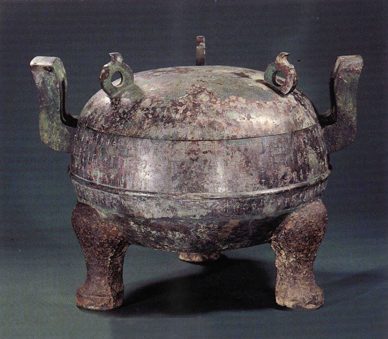
Bronze Ding des Königs Zhongshan
河北省博物馆 战国中山王铁足铜鼎,高51.5厘米,腹径65.8厘米。中山王鼎为王墓中同时出土的九件列鼎中的首鼎,铜身铁足,圆腹圜底,双附耳,蹄形足,上有覆钵形盖,盖顶有三环钮。鼎身刻有铭文469字。 据鼎铭得知,此鼎为奉祀宗庙的礼器。中山王鼎是中国迄今为止发现的最大的铁足铜鼎,也是铭文字数最多的一件战国青铜器。铭文字体瘦长,清秀挺拔,有所谓悬针篆风格。1977年于河北省平山县中山国王墓出土。
Mittelalterliche Karte, Alle Königreiche der Welt, Katalanischer Atlas, 1375/Medieval Map, All Kingdoms of the World, Catalan Atlas, 1375
Abraham Cresques’ (Crescas) stunning medieval depiction of the known world, “All Kingdoms of the World”, spanning from the North Atlantic to the South China Sea. The four maps are a part of Cresques’ 1375 mappamundi masterpiece Atles català (Catalan Atlas), the greatest example of the Majorcan cartographic school of Catalonia and Mallorca
Vereinbarung der Zentralen Volksregierung mit der Lokalen Regierung Tibets über Maßnahmen zur friedlichen Befreiung Tibets


 Art
Art


