
漢德百科全書 | 汉德百科全书
 Hungary


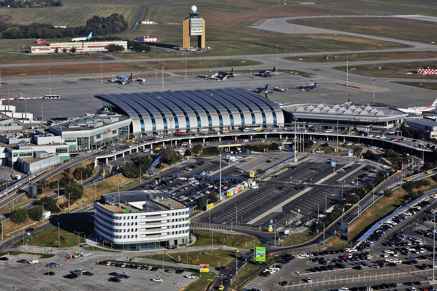

 UEFA European Championship 2020

 History
 ITU World Championship Series
 Silk road

 Sport
Sport
 Triathlon
 Hungary

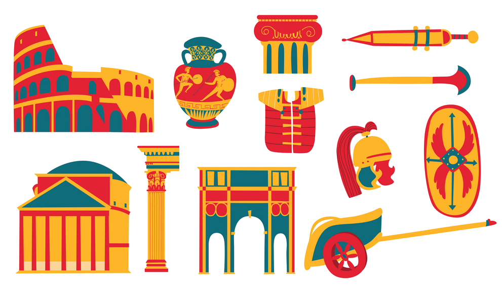 Cities founded by the Romans

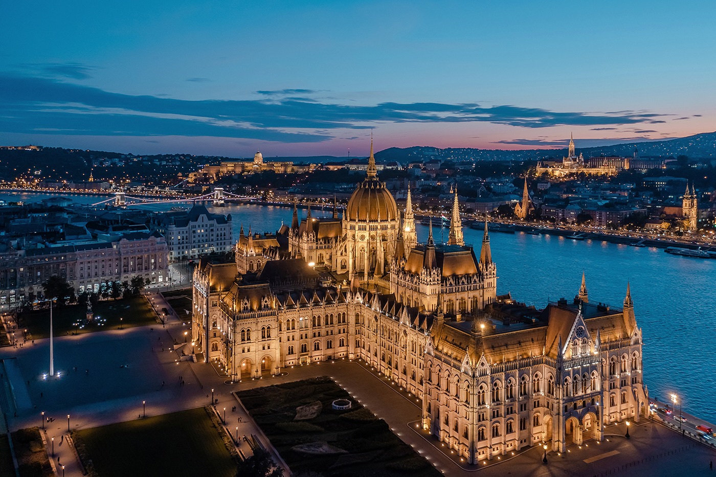

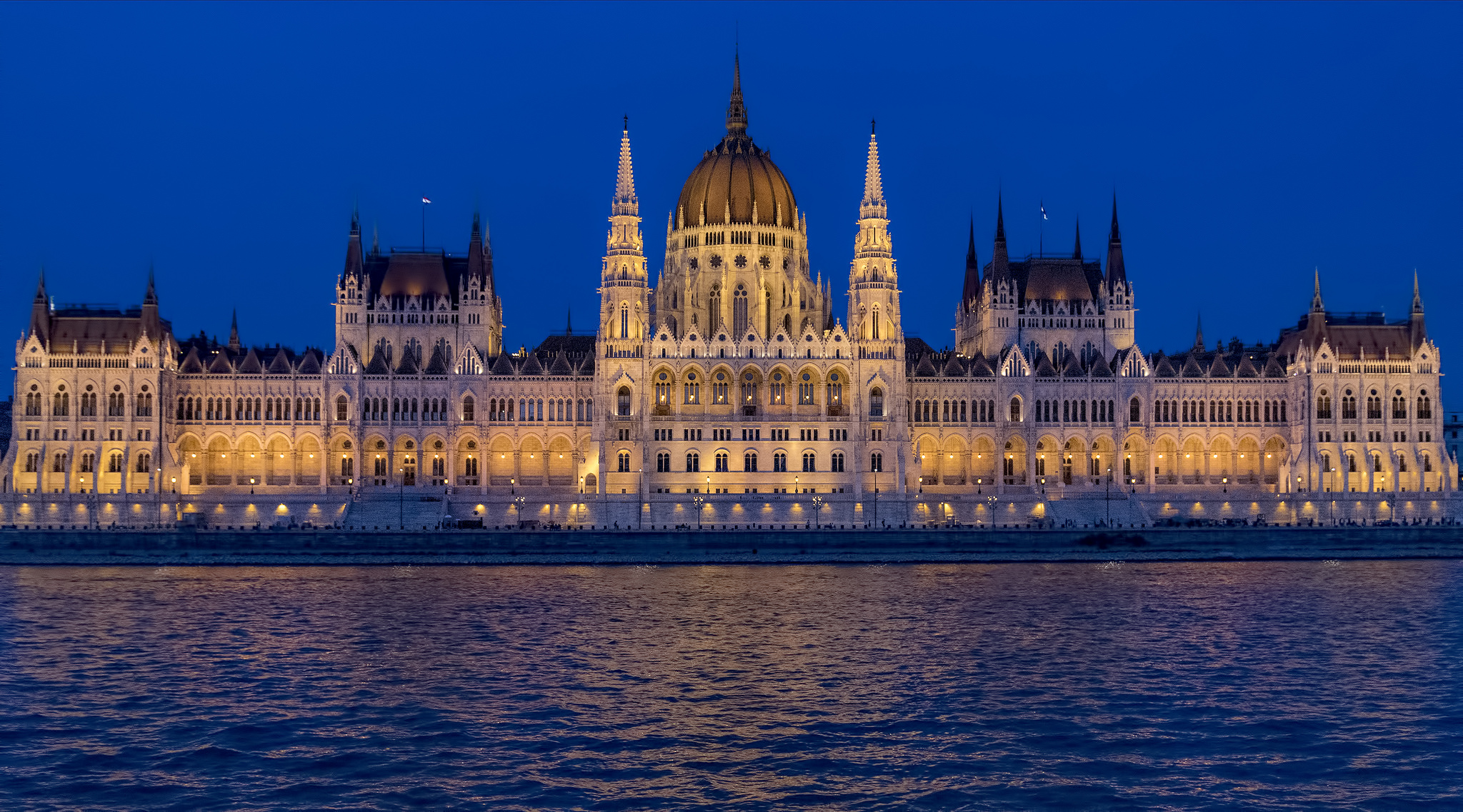
Budapest (ungarische Aussprache ['budɒpɛʃt];  anhören?/i) ist die Hauptstadt und zugleich größte Stadt Ungarns. Mit über 1,7 Millionen Einwohnern ist Budapest die zehntgrößte Stadt der Europäischen Union. Laut dem britischen Marktforschungsunternehmen Euromonitor International gehört sie zu den zwanzig am häufigsten von Touristen besuchten Städten Europas.[3] Die Einheitsgemeinde Budapest entstand 1873 durch die Zusammenlegung der zuvor selbstständigen Städte Buda (dt. Ofen), Óbuda (Alt-Ofen), beide westlich der Donau, und Pest östlich der Donau. Der Name Budapest selbst tauchte zuvor nicht auf, üblich im Sprachgebrauch war Pest-Buda.
Budapest liegt an der Donau, die an dieser Stelle das ungarische Mittelgebirge verlässt und in das ungarische Tiefland fließt. Die höchste Erhebung in Budapest ist der zu den Budaer Bergen zählende 527 Meter hohe János-Berg (ungarisch János-hegy). Weitere Budaer Berge sind der Gellértberg (Gellért-hegy), der Burgberg (Várhegy), der Rosenhügel (Rózsadomb), der Sonnenberg (Naphegy), der Adlerberg (Sashegy), der Martinsberg (Mártonhegy), der Schwabenberg (Svábhegy) und der Széchenyiberg (Széchenyi-hegy). Geotektonisch gesehen liegt die Stadt auf einer Bruchstelle, deshalb ist besonders Buda so reich an Thermalquellen.
Budapests Geschichte beginnt um 89 mit der Gründung eines römischen Militärlagers in ehemals vom keltischen Stamm der Eravisker besiedeltem Gebiet. In der Folge entstand um das Lager die römische Siedlung Aquincum, die zwischen 106 und 296 Hauptstadt der Provinz Pannonia inferior war. Unter römischer Herrschaft prosperierte die Stadt, es lassen sich ein Statthalterpalast, mehrere Amphitheater und Bäder nachweisen, außerdem wurde die an der gefährdeten römischen Donaugrenze gelegene Stadt mit einer Mauer versehen.
Die später christianisierten und sesshaft gewordenen Ungarn wohnten in Dörfern mit Kirchen und betrieben Ackerbau und Viehzucht. Im Zentrum wichtiger Verkehrswege gewann Pest immer mehr an Bedeutung. Bereits zu dieser Zeit entstand über die Donau (etwa bei der heutigen Elisabethbrücke) ein reger Fährverkehr zum gegenüberliegenden Buda. Mit der Krönung Stephans I. (am Weihnachtstag 1000 oder 1. Januar 1001) zum ersten König von Ungarn bauten die Ungarn ihre Vorherrschaft aus. Durch den Einfall der Mongolen („Mongolensturm“) 1241 kam es nach der Schlacht bei Muhi fast zur völligen Zerstörung. Die königliche Residenz wurde zunächst nach Visegrád verlegt. 1308 wurde die Stadt erneuert und 1361 Hauptstadt des Königreiches. 1514 fand ein Bauernaufstand statt.
布达佩斯(匈牙利语:Budapest,发音:'budɒpɛʃt)是匈牙利首都[6],也是该国主要的政治、商业、运输中心和最大的城市[7],也被认为是东欧一个重要的中继站[8]。布达佩斯的人口在1980年代中期曾达到高峰207万(布达佩斯都会区人口达到2,451,418人[9]),目前仅有约170万居民,它是欧洲联盟第七大城市。该市是在1873年由位于多瑙河右岸(西岸)的城市布达和古布达以及左岸(东岸)城市佩斯合并而成的[10][11]。此前没有布达佩斯这个称呼,过去人们一般将它称为佩斯-布达(Pest-Buda)。
布达佩斯有记载的历史开始于罗马帝国89年建立的的一个城堡阿奎库以及它北部产生的居民区,这个居民区位于今天的老布达。当时当地的居民主要是凯尔特人。从106年开始一直到4世纪阿奎库是潘诺尼亚省的省会,它位于潘诺尼亚的自然边界多瑙河上。其城堡对于罗马帝国来说有重要的地位,因此自然成为总督的驻地。107年哈德良开始在这里建造总督宫殿。
从1526年开始哈布斯堡王朝获得了匈牙利国王的位置。哈布斯堡王朝终于战胜了奥斯曼帝国恢复了匈牙利。但是布达与佩斯的处境并没有任何变化,统治它们的依然是外族人,而且它们的居民依然必须负很高的税。市内爆发市民暴动,但是被镇压。1723年佩斯成为王国政府的驻地。1838年佩斯发大水,七万人丧生。虽然如此佩斯依然是18世纪和19世纪发展最快的城市。到1800年,佩斯的人口在一个世纪里增长了20倍,达到600,000人。1780年哈布斯堡王朝设定德语为官方语言,试图以此来控制当地不断爆发的暴动。同时他们从德国向匈牙利移民。佩斯城内大多数居民是德国人。由于布达和佩斯市内有各种民族的人生活,而每个民族对这两座城市都有自己的名字,因此布达佩斯今天在许多语言中均有自己的名字。
ブダペストまたはブダペシュト(ハンガリー語: Budapest, 英語:[ˈbuːdəpɛst], [ˈbuːdəpɛʃt] or [ˈbʊdəpɛst]; ハンガリー語発音: [ˈbudɒpɛʃt] (![]() 音声ファイル))は、ハンガリーの首都であり、同国最大の都市である[2]。
音声ファイル))は、ハンガリーの首都であり、同国最大の都市である[2]。
「ブダペスト」として一つの市でドナウ川の両岸を占めるようになったのは1873年11月17日に西岸のブダとオーブダ、東岸のペストが合併してからである[3][4]。
ドナウ川河畔に位置し、ハンガリーの政治、文化、商業、産業、交通の一大中心都市で[5]、東・中央ヨーロッパ (en) では最大、欧州連合の市域人口では8番目に大きな都市である。しばしばハンガリーのプライメイトシティとも表現される[6]。
ブダペストの市域面積は525km2 (202.7 sq mi)[3]で、2011年の国勢調査によるブダペストの人口は174万人[7]、ピークであった1989年の210万人より減少している[8]。これは、ブダペスト周辺部の郊外化によるものである[9]。ブダペスト都市圏(通勤圏)の人口は330万人である[10][11]。
ブダペストの歴史の始まりはローマ帝国のアクインクムとしてで、もともとはケルト人の集落であった[12][13]。アクインクムは古代ローマの低パンノニア属州の首府となっている[12]。マジャル人がブダペスト周辺にやって来たのは[14]9世紀頃である。最初の集落は1241年から1242年にかけてモンゴルの襲来 (en) により略奪された[15]。15世紀に[16]町が再建されるとブダペストはルネサンス期の人文主義者文化の中心となった[17]。続いてモハーチの戦いが起こり、オスマン帝国による150年間の支配が続き[18]、18世紀、19世紀に新しい時代に入ると町は発展し繁栄する。ブダペストは1873年にドナウ川を挟んだ都市の合併が行われると、世界都市となる[19]。また、1848年から1918年の第一次世界大戦勃発まで列強に含まれたオーストリア=ハンガリー帝国のウィーンに続く第二の首都であった。1920年のトリアノン条約によりハンガリーは国土の72%を失い、ハンガリーの文化や経済をブダペストがすべてを占めるようになった。ブダペストはその大きさや人口で圧倒的に優位に立ち、ハンガリーの他の都市を小さく見せていた[20]。ブダペストはハンガリー革命 (1848年)や1919年のハンガリー評議会共和国、1944年のパンツァーファウスト作戦、1945年のブダペスト包囲戦、1956年のハンガリー動乱など数々の歴史的な舞台の場でもあった。
ブダペストはヨーロッパでも最も美しい街の一つで[2][21][22]、ドナウ川河岸を含め世界遺産が広がりブダ城やアンドラーシ通り、英雄広場は良く知られている。ブダペスト地下鉄1号線Millenniumi Földalatti Vasútはロンドン地下鉄に次いで世界で2番目に古い地下鉄である[21][23]。ブダペストの他のハイライトはセーチェーニ温泉を含めた80の温泉で[24]世界でも最大の地下熱水系統がある[25]。世界で3番目に大きなシナゴーグであるドハーニ街シナゴーグや国会議事堂などもブダペストの見所である。ブダペストの観光客数は年間270万人に上り、ロンドンにある民間調査機関ユーロモニターによればブダペストは世界で37番目に旅行者が多い観光地であるとされている[26]。
Budapest /ˈbuːdəpɛst/ is the capital and the most populous city of Hungary, and the tenth-largest city in the European Union by population within city limits.[9][10][11] The city had an estimated population of 1,752,704 in 2016 distributed over a land area of about 525 square kilometres (203 square miles).[12] Budapest is both a city and county, and forms the centre of the Budapest metropolitan area, which has an area of 7,626 square kilometres (2,944 square miles) and a population of 3,303,786, comprising 33 percent of the population of Hungary.[13][14]
The history of the city began when an early Celtic settlement transformed into a Roman town of Aquincum,[15][16] the capital of Lower Pannonia.[15] The Hungarians arrived in the territory in the late 9th century.[17] By the 11th century, Buda and Óbuda (Old Buda) became the names of their settlements on the west bank of the river Danube, with a formerly Slavic and then German settlement Pest on the opposite side.[3][18] The area was pillaged by the Mongols in 1241.[18] The Battle of Mohács in 1526 was followed by nearly 150 years of Ottoman rule.[19] After the reconquest of Buda in 1686, the region entered a new age of prosperity. Pest-Buda became a global city with the unification of Buda, Óbuda, and Pest on November 17, 1873, with the name 'Budapest' given to the new capital.[12][20] Budapest also became the co-capital of the Austro-Hungarian Empire,[21] a great power that dissolved in 1918, following World War I. The city was the focal point of the Hungarian Revolution of 1848, the Battle of Budapest in 1945, and the Hungarian Revolution of 1956.[22][23]
Budapest is a Beta+ global city with strengths in commerce, finance, media, art, fashion, research, technology, education, and entertainment.[24][25] It is Hungary's financial centre[26] and the highest ranked Central and Eastern European city on Innovation Cities Top 100 index,[27][28][29] as well ranked as the second fastest-developing urban economy in Europe.[30] Budapest is host to many major international organization's regional offices, including the United Nations and ICDT,[31] furthermore it is the headquarters of the European Institute of Innovation and Technology,[32] the European Police College[33] and the first foreign office of the China Investment Promotion Agency.[34] Over 40 colleges and universities are located in Budapest, including the Eötvös Loránd University, Semmelweis University and the notable Budapest University of Technology and Economics.[35][36] Opened in 1896,[37] the city's subway system, the Budapest Metro, serves 1.27 million, while the Budapest Tram Network serves 1.08 million passengers daily.[38]
Budapest is cited as one of the most beautiful cities in Europe,[9][39][40] ranked as "the world's second best city" by Condé Nast Traveler,[41] and "Europe's 7th most idyllic place to live" by Forbes.[42] Among Budapest's important museums and cultural institutions is the Museum of Fine Arts. Further famous cultural institutions are the Hungarian National Museum, House of Terror, Franz Liszt Academy of Music, Hungarian State Opera House and National Széchényi Library. The central area of the city along the Danube River is classified as a UNESCO World Heritage Site and has many notable monuments, including the Hungarian Parliament, Buda Castle, Fisherman's Bastion, Gresham Palace, Széchenyi Chain Bridge, Matthias Church and the Liberty Statue.[43] Other famous landmarks include Andrássy Avenue, St. Stephen's Basilica, Heroes' Square, the Great Market Hall, the Nyugati Railway Station built by the Eiffel Company of Paris in 1877 and the second-oldest metro line in the world, the Millennium Underground Railway.[39] The city also has around 80 geothermal springs,[44] the largest thermal water cave system,[45] second largest synagogue, and third largest Parliament building in the world.[46] Budapest attracts 4.4 million international tourists per year, making it a popular destination in Europe.[47]
Budapest (prononcé [by.da.ˈpɛst] , hongrois : Budapest [ˈbu.dɒ.pɛʃt] Écouter ; allemand : Budapest ou anciennement Ofen-Pesth) est la plus grande ville et la capitale de la Hongrie. Elle se situe en aval du coude du Danube entre le massif de Transdanubie et l'Alföld. Ses habitants sont les Budapestois (en hongrois, budapesti, -ek).
La ville actuelle est créée en 1873 par la fusion de Buda — alors capitale de la Hongrie — de Pest et d'Óbuda1. Elle a pour origine le site d'Aquincum2, un point de peuplement celte3 devenu capitale de la Pannonie inférieure pendant l'époque romaine3. Les Magyars arrivent dans la région au IXe siècle. Leur premier point d'implantation est pillé par les Mongols en 1241-12424. La ville est reconstruite et devient l'un des centres de la culture humaniste de la Renaissance5 au XVe siècle6. Après près de 150 ans de domination ottomane, elle poursuit son développement et connaît son apogée avec l'épanouissement de l'ère industrielle aux XVIIIe et XIXe siècles. Après la fusion de 1873 et l'accession de la ville au rang de seconde capitale de l'Autriche-Hongrie, Budapest atteint les proportions et les caractéristiques d'une ville mondiale7. Marquée par les différentes traces léguées par l'histoire, Budapest a notamment été l'épicentre de la révolution hongroise de 1848, de la République des conseils de Hongrie de 1919, de l'opération Panzerfaust en 1944, de la bataille de Budapest de 1945 et de l'insurrection de 1956.
Considérée comme l'une des plus belles villes d'Europe et comme la « perle » du Danube8,1,9, son panorama, le quartier du château de Buda, l'avenue Andrássy et le métropolitain du Millénaire figurent au patrimoine mondial de l'UNESCO8,10. Destination touristique importante, la ville attire plus de 4,3 millions de visiteurs par an11.
Plus grande ville du pays, elle en est le principal centre politique, culturel, commercial et industriel. Elle abrite le Parlement hongrois, les bâtiments ministériels et les ambassades du pays ainsi que les sièges sociaux des entreprises installées en Hongrie. Son ancien statut de cocapitale de l'Autriche-Hongrie lui confère un rayonnement important dans la Mitteleuropa. La partition du royaume de Hongrie à la suite du traité de Trianon en 1920 en fait une ville démesurée pour la Hongrie dans ses frontières actuelles. La macrocéphalie dont est atteinte la ville se concrétise par la convergence de la plupart des réseaux routiers et ferroviaires du pays en son centre et des écarts démographiques et économiques disproportionnés entre la capitale et la province12 (près de 20 % de la population hongroise est budapestoise). Avec ses 1 702 297 habitants13 (l'aire urbaine en compte 2 524 697), Budapest est également la ville la plus peuplée d'Europe centrale (si l'on exclut Berlin de l'Europe centrale). Elle en est également considérée du point de vue des échanges économiques comme une importante plaque tournante14. Budapest abrite le siège de l'Institut européen d'innovation et de technologie (IET)15.
Budapest (IPA: [ˈbudɒpɛʃt]; pronuncia italiana moderna: /ˈbudapest/[1]) è la capitale e la maggiore città dell'Ungheria.
Amministrata come un comune autonomo, costituisce inoltre il centro primario del Paese per la vita politica, economica e culturale; al 2016 conta 1 759 407 abitanti, mentre la popolazione residente nell'area metropolitana ammonta a oltre 3 300 000 persone.
Budapest nacque ufficialmente nel 1873 dall'unione delle città storiche di Buda e Óbuda, ubicate sulla sponda destra del Danubio, con l'abitato di Pest, situato sulla riva opposta del fiume e anch'esso di antiche origini; fino al 1918 fu una delle due capitali dell'Impero austro-ungarico, dissoltosi al termine della prima guerra mondiale.
Nel XXI secolo, Budapest è diventata una metropoli globale e si è affermata come una popolare destinazione turistica: nel 2011, secondo i dati forniti da Euromonitor International, la capitale ungherese è stata la 25ª città più visitata del mondo[2].
Budapest ( /ˈbudɒpɛʃt/ (?·i)) es la capital y ciudad más poblada de Hungría,2 así como su principal centro industrial, comercial y de transportes.3 La ciudad posee 1,74 millones de habitantes (2011),4 una disminución significativa respecto de los casi 2,1 millones con que contaba a mediados de los años 1980,5 que representan un quinto de la población total de Hungría. Es la ciudad más poblada de Europa central-oriental y la séptima de la Unión Europea. La ciudad ocupa una superficie de 525 km²6 y su



 Baden-Wuerttemberg

 Bavaria
 Bulgaria
 Germany
 Croatia
 Moldawien

 Upper Austria
 Austria
 Romania
 Serbia
 Slovakia
 Ukraine
 Hungary

 Vienna
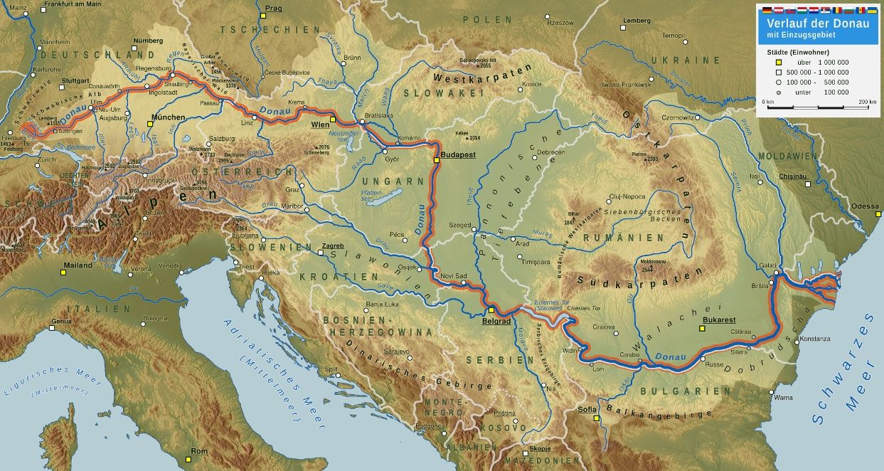
Die Donau ist mit einer mittleren Wasserführung von rund 6855 m³/s[2] und einer Gesamtlänge von 2857 Kilometern[1] nach der Wolga der zweitgrößte und zweitlängste Fluss in Europa. Der Strom entwässert weite Teile Mittel- und Südosteuropas. Er durchfließt bzw. berührt dabei zehn Länder (Deutschland, Österreich, Slowakei, Ungarn, Kroatien, Serbien, Bulgarien, Rumänien, die Republik Moldau und die Ukraine) – so viele wie kein anderer Fluss auf der Erde.
Die Donau führt ihren Namen ab der Vereinigung zweier Quellflüsse, der Brigach und der größeren Breg, die beide im Mittleren Schwarzwald entspringen. Sie durchquert drei große Beckenlandschaften: das nördliche Alpenvorland und das Wiener Becken (Oberlauf), die Pannonische Tiefebene (Mittellauf) und das Walachische Tiefland (Unterlauf). Die trennenden Gebirge durchschneidet sie in Engtälern, deren bekannteste Abschnitte der Donaudurchbruch bei Beuron, die Wachau, die Hainburger Pforte (auch Preßburger Pforte) und das Eiserne Tor sind. Der Strom mündet über das ausgedehnte Donaudelta ins Schwarze Meer.
Die Donau ist eine der ältesten und bedeutendsten europäischen Handelsrouten und verbindet dabei unterschiedliche Kulturkreise. Politische Spannungen und Kriege bewirkten immer wieder Sperren und Behinderungen der Wasserstraße. Seit dem Fall des Eisernen Vorhanges hat die Donau wieder ihre wirtschaftliche Bedeutung erhalten. Der Fluss verbindet viele artenreiche und unverbaute Naturräume und ist ein wichtiger Standort für Wasserkraftwerke.
多瑙河是一 条著名的国际河流,是世界上流经国家最多的一条河流。它发源于德国西南部黑林山东麓海拔679米的地方,自西向东流经奥地利、捷克、斯洛伐克、匈牙利、克 罗地亚、前南斯拉夫、保加利亚、罗马尼亚、乌克兰等9个国家后,流入黑海。多瑙河全长2860公里,是欧洲第二大河。多瑙河像一条蓝色的飘带蜿蜒在欧洲的 大地上。
多瑙河沿途接纳了300多条大小支流,形成的流域面积达81.7万平方公里,比中国的黄河还要大。多瑙河年平均流量为6430立方米/秒,入海水量为203立方公里。
从 源头到维也纳是多瑙河的上游,多瑙河在这里接纳了几条源自阿尔卑斯山融雪的支流,水量大增。这里山清水秀,一派田园风光。从维也纳到铁门是河流的中游, 这里河谷一般较宽,河床坡度不大,河道弯曲,多河汊。在贝尔格莱德以东的喀尔巴阡山中,形成了全长130公里的峡谷,著名的有卡桑峡、铁门等,蕴藏着丰富 的水力资源。自铁门以下至入海口为河流的下游。下游河段宽阔,水流平稳,接近河口时宽达15至28公里,航运业十分发达。多瑙河三角洲盛产芦苇(芦苇是造 纸的好原料)。这里还有大量的鸟类和奇特的浮岛,科学家因此称其为“欧洲最大的地质、生物实验室”。( 转载 作者佚名)
多瑙河(德文:Donau)是欧洲第二大河,次于俄罗斯的伏尔加河,发源于德国黑森林地区,最后注入黑海,全长2857千米[1],流域面积81.7万平方千米[1],平均流量为6500立方米/秒。
多瑙河是中东欧极为重要的国际河道,流经德国、奥地利、斯洛伐克、匈牙利、克罗地亚、塞尔维亚、罗马尼亚、保加利亚、摩尔多瓦和乌克兰等10个中欧及东欧国家,是世界上流经国家最多的河流,流域范围还包括波兰、瑞士、意大利、捷克、斯洛文尼亚、波斯尼亚和黑塞哥维那、黑山、马其顿共和国、阿尔巴尼亚等9个国家,有大小300多条支流[2]。多瑙河最后从多瑙河三角洲注入黑海。
ドナウ川(ドナウがわ、ラテン語:Danubius、 ドイツ語: Donau [ˈdoːnaʊ])は、ヴォルガ川に次いでヨーロッパで2番目に長い大河である。
ドイツ南部バーデン=ヴュルテンベルク州の森林地帯「シュヴァルツヴァルト(黒い森)」に端を発し、概ね東から南東方向に流れ、東欧各国を含む10ヶ国を通って黒海に注ぐ重要な国際河川である。河口にはドナウ・デルタが広がる。全長は2,850 km。
現在の名ドナウ(ドイツ語: ドーナウ)と各国語でそれに相当する名前は、ラテン語の Danubiusダーヌビウス に由来する。これはローマ神話のある河神の名である。スキタイ語、あるいはケルト語からの借用語がもとになっていると考えられている。スロヴァキア語ではDunaj、セルボクロアチア語ではDunav, ハンガリー語 Duna, ブルガリア語: Дунав, ルーマニア語: Dunăre、英語、フランス語: Danube 英語: [ˈdænjuːb]である。
語頭 Danu はインド・ヨーロッパ祖語で「川」を意味する「*dānu」という単語より来ている。ケルト神話のダヌ(Danu)、インド神話の水の女神ダヌ(Danu)など、印欧語族の神話にはこの語が残っている。黒海周辺にはドン川、ドニエプル川、ドネツ川、ドニエストル川など、同様の単語から派生したと見られる川の名が多数ある。
語尾 au は古ゲルマン語で流れを意味する ouwe に由来し、ドイツ語名称に1763年以降使われている。ドイツ語では以前は Tonach, その後は Donaw の名が使われ、現在に至る。日本語表記は、ドナウ川、ダニューブ川。
下流域は古代ギリシャ語では「イストロス川」と呼ばれた。これはケルト語の ys に由来する。
The Danube (/ˈdæn.juːb/ DAN-yoob), known by various names in other languages, is Europe's second longest river, after the Volga. It is located in Central and Eastern Europe.
The Danube was once a long-standing frontier of the Roman Empire, and today flows through 10 countries, more than any other river in the world. Originating in Germany, the Danube flows southeast for 2,850 km (1,770 mi), passing through or touching the border of Austria, Slovakia, Hungary, Croatia, Serbia, Romania, Bulgaria, Moldova and Ukraine before emptying into the Black Sea. Its drainage basin extends into nine more countries. The Danube river basin is home to fish species such as pike, zander, huchen, wels catfish, burbot and tench. It is also home to a large diversity of carp and sturgeon, as well as salmon and trout. A few species of euryhaline fish, such as European seabass, mullet, and eel, inhabit the Danube delta and the lower portion of the river.
Le Danube (prononcé [da.nyb]) est le deuxième fleuve d’Europe par sa longueur (après la Volga qui coule entièrement en Russie). Il prend sa source dans la Forêt-Noire en Allemagne lorsque deux cours d’eau, la Brigach et la Breg, se rencontrent à Donaueschingen où le fleuve prend le nom de Danube.
La longueur du Danube dépend du point de départ considéré : 2 852 km pour la confluence de Donaueschingen mais 3 019 km à partir de la source de la Breg1. Il coule vers l’est et baigne plusieurs capitales de l’Europe centrale, orientale et méridionale : Vienne, Bratislava, Budapest et Belgrade. Le delta du Danube s'ouvre sur la mer Noire : partagé entre la Roumanie et l'Ukraine, il est protégé par une réserve de biosphère et est inscrit au patrimoine mondial de l’UNESCO.
Le Danube est depuis des siècles une importante voie fluviale. Connu dans l’Antiquité comme frontière septentrionale de l’Empire romain, le fleuve traverse ou longe dix pays : l’Allemagne (7,5 %), l’Autriche (10,3 %), la Slovaquie (5,8 %), la Hongrie (11,7 %), la Croatie (4,5 %), la Serbie (9,4 %), la Bulgarie (5,2 %), la Roumanie (28,9 %), la Moldavie (1,7 %) et l’Ukraine (3,8 %).
Son bassin versant s'étend sur neuf autres pays : l’Italie (0,15 %), la Pologne (0,09 %), la Suisse (0,32 %), la République tchèque (2,6 %), la Slovénie (2,2 %), la Bosnie-Herzégovine (4,8 %), le Monténégro, la République de Macédoine et l’Albanie (0,03 %).
Il Danubio (AFI: /daˈnubjo/[1]; nell'uso antico anche la Danoia[2], /daˈnɔja/[3]; in tedesco Donau, ungherese Duna, slovacco e polacco Dunaj, croato Dunav, ucraino Дунай, bulgaro e serbo Дунав (Dunav), rumeno e moldavo Dunărea) è un fiume dell'Europa centro-orientale. Con 2.860 km è il secondo corso d'acqua più lungo del continente (dopo il Volga), e il più lungo fiume navigabile dell'Unione europea.
Le sue sorgenti sono nella Foresta Nera in Germania, dove due piccoli fiumi, il Brigach e il Breg, si riuniscono a Donaueschingen. È a partire da questo punto che il fiume prende il nome di Danubio, anche se si tende a pensare che il Brigach sia a sua volta un affluente del Breg, pertanto quest'ultimo sarebbe già il Danubio. Dalle sorgenti scorre verso est, e attraversa varie capitali dell'Europa centrale e orientale (Vienna, Bratislava, Budapest e Belgrado). Alla fine del suo corso si getta nel Mar Nero attraverso un ampio delta sul confine tra Romania e Ucraina. Il delta del Danubio è incluso nella lista del patrimonio mondiale dell'UNESCO.
Il Danubio è da decine di secoli un'importante via navigabile. Conosciuto nella storia come una delle frontiere dell'Impero romano, il fiume scorre entro i confini di dieci paesi: Germania (7,5% del bacino idrografico), Austria (10,3%), Slovacchia (5,8%), Ungheria (11,7%), Croazia (4,5%), Serbia, Bulgaria (5,2%), Romania (28,9%), Moldavia (1,7%) e Ucraina (3,8%). Il suo bacino idrografico comprende parte di altri nove paesi: Italia (0,15%), Polonia (0,09%), Svizzera (0,32%), Repubblica Ceca (2,6%), Slovenia (2,2%), Bosnia ed Erzegovina (4,8%), Montenegro, Repubblica di Macedonia e Albania (0,04%).
El Danubio (Donau, en alemán; Dunaj, en eslovaco; Дунав/Dunav, en bosnio, croata y serbio; Duna, en húngaro; Dunărea en rumano; y Дунай/Dunay, en ucraniano) es un río del centro de Europa que fluye en dirección principalmente este a través de diez países —Alemania, Austria, Eslovaquia, Hungría, Croacia, Serbia, Rumania, Bulgaria, Moldavia y Ucrania— desaguando en el mar Negro, donde forma el delta del Danubio, una región de gran valor ecológico. Con 2850 km es el segundo más largo de Europa, tras el Volga.
Constituyó durante la Edad Antigua una de las fronteras naturales que formaban el limes del Imperio romano (junto con el Rin y otros ríos y algunos trechos fortificados). En las fuentes clásicas se le llamaba Istro.
Дуна́й (рум. Dunărea, венг. Duna, нем. Donau, серб. Дунав, словацк. Dunaj, болг. Дунав, хорв. Dunav, укр. Дунай, лат. Danubius, Danuvius, др.-греч. Ἴστρος) — вторая по протяжённости река в Европе (после Волги), «интернациональная» река, самая длинная река на территории Европейского Союза. Длина — 2860 км.
Берёт исток в горах Шварцвальда в Германии. Дунай протекает по территории или является границей десяти государств: Германии, Австрии, Словакии, Венгрии, Хорватии, Сербии, Болгарии, Румынии, Украины и Молдавии; проходит через такие столицы Центральной и Юго-Восточной Европы, как Вена, Братислава, Будапешт и Белград[2]. Помимо этих десяти стран в бассейне Дуная находятся те или иные территории ещё девяти европейских государств[2]. Река впадает в Чёрное море, образуя дельту на границе Румынии и Украины; румынская часть этой дельты внесена в список объектов Всемирного наследия ЮНЕСКО[3].
 Music
Music
 Architecture
 CESAER
 Colleges and Universities in Europe
 Transport and traffic
 International cities
 Art
Art
 Geography