漢德百科全書 | 汉德百科全书

       
Chinese — German
Catalog Northern Ireland

Fußball-Europameisterschaft 2028/UEFA European Football Championship 2028

This image, video or audio may be copyrighted. It is used for educational purposes only. If you find it, please notify us byand we will remove it immediately.
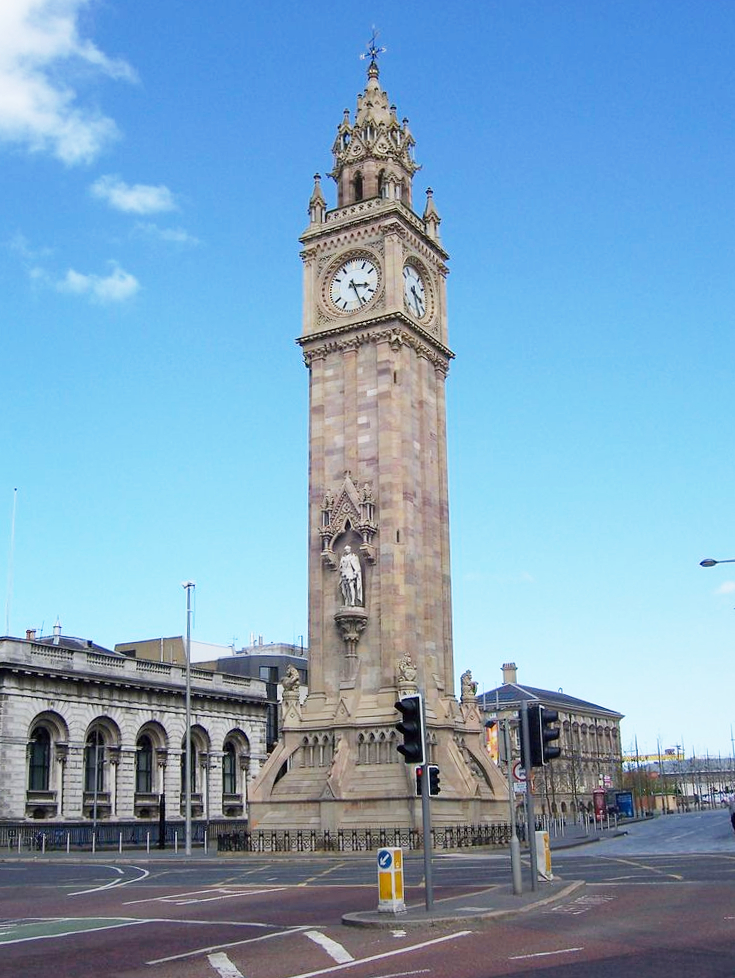
Albert Memorial Clock Tower

This image, video or audio may be copyrighted. It is used for educational purposes only. If you find it, please notify us byand we will remove it immediately.
University of Ulster

This image, video or audio may be copyrighted. It is used for educational purposes only. If you find it, please notify us byand we will remove it immediately.
Insel Irland
爱尔兰岛(英语:Ireland,爱尔兰语:Éire)是位于欧洲西北部的大西洋岛屿,以面积计算是欧洲第三大岛。岛上大部分区域属于爱尔兰共和国的领土,至于岛上东北部的北爱尔兰地区之主权则属于英国。
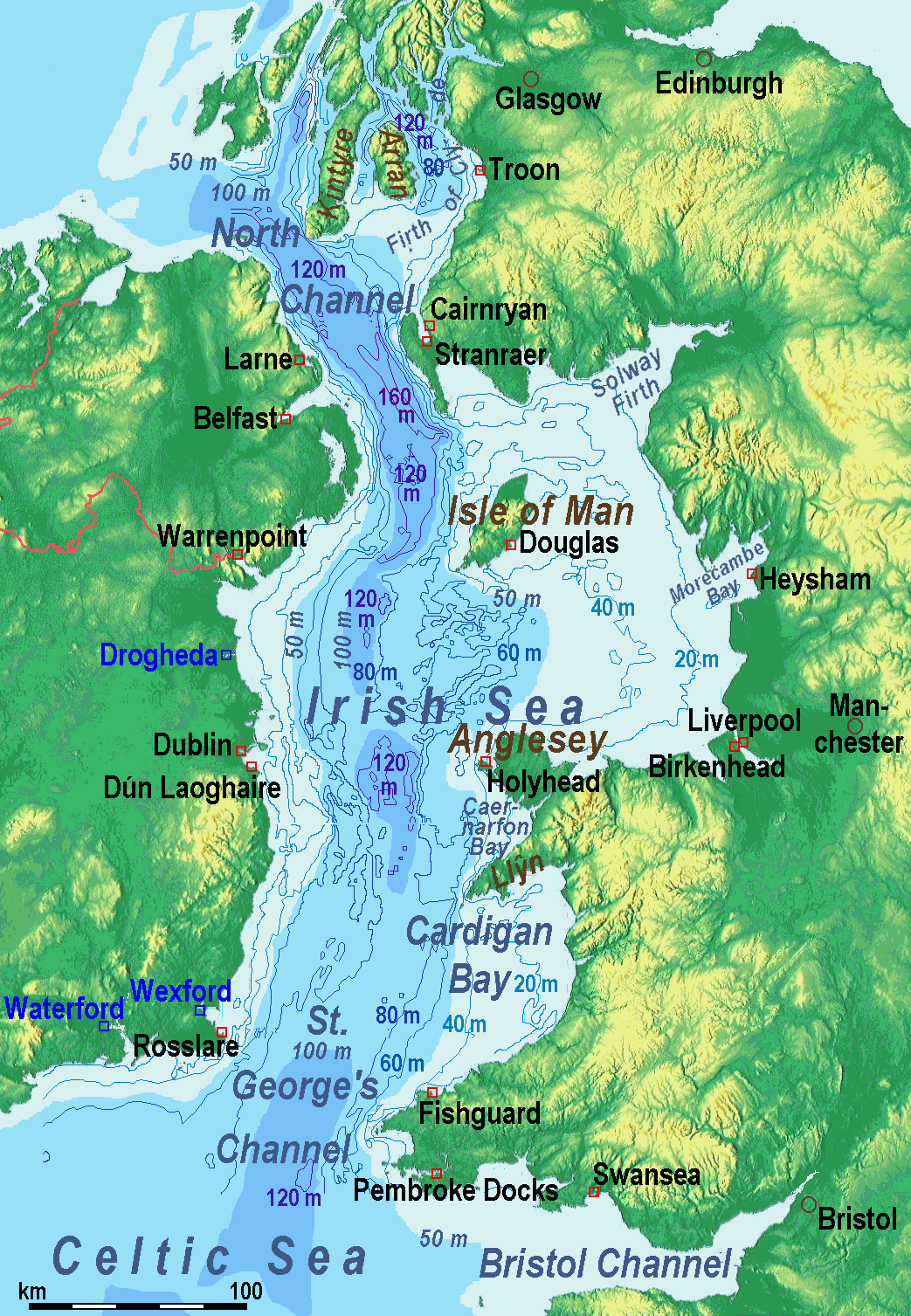
Die Insel Irland ist etwa 450 km lang und rund 260 km breit und liegt im Atlantik. Insgesamt hat sie eine Fläche von etwa 84.421 km². Sie ist damit die drittgrößte Insel Europas und die zwanzigstgrößte der Welt. An der Küste gelegene Berge umgeben zentrale Ebenen. Der Carrauntuohill im County Kerry ist mit 1041 Metern der höchste Berg. Der Shannon teilt die Insel in zwei nicht gleich große Teile und ist mit rund 370 km, von denen knapp 250 km schiffbar sind, der längste Fluss.

爱尔兰岛(英语:Ireland,爱尔兰语:Éire)是位于欧洲西北部的大西洋岛屿,以面积计算是欧洲第三大岛。岛上大部分区域属于爱尔兰共和国的领土,至于岛上东北部的北爱尔兰地区之主权则属于英国

This image, video or audio may be copyrighted. It is used for educational purposes only. If you find it, please notify us byand we will remove it immediately.
Irische See/Irish Sea
爱尔兰海(英语:Irish Sea、爱尔兰语:Muir Éireann)位于英国不列颠岛和爱尔兰岛之间;它南端的圣乔治海峡处于爱尔兰和威尔士之间,北端的北海海峡处于爱尔兰和苏格兰之间,两者都与大西洋相通。
Die Irische See (irisch Muir Éireann, englisch Irish Sea, walisisch Môr Iwerddon) trennt die Inseln Irland und Großbritannien.Die Irische See ist im Süden durch den St.-Georgs-Kanal (zwischen Irland und Wales) mit der Keltischen See und im Norden durch den Nordkanal (zwischen Irland und Schottland) mit der Schottischen See und damit mit dem offenen Atlantik verbunden.

爱尔兰海(英语:Irish Sea、爱尔兰语:Muir Éireann)位于英国不列颠岛爱尔兰岛之间;它南端的圣乔治海峡处于爱尔兰威尔士之间,北端的北海海峡处于爱尔兰苏格兰之间,两者都与大西洋相通。

爱尔兰海面积10万平方公里,平均水深61米,西北部最深处达272米。

马恩岛安格尔西岛位于爱尔兰海的中部。

不列颠岛和爱尔兰岛之间经爱尔兰海的交通连接包括由斯旺西(Swansea)至科克(Cork)、费什加德(Fishguard)及彭布洛克(Pembroke)至罗斯莱尔(Rosslare)、荷利赫德(Holyhead)至当莱瑞(Dún Laoghaire)、斯特兰拉尔(Stranraer)至贝尔法斯特拉恩(Larne)、和凯安雷恩(Cairnryan)至拉恩的路线。另外还有利物浦经马恩岛往贝尔法斯特的路线。

This image, video or audio may be copyrighted. It is used for educational purposes only. If you find it, please notify us byand we will remove it immediately.
Nordirland
This image, video or audio may be copyrighted. It is used for educational purposes only. If you find it, please notify us byand we will remove it immediately.
Northern Ireland Assembly


This image, video or audio may be copyrighted. It is used for educational purposes only. If you find it, please notify us byand we will remove it immediately.
Nordirische Fußballnationalmannschaft/Northern Ireland national football team
http://www.net4info.de/photos/cpg/albums/userpics/10002/Nordirische_Fussballnationalmannschaft.png
This image, video or audio may be copyrighted. It is used for educational purposes only. If you find it, please notify us byand we will remove it immediately.
Nordkanal/North Channel
This image, video or audio may be copyrighted. It is used for educational purposes only. If you find it, please notify us byand we will remove it immediately.
Queen´s University Belfast
 
 
http://www.net4info.de/photos/cpg/albums/userpics/10002/Queen27s_University_Belfast.png
 
 
This image, video or audio may be copyrighted. It is used for educational purposes only. If you find it, please notify us byand we will remove it immediately.
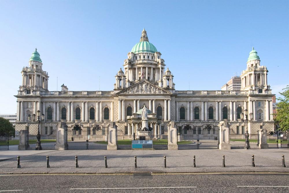
Belfast City Hall

This image, video or audio may be copyrighted. It is used for educational purposes only. If you find it, please notify us byand we will remove it immediately.
Belfast
This image, video or audio may be copyrighted. It is used for educational purposes only. If you find it, please notify us byand we will remove it immediately.