
Deutsch-Chinesische Enzyklopädie, 德汉百科
 International cities

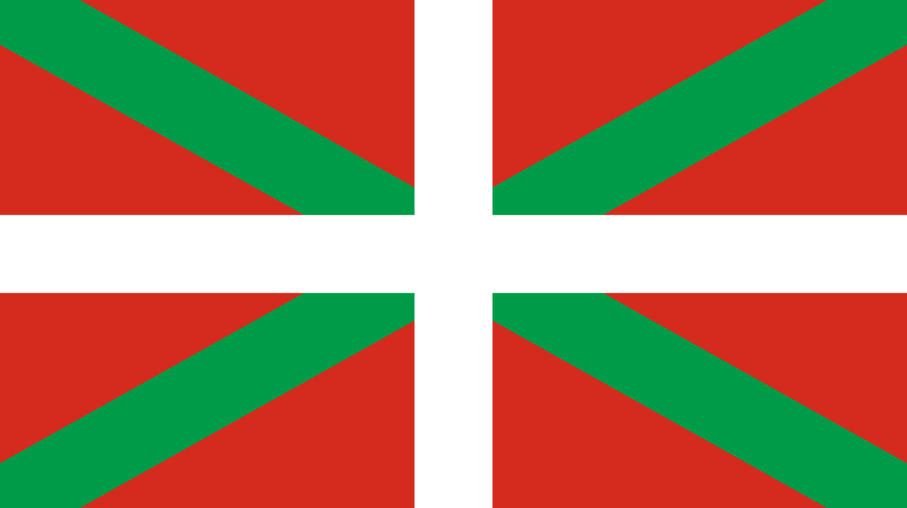 Comunidad Autónoma del País Vasco
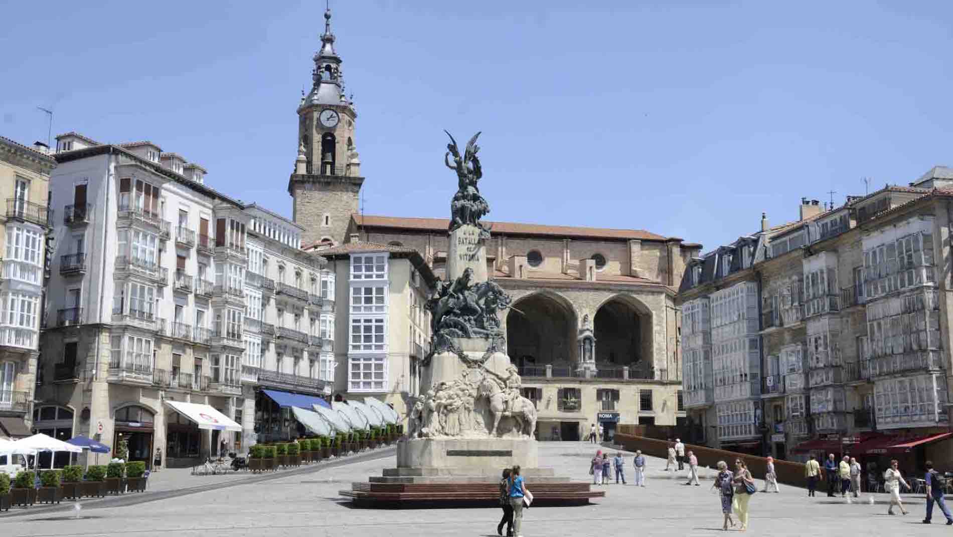
维多利亚巴斯克自治区首都,位于四面环山的平原上,距离海滩60公里,距离葡萄园和拉里奥哈自治区古老酒窖30公里,距离西班牙语创始地50公里 。50年前,仅60.000 人口,短短数年内增长到230.000人口,大部分的因数为她充满活力的现代化工业发展,吸引着开发商,以及西班牙其他城市的居民前来定居。现在她还在一迅猛的速度持续发展。
维多利亚距离马德里351公里,距离毕尔巴鄂66公里,距离圣塞瓦斯蒂安110公里,距离步尔戈斯112公里,距离蟠普洛纳90公里。 以上城市以及萨拉戈萨,巴塞罗那皆可通过高速公路由汽车,火车或飞机抵达。(与马德里与和巴塞罗有固定航班)从伦敦和柏林皆有固定航班飞往维多利亚。(Quelle:http://www.zadorspain.com)
 Bretagne
 Medieval cities in Europe


华沙(波兰语:Warszawa [varˈʂava] ![]() 试听)是波兰首都及最大城市,位于维斯拉河两岸,距波罗的海和喀尔巴阡山脉大约350公里。2008年人口数字为1,707,983人,都市圈人口大约2,785,000人。城市面积512平方公里,都市圈面积12266平方公里。冷战时期著名的华沙公约就是于此签署的。
试听)是波兰首都及最大城市,位于维斯拉河两岸,距波罗的海和喀尔巴阡山脉大约350公里。2008年人口数字为1,707,983人,都市圈人口大约2,785,000人。城市面积512平方公里,都市圈面积12266平方公里。冷战时期著名的华沙公约就是于此签署的。
该市也是马佐夫舍省的省会,拥有许多工业企业(制造、钢铁、电气工程、自动工业),66所高等学府(包括华沙大学),和超过30家剧院。
第二次世界大战时期的1944年8月,十八世纪的历史名城-华沙,在纳粹德国占领军的空袭下,百分之八十五的历史建筑遭到毁灭。二战之后,华沙人民用长达五年的时间重建家园,他们修建了教堂、宫殿和贸易场所。华沙的重生是十三至二十世纪建筑史上的不可抹灭的一笔。
波兰的首都华沙建立于公元13世纪,位于欧洲北部平原心脏地带,地势为维斯图拉河岸边水土丰饶的斜坡地,沿克拉科夫下游的城市横跨维斯图拉河两岸。历史上一直是政治、行政中心,现为国家首都和主要省会城市。
1280年马佐瓦亚公爵建立华沙,修建城堡以控制维斯图拉河渡口,这是华沙城开始发展的标志。1344年华沙成为马佐瓦亚公国首都。15世纪,历任公 爵在华沙修建了自己的住宅,随着城市功能的迅速完善,华沙的政治地位也越发显赫。1596年,波兰王城从克拉科夫迁移至华沙古城,从此华沙成为波兰的政治 文化中心。城市大兴土木,华沙即刻兴盛起来。1656和1702年华沙两次被瑞典人摧毁,又两度重建。18世纪末华沙成为欧洲最大的城市。
二次大战末期,华沙举行反纳粹占领者起义,起义总指挥部设在古城。起义失败后,希特勒下令把华沙从地球上抹掉。古城90%被毁。战后,人们急切地展开了重建工作。到1966年,所有旧城的纪念建筑都依照14至18世纪原样重新修建。
华沙文化中心靠近维斯图拉河岸,城市围绕着集市广场发展起来,主要特点是街道按照方格网状进行布局规划。随着街道从市中心向外延伸,这种布局的规范性逐渐消失。宽阔的广场提供了广大深远的视野。
16-18世纪的建筑物外墙为华沙提供了一种赏心悦目的景色,装饰着壁画和石门的房屋沿市场一直延展开去。广场附近另一排房屋正面建造了装饰性的拱顶 和游廊。老城边上靠近城堡的地方,一连片色彩艳丽的住房与整个城市和谐地融为一体。俯瞰全城的皇宫旁另有一些纪念建筑成为重建后华沙的点缀,这些建筑具有 哥特式、文艺复兴式和巴洛克等各种风格。靠近城堡并沿维斯图拉河生长的绿林将老城环绕起来。
(Quelle: www.guwh.com)
Warschau (polnisch Warszawa [varˈʃava] ) ist seit 1596 die Hauptstadt Polens[2] und die flächenmäßig größte sowie mit über 1,7 Mio. Einwohnern bevölkerungsreichste[3] Stadt des Landes. Als eines der wichtigsten Verkehrs-, Wirtschafts- und Handelszentren Mittel- und Osteuropas genießt Warschau große politische und kulturelle Bedeutung. In der Stadt befinden sich zahlreiche Institutionen, Universitäten, Theater, Museen und Baudenkmäler.
Beidseitig am Strom der Weichsel (pln. Wisła) in der Woiwodschaft Masowien gelegen, stellt sie das Zentrum der zweitgrößten Agglomeration Polens mit rund 3,5 Mio. Einwohnern dar. Ihr Stadtgebiet gliedert sich in 18 Stadtbezirke, unter denen Śródmieście (Stadtmitte) die Innenstadt ausmacht und das UNESCO-Welterbe der wiederaufgebauten Warschauer Altstadt beherbergt.
ワルシャワ(Warszawa![]() [varˈʂava];ヴァルシャヴァ、英: Warsaw、ワルソー[ˈwɔːrsɔː])は、ポーランドの首都でかつ同国最大の都市。マゾフシェ県の県都。ポーランドの政治、経済、交通の要衝でもある。
[varˈʂava];ヴァルシャヴァ、英: Warsaw、ワルソー[ˈwɔːrsɔː])は、ポーランドの首都でかつ同国最大の都市。マゾフシェ県の県都。ポーランドの政治、経済、交通の要衝でもある。
ワルシャワにはヴィスワ川の中流、マゾフシェ地方に位置し、市内をヴィスワ川が貫通する。第2次世界大戦後、戦火で荒廃した旧市街を「煉瓦のヒビに至るまで」復元して往時の町並みを回復した。1980年、ユネスコに「ワルシャワ歴史地区」として世界遺産に登録された。
製造業、鉄鋼業、電機産業、自動車産業などの工業都市であり、ワルシャワ大学を初めとするポーランド有数の高等教育機関が集中し、歌劇場やワルシャワ国立フィルハーモニー管弦楽団を擁する首都。
毎年8月1日の午後5時、サイレンの音を合図にワルシャワ市内では人によりその場で直立不動となり1分間の黙祷を捧げるとされる。この1分間は全ワルシャワ市の部分的な機能が停止するとも云われる。これは1944年8月1日午後5時に開始されたワルシャワ蜂起での犠牲者を追悼する行事。この時刻およびその行事は、ワルシャワ(Warszawa)の頭文字をとって「時刻W」と呼ばれる。
Warsaw (Polish: Warszawa [varˈʂava] (![]() listen); see also other names) is the capital and largest city of Poland. The metropolis stands on the Vistula River in east-central Poland and its population is officially estimated at 1.765 million residents within a greater metropolitan area of 3.101 million residents,[4] which makes Warsaw the 8th most-populous capital city in the European Union. The city limits cover 516.9 square kilometres (199.6 sq mi), while the metropolitan area covers 6,100.43 square kilometres (2,355.39 sq mi).[5] Warsaw is an alpha global city, a major international tourist destination, and a significant cultural, political and economic hub.[6][7] With a GDP PPP of $230 billion and $43,200 per capita, it is one of the wealthiest capital cities in Central and Eastern Europe.[8] Moreover, its historical Old Town was designated a UNESCO World Heritage Site.
listen); see also other names) is the capital and largest city of Poland. The metropolis stands on the Vistula River in east-central Poland and its population is officially estimated at 1.765 million residents within a greater metropolitan area of 3.101 million residents,[4] which makes Warsaw the 8th most-populous capital city in the European Union. The city limits cover 516.9 square kilometres (199.6 sq mi), while the metropolitan area covers 6,100.43 square kilometres (2,355.39 sq mi).[5] Warsaw is an alpha global city, a major international tourist destination, and a significant cultural, political and economic hub.[6][7] With a GDP PPP of $230 billion and $43,200 per capita, it is one of the wealthiest capital cities in Central and Eastern Europe.[8] Moreover, its historical Old Town was designated a UNESCO World Heritage Site.
Once described as the Paris of the East, Warsaw was believed to be one of the most beautiful cities in the world until World War II.[9] Bombed at the start of the German invasion in 1939, the city withstood a siege for which it was later awarded Poland's highest military decoration for heroism, the Virtuti Militari.[10][11][12] Deportations of the Jewish population to concentration camps led to the Warsaw Ghetto Uprising in 1943 and the destruction of the Ghetto after a month of combat. A general Warsaw Uprising between August and October 1944 led to even greater devastation and systematic razing by the Germans in advance of the Vistula–Oder Offensive. Warsaw gained the new title of Phoenix City because of its extensive history and complete reconstruction after World War II, which had left over 85% of its buildings in ruins.[13][14]
Warsaw is one of Europe's most dynamic metropolitan cities.[15] In 2012 the Economist Intelligence Unit ranked Warsaw as the 32nd most liveable city in the world.[16] In 2017 the city came 4th in the "Business-friendly" category and 8th in "Human capital and life style".[15] It was also ranked as one of the most liveable cities in Central and Eastern Europe.
The city is a significant centre of research and development, Business process outsourcing, Information technology outsourcing, as well as of the Polish media industry. The Warsaw Stock Exchange is the largest and most important in Central and Eastern Europe.[17][18] Frontex, the European Union agency for external border security as well as ODIHR, one of the principal institutions of the Organization for Security and Cooperation in Europe have their headquarters in Warsaw. Together with Frankfurt, London and Paris, Warsaw is also one of the cities with the highest number of skyscrapers in the European Union.[19]
The city is the seat of the Polish Academy of Sciences, Warsaw National Philharmonic Orchestra, University of Warsaw, the Warsaw Polytechnic, the National Museum, the Great Theatre—National Opera, the largest of its kind in the world,[20] and the Zachęta National Gallery of Art. The picturesque Old Town of Warsaw, which represents examples of nearly every European architectural style and historical period,[21] was listed as a World Heritage Site by UNESCO in 1980. Other main architectural attractions include the Castle Square with the Royal Castle and the iconic King Sigismund's Column, the Wilanów Palace, the Łazienki Palace, St. John's Cathedral, Main Market Square, palaces, churches and mansions all displaying a richness of colour and detail. Warsaw is renowned for its bars, restaurants, art galleries and, most notably, several dozen museums and outspread greenery,[22] with around a quarter of the city's area occupied by parks.[23]
Varsovie (prononcé [vaʁ.sɔ.vi] ; en polonais : Warszawa [var.ˈʃa.va] Écouter) est depuis 1596 la capitale de la Pologne et depuis 1999 le chef-lieu de la voïvodie de Mazovie. Elle est située sur la Vistule, à environ 320 km de la mer Baltique et des Carpates. Peuplée par plus d'1,8 million d'habitants (3 millions pour l'agglomération), la capitale polonaise est aussi la plus grande ville du pays et la 8e plus grande de l'Union européenne. Varsovie se divise en dix-huit arrondissements (dzielnice).
Connue comme la Ville-phénix pour avoir réussi à renaître de ses cendres (84 % de ses bâtiments ont été détruits durant la Seconde Guerre mondiale2,3), Varsovie a connu une croissance spectaculaire au cours de la seconde moitié du XXe siècle et cette croissance a encore été ravivée après le passage de la Pologne à l’économie de marché dans les années 1990. L’agglomération continue à se transformer et à se développer à un rythme soutenu : elle regroupe toute une gamme d'industries et soixante-six établissements d'enseignement supérieur. C’est aussi un centre artistique et culturel important, une place financière et un pôle économique majeur en Europe centrale.
Varsovie a donné son nom à la Confédération de Varsovie, au Pacte de Varsovie, au Duché de Varsovie, à la Convention de Varsovie, aux différents Traités de Varsovie et à l'Insurrection de Varsovie. La Varsovienne de 1831 est largement considérée comme l'hymne officieux de Varsovie4.
Varsovie dispute à Budapest le rang de 9e plus grande ville de l'Union européenne.
Varsavia (AFI: /varˈsavja/[1]; in polacco , [varˈʂava]) è la capitale della Polonia, e la più grande città del Paese, situata nella parte centro-orientale della Polonia nel voivodato della Masovia, sul fiume Vistola. Varsavia è il principale centro scientifico, culturale, politico ed economico della Polonia. Varsavia è anche il capoluogo del voivodato della Masovia, e costituisce al contempo comune e distretto.
Varsavia è la più grande città polacca in termini di popolazione (1.726.581 residenti registrati nel 2014[2]) con una estensione superficiale di 517,24 km² (compresa la Vistola), si classifica al decimo posto delle città più popolose dell'Unione europea (escludendo la sua area metropolitana di circa 3.101.000 abitanti).
Varsovia (en polaco: Warszawa, en Alfabeto Fonético Internacional: ![]() [varˈʂava] (?·i), en inglés: Warsaw) es la ciudad más grande de Polonia, y la capital del país desde el año 1596, cuando el rey Segismundo III Vasa la trasladó desde Cracovia. Varsovia es también la sede del presidente de la República, del Parlamento y del resto de las autoridades centrales. Cuenta con una población de 1 745 000 habitantes2 (en 2014), lo que la convierte en la novena ciudad más poblada de la Unión Europea, y que posee unos 3 101 000 habitantes en su área metropolitana.
[varˈʂava] (?·i), en inglés: Warsaw) es la ciudad más grande de Polonia, y la capital del país desde el año 1596, cuando el rey Segismundo III Vasa la trasladó desde Cracovia. Varsovia es también la sede del presidente de la República, del Parlamento y del resto de las autoridades centrales. Cuenta con una población de 1 745 000 habitantes2 (en 2014), lo que la convierte en la novena ciudad más poblada de la Unión Europea, y que posee unos 3 101 000 habitantes en su área metropolitana.
Varsovia es conocida internacionalmente por haber dado su nombre al Pacto de Varsovia, a la Convención de Varsovia, al Tratado de Varsovia y al Alzamiento de Varsovia.
El centro histórico de la ciudad, completamente destruido a raíz del Alzamiento de Varsovia en 1944, fue reconstruido meticulosamente después de la guerra, y en 1980 fue declarado Patrimonio de la Humanidad por la Unesco como "ejemplo destacado de reconstrucción casi total de una secuencia histórica que se extiende desde el siglo XIII hasta el siglo XX".3
Es uno de los principales centros económico-financieros y culturales de Europa Central.
Варша́ва (польск. Warszawa, МФА: [varˈʂava] ![]() слушать) — столица и крупнейший по населению и по территории город в Польше.
слушать) — столица и крупнейший по населению и по территории город в Польше.
Город стал фактической столицей в 1596 году, когда после пожара в Вавельском замке в Кракове король Сигизмунд III перенёс свою резиденцию сюда, при этом столичный статус города был подтверждён только в Конституции 1791 года. Через город протекает река Висла.
Впервые название появляется в рукописях XIV века в виде Warseuiensis (1321) и Varschewia (1342), а в XV веке как Warschouia (1482).
Большинство историков и лингвистов считает, что название города произошло от притяжательного прилагательного Warszewa (или Warszowa) от имени Warsz (популярного в средневековье сокращения имени Warcisław, Wrocisław).
Смена названия с Warszewa на Warszawa произошло в XVI веке, и связано это было с особенностями мазовецкого диалекта, на территории распространения которого расположена Варшава. В этом диалекте до конца XV века гласный a переходил в e после мягких согласных (а sz в польском языке на тот момент был мягким). В XV веке формы с вторичным e считались диалектными, поэтому люди, старавшиеся говорить на литературном языке, заменяли их формами с a. В случае с Варшавой же произошла замена этимологически правильной формы на гиперкорректную.
В народе же распространено мнение, что название Warszawa появилось в результате соединения имени рыбака по имени Wars и русалки, прозванной Sawa, на которой рыбак женился. Образ Русалки Савы стал символом Варшавы[3].
Существует легенда об основании Варшавы: некий князь (властелин) по имени Казимир, заблудившись на охоте, набрёл на бедную рыбацкую хижину на берегу Вислы. Там он обнаружил молодую рыбачку, только родившую близнецов с именами Варш и Сава. Казимир стал их крёстным отцом и наградил семью рыбака за гостеприимство. Рыбак на эти деньги построил дом, вокруг которого стали селиться другие рыбаки, что положило начало Варшаве[4].
FIFA Fussball-Weltmeisterschaft 1994
FIFA Club World Cup 2025
 Financial
 ***Global Financial Center
Women's Soccer World Cup 2003
***Global Financial Center
Women's Soccer World Cup 2003
 History
N 2000 - 2100 AD
History
M 1500 - 2000 AD
United States
History
N 2000 - 2100 AD
History
M 1500 - 2000 AD
United States
 Washington, D.C.


华盛顿哥伦比亚特区(英语:Washington, D.C.),是美国的首都,原称哥伦比亚特区[注 1](District of Columbia,缩写为 D.C.),以及简称华盛顿(Washington)、特区(the District)等。中文通常简称华府。华盛顿哥伦比亚特区是大多数美国联邦政府机关、与各国驻美大使馆的所在地,也是世界银行、国际货币基金、美洲国家组织等国际组织总部的所在地,并拥有为数众多的博物馆与文化史迹。哥伦比亚特区是美国最富裕、财富高度集中的地区;该地区2015年的人均生产总值为181,185美元,冠绝全美。
1776年美国独立时的首都是费城,之后因独立战争和国家新立而屡有变迁,到1785年开始纽约被定为美国的首都。1790年7月1日,国会通过《首都选址法》,决定将首都从纽约迁至波多马克河和安那考斯迪亚河汇合处附近;但完成正式迁都前先由费城暂代首都。1800年,美国联邦政府部门从临时首都的费城迁往建设完成的华盛顿,华盛顿开始作为美国首都正式运作至今[3]。华盛顿哥伦比亚特区实际上是由美国国会直接管辖的联邦地区,因此不属于美国的任何州份。
华盛顿哥伦比亚特区位于美国东岸的中大西洋地区,属马里兰州和弗吉尼亚州的交界处,两州界河波多马克河由西北向东南流贯特区,形成特区西面的天然界限。成立之初,哥伦比亚特区是一个边长10英里(16千米)的长方形区域,不仅包括了特区现在的全部范围,还包括波多马克河西岸弗吉尼亚州亚历山德里亚县,即今日的阿灵顿县以及亚历山德里亚市。特区成立后不久,西岸的居民就因为国会过度重视东岸以及蓄奴等问题,发起了回归弗吉尼亚的运动,经他们多次请愿,美国国会于1846年7月9日通过法案,并经弗吉尼亚人民大会批准,将波多马克河南岸的土地交还南方的弗吉尼亚州。特区设立早期,波多马克河北岸有乔治城镇、华盛顿市及华盛顿县三个分开的行政区划;其中建立于1791年的华盛顿市乃为彰显乔治·华盛顿对美国建国的贡献而命名,后来发展为特区中的核心城市。依据一项1871年的立法,前述三区于1878年合并为华盛顿市,而联邦管辖的特区及华盛顿市地方政府从此辖区重叠,因此产生今日使用的“华盛顿哥伦比亚特区”合称。
Der District of Columbia oder Washington, D.C. [ˈwɔʃɪŋtn̩] ist Bundesdistrikt, Regierungssitz und seit 1800 die Hauptstadt der Vereinigten Staaten. Der Distrikt ist kein Bundesstaat und gehört auch zu keinem, er ist vielmehr dem Kongress der Vereinigten Staaten direkt unterstellt. Trotz Namensgleichheit mit dem Bundesstaat Washington wird Washington, D.C. im deutschen Sprachraum meist nur „Washington“ genannt. D.C. steht dabei für District of Columbia.
Bei der Volkszählung 2010 hatte Washington, D.C. 601.723 Einwohner.[1] Das United States Census Bureau schätzte die Einwohnerzahl zum 1. Juli 2015 auf 672.228 Einwohner, nach einem stetigen Abfall der Bevölkerung seit 1950 der erste größere Zuwachs.[2] Der Großraum Washington[3] hatte 5.582.170 Einwohner. Zusammen mit dem benachbarten Großraum Baltimore hatte die Region laut Zensus insgesamt 8.572.971 Einwohner.[4]
Mit dem Weißen Haus als Amts- und Wohnsitz des Präsidenten und dem Kapitol, das den Kongress (bestehend aus Senat und Repräsentantenhaus) beherbergt, sowie dem Obersten Gerichtshof befinden sich die Spitzen aller drei verfassungsmäßigen Gewalten in der Stadt. Washington ist darüber hinaus Sitz des Internationalen Währungsfonds, der Weltbank und der Organisation Amerikanischer Staaten.
ワシントンD.C.(ワシントン・ディーシー、英: Washington, D.C.)は
同国東海岸、メリーランド州とヴァージニア州に挟まれたポトマック川河畔に位置する。
現代の主要都市としては狭隘で人口もさほど多くないが、超大国の政府所在地として国際的に強大な政治的影響力を保持する世界都市であり、また金融センターとしても高い重要性を持つ。首都としての機能を果たすべく設計された、計画都市である[† 1]。
Washington, D.C., formally the District of Columbia and commonly referred to as Washington or D.C., is the capital of the United States of America.[4] Founded after the American Revolution as the seat of government of the newly independent country, Washington was named after George Washington, first President of the United States and Founding Father.[5] Washington is the principal city of the Washington metropolitan area, which has a population of 6,131,977.[6] As the seat of the United States federal government and several international organizations, the city is an important world political capital.[7] Washington is one of the most visited cities in the world, with more than 20 million annual tourists.[8][9]
The signing of the Residence Act on July 16, 1790, approved the creation of a capital district located along the Potomac River on the country's East Coast. The U.S. Constitution provided for a federal district under the exclusive jurisdiction of the Congress and the District is therefore not a part of any state. The states of Maryland and Virginia each donated land to form the federal district, which included the pre-existing settlements of Georgetown and Alexandria. Named in honor of President George Washington, the City of Washington was founded in 1791 to serve as the new national capital. In 1846, Congress returned the land originally ceded by Virginia; in 1871, it created a single municipal government for the remaining portion of the District.
Washington had an estimated population of 693,972 as of July 2017, making it the 20th largest American city by population. Commuters from the surrounding Maryland and Virginia suburbs raise the city's daytime population to more than one million during the workweek. The Washington metropolitan area, of which the District is the principal city, has a population of over 6 million, the sixth-largest metropolitan statistical area in the country.
All three branches of the U.S. federal government are centered in the District: U.S. Congress (legislative), President (executive), and the U.S. Supreme Court (judicial). Washington is home to many national monuments and museums, which are primarily situated on or around the National Mall. The city hosts 177 foreign embassies as well as the headquarters of many international organizations, trade unions, non-profit, lobbying groups, and professional associations, including the Organization of American States, AARP, the National Geographic Society, the Human Rights Campaign, the International Finance Corporation, and the American Red Cross.
A locally elected mayor and a 13‑member council have governed the District since 1973. However, Congress maintains supreme authority over the city and may overturn local laws. D.C. residents elect a non-voting, at-large congressional delegate to the House of Representatives, but the District has no representation in the Senate. The District receives three electoral votes in presidential elections as permitted by the Twenty-third Amendment to the United States Constitution, ratified in 1961.
Washington, dans le district de Columbia (en anglais : Washington, District of Columbia), souvent appelée Washington, D.C., The District, ou simplement D.C. (pour éviter la confusion avec l'État de Washington), est une ville indépendante américaine, capitale des États-Unis. Selon les dernières estimations (2013), elle compte 646 449 habitants intra-muros sur une superficie de 177 km2 ; son aire urbaine en compte environ 5,8 millions, la septième des États-Unis.
En tant que capitale fédérale, elle ne fait pas partie des cinquante États de l'Union et dépend directement du gouvernement fédéral. À ce titre, la ville est le siège de nombreuses institutions américaines, telles que la Maison-Blanche, résidence officielle du président ; le Capitole, siège du Congrès (constitué de ses deux chambres : celle des représentants et le Sénat), ainsi que le siège de la Banque mondiale (BM), de la Cour suprême et d'autres organismes fédéraux, comme la Réserve fédérale des États-Unis (Fed). Elle accueille en outre 176 ambassades et représentations diplomatiques.
Washington est créée à la suite de la signature du Residence Act en 1790, qui prévoit la création d'une capitale fédérale. Elle est fondée en janvier 1791, sur les rives du fleuve Potomac, à proximité des villes de Georgetown et d'Alexandria. Nommée en hommage au premier président des États-Unis, George Washington, elle est construite ex nihilo selon un plan hippodamien de l'ingénieur franco-américain Pierre Charles L'Enfant. L'urbanisme diffère de la plupart des autres villes américaines car la construction de gratte-ciel y est interdite : l'architecture de Washington est marquée par une faible hauteur et un héritage de l'architecture coloniale. Peu peuplée durant la première moitié du XIXe siècle, ce n'est qu'à la fin de la guerre de Sécession qu'elle acquiert sa légitimité en tant que capitale, devenant le symbole de l'unité retrouvée.
Située sur la côte atlantique du nord-est du pays, entre le Maryland et la Virginie, la ville se trouve à soixante kilomètres au sud de Baltimore, à deux cents kilomètres de Philadelphie et trois cents kilomètres de New York. Elle marque l'extrémité méridionale de la mégalopole américaine, appelée également BosWash. Les coordonnées géographiques de la ville correspondent au point zéro, d'où sont calculées toutes les distances routières aux États-Unis. Son climat est de type subtropical humide, avec de fortes variations de température entre l'été et l'hiver.
En tant que siège de la plupart des institutions fédérales, l'économie est fortement dépendante des activités gouvernementales, qui représentent jusqu'à 50 % de son PIB au milieu du XXe siècle. Aujourd'hui, l'économie est diversifiée, notamment dans l'industrie de l'armement et de l'informatique.
La population de la ville se stabilise de nos jours autour de 600 000 habitants, après avoir connu une baisse importante depuis la Seconde Guerre mondiale, essentiellement en raison du départ des Blancs pour les banlieues environnantes. Devenue une ville en majorité composée d'Afro-Américains (50,1 %), Washington comprend historiquement plusieurs ghettos — dont certains connaissent actuellement un processus de gentrification — et est depuis sa fondation un bastion du Parti démocrate.
La ville compte plusieurs universités, dont la prestigieuse université de Georgetown, ainsi que la Bibliothèque du Congrès, plus grande bibliothèque au monde.
Washington dispose de services de polices dépendant de la municipalité ; ainsi que la Garde nationale du district de Columbia (en) qui en tant que force fédérale dépend du président lui-même. Le district de Columbia ne dispose donc pas de forces autonomes comme les Polices d'État ou les Forces de défense d'État existant dans les États de l'Union.
Washington D.C. (AFI: /ˈwɔʃʃinton/[2]; in inglese [ˈwɒʃɪŋtən]) è la capitale degli Stati Uniti d'America, con una popolazione di 672 228 abitanti[1] (5 582 170 abitanti nell'area metropolitana)[3]. Si trova sulla costa orientale degli Stati Uniti a circa 50 km dal mare, a sud dello stato del Maryland, a nord dello stato della Virginia e a 374 km circa a sud di New York.
La città di Washington coincide territorialmente e politicamente con il Distretto di Columbia[4] (in inglese: District of Columbia, in sigla D.C., distretto federale previsto dalla Costituzione dell'Unione e formalizzato dal District of Columbia Organic Act del 1801), di cui è parte integrante. Infatti, mentre in origine il distretto comprendeva le contee di Washington (donata dallo stato del Maryland) ed Alexandria (donata dallo stato della Virginia), in seguito ad un referendum del 1846 quest'ultima è tornata allo stato della Virginia e ha cambiato nome in Contea di Arlington.
Di conseguenza con il District of Columbia Organic Act del 1871,[5] il Congresso ha ufficialmente soppresso la contea di Washington, che comprendeva l'attuale città di Washington, sottoponendo l'intero territorio dapprima ad un unico governatore di nomina presidenziale, poi, dal 1845, ad un triumvirato composto da due politici e un ingegnere. Da quel momento la Città di Washington e il Distretto di Columbia divennero la stessa entità, condidivendo la personalità giuridica.[6]
Ciononostante, l'area metropolitana di Washington deborda dai confini del distretto, estendendosi anche su 7 contee del Maryland (Anne Arundel, Calvert, Charles, Frederick, Howard, Montgomery e Prince George's), su 5 contee della Virginia (Arlington, ossia l'ex Contea di Alexandria, Fairfax, Loudon, Prince William e Stafford) e su 5 città autonome dello stesso Stato (Alexandria, Fairfax, Falls Church, Manassas e Manassas Park). Gran parte dell'area è collegata da un servizio di metropolitana.
Nel 1973 le richieste per una maggiore democrazia nel distretto portarono all'approvazione del District of Columbia Home Rule Act,[7] la legge che soppresse il triumvirato e affidò l'amministrazione cittadina a un sindaco eletto dal popolo, il Mayor, e a un Consiglio comunale, il Council of the District. Il distretto, che gode di 3 voti nel collegio dei Grandi elettori del Presidente dell'Unione, non prevede nella propria legislazione la pena di morte.
Hanno sede a Washington le principali istituzioni di governo degli Stati Uniti (Presidente, Congresso, Corte Suprema), molti ministeri ed enti federali, e alcune organizzazioni internazionali, tra cui la Banca Mondiale, il Fondo Monetario Internazionale e l'Organizzazione degli Stati Americani.
Washington D. C. (/ˈwɑʃɪŋtən diˈsi/ en inglés), oficialmente denominado Distrito de Columbia (District of Columbia), es la capital de los Estados Unidos de América. Se administra como distrito federal, una entidad diferente a los cincuenta estados que componen dicha nación, y depende directamente del gobierno federal. El Distrito de Columbia fue fundado el 16 de julio de 1790, y en 1791 se oficializó, dentro del distrito, una nueva ciudad denominada Washington, al este de la ya existente Georgetown. En 1871 se unificaron los gobiernos de estas dos ciudades y del resto de poblaciones del distrito en una sola entidad, D. C.
Se localiza a orillas del río Potomac y está rodeada por los estados de Virginia al oeste, y de Maryland al norte, este y sur.
La ciudad de Washington nació como una ciudad planificada, y fue desarrollada a finales del siglo XVIII para servir como la capital nacional permanente, después de que diversas localidades ostentaran dicha posición desde la independencia del país, en 1776; en tanto, el distrito federal fue formado para marcar la diferencia entre la capital nacional y los estados. La ciudad fue nombrada en honor a George Washington, el primer presidente de los Estados Unidos. El nombre del distrito, Columbia, es el nombre poético de Estados Unidos, en referencia a Cristóbal Colón (en inglés Christopher Columbus), primer explorador en llegar a América. La ciudad es llamada comúnmente Washington, the District (el Distrito) o simplemente D. C. En el siglo XIX también se la conoció como Ciudad Federal o Ciudad de Washington.
Los centros de las tres ramas del Gobierno de los Estados Unidos se ubican en el Distrito. También situadas en la ciudad están las sedes del Banco Mundial, el FMI, la OEA, el BID, y otras instituciones nacionales e internacionales, incluyendo asociaciones profesionales y sindicatos. Debido a su importancia a nivel político, Washington es un lugar de frecuentes manifestaciones y protestas, particularmente en el National Mall. Además es un destino popular entre los turistas, debido a los numerosos monumentos y lugares de interés nacional. La ciudad es un centro de la historia y cultura estadounidense, y en ella se encuentra el complejo de museos más grande del mundo (el Instituto Smithsoniano), además de galerías de arte, universidades, catedrales, centros e instituciones de arte dramático, y escenarios de música nativa.
El Distrito de Columbia y la ciudad de Washington son gobernados por un solo gobierno municipal. Para cuestiones prácticas son considerados como la misma entidad. Éste no siempre ha sido el caso: hasta 1871 —cuando Georgetown dejó de ser una ciudad separada— había múltiples jurisdicciones dentro del Distrito.3 A pesar de que hay un gobierno municipal y un alcalde, el Congreso tiene la autoridad suprema sobre la ciudad y el distrito, lo que resulta en que los ciudadanos tengan menos autogobierno que los residentes de los estados. El Distrito tiene un delegado en el Congreso, que participa en los debates pero no tiene derecho a voto.
La población del Distrito de Columbia es de 646 449 habitantes en 2013 según estimaciones de la Oficina del Censo de los Estados Unidos.1 El área metropolitana de Washington D. C. es la octava más grande de Estados Unidos, con más de 5 millones de residentes,2 y el área metropolitana que forma junto a la cercana Baltimore tiene una población que excede los 8 millones. Si Washington D. C. fuera un estado, estaría último en cuanto a superficie (por detrás de Rhode Island), en penúltimo lugar en cuanto a población (por delante de Wyoming), en el lugar n.º 35 en cuanto a producto interno bruto y primero en densidad de población.
Aunque el Distrito de Columbia no tiene un miembro votante del Congreso los residentes todavía están obligados a pagar impuestos al gobierno federal. Esto es diferente de los territorios de Estados Unidos, como Puerto Rico, cuyos ciudadanos en general no pagan impuestos sobre la renta individual. Los residentes protestan por la falta de derechos de voto, sobre todo porque la falta de representación en el Parlamento británico fue una de las principales razones para la independencia del país del Reino Unido. La ciudad adoptó una frase de la Guerra de la Independencia, «No hay tributación sin representación», para protestar por la falta de derechos de voto.4 El eslogan también aparece en las placas de automóvil expedidas por la ciudad.5
 Iowa-IA
 Germany
International cities
*European Capital of Culture
Germany
International cities
*European Capital of Culture
 Thuringia
 Vacation and Travel
 World Heritage

就像雅典曾是欧洲文化的心脏一样,魏玛也有过作为德国文化中心的辉煌时代。两位文坛巨擘歌德和席勒曾在这里创作出不朽的文学作品,李斯特等世界闻名的 艺术家也曾在这里生活。魏玛代表着古典文化的传统,被人们赞誉为德国的雅典。魏玛位于图林根州府以东20公里,人口6万,是座风景优美、古色古香的城市。 它依偎在埃特斯山的怀抱中,清澈的伊尔姆河水从身边静静的流过,掩映在树木花丛中的中世纪建筑物,以及富有田园诗风味的公园,还有矗立在公园和街头的雕 像,都给魏玛增添了无穷的魅力。丹麦童话作家安徒生曾说过,魏玛不是一座有公园的城市,而一座有城市的公园。 当然,魏玛的魅力更在于它的悠久历史和文化传统。公元975年,皇帝奥托二世在这里大会诸侯,使这座千年古城首次载入史册。从1547年起,魏玛成为萨克 森-魏玛公国(后为大公国)的京城。城里的故宫和郊区的贝尔维德雷宫及梯夫特宫就是当年留下的宫邸。这个诸侯国小国寡民,无力争雄,于是历代邦君都把注意 力集中在文化艺术方面。公爵卡尔·奥古斯特(1758-1828)特意邀请在文坛初露才华的歌德来担任大臣。1775年年仅26岁的歌德来到魏玛,在这里 一直生活到1832年逝世。他的非凡才华,为魏玛开创了第一个文化上的黄金时代。歌德不少千古传世的作品都是在这里创作的,他的巨著《浮士德》也完成于魏 玛。诗人和剧作家席勒也两度在魏玛生活,并在这里写了剧本《威廉·退尔》。此剧歌颂了瑞士传奇式的自由英雄,鼓舞了人民反抗专制的斗争意志。然而受到奥古 斯特公爵资助的不仅有歌德和席勒。
魏玛(德语:Weimar)位于德国中部的联邦州图林根,埃特斯山的山脚,伊尔姆河的河畔。德国历史上第一个统一共和国——魏玛共和国和历史上第一部民主宪法正是在这里诞生。这里是现代设计——包豪斯的发源地,对世界艺术与设计的发展有着巨大的贡献。虽然它仅有6万人口,但却是一座风景优美、古色古香充满着文化气息的都市。这里有着各种各样的博物馆,在宫殿博物馆和市立博物馆里有很多国家收藏的艺术品。在德国的国家大剧院前面有著名雕刻家恩斯特·里彻尔所创作的歌德和席勒纪念雕像。1998年,“古典魏玛”(Classical Weimar)被列为世界文化遗产。
Weimar ist eine kreisfreie Stadt in Thüringen in Deutschland, die vor allem für ihr kulturelles Erbe bekannt ist. Weimar liegt an einem Bogen der Ilm südöstlich des Ettersberges, des mit 478 Metern höchsten Berges im Thüringer Becken. Die Stadt ist nach Erfurt, Jena und Gera die viertgrößte Thüringens und liegt etwa auf halbem Wege zwischen Erfurt im Westen und Jena im Osten.
Weimar ist ein Mittelzentrum, das zum Teil Funktionen eines Oberzentrums erfüllt und seit 2004 offiziell als Universitätsstadt bezeichnet wird. Neben der Bauhaus-Universität beherbergt die Stadt die Hochschule für Musik Franz Liszt und die Herzogin Anna Amalia Bibliothek. Außerdem haben in Weimar zahlreiche Behörden ihren Sitz, zum Beispiel das Thüringer Oberverwaltungsgericht, das Thüringer Landesverwaltungsamt, der Thüringer Verfassungsgerichtshof und das Thüringische Landesamt für Denkmalpflege und Archäologie.
Zum kulturellen Erbe der Stadt gehören neben den Traditionen der Weimarer Klassik um Wieland, Goethe, Herder und Schiller auch das Bauhaus und die Nationalversammlung von 1919, von der sich der Name der Weimarer Republik herleitet, sowie eine Vielzahl weiterer hochrangiger kultureller Hinterlassenschaften aus dem 16. Jahrhundert (Lucas Cranach d. Ä. und d. J.), 17. Jahrhundert (Gründung der Fruchtbringenden Gesellschaft), 18. Jahrhundert (Johann Sebastian Bach), 19. Jahrhundert (genannt seien Franz Liszt, Richard Strauss, Friedrich Nietzsche, die Landschaftsmaler der Weimarer Malerschule an der Großherzoglich-Sächsischen Kunstschule Weimar) und 20. Jahrhundert (Harry Graf Kessler, Henry van de Velde). Das Bauhaus und seine Stätten in Weimar (und Dessau) wurden 1996, das „klassische Weimar“ im Dezember 1998 von der UNESCO zum Weltkulturerbe erklärt. Die zuletzt genannte Entscheidung wurde begründet mit der „großen kunsthistorischen Bedeutung öffentlicher und privater Gebäude und Parklandschaften aus der Blütezeit des klassischen Weimar.“[2] Zudem wurde der im Goethe- und Schiller-Archiv in Weimar aufbewahrte Nachlass Goethes 2001 von der UNESCO in das kulturelle Gedächtnis der Menschheit als Weltdokumentenerbe (Memory of the World) aufgenommen. Zum Weltdokumentenerbe zählen seit 2015 auch frühe Schriften der Reformation, von denen ein Teil in der Herzogin Anna Amalia Bibliothek in Weimar aufbewahrt werden. In über 25 Museen und Ausstellungsorten wird das kulturelle Erbe von nationalem und internationalem Rang präsentiert.
Weimar war seit 1547/52 Haupt- und Residenzstadt des Herzogtums Sachsen bzw. Sachsen-Weimar, später Sachsen-Weimar-Eisenach (seit 1815: Großherzogtum). Dies war der erste Staat Deutschlands, der sich eine Verfassung gab (1816). Von 1920 bis 1952 war Weimar die Hauptstadt des Landes Thüringen. 1999 war sie Kulturhauptstadt Europas.
ヴァイマル(Weimar ドイツ語発音: [ˈvaɪmaɐ])は、ドイツ・テューリンゲン州の都市で、主要な歴史的文化都市のひとつ。ワイマール、ヴァイマール、ワイマル、ヴァイマー、ワイマー、ウァイマーなどとも表記される。慣用的に「ワイマール」と表記されることが多い。
面積は84,27 km2、人口は約64,000人。主な宗教はキリスト教プロテスタントルター派。1999年には欧州文化首都に選ばれている。
Weimar (German pronunciation: [ˈvaɪmaɐ̯]; Latin: Vimaria or Vinaria) is a city in the federal state of Thuringia, Germany. It is located between Erfurt in the west and Jena in the east, approximately 80 kilometres (50 miles) southwest of Leipzig, 170 kilometres (106 miles) north of Nuremberg and 170 kilometres (106 miles) west of Dresden. Together with the neighbour-cities Erfurt and Jena it forms the central metropolitan area of Thuringia with approximately 500,000 inhabitants, whereas the city itself counts a population of 65,000. Weimar is well known because of its large cultural heritage and its importance in German history.
The city was a focal point of the German Enlightenment and home of the leading characters of the literary genre of Weimar Classicism, the writers Johann Wolfgang von Goethe and Friedrich Schiller. In the 19th century, famous composers like Franz Liszt made a music centre of Weimar and later, artists and architects like Henry van de Velde, Wassily Kandinsky, Paul Klee, Lyonel Feininger and Walter Gropius came to the city and founded the Bauhaus movement, the most important German design school of the interwar period. However, the political history of 20th-century Weimar was inconsistent: it was the place where Germany's first democratic constitution was signed after the First World War, giving its name to the Weimar Republic period in German politics (1918–33), as well as one of the cities mythologized by the National Socialist propaganda.
Until 1948, Weimar was the capital of Thuringia. Today, many places in the city centre have been designated as UNESCO World Heritage sites (either as part of the Weimar Classicism complex or as part of the Bauhaus complex) and tourism is one of the leading economic sectors of Weimar. Relevant institutions in Weimar are the Bauhaus University, the Liszt School of Music, the Duchess Anna Amalia Library and two leading courts of Thuringia (the Supreme Administrative Court and Constitutional Court). In 1999, Weimar was the European Capital of Culture.
Weimar est une ville d'Allemagne, traversée par l'Ilm. Elle se situe dans le land de Thuringe (en allemand Thüringen). Sa population est d'environ 65 000 habitants, ce qui en fait la quatrième ville la plus peuplée de Thuringe après Erfurt, Iéna et Gera. Ville aux nombreux monuments historiques, Weimar a été inscrit par l'UNESCO au patrimoine mondial en décembre 19981 et a été nommée capitale européenne de la culture en 1999.
Weimar, in italiano arcaico Vimaria[2], è una città extracircondariale di 65.479 abitanti[1] della Turingia, in Germania. È uno dei maggiori centri culturali della Germania e appartiene al Patrimonio dell'umanità dell'UNESCO con i siti Weimar classica e Il Bauhaus e i suoi siti a Weimar e Dessau. Nelle sue vicinanze, a circa 8 km, si trovava il campo di concentramento di Buchenwald dove, fra il 1937 e il 1943 furono uccise più di 54.000 persone. La località ospita ora un centro di memorie e di documentazione.
Il nome di Weimar è associato anche alla cosiddetta "Repubblica di Weimar", nome dato al governo della Germania nel periodo che va dal 1919 al 1933, cioè dalla fine della prima guerra mondiale alla presa del potere da parte dei nazionalsocialisti. Il nome è dovuto al fatto che il Congresso nazionale, per approvare la nuova costituzione della repubblica tedesca, si riunì proprio a Weimar, al Deutsches Nationaltheater.
Weimar es una ciudad del estado federado de Turingia en Alemania, conocida por su rico legado cultural. Está situada a orillas del río Ilm y al pie de la montaña Ettersberg al norte del bosque de Turingia. La ciudad está dividida en trece distritos.
Weimar fue el centro del movimiento Bauhaus. La obra de la Bauhaus en Weimar y en Dessau fueron nombradas Patrimonio de la Humanidad por la Unesco en 1996.1
El conjunto de las edificaciones conocidas como Weimar clásico fueron declaradas Patrimonio de la Humanidad por la Unesco en 1998, destacando la alta calidad artística tanto de los edificios como de los parques públicos y privados en la ciudad y sus alrededores, que testimonian el notable florecimiento cultural del periodo clásico en Weimar.2 El mecenazgo de los duques de Sajonia-Weimar-Eisenach atrajo a muchos destacados escritores y eruditos de Alemania, haciendo de Weimar el principal centro cultural europeo de la época.
La ciudad fue seleccionada Capital Europea de la Cultura en 1999.
Ве́ймар, Ва́ймар (нем. Weimar, произ.:[ˈvaɪmaɐ̯]) — город окружного подчинения в Германии, в федеральной земле Тюрингия. Население — 65,2 тыс. человек (2010).
Women's Soccer World Cup 2023
ITU World Championship Series
New Zealand
 Sport
Triathlon
Sport
Triathlon
 Important port

惠灵顿(英语:Wellington、毛利语:Te Whanganui-a-Tara 或 Poneke)是新西兰的首都,位于新西兰北岛南端,人口约四十万。它是新西兰的第二大城市,与悉尼和墨尔本一起成为大洋洲的文化中心。许多艺术家在此定居或活动,它还有许多艺术咖啡馆和生动的夜生活。
惠灵顿位于北岛的南端,与南岛隔库克海峡相望。在晴朗的日子里,人们可以隔海峡看到南岛上凯库拉岭的雪峰。城市北面是卡培提市的金色海岸。城市东面的里姆塔卡山将城市与盛产葡萄酒的怀拉拉帕平原隔开。
惠灵顿是世界最南方的首都,其纬度高达41度。由于港口和周围山脉之间的可用地带有限,它比新西兰其它城市的人口密度要高。由于它位于纬度40度的咆哮西风带,以及库克海峡对风的影响,他在当地有“多风的惠灵顿”之称号。
惠灵顿市中心的商业区是它的最重要部分,约6.2万人在那里工作(比较:奥克兰的居民数是惠灵顿的三倍,而它的中心商业区工作人员的数目仅比惠灵顿多4千)。惠灵顿的艺术和夜生活主要集中在中心商业区的南部,Te Aro区是新西兰最大的娱乐中心。
惠灵顿以其美丽的自然港口和绿色的山坡而著称。山坡上点缀着殖民时期遗留下来的盖瓦洋房。城市的中心商业区位于港口的附近。惠灵顿的尼可森海港的走向沿着一个活跃的地质断层。向西地势骤然高起,因此惠灵顿的许多市区高于市中心。
惠灵顿的南端是密拉马半岛,它与北岛的其它部分通过一条狭窄的地峡相连。惠灵顿国际机场也在这里。
Wellington, offizielle Bezeichnung: Wellington City (Māori Te Whanganui-a-Tara, wobei damit der Wellington Harbour und seine Umgebung gemeint ist), ist die Hauptstadt von Neuseeland und stellt zusammen mit den angrenzenden Städten Lower Hutt, Upper Hutt und Porirua nach Auckland den zweitgrößten Ballungsraum des Landes dar. Die Stadt Wellington selbst hat rund 190.000 Einwohner.
Wellington City liegt am südlichen Ende der Nordinsel. Die Stadt verfügt über eine reine Landfläche von 290 km² und zählte zum Census im Jahr 2013 190.959 Einwohner.[2] Damit ist die Stadt zwar flächenmäßig die zweitkleinste Stadt der vier eigenständigen Städte in der Region Wellington, ist aber mit 658,7 Einwohner pro km² die Stadt mit der dritthöchsten Bevölkerungsdichte des Landes, hinter Hamilton und Tauranga.
Im Norden und Nordosten der Stadt bilden die Stadtgebiete von Porirua City und Hutt City die Grenze, im Westen tut dies die Küstenlinie der Tasmansee, im Süden die Küstenlinie der Cook Strait und im Osten der Wellington Harbour.[3] Der westliche Teil der Stadt ist durch eine Berglandschaft geprägt, die mit dem 537 m hohen Outlook Hill an der Südspitze ihre Höhepunkt findet.
Die Gegenden im Westen des bebauten Gebiets von Wellington steigen relativ steil zu einer hügeligen Mittelgebirgskette an, so dass die dort gelegenen Stadtteile mitunter um einiges höher als das Stadtzentrum liegen. Aufgrund seiner geographischen Beschaffenheit wird Wellington oft mit San Francisco verglichen. Der südlich des Stadtzentrums gelegene Mount Victoria ist ein beliebter Aussichtspunkt und eine der markantesten geographischen Besonderheiten der Stadt. Die Miramar Peninsula (spanisch; Seeblick) bildet den östlichsten Punkt der Stadt. Auf dem zu dieser Halbinsel führenden Isthmus befindet sich der Internationale Flughafen der Stadt und direkt östlich dieser Halbinsel die Hafeneinfahrt in den Wellington Harbour mit dem berüchtigten Barrett-Riff, dem schon zahlreiche Schiffe zum Opfer fielen. Die Wahine, die 1968 an dem Riff gesunken ist und 52 Menschen in den Tod gerissen hat, ist das wohl bekannteste Opfer. Im Naturhafen selbst gibt es die drei Inseln Matiu/Somes Island, Ward (Makaro) und Mokopuna, von denen nur die erste bewohnt ist. Im Norden mündet einer der großen Flüsse der Nordinsel, der Hutt River in die Bucht. In seinem Tal, dem Hutt Valley befinden sich die Städte Upper Hutt im Norden und Lower Hutt südlich davon. Die beiden Städte werden westlich von den Bergen des Akatarawa Forest als Ausläufer der Tararua Range und östlich von der Rimutaka Range eingegrenzt.
Bekannte Sehenswürdigkeiten sind das ältere neuseeländischen Parlamentsgebäude und das 1979 fertiggestellte Regierungsgebäude, Beehive (Bienenstock) genannt, in dem der Prime Minister und die Minister des Kabinetts ihre Büros haben und das Kabinett tagt; das historische Wellington Cable Car und der dadurch an die City angeschlossene Botanische Garten mitsamt Aussichtspunkt oberhalb der Victoria University of Wellington; das Old Government Building als größtes Holzgebäude der Südhalbkugel (heute die juristische Fakultät der Universität) sowie Mount Victoria als einer der besten Aussichtspunkte der Stadt. Old Saint Paul’s, die erste anglikanische Kathedrale, wurde ab 1855 als Holzkirche in neugotischen Formen errichtet. 1964 ging ihre Funktion an die neu erbaute Cathedral of Saint Paul über. Bischofskirche des römisch-katholischen Erzbistums Wellington ist die 1901 vollendete Sacred Heart Cathedral.
Während der Stadtentwicklung sind um den Beginn des 20. Jahrhunderts eine Reihe von Profanbauten entstanden, welche das Bild der Innenstadt mitbestimmen. Dazu zählen die Aida Konditorei und das Barber Building in der Cuba Street, das Thistle Inn als einer der ältesten Pubs Neuseelands, das Albemarle Hotel in der Ghuznee Street, das Antrim House inmitten höherer moderner Gebäude, Alcohol and Drug Dependence Centre Building, das Appraisal House in der Willis Street, das Ashleigh Court Private Hotel sowie der Aqua Vitae Bottle Store, als seltenes Zeugnis der frühen kolonialen Bebauung.
ウェリントン(英語: Wellington、マオリ語: Te Whanga-nui-a-Tara)は、ニュージーランドの首都。同国2番目の都市圏で、オセアニアの首都の中では最も人口が多い。オセアニア有数の世界都市でもある。ウェリントン広域自治体(Wellington Region)に属し、ニュージーランド北島の南端にあり、ちょうど同国の国土の中央に位置する。マオリ語ではテ・ワンガヌイ=ア=タラあるいはポネケ(Poneke)という。
ニュージーランドの主要な金融機関はウェリントンとオークランドに分かれ、幾つかの企業は本社を両都市に置いている。ウェリントンはニュージーランドの政治の中心地であり、ニュージーランド議会とすべての行政機関の本庁舎が置かれている。
またウェリントンは、ニュージーランドの映画・演劇産業の中心地である。テ・パパ(Te Papa ニュージーランド国立博物館)、ニュージーランド交響楽団 (New Zealand Symphony Orchestra)、そしてロイヤル・ニュージーランド・バレエ団 (Royal New Zealand Ballet) が本拠地を置いている。隔年でニュージーランド国際アートフェスティバル (New Zealand International Arts Festival) も開催される。
小さくまとまった都心部では、都市の大きさのわりに大規模なアートシーンやカフェ文化、ナイトライフが展開されている。
ウェリントンの名前は、ワーテルローの戦いでナポレオン1世に勝利した初代ウェリントン公爵アーサー・ウェルズリーに敬意を表してつけられたものである。そしてその「ウェリントン」の爵号は、イングランド・サマセット州のウェリントンという町の名に由来する。
マオリ語ではウェリントンは2つの名前で呼ばれる。「テ・ワンガヌイ=ア=タラ (Te Whanganui-a-Tara)」はウェリントン港を指すもので、「タラ(ポリネシアの神話に登場する女神)の大いなる港」を意味する。もう一つの名称の「ポネケ」の方は、港のかつての名称「ポート・ニコルソン (Port Nicholson)」を縮めた愛称である「ポート・ニック (Port Nick)」の音訳でしかないと信じられているため、必ずしもマオリ語名とは言えないとされることも多い。
ウェリントンの都市圏は単独の地方自治体の境界を大きく越えて広がっている。「大ウェリントン (Greater Wellington)」あるいは「ウェリントン地方 (Wellington Region)」と呼ばれるのは、都市圏全体に加え、それを構成する市の市街地以外の部分、カピティ海岸 (Kapiti Coast)、それにリムタカ山脈 (Rimutaka Range) を挟んでワイララパ (Wairarapa) に至る範囲である。
Wellington (Māori: Te Whanganui-a-Tara [tɛ ˈfaŋanʉi a taɾa]) is the capital city and second most populous urban area of New Zealand, with 418,500 residents.[3] It is located at the south-western tip of the North Island, between Cook Strait and the Remutaka Range. Wellington is the major population centre of the southern North Island, and is the administrative centre of the Wellington Region, which also includes the Kapiti Coast and Wairarapa. Its latitude is 41°17′S, making it the world's southernmost capital of a sovereign state.[4] Wellington features a temperate maritime climate and is the world's windiest city, with an average wind speed of over 26 km/h (16 mph).[5]
The Wellington urban area comprises four local authorities: Wellington City, on the peninsula between Cook Strait and Wellington Harbour, contains the central business district and about half the population; Porirua on Porirua Harbour to the north is notable for its large Māori and Pacific Island communities; Lower Hutt and Upper Hutt are largely suburban areas to the northeast, together known as the Hutt Valley.
Situated near the geographic centre of the country, Wellington was well placed for trade. In 1839 it was chosen as the first major planned settlement for British immigrants coming to New Zealand. The settlement was named in honour of Arthur Wellesley, the first Duke of Wellington and victor of the Battle of Waterloo.
As the nation's capital since 1865, the New Zealand Government and Parliament, Supreme Court and most of the public service are based in the city. Architectural sights include the Government Building—one of the largest wooden buildings in the world—as well as the iconic Beehive. Wellington is also home to several of the largest and oldest cultural institutions in the nation such the National Archives, the National Library, the Museum of New Zealand Te Papa Tongarewa, and numerous theatres. It plays host to many artistic and cultural organisations, including the New Zealand Symphony Orchestra and Royal New Zealand Ballet. One of the world's most liveable cities, the 2014 Mercer Quality of Living Survey ranked Wellington 12th in the world.[6]
Wellington's economy is primarily service-based, with an emphasis on finance, business services, and government. It is the centre of New Zealand's film and special effects industries, and increasingly a hub for information technology and innovation,[7] with two public research universities. Wellington is one of New Zealand's chief seaports and serves both domestic and international shipping. The city is served by Wellington International Airport, the third busiest airport in the country. Wellington's transport network includes train and bus lines which reach as far as the Kapiti Coast and Wairarapa, and ferries connect the city to the South Island.
Wellington est la capitale de la Nouvelle-Zélande depuis 1865 et la deuxième ville la plus peuplée du pays. Elle est située à l'extrémité sud de l'île du Nord, dans la région de Wellington, au centre du pays. Cette situation en fait la capitale de pays la plus australe. Comme beaucoup de villes, l'aire urbaine de Wellington s'étend au-delà des frontières de son administration territoriale. Le Grand Wellington ou la région de Wellington comprend toute l'aire urbaine ainsi que les villes, les régions rurales, le Kapiti Coast, la chaine des monts Rimutaka et la Wairarapa.
Les principales institutions financières néo-zélandaises sont réparties entre Wellington et Auckland, et certaines organisations ont des bureaux dans les deux villes. Wellington est en revanche le centre politique de la Nouvelle-Zélande, le siège du parlement, des ministères et des départements d'État. Son centre-ville dense est le foyer d'une scène artistique, d'une culture des cafés et d'une vie nocturne que pourraient lui envier bon nombre de villes de taille similaire. Elle accueille également une industrie cinématographique d'échelle mondiale, ainsi qu'une scène théâtrale importante, Te Papa Tongarewa (le musée national), l'Orchestre symphonique de Nouvelle-Zélande et le Ballet national de Nouvelle-Zélande.
Wellington è la capitale della Nuova Zelanda, ed è la seconda città del paese, dopo Auckland.
Wellington è situata sulla punta sud-occidentale dell'isola del Nord e si trova tra lo Stretto di Cook e la zona di Rimutaka. È la città capitale più meridionale del mondo, ed è nel contempo anche la più remota capitale poiché lontana da qualsiasi altra.
L'area urbana di Wellington è il centro principale del sud dell'Isola del Nord, ed è il capoluogo della Regione di Wellington, che oltre alla zona urbana copre la costa Kapiti e Wairarapa.
La zona metropolitana della città comprende quattro quartieri: "Wellington City", sulla penisola tra lo stretto di Cook ed il porto, "Porirua City", a nord, "Lower Hutt City" e Upper Hutt City.
Wellington, inoltre, ha tre isole: Matiu, Makaro e Mokopuna. La prima di queste isole è stata usata come luogo di quarantena per le persone e gli animali, e anche come campo di internamento durante i due conflitti mondiali; oggi è un luogo di conservazione, in cui vengono protette specie in pericolo, proprio come Kapiti, che si trova più avanti rispetto alla costa. È possibile raggiungere queste isole tramite il traghetto Dominion Post.
Wellington ha subito gravi danni in una serie di terremoti nel 1848 (8,2 della scala Richter) e nel 1855. Questi terremoti trasformarono l'area intorno al porto in una palude; la zona è stata successivamente recuperata ed oggi vi si trova il Central Business District, il quartiere degli affari.
Una leggenda maori racconta che il grande navigatore polinesiano Kupe scoprì ed esplorò intorno al X secolo la zona dove sorge la città.
Il primo insediamento europeo si stabilì con l'arrivo dei coloni a bordo della nave Tory, il 20 settembre 1839; altre 150 persone arrivarono sulla nave Aurora il 22 gennaio 1840. I coloni costruirono le loro case alla foce della zona pianeggiante del fiume Hutt.
Nel 1865 Wellington divenne la capitale della Nuova Zelanda, in sostituzione di Auckland, dove William Hobson, l'aveva posta nel 1841. Il primo ministro della Nuova Zelanda, Alfred Domett, presentò al Parlamento una proposta di legge, in cui si esprimeva la necessità di trasferire la capitale in una località adatta.
Wellington (en maorí: Te Whanganui-a-Tara o Pōneke) es la capital de Nueva Zelanda, así como de la región de Wellington. Está localizada al sur de la isla Norte (North Island en inglés), en la que Wellington es la ciudad principal. Con 179 463 habitantes en 2006,1 es la tercera ciudad más poblada del país, después de Auckland y Christchurch.
Como muchas otras grandes ciudades y capitales, la ciudad se extiende más allá de los límites de su término municipal, y su área metropolitana o Gran Wellington incluye las poblaciones y áreas rurales cercanas, la costa de Kapiti y los montes Rimutaka hasta la región de Wairarapa. El área urbana incluye cuatro ciudades: Wellington, entre el estrecho de Cook y el puerto de Wellington, abarca la mitad de la población de todas las áreas y por lo tanto es su centro económico; al norte se encuentra Porirua, se caracteriza por su gran afluencia de maoríes y procedentes de las islas del pacífico; Lower Hutt y Upper Hutt al noreste, situadas junto al valle de Hutt.
La ciudad es un importante centro financiero y de negocios en el país. Es también un importante centro cultural, que alberga el museo Te Papa ("nuestro lugar" en lengua maorí), el ballet, la orquesta sinfónica y la producción cinematográfica en Nueva Zelanda. Fue fundada a finales de 1830 y se convirtió en la capital de Nueva Zelanda en 1865, en sustitución de Auckland. La ciudad está situada a 41 grados latitud sur y es la capital nacional más austral en el mundo.
Веллингто́н, Уэ́ллингтон (англ. Wellington) — столица Новой Зеландии, второй по численности населения город страны с учётом агломерации, крупнейшая столица среди стран Океании и самая южная столица в мире[2]. Город расположен в регионе Веллингтон в южной части острова Северный. Маорийское название Веллингтона — Те Фанауи-а-Тара (маори Te Whanganui-a-Tara). В начале XIX века начался процесс захвата европейцами земель коренного населения маори. В 1839 году полковник Уильям Уэйкфилд, служивший в Новозеландской компании, основал город немного северней его современного расположения. Однако в 1840 году сильные разливы реки Хатт заставили переселиться южнее. Первые переселенцы назвали город Веллингтоном в честь фельдмаршала герцога Артура Уэлсли Веллингтона, командующего объединёнными англо-голландскими войсками, в благодарность за ту помощь, которую он оказал первым переселенцам. Сильное землетрясение 1848 года вызвало серьёзные разрушения в городе, а в 1854 году по той же причине погибло много людей. В 1865 году Веллингтон стал столицей Новой Зеландии, которой остается и поныне. Веллингтон — красивый и уютный город, с большим количеством мостов, виадуков, тоннелей, парков и скверов. Многообразен его архитектурный облик: эклектические сооружения, относящееся к XIX — первой половине XX веков, на улицах города сочетаются со зданиями современного стиля и массовой деревянной застройкой. Одной из интереснейших построек столицы является круглое здание парламента, которое горожане называют ульем. Напротив парламента расположен бывший дворец правительства, являющейся второй в мире по величине постройкой из дерева. Также привлекает внимание собор Святого Павла. Впечатляет столичный ботанический сад, который расположился на склоне высокой горы. Особой гордостью города можно также считать зоопарк, в котором животные размещаются чаще всего не в клетках, а в просторных открытых вольерах.
 Upper Austria


温州市(普通话发音:Wēnzhōu,温州话发音:[ʔy33-11 tɕiɤu33-32],浙南闽语发音:Vo'e Jeu)是中华人民共和国浙江省下辖的地级市,位于浙江省东南部,瓯江下游南岸,为沿海港口城市,亦是中华人民共和国沿海开放城市,古称瓯。旧城为东晋著名学者郭璞根据风水思想而建。当时,郭璞登上南岸的西郭山,见数峰错立,状如北斗,华盖山锁“北斗之口”,以此设计温州城。故而温州有“山如北斗城似锁”之美称,别称“斗城”[2]。传说筑城时,有白鹿衔花而过,人们视为瑞兆,故温州又别称“鹿城”[3]。是浙江第三大城市。温州是国家历史文化名城 ,素有“东南山水甲天下”之美誉。 温州古为瓯地,也称东瓯,公元323年建郡,为永嘉郡,传说建郡城时有白鹿衔花绕城一周,故名鹿城。 唐朝时(公元675年)始称温州 ,至今已有2000余年的建城历史。温州是中国民营经济发展的先发地区与改革开放的前沿阵地,在改革开放初期,以“南有吴川,北有温州”享誉全国。温州文化属瓯越文化,温州人属江浙民系使用吴语,温州话被评为中国最难懂方言之一。温州是中国数学家的摇篮、中国南戏的故乡、中国海鲜鸡蛋之乡,温州人被国人称之为东方犹太人。
Wenzhou (温州) ist eine bezirksfreie Stadt im Süden der Provinz Zhejiang in der Volksrepublik China. Wenzhou liegt in einer gebirgigen Region am Fluss Ou (Ou Jiang), ca. 30 km von der Küste zum Ostchinesischen Meer entfernt und ist das wirtschaftliche und kulturelle Zentrum Süd-Zhejiangs. Die Stadt hat eine verwaltete Fläche von 11.784 km² und ca. 7,44 Millionen Einwohner (Ende 2003). Der geschlossene Siedlungskern Wenzhous beherbergt auf einer Fläche von 1188 km² rund 1,4 Millionen Einwohner mit stark wachsender Tendenz.(Quelle:Wikipedia)
温州市(おんしゅうし/うんしゅうし、英: Wenzhou、温州語:[y tɕiɤu])は中華人民共和国浙江省東南沿海に位置する地級市。商才に長けた温州人は「中国のユダヤ人」と称されることがある。
浙江省東南部に位置し、北部は同省台州市、西部は同省麗水市、南部は福建省に接する。東は東シナ海である。温州港は古くから浙江省南部山間地帯の物産の積出港として栄えた。
Wenzhou (pronounced [wə́n.ʈʂóu] ( listen); Wenzhounese: [ʔy33-11 tɕiɤu33-32], Chinese: 温州) is a prefecture-level city in southeastern Zhejiang province in the People's Republic of China. Wenzhou is located at the extreme south east of Zhejiang Province with its borders connecting to Lishui on the west, Taizhou on the north, and Fujian to the south. It is surrounded by mountains, the East China Sea, and 436 islands, while its lowlands are almost entirely along its East China Sea coast, which is nearly 355 kilometres (221 miles) long. Most of Wenzhou's area is mountainous as almost 76 percent of its 11,784-square-kilometre (4,550 sq mi) surface area is classified as mountains and hills.[3] It is said that Wenzhou has 7/10 mountains, 1/10 water, and 2/10 farmland.[4] At the time of the 2010 Chinese census, 3,039,500 people lived in Wenzhou's urban area;[1] the area under its jurisdiction (which includes two satellite cities and six counties) held a population of 9,122,100 of which 31.16% are non-local residents from outside of Wenzhou.[5]
Originally known as Yongjia (Chinese: 永嘉),[6] Wenzhou was a prosperous foreign treaty port, which remains well-preserved today. It is situated in a mountainous region and, as a result, has been isolated for most of its history from the rest of the country, making the local culture and language very distinct not only from the rest of China but from neighbouring areas as well. It is also known for its emigrants who leave their native land for Europe and the United States, with a reputation for being entrepreneurs who start restaurants, retail and wholesale businesses in their adopted countries. Wenzhou people make up a large number of ethnic Chinese residents of Italy (where they comprise 90% of all Chinese residents), France, and Spain.
Wenzhou (chinois simplifié : 温州 ; chinois traditionnel : 溫州 ; pinyin : Wēnzhōu ; Wade : Wen¹chou¹ ; cantonais Jyutping : Wan¹zau¹ ; cantonais Yale : wānjāu, prononciation ; wenzhounais : [ʔy33-11 tɕiɤu33-32] (iu ciou)) est une ville-préfecture dans l'extrême sud-est de la province du Zhejiang en Chine. C'est une ville historiquement industrielle et considérée par les chinois comme une ville riche où l'on pouvait trouver du travail facilement. Cette affirmation vient du fait que cette ville était principalement composée de commerçants qui voyageaient dans la Chine entière, pour vendre des produits en tout genre. Se trouvant à 400 km au sud de Shanghai, la ville portuaire de Wenzhou partage ses frontières avec Lishui à l'ouest, Taizhou au nord et le Fujian au sud. Il est entouré de montagnes, de la mer de Chine orientale et de 436 îles, tandis que ses plaines sont presque entièrement sur le long de la côte de la mer de Chine orientale, soit près de 355 kilomètres de long. La majeure partie de la région de Wenzhou est montagneuse, car près de 76 % de sa superficie de 11 784 kilomètres carrés y est classée en tant que montagnes et collines2.
Lors du recensement national de 2010, la municipalité de Wenzhou compte 9,1 millions d'habitants dont 3 039 439 dans la ville elle-même; 31.16 % de ces 9,1 millions de personnes sont des résidents venant de l'extérieur de Wenzhou3.
Wenzhou, qui se traduit par « une terre douce et agréable », tire son nom de son climat, car il ne fait ni extrêmement chaud en été ni extrêmement froid en hiver.
À l'origine connu sous le nom de Yongjia (chinois : 永嘉 ; pinyin : Yǒngjiā ; Wade : Yung³chia¹)4, Wenzhou était un port prospère de traité étranger, qui reste bien préservé de nos jours. Situé dans une région montagneuse et, par conséquent, la ville a été isolée pour la plupart de son histoire du reste du pays, ce qui rend la culture et le langage locaux très distincts, non seulement du reste de la Chine, mais aussi des régions avoisinantes, dont on y parle une forme très particulière du wu. Il est également connu pour ses émigrants qui quittent leur pays d'origine pour l'Europe et les États-Unis, avec une réputation d'être des entrepreneurs qui commencent les restaurants, les commerces au détail et en gros dans leurs pays d'accueil. Les Wenzhou forment un grand nombre de résidents d'origine chinoise d'Italie (où ils représentent une majorité des résidents chinois), de France et d'Espagne.
Wenzhou (溫州T, 温州S, Wēn ZhōuP) in mandarino o Ou (甌T, 瓯S, ŌuP) di origine è una città-prefettura situata nella parte sud-orientale della provincia cinese dello Zhejiang. Ha una popolazione di 3,039,500 abitanti (2010). Ha una superficie di 1.082 km quadrati.
Confina a ovest con Lishui, a nord con Taizhou e a est si affaccia sul Mar Cinese Orientale.
Wenzhóu (en chino tradicional: 溫州, en chino simplificado: 温州, pinyin: Wēnzhōu, transcripción antigua: Wenchow) es una ciudad-prefectura situada en Zhejiang en la República Popular China. La prefectura ocupa un área total de 11 784 km²; la ciudad propiamente dicha tiene 1,42 millones habitantes y el área metropolitana, 9,12 millones. En torno al 11% de la población es cristiana. La lengua local no es el mandarín sino una variedad de chino wu (吳語, wúyǔ).
Fue un importante puerto de comercio internacional que hoy en día sigue bastante bien conservado. La ciudad es también conocida ya que es el lugar de origen de numerosos emigrantes que viven en Europa y en los Estados Unidos. Los habitantes de esta ciudad son gente emprendedora que regenta restaurantes o tiendas en sus países de adopción.
Вэньчжóу (кит. трад. 溫州, упр. 温州, пиньинь: Wēnzhōu) — городской округ в провинции Чжэцзян КНР. Он граничит с городами Лишуй на западе, Тайчжоу на севере, с востока омывается Восточно-Китайским морем. Площадь города 11 784 км² на суше и 11 000 км² на море, береговая линия 255 километров. ВВП на душу населения составляет 20 779 юаней (2005).
Eurovision Song Contest,ESC
 Geography
*World's Most Livable Cities
History
Austria
Silk road
Vacation and Travel
Geography
Geography
*World's Most Livable Cities
History
Austria
Silk road
Vacation and Travel
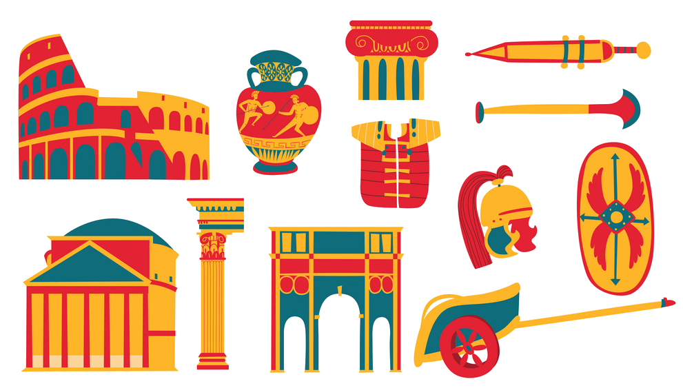 Cities founded by the Romans
World Heritage
Cities founded by the Romans
World Heritage
 Vienna

奥地利首都、著名音乐城市、国际旅游胜地维也纳,位于国境东北部阿尔卑斯山 北麓多瑙河畔,座落在维也纳盆地中,蓝色的多瑙河从市区静静流过,水秀山青,风景幽雅。著名的维也纳森林从西、北、南三面环绕着城市,辽阔的东欧平原从东 面与其相对,到处郁郁葱葱,生机勃勃。登上阿尔卑斯山麓,维也纳森林波浪起伏,尽收眼底。从多瑙河盆地可以远眺喀尔巴阡山闪耀的绿色峰尖,辽阔的平原犹如 一幅特大的绿毯,碧波粼粼的多瑙河穿流其间。维也纳环境优美,景色诱人,素有“多瑙河的女神”之称。
维也纳是一座拥有1800多年历史的古老城市,公元1世纪罗马人曾在这里建立城堡,到1137年成为奥地利公园的首邑。13世纪末期,城内出现大批宏伟的哥特式建筑,15世纪以后成为罗马帝国的首都和欧洲的经济中心。18世纪,随着艺术的繁荣,维也纳作为“音乐城市”闻名遐迩。
维也纳城区占地面积415平方公里,城市人口150万,房屋顺山势而建,布局层次分明,各种风格的教堂错落其间,使这座山青水碧的城市保持着浓厚的古 老庄重色彩。维也纳从内城向外城依次展开,分为3层。内城即老城,这里街道狭窄,卵石铺路,纵横交错,两旁多为巴罗克式、哥特式和罗马式建筑,中世纪的圣 斯特凡大教堂和双塔教堂的尖塔耸立蓝天,在高层建筑不多的城区显得格外醒目。围绕内城的内环城线,宽达50米,路边生长着各种树木,两旁有博物馆、市政 厅、国会、大学和国家歌剧院等重要建筑。内环城线与外环城线之间是城市的中间层,这儿是密集的商业区和住宅区,其间也有教堂、宫殿等建筑。外环城路的南面 和东面是工业区,西面是别墅区、公园区、宫殿等,一直延伸到森林的边缘。城市北面,多瑙河紧贴内城而流,在多瑙河与多瑙河运河之间,有一片岛状地带,这里 有公园、游艺场、体育场、码头、车站等。座落在城市北面的多瑙公园,也是游人云集的地方。多瑙公园内有一座耸入云天的多瑙塔,塔高252米,塔内装有两部 快速电梯,游客只须用45秒钟便可从塔底到达塔顶。塔顶设有室内咖啡馆和室外咖啡座,从塔顶四周眺望,远方的阿尔卑斯山的英姿和多瑙河两岸的美景尽收眼 底,随着塔顶的自动旋转,40分钟内可将维也纳全城景色一览无余。这里既有繁华都市景色,又有山林田园风光,游人常常会情不自禁地赞叹道:“美啊!维也 纳。”(Quelle:http://eur.bytravel.cn/v/39/)
维也纳(德语:Wien;英语:Vienna)是奥地利共和国的首都,也是该国最大都市,同时是奥地利九个联州之一。维也纳是奥地利的首要型都市,有着 172.3 万人口[5](若包含都会区则约 240 万人[4],将近奥地利人口的三分之一),并且是奥地利政治、经济、。文化中心,该市人口数在欧盟城市中名列第七。二十世纪初,维也纳是世界上最大的德语都市,在第一次世界大战中奥匈帝国瓦解前,该市有 2 百万居民,时至今日,维也纳仍是德语区第二大都市,仅次于柏林。维也纳拥有许多重要的国际组织,包含联合国以及 OPEC 。城市坐落于奥地利东部,紧邻捷克、斯洛伐克和匈牙利边界,这些地区紧密相连,形成欧洲中部地区。如果加上布拉提斯拉瓦,维也纳就是个拥有 3 百万居民的大都会区。2001 年维也纳市中心古城区被指定为联合国世界遗产。2017 年 7 月它被移至濒危世界遗产的名录中。
维也纳除了因为丰富的音乐历史遗产而被称作“音乐之都”,也因为它是世界第一个心理治疗师西格蒙德·佛洛伊德的家乡而被称作“梦之都”。该城市最早是凯尔特人和罗马人的定居点,随后逐渐转变为中世纪及巴洛克时期的都市,接着成为奥匈帝国的首都。众所周知,从古典主义时代至 20 世纪初期,维也纳是具有领导地位的的欧洲音乐中心。维也纳历史中心有着丰富的建筑群,包含巴洛克式的城堡和花园、19 世纪末期环城大道上雄伟的建筑物、雕像以及公园。
维也纳也以高品质的生活著称。在 2005 年的研究中,经济学人智库在 127 个全球都市中,将维也纳选为世界最佳宜居城市第一名,与温哥华及旧金山同列。2011 到 2015 年之间,名列第二,仅次于墨尔本。2018 年,维也纳取代墨尔本,再次成为第一。连续八年(2009 年至 2016 年),人力资源顾问公司美世将维也纳列为年度生活质素调查的第一名。以此为基础,Monocle 的 2015 年生活品质调查,在世界最佳 25 个城市中将维也纳列为第二。
2012 及 2013 年,联合国人居署将维也纳列为世界最繁荣的都市。2007 及 2008 年,该城市在创新文化名列世界第一,并且在 2014 年的创新城市指数中从 256 个城市中拿到第六名,该指数分析 162 项指标,内容涵盖三大领域:文化、基础设施和市场。维也纳定期举办城市规划会议,而该城市本身也经常被城市规划者用作案例研究。
2005 年至 2010 年间,维也纳是世界上国际会议和大会的首选城市。维也纳每年吸引超过 680 万游客。
Wien ![]() [viːn] ist die Bundeshauptstadt von Österreich und zugleich eines der neun österreichischen Bundesländer. Mit über 1,8 Millionen Einwohnern ist das an der Donau gelegene Wien die bevölkerungsreichste Großstadt Österreichs, die zweitgrößte im deutschen Sprachraum sowie die sechstgrößte Stadt der Europäischen Union.[10] Im Großraum Wien leben etwa 2,8 Millionen Menschen – das entspricht rund einem Drittel der österreichischen Gesamtbevölkerung.
[viːn] ist die Bundeshauptstadt von Österreich und zugleich eines der neun österreichischen Bundesländer. Mit über 1,8 Millionen Einwohnern ist das an der Donau gelegene Wien die bevölkerungsreichste Großstadt Österreichs, die zweitgrößte im deutschen Sprachraum sowie die sechstgrößte Stadt der Europäischen Union.[10] Im Großraum Wien leben etwa 2,8 Millionen Menschen – das entspricht rund einem Drittel der österreichischen Gesamtbevölkerung.
Architektonisch ist Wien bis heute vor allem von den Bauwerken um die Wiener Ringstraße aus der Gründerzeit, aber auch von Barock und Jugendstil geprägt. Durch seine Rolle als kaiserliche Reichshaupt- und Residenzstadt des Kaisertums Österreich ab 1804 wurde Wien im 19. Jahrhundert zu einem kulturellen und politischen Zentrum Europas. Als fünftgrößte Stadt der Welt zählte die Stadt um das Jahr 1910 über zwei Millionen Einwohner.[11] Das historische Zentrum von Wien sowie das Schloss Schönbrunn gehören heute zum UNESCO-Weltkulturerbe. Mit jährlich rund sieben Millionen Touristen und rund 15 Millionen Gästeübernachtungen zählt Wien zu den zehn meistbesuchten Städten Europas.[12]
Bereits beim Wiener Kongress 1814/15 spielte die Stadt eine bedeutende Rolle in der internationalen Diplomatie, die sie bis in die Gegenwart beibehalten hat. So ist Wien heute als internationaler Kongress- und Tagungsort Sitz von über 30 internationalen Organisationen,[13] darunter das Erdölkartell OPEC, die internationale Atomenergiebehörde IAEO und die OSZE, und zählt damit zu den Weltstädten.[14][15] Das Büro der Vereinten Nationen in Wien (UNOV) beherbergt im Vienna International Centre (VIC) einen der vier Amtssitze der UNO, im Volksmund meist als UNO-City bezeichnet.
Zudem gilt Wien als Stadt mit sehr hoher Lebensqualität. In der internationalen Mercer-Studie 2017/2018, in der die Lebensqualität anhand von 39 Kriterien wie politische, wirtschaftliche, soziale und Umweltfaktoren in 231 Großstädten weltweit verglichen wurden, belegte Wien zum neunten Mal in Folge den ersten Rang.[16] Eine Studie der Vereinten Nationen sah Wien 2012 als wohlhabendste Stadt der Welt.[17]
ウィーン[2](標準独: Wien〈ヴィーン〉、バイエルン・オーストリア語: Wean〈ヴェアン〉、仏: Vienne〈ヴィエンヌ〉、英: Vienna〈ヴィエナ〉)は、オーストリアの首都。2017年1月1日時点の人口は186万7582人。都市単独で一つの連邦州であり、ヨーロッパ有数の世界都市である。位置は、北緯48度12分5秒、東経16度22分38秒。第一次世界大戦まではオーストリア=ハンガリー帝国の首都としてドイツを除く中東欧の大部分に君臨し、さらに19世紀後半まではドイツ連邦や神聖ローマ帝国を通じて形式上はドイツ民族全体の帝都でもあった。クラシック音楽が盛んで過去にモーツァルトやベートーヴェン、シューベルトなど、多くの作曲家が活躍したことから「音楽の都」・「楽都」とも呼ばれる[3]。
ローマ帝国の宿営地ウィンドボナ (Vindobona) をその起源とし、かつてヨーロッパの数か国を支配したハプスブルク家のオーストリア帝国の首都であった。マリア・テレジア女帝時代に栄えた市街は、フランツ・ヨーゼフ1世の治下で整備された。リングと呼ばれる環状道路は、ウィーンの近代化を実現するために、19世紀の後半にかつて旧市街を囲んでいた堀を埋め立てて造られたものである。シュテファン寺院(シュテファン大聖堂)や旧市街をふくむ歴史地区は、「ウィーン歴史地区」の名称で2001年にユネスコの世界遺産に登録された。ここには旧王宮であるホーフブルク宮殿(現在は大統領官邸や博物館、国立図書館などとして使用)・ウィーン国立歌劇場・ブルク劇場・自然史博物館・美術史博物館、南駅に近いベルヴェデーレ宮殿などが含まれる。
ウィーンは、そもそもの成り立ちが2つの道が交差するところに生まれた町であった。ドナウ川に沿ってヨーロッパを東西に横切る道と、バルト海とイタリアを結ぶ南北の道(「琥珀街道」)である。そこはゲルマン系、スラヴ系、マジャール系、ラテン系のそれぞれの居住域の接点にあたり、歴史的にみても、上述のように、紀元前5世紀以降ケルト人の居住する小村であったところにローマ帝国の北の拠点が建設されたのが起源であった。オスマン帝国の隆盛時にはヨーロッパからみてアジアへの入り口にもあたっており、伝統的にも多彩な民族性を集約する都市として栄えた。
その地理上の位置は、かつて共産圏に属した東ドイツのベルリンや東欧スラヴ民族の国家チェコのプラハよりも東であり、第二次世界大戦後の冷戦時代にあっても、国際政治上微妙な位置にあった。
また、都心から南南西方面に離れた場所には、かつてウィーン会議の舞台となった世界遺産のシェーンブルン宮殿がある。これは、レオポルト1世が狩猟用の別荘として建てたものを、マリア・テレジアが離宮として完成させたものである。
現在のウィーンは、国際機関本部の集積地ともなっており、日本政府も在ウィーン国際機関日本政府代表部を置いている。ウィーンに本部を置いている機関は次の通り。
Vienna (/viˈɛnə/ (![]() listen);[10][11] German: Wien, pronounced [viːn] (
listen);[10][11] German: Wien, pronounced [viːn] (![]() listen)) is the federal capital and largest city of Austria, and one of the nine states of Austria. Vienna is Austria's primary city, with a population of about 1.8 million[1] (2.6 million within the metropolitan area,[4] nearly one third of Austria's population), and its cultural, economic, and political centre. It is the 7th-largest city by population within city limits in the European Union. Until the beginning of the 20th century, it was the largest German-speaking city in the world, and before the splitting of the Austro-Hungarian Empire in World War I, the city had 2 million inhabitants.[12] Today, it has the second largest number of German speakers after Berlin.[13][14] Vienna is host to many major international organizations, including the United Nations and OPEC. The city is located in the eastern part of Austria and is close to the borders of the Czech Republic, Slovakia, and Hungary. These regions work together in a European Centrope border region. Along with nearby Bratislava, Vienna forms a metropolitan region with 3 million inhabitants.[citation needed] In 2001, the city centre was designated a UNESCO World Heritage Site. In July 2017 it was moved to the list of World Heritage in Danger.[15]
listen)) is the federal capital and largest city of Austria, and one of the nine states of Austria. Vienna is Austria's primary city, with a population of about 1.8 million[1] (2.6 million within the metropolitan area,[4] nearly one third of Austria's population), and its cultural, economic, and political centre. It is the 7th-largest city by population within city limits in the European Union. Until the beginning of the 20th century, it was the largest German-speaking city in the world, and before the splitting of the Austro-Hungarian Empire in World War I, the city had 2 million inhabitants.[12] Today, it has the second largest number of German speakers after Berlin.[13][14] Vienna is host to many major international organizations, including the United Nations and OPEC. The city is located in the eastern part of Austria and is close to the borders of the Czech Republic, Slovakia, and Hungary. These regions work together in a European Centrope border region. Along with nearby Bratislava, Vienna forms a metropolitan region with 3 million inhabitants.[citation needed] In 2001, the city centre was designated a UNESCO World Heritage Site. In July 2017 it was moved to the list of World Heritage in Danger.[15]
Apart from being regarded as the City of Music[16] because of its musical legacy, Vienna is also said to be "The City of Dreams" because it was home to the world's first psychotherapist – Sigmund Freud.[17] The city's roots lie in early Celtic and Roman settlements that transformed into a Medieval and Baroque city, and then the capital of the Austro-Hungarian Empire. It is well known for having played an essential role as a leading European music centre, from the great age of Viennese Classicism through the early part of the 20th century. The historic centre of Vienna is rich in architectural ensembles, including Baroque castles and gardens, and the late-19th-century Ringstraße lined with grand buildings, monuments and parks.[18]
Vienna is known for its high quality of life. In a 2005 study of 127 world cities, the Economist Intelligence Unit ranked the city first (in a tie with Vancouver and San Francisco) for the world's most liveable cities. Between 2011 and 2015, Vienna was ranked second, behind Melbourne.[19][20][21][22][23] In 2018, it replaced Melbourne as the number one spot.[24] For eight consecutive years (2009–2016), the human-resource-consulting firm Mercer ranked Vienna first in its annual "Quality of Living" survey of hundreds of cities around the world, a title the city still held in 2016.[25][26][27][28][29][30][31] Monocle's 2015 "Quality of Life Survey" ranked Vienna second on a list of the top 25 cities in the world "to make a base within."[32][33][34][35][36]
The UN-Habitat classified Vienna as the most prosperous city in the world in 2012/2013.[37] The city was ranked 1st globally for its culture of innovation in 2007 and 2008, and sixth globally (out of 256 cities) in the 2014 Innovation Cities Index, which analyzed 162 indicators in covering three areas: culture, infrastructure, and markets.[38][39][40] Vienna regularly hosts urban planning conferences and is often used as a case study by urban planners.[41]
Between 2005 and 2010, Vienna was the world's number-one destination for international congresses and conventions.[42] It attracts over 6.8 million tourists a year.[43]
Vienne (prononcé : /vjɛn/ ; en allemand : Wien [viːn] Écouter ; en bavarois : ; en hongrois : Bécs) est la capitale et la plus grande ville de l'Autriche ; elle est aussi l'un des neuf Länder (État fédéré) du pays (en allemand : Bundesland Wien).
La ville est située dans l'est du pays et traversée par le Danube (Donau). Capitale du duché puis archiduché d'Autriche, elle fut de fait celle du monde germanique durant le règne de la maison de Habsbourg (devenue en 1745 la maison de Habsbourg-Lorraine) sur le Saint-Empire romain germanique (1273-1291, 1298-1308, 1438-1806) puis présida la Confédération germanique (1815-1866). Elle fut en même temps celle de l'empire d'Autriche (1804–1867) puis de l'Autriche-Hongrie (1867-1918). Elle a été le point de départ de la crise bancaire de mai 1873. Depuis plusieurs années, elle figure dans les premières places de nombreux classements internationaux récompensant la qualité de vie des métropoles. Par exemple, la ville est en tête du classement selon l'indice Mercer évaluant le coût de la vie et la qualité de vie de 221 villes dans le monde1,2.
Peuplée d'environ 1,8 million d'habitants3, Vienne est le principal centre culturel, politique et économique de l'Autriche. Jusqu'au début du XXe siècle, elle est la plus grande ville germanophone au monde. Elle est aujourd'hui deuxième derrière Berlin.
Vienne est un important centre politique international, notamment en raison de la neutralité autrichienne, puisqu'y siègent l'OSCE, l'OPEP et diverses agences de l'ONU, comme l'Agence internationale de l'énergie atomique, l'Office des Nations unies contre la drogue et le crime ou l'ONUDI. En 1958, Vienne partage avec La Haye le prix de l'Europe4. Par ailleurs, la ville a été le lieu de signature d'un grand nombre de conventions et traités internationaux. Entre 2005 et 2010, Vienne a été la première destination mondiale pour les congrès et conventions internationales.
Surnommée la « Ville des rêves » parce que l'inventeur de la psychanalyse, Sigmund Freud, y résida, ou encore la « Ville de la musique », en raison de l'influence considérable que la ville a eue dans le domaine de la musique, notamment à travers le classicisme viennois, Vienne accueille environ 3,7 millions de touristes chaque année. Grâce à sa riche histoire, elle bénéficie d'un patrimoine culturel et architectural remarquable. Depuis 2001, le centre historique de Vienne est classé au patrimoine mondial de l'UNESCO5.
Viena (en alemán: Wien AFI: ![]() [viːn] (?·i)) es una ciudad austriaca en Europa Central situada a orillas del Danubio, en el valle de los Bosques de Viena, al pie de las primeras estribaciones de los Alpes. Es la capital de Austria y uno de sus nueve estados federados (Bundesland Wien).
[viːn] (?·i)) es una ciudad austriaca en Europa Central situada a orillas del Danubio, en el valle de los Bosques de Viena, al pie de las primeras estribaciones de los Alpes. Es la capital de Austria y uno de sus nueve estados federados (Bundesland Wien).
Está rodeada por el Estado federado de Baja Austria. Viena es la mayor ciudad, centro cultural y político de Austria. Además es la segunda ciudad más poblada de Europa Central (tras Berlín) y la décima ciudad en población de la Unión Europea. Su población supera el 1.800.000 de habitantes (2017) y su área metropolitana cuenta con 2,4 millones, población similar a la que tenía la ciudad en 1914. El idioma oficial es el alemán y se habla en una de sus variantes bávaras.
La ciudad tiene una larga historia, ya que es una de las más antiguas capitales de Europa, por lo que cuenta con un importante patrimonio artístico. Durante el siglo XIX fue una de las grandes capitales musicales del mundo y a principios del siglo XX meca de la filosofía y el debate político de Occidente, así como uno de los principales centros culturales mundiales.
Ве́на (нем. Wien [ˈviːn], бав. Wean, лат. Vindobona и Metropolis civitas Viennensium) — федеральная столица Австрии и одновременно одна из девяти федеральных земель Австрии, расположенная внутри другой земли, Нижней Австрии. Расположена в восточной части страны. Население Вены составляет 1 867 582 чел. (2017-01-01)[1]; вместе с пригородами — около 2,6 млн (более 25 % населения Австрии); таким образом, Вена является самым крупным по населению городом Австрии, занимая седьмое место среди самых крупных городов Европейского союза и второе место среди немецкоязычных городов после Берлина. Культурный, экономический и политический центр Австрии.
Вена является третьим городом-резиденцией ООН после Нью-Йорка и Женевы. Венский международный центр (так называемый UNO-City) включает в себя МАГАТЭ, УНП ООН, организации ООН по промышленному развитию и др. В Вене находятся штаб-квартиры таких международных организаций, как ОПЕК и ОБСЕ.
В течение многих столетий Вена являлась городом-резиденцией Габсбургов, а во времена их правления и столицей Священной Римской империи германской нации, превратившись в культурный и политический центр Европы. В 1910 году в Вене проживало два миллиона человек, она занимала четвёртое место среди крупнейших городов мира, уступая лишь Лондону, Нью-Йорку и Парижу. После Первой мировой войны, повлёкшей за собой окончательный развал империи, население Вены сократилось почти на четверть и расти перестало.
Старый город Вены и дворец Шёнбрунн в декабре 2001 года были внесены в список Всемирного наследия ЮНЕСКО.
Согласно результатам международного исследования агентства Mercer, опубликованного в мае 2012 года, в котором сравнивалось качество жизни в 221 городе, Вена пятый раз подряд заняла первое место в мире по качеству жизни[3][4]. Журнал The Economist в 2011 году поставил Вену на второе место в мире по комфортности проживания (после Мельбурна и перед Ванкувером)[5].