
漢德百科全書 | 汉德百科全书
 Egypt
Egypt
 *Mediterranean Sea
 Egypt
Egypt

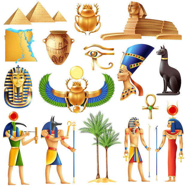 Ancient Egypt

 History
 B 5000 - 4000 BC

 History
 D 3000 - 2500 BC

 History
 E 2500 - 2000 BC

 History
 F 2000 - 1500 BC

 History
 G 1500 - 1000 BC

 History
 H 1000 - 500 BC

 History
 I 500 - 0 BC

 History
 J 0 - 500 AD

 World Heritage

 Civilization
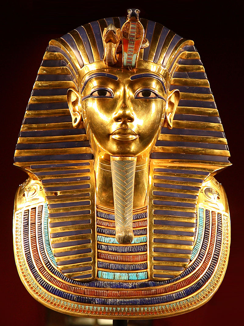
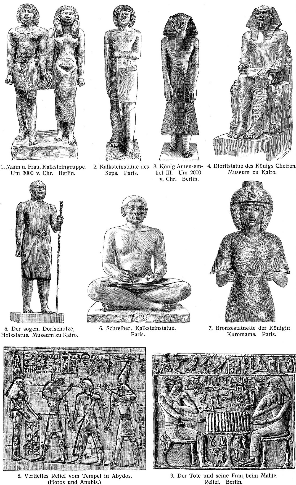
Altes Ägypten ist die allgemeine Bezeichnung für das Land Ägypten im Altertum. Der ägyptische Name lautete Kemet und bedeutet „schwarzes Land“. Kemet bezeichnet das Delta des Nils und geht auf den schwarzen Schlamm zurück, der nach der jährlichen Nilschwemme zurückblieb und eine fruchtbare Ernte garantierte. Eine andere Bezeichnung für das Land des Altertums war Ta meri (T3 mrj), was mit „geliebtes Land“ übersetzt wird.[1]
古埃及(阿拉伯语:مصر القديمة)是位于非洲东北部尼罗河中下游地区的一段时间跨度近3000年的古代文明,开始于公元前32世纪左右时美尼斯统一上下埃及建立第一王朝,终止于公元前343年波斯再次征服埃及,虽然之后古埃及文化还有少量延续,但到公元以后的时代,古埃及已经彻底被异族文明所取代,在连象形文字也被人们遗忘后,古代史前社会留给后人的是宏伟的建筑与无数谜团,1798年,拿破仑远征埃及,发现罗塞塔石碑,1822年法国学者商博良解读象形文字成功,埃及学才诞生,古埃及文明才重见天日。直到今日都还不断被挖掘出来。
古埃及的居民是由北非的土著居民和来自西亚的游牧民族塞姆人融合形成的多文化圈。约公元前6000年,因为地球轨道的运转规律性变化、间冰期的高峰过去等客观气候因素,北非茂密的草原开始退缩,人们放弃游牧而开始寻求固定的水源以耕作,即尼罗河河谷一带,公元前4千年后半期,此地逐渐形成国家,至公元前343年为止,共经历前王朝、早王朝、古王国、第一中间期、中王国、第二中间期、新王国、第三中间期、后王朝9个时期31个王朝的统治(参见“古埃及历史”一节)。其中古埃及在十八王朝时(公元前15世纪)达到鼎盛,南部尼罗河河谷地带的上埃及的领域由现在的苏丹到埃塞俄比亚,而北部三角洲地区的下埃及除了现在的埃及和部分利比亚以外,其东部边界越过西奈半岛直达迦南平原。[1]
在社会制度方面,古埃及有自己的文字系统,完善的行政体系和多神信仰的宗教系统,其统治者称为法老,因此古埃及又称为法老时代或法老埃及[2]。古埃及的国土紧密分布在尼罗河周围的狭长地带,是典型的水力帝国[来源请求]。古埃及跟很多文明一样,具有保存遗体的丧葬习俗,透过这些木乃伊的研究能一窥当时人们的日常生活,对古埃及的研究在学术界已经形成一门专门的学科,称为“埃及学”。
エジプトは不毛の砂漠地帯であるが、毎年春のナイル川の増水で水に覆われる地域には河土が運ばれて堆積し、農耕や灌漑が可能になる。この氾濫原だけが居住に適しており、主な活動はナイル河畔で行われた。ナイル川の恩恵を受ける地域はケメト(黒い大地)と呼ばれ、ケメトはエジプトそのものを指す言葉として周囲に広がるデシェレト(赤い大地、ナイル川の恩恵を受けない荒地)と対比される概念だった。このケメトの範囲の幅は非常に狭く、ナイル川の本流・支流から数kmの範囲にとどまっていた。しかしながら川の周囲にのみ人が集住しているということは交通においては非常に便利であり、川船を使って国内のどの地域にも素早い移動が可能であった。この利便性は、ナイル河畔に住む人々の交流を盛んにし、統一国家を建国し維持する基盤となった。
ナイル川本流からナイル川の上流は谷合でありナイル川1本だけが流れ、下流はデルタ地帯(ナイル川デルタ)が広がっている。最初に上流地域(上エジプト)と下流地域(下エジプト)[1]でそれぞれ違った文化が発展した後に統一されたため、ファラオ(王)の称号の中に「上下エジプト王」という部分が残り、古代エジプト人も自国のことを「二つの国」と呼んでいた。
毎年のナイル川の氾濫を正確に予測する必要から天文観測が行われ、太陽暦が作られた。太陽とシリウス星が同時に昇る頃、ナイル川は氾濫したという。また、氾濫が収まった後に農地を元通り配分するため、測量術、幾何学、天文学が発達した。ヒエログリフから派生したワディ・エル・ホル文字と原シナイ文字(原カナン文字)は世界の殆どのアルファベットの起源となったされる。
エジプト文明と並ぶ最初期における農耕文明の一つであるメソポタミア文明が、民族移動の交差点にあたり終始異民族の侵入を被り支配民族が代わったのと比べ、地理的に孤立した位置にあったエジプトは比較的安定しており、部族社会が城壁を廻らせて成立する都市国家の痕跡は今の所発見されていない。
Ancient Egypt was a civilization of ancient North Africa, concentrated along the lower reaches of the Nile River in the place that is now the country Egypt. Ancient Egyptian civilization followed prehistoric Egypt and coalesced around 3100 BC (according to conventional Egyptian chronology)[1] with the political unification of Upper and Lower Egypt under Menes (often identified with Narmer).[2] The history of ancient Egypt occurred as a series of stable kingdoms, separated by periods of relative instability known as Intermediate Periods: the Old Kingdom of the Early Bronze Age, the Middle Kingdom of the Middle Bronze Age and the New Kingdom of the Late Bronze Age.
Egypt reached the pinnacle of its power in the New Kingdom, ruling much of Nubia and a sizable portion of the Near East, after which it entered a period of slow decline. During the course of its history Egypt was invaded or conquered by a number of foreign powers, including the Hyksos, the Libyans, the Nubians, the Assyrians, the Achaemenid Persians, and the Macedonians under the command of Alexander the Great. The Greek Ptolemaic Kingdom, formed in the aftermath of Alexander's death, ruled Egypt until 30 BC, when, under Cleopatra, it fell to the Roman Empire and became a Roman province.[3]
The success of ancient Egyptian civilization came partly from its ability to adapt to the conditions of the Nile River valley for agriculture. The predictable flooding and controlled irrigation of the fertile valley produced surplus crops, which supported a more dense population, and social development and culture. With resources to spare, the administration sponsored mineral exploitation of the valley and surrounding desert regions, the early development of an independent writing system, the organization of collective construction and agricultural projects, trade with surrounding regions, and a military intended to assert Egyptian dominance. Motivating and organizing these activities was a bureaucracy of elite scribes, religious leaders, and administrators under the control of a pharaoh, who ensured the cooperation and unity of the Egyptian people in the context of an elaborate system of religious beliefs.[4][5]
The many achievements of the ancient Egyptians include the quarrying, surveying and construction techniques that supported the building of monumental pyramids, temples, and obelisks; a system of mathematics, a practical and effective system of medicine, irrigation systems and agricultural production techniques, the first known planked boats,[6] Egyptian faience and glass technology, new forms of literature, and the earliest known peace treaty, made with the Hittites.[7] Ancient Egypt has left a lasting legacy. Its art and architecture were widely copied, and its antiquities carried off to far corners of the world. Its monumental ruins have inspired the imaginations of travelers and writers for centuries. A new-found respect for antiquities and excavations in the early modern period by Europeans and Egyptians led to the scientific investigation of Egyptian civilization and a greater appreciation of its cultural legacy.[8]
L'Égypte antique est une ancienne civilisation du nord-est de l'Afrique, concentrée le long du cours inférieur du Nil, dans ce qui constitue aujourd'hui l'Égypte.
La civilisation de l'Égypte antique prend forme autour de -31501 avec l'unification politique de la Haute-Égypte au sud et de la Basse-Égypte au nord sous le règne du premier roi et se développe sur plus de trois millénaires2. Son histoire est parsemée d'une série de périodes stables politiquement, entrecoupées de plusieurs périodes intermédiaires, plus troublées. L'Égypte antique atteint son apogée sous le Nouvel Empire puis entre dans une période de lent déclin. Le pays subit les assauts répétés de puissances étrangères dans cette période tardive et le règne des pharaons prend officiellement fin en -30 où l'Empire romain conquiert l'Égypte pour en faire une province3.
Le succès de la civilisation égyptienne antique découle en partie de sa capacité à s'adapter aux conditions de la vallée du Nil. L'inondation prévisible du fleuve et le contrôle de l'irrigation de la vallée produit des récoltes excédentaires qui alimentent le développement social et culturel du pays. Ce surplus agricole donne à l'administration les moyens de financer l'exploitation minière de la vallée et des régions voisines du désert. Le développement rapide d'un système d'écriture indépendant, l'organisation de constructions collectives et de projets agricoles, les relations commerciales avec les pays voisins et une armée solide permettent à l'Égypte d'affirmer sa domination sur la région. Toutes ces activités sont organisées par une bureaucratie de scribes, de dirigeants religieux et d'administrateurs sous le contrôle du pharaon qui assure l'unité du peuple égyptien dans le cadre d'un système complexe de croyances religieuses4,5.
Les nombreuses réalisations des Égyptiens de l'Antiquité comprennent l'extraction minière, l'arpentage et les techniques de construction qui facilitent la construction de pyramides monumentales, de temples et d'obélisques. On compte également à leur crédit le développement des mathématiques, de la médecine, de l'irrigation et de la production agricole, la construction des premiers navires connus, la faïence égyptienne, de nouvelles formes de littérature6. Du rassemblement des tribus primitives qui créent le premier royaume pharaonique jusqu'à son absorption au Ier siècle av. J.-C., l'Égypte antique est le théâtre d'évènements majeurs qui influencent assurément la culture et l'imaginaire des peuples lui ayant succédé. Son art et son architecture sont largement copiés et ses antiquités sont disséminées aux quatre coins du monde. Un regain d'intérêt pour la période antique au début de l'époque moderne conduit à de nombreuses investigations scientifiques de la civilisation égyptienne, notamment par des fouilles, et à une meilleure appréciation de son héritage culturel, pour l'Égypte et le monde7.
Con Antico Egitto si intende la civiltà sviluppatasi lungo la Valle del Nilo a partire dalle cateratte, a sud e al confine con l’attuale Sudan[N 1], alla foce, al delta, nel Mar Mediterraneo, per un’estensione complessiva di circa 1000 km. Benché il territorio fosse molto più vasto, comprendendo gran parte anche del Deserto Libico-Nubiano, gli insediamenti umani, fin dai tempi più remoti, si svilupparono solo nella stretta fascia verdeggiante a ridosso delle rive del fiume larga, in alcuni punti anche solo poche centinaia di metri.
Fin dal 3500 a.C., di pari passo con l'avvento dell'agricoltura, in particolare la coltivazione del grano, dell’orzo e del lino, si ha contezza di insediamenti umani specie lungo le rive del Nilo[1]. Le piene annuali del fiume, infatti, favorivano la coltivazione anche con più raccolti annui grazie ai sedimenti, particolarmente fertili (Limo), che il fiume, nel suo ritirarsi, lasciava sul terreno. Ciò comportò, fin dai tempi più remoti, conseguentemente, la necessità di controllare, incanalare e conservare le acque onde garantire il costante approvvigionamento, vuoi per il sostentamento umano, vuoi per quello del bestiame e delle piantagioni.
Non è da escludersi che proprio la complessa necessità di dover far fronte alle esigenze connesse con la gestione dell’agricoltura, e segnatamente, delle acque nilotiche, abbia favorito proprio il formarsi delle prime comunità su territori parziali tuttavia ben differenziati e politicamente e geograficamente individuabili. Tali entità, normalmente individuate con il termine greco di nomoi, ben presto si costituirono in due distinte entità geo-politiche più complesse. Tale l’importanza del fiume Nilo, che attraversava tutto il paese, che anche le denominazioni di tali due macro-aree fanno riferimento al fiume: considerando che le sorgenti del Nilo, benché all'epoca non note, dovevano essere a sud, tale sarà l’Alto Egitto, mentre, di converso, l’area del delta, verso il Mediterraneo, sarà indicato come Basso Egitto[2].
Varie culture si susseguirono nella valle nilotica fin dal 3900 a.C. in quello che viene definito Periodo Predinastico. Un’entità embrionale di Stato può riconoscersi, invece, a partire dal 3200-3100 a.C. con la I dinastia e l’unificazione delle due macro-aree che resteranno, tuttavia, sempre distinte tanto che per tutta la storia del Paese i regnanti annovereranno tra i loro titoli quello di Signore delle Due Terre.
La storia dell’Antico Egitto copre, complessivamente, circa 4000 anni, dal 3900 a.C. (con il Periodo Predinastico) al 342 a.C. (con il Periodo tardo) e comprende, dal 3200 a.C., trenta dinastie regnanti riconosciute archeo-storicamente. A queste debbono esserne aggiunte altre, dette di comodo, giacché riferite, di fatto, non a governi autoctoni, o comunque derivanti dal Paese, bensì frutto di invasioni o di raggiungimento del potere da parte di regnanti stranieri. Avremo perciò una XXXI dinastia, costituita da re persiani, una XXXII dinastia macedone, che annovera un solo sovrano, Alessandro Magno, e una XXXIII dinastia, meglio nota come Dinastia tolemaica, nata dallo smembramento dell’impero di Alessandro.
Anche molti imperatori romani, occupato l’Egitto, non disdegnarono di assumere il titolo di faraone con titolatura geroglifica.
El Antiguo Egipto fue una civilización que se originó a lo largo del cauce medio y bajo del río Nilo, y que alcanza tres épocas de esplendor faraónico en los periodos denominados Imperio Antiguo, Imperio Medio, e Imperio Nuevo. Alcanzaba desde el delta del Nilo en el norte, hasta Elefantina, en la primera catarata del Nilo, en el sur, llegando a tener influencia desde el Éufrates hasta Jebel Barkal, en la cuarta catarata del Nilo, en épocas de máxima expansión. Su territorio también abarcó, en distintos periodos, el desierto oriental y la línea costera del mar Rojo, la península del Sinaí, y un gran territorio occidental dominando los dispersos oasis. Históricamente, fue dividido en Alto y Bajo Egipto, al sur y al norte respectivamente.
La civilización egipcia se desarrolló durante más de 3000 años. Comenzó con la unificación de algunas ciudades del valle del Nilo,1 alrededor del año 3150 a. C.,2 y convencionalmente se da por terminado en el año 31 a. C., cuando el Imperio romano conquistó y absorbió el Egipto ptolemaico, que desaparece como Estado.3 Este acontecimiento no representó el primer período de dominación extranjera, pero fue el que condujo a una transformación gradual en la vida política y religiosa del valle del Nilo, marcando el final del desarrollo independiente de su cultura. Su identidad cultural había comenzado a diluirse paulatinamente tras las conquistas de los reyes de Babilonia (siglo VI a. C.) y Macedonia (siglo IV a. C.), desapareciendo su religión con la llegada del cristianismo, en la época de Justiniano I, cuando en 535 fue prohibido el culto a la diosa Isis, en el templo de File.
Egipto tiene una combinación única de características geográficas, situada en el África nororiental y confinada por Libia, Sudán, el mar Rojo y el mar Mediterráneo. El río Nilo fue la clave para el éxito de la civilización egipcia, ya que éste permitía el aprovechamiento de los recursos y ofrecía una significativa ventaja sobre otros oponentes: el légamo fértil depositado a lo largo de los bancos del Nilo tras las inundaciones anuales significó para los egipcios el practicar una forma de agricultura menos laboriosa que en otras zonas, liberando a la población para dedicar más tiempo y recursos al desarrollo cultural, tecnológico y artístico.
La vida se ordenaba en torno al desarrollo de un sistema de escritura y de una literatura independientes, así como en un cuidadoso control estatal sobre los recursos naturales y humanos, caracterizado sobre todo por la irrigación de la fértil cuenca del Nilo y la explotación minera del valle y de las regiones desérticas circundantes, la organización de proyectos colectivos como las grandes obras públicas, el comercio con las regiones vecinas de África del este y central y con las del Mediterráneo oriental y, finalmente, por un poderío militar capaz de derrotar a cualquier enemigo, y que mantuvieron una hegemonía imperial y la dominación territorial de civilizaciones vecinas en diversos períodos. La motivación y la organización de estas actividades estaba encomendada a una burocracia de élite sociopolítica y económica, los escribas, bajo el control del Faraón, un personaje semidivino, perteneciente a una sucesión de dinastías, que garantizaba la cooperación y la unidad del pueblo egipcio en el contexto de un elaborado sistema de creencias religiosas.45
Los muchos logros de los egipcios incluyen la extracción minera, la topografía y las técnicas de construcción que facilitaron el levantamiento de monumentales pirámides, templos y obeliscos, unos procedimientos matemáticos, una práctica médica eficaz, métodos de riego y técnicas de producción agrícola, las primeras naves conocidas,6 la tecnología del vidrio y de la fayenza, las nuevas formas de la literatura y el tratado de paz más antiguo conocido, firmado con los hititas.7 Egipto dejó un legado duradero, su arte y arquitectura fueron ampliamente copiados, y sus antigüedades se llevaron a los rincones más lejanos del mundo. Sus ruinas monumentales han inspirado la imaginación de los viajeros y escritores desde hace siglos. Un nuevo respeto por las antigüedades y excavaciones en la época moderna han llevado a la investigación científica de la civilización egipcia y a una mayor apreciación de su legado cultural.8
Древний Еги́пет (от др.-греч. Αἴγυπτος и лат. Aegyptus), самоназвание Та-кемет, Та-мери, Та-уи и др. (транслит. егип. tA-kmt, tA-mrj, tA-wy), Ке́ми (копт. Ⲭⲏⲙⲓ) — название исторического региона и культуры значительной цивилизации Древнего мира, существовавшей на северо-востоке Африки вдоль нижнего течения реки Нил. История Древнего Египта составляет около 40 веков и подразделяется исследователями на додинастический период (относится к финалу доисторического периода, краткий обзор которого также приводится в статье), династический период (основной этап существования египетской цивилизации протяжённостью около 27 веков), эллинистический период (синтез с греко-македонской культурой под властью династии Птолемеев), римский период (в составе древнеримского государства, как одна из важнейших провинций Римской империи). Временные границы существования древнеегипетской культуры, принятые исследователями, охватывают период с середины IV тысячелетия до н. э. до IV век н. э. Византийско-коптский период (в составе Византии) хотя и относится уже к раннему средневековью, при этом также иногда рассматривается в рамках изучения Древнего Египта. Временные границы начинаются с IV века и заканчиваются арабским завоеванием в VII веке.
Возвышение древнеегипетской цивилизации в большой степени было результатом её способности адаптироваться к условиям речной долины и дельты Нила. Регулярные ежегодные разливы, удобряющие почву плодородным илом, а также организация ирригационной системы земледелия позволяли производить зерновые культуры в избыточном количестве, обеспечивавшем социальное и культурное развитие. Концентрация людских и материальных ресурсов в руках администрации способствовала созданию и поддержанию сложной сети каналов, появлению регулярной армии и расширению торговли, а с постепенным развитием горнодобывающего дела, полевой геодезии и строительных технологий давала возможность организовывать коллективные возведения монументальных сооружений. Принуждающей и организующей силой в Древнем Египте был хорошо развитый государственный аппарат, состоявший из жрецов, писцов и администраторов во главе с фараоном, который часто обожествлялся в сложной системе религиозных верований с развитым культом погребальных обрядов.
Древний Египет оставил огромное культурное наследие для мировой цивилизации, произведения его искусства ещё в древности вывозились в различные уголки мира и широко копировались мастерами других стран. Своеобразные архитектурные формы — величественные пирамиды, храмы, дворцы и обелиски вдохновляли воображение путешественников и исследователей в течение многих столетий. Египетскими мастерами создавались прекрасные настенные росписи и статуи, были освоены способы производства стекла и фаянса, поэтами и писателями созданы новые формы в литературе. В числе научных достижений древних египтян было создание оригинальной системы письма, математика, практическая медицина, астрономические наблюдения и возникший на их основе календарь. Интерес к памятникам, артефактам и археологическим раскопкам в Древнем Египте, возникший на рубеже XVIII—XIX веков, привёл к созданию науки египтологии и возникновению направлений искус
 *Mediterranean Sea
 Egypt
Egypt
 Algeria
 Belgium
 Bulgaria
 Germany
 France

 History

 History
 H 1000 - 500 BC

 History
 I 500 - 0 BC

 History
 J 0 - 500 AD
 Israel
 Italy
Italy
 Jordan
 Croatia
 Libanon
 Libya
Libya
 Morocco
 Netherlands
 Portugal
 Romania
 Switzerland
 Serbia
 Syria
Syria
 Tunisia
 Turkey
 Hungary
 United Kingdom

 Civilization
 Cyprus

Als römische Architektur bezeichnet man die Baukunst der Römer zur Zeit der römischen Republik und der Kaiserzeit. Die römische Architekturgeschichte umfasst damit einen Zeitraum von etwa neun Jahrhunderten (500 v. Chr.–400 n. Chr.). Die Epochen der römischen Architektur werden nach einzelnen Herrschern, Dynastien oder retrospektiv formulierten historischen Zeitabschnitten benannt. Die seitens der Klassischen Archäologie geprägten Epochen- oder Stilbegriffe finden keine Entsprechungen in der schriftlichen antiken Überlieferung, entsprechen also nicht antiker Wahrnehmung und Einteilung.
古罗马建筑(英语:Ancient Roman architecture),是指由古罗马人创造并且扩展到地中海沿岸其所控制疆域的一种新风格的建筑艺术,经常简称为罗马建筑(英语:Roman architecture)。它直接继承了古希腊晚期的建筑成就,而且将其向前大大推进,使之在1到3世纪达到奴隶制时代全世界建筑的顶峰[1][2]。在西方学术界传统上特指古罗马共和国与帝国时期的建筑[3],中文学术界定义较为宽泛,有时可以包括前期的伊特鲁里亚建筑[4],也可以包括分裂之后的西罗马帝国建筑[2],但是一般不包含东罗马帝国建筑。
 Egypt
Egypt
 Australia
 Belgium
 Brazil
 China
China
 Denmark
 Germany
 Finland
 France
 Greece

 Hand in Hand

 Hand in Hand
 Driver's license
 India
India
 Indonesia
 Italy
Italy
 Japan
Japan
 Canada
 Kasachstan
 Croatia
 Malaysia

 Mongolei
 New Zealand
 Netherlands
 Useful info
 Austria
 Portugal
 Republic of Korea
 Russia
 Saudi Arabia
 Sweden
 Switzerland
 Singapore
 Spain
Spain
 South Africa
 Thailand
 Czech Republic
 Turkey
 Hungary

 Vacation and Travel
 United Arab Emirates
 United States
 United Kingdom
国际驾驶执照(International Driving Permit)依照1949年日内瓦国际道路交通公约及1968年维也纳国际道路交通公约,由公约签署国政府签发,方便本国驾驶员在其他签约国驾驶私人车辆。国际驾驶执照为附加在一国驾驶执照之上的一本附加多国语言的说明,标注了驾驶人的基本信息以及允许驾驶的对应车辆种类等,解决驾驶员与其他国家的交通管理部门之间的沟通障碍。国际驾照不能独立存在,当驾驶员同时持有一国驾照与该国政府签发的国际驾照时,此国际驾照才视作有效。[1]
国际驾驶执照之内容及格式依照维也纳道路交通会议制订,但并非各国均批准该公约。
Ein Internationaler Führerschein ist ein Dokument, das von den Straßenverkehrsbehörden oder Automobilclubs[1] eines Landes aufgrund zwischenstaatlicher Verträge ausgestellt wird. Er soll vor allem der Polizei eines anderen Landes die Feststellung ermöglichen, ob ein ausländischer Kraftfahrer die Fahrerlaubnis hat, die für sein aktuelles Fahrzeug erforderlich ist.
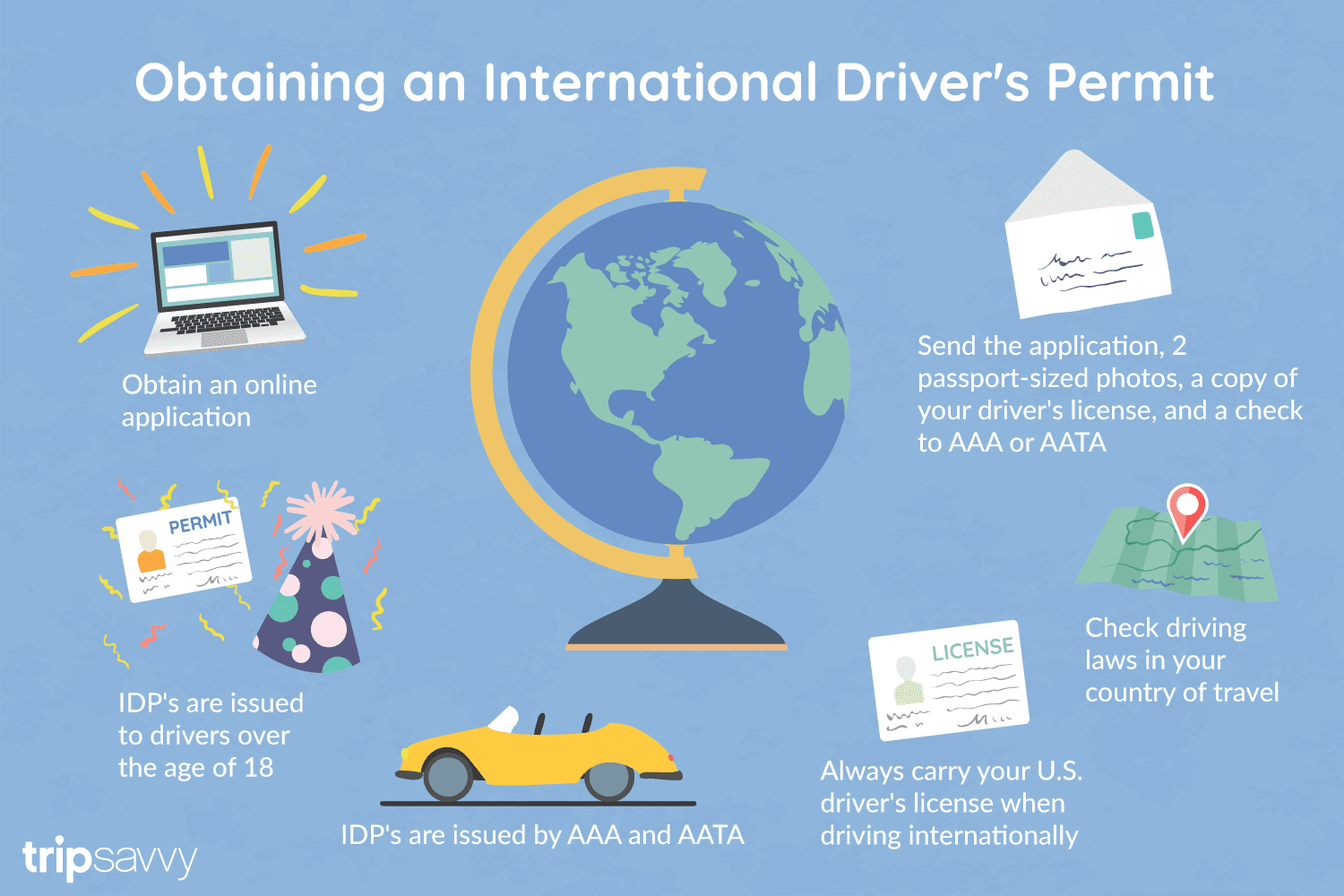
An International Driver's Permit (IDP) allows you to drive a vehicle in another country, as long as you also have a valid driver's license issued by your state. It is also recognized as a proper form of identification in over 175 countries and by many major car rental companies internationally.
Getting an International Driver's Permit (sometimes incorrectly called an international driver's license) can take anywhere from a day to a few weeks, depending on whether you're going through walk-in processing or applying via mail, so make sure to plan ahead if you're planning to drive on your international trip. There are only two locations in the United States that issue these documents: The American Automobile Association (AAA) and the American Automobile Touring Alliance (AATA).
In the United States, International Driver Permits (IDPs) are only issued by the American Automobile Association and the American Automobile Touring Alliance, and the State Department recommends against purchasing an IDP from other outlets as they are all entirely illegal to buy, carry, or sell.
IDPs can be issued to anyone over 18 who has had a valid driver's license for six months or longer. They typically remain valid for one year or the expiration of your existing state driving license. It's essential to investigate an IDP before your trip and make sure you know the requirements.
Both AAA and AATA are excellent sources for these documents, so once you've selected a provider, go to either the AAA's or NAATA's website, print out the International Driving Permit Application, complete all applicable fields, and submit it.
Once you have the application completed, you can send it in via the mail or visit a local office of an organization like AAA; you'll also need two original passport-sized photos and a signed copy of your valid U.S. driver's license as well as an enclosed check for the fee.
Tips to Getting and Using Your Permit
AAA offices can process IDPs during your visit, but processing generally takes 10 to 15 business days if you send the application in. However, expedited services may be available to get your license within one or two business days for an additional fee.
When applying, you'll need a computer and printer, a completed application, a copy of your valid U.S. driver's license, two passport photos, and a check, money order, or credit card to complete the process. Remember to bring these with you if you're applying in person.
Always make sure to carry your valid United States driver's license when driving internationally, as your IDP is invalid without this accompanying proof of eligibility to drive. IDPs only translate domestically-accepted licenses and do not allow those without government-issued driver's licenses to drive abroad.
You'll also want to make sure to enclose the proper fees (the fee for the IDP, as well as any shipping and handling fees), photos, and photocopies of your license when submitting your application to AAA or AATA as omitting any of these required documents will result in your application being rejected.
You should also check the driving requirements and laws for the countries you will be driving in on your vacation, so you'll know what will be required in the event you get stopped by local authorities. (Quelle:https://www.tripsavvy.com/)

红海(阿拉伯语:البحر الأحمر;希伯来语:יַם סוּף;法语:Mer Rouge;英语:Red Sea)位于非洲东北部与阿拉伯半岛之间,呈狭长型,长约2250公里,最宽355公里,均深490公尺,最深2211公尺,面积438,000平方公里。其西北面通过苏伊士运河与地中海相连,南面通过曼德海峡与亚丁湾相连。
紅海是直接由希臘文、拉丁文、阿拉伯文翻譯過來。虽然红海在大多数时候并不呈红色,但是偶尔会季节性地出现大片红色藻类,这提供了其名称的一个可能的来源。另一些学者认为,“红”来源于其相对于命名者的方位(许多民族都有以颜色指代方向的传统),指南方或者西方。
另外一些该名稱的可能來源是:附近的紅色山脈;一個名稱為紅色的本地種族;紅地的海(古埃及稱沙漠為紅地)等。
紅海(こうかい、ヘブライ語: יַם סוּף, アラビア語: البحر الأحمر, フランス語: Mer Rouge)は、アフリカ東北部と、アラビア半島とに挟まれた湾である。
長さ2250km、幅最大355km、面積438,000km2、平均水深491m、最深部2211m。海水は強い蒸発作用(少ない降雨)、流入河川無し、インド洋との限られた循環などにより塩分濃度は3.6%-3.8%と高い。北部にはシナイ半島があり、チラン海峡を通じてアカバ湾とつながっている。また、北西部にはスエズ湾があり、スエズ湾はスエズ運河を経て地中海とつながっているほか、南部はバブ・エル・マンデブ海峡を経てアデン湾とつながっている。同海峡は国際海峡である。
域内には大きな島嶼は無く、沿岸部に小島嶼が数多くある。エリトリアのダフラク諸島、サウジアラビアのファラサン諸島、イエメンのカマラン島などがある。
2011年12月から2012年1月にかけ、イエメン沖のズバイル諸島で海底火山の活動によって新しい島が生まれた[1]。
The Red Sea (also the Erythraean Sea, Arabic: البحر الأحمر) is a seawater inlet of the Indian Ocean, lying between Africa and Asia. The connection to the ocean is in the south through the Bab el Mandeb strait and the Gulf of Aden. To the north lie the Sinai Peninsula, the Gulf of Aqaba, and the Gulf of Suez (leading to the Suez Canal). The Red Sea is a Global 200 ecoregion. The sea is underlain by the Red Sea Rift which is part of the Great Rift Valley.
The Red Sea has a surface area of roughly 438,000 km2 (169,100 mi2),[1][2] is about 2250 km (1398 mi) long and, at its widest point, 355 km (220.6 mi) wide. It has a maximum depth of 3,040 m (9,970 ft) in the central Suakin Trough,[3] and an average depth of 490 m (1,608 ft). However, there are also extensive shallow shelves, noted for their marine life and corals. The sea is the habitat of over 1,000 invertebrate species, and 200 soft and hard corals. It is the world's northernmost tropical sea.
La mer Rouge (arabe : البحر الأحمر al-Bahr al-Ahmar, hébreu ים סוף Yam Souph) est une mer intracontinentale du bassin Indo-Pacifique entre l’Afrique du Nord et le Moyen-Orient d’une superficie d’environ 450 000 km². C'est une mer d'une grande importance stratégique et commerciale qui permet aux navigateurs en provenance de la mer Méditerranée et à destination de l'océan Indien, ou vice-versa, de ne pas être contraints de faire le tour de l'Afrique.
Il Mar Rosso (in arabo: البحر الأحمر, al-Baḥr al-Aḥmar; ebraico: ים סוף, Yam Suf; tigrino: ቀይሕ ባሕሪ, Qeyḥ baḥri) è un mare del Vicino Oriente compreso tra l'Africa e la penisola araba, comunicante con il mar Mediterraneo attraverso il canale di Suez, e con l'Oceano Indiano tramite lo stretto di Bab el-Mandeb.
El mar Rojo (en árabe, البحر الأحمر al-Baḥr al-Aḥmar, al-Baḥru l-’Aḥmar y ים סוף Yam Suff en hebreo, que se traduce como "mar de los juncos" o "mar de las cañas"1) La traducción hebrea también puede ser referencia a un lago de agua dulce o salada (los juncos son fauna de agua dulce2) al norte del actual canal de Suez que fue drenado en su construcción, o al extremo de Aqaba; otras alternativas lo ubican en el lago de Sorbona, al norte del Sinaí, el cual es un brazo del mar mediterraneo.3 Es un golfo o cuenca del océano Índico entre África y Asia. La conexión con el océano es hacia el Sur, a través del estrecho de Bab el-Mandeb y el golfo de Adén. Hacia el norte se encuentra la península del Sinaí, el golfo de Aqaba y el golfo de Suez (que a su vez llega al canal de Suez). El mar tiene unos 2.200 km de largo y su ancho máximo es de 335 km. La profundidad máxima es de 2.130 m, siendo la media de unos 500 m. También posee extensas plataformas de escasa profundidad, en las que se encuentra abundante vida marina y corales. La superficie total es de, aproximadamente, 450.000 km². Este mar es parte del valle del Gran Rift y es una importante vía de comunicación entre Europa y el Extremo Oriente.
Кра́сное мо́ре (др.-греч. Ερυθρὰ Θάλασσα Эритра Таласса, араб. البحر الأحمر Bahr el-Ahmar, ивр. ים סוף Yam Suf, англ. Red Sea) — внутреннее море Индийского океана, расположенное между Аравийским полуостровом и Африкой в тектонической впадине. На севере море примыкает к Суэцкому перешейку, который разделяет два залива: Суэцкий и Акаба, — через Суэцкий канал соединяется с Средиземным морем, а с Аравийским морем на юге соединяется Баб-эль-Мандебским проливом («Врата слёз») с Аденским заливом. Красное море — самое солёное море из входящих в состав Мирового океана и единственное в мире, в которое не впадает ни одной реки.
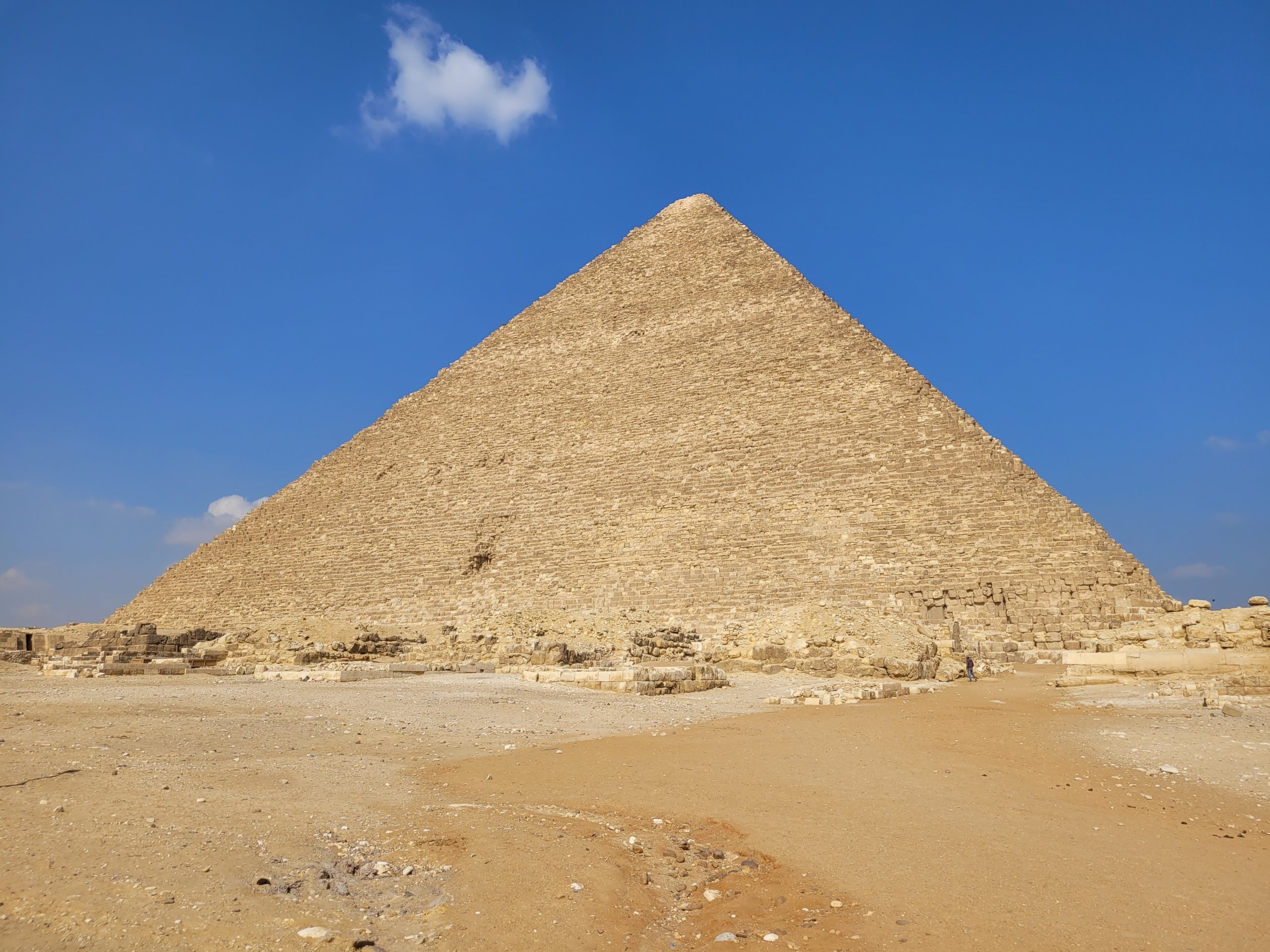
Die Cheops-Pyramide ist die älteste und größte der drei Pyramiden von Gizeh und wird deshalb auch als „Große Pyramide“ bezeichnet. Die höchste Pyramide der Welt wurde als Grabmal für den ägyptischen König (Pharao) Cheops (altägyptisch Chufu) errichtet, der während der 4. Dynastie im Alten Reich regierte (etwa 2620 bis 2580 v. Chr.[2]). Zusammen mit den benachbarten Pyramiden der Pharaonen Chephren und Mykerinos ist sie das einzige der Sieben Weltwunder der Antike, das sich bis heute erhalten hat. Als Bauplatz wählte Cheops nicht die königliche Nekropole von Dahschur wie sein Vorgänger Snofru, sondern das Gizeh-Plateau.
Altägyptisch wurde die Pyramidenanlage Achet Chufu („Horizont des Cheops“) genannt. Ihre ursprüngliche Seitenlänge wird auf 230,33 m und die Höhe auf 146,59 m (ca. 280 Ellen) berechnet. Damit war sie rund viertausend Jahre lang das höchste Bauwerk der Welt. Da sie in späterer Zeit als Steinbruch diente, beträgt ihre Höhe heute noch 138,75 m. Ihre Einmessung wurde in sehr hoher Genauigkeit vorgenommen, die in den nachfolgenden Bauten nicht mehr erreicht wurde. Sie ist genau nach den vier Himmelsrichtungen ausgerichtet, und der Unterschied in den Längen ihrer vier Seiten beträgt weniger als ein Promille. Als Baumaterial diente hauptsächlich örtlich vorkommender Kalkstein. Für einige Kammern wurde Granit verwendet. Die Verkleidung der Pyramide bestand ursprünglich aus weißem Tura-Kalkstein, der im Mittelalter fast vollständig abgetragen wurde.
An der Nordseite befindet sich der ursprüngliche Eingang und im Innern ein Kammersystem aus drei Hauptkammern: die Felsenkammer im gewachsenen Fels, die sogenannte Königinnenkammer etwas höher im Kernmauerwerk und die sogenannte Königskammer oberhalb der großen Galerie mit dem Sarkophag, in welchem der König vermutlich bestattet wurde. Ein Leichnam oder Grabbeigaben wurden nicht gefunden. Die Pyramide wurde offensichtlich spätestens im Mittelalter, wahrscheinlich schon zu pharaonischer Zeit geplündert. Die Funktion der einzelnen Kammersysteme in der Cheops-Pyramide ist in vielfacher Hinsicht ungeklärt. Das Raumprogramm spiegelt vermutlich religiöse Vorstellungen wider, wie die Idee des Himmelsaufstiegs des toten Königs: anfänglich zu den unvergänglichen Sternen des Nordhimmels, dann zum Lichtland, den Gefilden des Re am Himmel.
An der Ostseite der Pyramide befindet sich der Totentempel, von dem heute nur noch die Fundamente erhalten sind. Vom Aufweg und Taltempel ist fast nichts erhalten. Im anliegenden Ostfriedhof wurden die näheren Verwandten des Cheops bestattet. Dazu gehören mehrere große Mastabas vorwiegend für seine Söhne und deren Frauen sowie drei Königinnenpyramiden, deren Zuordnung zu einzelnen Königinnen und Prinzessinnen bisher nicht zweifelsfrei vorgenommen werden kann. Eine vierte, kleinere Pyramide diente als Kultpyramide für den König. Im Westen wurde ein Friedhof aus kleineren Mastabas angelegt, hauptsächlich für hohe Beamte. Im Umfeld der Cheops-Pyramide wurden sieben Bootsgruben entdeckt, zwei davon noch intakt und verschlossen. Die in 1224 Einzelteile zerlegte Barke des Königs ist, restauriert und wieder zusammengesetzt, seit 1982 im Bootsmuseum ausgestellt. Die Bedeutung der Königsboote ist noch ungeklärt. Vielleicht stehen sie im Zusammenhang mit der Bestattung oder mit gewissen Jenseitsvorstellungen.
Bereits antike Historiker befassten sich mit der Cheops-Pyramide, insbesondere Herodot, der über 2.000 Jahre nach dem Bau der Pyramiden lebte, seine Informationen teilweise aus zweifelhaften Quellen bezog und aus der Sicht eines Griechen schrieb. Mit ihm nahmen bis heute andauernde Irrungen und Wirrungen über die Pyramide ihren Anfang. Ab dem 15. Jahrhundert war sie Ziel europäischer Reisender und ab dem 18. Jahrhundert von Forschungsexpeditionen. Spätestens die Untersuchungen Flinders Petries, Begründer der modernen ägyptischen Archäologie, widerlegten zahlreiche mythische Ideen. In jüngerer Zeit waren vor allem die Schächte der Königinnenkammer Gegenstand von Untersuchungen.
Von besonderem Interesse für die Logistik beim Bau der Cheopspyramide sind Papyrus-Fragmente, die 2013 in Wadi al-Garf entdeckt wurden. Darunter befand sich ein Logbuch eines Inspektors namens Merer, der einen Arbeitstrupp leitete, der Steine vom Steinbruch Tura für den Bau der Cheopspyramide nach Giza schiffte (Papyrus Jarf A und B). Diese Papyrus-Funde liefern erstmals ein „inneres“ Bild der Verwaltung des frühen Alten Reiches.
Die Cheops-Pyramide gehört seit 1979 zusammen mit vielen weiteren Pyramiden als Teil des Komplexes „Memphis und seine Totenstadt – die Pyramidenfelder von Gizeh bis Dahschur“ zum UNESCO-Weltkulturerbe.[3]
胡夫金字塔(阿拉伯语:هرم أكبر,希腊语:Πυραμίδες της Γκίζα,英语:Pyramid of Khufu)又称吉萨大金字塔,是位于埃及吉萨的三座著名金字塔中最为古老也是最大的一座,同时也是古代世界七大奇迹唯一尚存的建筑物。
根据一间墓室墙上关于工头和埃及第四王朝胡夫法老的记号,[1][2]埃及学家们认为这座金字塔是他的陵墓。金字塔的建造大约持续了10至20年,并于公元前2560年完成(距今约四千五百年)。原高146.59米(480.9英尺),底边长230.37米(755.8英尺)[3],在其建成后的3800多年中一直是世界上最高的建筑物。最初,金字塔表面包有一层光滑的外包石块;而现在金字塔呈现的则是石块下的核心结构,金字塔基座现在仍有外包石块的残留。金字塔的建造方式有着很多不同的解释以及假说,最广泛接受的假说认为金字塔的修建是通过用人力将巨石从采石场开掘出来,将其提升安放到预定位置这种方式进行的。
金字塔内部现在已知有三个墓室,最下面的一个是直接在金字塔的基岩中开凿出来的,但是它并未完成,王后墓室和国王墓室则位于它上方的金字塔内部。吉萨大金字塔是目前在埃及唯一一座已知有上升和下降通道的金字塔。金字塔建筑群的主要部分包括了两座胡夫法老的祭庙(一座紧邻金字塔,而另外一座则位于尼罗河边上)、三座为胡夫法老的妻子们而建的小金字塔、一座更小一点的“卫星”金字塔、一条高于地面连接两座祭庙的甬道和围绕金字塔为贵族修建的马斯塔巴墓。2017年,“扫描金字塔”项目团队在埃及胡夫金字塔内发现一个“巨大的神秘空间”,成像技术显示该空间为一大型中空结构,但由于没有入口,因此无法确定其具体功用[4]。2023年3月2日,埃及旅游和文物部宣布,在位于2017年发现的中空结构上方发现了一条长9米、宽2.1米的新通道[4]。

Bei den Pyramiden von Gizeh handelt es sich um das einzige noch heute erhaltene der Sieben Weltwunder der Antike und damit um eines der bekanntesten Bauwerke der Welt. Sie liegen ca. 15 Kilometer von der Innenstadt von Kairo, der Hauptstadt von Ägypten, entfernt direkt am Stadtrand von Gizeh, einem Vorort von Kairo mit 2 Millionen Einwohnern. Die Entfernung vom Stadtzentrum von Gizeh beträgt rund 8 Kilometer. Das ganze Areal befindet sich auf der westlichen Seite des Nils, aber in einiger Entfernung von diesem, weshalb es in der Wüste liegt.
Zu den Pyramiden von Gizeh zählen neben den drei Hauptpyramiden, der Cheops Pyramide, der Chephren Pyramide und der Mykerinos Pyramide auch die Große Sphinx von Gizeh, einige weitere kleiner Nebenpyramiden, in denen zum Beispiel die Frauen der Pharaonen begraben wurden, sowie Arbeiterdörfer, Tempel und Gräberfelder.
Die Pyramiden von Gizeh entstanden bereits in den Jahren 2620 bis 2500 vor Christus, was der 4. Dynastie entspricht. Aber schon zuvor, in der 1. bis 3. Dynastie, wurde das rund 3 Quadratkilometer große Areal der Pyramiden von Gizeh und der Sphinx als Grabstätte der Pharaonen genutzt. Inwieweit die damals entstandenen Gräber bei dem Bau der Pyramiden zerstört wurden ist allerdings unklar.(Quelle:http://www.aegypten-magazin.de/sehenswuerdigkeiten/die-pyramiden-von-gizeh/)
Die Pyramiden von Gizeh in Ägypten gehören zu den bekanntesten und ältesten erhaltenen Bauwerken der Menschheit. Sie stehen am westlichen Rand des Niltals, etwa acht Kilometer südwestlich der Stadt Gizeh (Gîza). Sie sind rund 15 km vom Kairoer Stadtzentrum entfernt und sind das einzige erhaltene der sieben Weltwunder der Antike. Sie zählen seit 1979 zum Weltkulturerbe.
吉萨金字塔群(阿拉伯语:أهرام الجيزة)是指一大片位在埃及开罗郊区的吉萨高原内之陵墓群,于1979年登入联合国教科文组织世界遗产,于2007年7月7日获选为世界新七大奇迹中的荣誉奇迹。陵墓群建于埃及第四王朝,主要由三个金字塔组成,而当中最大的是胡夫金字塔(又称“大金字塔”),同时也是古代世界七大奇迹中最古老及唯一尚存的建筑物,现在旁边还设立了太阳船博物馆;次大的是卡夫拉金字塔;最小的是孟卡拉金字塔。此外,在这三个主要金字塔旁有著名的狮身人面像和3座属于皇后的小型金字塔。吉萨金字塔群是联合国教科文组织世界遗产孟菲斯及其墓地金字塔的一部分。
胡夫金字塔
胡夫金字塔是三者中最高也是最古老的金字塔,它也是世界上现存的最大的金字塔,埋葬的是埃及第四王朝时期的法老胡夫。它的四个边分别对应东南西北四个方向,误差很小。由于常年的风吹日晒,塔高已经由原先的146.5米变为137米,边长接近230米。胡夫金字塔由230万块巨石搭建而成,最重的石块可达50吨,最小的也有1.5吨。不过胡夫金字塔并非由这230万块石头简单堆砌而成,硬质的扶壁和软质的填石层构成了类似树木年轮的金字塔结构。因而,如果金字塔的一部分发生坍塌也不至于使整体崩坏。这些巨大的石头都为石灰岩,是从尼罗河东岸的图拉采石场开采、运输过来的。因为没有车轮,当年的埃及人可能是使用圆木运输的。金字塔的外面原先还有白色的石灰岩,因为地震、偷窃等原因如今外部的石块已经不复存在。根据公元前5世纪的古希腊学者希罗多德的记载,建造这样的金字塔需要10万人劳动20年。[1]
胡夫金字塔的内部有三个墓室,第一个位于地下,是在岩基上开凿出来的。第二个高于地平面,最初的一批探险者称其为女王墓室。然而后来根据研究得知这个墓室并没有埋葬胡夫的妻子,可能是放置法老自己的神像。第三个则是法老的墓室,它里面放置的红色花岗岩石棺几乎位于金字塔的正中心。[2]
卡夫拉金字塔
卡夫拉是仅次于胡夫金字塔的第二大金字塔,由胡夫的继任者卡夫拉建造。虽然它的高度只有136米不及胡夫的金字塔,然而它建在了一块高地上,看上去似乎更为高大,同时周围的附属设施也更为复杂。[3]据估计它一共用了488万吨的石头,它的坡度为53°,大于胡夫金字塔的51°。在金字塔的主墓室内有一个石棺,但是金字塔内部没有任何标记,甚至无法判断墓室内是不是埋葬了什么人。这个金字塔有两个上下排列,位于同一方向的入口。较高的那个距离地面15米,如今它是出入口。通往墓室的通道角度为25°,墙上贴着红色的花岗岩。较低的通道曾经有一个吊闸,可以用来关闭入口。这个通道的角度同它上面的那个完全一致,底下的通道内有一个开凿在岩基上的墓室。不过这个墓室没有完工,也没有投入使用。卡夫拉金字塔的顶部依然残留了一些石灰石,同胡夫金字塔一样,在1818年近代探险家进入金字塔内之前,它就曾被偷窃过。[4]
卡夫拉金字塔面前是著名的狮身人面像斯芬克斯,它长73.5米,高20米。然而狮身人面像的意义以及其制造者都是一个谜。[5]斯芬克斯其实是希腊的舶来品,在希腊神话中,这是一种狮身人面长着翅膀的雌性。斯芬克斯的头部和身体不成正比,有人认为这是因为现在头像是后来重新雕刻的。不过,考虑到斯芬克斯身体部分出现的多道裂缝,很有可能是工匠们不得已之下延长了身体,造成了现在的这种比例。原先用于支撑它头部的胡须,如今位于大英博物馆内。可是它的鼻子是何时以及如何消失的却很难搞清楚,根据16、17世纪时法国探险者的画像,当时它仍然有鼻子。后来的一些图像作者,实际上并没有亲眼见过斯芬克斯。等到19世纪拿破仑入侵埃及时,它的鼻子已经消失了。[6]
孟卡拉金字塔
孟卡拉是第四王朝时期的第16位法老,孟卡拉金字塔远小于前两座金字塔,它的高度只有大约65米,总体积大约只有卡夫拉金字塔1/10。不同于外面包覆石灰石的胡夫金字塔,孟卡拉金字塔底部包覆的是花岗岩。它内部的墓室同样也使用了花岗岩,开采难度要比石灰石高出许多。孟卡拉死得较为突然,他的金字塔也被迫停工,后来可能是他的继任者用土砖完成了剩余的建造工作。[7]
孟卡拉金字塔的周围还有三座小型金字塔,不过似乎都没有完工。最大的那个完成度较高,就像孟卡拉金字塔一样,它也是由部分花岗岩构成的。[8][9]
三大ピラミッド(さんだいピラミッド)は、エジプト、ギザの砂漠にある、3基のピラミッドの総称。英語ではGiza pyramid complex(ギザのピラミッド群)と呼ばれる。隣接するスフィンクスとともに、エジプトを象徴するイメージとなっている。
造営時期は現在より約4500年前の、紀元前2500年頃とされ、いずれもエジプト第4王朝期に建設されている。古代エジプト王国のファラオの墓陵であり、被葬者はクフ王、カフラー王、メンカウラー王とされる。また、それぞれのピラミッドには王妃たちのピラミッドや衛星ピラミッド、参道やマスタバ墓群などが付属しており、いわゆるピラミッド複合体(ピラミッド・コンプレックス)を形成している。カフラー王のピラミッドの参道入り口にそびえたつギザの大スフィンクスも、このピラミッド複合体の一部に含まれている。こうしたギザに広がるピラミッド付属の墓地遺跡を総称してギザの墓地遺跡(ギザ・ネクロポリス)と呼び、メンフィスとその墓地遺跡の一部として世界遺産に登録されている。 クフによってこの地にピラミッドが建設されるまで、ギザの地は王墓の地となっていなかった。主に王墓が建設されていたのはギザの南にあるサッカラであり、世界最古のピラミッドとされるジェゼル王のピラミッドもこの地に建設されている。このピラミッドの建設は後世に多大な影響を及ぼし、それまでのマスタバ墓に代わって以後はピラミッドが王墓の中心的な様式となった。ジェゼル王のピラミッドはマスタバ墓を6段積み重ねたような、いわゆる階段ピラミッドであったが、その後ピラミッドの建設技術は進化していった。クフの前の王であるスネフェルはダハシュールに屈折ピラミッドを建設した。これはそれまでの階段ピラミッドから一段階進み、直線の稜線を持っていたものの、下部を急角度で建設したために上部で傾斜角を緩やかにせざるを得ず、上部と下部で傾斜が異なって屈折したように見えるピラミッドとなった。スネフェルはさらにその後、同じくダハシュールに赤いピラミッドを建設した。これは美しい二等辺三角形の形をした、世界最初の真正ピラミッドであり、ここでクフ王のピラミッドの建設を可能とした技術のかなりが出そろうこととなった。
The Giza pyramid complex is an archaeological site on the Giza Plateau, on the outskirts of Cairo, Egypt. It includes the three Great Pyramids (Khufu/Cheops, Khafre/Chephren and Menkaure/Mykerinos), the Great Sphinx, several cemeteries, a workers' village and an industrial complex. It is located in the Western Desert, approximately 9 km (5 mi) west of the Nile river at the old town of Giza, and about 13 km (8 mi) southwest of Cairo city centre.
The pyramids, which have historically been common as emblems of ancient Egypt in the Western imagination,[1][2] were popularised in Hellenistic times, when the Great Pyramid was listed by Antipater of Sidon as one of the Seven Wonders of the World. It is by far the oldest of the ancient Wonders and the only one still in existence.
Les pyramides de Gizeh, appelées aussi complexe pyramidal de Gizeh, sont l'ensemble des pyramides égyptiennes situées dans la nécropole de Gizeh sur le plateau de Gizeh. Ce complexe pyramidal égyptien est classé au patrimoine mondial de l'humanité depuis 1979.
Le plateau de Gizeh est situé sur la rive ouest du Nil dans le désert à 8 km du centre ville de Gizeh et à 25 km du Caire. Ce plateau, nivelé par l'homme il y a 4 500 ans1, a la forme approximative d'un carré de 1,6 à 1,9 km de côté2. Le plateau est délimité au sud-est et au sud-ouest par deux failles orientées respectivement NE-SO et NO-SE, avec un escarpement côté sud-est descendant à 40 m de dénivellation, au pied duquel courait un canal du Nil séparant la zone désertique de la terre fertile3. Ce canal présent au moment de la construction de la pyramide a dérivé vers l'Est probablement en raison d'une catastrophe naturelle, la rive ouest du Nil actuel étant désormais à 8 km à l’est du site. L’assise du plateau s’abaisse doucement vers le sud-est (l’inclinaison des roches va de moins de 5° à plus de 10°)4.
L'alignement des pyramides est situé sur le sommet d'un pli anticlinal d’axe NE-SW5. Contrairement à ce que l'on peut lire ou entendre, ce n'est pas la constellation du Grand Chien ou le lever héliaque de Sirius qui a dicté l'orientation N-S et E-W des trois grandes pyramides. Étant situées au milieu des carrières d'où proviennent les matériaux avec lesquels elles furent construites, leur orientation N-S et E-W est principalement commandée par la fracturation la plus fine des diaclases métriques diagonales (N-S et E-W) par rapport à l'axe du pli6 et qui ont été préférentiellement utilisées dans l'exploitation des carrières. Ces discontinuités facilitaient en effet l'extraction en servant de limites aux blocs7.
Комплекс пирамид в Гизе — комплекс древних памятников на плато Гиза в пригороде Каира, современной столицы Египта. Находится на расстоянии около 8 км по направлению в центр Ливийской пустыни от старого города Гиза на реке Нил, примерно в 25 км к юго-западу от центра Каира. Принято считать, что постройки были созданы в Древнем царстве Древнего Египта во время правления IV—VI династий (XXVI—XXIII века до н. э.).
Пирамида Хеопса (Хуфу) является единственным оставшимся памятником из семи чудес древнего мира. Также является национальным достоянием Египта.
 Egypt
Egypt
 Ethiopia
 Brazil
 BRICS summit
 China
China

 Hand in Hand
 India
India
 Iran
Iran
 Russia
 South Africa
 United Arab Emirates

 Important International Organizations

 Economy and trade

金砖国家,简称金砖国,原称金砖四国(英语:BRIC)、金砖五国(英语:BRICS),现指九个主要的新兴市场国家,分别为巴西、俄罗斯、印度、中华人民共和国、南非、埃及、埃塞俄比亚、伊朗及阿拉伯联合酋长国。
金砖国家人口和国土面积在全球占有重要份额,是世界经济增长的主要动力之一。[1]组织中国家的共同点为领土面积大、人口多、发展中国家以及被认为有一定甚至巨大的发展潜力。所以可以说在可见的未来里,这个组织或者组织中某个或多个国家会一定程度上的影响甚至领导全球经济。
2010年12月23日,南非作为正式成员加入金砖国家。2023年金砖国家峰会后,南非总统宣布邀请阿根廷(后撤回加入申请)、埃及、埃塞俄比亚、伊朗、沙特阿拉伯(后搁置加入申请)、阿拉伯联合酋长国成为金砖国家的正式成员[2]。
BRICS is the acronym coined by British Economist Jim O’Neill meant for an association of five major emerging national economies: Brazil, Russia, India, China and South Africa. Originally the first four were grouped as "BRIC" (or "the BRICs"), before the induction of South Africa in 2010.[4] The BRICS members are known for their significant influence on regional affairs; all are members of G20.[5] Since 2009, the BRICS nations have met annually at formal summits. China hosted the 9th BRICS summit in Xiamen on September 2017,[6] while South Africa will do so for the 10th BRICS summit in July 2018. The term does not include countries such as South Korea, Mexico and Turkey for which other acronyms and group associations were later created.
In 2015, the five BRICS countries represent over 3.1 billion people, or about 41% of the world population; four out of five members (excluding South Africa at #24) are in the top 10 of the world by population. As of 2018, these five nations have a combined nominal GDP of US$18.6 trillion, about 23.2% of the gross world product, combined GDP (PPP) of around US$40.55 trillion (32% of World's GDP PPP) and an estimated US$4.46 trillion in combined foreign reserves.[7][8] Overall the BRICS are forecasted to expand 4.6% in 2016, from an estimated growth of 3.9% in 2015. The World Bank expects BRICS growth to pick up to 5.3% in 2017.[9] The BRICS have received both praise and criticism from numerous commentators.[10][11][12] Bilateral relations among BRICS nations have mainly been conducted on the basis of non-interference, equality, and mutual benefit.[13]
BRICS est un acronyme anglais pour désigner un groupe de cinq pays qui se réunissent depuis 2011 en sommets annuels : Brésil, Russie, Inde, Chine et Afrique du Sud (en anglais : Brazil, Russia, India, China, South Africa).
Avant l'ajout de l'Afrique du Sud en 2011, le groupe était appelé BRIC, terme initial inventé en 2001 et qui a conduit à l'organisation des premiers sommets à quatre pays en 2009. Rarement utilisés, les équivalents français de cet acronyme - après l'adhésion de l'Afrique du Sud - sont ABRIC (Afrique du Sud, Brésil, Russie, Inde et Chine1), BRASIC ou encore BRICA2.
L'acronyme BRICSAM (en anglais : Brazil, Russia, India, China, South Africa, Mexico) est également utilisé pour y adjoindre le Mexique, sans qu'il ne soit membre du groupe.
Il BRICS in economia internazionale è un'associazione di cinque paesi tra le maggiori economie emergenti. Il nome è l'acronimo delle iniziali dei cinque stati:
Tali economie si propongono di costruire un sistema commerciale globale attraverso accordi bilaterali che non siano basati esclusivamente sul petrodollaro. Il termine ha avuto origine dal precedente BRIC, con l'aggiunta della S relativa al Sudafrica.
En economía internacional,1 se emplea la sigla BRICS para referirse conjuntamente a Brasil, Rusia, India, China y Sudáfrica,2 aunque en este artículo se hará más referencia al BRIC, que excluye este último país, el que se unió al grupo en 2011. En términos generales, BRICS es el acrónimo de una asociación económica-comercial de las cinco economías nacionales emergentes más importantes del mundo. Los BRICS son considerados el paradigma de la cooperación Sur-Sur, aunque recientemente esta interpretación fue puesta en cuestión dadas las contradicciones entre los intereses de China y los demás miembros.3
Todas estas naciones tienen en común una gran población (China e India por encima de los mil cien millones, Brasil y Rusia por encima de los ciento cuarenta millones), un enorme territorio (casi 38,5 millones km²), lo que les proporciona dimensiones estratégicas continentales, una gigantesca cantidad de recursos naturales y, lo más importante, las enormes cifras que han presentado de crecimiento de su producto interno bruto (PIB) y de participación en el comercio mundial en los últimos años, lo que los hace atractivos como destino de inversiones.4
México y Corea del Sur son los únicos países comparables a los BRIC, pero sus economías se excluyeron debido a que ya son miembros de la OCDE.5 Estos países, Brasil, China, India y Sudáfrica, exceptuando a Rusia que pertenece al G-8, también forman parte del G-5. Argentina, en tanto, fue invitada a la cumbre de Fortaleza, junto a los miembros de la Unión de Naciones Suramericanas realizada en julio de 2014.
Em economia, BRICS é um acrônimo que se refere aos países membros fundadores (o grupo BRIC: Brasil, Rússia, Índia e China), que juntos formam um grupo político de cooperação. Em 14 de abril de 2011,[1] o "S" foi oficialmente adicionado à sigla BRIC para formar o BRICS, após a admissão da África do Sul (em inglês: South Africa) ao grupo.[2][3][4] Os membros fundadores e a África do Sul estão todos em um estágio similar de mercado emergente, devido ao seu desenvolvimento econômico. É geralmente traduzido como "os BRICS" ou "países BRICS" ou, alternativamente, como os "Cinco Grandes".
Apesar de o grupo ainda não ser um bloco econômico ou uma associação de comércio formal, como no caso da União Europeia,[5] existem fortes indicadores de que os quatro países do BRIC têm procurado formar um "clube político" ou uma "aliança", e assim converter "seu crescente poder econômico em uma maior influência geopolítica."[6][7] Desde 2009, os líderes do grupo realizam cúpulas anuais.[8]
A sigla (originalmente "BRIC") foi criada por Jim O'Neill em um estudo de 2001 intitulado "Building Better Global Economic BRICs".[9][10][11] Desde então, a sigla passou a ser amplamente usada como um símbolo da mudança no poder econômico global, distanciando-se das economias desenvolvidas do G7 em relação ao mundo em desenvolvimento.
De acordo com um artigo publicado em 2005, o México e a Coreia do Sul seriam os únicos outros países comparáveis aos BRICS, mas suas economias foram inicialmente excluídas por serem consideradas mais desenvolvidas, uma vez que já eram membros da Organização para a Cooperação e Desenvolvimento Econômico.[12] As relações bilaterais entre os países dos BRICS tem sido conduzidas principalmente com base nos princípios de não-interferência, igualdade e benefício mútuo.[13]
ब्रिक्स (BRICS) उभरती राष्ट्रीय अर्थव्यवस्थाओं के एक संघ का शीर्षक है। इसके घटक राष्ट्र ब्राज़ील, रूस, भारत, चीन और दक्षिण अफ्रीका हैं। इन्हीम देशों के अंग्रेज़ी में नाम के प्रथमाक्षरों B, R, I, C व S से मिलकर इस समूह का यह नामकरण हुआ है।[1] मूलतः, २०१० में दक्षिण अफ्रीका के शामिल किए जाने से पहले इसे "ब्रिक" के नाम से जाना जाता था। रूस को छोडकर[2], ब्रिक्स के सभी सदस्य विकासशील या नव औद्योगीकृत देश हैं जिनकी अर्थव्यवस्था तेजी से बढ़ रही है। ये राष्ट्र क्षेत्रीय और वैश्विक मामलों पर महत्वपूर्ण प्रभाव डालते हैं। वर्ष २०१३ तक, पाँचों ब्रिक्स राष्ट्र दुनिया के लगभग 3 अरब लोगों का प्रतिनिधित्व करते हैं और एक अनुमान के अनुसार ये राष्ट्र संयुक्त विदेशी मुद्रा भंडार में ४ खरब अमेरिकी डॉलर का योगदान करते हैं। इन राष्ट्रों का संयुक्त सकल घरेलू उत्पाद १५ खरब अमेरिकी डॉलर का है।[3] वर्तमान में, दक्षिण अफ्रीका ब्रिक्स समूह की अध्यक्षता करता है।
БРИКС (англ. BRICS — сокращение от Brazil, Russia, India, China, South Africa) — группа из пяти стран: Бразилия, Россия, Индия, Китай, Южно-Африканская Республика.
Сокращение БРИК (BRIC) было впервые предложено аналитиком Джимом О’Нилом в ноябре 2001 года в аналитической записке банка «Goldman Sachs» Building Better Global Economic BRICs (Кирпичи для новой экономики)[1][2]. До 2011 года по отношению к организации использовалась аббревиатура БРИК. В связи с присоединением ЮАР к БРИК 18 февраля 2011 года, по заявлению индийского министра финансов с этого времени группа стала носить название BRICS[3].
Последовательность букв в слове определяется не только благозвучием, но и тем, что само слово в английской транскрипции BRICS очень похоже на английское слово bricks — «кирпичи»[4], таким образом, данный термин используется в качестве обозначения группы стран, за счёт роста которых во многом будет обеспечиваться будущий рост мировой экономики.
Организация была основана в июне 2006 года, в рамках Петербургского экономического форума (ПЭФ) с участием министров экономики Бразилии, России, Индии, Китая. Помимо саммитов, встречи проходят на уровне глав МИД, министров финансов и др.
Эксперты не предполагали наличия координации экономических политик между странами БРИК. Тем более не предполагалось, что страны БРИК образуют некий экономический блок или официальную торговую ассоциацию, как Европейский союз. Однако со временем появились признаки, что «четыре страны БРИК стремятся сформировать политический клуб» или «союз», и таким образом преобразовать «свою растущую экономическую власть в большее геополитическое „влияние“». С сентября 2006 года началось налаживание политических связей в рамках БРИК: во время 61-й сессии ООН была проведена встреча министров иностранных дел четырёх стран. Главы государств БРИК впервые встретились 9 июля 2008 года в Тояко-Онсэн (Хоккайдо, Япония) в рамках 34-го саммита G8 и договорились о проведении полноформатного саммита, который состоялся в Екатеринбурге 16 июня 2009 года[5]. [источник не указан 1284 дня]
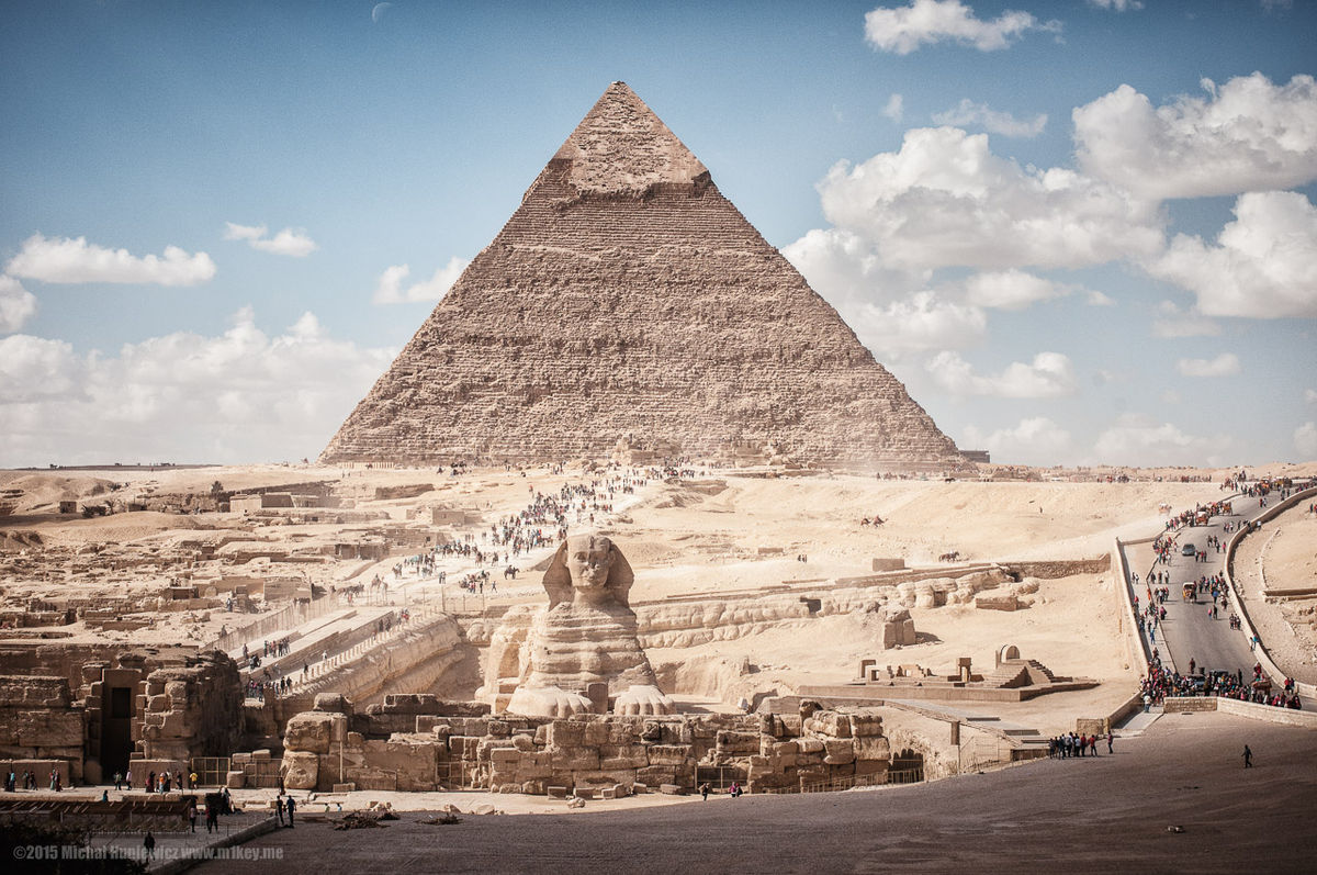

Die altägyptische Chephren-Pyramide ist die zweithöchste der Pyramiden von Gizeh und zugleich die zweithöchste aller ägyptischen Pyramiden. Trotzdem erscheint sie höher als die Cheops-Pyramide, was an dem steileren Neigungswinkel und dem etwas höheren Untergrund liegt. Wie alle Pyramiden von Gizeh wurde sie in der 4. Dynastie um 2550 v. Chr. erbaut und erhielt den Namen Wer Chaefre (‚Chaefre ist groß‘).
Pharao Chephren (auch Chaefre), der hier bestattet wurde, war der Halbbruder seines Vorgängers Radjedef (alternative Lesung Djedefre) und Sohn von Pharao Cheops (auch Chufu), der ebenfalls in Gizeh begraben wurde. Auf dem Ostfriedhof in Gizeh findet man eine große Doppelmastaba (Nr. G7130-40), die nach Stadelmann dem Königssohn Chaefchufu zuzuordnen ist. Dieser Chaefchufu änderte nach dem Tode seiner Halbbrüder Kawab und Djedefre sowie seiner Machtübernahme den Namen in Chaefre („Er erscheint wie Re“).
卡夫拉金字塔(阿拉伯语:هرم خفرع),也称齐夫林金字塔,是埃及的一座金字塔,也是埃及第2大的金字塔,仅次于胡夫金字塔。卡夫拉金字塔,在公元前2570年动工建造,也是埃及第四王朝法老卡夫拉的陵墓。卡夫拉金字塔与附近2座金字塔相异的是,在金字塔顶端,仍然保留着部分的石灰岩外壳,这些贴皮至今尚未脱落。
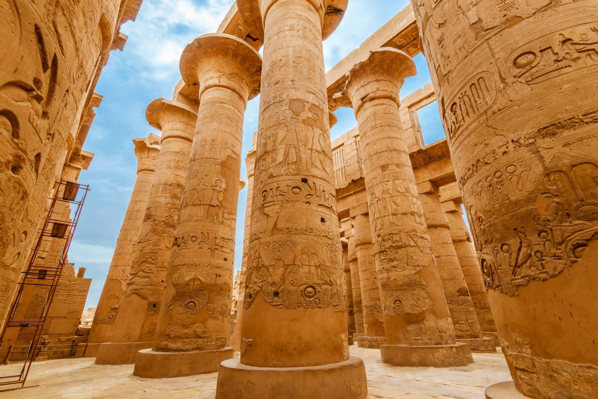

Die Karnak-Tempel liegen als größte Tempelanlage von Ägypten in Karnak, einem Dorf etwa 2,5 Kilometer nördlich von Luxor und direkt am östlichen Nilufer. Die ältesten heute noch sichtbaren Baureste des Tempels stammen aus der 12. Dynastie unter Sesostris I.[1] Bis in die römische Kaiserzeit wurde die Tempelanlage immer wieder erweitert und umgebaut.
Die Tempelanlage steht seit 1979 zusammen mit dem Luxor-Tempel und der thebanischen Nekropole auf der Weltkulturerbeliste der UNESCO.
卡纳克(Karnak)神庙是底比斯最为古老的庙宇,在尼罗河东岸的卢克索镇北4千米处,该神庙经很长时间陆续建造起来,由砖墙隔成三部分。其中中间的部分保存得最完好,也是面积最大的一部分,占地约有30公顷,也是献给太阳神阿蒙的。
 Art
Art
 Architecture
 Driving school
 Religion
 Geography
 Party and government
 Transport and traffic