
漢德百科全書 | 汉德百科全书
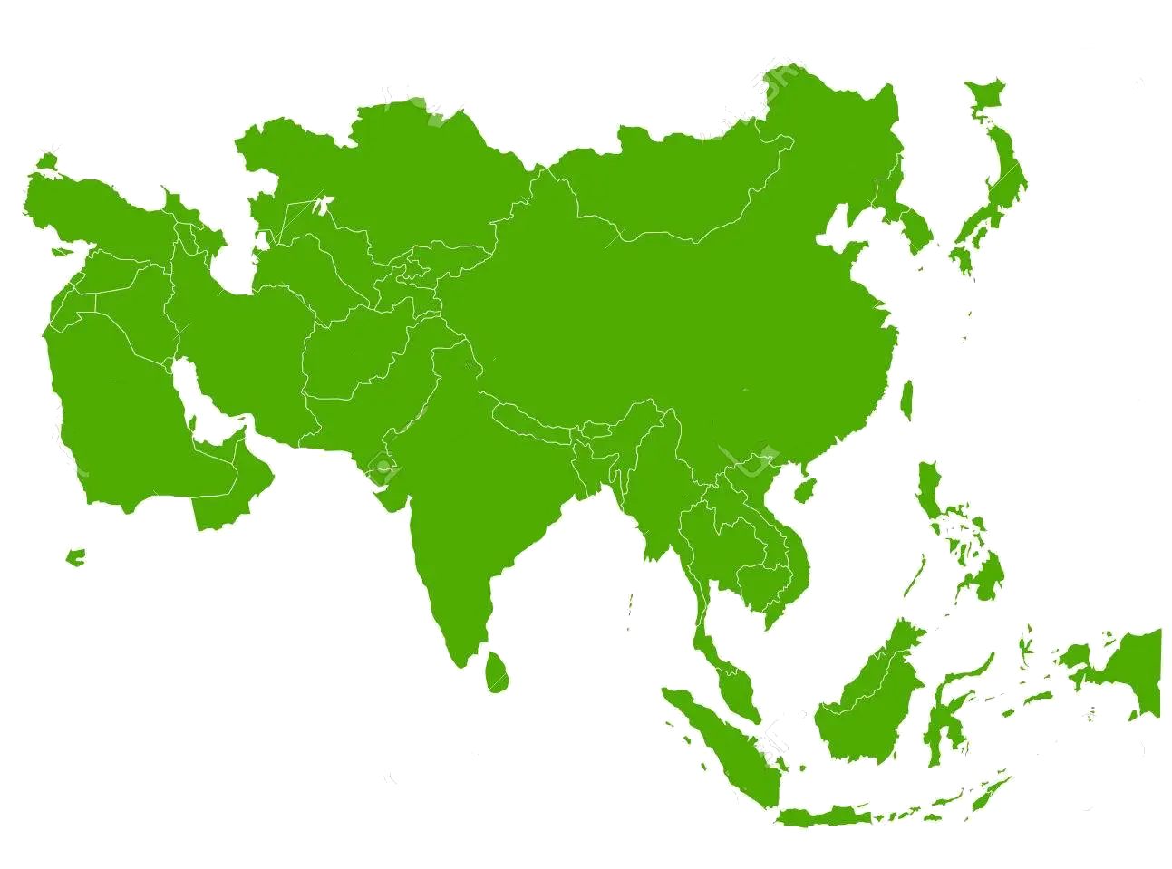
 States of Asia
 Afghanistan

 Geography
 Party and government


Ägypten (Aussprache [ɛˈɡʏptn̩] oder [ɛˈɡɪptn̩]; arabisch مصر Miṣr, offiziell Arabische Republik Ägypten) ist ein Staat im nordöstlichen Afrika mit über 100 Millionen Einwohnern[6] und einer Fläche von über einer Million Quadratkilometern. Die Megastadt Kairo ist ägyptische Hauptstadt und die größte Metropole Afrikas und Arabiens, der Ballungsraum „Greater Cairo“ ist eine der bevölkerungsreichsten Stadtregionen der Erde. Weitere Millionenstädte des Landes sind Alexandria und Gizeh. Hinsichtlich der Wirtschaftsleistung beim BIP pro Kopf liegt Ägypten auf Platz 94 von 190 Ländern (2016, PPP).
Das Alte Ägypten gilt als eine der frühen Hochkulturen der Welt. Ägypten wird seit der arabisch-islamischen Expansion zur Maschrek-Region des arabischen Raumes gezählt. Es hat als interkontinentaler Staat eine Landbrücke vom größeren afrikanischen Teil nach Asien, zur Sinai-Halbinsel. Durch die Revolution von 2011 änderten sich die gesellschaftlichen und politischen Verhältnisse im Land.
阿拉伯埃及共和国(阿拉伯语:جمهوريّة مصرالعربيّة,![]() 发音 帮助·信息),通称埃及,是东北非洲人口最多的国家,面积为1,001,450平方千米,2020年2月人口突破1亿[3]。原存在于当地的古埃及是世界文明古国之一,与两河流域文明有一定程度的交流,不过在希腊与罗马人的统治下,古埃及文明在公元前逐渐没落,后来被阿拉伯文化所取代。二战后,埃及于1953年由阿拉伯人建立共和国,地理上该国地跨二洲即亚洲和非洲,西奈半岛位于西南亚(西亚),而该国大部分国土位于北非地区。伊斯兰教为国教。埃及人大部分信仰伊斯兰教逊尼派,最大的宗教少数派为科普特正教。另外还有基督教其他教派和伊斯兰教什叶派;官方语言为阿拉伯语,通用英语和法语。埃及经济的多元化程度在中东地区名列前茅。
发音 帮助·信息),通称埃及,是东北非洲人口最多的国家,面积为1,001,450平方千米,2020年2月人口突破1亿[3]。原存在于当地的古埃及是世界文明古国之一,与两河流域文明有一定程度的交流,不过在希腊与罗马人的统治下,古埃及文明在公元前逐渐没落,后来被阿拉伯文化所取代。二战后,埃及于1953年由阿拉伯人建立共和国,地理上该国地跨二洲即亚洲和非洲,西奈半岛位于西南亚(西亚),而该国大部分国土位于北非地区。伊斯兰教为国教。埃及人大部分信仰伊斯兰教逊尼派,最大的宗教少数派为科普特正教。另外还有基督教其他教派和伊斯兰教什叶派;官方语言为阿拉伯语,通用英语和法语。埃及经济的多元化程度在中东地区名列前茅。
埃及也被认为是一个中等强国,各项重要产业如旅游业、农业、工业和服务业有着几乎同等的发展比重,埃及的苏伊士运河是亚洲与欧洲的桥梁。在地中海、中东和伊斯兰信仰地区尤其有广泛的影响力。
2015年埃及经济发展会议(EEDC),埃及计划于2019年底正式迁往新首都,缓解开罗人口压力。后该搬迁计划被推迟至2021年7月。
エジプト・アラブ共和国(エジプト・アラブきょうわこく、アラビア語: جمهورية مصر العربية)、通称:エジプト(アラビア語: مِصر)は、中東および北アフリカに位置する共和制国家。首都はカイロ。
アフリカ大陸では北東端に位置し、西にリビア、南にスーダン、北東のシナイ半島ではイスラエル、パレスチナ国・ガザ地区と国境を接する。北部は地中海、東部は紅海に面している。
エジプトは中東と北東アフリカの接点に存在し、古代文明が存在していた地域のひとつに数え上げられる。その歴史は紀元前の時代にまで遡るほど古い。
人口はアラブ諸国で最も多く、2020年2月に1億人を超えている[2]。同国地域には数千年前の古代都市の痕跡や幾多もの史跡がナイル川に沿う形で点在している。
また、水源が乏しい国の一つとしても知られており、南北に流れるナイル川の河谷とデルタ地帯(ナイル・デルタ)のほかは、国土の大部分の95%以上が砂漠である[3]。ナイル河口の東には地中海と紅海を結ぶスエズ運河がある。
同国は現在、MENA地域において2番目に人口密度の高い国と見做されており、中でもカイロは世界で最も人口密度の高い都市のひとつに当たる。
Egypt (/ˈiːdʒɪpt/ (![]() listen) EE-jipt; Arabic: مِصر, romanized: Miṣr), officially the Arab Republic of Egypt, is a transcontinental country spanning the northeast corner of Africa and southwest corner of Asia by a land bridge formed by the Sinai Peninsula. Egypt is a Mediterranean country bordered by the Gaza Strip (Palestine) and Israel to the northeast, the Gulf of Aqaba and the Red Sea to the east, Sudan to the south, and Libya to the west. Across the Gulf of Aqaba lies Jordan, across the Red Sea lies Saudi Arabia, and across the Mediterranean lie Greece, Turkey and Cyprus, although none share a land border with Egypt.
listen) EE-jipt; Arabic: مِصر, romanized: Miṣr), officially the Arab Republic of Egypt, is a transcontinental country spanning the northeast corner of Africa and southwest corner of Asia by a land bridge formed by the Sinai Peninsula. Egypt is a Mediterranean country bordered by the Gaza Strip (Palestine) and Israel to the northeast, the Gulf of Aqaba and the Red Sea to the east, Sudan to the south, and Libya to the west. Across the Gulf of Aqaba lies Jordan, across the Red Sea lies Saudi Arabia, and across the Mediterranean lie Greece, Turkey and Cyprus, although none share a land border with Egypt.
Egypt has one of the longest histories of any country, tracing its heritage along the Nile Delta back to the 6th–4th millennia BCE. Considered a cradle of civilisation, Ancient Egypt saw some of the earliest developments of writing, agriculture, urbanisation, organised religion and central government.[14] Iconic monuments such as the Giza Necropolis and its Great Sphinx, as well the ruins of Memphis, Thebes, Karnak, and the Valley of the Kings, reflect this legacy and remain a significant focus of scientific and popular interest. Egypt's long and rich cultural heritage is an integral part of its national identity, which reflects its unique transcontinental location being all Mediterranean, Middle Eastern and North African.[15] Egypt was an early and important centre of Christianity, but was largely Islamised in the seventh century and remains a predominantly Muslim country, albeit with a significant Christian minority.
Modern Egypt dates back to 1922, when it gained independence from the British Empire as a monarchy. Following the 1952 revolution, Egypt declared itself a republic, and in 1958 it merged with Syria to form the United Arab Republic, which dissolved in 1961. Throughout the second half of the 20th century, Egypt endured social and religious strife and political instability, fighting several armed conflicts with Israel in 1948, 1956, 1967 and 1973, and occupying the Gaza Strip intermittently until 1967. In 1978, Egypt signed the Camp David Accords, officially withdrawing from the Gaza Strip and recognising Israel. The country continues to face challenges, from political unrest, including the recent 2011 revolution and its aftermath, to terrorism and economic underdevelopment. Egypt's current government, a semi-presidential republic has been described by a number of watchdogs as authoritarian or heading an authoritarian regime, responsible for perpetuating the country's problematic human rights record.
Islam is the official religion of Egypt and Arabic is its official language.[16] With over 100 million inhabitants, Egypt is the most populous country in North Africa, the Middle East, and the Arab world, the third-most populous in Africa (after Nigeria and Ethiopia), and the thirteenth-most populous in the world. The great majority of its people live near the banks of the Nile River, an area of about 40,000 square kilometres (15,000 sq mi), where the only arable land is found. The large regions of the Sahara desert, which constitute most of Egypt's territory, are sparsely inhabited. About half of Egypt's residents live in urban areas, with most spread across the densely populated centres of greater Cairo, Alexandria and other major cities in the Nile Delta.
Egypt is a developing country, ranking 116th on the Human Development Index. Politically, however, it is considered to be a regional power in North Africa, the Middle East and the Muslim world, and a middle power worldwide.[17] Egypt has a diversified economy, which is the second-largest in Africa, the 33rd-largest economy by nominal GDP, and the 20th-largest globally by PPP. Egypt is a founding member of the United Nations, the Non-Aligned Movement, the Arab League, the African Union, Organisation of Islamic Cooperation and the World Youth Forum.
L'Égypte Écouter (en arabe : مصر / miṣr ; en arabe égyptien : مصر / maṣr masˤɾ), en forme longue la république arabe d'Égypte (en arabe : جمهورية مصر العربية) / jumhuriyat misr al arabiya2, est un pays se trouvant en Afrique du Nord-Est et, pour la péninsule du Sinaï, en Asie de l'Ouest. Située sur la côte sud de la Méditerranée orientale, le bassin Levantin, l'actuelle Égypte occupe l'espace géographique qui fut autrefois celui de l'Égypte antique.
Avec plus de 106 millions d'habitants en 2021, l'Égypte est le troisième pays le plus peuplé d'Afrique derrière le Nigeria et l'Éthiopie. En très forte croissance, sa population a été multipliée par quatre en soixante ans.
Sa capitale est Le Caire et sa monnaie la livre égyptienne. La langue officielle du pays est l'arabe, utilisé dans tous les documents et dans l'éducation. En revanche, la langue parlée est l'arabe égyptien (arabe dialectal). Le siwi — tamazight (berbère) de l'ouest du pays — est parlé à Siwa. Le copte n'est utilisé que comme langue liturgique des chrétiens d'Égypte. Le nubien est parlé par les habitants de Haute-Égypte, au sud d'Assouan, qui fait partie du nord de la région de Nubie.
L'Egitto (in arabo: مصر, Miṣr), ufficialmente Repubblica Araba d'Egitto (in arabo: جمهورية مصر العربية, Ǧumhūriyya Miṣr al-ʿArabiyya), è un paese transcontinentale che attraversa l'angolo nord-est dell'Africa e l'angolo sud-ovest dell'Asia attraverso un ponte di terra formato dalla penisola del Sinai. La maggior parte del suo territorio di 1 001 000 chilometri quadrati si trova nel Nord Africa e confina con il mar Mediterraneo a nord, la striscia di Gaza e Israele a nord-est, il golfo di Aqaba e il mar Rosso ad est, il Sudan a sud e la Libia ad ovest. Dal 1958 al 31 dicembre 1971 era denominato Repubblica Araba Unita.
L'Egitto è uno dei paesi più popolati dell'Africa e del Medio Oriente, e il 14º più popolato al mondo. Buona parte dei suoi più di 100 milioni di abitanti[6] vive vicino alle rive del fiume Nilo, su una superficie di circa 10 000 chilometri quadrati, dove si trova l'unica terra arabile del paese. Le grandi regioni del deserto del Sahara, che costituiscono la maggior parte del territorio dell'Egitto, sono scarsamente abitate. Circa il 42% dei residenti in Egitto vive in aree urbane, con la maggior diffusione di tutti i centri densamente popolati al Cairo, Alessandria e altre grandi città del delta del Nilo, come Mansura.
L'Egitto ha una delle più lunghe storie di ogni Stato moderno, essendo stato continuamente abitato dal X millennio a.C.[7] I suoi monumenti, come la piramide di Giza e la Grande Sfinge, sono stati costruiti per la sua antica civiltà, che è stata una delle più avanzate del suo tempo. Le sue antiche rovine, come quelle di Menfi, Tebe, Karnak e la Valle dei Re, al di fuori di Luxor, sono un focus significativo di studi archeologici e di interesse popolare. La ricca eredità culturale dell'Egitto, così come l'attrazione della sua riviera del mar Rosso, hanno fatto del turismo una parte vitale dell'economia, che impiega circa il 34% della forza lavoro del paese.
L'economia dell'Egitto è una delle più diversificate del Vicino Oriente, con settori quali il turismo, l'agricoltura, l'industria e dei servizi a livelli di produzione senza uguali. L'Egitto è considerato una media potenza,[8] con una significativa influenza culturale, politica e militare in Nord Africa, Vicino Oriente e mondo musulmano.
Egipto (en árabe, مصر, Miṣr, pronunciado en dialecto egipcio: Maṣr; en copto, Ⲭⲏⲙⲓ, khemi), oficialmente la República Árabe de Egipto (en árabe: جمهوريّة مصرالعربيّة Ŷumhūriyyat Miṣr Al-ʿArabiyyah7), es un país soberano transcontinental. Está ubicado mayoritariamente en el extremo noreste de África, mientras que en Asia se encuentra en la península del Sinaí. Limita con Sudán al sur, con Libia al oeste y con la Franja de Gaza (Palestina) e Israel al noreste. Al norte limita con el mar Mediterráneo y al sureste con el mar Rojo.
La mayor parte de su superficie la integra el desierto del Sahara. El río Nilo cruza el desierto de sur a norte, formando un estrecho valle y un gran delta en su desembocadura en el Mediterráneo. Estas tierras fértiles se hallan densamente pobladas, concentrando la mayor población nacional de África. Casi la mitad de los egipcios viven en áreas urbanas, sobre todo en los centros densamente poblados de El Cairo, su capital, y Alejandría.
Fue cuna de la antigua civilización egipcia, que junto con la mesopotámica fue el origen de la actual cultura occidental, influyendo decisivamente en la historia de la humanidad. Los restos de esta civilización jalonan el país, como las pirámides y la gran esfinge, o la ciudad meridional de Lúxor, que contiene un gran número de restos antiguos, tales como el templo de Karnak y el Valle de los Reyes. Egipto es actualmente un centro político y cultural importante del Oriente Próximo y se le considera una potencia regional. Su actual forma de gobierno es la república semipresidencialista. Entre 2013 y 2014 estuvo bajo gobierno interino, formado tras el golpe de Estado de 2013 que derrocó al primer presidente democrático del país, Mohamed Morsi.8
Еги́пет (араб. مصر Миср/Miṣr [misˤɾ], масри مصر Маср/Maṣr [ˈmɑsˤɾ], копт. Ⲭⲏⲙⲓ [kʰēmi]), официальное название — Ара́бская Респу́блика Еги́пет (араб. جمهورية مصر العربية Джумхурийят Миср аль-Арабийя, масри جمهورية مصر العربية Гумхурия Маср иль-Арабийя), — трансконтинентальное государство, расположенное в Северной Африке и на Ближнем Востоке (Синайский полуостров).
На северо-востоке граничит с Израилем и частично признанным государством Палестиной, на юге — с Суданом, на западе — с Ливией. На севере территория страны омывается водами Средиземного моря, на востоке — Красным морем, при этом оба моря соединены посредством искусственно сооружённого Суэцкого канала.
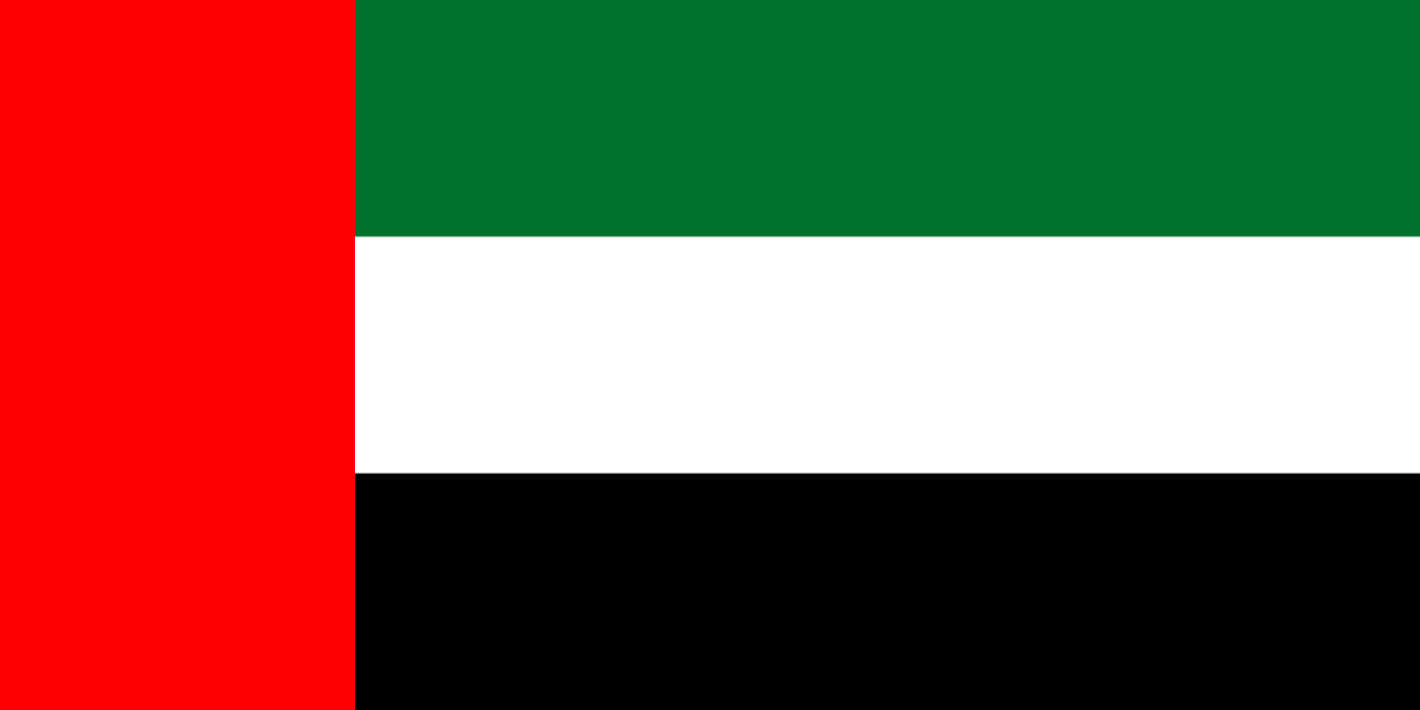
Die Vereinigten Arabischen Emirate (arabisch الإمارات العربية المتحدة, DMG al-Imārāt al-ʿArabiyya al-Muttaḥida; amtlich: arabisch دولة الإمارات العربية المتحدة, DMG Dawlat al-Imārāt al-ʿArabiyya al-Muttaḥida ‚Staat der Vereinigten Arabischen Emirate‘), kurz VAE, sind eine Föderation von sieben Emiraten im Osten der Arabischen Halbinsel in Südwestasien. An der Küste des Persischen Golfs gelegen und mit Zugang zum Golf von Oman, grenzt das Land an Saudi-Arabien und Oman. Es besteht aus den Emiraten Abu Dhabi, Adschman, Dubai, Fudschaira, Ra’s al-Chaima, Schardscha und Umm al-Qaiwain.
Die Hauptstadt der VAE ist Abu Dhabi, als eine der fünf großen Städte des Landes neben Dubai, Schardscha, Adschman und Al-Ain ist es auch ein wichtiges Wirtschafts- und Kulturzentrum.[5]
Vor der Unabhängigkeit 1971 waren die VAE wegen der Protektoratsverträge, die die einheimischen Herrscher im 19. Jahrhundert mit dem Vereinigten Königreich abgeschlossen hatten, als „Vertragsküste“ oder „Vertragsstaaten“ bekannt. Das politische System gründet auf der Verfassung von 1971. Der Islam ist die offizielle Religion und Arabisch die offizielle Sprache. Das siebte Emirat Ra’s al-Chaima kam 1972 dazu.
Die VAE besitzen die siebtgrößten Ölvorkommen der Welt, sind die am weitesten entwickelten Volkswirtschaften des Nahen Ostens[6] und eines der reichsten Länder der Welt mit einem Pro-Kopf-Bruttoinlandsprodukt von $ 67.871 (Kaufkraftbereinigt).[7] Das Land steht beim Index der menschlichen Entwicklung auf dem 35. Platz (Stand 2019).[8][9] Der Internationale Währungsfonds klassifiziert die VAE als “high income developing economy”.
Das Land ist Gründungsmitglied des Golf-Kooperationsrates sowie Mitgliedsstaat der Arabischen Liga, der Vereinten Nationen, der Organisation für Islamische Zusammenarbeit, der OPEC und der Welthandelsorganisation.
阿拉伯联合酋长国或阿拉伯联合酋长国(阿拉伯语:دولة الإمارات العربية المتحدة),通称阿联酋、阿联,是由阿布扎比、沙迦、迪拜、阿治曼、富查伊拉、乌姆盖万、哈伊马角七个酋长国组成的联邦制君主国。位于西南亚的阿拉伯半岛东南部,与阿曼和沙特阿拉伯接壤。首都阿布扎比,也是境内最大部族的酋长国领地,阿联酋的国家地区代码为UAE。
アラブ首長国連邦(アラブしゅちょうこくれんぽう、アラビア語: الإمارات العربية المتحدة、英: United Arab Emirates,UAE)は、西アジア・中東に位置し、7つの首長国からなる連邦制国家。首都はアブダビ市。
アラビア半島のペルシア湾(アラビア語圏ではアラビア湾と呼ぶ)に面した地域にある。東部ではオマーンと、南部および西部ではサウジアラビアと隣接する。カタールとは国境を接していないが、カタールとの間のサウジアラビアの一部地域の領有権をめぐる論争がある。
The United Arab Emirates (UAE; Arabic: الإمارات العربية المتحدة al-ʾImārāt al-ʿArabīyyah al-Muttaḥidah), sometimes simply called the Emirates (Arabic: الإمارات al-ʾImārāt), is a country in Western Asia at the northeast end of the Arabian Peninsula on the Persian Gulf, bordering Oman to the east and Saudi Arabia to the south and west, as well as sharing maritime borders with Qatar to the west and Iran to the north. The sovereign constitutional monarchy is a federation of seven emirates consisting of Abu Dhabi (which serves as the capital), Ajman, Dubai, Fujairah, Ras Al Khaimah, Sharjah and Umm Al Quwain. Their boundaries are complex, with numerous enclaves within the various emirates.[9] Each emirate is governed by a ruler; together, they jointly form the Federal Supreme Council. One of the rulers serves as the President of the United Arab Emirates.[10] In 2013, the UAE's population was 9.2 million, of which 1.4 million are Emirati citizens and 7.8 million are expatriates.[11][12][13]
Human occupation of the present UAE has been traced back to the emergence of anatomically modern humans from Africa some 125,000 BCE through finds at the Faya-1 site in Mleiha, Sharjah. Burial sites dating back to the Neolithic Age and the Bronze Age include the oldest known such inland site at Jebel Buhais. Known as Magan to the Sumerians, the area was home to a prosperous Bronze Age trading culture during the Umm Al Nar period, which traded between the Indus Valley, Bahrain and Mesopotamia as well as Iran, Bactria and the Levant. The ensuing Wadi Suq period and three Iron Ages saw the emergence of nomadism as well as the development of water management and irrigation systems supporting human settlement in both the coast and interior. The Islamic age of the UAE dates back to the expulsion of the Sasanians and the subsequent Battle of Dibba. The UAE's long history of trade led to the emergence of Julfar, in the present-day emirate of Ras Al Khaimah, as a major regional trading and maritime hub in the area. The maritime dominance of the Persian Gulf by Emirati traders led to conflicts with European powers, including the Portuguese Empire and the British Empire.
Following decades of maritime conflict, the coastal emirates became known as the Trucial States with the signing of the General Maritime Treaty with the British in 1820 (ratified in 1853 and again in 1892), which established the Trucial States as a British Protectorate. This arrangement ended with independence and the establishment of the United Arab Emirates on 2 December 1971, immediately following the British withdrawal from its treaty obligations. Six emirates joined the UAE in 1971, the seventh, Ras Al Khaimah, joined the federation on 10 February 1972.[14]
Islam is the official religion and Arabic is the official language of the UAE. The UAE's oil reserves are the sixth-largest in the world while its natural gas reserves are the world's seventh-largest.[15][16] Sheikh Zayed, ruler of Abu Dhabi and the first President of the UAE, oversaw the development of the Emirates and steered oil revenues into healthcare, education and infrastructure.[17] The UAE's economy is the most diversified in the Gulf Cooperation Council, while its most populous city of Dubai is an important global city and international aviation and maritime trade hub.[18][19] Consequently, the country is much less reliant on oil and gas than in previous years and is economically focusing on tourism and business. The UAE government does not levy income tax although there is a system of corporate tax in place and Value Added Tax at 5% was established in 2018.[20]
The UAE's rising international profile has led to it being recognised as a regional and a middle power.[21][22] It is a member of the United Nations, the Arab League, the Organisation of Islamic Cooperation, OPEC, the Non-Aligned Movement and the Gulf Cooperation Council.
Les Émirats arabes unis Écouter (abrégés en EAU ou Émirats ; en arabe : الإمارات العربية المتحدة (al-imārāt al-ʿarabiyyat al-muttaḥida) دولة الإمارات العربيّة المتّحدة (dawlat al-imārāt al-ʿarabiyyat al-muttaḥida)) sont un État fédéral, créé en 1971, situé au Moyen-Orient entre le golfe Persique et le golfe d'Oman. Il est composé de sept émirats : Abou Dabi, Ajman, Charjah, Dubaï, Fujaïrah, Ras el Khaïmah et Oumm al Qaïwaïn4. Sa capitale fédérale est la ville d'Abou Dabi.
Les Émirats arabes unis comptent parmi les plus importants producteurs et exportateurs de pétrole.
En 2018, il comptent 9 701 315 habitants. L'ONU estime que 90 % de la population est constituée d'immigrants2.
Les principales réserves gazières et pétrolières sont dans l'émirat d'Abou Dabi, déjà membre de l'Organisation des pays exportateurs de pétrole avant la création de la fédération. Les sept Émirats ne sont pas égaux entre eux en ce qui concerne les ressources pétrolières.
L'émirat de Dubaï s'est tourné depuis quelques années vers de nouvelles ressources telles que les ports francs, les nouvelles technologies mais surtout le tourisme de luxe. La ville de Dubaï est d'ailleurs devenue la capitale économique de la fédération.
Gli Emirati Arabi Uniti (in arabo: دولة الإمارات العربية المتحدة, Dawlat al-Imārāt al-ʿArabiyya al-Muttaḥida, «Stato degli Emirati Arabi Uniti») sono uno Stato nel sud-est della Penisola araba, nell'Asia sud-occidentale. Esso è composto da sette emirati: Abu Dhabi, Ajman, Dubai, Fujaira, Ras al-Khaima, Sharja e Umm al-Qaywayn. Prima del 1971, erano noti come gli Stati della tregua (Trucial States), con riferimento a una tregua imposta nel XIX secolo dai britannici ad alcuni sceicchi arabi che non contrastavano, e anzi foraggiavano, attività piratesche miranti a colpire il naviglio transitante nel tratto di mare di loro competenza. La nazione confina con l'Oman a sud-est, con l'Arabia Saudita a sud-Ovest ed è bagnata dal Golfo Persico a nord.
Los Emiratos Árabes Unidos (en árabe, دولة الإمارات العربية المتحدة Dawlat Al-Imārāt al-‘Arabīya al-Muttaḥida) —o simplemente conocido como EAU— es un país soberano constituido en monarquía federal5 de Oriente Medio, situado en la península de Arabia. Está compuesto por siete emiratos:6 Abu Dabi, Ajmán, Dubái, Fuyaira, Ras al-Jaima, Sarja y Umm al-Qaywayn. Limita con Omán al sureste, con el golfo Pérsico al norte y con Arabia Saudita al oeste y sur.
El petróleo es la principal fuente de ingresos y el componente esencial de su PIB.7 Los Emiratos Árabes Unidos son la 30ª economía por volumen de PIB y en cuanto al índice de desarrollo humano elaborado por Naciones Unidas fueron situados en el puesto n.º 42 de entre de 188 países en 2016.8
Los primeros asentamientos importantes en la región datan de la Edad del Bronce.9 En el siglo VII d.C. se vio la llegada del Islam y durante el siglo XVI, el territorio cayó bajo la influencia de las potencias coloniales europeas, asentándose finalmente el dominio británico. Tras el fin del protectorado del Reino Unido en diciembre de 1971, seis jeques formaron la unión suscribiendo la Constitución de 1971, a la cual se unió Ras al-Jaima unos meses después.10 Cada emirato conserva una considerable autonomía política, judicial y económica.11
Объединённые Ара́бские Эмира́ты (араб. الإمارات العربية المتحدة [аль-Имара́т аль-Араби́я аль-Мутта́хида], англ. United Arab Emirates), аббр. ОАЭ (сокращённо — Арабские Эмираты или просто Эмираты) — федеративное государство на Ближнем Востоке, состоящее из семи эмиратов (араб. إمارات [имара́т], ед.ч. إمارة [има́ра]), каждый из которых представляет собой государство — абсолютную монархию: Абу-Даби, Аджман, Дубай, Рас-аль-Хайма, Умм-эль-Кайвайн, Фуджейра и Шарджа. Некоторые из перечисленных эмиратов попадают под определение карликового государства.
Государство возглавляется президентом Объединённых Арабских Эмиратов, которым является эмир крупнейшего эмирата Абу-Даби. Столицей Объединённых Арабских Эмиратов также является одноимённая столица этого эмирата.
Такая ключевая роль эмирата Абу-Даби, крупнейшего и наиболее богатого из эмиратов, во многом связана с тем, что административное устройство ОАЭ опирается на право каждого эмирата распоряжаться запасами углеводородов на своей территории. Таким образом, фактически, в соответствии с запасами нефти распределяется влияние тех или иных эмиратов в определении общей политики страны. Например, эмир Дубая является главой правительства ОАЭ.
Государство ОАЭ расположено в юго-западной части Азии, восточной части Аравийского полуострова. Граничит с Саудовской Аравией на западе и юге, с Оманом — на юго-востоке и на северо-востоке (оманский полуанклав губернаторство Мусандам и его полный анклав, вилайет Мусандама Мадха). Омывается водами Персидского и Оманского заливов.


Aserbaidschan (aserbaidschanisch Azərbaycan, amtlich Republik Aserbaidschan, aserbaidschanisch Azərbaycan Respublikası) ist ein Staat in Vorderasien mit rund 10 Millionen Einwohnern. Zwischen Kaspischem Meer und Kaukasus gelegen, grenzt er im Norden an Russland, im Nordwesten an Georgien, im Süden an den Iran, im Westen an Armenien und über die Exklave Nachitschewan, die vom aserbaidschanischen Kernland durch einen armenischen Gebietsstreifen getrennt ist, an die Türkei. Hauptstadt und mit rund 2,2 Millionen Einwohnern größte Stadt Aserbaidschans ist Baku (aserbaidschanisch Bakı), eine bedeutende Hafenstadt am Kaspischen Meer. Weitere wichtige Städte sind Sumgait, Gandscha und Lankaran. Die Gesamtfläche des Landes beträgt 86.600 km². Mehr als 89 Prozent der Bevölkerung sind schiitische Muslime.
„Aserbaidschan“ bezeichnete ursprünglich die weiter südlich gelegene iranische Region Aserbaidschan, während das heutige Staatsgebiet Arrān und Albania hieß. Als das Russische Kaiserreich zerfiel, wurde am 28. Mai 1918 die unabhängige Demokratische Republik Aserbaidschan ausgerufen. Die Aserbaidschanische Sozialistische Sowjetrepublik war ein Teilstaat der Sowjetunion. Sie wurde 1991 unabhängig, das Land wird wie zuvor autoritär regiert.
Aserbaidschan verfügt über bedeutende Ölreserven. Ein rasanter Wirtschaftsaufschwung ab dem Jahr 2000 hat es zu einem Land mittleren Einkommens gemacht.
阿塞拜疆共和国(阿塞拜疆语:Azərbaycan Respublikası),通称阿塞拜疆(阿塞拜疆语:Azərbaycan,发音:[ɑzærbɑjdʒɑn]),是一个位于西亚外高加索东部的跨大陆的总统制、宪法共和制的国家,所处地区是连接东欧和西亚的十字路口[注 1],东临里海,南接伊朗,西边和亚美尼亚、土耳其及格鲁吉亚为邻,北界俄罗斯。阿塞拜疆的一块飞地:纳希切万自治共和国,与土耳其东北部有小段接壤。国名来自于古波斯语,意为“火的国家”[5]。该国以地理位置而言属于亚洲,但对外一般自称欧洲国家。
阿塞拜疆民主共和国于1918年正式宣布独立,成为第一个以穆斯林占绝大多数的世俗化民主共和国[6],也是第一个有歌剧和戏剧院和现代大学的穆斯林国家[7]。阿塞拜疆于1920年并入苏联成为一个社会主义国家[8][9],阿塞拜疆在苏联解体前的1991年8月30日独立。1991年9月,阿塞拜疆境内具有争议、以亚美尼亚人为主体的纳戈尔诺-卡拉巴赫区域,重申了它们自愿想要独立建国的宣言,即纳戈尔诺-卡拉巴赫共和国[10]。自1991年的纳戈尔诺-卡拉巴赫战争爆发以来纳戈尔诺-卡拉巴赫共和国才正式独立运作,之前在法理上被国际广泛认作是阿塞拜疆的领土,直到战事结束,在欧洲安全与合作组织的推动下,就其地位经过谈判已经解决,纳戈尔诺-卡拉巴赫共和国在实际上取得独立[11][12][13][14]。
阿塞拜疆现为欧洲委员会、欧洲安全与合作组织、北约和平伙伴关系计划(PfP)的成员国,以及不结盟运动的成员国[15],也是世界贸易组织观察员国身份和国际电信联盟的成员国。阿塞拜疆是突厥语族6个独立的国家之一,也是突厥议会和突厥文化国际组织的成员,和独联体 (CIS)、古阿姆民主和经济发展组织 (GUAM) 的创始成员国之一[16]。阿塞拜疆于1992年加入联合国,在2006年5月9日召开的联合国大会上,阿塞拜疆当选联合国人权理事会理事国(任期从2006年6月19日开始)[17]。阿塞拜疆现在与世界上的158个国家建立了外交关系,并加入了38个国际组织[18]。
アゼルバイジャン共和国(アゼルバイジャンきょうわこく、アゼルバイジャン語: Azərbaycan Respublikası)、通称アゼルバイジャン は、南コーカサスに位置する共和制国家。東ヨーロッパに含められることもある。北はロシア、北西はジョージア(グルジア)、西はアルメニア、南はイランと国境を接し、東はカスピ海に面する。アルメニアをまたいで西南方に飛地のナヒチェヴァン自治共和国があり、アルメニア、イランおよびトルコと接している。首都はバクー。アルメニア人が多数居住する西部のナゴルノ・カラバフ地方は、事実上独立した状態となっている。
Azerbaijan (UK: /ˌæzərbaɪˈdʒɑːn, -ˈʒɑːn/ (![]() listen), US: /ˌɑːzərbaɪˈdʒɑːn, ˌæz-/;[8][9] Azerbaijani: Azərbaycan [ɑːzæɾbɑjˈd͡ʒɑn]), officially the Republic of Azerbaijan (Azerbaijani: Azərbaycan Respublikası [ɑːzæɾbɑjˈd͡ʒɑn ɾespublikɑˈsɯ]), is a country in the South Caucasus region of Eurasia at the crossroads of Eastern Europe and Western Asia.[10] It is bounded by the Caspian Sea to the east, Russia to the north, Georgia to the northwest, Armenia to the west and Iran to the south. The exclave of Nakhchivan is bounded by Armenia to the north and east, Iran to the south and west, and has an 11 km (6.8 mi) long border with Turkey in the northwest.
listen), US: /ˌɑːzərbaɪˈdʒɑːn, ˌæz-/;[8][9] Azerbaijani: Azərbaycan [ɑːzæɾbɑjˈd͡ʒɑn]), officially the Republic of Azerbaijan (Azerbaijani: Azərbaycan Respublikası [ɑːzæɾbɑjˈd͡ʒɑn ɾespublikɑˈsɯ]), is a country in the South Caucasus region of Eurasia at the crossroads of Eastern Europe and Western Asia.[10] It is bounded by the Caspian Sea to the east, Russia to the north, Georgia to the northwest, Armenia to the west and Iran to the south. The exclave of Nakhchivan is bounded by Armenia to the north and east, Iran to the south and west, and has an 11 km (6.8 mi) long border with Turkey in the northwest.
The Azerbaijan Democratic Republic proclaimed its independence in 1918 and became the first secular democratic Muslim-majority state. In 1920 the country was incorporated into the Soviet Union as the Azerbaijan Soviet Socialist Republic.[11][12] The modern Republic of Azerbaijan proclaimed its independence on 30 August 1991,[13] shortly before the dissolution of the USSR in the same year. In September 1991, the Armenian majority of the disputed Nagorno-Karabakh region seceded to form the Republic of Artsakh.[14] The region and seven adjacent districts outside it became de facto independent with the end of the Nagorno-Karabakh War in 1994. These regions are internationally recognized as part of Azerbaijan pending a solution to the status of the Nagorno-Karabakh through negotiations facilitated by the OSCE.[15][16][17][18]
Azerbaijan is a unitary semi-presidential[3] republic. It is one of six independent Turkic states and an active member of the Turkic Council and the TÜRKSOY community. Azerbaijan has diplomatic relations with 158 countries and holds membership in 38 international organizations,[19] including the United Nations (since 1992), the Council of Europe, the Non-Aligned Movement, the OSCE, and the NATO Partnership for Peace (PfP) program. It is one of the founding members of GUAM, the Commonwealth of Independent States (CIS)[20] and the Organisation for the Prohibition of Chemical Weapons. Azerbaijan also holds observer status in the World Trade Organization.[19][21]
L’Azerbaïdjan (en azéri : Azərbaycana [ɑzærbɑjˈd͡ʒɑn]), en forme longue la république d'Azerbaïdjan (en azéri : Azərbaycan Respublikasıb [ɑzærbɑjˈd͡ʒɑn respublicɑˈsɯ]), est un pays du Caucase situé sur la ligne de division entre l'Europe et l'Asie. Sa capitale est Bakou, sa langue officielle est l'azéri et sa monnaie est le manat. Le pays a gagné son indépendance au moment de l'éclatement de l'Union des républiques socialistes soviétiques (URSS) en 1991.
Cette ancienne république soviétique a des frontières terrestres avec la Russie au nord, l'Iran au sud, la Turquie à l'ouest-sud-ouest, l'Arménie à l'ouest et la Géorgie au nord-ouest3. Bien que le pays n'ait pas accès à la mer ouverte (c'est-à-dire donnant sur l'océan mondial), il possède un littoral de 713 kilomètres sur la mer Caspienne, (mer fermée3) à l'est.
Ce pays est membre de plus de quarante organisations internationales, dont l'ONU, le Conseil turcique, la Communauté des États indépendants, l'Organisation de la coopération islamique et le Conseil de l'Europe.
L'Azerbaigian (/aʣʣerbaiˈʤan/[4][5]; in azero Azərbaycan[4]), ufficialmente Repubblica dell'Azerbaigian (in azero: Azərbaycan Respublikası), è uno Stato asiatico[6] situato nella regione del Caucaso,
Dato che il territorio azero si estende per la quasi totalità a sud dello spartiacque del Caucaso, il paese fa parte della regione transcaucasica. Confina con il Mar Caspio a est, con la Russia a nord, la Georgia e l'Armenia a ovest e l'Iran a sud.
L'Azerbaigian, pur essendo un paese asiatico[6] (anche secondo la Commissione statistica delle Nazioni Unite, nel suo geoschema[7]), ciononostante, in base a considerazioni geopolitiche, è membro del Consiglio d'Europa, del quale è entrato a far parte nel 2001, nonché membro di alcune organizzazioni internazionali europee (come ad esempio l'Unione europea di radiodiffusione).
Il territorio azero comprende un'exclave: la Repubblica Autonoma di Naxçıvan, che confina con l'Armenia a nord e a est, con l'Iran a sud e a ovest e con la Turchia nel nord-ovest.
La regione del Nagorno Karabakh, si è dichiarata indipendente nel 1991. Al termine della Guerra del Nagorno Karabakh nel 1994 sette province dell'Azerbaigian sudoccidentale sono state conquistate dalle forze armene e sono rientrate nel territorio della repubblica del Nagorno Karabakh[8].
Il territorio del paese comprende anche alcune isole nel Mar Caspio con l'area totale di trenta chilometri quadrati.
L'Azerbaigian è una repubblica laica; è il paese più grande del Caucaso sia per superficie che per popolazione. È anche uno dei fondatori della Comunità degli Stati Indipendenti, del GUAM ed è membro del Consiglio d'Europa dal 2001. Ha una missione permanente nell'Unione europea e ospita anche una missione della Commissione europea.
La lingua ufficiale è l'azero[1] appartenente alla famiglia delle lingue turche; dal punto di vista etno-geografico quindi l'Azerbaigian rappresenta l'anello di congiunzione tra l'odierna Turchia, nell'Asia occidentale, e i paesi del Turkestan, nell'Asia Centrale.
Azerbaiyán (en azerí, Azərbaycan,567 pronunciado [ɑːzæɾbɑjˈd͡ʒɑn] (![]() escuchar)) —oficialmente República de Azerbaiyán (en azerí, Azərbaycan Respublikası, pronunciado [ɑːzæɾbɑjˈd͡ʒɑn ɾespublikɑˈsɯ]) para diferenciarla del Azerbaiyán iraní— es el país soberano más grande en la región del Cáucaso, localizado entre Asia Occidental y Europa Oriental.nota 1 Limita al este con el mar Caspio, al norte con Rusia, al noroeste con Georgia, al oeste con Armenia y al sur con Irán. El exclave de Najicheván limita con Armenia al norte y al este, con Irán al sur y oeste .
escuchar)) —oficialmente República de Azerbaiyán (en azerí, Azərbaycan Respublikası, pronunciado [ɑːzæɾbɑjˈd͡ʒɑn ɾespublikɑˈsɯ]) para diferenciarla del Azerbaiyán iraní— es el país soberano más grande en la región del Cáucaso, localizado entre Asia Occidental y Europa Oriental.nota 1 Limita al este con el mar Caspio, al norte con Rusia, al noroeste con Georgia, al oeste con Armenia y al sur con Irán. El exclave de Najicheván limita con Armenia al norte y al este, con Irán al sur y oeste .
Azerbaiyán cuenta con una herencia cultural histórica y antigua. Además de ser el primer país de mayoría musulmana en contar con óperas, teatros y obras teatrales, es uno de los países musulmanes con mayor apoyo al secularismo y tolerancia religiosa.8 En 1918 se estableció la República Democrática de Azerbaiyán, la primera república secular y democrática en el mundo islámico,91011 pero pasó a formar parte de la Unión Soviética desde 1920 hasta su independencia en 1991.1213 Poco después, durante la Guerra de Nagorno Karabaj, Armenia ocupó la región de Nagorno Karabaj así como otros territorios y enclaves circundantes anteriormente en poder azerbaiyano. La República de Nagorno Karabaj, que emergió en la región, continúa sin el reconocimiento diplomático de ninguna nación y aún es considerada de jure como parte de Azerbaiyán, pese a ser independiente de facto desde el final de la guerra.14151617
Azerbaiyán es una república constitucionalista, secular y unitaria. Es uno de los seis estados túrquicos independientes, así como un miembro activo del Consejo Túrquico y de la comunidad Türksoy. Además posee relaciones diplomáticas con 158 países y es miembro de 38 organizaciones internacionales.18 Es uno de los miembros fundadores de GUAM y de la Comunidad de Estados Independientes (CEI).19 El 9 de mayo de 2006, Azerbaiyán fue elegido miembro del recién creado Consejo de Derechos Humanos por la Asamblea General de las Naciones Unidas.20
Después de obtener su independencia, Azerbaiyán alcanzó un nivel alto de desarrollo humano,21 económico22 y de alfabetización,23 así como niveles bajos de desempleo24 y homicidios25 comparados a otros países de la CEI y de Europa oriental. El 1 de enero de 2012, el país comenzó su periodo de dos años como miembro no permanente del Consejo de Seguridad de las Naciones Unidas. En 2015 el país ingresó como miembro observador al Foro de Países Exportadores de Gas (FPEG). 26
Азербайджа́н (азерб. Azərbaycan), официальное название — Азербайджа́нская Респу́блика[3] (азерб. Azərbaycan Respublikası) — государство в восточной части Закавказья на побережье Каспийского моря[* 1], относится к Передней Азии и к Ближнему Востоку, а также, по мнению некоторых источников, частично и к Восточной Европе[* 2]. Население, по оценочным данным на январь 2013 года, составляет более 9 млн человек[19], территория — 86 600 км²[8], по обоим этим показателям является крупнейшей страной Закавказья. Занимает 88-е место в мире по численности населения и 112-е по территории.
Столица — Баку. Государственный язык — азербайджанский. Является светским государством[20].
Азербайджан — многонациональная и многоконфессиональная страна[21][22][23][24]. Большинство населения республики исповедует ислам (преимущественно шиитского толка), меньшинство — христианство и иудаизм.
Унитарное государство[20], президентская республика. В октябре 2003 года пост президента занял Ильхам Алиев. Подразделяется на 66 районов, 11 городов республиканского подчинения и 1 автономную республику — Нахичеванскую Автономную Республику. Часть территории Азербайджана контролируется непризнанной Нагорно-Карабахской Республикой, часть — Арменией (эксклавы Кярки, Бархударлы, Софулу, Верхняя Аскипара). Азербайджан контролирует часть территории Армении (анклав Арцвашен).
Омывается водами Каспийского моря. Имеет сухопутную границу с Россией, Грузией, Арменией и Иран
Atomic bomb
Commonwealth of Nations


 Military, defense and equipment
 Nuclear Weapon
Pakistan
Silk road
Shanghai Cooperation Organization
States of Asia
Nuclear Weapon
Pakistan
Silk road
Shanghai Cooperation Organization
States of Asia


 Atomic bomb
Democratic People's Republic of Korea
Military, defense and equipment
Nuclear Weapon
Silk road
States of Asia
Atomic bomb
Democratic People's Republic of Korea
Military, defense and equipment
Nuclear Weapon
Silk road
States of Asia


Die Demokratische Volksrepublik Korea, weithin Nordkorea genannt, ist ein Staat in Ostasien. Nordkorea umfasst den nördlichen Teil der koreanischen Halbinsel und ist nach dem Zusammenfall des Ostblocks einer der wenigen verbliebenen stalinistischen Staaten. Das Land wird diktatorisch regiert und gilt als das weltweit restriktivste politische System der Gegenwart.
Im Norden grenzt Nordkorea an die Volksrepublik China, im äußersten Nordosten an Russland. Nordkoreas Westgrenze bildet das Gelbe Meer, im Osten umgibt das Japanische Meer das Land. Im Süden bildet die demilitarisierte Zone die Grenze zu Südkorea (Republik Korea), das zusammen mit dem Norden bis zur Annexion Koreas durch Japan 1910 einen gemeinsamen Staat bildete. Die Teilung des Landes begann nach dem Zweiten Weltkrieg mit der Aufteilung Koreas in eine amerikanische und eine sowjetische Besatzungszone, aus denen 1948 zwei unabhängige Staaten hervorgingen. Der Koreakrieg (1950 bis 1953) besiegelte die Spaltung der koreanischen Halbinsel. (Quelle:http://de.wikipedia.org)