
Deutsch-Chinesische Enzyklopädie, 德汉百科
 UEFA European Championship 2020
 Albania
 UEFA European Championship 2016
 UEFA European Championship 2020
 Group H

 UEFA European Championship 2024

 Sport
Sport
 (F)UEFA Nations League
 UEFA Nations League
 UEFA Nations League C - Group 1


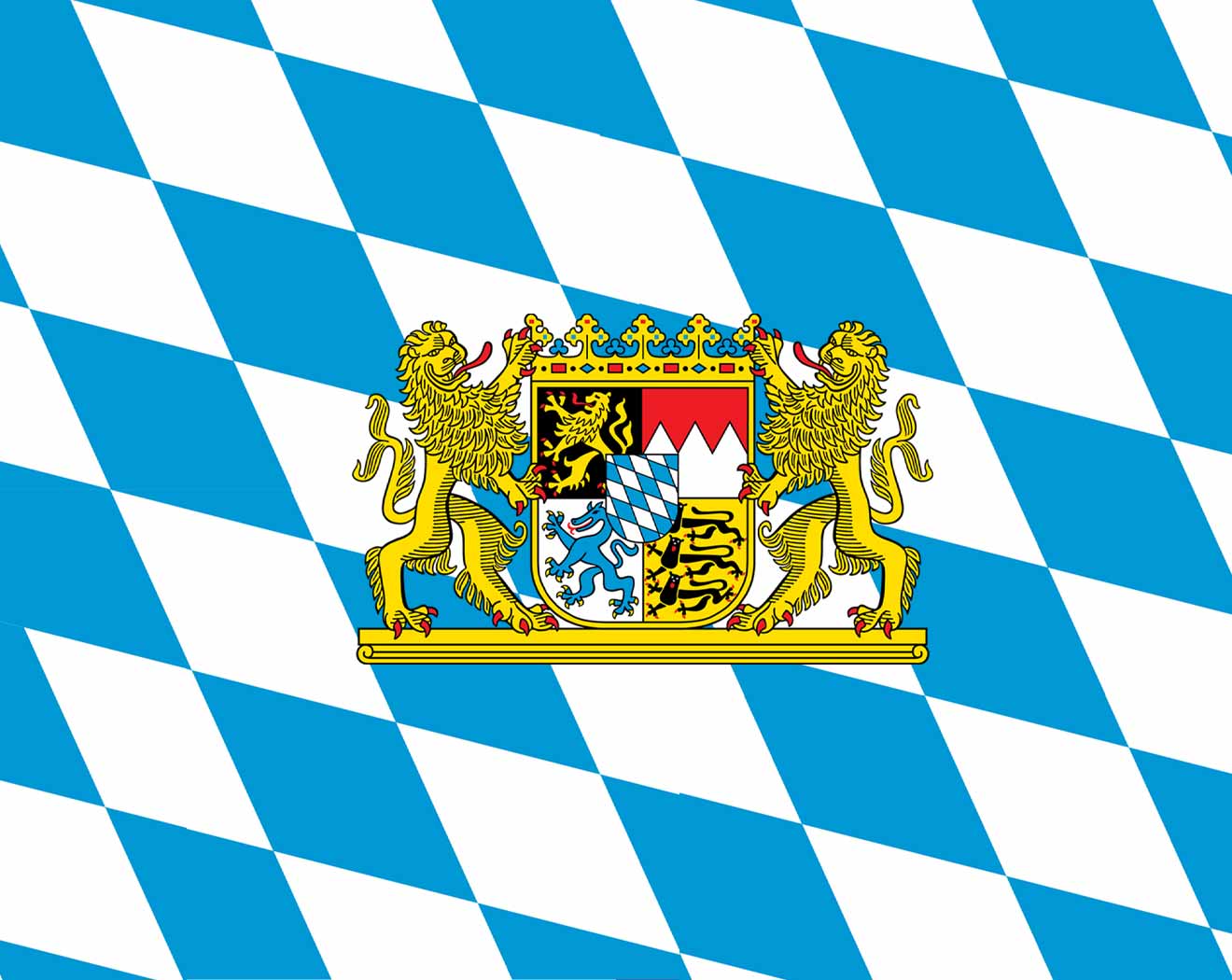 Bavaria
 Germany
 UEFA European Championship 2020

 UEFA European Championship 2024

 Sport
Sport

 Vacation and Travel

从2005-06赛季起,拜仁慕尼黑队将使用他们新的主场:安联体育场。作为慕尼黑市标志的奥林匹克体育场以充满艺术气息的顶棚设计曾经闻名于世,但如今 也要成为历史了。人们不禁要问,安联体育场为什么能给人留下如此深刻的印象,并成为慕尼黑市,尤其是拜仁慕尼黑俱乐部的新的标志?
安联体育场是欧洲最现代化的球场,2006年德国世界杯的揭幕战也放在了这里。当拜仁慕尼黑队主场比赛时,能容纳66000名观众的体育场将在照明系统的映射下成为一个红色的发光体,几英里外都可以看到。
安 联体育场由瑞士设计师雅克·赫尔佐格和皮埃尔·缪隆设计。外墙体由2874个气垫构成,其中1056个在比赛中可以发光。当体育场中比赛的球队发生变化 时,墙的颜色就可以随之改变,其奇妙之处将远超想象。慕尼黑人非常喜欢这个体育场,并亲切地将其称为“安全带”或“橡皮艇”。投票显示,大多数慕尼黑人都 愿意为这座“世界上最奇妙的体育场”支付更多的税款,而拜仁和1860也将分担相应费用。
Die Allianz Arena ist ein Fußballstadion im Norden von München und bietet bei nationalen Spielen 75.021 Plätze, zusammengesetzt aus 57.343 Sitzplätzen, 13.794 Stehplätzen, 1.374 Logenplätzen, 2.152 Business Seats (einschließlich 102 Sitzplätzen für Ehrengäste) und 966 Sponsorenplätzen. In der Allianz Arena bestreitet der FC Bayern München seit der Saison 2005/06 seine Heimspiele. Bis zum Saisonende 2016/17 war die Allianz Arena auch Spielstätte des TSV 1860 München. Außerdem war sie Spielort der Fußball-Weltmeisterschaft 2006 und Austragungsort des Champions-League-Finals 2012. Das Stadion befand sich zuerst im gemeinsamen Eigentum der FC Bayern München AG und der TSV München von 1860 GmbH & Co. KGaA. Später erwarb die FC Bayern München AG die Anteile der TSV München von 1860 GmbH & Co. KGaA und ist nun alleiniger Eigentümer.
Heimspielbetrieb FC Bayern München (seit 2005) TSV 1860 München (2005–2017) Veranstaltungen Länderspiele der deutschen Nationalmannschaft (seit 2006) Fußball-Weltmeisterschaft 2006 Champions-League-Finale 2012 Fußball-Europameisterschaft 2021 Spiele der National Football League (seit 2022) Fußball-Europameisterschaft 2024 Champions-League-Finale 2025
 Eurovision Song Contest,ESC
 UEFA European Championship 2020

 International cities
 *European Capital of Culture
 Netherlands
 Olympic Summer Games
 1928 Summer Olympics

 World Heritage

 Important port
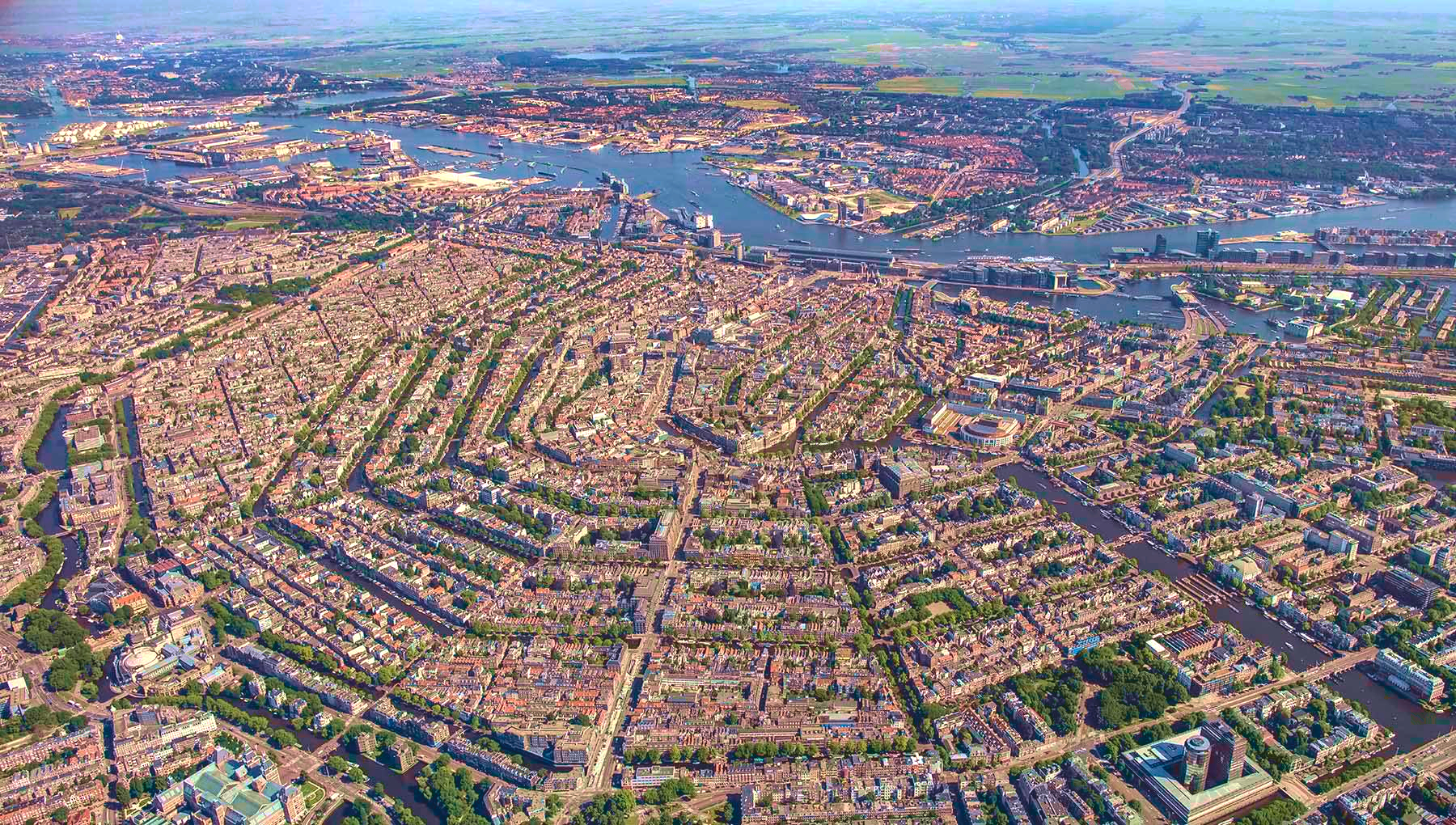
阿姆斯特丹(荷兰语:Amsterdam[ɑmstərˈdɑm] ),是荷兰首都及最大城市,位于该国西部省份北荷兰省。根据2008年1月的统计数据,这座城市人口达747,290人;而该城市所处的兰斯台德都市圈,大约有670万人口,是欧洲第6大都市圈。
其名称源于Amstel dam,这表明了该城市的起源:一个位于阿姆斯特尔河上的水坝,即今水坝广场址。12世纪晚期一个小渔村建于此,而后由于贸易的迅猛发展,阿姆斯特丹在荷兰黄金时代一跃而成为世界上最重要的港口。在那个时代,该城是金融和钻石的中心。 19和20世纪,该城扩展,许多新的街坊与近郊住宅区形成。
阿姆斯特丹是荷兰的金融和文化首都。许多荷兰大型机构的总部都设于此,其中包括飞利浦和ING等7家世界500强企业的总部。作为泛欧交易所的一部分,阿姆斯特丹证券交易所坐落于城市中心。阿姆斯特丹有很多旅游景点,包括历史悠久的运河网、荷兰国家博物馆、凡·高博物馆、安妮之家、红灯区以及许多大麻咖啡馆。每年有大约420万游客来此观光。
作为当前荷兰第一大城市,阿姆斯特丹历经了从渔村到国际化大都市的发展过程,经历了辉煌与破坏,以及世界大战的洗礼,从一定程度上讲,她的历史也是荷兰历史的一个缩影。
Amsterdam (niederländisch ) ist die Hauptstadt und einwohnerstärkste Stadt des Königreichs der Niederlande. Die Gemeinde Amsterdam hat 851.223 Einwohner (Stand: 31. August 2017)[2] und als Agglomeration Groot-Amsterdam 1.362.270 Millionen (Stand: 28. Februar 2018).[3] Im Großraum Amsterdam, der den nördlichen Teil des niederländischen Verdichtungsraumes Randstad ausmacht, leben etwa 2,4 Millionen Menschen (2012).[4] Auch wenn sich der Regierungssitz des Landes sowie die Königsresidenz im 60 Kilometer entfernten Den Haag befinden, ist Amsterdam seit 1983 gemäß niederländischer Verfassung die Hauptstadt der Niederlande.[5]
Amsterdam liegt in der niederländischen Provinz Nordholland, wo Amstel und IJ direkt hintereinander in das IJsselmeer münden. Der Hafen der Stadt ist durch den Nordseekanal mit der Nordsee verbunden. Amsterdam ist für die vielen Grachten weltberühmt.
アムステルダム(オランダ語: Amsterdam [ˌʔɑmstərˈdɑm] (![]() 音声ファイル))は、オランダの北ホラント州の基礎自治体(ヘメーンテ)であり、オランダ最大の都市である。人口820,654人(2012年)、都市圏人口は2,289,762人にのぼる。商業や観光が盛んなヨーロッパ屈指の世界都市である[6]。オランダ語での発音は片仮名で表記すると「アムスタダム」に近い。地名は「アムステル川のダム(堤防)」の意(「ダム広場」の項を参照)。
音声ファイル))は、オランダの北ホラント州の基礎自治体(ヘメーンテ)であり、オランダ最大の都市である。人口820,654人(2012年)、都市圏人口は2,289,762人にのぼる。商業や観光が盛んなヨーロッパ屈指の世界都市である[6]。オランダ語での発音は片仮名で表記すると「アムスタダム」に近い。地名は「アムステル川のダム(堤防)」の意(「ダム広場」の項を参照)。
憲法に規定されたオランダの首都だが、国会、中央官庁、王宮、各国の大使館など首都機能のほとんどはデン・ハーグにある[7]。
元々は小さな漁村だったが、13世紀にアムステル川の河口にダムを築き、町が築かれた。16世紀には海運貿易の港町として、ヨーロッパ屈指の都市へと発展した。現在のアムステルダムは、アムステルダム中央駅を中心に市内に網の目状に広がる運河や、その運河に沿って並ぶ無総督時代の豪商の邸宅、自転車、飾り窓の女性たち、アンネ・フランクの家などで広く知られる。
Amsterdam (/ˈæmstərdæm/, UK also /ˌæmstərˈdæm/;[9][10] Dutch: [ɑmstərˈdɑm] (![]() listen)) is the capital and most populous municipality of the Netherlands. Its status as the capital is mandated by the Constitution of the Netherlands,[11] although it is not the seat of the government, which is The Hague.[12] Amsterdam has a population of 851,373 within the city proper, 1,351,587 in the urban area,[13] and 2,410,960 in the Amsterdam metropolitan area.[8] The city is located in the province of North Holland in the west of the country but is not its capital, which is Haarlem. The metropolitan area comprises much of the northern part of the Randstad, one of the larger conurbations in Europe, with a population of approximately 8 million.[14]
listen)) is the capital and most populous municipality of the Netherlands. Its status as the capital is mandated by the Constitution of the Netherlands,[11] although it is not the seat of the government, which is The Hague.[12] Amsterdam has a population of 851,373 within the city proper, 1,351,587 in the urban area,[13] and 2,410,960 in the Amsterdam metropolitan area.[8] The city is located in the province of North Holland in the west of the country but is not its capital, which is Haarlem. The metropolitan area comprises much of the northern part of the Randstad, one of the larger conurbations in Europe, with a population of approximately 8 million.[14]
Amsterdam's name derives from Amstelredamme,[15] indicative of the city's origin around a dam in the river Amstel. Originating as a small fishing village in the late 12th century, Amsterdam became one of the most important ports in the world during the Dutch Golden Age (17th century), a result of its innovative developments in trade. During that time, the city was the leading centre for finance and diamonds.[16] In the 19th and 20th centuries the city expanded, and many new neighbourhoods and suburbs were planned and built. The 17th-century canals of Amsterdam and the 19–20th century Defence Line of Amsterdam are on the UNESCO World Heritage List. Since the annexation of the municipality of Sloten in 1921 by the municipality of Amsterdam, the oldest historic part of the city lies in Sloten (9th century).
As the commercial capital of the Netherlands and one of the top financial centres in Europe, Amsterdam is considered an alpha world city by the Globalization and World Cities (GaWC) study group. The city is also the cultural capital of the Netherlands.[17] Many large Dutch institutions have their headquarters there, and seven of the world's 500 largest companies, including Philips, AkzoNobel, TomTom and ING, are based in the city.[18] Also, many leading technology companies have their European headquarters in Amsterdam, such as Uber, Netflix and Tesla.[19] In 2012, Amsterdam was ranked the second best city to live in by the Economist Intelligence Unit (EIU)[20] and 12th globally on quality of living for environment and infrastructure by Mercer.[21] The city was ranked 3rd in innovation by Australian innovation agency 2thinknow in their Innovation Cities Index 2009.[22] The Port of Amsterdam to this day remains the second in the country, and the fifth largest seaport in Europe.[23] Famous Amsterdam residents include the diarist Anne Frank, artists Rembrandt van Rijn and Vincent van Gogh, and philosopher Baruch Spinoza.
The Amsterdam Stock Exchange, the oldest stock exchange in the world, is located in the city centre. Amsterdam's main attractions, include its historic canals, the Rijksmuseum, the Van Gogh Museum, the Stedelijk Museum, Hermitage Amsterdam, the Anne Frank House, the Scheepvaartmuseum, the Amsterdam Museum, the Heineken Experience, the Royal Palace of Amsterdam, Natura Artis Magistra, Hortus Botanicus Amsterdam, NEMO Science Museum, its red-light district and its many cannabis coffee shops draw more than 5 million international visitors annually.[24] The city is also well known for its nightlife and festival activity; several of its nightclubs (Melkweg, Paradiso) are among the world's most famous. It is also one of the world's most multicultural cities, with at least 177 nationalities represented.[25]
Amsterdam (Écouter) est la commune la plus peuplée et la capitale du royaume des Pays-Bas, bien que le gouvernement ainsi que la plupart des institutions du pays siègent à La Haye. Sur la base des chiffres de l'année 2017, la commune d'Amsterdam compte plus de 850 000 habitants appelés Amstellodamois, au cœur de la région d'Amsterdam qui regroupe environ 1 350 000 habitants. L'aire urbaine, qui rassemble plus de 2 400 000 résidents3,4 fait elle-même partie d'une conurbation appelée Randstad Holland qui compte 7 100 000 habitants. La ville est située en Hollande-Septentrionale, mais n'est cependant pas la capitale de la province, cette dernière étant Haarlem, située à 19 kilomètres à l'ouest d'Amsterdam.
Le nom de la commune vient de l'ancien nom néerlandais Amstelredamme évoquant les origines de la ville : la digue (Dam) sur l'Amstel. Petit village de pêcheurs au XIIe siècle, la ville connaît une très forte croissance au Moyen Âge au point de devenir l'un des principaux ports du monde durant le Siècle d'or néerlandais. Le quartier De Wallen est la partie la plus ancienne de la ville, qui se développe autour d'un réseau concentrique de canaux semi-circulaires reliés par des canaux perpendiculaires, formant une « toile d'araignée ». Au centre de la vieille ville se trouve, sur la place du Dam, le palais royal d'Amsterdam, construit au XVIIe siècle, symbole de l'importance de la ville. Guillaume Ier en fait sa résidence en 1815. Depuis juillet 2010, le quartier du Grachtengordel, délimité par le Herengracht, Keizersgracht et Prinsengracht, figure sur la liste du patrimoine mondial de l'UNESCO. Dans cette zone que se trouve le renommé béguinage d'Amsterdam, cour arborée et bordée d'habitations anciennes — la plus vieille datant de 1528 environ — abritant en son sein une chapelle anglicane.
Amsterdam est l'un des centres économiques majeurs des Pays-Bas et l'un des principaux centres financiers d'Europe. Les sièges sociaux de plusieurs firmes multinationales (Philips, AkzoNobel, ING et TomTom notamment) sont situés dans la ville et d'autres ont leurs bureaux européens basés à Amsterdam (principalement Netflix, Uber et Tesla). La ville est également la première destination touristique et culturelle néerlandaise, notamment du fait de la renommée ses principaux musées concentrés autour du Museumplein : le musée d'État, la fondation d'art moderne Stedelijk Museum et le Van Gogh Museum figurent parmi les plus visités au monde. D'autres lieux culturels d'importance sont le musée scientifique NEMO, l'Institut royal des Tropiques, le musée d'art Hermitage, l'institut du cinéma EYE, le musée maritime néerlandais et la Maison Anne Frank.
Divers classements placent Amsterdam parmi les métropoles mondiales offrant le meilleur confort de vie5, le magazine américain Forbes la positionnant à la première place en 20166. Selon l'Economist Intelligence Unit, elle est également la deuxième ville la plus sûre d'Europe après Stockholm7. La majorité des déplacements en ville s'effectue grâce aux quinze lignes de tramway, aux cinq lignes de métro, à pied ou à vélo. La ville est réputée pour ses événements festivaliers (particulièrement l'Amsterdam Music Festival, Sensation, In Qontrol et Uitmarkt), ses discothèques (spécifiquement Paradiso et Melkweg) et ses salles de concert (notamment le Ziggo Dome, Concertgebouw, Heineken Music Hall et Stadsschouwburg). Amsterdam est aussi connue pour son quartier rouge, ainsi que pour ses nombreux coffee shops possédant une licence leur permettant de commercialiser le cannabis, reflétant le progressisme politique des Pays-Bas8.
Amsterdam (pron. /ˈamsterdam/[1]; in olandese: /ˌɑmstər'dɑm/, ) è la capitale e la maggiore città dei Paesi Bassi, nella provincia dell'Olanda Settentrionale. La municipalità di Amsterdam ha 851.573 residenti (al 2017) di oltre 170 nazionalità, mentre la popolazione che risiede nell'area metropolitana è di circa 2.289.762 persone. L'area al centro della città circondata dai canali del XII secolo è dal 2010 Patrimonio dell'umanità.
Amsterdam possiede uno dei maggiori centri rinascimentali di tutta l'Europa. Numerose costruzioni che risalgono al periodo tra il XVI e XVII secolo, conosciuto anche come Secolo d'oro, sono ora considerate monumenti storici e sono collocate intorno ad una serie di canali poligonali concentrici. Questi cingono il vecchio porto che un tempo era affacciato sullo Zuiderzee, oggi un lago separato dal resto del mare e noto con il nome di IJsselmeer. La città è famosa per ospitare il Rijksmuseum (museo statale), il museo Van Gogh, il Concertgebouw, il Rembrandthuis, la casa di Anna Frank e un enorme numero di biciclette.
Amsterdam è anche famosa per il suo quartiere a luci rosse, il De Wallen, e i suoi numerosi coffee-shop autorizzati alla vendita di marijuana e di derivati della cannabis.
Il motto ufficiale della città è "Heldhaftig, Vastberaden, Barmhartig" ("valorosa, decisa, misericordiosa"). Le tre croci di Sant'Andrea sulla bandiera sono associate a queste tre parole, benché siano entrate in uso prima del motto.
Ámsterdam5 o Amsterdam, según la pronunciación etimológica (![]() Amsterdam (?·i) [ɑmstər'dɑm]), es la capital oficial de los Países Bajos. La ciudad está situada entre la bahía del IJ, al norte, y a las orillas del río Amstel, al sureste. Fue fundada en el siglo XII como un pequeño pueblo pesquero. Sin embargo, en la actualidad es la ciudad más grande del país y un gran centro financiero y cultural de proyección internacional.
Amsterdam (?·i) [ɑmstər'dɑm]), es la capital oficial de los Países Bajos. La ciudad está situada entre la bahía del IJ, al norte, y a las orillas del río Amstel, al sureste. Fue fundada en el siglo XII como un pequeño pueblo pesquero. Sin embargo, en la actualidad es la ciudad más grande del país y un gran centro financiero y cultural de proyección internacional.
Tiene una población de unos 810 000 habitantes y en su área metropolitana residen aproximadamente 1,5 millones. Cabe destacar que Ámsterdam forma parte de la gran conurbación neerlandesa llamada Randstad (junto con las ciudades de La Haya, Róterdam y Utrecht), que cuenta con más de 6,5 millones de habitantes. Este núcleo es una de las conurbaciones más grandes de Europa.
El centro histórico de la ciudad fue construido en gran parte en el siglo XVII y es hoy en día uno de los centros históricos más grandes de Europa. En aquella época se construyeron una serie de canales semicirculares alrededor del casco antiguo ya existente de la ciudad. Después se edificaron las nuevas calles que ahora habían sido creadas con casas y almacenes en un estilo típico neerlandés que es una de las imágenes más famosas de Ámsterdam y del país. Al igual que otras ciudades de Europa septentrional con abundancia de agua, como Brujas, Hamburgo y Estocolmo, es conocida coloquialmente como la «Venecia del norte».
Aunque durante casi toda su historia (excepto entre 1808–1810) ha sido la capital oficial de los Países Bajos, nunca ha sido la sede de la justicia, el gobierno o el parlamento neerlandés, ya que todos estos órganos se encuentran en la ciudad de La Haya, que por tanto es la principal ciudad del país con respecto a política y justicia. Ámsterdam tampoco es la capital de la provincia de Holanda Septentrional, que siempre ha sido Haarlem.
Амстерда́м (нидерл. Amsterdam [ˌɑmstərˈdɑm]) — столица и крупнейший город Нидерландов. Является столицей королевства с 1814 года. Расположен в провинции Северная Голландия на западе страны в устье рек Амстел и Эй. Амстердам соединён Нордзе-каналом с Северным морем.
По состоянию на 1 января 2012 года население муниципалитета Амстердам составляет 801 847 человек[1], вместе с пригородами (городской округ) — 2,3 млн жителей. Амстердам является частью агломерации Рандстад, которая является 6-й по величине в Европе.
Название города произошло от двух слов: «Амстел» — название реки и «дам» — «дамба». В XII веке это была небольшая рыбачья деревня, но во времена Золотого века Нидерландов Амстердам стал одним из наиболее значимых портов мира и крупным торговым центром.
Город является местом концентрации различных культур — в апреле 2009 года здесь проживали представители 177 национальностей.
Амстердам также является финансовой и культурной столицей Нидерландов. Здесь расположились штаб-квартиры 7 из 500 наиболее крупных мировых компаний, например, Philips и ING Groep. Также в центре города расположена старейшая в мире фондовая биржа.
В Амстердаме расположен главный офис Гринпис.
Множество достопримечательностей: Рейксмюзеум, Музей Винсента Ван Гога, Городской музей, Эрмитаж на Амстеле, квартал красных фонарей (Де Валлен) — ежегодно привлекает в город около 4,2 миллиона туристов.
 Andorra
 UEFA European Championship 2020
 Group H

 Sport
Sport
 (F)UEFA Nations League
 UEFA Nations League
 UEFA Nations League D- Group 1


 Armenia
 UEFA European Championship 2020
 Group J

 Sport
Sport
 (F)UEFA Nations League
 UEFA Nations League
 UEFA Nations League D- Group 4
 Azerbaijan
 UEFA European Championship 2020
 Group E

 Sport
Sport
 (F)UEFA Nations League
 UEFA Nations League
 UEFA Nations League D- Group 3

 Azerbaijan
 Eurovision Song Contest,ESC
 UEFA European Championship 2020

 History
 Silk road

 World Heritage
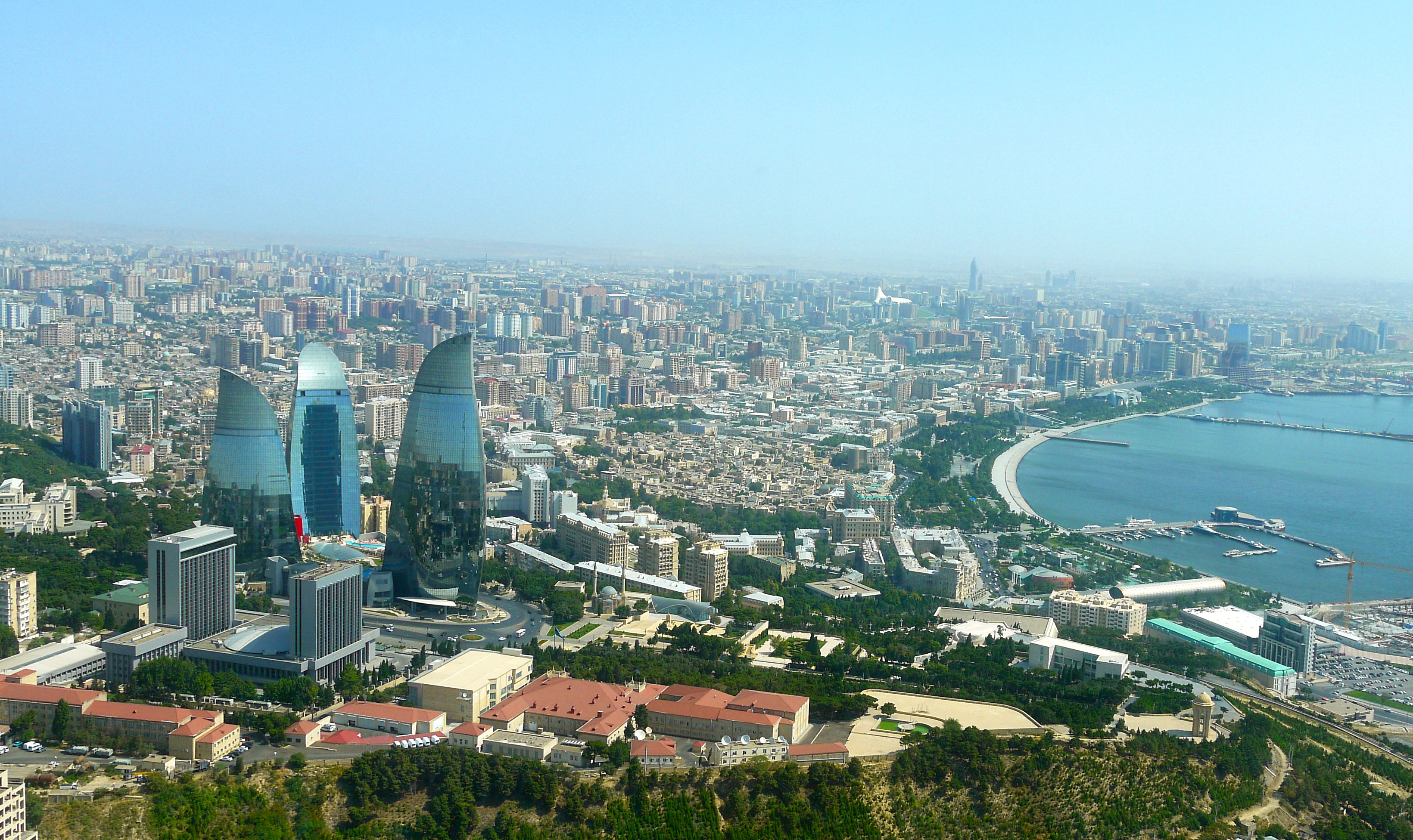
巴库(Baku, Баку)是阿塞拜疆首都和全国经济、文化中心。里海最大港口。位于阿普歇伦米岛南部,是石油工业中心,有“石油城”之誉。也是前苏联外高加索最大城市。 巴库由10个行政区和46个城镇组成,面积2200平方公里。人口182.88万。1月平均气温为4℃,7月平均气温为27.3℃。 在18世纪,巴库为巴库汗国都城。19世纪70年代开始工业性采油,19世纪末成为外高加索工业中心和石油基地,有22大炼油基地,其他工业多与石油有 关。1991年8月成为独立后阿塞拜疆的首都。城市西部的比比埃巴特区为老采油区。东部的基什雷区和邵武勉区为重要工业区。石油是巴库的经济命脉。石油开 采正向深处和外围海域发展。以石油、天然气开采和石油加工为主要工业,还有石油机械、电力和轻工 、食品工业。外高加索主要铁路枢纽,铁路通罗斯托夫、第比利斯和埃里温。有输油管道通黑海港口巴统。巴库是里海航运中心,可泊中等吨位船舶。城市中部为行 政、文化和居住区。建有科学院,大学和博物馆。里海最大港口,有“石油城”之誉。市内建有地铁,有阿塞拜疆科学学院、阿塞拜疆大学、石油化工学院等多所高 等院校。城市的中部是行政、文化区域,有历史博物馆和艺术博物馆。老城区以旧要塞为中心。 巴库是一座有着悠久历史的古城,城内有众多名胜古迹,如11世纪建造的瑟纳克一卡尔清真寺塔,12世纪的克孜一卡拉瑟塔楼,13世纪的巴伊洛夫石堡,15 世纪的希尔凡王宫及17世纪的汗王宫殿至今保存完好。2000年联合国教科文组织将巴库墙城及城内的希尔梵国王宫殿和少女塔作为文化遗产,列入《世界遗产 名录》。(Quelle:http://you.kuxun.cn)
巴库(阿塞拜疆语:Bakı,[bɑˈcɯ] (ⓘ))是阿塞拜疆的首都、经济文化中心。巴库同时也是里海最大港口,外高加索最大城市[4]。它的海拔是低于海平面28米(92英尺) ,使它成为世界上海拔最低的首都以及低于海平面的最大城市。面积2192平方公里,人口300万(2008年计算)[5]。巴库全市分为内城和新城两部分(亦有将苏联时期兴建区域分别划分的)。
在2007年,伊斯兰会议组织文化部长宣布巴库为2009年伊斯兰文化中心。为2015年第一届欧洲运动会主办国。巴库曾先后申办2016年夏季奥运会和2020年夏季奥运会,但皆因基础设施不完备没有入围。不过由于阿塞拜疆歌手艾尔与妮基在2011年欧洲歌唱大赛获得冠军,终使巴库获得举办2012年欧洲歌唱大赛的机会。
Baku (aserbaidschanisch Bakı / باکی; russisch Баку́ Baku) ist die Hauptstadt Aserbaidschans. Mit zwei Millionen Einwohnern in der Stadtprovinz ist Baku die bevölkerungsreichste und flächengrößte Stadt des Landes und des gesamten Kaukasus. Die Stadt an der Küste des Kaspischen Meeres ist Verkehrsknotenpunkt sowie Wirtschafts- und Kulturzentrum mit mehreren Universitäten, Hochschulen, Forschungsinstituten, Theatern und Museen. Durch die Lage innerhalb eines Erdölfördergebiets ist Baku der Knotenpunkt mehrerer Erdölleitungen und besitzt einen bedeutenden Erdölhafen. Baku kann aufgrund seiner günstigen Lage an mehreren historischen Handelswegen auf eine reiche Stadtgeschichte zurückblicken. In der Altstadt, die seit 2000 den Status eines UNESCO-Welterbes hat, sind zahlreiche Paläste, Moscheen und Festungsbauten erhalten geblieben.
バクー(Baku)は、アゼルバイジャン共和国の首都。カスピ海西岸に突き出したアブシェロン半島南岸に位置し、市街はバクー湾に面するように広がった港町である。行政的には11の行政区、48の町区に分割されており、2005年時点の総人口は2,045,815人[1]。アゼルバイジャン最大の都市であると同時に、南カフカース地域でも有数の大都市である。大規模な油田(バクー油田)をもち、帝政ロシア時代から石油の生産地として発展してきた。
日本語名のバクーはキリル文字綴りによるロシア語綴り・アゼルバイジャン語(アゼリー語)旧綴り Баку (Baku) に基づくが、アゼルバイジャン語の発音では母音の前で子音 k が軟音化するためカタカナ表記するならば「バキュ」に近く、現在アゼルバイジャンで使われているアゼルバイジャン語のラテン文字正書法では Bakı と綴る。バクーという名前の由来には諸説あるが、最も一般的なものは、ペルシャ語で「風が吹きつけた」という意味の "bād-kūbe"(バード・クーベ)から来ているとする説が一般的である。
気候は晴天が多く、乾燥している。寒気と暖気がぶつかることで起きる強風が時折吹き付け、先述した語源の根拠となっている。海岸は美しく、市街近郊には温泉や鉱泉がある。
市街の中心はその南西部にあり、イチェリ・シェヘル (İçəri Şəhər) すなわち「内城」と呼ばれる城壁に囲まれた旧市街と、帝政ロシア時代にその周囲に築かれた新市街とに分かれる。その周囲、北から東にかけての平地から丘陵の斜面一帯にソビエト連邦時代につくられた市街が広がっている。近年は豊富なオイルマネーをもとに近未来的な巨大建築物が出現し、「第二のドバイ」「第二のシンガポール」とも呼ばれている[2]。
Baku (/bəˈkuː/ bə-KOO, /ˈbɑːkuː/ BAH-koo; Azerbaijani: Bakı, IPA: [bɑˈcɯ]) is the capital and largest city of Azerbaijan, as well as the largest city on the Caspian Sea and of the Caucasus region, with a population of 2,262,600 (January 1, 2018). Baku is located 28 metres (92 ft) below sea level, which makes it the lowest lying national capital in the world and also the largest city in the world located below sea level. It is located on the southern shore of the Absheron Peninsula, alongside the Bay of Baku. At the beginning of 2009, Baku's urban population was estimated at just over two million people.[5] Officially, about 25 percent of all inhabitants of the country live in Baku's metropolitan area. Baku is the sole metropolis in Azerbaijan.
Baku is divided into twelve administrative districts (raions) and 48 townships. Among these are the townships on the islands of the Baku Archipelago, and the town of Oil Rocks built on stilts in the Caspian Sea, 60 kilometres (37 miles) away from Baku. The Inner City of Baku, along with the Shirvanshah's Palace and Maiden Tower, were inscribed as a UNESCO World Heritage Site in 2000. According to the Lonely Planet's ranking, Baku is also among the world's top ten destinations for urban nightlife.[6]
The city is the scientific, cultural, and industrial center of Azerbaijan. Many sizeable Azerbaijani institutions have their headquarters there. The Baku International Sea Trade Port is capable of handling two million tons of general and dry bulk cargoes per year.[7] In recent years, Baku has become an important venue for international events. It hosted the 57th Eurovision Song Contest in 2012, the 2015 European Games, 4th Islamic Solidarity Games, the F1 Azerbaijan Grand Prix since 2016, and will host UEFA Euro 2020. The city is bidding for Expo 2025 against Yekaterinburg, Russia and Osaka, Japan.
La ville de Bakou (azéri : Bakı, IPA: [bɑˈcɯ]) est la capitale de l'Azerbaïdjan. Elle se trouve dans l'est du pays, sur la rive sud de la péninsule d'Abşeron, au bord de la mer Caspienne. Son histoire débute au Ier millénaire avant Jésus-Christ, mais les traces écrites les plus anciennes ne datent que du Ve siècle.
En 2011, sa population est estimée à 2 045 815 habitants1 et 3 millions de personnes environ vivent dans l'agglomération.
Baku (pron. bakù[2]; in azero: Bakı?; in russo: Баку?), conosciuta anche come Baqy, Baky o Baki, in italiano Bacù[2], è la capitale, la più grande città e il più grande porto dell'Azerbaigian e di tutto il Caucaso.
È considerata una delle più antiche e più grandi città dell'Oriente. Situata sulla costa meridionale della penisola di Abşeron, la città si compone di tre parti principali: il centro, la vecchia Città Murata estesa sul territorio di 21,5 ettari e la parte della città costruita nell'epoca sovietica. La sua popolazione nel 2014 era stimata in 2.122.300 di abitanti.
Bakú (en azerí, Bakı, [bɑˈkɯ]) es la capital y ciudad más poblada de Azerbaiyán, del mar Caspio y del Cáucaso. Está situada en la costa sur de la península de Absheron, que se proyecta en el Caspio. La ciudad se compone de dos partes principales: el centro y la ciudad vieja interior. En enero de 2018 Bakú tenía una población de 2.262.600 habitantes,3 de los cuales 153.400 eran desplazados internos y 143.400 refugiados de la guerra de Nagorno Karabaj.
Bakú se divide en once distritos administrativos (raiones) y 48 municipios. Entre estos se encuentran los municipios de las islas de la bahía de Bakú y Neft Daşları construidas sobre pilotes en el mar Caspio, a 60 km de Bakú. El centro urbano de la ciudad, con el Palacio de los Shirvanshah y la Torre de la Doncella, fue inscrito por la Unesco como Patrimonio de la Humanidad en 2000. De acuerdo con la clasificación de Lonely Planet, Bakú también se encuentra entre los diez mejores destinos de vida nocturna urbana del mundo.4
La ciudad fue uno de los mayores centros petrolíferos de la antigua Unión Soviética y actualmente es el centro científico, cultural e industrial de Azerbaiyán. Muchas instituciones importantes de Azerbaiyán tienen su sede allí, incluyendo SOCAR, una de las cien principales empresas del mundo, entre otras.5 El Puerto de Comercio Marítimo Internacional de Bakú, protegido por las islas del archipiélago Bakú hacia el este y la península de Absheron al norte, es capaz de transportar dos millones de toneladas de carga general y seca a granel por año.6 La ciudad acogió el 57.º Festival de Eurovisión en 2012 y fue la sede de los Juegos Europeos 2015, es la sede del Gran Premio de Azerbaiyán de Fórmula 1 desde 2016 y será la sede del Campeonato Mundial de Ciclismo BMX en 2018 y de la EURO 2020.7
Баку́ (азерб. Bakı, МФА (азерб.): [bɑˈcɯ]) — столица Азербайджанской Республики, крупнейший промышленный, экономический и научно-технический центр Закавказья, а также самый крупный порт на Каспийском море и самый большой город на Кавказе[9][10].
Площадь территории, которая административно управляется Баку, составляет 2150 км²[1]; население данной территории — 2 181,8 тыс. жителей (на 1 января 2014 года). Баку расположен на южном берегу Апшеронского полуострова. Город по своей древности, величине территории и численности населения является одним из старинных и крупнейших городов Востока. Население всего Апшеронского полуострова (Бакинской агломерации) составляет 2 673,7 тыс. жителей[7]. Баку удостоен в 2010 году Программой ООН по окружающей среде (UNEP) звания одного из главных городов по проведению Всемирного дня окружающей среды. Подобные города избираются ежегодно. В 2010 году, наряду с Баку, этих званий были удостоены также Генуя (Италия) и Женева (Швейцария)[11].
 Belgium
 FIFA Fussball-Weltmeisterschaft 2014
 FIFA Fussball-Weltmeisterschaft 2018
 Group G
 FIFA Fussball-Weltmeisterschaft 2022
 FIFA Fussball-Weltmeisterschaft 2022
 Group F
 UEFA European Championship 2016
 UEFA European Championship 2020
 Group I

 UEFA European Championship 2024

 Sport
Sport
 (F)UEFA Nations League

 Sport
Sport
 (F)Soccer at the Olympic Games
 UEFA Nations League
 UEFA Nations League A - Group 2


毕尔巴鄂(西班牙语:Bilbao,巴斯克語:Bilbo)位于西班牙北部沿海,坐落在距大西洋比斯开湾14公里的地方。它是巴斯克自治区最大的城市和经济中心,也是比斯开省的首府。比斯开矿区的铁矿,丰富的水力资源和良好的水运条件,使毕尔巴鄂成为西班牙最大的钢铁工业基地。在钢铁工业的带动下,造船、火车机车、机械、电工器材、炼油、化工和造纸等工业也蓬勃发展。从毕尔巴鄂以东,知道内维翁河口连绵几千米,工厂栉比,烟囱林立,曾为一个在欧洲都屈指可数的发达工业区。以重工业为后盾,这里的银行家和商人掌握了雄厚的金融力量,其中毕尔巴鄂银行已跃居全国最大的银行。
毕尔巴鄂是西班牙最大的海港之一。港区分布在市区到河口的河流两岸,以及外港两大部分。码头岸线总长达16公里,远洋大船都停靠在外港。这里有巨大的散货码头、油轮泊位、集装箱码头、滚装船和载驳船泊位,水深14米。可泊35万吨的大油轮和大型集装箱船。输出铁矿石、钢铁和化工产品,输入以石油、煤炭为大宗。港口对于毕尔巴鄂的经济,特别是钢铁等重工业,起着举足轻重的作用。
Bilbao (bask. auch Bilbo[2]) ist die Hauptstadt der Provinz Bizkaia (spanisch: Vizcaya) und größte Stadt der Autonomen Gemeinschaft Baskenland in Spanien.
Weiter ist sie die wichtigste Industrie- und Hafenstadt des Baskenlands und hat zuzüglich des Umlands fast 900.000 Einwohner. Mit 345.110 Einwohnern im Stadtgebiet[3] ist Bilbao eine der zehn größten Städte Spaniens.Die Stadt liegt an der Ría de Bilbao, die bei Portugalete in den Golf von Biscaya (Kantabrisches Meer) mündet. In Basauri vereinigen sich die Flüsse Nervión und Ibaizabal (baskisch für Breiter Fluss) und fließen von dort gemeinsam in die Ría. Die Gezeitengrenze liegt in der Altstadt etwa an der San-Antón-Brücke.
Diego López V de Haro gründete die Stadt an der Mündung des Nervión auf dem Gebiet der Vorgängerkirche von Begoña am 15. Juni 1300. Rechtliche Grundlage war der am 15. Juni 1300 in Valladolid geschriebene und am 4. Januar 1301 durch Ferdinand IV. von Kastilien und León in Burgos bestätigte Gründungsbrief (carta puebla). In der Einleitung dieses Gründungsbriefes heißt es:
En el nombre de Dios é de la vgen vienaventurada Sancta María. Sepan por esta carta quantos la vieren é oieren como yo Diego Lope de Haro, sennor de Vizcaia, en uno con mi fijo Don Lope Diaz é con placer de todos los vizcaynos, fago en Bilvao de parte de Vegonna nuevamente población é villa qual dizen el puerto de Bilvao...(dt.: Im Namen Gottes und der seligen heiligen Jungfrau Maria. Wisst, dass durch diesen Brief, wenn ihr ihn sehen oder davon hören mögt, wie ich, Diego Lope de Haro, Graf von Vizcaya, einig mit meinem Sohne Don Lope Diaz und zur Freude aller Vizcaynos, mache in Bilvao auf dem Teil der Vegonna (Begoña) von neuem Ortschaft und Gemeinde, die man Hafen von Bilvao nennen soll...)
Zuvor hatte hier u. a. schon eine römische Siedlung namens Bellum Vadum existiert. Daraus soll sich über die Zwischenstufe Bilbaum[4] der heutige Stadtname abgeschliffen haben, so dass man bei Bilbao auf deutsch von Schönfurt sprechen könnte.[5][6] Weitere Theorien führen den Namen auf das baskische bi albo[7] (dt.: zwei Seiten, auf die zwei Ufer der Ría referierend) oder auf die Burg Biribilbao zurück, die sich nahe der Kirche San Anton befand.
Zum Zeitpunkt der Gründung befand sich dort, wo heute Bilbao la Vieja steht, ein kleines Dorf von Eisenschmieden, Seeleuten und Bauern. Die ersten Straßen Bilbaos waren Somera, Artekale sowie die Tenderia.
 Bosnia Herzegovina
 FIFA Fussball-Weltmeisterschaft 2014
 UEFA European Championship 2020
 Group J

 Sport
Sport
 (F)UEFA Nations League
 UEFA Nations League
 UEFA Nations League B - Group 3

 Architecture
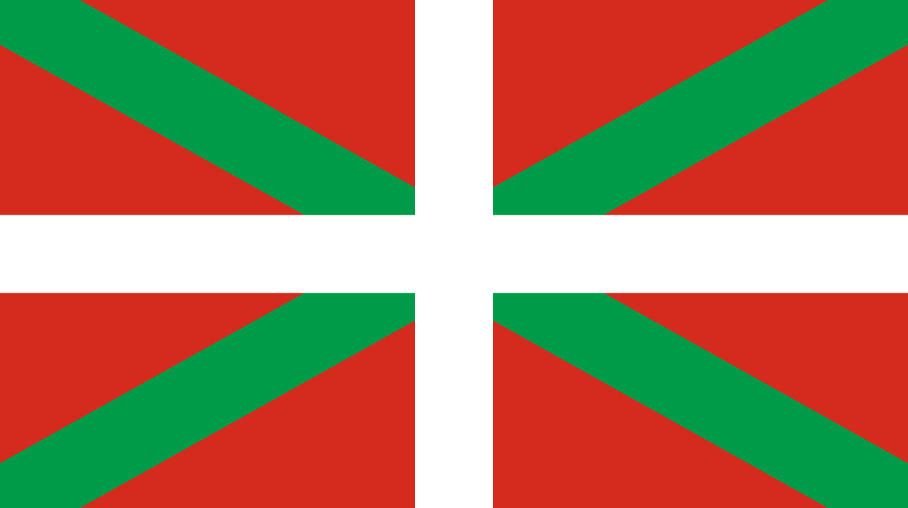 Comunidad Autónoma del País Vasco