
Deutsch-Chinesische Enzyklopädie, 德汉百科
 Turkey
 Party and government

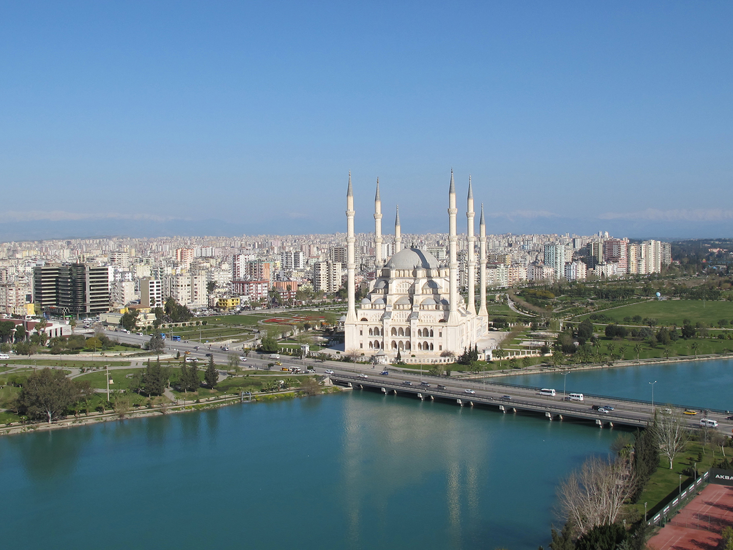
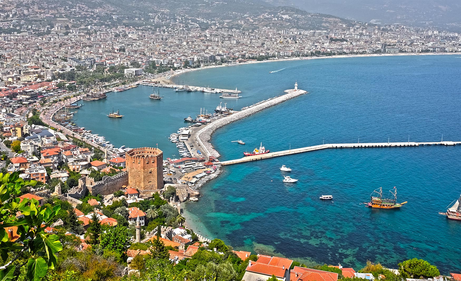
 International cities
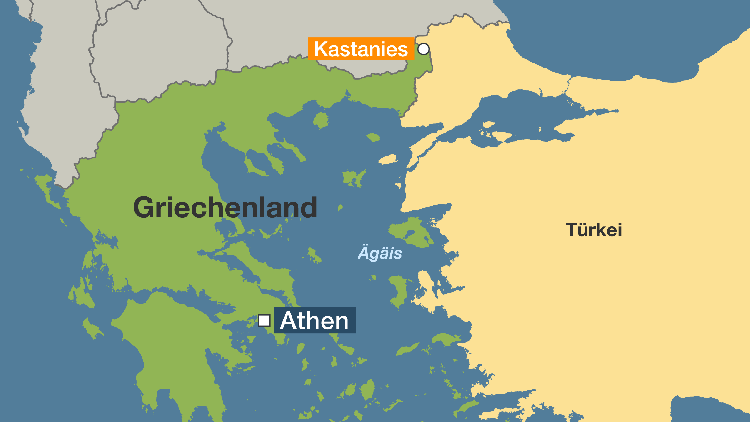
 Geography
 Architecture
 Financial
 Companies

 Sport
Sport

 Performing Arts
 History
 J 0 - 500 AD
 Music
Music Hall, State Theater, Opera House
Turkey
Music
Music Hall, State Theater, Opera House
Turkey
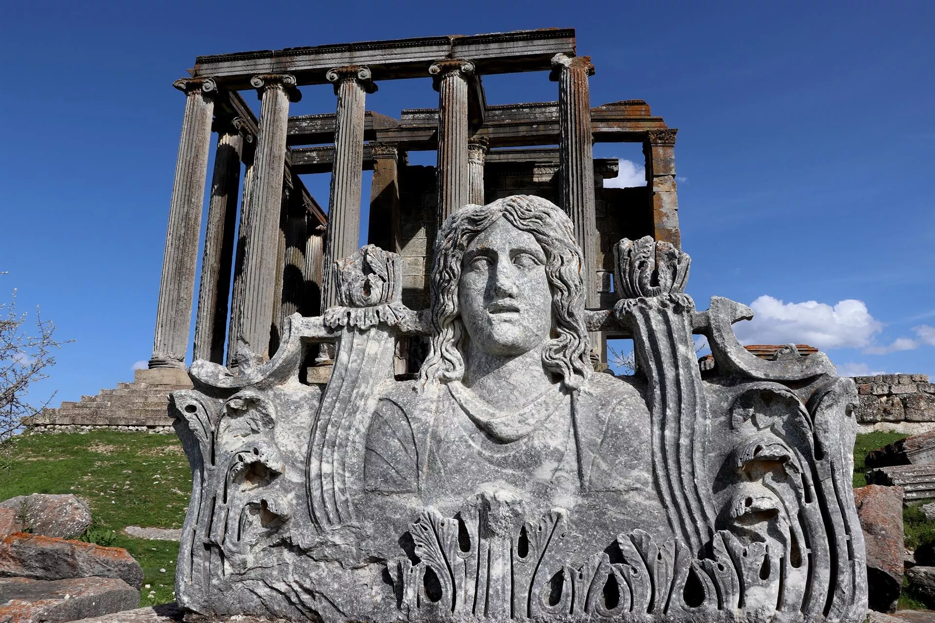
 Civilization
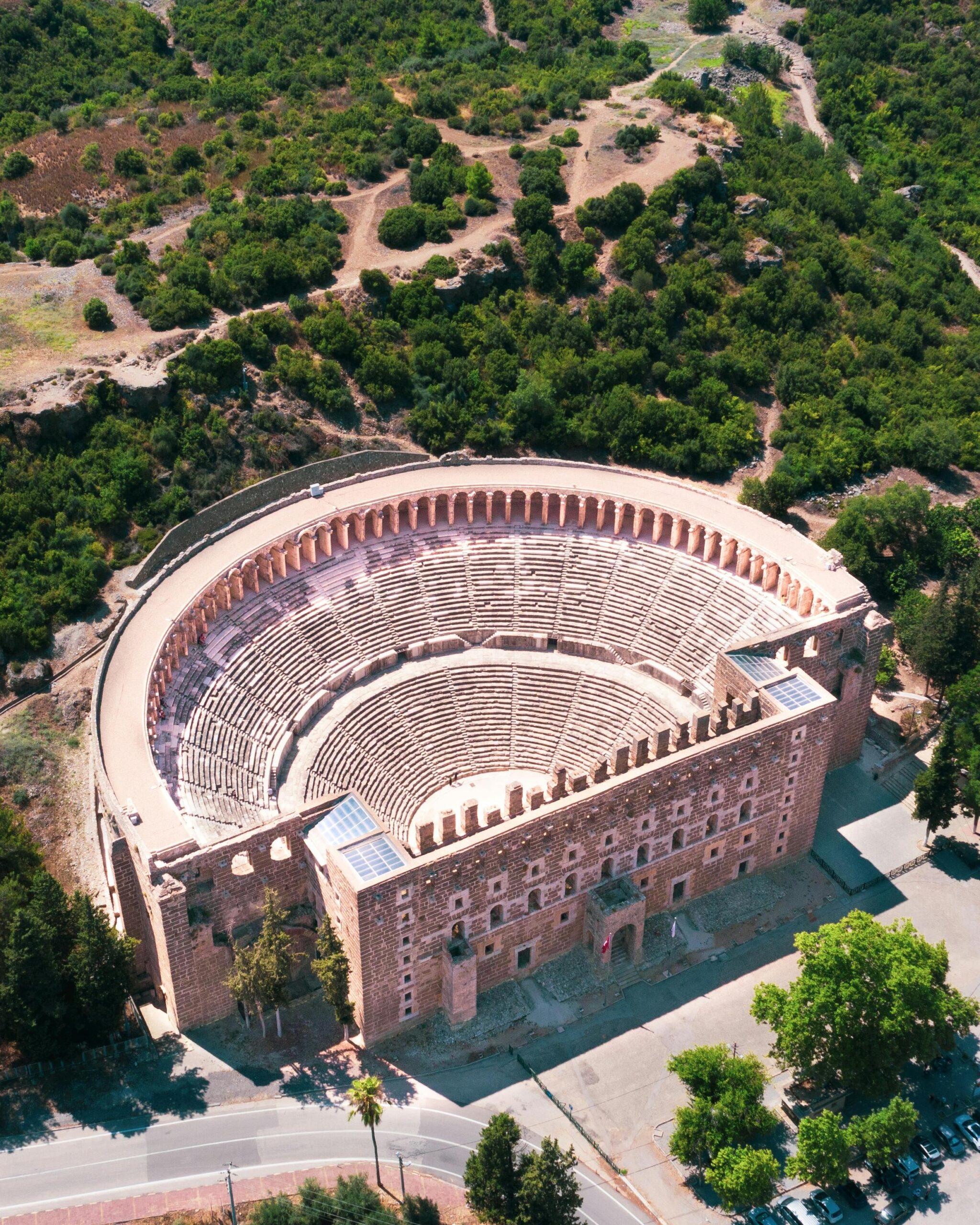
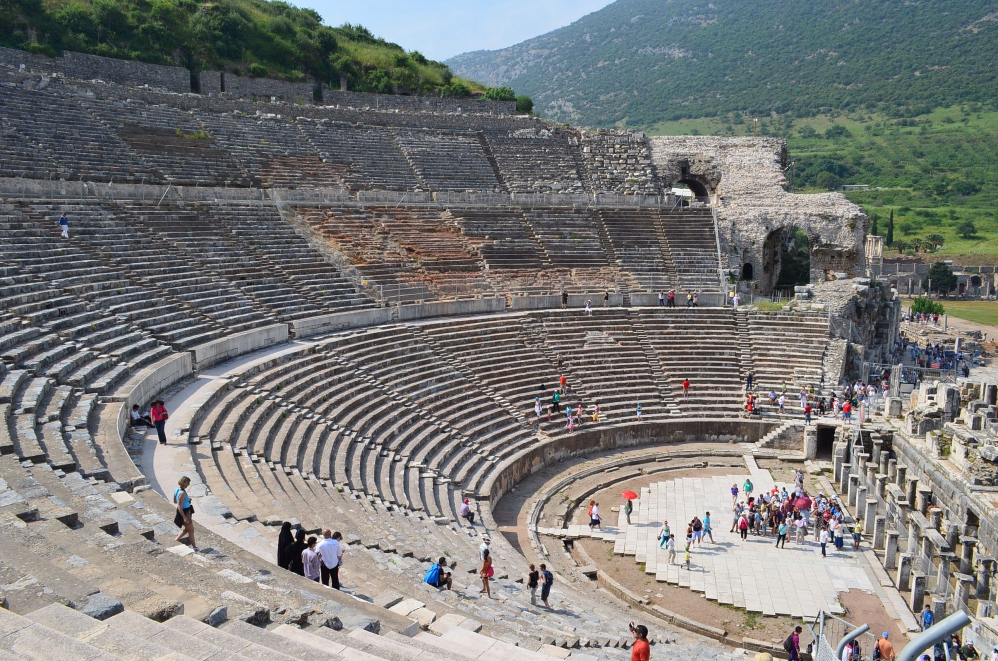
Aspendos (altgriechisch Ἄσπενδος) war eine antike Stadt in Pamphylien in Kleinasien an der Südküste der jetzigen Türkei, in der Nähe des Dorfes Büyükbelkiz, etwa 5 km östlich von Serik. Das große Theater aus römischer Zeit ist eines der besterhaltenen der Antike. Es wird auch heute noch für Aufführungen genutzt.[1] Die Stadt Aspendos ist nicht ausgegraben. Alle aufragenden Gebäude stammen aus der römischen Blütezeit des 2. und 3. Jahrhunderts n. Chr., als Aspendos ein bedeutendes pamphylisches Handelszentrum war. Die Örtlichkeit liegt 46 Kilometer östlich von Antalya an der Straße nach Alanya.
阿斯潘多斯剧场(古希腊语 Ἄσπενδος)是小亚细亚潘菲利亚的一座古城,位于现在的土耳其南部海岸,靠近比尤克贝尔基兹村,在塞里克以东约 5 公里处。罗马时代的大剧院是古代保存最完好的剧院之一。阿斯本多斯城尚未发掘。所有高耸的建筑都是公元 2 世纪和 3 世纪罗马全盛时期的产物,当时阿斯本多斯是重要的潘菲利亚贸易中心。该遗址位于安塔利亚以东 46 公里处通往阿兰亚的公路上。
 Media and press

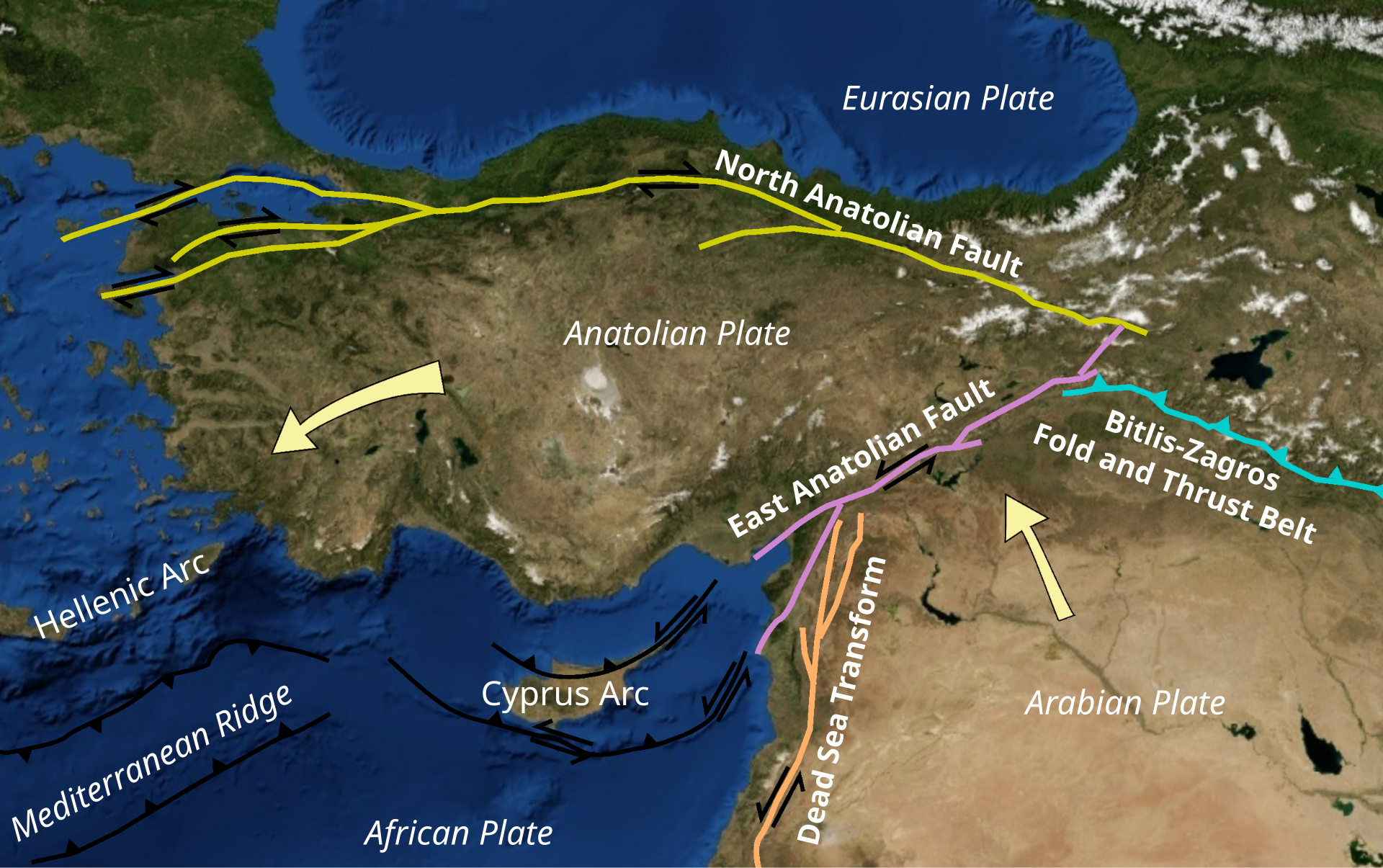
安纳托利亚高原(Anatolia Plateau),又名土耳其高原,位于亚洲西部小亚细亚半岛,在土耳其境内。北临黑海、南临地中海、东隔内托罗斯山与亚美尼亚高原相邻,西至土耳其西部地区。面积约50万平方千米。高原三面环山,一面敞开,地势自东向西逐渐降低,海拔800~1200米。
Die Anatolische Hochebene (türkisch: Anadolu Platosu) ist eine Hochebene, die den größten Teil der Fläche der Türkei einnimmt. Die Höhenlage der Hochebene reicht von 600 Metern im Westen bis zu 1.200 Metern.[citation needed] Der Berg Erciyes in der Nähe von Kayseri ist mit 3.917 Metern die höchste Erhebung. Ankara, die Hauptstadt der Türkei, befindet sich im nordwestlichen Teil dieser Hochebene.
