
Deutsch-Chinesische Enzyklopädie, 德汉百科
 Egypt
Egypt
 Hand in Hand
 Afghanistan
Egypt
Azerbaijan
Bahrain
China
India
Iraq
Iran
Israel
Jordan
Cambodia
Kasachstan
Kyrgyzstan
Afghanistan
Egypt
Azerbaijan
Bahrain
China
India
Iraq
Iran
Israel
Jordan
Cambodia
Kasachstan
Kyrgyzstan
 Mongolei
Pakistan
Palestine
Republic of Korea
Russia
Tajikistan
Thailand
Turkey
Uzbekistan
United Arab Emirates
Vietnam
Mongolei
Pakistan
Palestine
Republic of Korea
Russia
Tajikistan
Thailand
Turkey
Uzbekistan
United Arab Emirates
Vietnam

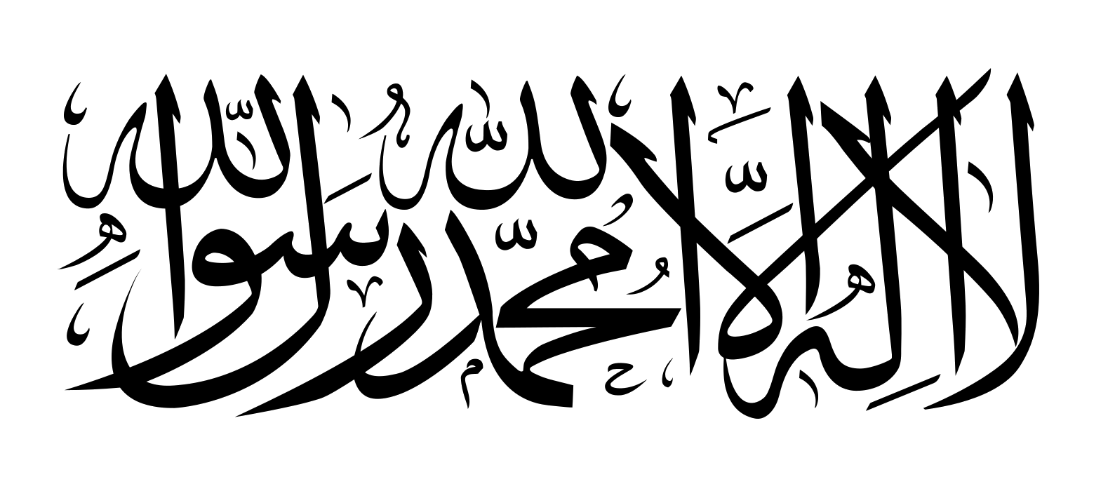
 Religion

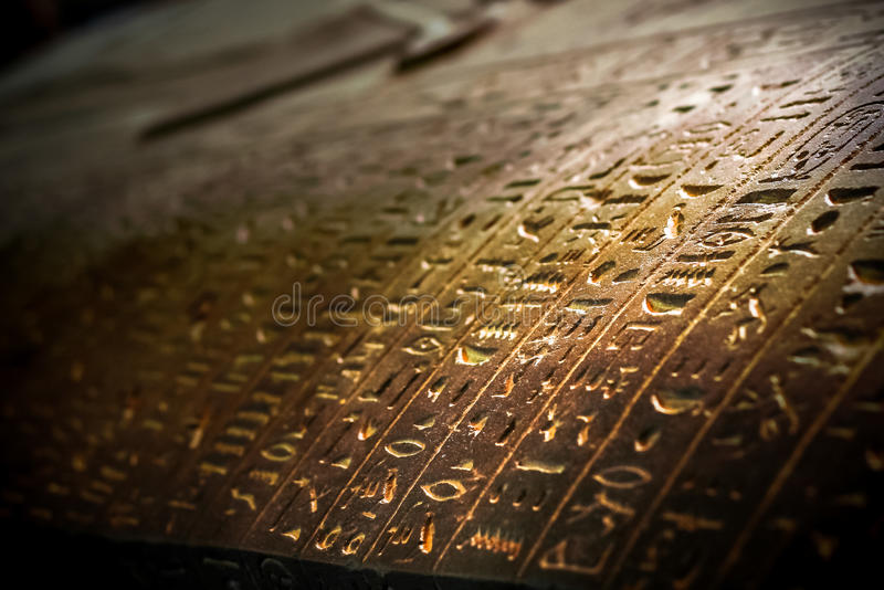
 History

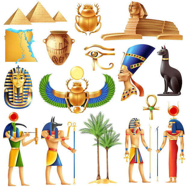 Ancient Egypt
 Architecture
 World Heritage
 Civilization


Der Luxor-Tempel (altägyptisch Ipet-reset) ist eine Tempelanlage im heutigen Luxor in Ägypten. Er wurde zur Zeit des Neuen Reichs errichtet und südlicher Harem des Amun von Karnak genannt. Er war dem Gott Amun, seiner Gemahlin Mut und ihrem gemeinsamen Sohn, dem Mondgott Chons, geweiht.
Der Tempel steht seit 1979 zusammen mit dem Karnak-Tempel und der thebanischen Nekropole auf der Weltkulturerbeliste der UNESCO.[1]
Aus wiederverwendetem Baumaterial wird geschlossen, dass hier bereits während der 12. Dynastie ein Heiligtum errichtet worden war. Unter Pharao Thutmosis III. wurde die Stationskapelle im ersten Hof gebaut.
An der vermeintlichen Stelle eines Heiligtums aus der 12. Dynastie ließ Amenophis III. durch seinen Baumeister Amenophis (Sohn des Hapu) den heutigen südlichen Teil des Tempels mit Sanktuar, Säulenhalle und dem zweiten Hof errichten. Auch der Säulengang wurde zu seiner Regierungszeit begonnen. Unter Amenophis IV. (Echnaton) wurde der Tempel geschlossen, der Name des Gottes Amun getilgt und der König errichtete in der Nähe ein Atonheiligtum. Tutanchamun baute am Säulensaal weiter, der durch Haremhab fertiggestellt wurde.
Ramses II. ließ den ersten Hof samt dem mächtigen Pylon sowie Statuen und Obelisken ausführen. Nektanebos I. gestaltete den Vorhof.
Alexander der Große ließ das Sanktuar umbauen. Statt der vier Säulen, die das Dach trugen, wurde eine Kapelle errichtet. In der Römerzeit wurde die Tempelanlage in eine Festung integriert. In den ersten nachchristlichen Jahrhunderten wurden vier Kirchen auf dem Gelände errichtet.
卢克索神庙(Luxor Temple)位于埃及卢克索的尼罗河东岸,即古埃及新王国时期的首都底比斯,大约建于公元前十四世纪。
通过神庙中重新被使用的建筑材料可以推导出在埃及第十二王朝时这里就已经有一座神庙了。法老图特摩斯三世在这里建造了新神庙的第一个部分。
阿蒙霍特普三世命令他的建筑师阿蒙霍特普在今天神庙的南部建造了圣殿、柱殿和第二个内院。柱廊也是他统治时期开始建造的。阿蒙霍特普四世时神庙被关闭,阿蒙的名字被涂抹,在神庙的边缘建造了一座阿頓的神庙。图坦卡蒙继续了神庙的建造,哈伦海布完成了柱殿。
拉美西斯二世建造了第一院、带有雕像的大门和方尖塔。内克塔内布一世建造了大门前的院。
亚历山大大帝下令改造圣殿,将支撑屋顶的四根柱子改为一座小堂。在罗马帝国时期整个神庙被结合到一座要塞中。公元后一开始的几个世纪里整个神庙内还建造了四座教堂。
ルクソール神殿(ルクソールしんでん、英語: Luxor Temple)は、エジプトのルクソール(古代のテーベ)東岸にある古代エジプト時代の神殿複合体である。もともとカルナック神殿の中心を形成するアメン大神殿の付属神殿として[2]、エジプト第18王朝(紀元前1550-1295年頃[3])ファラオのアメンホテプ3世(紀元前1390-1352年頃[3])によって中心部分が建立された[1]。
神殿の後方には、アメンホテプ3世およびアレクサンドロス3世(紀元前332-323年[3])によって構築された祠堂がある[4][5]。ローマ時代には、神殿およびその周辺は軍の要塞となり、その領域はローマ政府の基地であった[6]。
アメン大神殿とはスフィンクスの参道で結ばれていた。神殿入口となる第1塔門の前には1対のラムセス2世(紀元前1279-1213年頃[3])の坐像、その手前にはオベリスク(高さ25メートル[7])が1本立っている[4]。オベリスクは本来左右2本あったが、右側の1本(高さ22.55メートル[7])は1819年[4]、フランスに贈られてパリに運ばれ、現在コンコルド広場にある[8]。
Luxor Temple is a large Ancient Egyptian temple complex located on the east bank of the Nile River in the city today known as Luxor (ancient Thebes) and was constructed approximately 1400 BCE. In the Egyptian language it is known as ipet resyt, "the southern sanctuary". In Luxor there are several great temples on the east and west banks. Four of the major mortuary temples visited by early travelers and tourists include the Temple of Seti I at Gurnah, the Temple of Hatshepsut at Deir el Bahri, the Temple of Ramesses II (a.k.a. Ramesseum), and the Temple of Ramesses III at Medinet Habu; and the two primary cults temples on the east bank are known as the Karnak and Luxor.[1] Unlike the other temples in Thebes, Luxor temple is not dedicated to a cult god or a deified version of the king in death. Instead Luxor temple is dedicated to the rejuvenation of kingship; it may have been where many of the kings of Egypt were crowned in reality or conceptually (as in the case of Alexander the Great who claimed he was crowned at Luxor but may never have traveled south of Memphis, near modern Cairo.)
To the rear of the temple are chapels built by Amenhotep III of the 18th Dynasty, and Alexander. Other parts of the temple were built by Tutankhamun and Ramesses II. During the Roman era, the temple and its surroundings were a legionary fortress and the home of the Roman government in the area.
Le temple d'Amon à Louxor ou Opet du sud1 est un temple égyptien voué au culte d'Amon. Situé au cœur de l’ancienne Thèbes, il fut construit pour l’essentiel sous les XVIIIe et XIXe dynasties. Il était consacré au dieu dynastique Amon sous ses deux aspects d’Amon-Rê céleste et d'Amon-Min (divinité ithyphallique). Les parties les plus anciennes actuellement visibles remontent à Amenhotep III et à Ramsès II. Par la suite, de nouveaux éléments furent ajoutés par Chabaka, Nectanébo Ier et les Lagides. À l’époque romaine, le temple fut partiellement transformé en camp militaire. L’édifice, l’un des mieux préservés du Nouvel Empire, a gardé de nombreuses structures en élévation. Outre le grand pylône, le visiteur peut ainsi traverser deux grandes cours à péristyle et la colonnade monumentale qui relie ces deux cours. Le sanctuaire proprement dit, résidence de l'Amon d'Opet, de même que les salles qui précèdent ont conservé une bonne partie de leur couverture en dalles.
Il tempio di Luxor è un grande complesso templare egiziano situato sulla riva orientale del Nilo nella città di Luxor (antica Tebe).
Noto nella lingua egizia come ipet resyt, o "harem meridionale", il tempio era dedicato a Amon; durante il Nuovo Regno fu il centro della festa annuale di Opet, nella quale una statua di Amon era trasferita lungo il Nilo dal vicino Grande tempio di Amon noto anche come Tempio di Karnak Ipet-sut[1] per il rito di fertilità.
El templo de Lúxor, situado en el corazón de la antigua Tebas, fue construido esencialmente bajo las dinastías XVIII y XIX egipcias. Estaba consagrado al dios Amón bajo sus dos aspectos de Amón-Ra (Ra, era considerado el dios del cielo, dios del Sol y del origen de la vida en la mitología egipcia). Las partes más antiguas actualmente visibles remontan a Amenhotep III y a Ramsés II. Seguidamente, nuevos elementos fueron añadidos por Shabako, Nectanebo I y la dinastía ptolemaica. En época romana, el templo fue parcialmente transformado en campo militar. El edificio, uno de los mejores conservados del Nuevo Imperio egipcio, aún mantiene numerosas estructuras. Además del gran pilono, el visitante puede también atravesar dos grandes peristilos y la columnata monumental que enlaza estos dos patios. El santuario propiamente dicho, residencia del Amón de Opet, al igual que las salas que conservan una gran parte de sus baldosas.
Forma parte del conjunto denominado Antigua Tebas con sus necrópolis, declarado Patrimonio de la Humanidad por la Unesco en 1979.
Луксорский храм — развалины центрального храма Амона-Ра, на правом берегу Нила, в южной части Фив, в пределах современного города Луксор.
Храм богов Амона, Мут и Хонсу представляет собой наиболее полное воплощение архитектурных особенностей Нового царства (XVI—XI вв. до н. э.) Его отличают грандиозность замысла, монументальность и торжественность деталей, большое количество колонн.
Храм ориентирован с северо-запада на юго-восток. Для соответствия с пилонами стоявшего в получасовом расстоянии к северу Карнака, с которым он был соединён мощёной аллеей сфинксов, северный пилон его уклонен несколько к востоку от общей оси.
Древнейшая часть — святая святых, с примыкающими залами, украшенными монументальными рельефами и надписями — основана при Аменхотепе III; первые цари XIX династии прибавили к югу двор с 74 колоннами, перемежающимися статуями фараонов. Рамсес Великий пристроил северный перистиль и пилон и изобразил на внешней стороне последнего свои подвиги в войне с хеттами; здесь же начертан так называемый «эпос Пентаура».
У северного входа Луксорского храма — четыре колосса-монолита и два обелиска, из которых один перевезен в 1830-е гг. в Париж, на площадь Согласия. Длина сооружения от входа до самой северной стены — 260 метров.
 *Mediterranean Sea
Egypt
Albania
Algeria
Amber Road
Bosnia Herzegovina
France
Gibraltar
Greece
Israel
Italy
Croatia
Libanon
Libya
Malta
Malta
Monaco
Montenegro
Palestine
*Mediterranean Sea
Egypt
Albania
Algeria
Amber Road
Bosnia Herzegovina
France
Gibraltar
Greece
Israel
Italy
Croatia
Libanon
Libya
Malta
Malta
Monaco
Montenegro
Palestine
 Review
Slovenia
Spain
Syria
Tunisia
Turkey
Cyprus
Review
Slovenia
Spain
Syria
Tunisia
Turkey
Cyprus


Memphis (altägyptisch Men-nefer, Inbu-hedj, Hut-ka-Ptah; biblisch Noph, Movh; arabisch منف, DMG Manf) war die Hauptstadt des ersten Gaus von Unterägypten. Ihre Ruinen befinden sich in der Nähe der Ortschaften Mit-Rahineh und Helwan etwa 18 km südlich von Kairo und gehören seit 1979 als Teil der Stätte Memphis und seine Nekropole – die Pyramidenfelder von Gizeh bis Dahschur zum UNESCO-Welterbe.
Manetho berichtet, dass Memphis der Legende nach von König Menes 3000 v. Chr. gegründet wurde. Während des Alten Reiches war sie Hauptstadt von Ägypten und blieb eine wichtige Stadt in der ägyptischen Geschichte. Memphis stand unter dem Schutz des Gottes Ptah, des Schutzpatrons der Handwerker, dessen Tempel Hut-Ka-Ptah sich im Zentrum der Stadt befand.[1]
Die Stadt nahm eine strategische Position am Beginn des Nildeltas ein und beherbergte deshalb viele Werk- und Produktionsstätten, darunter auch für Waffen. Der Aufstieg und das Scheitern von Memphis sind eng mit der Geschichte des gesamten Landes verbunden. Aufgrund des Aufstiegs Alexandrias verlor Memphis ihre wirtschaftliche Rolle im Land und wurde nach und nach aufgegeben. Mit dem Edikt von Thessaloniki endete auch ihre religiöse Bedeutung.
孟菲斯(阿拉伯语:ممفس;埃及阿拉伯语:ممفيس;希腊语:Μέμφις)曾是诺姆─阿纳赫奇的都城,也是下埃及的第一个诺姆。它的遗迹在拉希纳村附近,位于开罗南方20公里处。
根据曼涅托的叙述,这座城市是由法老美尼斯于公元前3100年左右建立的。它是埃及古王国的首都,并直到古地中海时期都是一座重要的城市。[2][3][4]它在尼罗河三角洲的河口占据了一个重要的战略位置,并是一系列重要活动的故乡。城市里有许多的工坊,工厂,以及仓库,人们在此将商品和食物运往整个王国。在巅峰时期,孟菲斯是商业,贸易和宗教中心。
一般认为孟非斯的保护神是卜塔,他同时也是工匠们的保护神。他的神庙Hut-ka-Ptah(意为“卜塔灵魂的所在”)是城市中最为杰出的建筑物之一。曼涅托将这座神庙的名称翻译成希腊文Aί γυ πτoς(Ai-gy-ptos),这个词被认为是现代埃及在英文中的名字(Egypt)的词源。
孟菲斯的历史和古埃及历史息息相关。它最终的衰落被认为是后来建造的亚历山大港在经济上超过它的重要性的结果。而它在宗教上的重要性也在《萨洛尼卡敕令》发布之后,人们逐渐抛弃古代宗教而逐渐消散。
现在这座古代都城的遗址能让人们一窥它曾经的荣耀。自1979年以来,它就和吉萨的金字塔一同被认定为世界遗产。目前它作为生态博物馆开放给人们参观。
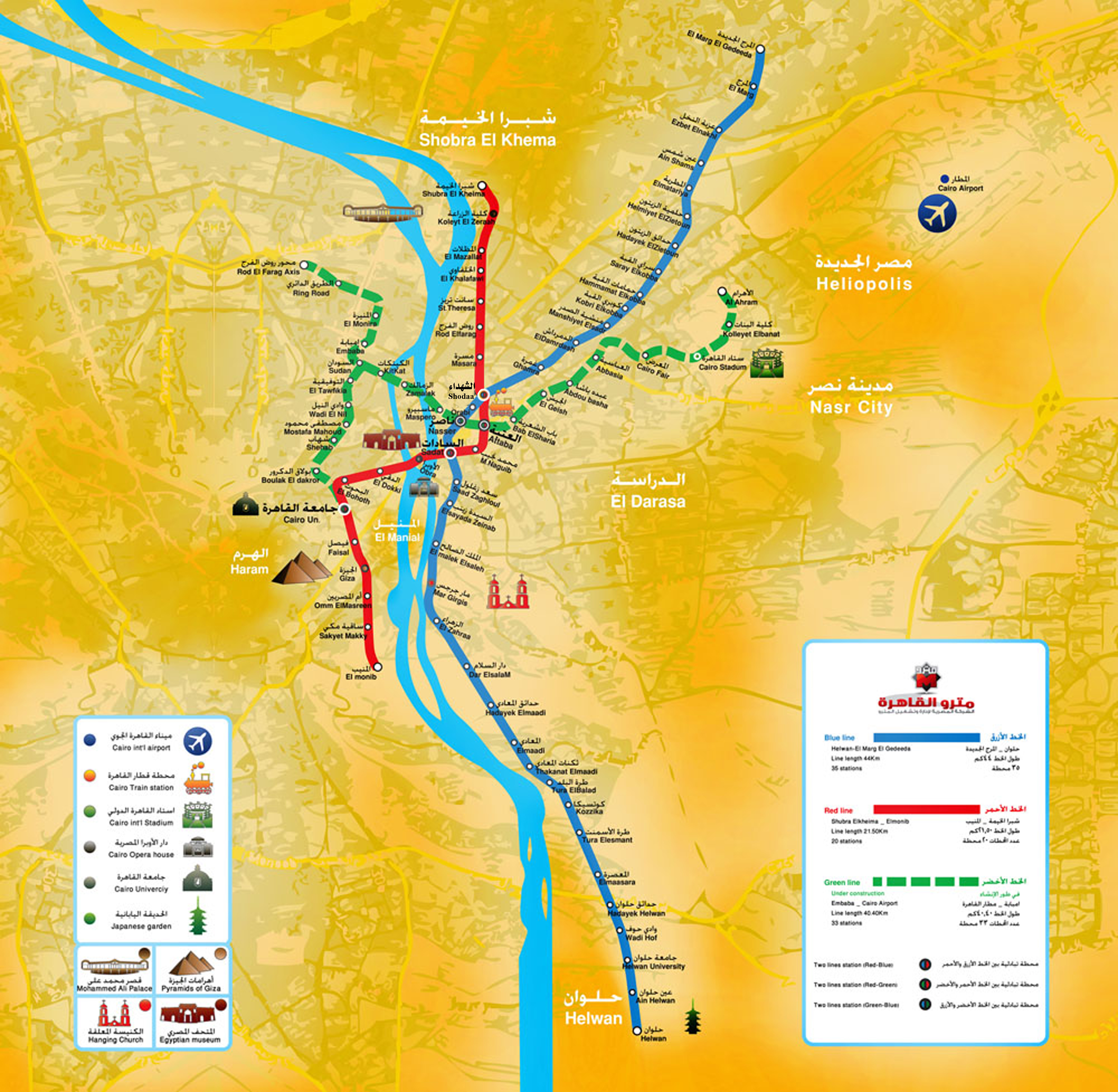
 Transport and traffic
 Media and press

 Geography
*Mediterranean Sea
Egypt
Albania
Algeria
Amber Road
Bosnia Herzegovina
France
Gibraltar
Greece
Israel
Italy
Croatia
Libanon
Libya
Malta
Morocco
Monaco
Montenegro
Palestine
Slovenia
Spain
Syria
Tunisia
Turkey
Cyprus
Geography
*Mediterranean Sea
Egypt
Albania
Algeria
Amber Road
Bosnia Herzegovina
France
Gibraltar
Greece
Israel
Italy
Croatia
Libanon
Libya
Malta
Morocco
Monaco
Montenegro
Palestine
Slovenia
Spain
Syria
Tunisia
Turkey
Cyprus
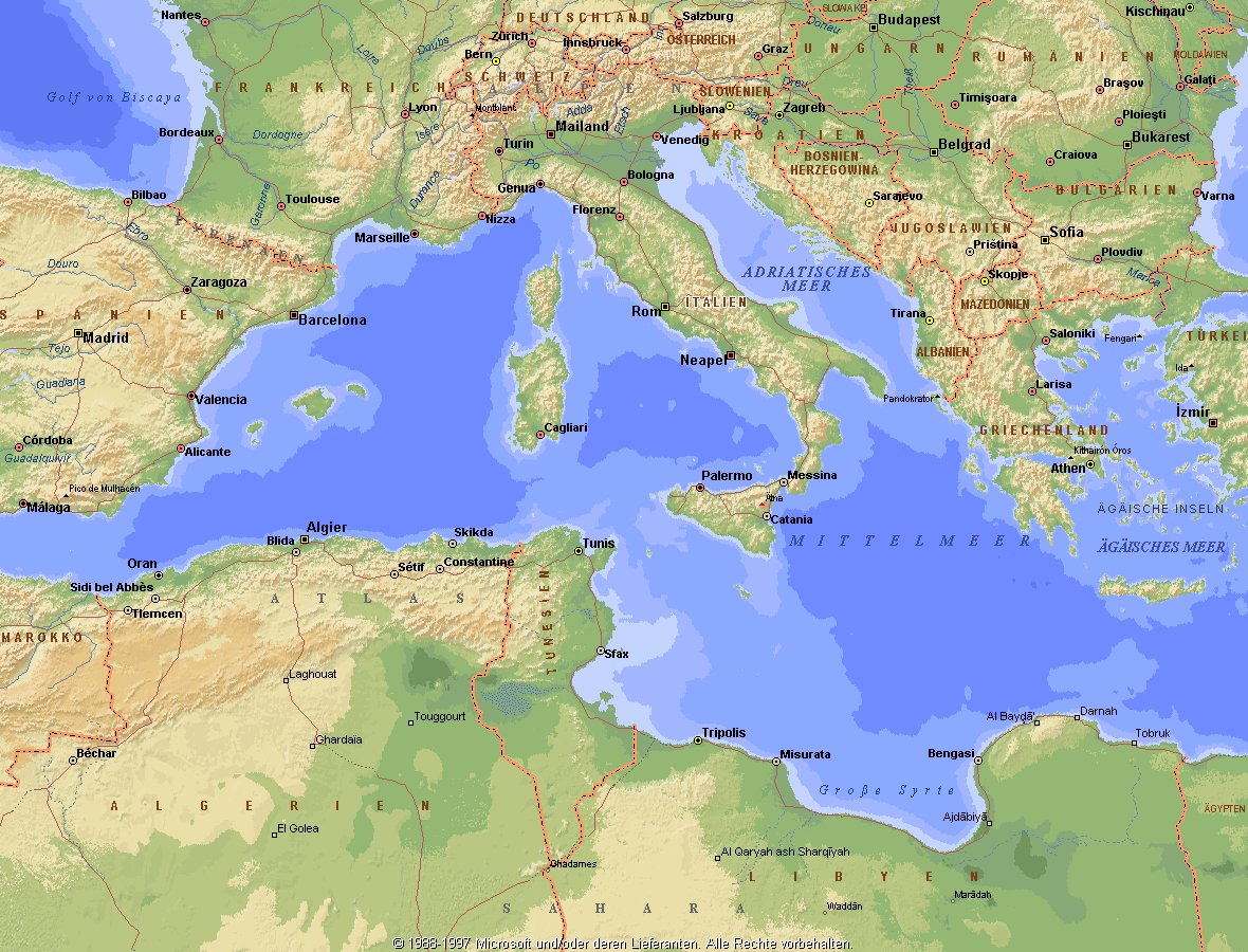
地中海,由北面的欧洲大陆,南面的非洲大陆以及东面的亚洲大陆包围着。东西长约4000千米,南北最宽处大约为1800千米,面积251.6万平方千米,是世界最大的陆间海。地中海的平均深度是1500米,最深处为5267米。
地中海西部通过直布罗陀海峡与大西洋相接,东部通过土耳其海峡(达达尼尔海峡和博斯普鲁斯海峡、马尔马拉海)和黑海相连。19世纪时开通了的苏伊士运河,接通了地中海与红海。 地中海是世界上最古老的海之一,[3] 而其附属的大西洋却是年轻的海洋。地中海处在欧亚板块和非洲板块交界处,是世界最强地震带之一。地中海地区有维苏威火山、埃特纳火山。
地中海作为陆间海,风浪较小,加之沿岸海岸线曲折、岛屿众多,拥有许多天然良好的港口,成为沟通三个大陆的交通要道。这样的条件,使地中海从古代开始海上贸易就很繁盛,促进了古代古埃及文明、古希腊文明、罗马帝国等的发展。现在也是世界海上交通的重要地区之一。其沿岸的腓尼基人、克里特人、希腊人,以及后来的葡萄牙人和西班牙人都是航海业发达的民族。著名的航海家如哥伦布、达·伽马、麦哲伦等,都出自地中海沿岸的国家。
地中海的沿岸夏季炎热干燥,冬季温暖湿润,被称作地中海性气候。植被,叶质坚硬,叶面有蜡质,根系深,有适应夏季干热气候的耐旱特征,属亚热带常绿硬叶林。这里光热充足,是欧洲主要的亚热带水果产区,盛产柑橘、无花果,和葡萄等,还有木本油料作物油橄榄。
Das Mittelmeer (lateinisch Mare Mediterraneum,[1] deshalb deutsch auch Mittelländisches Meer, präzisierend Europäisches Mittelmeer, im Römischen Reich Mare Nostrum) ist ein Mittelmeer zwischen Europa, Afrika und Asien, ein Nebenmeer des Atlantischen Ozeans und, da es mit der Straße von Gibraltar nur eine sehr schmale Verbindung zum Atlantik besitzt, auch ein Binnenmeer. Im Arabischen und Türkischen wird es auch als „Weißes Meer“ (البحر الأبيض/al-baḥr al-abyaḍ bzw. türk. Akdeniz) bezeichnet.
Zusammen mit den darin liegenden Inseln und den küstennahen Regionen Südeuropas, Vorderasiens und Nordafrikas bildet das Mittelmeer den Mittelmeerraum, der ein eigenes Klima (mediterranes Klima) hat und von einer eigenen Flora und Fauna geprägt ist.
地中海(ちちゅうかい、ラテン語: Mare Mediterraneum)は、北と東をユーラシア大陸、南をアフリカ大陸(両者で世界島)に囲まれた地中海盆地に位置する海である。面積は約3000平方キロメートル、平均水深は約1500メートル[2]。海洋学上の地中海の一つ。
地中海には、独立した呼称を持ついくつかの海域が含まれる(エーゲ海、アドリア海など)。地中海と接続する他の海としては、ジブラルタル海峡の西側に大西洋が、ダーダネルス海峡を経た北東にマルマラ海と黒海があり、南西はスエズ運河で紅海と結ばれている(「海域」「地理」で詳述)。
北岸の南ヨーロッパ、東岸の中近東、南岸の北アフリカは古代から往来が盛んで、「地中海世界」と総称されることもある[3]。
The Mediterranean Sea is a sea connected to the Atlantic Ocean, surrounded by the Mediterranean Basin and almost completely enclosed by land: on the north by Southern Europe and Anatolia, on the south by North Africa and on the east by the Levant. Although the sea is sometimes considered a part of the Atlantic Ocean, it is usually identified as a separate body of water. Geological evidence indicates that around 5.9 million years ago, the Mediterranean was cut off from the Atlantic and was partly or completely desiccated over a period of some 600,000 years, the Messinian salinity crisis, before being refilled by the Zanclean flood about 5.3 million years ago.
It covers an approximate area of 2.5 million km2 (965,000 sq mi), but its connection to the Atlantic (the Strait of Gibraltar) is only 14 km (8.7 mi) wide. The Strait of Gibraltar is a narrow strait that connects the Atlantic Ocean to the Mediterranean Sea and separates Gibraltar and Spain in Europe from Morocco in Africa. In oceanography, it is sometimes called the Eurafrican Mediterranean Sea or the European Mediterranean Sea to distinguish it from mediterranean seas elsewhere.[2][3]
The Mediterranean Sea has an average depth of 1,500 m (4,900 ft) and the deepest recorded point is 5,267 m (17,280 ft) in the Calypso Deep in the Ionian Sea. The sea is bordered on the north by Europe, the east by Asia, and in the south by Africa. It is located between latitudes 30° and 46° N and longitudes 6° W and 36° E. Its west-east length, from the Strait of Gibraltar to the Gulf of Iskenderun, on the southwestern coast of Turkey, is approximately 4,000 km (2,500 miles). The sea's average north-south length, from Croatia’s southern shore to Libya, is approximately 800 km (500 miles). The Mediterranean Sea, including the Sea of Marmara (connected by the Dardanelles to the Aegean Sea), has a surface area of approximately 2,510,000 square km (970,000 square miles).[4]
The sea was an important route for merchants and travellers of ancient times that allowed for trade and cultural exchange between emergent peoples of the region. The history of the Mediterranean region is crucial to understanding the origins and development of many modern societies.
The countries surrounding the Mediterranean in clockwise order are Spain, France, Monaco, Italy, Slovenia, Croatia, Bosnia and Herzegovina, Montenegro, Albania, Greece, Turkey, Syria, Lebanon, Israel, Egypt, Libya, Tunisia, Algeria, and Morocco; Malta and Cyprus are island countries in the sea. In addition, the Gaza Strip and the British Overseas Territories of Gibraltar and Akrotiri and Dhekelia have coastlines on the sea.
La mer Méditerranée (prononcé [me.di.tɛ.ʁa.ne]) est une mer intercontinentale presque entièrement fermée, bordée par les côtes d'Europe du sud, d’Afrique du Nord et d’Asie, depuis le détroit de Gibraltar à l'ouest aux entrées des Dardanelles et du canal de Suez à l'est. Elle s’étend sur une superficie d’environ 2,5 millions de kilomètres carrés. Son ouverture vers l’océan Atlantique par le détroit de Gibraltar est large de 14 kilomètres.
Elle doit son nom au fait qu’elle est littéralement une « mer au milieu des terres », en latin « mare medi terra »1.
Durant l’Antiquité, la Méditerranée était une importante voie de transports maritimes permettant l’échange commercial et culturel entre les peuples de la région — les cultures mésopotamiennes, égyptienne, perse, phénicienne, carthaginoise, berbère, grecque, arabe (conquête musulmane), ottomane, byzantine et romaine. L’histoire de la Méditerranée est importante dans l’origine et le développement de la civilisation occidentale.
Il mar Mediterraneo, detto brevemente Mediterraneo, è un mare intercontinentale situato tra Europa, Nordafrica e Asia occidentale connesso all'Oceano Atlantico. La sua superficie approssimativa è di 2,51 milioni di km² e ha uno sviluppo massimo lungo i paralleli di circa 3 700 km. La lunghezza totale delle sue coste è di 46 000 km, la profondità media si aggira sui 1 500 m, mentre quella massima è di 5 270 m presso le coste del Peloponneso. La salinità media si aggira dal 36,2 al 39 ‰.[2] La popolazione presente negli stati bagnati dalle sue acque ammonta a circa 450 milioni di persone.[2].
El mar Mediterráneo es uno de los mares del Atlántico. Está rodeado por la región mediterránea, comprendida entre Europa meridional, Asia Occidental y África septentrional. Fue testigo de la evolución de varias civilizaciones como los egipcios, los fenicios, hebreos, griegos, cartagineses, romanos, etc. Con aproximadamente 2,5 millones de km² y 3.860 km de longitud, es el segundo mar interior más grande del mundo, después del Caribe.1 Sus aguas, que bañan las tres penínsulas del sur de Europa (Ibérica, Itálica, Balcánica) y una de Asia (Anatolia), comunican con el océano Atlántico a través del estrecho de Gibraltar, con el mar Negro por los estrechos del Bósforo y de los Dardanelos y con el mar Rojo por el canal de Suez.2 Es el mar con las tasas más elevadas de hidrocarburos y contaminación del mundo.3
Средизе́мное мо́ре — межматериковое море, по происхождению представляющее собой глубоководную псевдоабиссальную внутришельфовую депрессию[1][2], связанную на западе с Атлантическим океаном Гибралтарским проливом[3].
В Средиземном море выделяют, как его составные части, моря: Адриатическое, Альборан, Балеарское, Ионическое, Кипрское, Критское, Левантийское, Ливийское, Лигурийское, Тирренское и Эгейское. В бассейн Средиземного моря также входят Мраморное, Чёрное и Азовское моря.


Die Muhammad-Ali-Moschee (arabisch مسجد محمد علي Masdschid Muhammad ʿAlī ‚Moschee des Mohammed Ali‘), manchmal auch als Alabastermoschee bezeichnet, ist eine der großen Moscheen in Kairo. Sie wurde im Auftrag von Pascha Muhammad Ali in den Jahren 1824 bis 1884 im osmanischen Stil mit barocken Elementen erbaut. Verantwortlich für den Bau zeichnete der Grieche Boşnak Yusuf aus Istanbul, der sich stilistisch an der dortigen Neuen Moschee (türk. Yeni Cami) orientierte.
穆罕默德·阿里清真寺(阿拉伯语:مسجد محمد علي Masjid Muhammad ʿAlī 'Mosque of Mohammed Ali'),有时也被称为阿拉巴斯清真寺,是开罗最大的清真寺之一。该清真寺由帕夏-穆罕默德-阿里委托建造,建于 1824 年至 1884 年之间,采用了带有巴洛克元素的奥斯曼风格。来自伊斯坦布尔的希腊人博什纳克-尤素福负责建造,他的风格是以当地的新清真寺(土耳其语:Yeni Cami)为蓝本。