Deutsch-Chinesische Enzyklopädie, 德汉百科

       
Deutsch — Chinesisch
Catalog Virginia-VA

美國國道1 美国国道1
Der U.S. Highway 1 ist ein Highway, der parallel zur US-amerikanischen Ostküste verläuft. Die Gesamtlänge beträgt 3846 Kilometer. Im Norden endet der Highway in Fort Kent in Maine an der kanadischen Grenze. Im Süden ist es Key West an Floridas Küste zum Golf von Mexiko. Die US Route 1 verläuft an vielen Orten parallel zur Interstate 95. Festgelegt wurde sie 1926 zunächst nur zwischen der kanadischen Grenze und dem U.S. Highway 94 in Miami.
/assets/contentimages/US_Route_1.png
美国国道1U.S. Route 1)是美国国道系统中一条贯穿美国东岸各州的公路,在多数路段与较滨海的95号州际公路平行,但在杰克逊维尔维吉尼亚州彼得堡之间路段,国道一号位于I-95之西,即采较内陆之路线。整条公路南起佛罗里达州基韦斯特,北至缅因州肯特堡加拿大边境连接,全长3,846公里[1],中间经过东岸多数大城,包括:迈阿密华盛顿特区费城纽约市、以及波士顿等。

Der U.S. Highway 1 (auch U.S. Route 1 oder US 1) ist ein Highway, der parallel zur US-amerikanischen Ostküste verläuft. Die Gesamtlänge beträgt 3846 Kilometer. Im Norden endet der Highway in Fort Kent in Maine an der kanadischen Grenze. Im Süden ist es Key West an Floridas Küste zum Golf von Mexiko. Die US Route 1 verläuft an vielen Orten parallel zur Interstate 95. Festgelegt wurde sie 1926 zunächst nur zwischen der kanadischen Grenze und dem U.S. Highway 94 in Miami.

Die wichtigsten Städte, die der Highway passiert, sind MiamiColumbiaRichmondWashington, D.C.BaltimorePhiladelphiaNew York CityBoston und Portland.

Der Highway trägt die Nummer eins, weil er der am östlichsten gelegene ist und Nord-Süd-Highways von Ost nach West nummeriert werden.

Dieses Bild, Video oder Audio ist eventuell urheberrechtlich geschützt. Es wird nur für Bildungszwecke genutzt. Wenn Sie es finden, benachrichtigen Sie uns bitte per und wir werden es sofort entfernen.
美国国道11
http://www.net4info.de/photos/cpg/albums/userpics/10001/US_Route_11.png
Dieses Bild, Video oder Audio ist eventuell urheberrechtlich geschützt. Es wird nur für Bildungszwecke genutzt. Wenn Sie es finden, benachrichtigen Sie uns bitte per und wir werden es sofort entfernen.
美国国道50
Der U.S. Highway 50 (kurz US 50) ist ein United States Highway in den Vereinigten Staaten. Er beginnt in West Sacramento an der Interstate 80 im Bundesstaat Kalifornien und endet nach 4846 Kilometern in Ocean City an der Maryland Route 528. Bei der Eröffnung des Highways im Jahr 1926 gab es zwei getrennte Abschnitte. Der westliche Teil verband Sacramento mit Ely in Nevada und der Abschnitt im Osten verlief von Thistle in Utah nach Annapolis südlich von Baltimore im Bundesstaat Maryland. Die Absc
/assets/contentimages/us_route_50.png

50号美国国道(英语:U.S. Route 50)是美国国道中一条东西向的主要道路。它横跨3000英里(4800公里),从紧邻大西洋的马里兰州大洋城,到加利福尼亚州西萨克拉门托。到了1972年,西萨克蒙托境内的美国州际公路使它的端点又扩展到了邻近太平洋旧金山(途经斯托克顿阿尔塔蒙特山口奥克兰海湾大桥)。随后,州际公路建立了起来,大部分与这条路是分开的。它逐渐成为了连接南部的7080号州际公路,以及北部的6440号州际公路的走廊。

Dieses Bild, Video oder Audio ist eventuell urheberrechtlich geschützt. Es wird nur für Bildungszwecke genutzt. Wenn Sie es finden, benachrichtigen Sie uns bitte per und wir werden es sofort entfernen.
美国国道60
http://www.net4info.de/photos/cpg/albums/userpics/10001/US_Route_60.png
Dieses Bild, Video oder Audio ist eventuell urheberrechtlich geschützt. Es wird nur für Bildungszwecke genutzt. Wenn Sie es finden, benachrichtigen Sie uns bitte per und wir werden es sofort entfernen.
美国生物质发电厂/U.S. Biomass Power Plants

Last Modified on November 21, 2022
*Capacity noted in (MW)


Plant Location Feedstock Capacity
Agrilectric Power Partners Ltd.  LA  Rice hulls   12.00
Albany Green Energy  GA  Forest residue, urban wood waste, pecan shells, peanut hulls  50.00
Allendale Biomass  SC  Mill/forestry residue  20.00
Altavista Power Station  VA  Woody biomass  51.00
Arnold O. Chantland Incineration Plant  IA  MSW/Refused-derived fuel (RDF)  4.00
Barron County Waste-to-Energy & Recycling Facility  WI  MSW  2.00
Bay Front Power Plant  WI  Wood waste  56.00
Biomass One  OR  Logging/wood debris  30.00
Bridgewater Power LP  NH  Woody biomass  20.00
Buckeye Florida Biomass  FL  Wood waste, black liquor  69.40
Burgess BioPower  NH  Wood waste  75.00
Burney Forest Power  CA  Wood waste  31.00
Cadillac Renewable Energy  MI  Forest residue  40.00
City of Spokane Waste to Energy Facility  WA  MSW  22.00
Collins Pine Co. Power Plant  CA  Forest thinnings/residue  12.00
Covanta Alexandria  VA  MSW  22.00
Covanta Babylon  NY  MSW  17.00
Covanta Bristol  CT  MSW  16.00
Covanta Camden  NJ  MSW  21.00
Covanta Dade  FL  MSW, wood waste  77.00
Covanta Delaware Valley  PA  MSW  87.00
Covanta Essex  NJ  MSW  66.00
Covanta Fairfax  VA  MSW  93.00
Covanta Harrisburg  PA  MSW  21.00
Covanta Haverhill  MA  MSW  45.00
Covanta Hempstead  NY  MSW  72.00
Covanta Hillsborough  FL  MSW  47.00
Covanta Honolulu  HI  MSW  90.00
Covanta Huntington  NY  MSW  24.00
Covanta Indianapolis  IN  MSW  6.50
Covanta Kent  MI  MSW  17.00
Covanta Lake  FL  MSW  15.00
Covanta Lancaster  PA  MSW  33.00
Covanta Lee  FL  MSW  57.00
Covanta Long Beach  CA  MSW  36.00
Covanta MacArthur  NY  MSW  12.00
Covanta Marion  OR  MSW  13.00
Covanta Montgomery  MD  MSW  63.00
Covanta Niagara  NY  MSW  50.00
Covanta Onondaga  NY  MSW  39.00
Covanta Palm Beach Renewable Energy #1  FL  MSW  62.00
Covanta Palm Beach Renewable Energy #2  FL  MSW  95.00
Covanta Pasco  FL  MSW  30.00
Covanta Pinellas  FL  MSW  75.00
Covanta Plymouth  PA  MSW  32.00
Covanta SECONN  CT  MSW  17.00
Covanta SEMASS  MA  MSW  78.00
Covanta Stanislaus  CA  MSW  22.00
Covanta Tulsa  OK  MSW  17.00
Covanta Union  NJ  MSW  42.00
Covanta York  PA  MSW  42.00
Cox Waste-to-Energy  KY  Wood waste  5.00
Craven County Wood Energy  NC  Wood chips, forestry residue, mill waste, bark, sawdust, poultry litter  50.00
Deerhaven Renewable Generating Station  FL  Wood waste  102.50
Desert View Power  CA  Woody biomass  45.00
DG Fairhaven Power  CA  Wood waste  18.00
Dillard Complex Cogeneration Plant  OR  Mill residue  51.50
Dorchester Biomass  SC  Mill/forestry residue  20.00
Douglas County Forest Products  OR  Wood residue  6.00
DTE Stockton Biomass Power  CA  Woody biomass, ag residue  45.00
Eagle Valley Clean Energy  CO  Forest restoration thinnings/residue   12.00
Ecomaine Waste-to-Energy Plant  ME  MSW  14.00
Evergreen Biopower LLC  OR  Mill residue  10.00
Fernandina Biomass Plant  FL  Mill residuals  22.50
French Island Generating Station  WI  MSW/RDF, wood waste, railroad ties  28.00
Genesee Power Station  MI  Landscaping/storm debris, waste wood  40.00
Grayling Generating Station  MI  Forestry residue, mill waste, bark  38.00
Green Energy Team LLC  HI  Eucalyptus, albizia  7.50
GRP-Franklin LLC  GA  C&D waste  65.00
GRP-Madison LLC  GA  C&D waste   65.00
Halifax County Biomass Plant  VA  Logging waste, forest slash  49.90
Hennepin Energy Recovery Center  MN  MSW  40.00
Hillman Power LLC  MI  Wood waste  20.00
Honey Lake Power  CA  High-hazard forest material/thinnings  30.00
Hopewell Power Station  VA  Woody biomass  51.00
Joseph C McNeil Generating Station  VT  Logging residue, bark, shavings, clean urban wood waste  50.00
Kapstone Kraft Paper Corp.-Longview  WA  Mill residue, wood waste  25.00
Kettle Falls Generating Station  WA  Logging/mill residue  53.00
Koda Energy LLC  MN  Oat/rice hulls, corn, barley and malt screening, urban tree waste  23.40
L'Anse Warden Electric Company  MI  Wood waste, railroad ties  20.00
M.L. Hibbard Energy Center  MN  Wood waste  72.80
Macon Mill  GA  Logging waste  38.00
McKay Bay Refuse-to-Energy Plant  FL  MSW  22.00
McKinley Paper Cogeneration Facility  WA  Logging/mill residue  9.50
Merced Power  CA  Ag waste   12.50
MMWAC Resource Recovery Facility  ME  MSW  5.00
Mt. Poso Cogeneration Co. LLC  CA  Wood waste  44.00
Multitrade Rabun Gap  GA  Woody biomass  18.00
National Energy-Lincoln  MI  Wood waste   18.00
National Energy-McBain  MI  Wood waste  18.00
North Carolina Renewable Power  NC  C&D waste, wood waste, poultry litter  22.00
North Fork Community Power  CA  High-hazard forest material  2.00
Novo BioPower LLC  AZ  Wood waste  27.00
Okeelanta Biomass Cogeneration  FL  Baggasse, natural gas  74.90
Olmsted Waste-To-Energy Facility  MN  MSW  9.60
Oswego Energy Recovery Facility  NY  MSW  4.00
Pacific Ultrapower Chinese Station  CA  Woody biomass  25.00
Penobscot Energy Recovery  ME  MSW  25.00
Piedmont Green Power  GA  Urban wood waste, mill and logging residue  55.00
Plainfield Renewable Energy  CT  C&D/forestry waste  37.50
Plummer Cogen  ID  Wood waste  6.20
Potlatch Land & Lumber Power Plant  AR  Bark, sawdust, shavings  10.00
Rapids Energy Center  MN  Logging/mill residue   28.60
Red Wing Generating Station  MN  MSW/RDF  22.00
ReEnergy Black River  NY  Woody biomass  60.00
ReEnergy Livermore Falls  ME  Forest residue, C&D waste  39.00
ReEnergy Stratton  ME  Forest/mill residue  48.00
Resolute Forest Products Coosa Pines  AL  Wood-processing waste  30.00
Rio Bravo Fresno  CA  Ag/urban wood waste  24.30
Rio Bravo Rocklin  CA  High-hazard forest material, ag/urban waste  24.40
RockTenn-Tacoma Mill  WA  Mill residue  55.00
Roseburg Forest Products Biomass   CA  Wood waste  13.00
Rothschild Biomass Cogeneration Plant  WI  Urban wood waste, mill residue  50.00
Savannah River Site Biomass Cogeneration Facility  SC  Forest residue  20.00
Scotia Cogen  CA  Wood waste  28.00
SDS Lumber Gorge Energy Division  WA  Logging/mill residue  10.00
Shasta-Sustainable Resource Management   CA  Wood waste, forest residue  56.00
Southampton Power Station  VA  Woody biomass  51.00
Southern Co. Nacogdoches Generating Facility  TX  Forest/wood processing residue  115.00
SPI-Aberdeen Biomass Power  WA  Logging/mill residue  18.00
SPI-Anderson Biomass Power   CA  Logging/mill residue  30.00
SPI-Burlington Biomass Power   WA  Logging/mill residue  28.00
SPI-Burney  CA  Logging/mill residue  20.00
SPI-Eugene  OR  Mill, forest residue  19.80
SPI-Lincoln Biomass Power  CA  Logging/mill residue  18.00
SPI-Quincy Biomass Power   CA  Mill residue  35.20
SPI-Sonora Biomass Power   CA  Logging/mill residue  10.90
St. Paul Cogeneration LLC  MN  Urban wood residue  33.00
Stoltze Cogeneration Power Plant  MT  Mill residue  3.00
Stored Solar Bethlehem  NH  Logging residue, forest thinnings  20.00
Stored Solar Fitchburg  MA  Woody biomass  17.00
Stored Solar Jonesboro  ME  Woody biomass  25.00
Stored Solar Ryegate  VT  Woody biomass  20.00
Stored Solar Springfield  NH  Woody biomass  19.00
Stored Solar Tamworth  NH  Woody biomass  20.00
Stored Solar West Enfield  ME  Woody biomass  25.00
Stored Solar Whitefield  NH  Woody biomass  15.00
Telogia Power  FL  Logging/mill residue, hog fuel, peanut hulls  14.00
U.S. Sugar Corp. Cogeneration Plant  FL  Bagasse  50.00
Virginia City Hybrid Energy Center  VA  *Woody biomass  120.00
Wadham Energy LP  CA  Rice hulls  30.00
Westervelt Renewable Energy Moundville  AL  Wood waste  13.00
WestRock Covington  VA  Logging, papermaking residue  75.00
Wheelabrator Baltimore  MD  MSW  64.50
Wheelabrator Bridgeport  CT  MSW  67.00
Wheelabrator Concord  NH  MSW  14.00
Wheelabrator Dutchess County  NY  MSW  9.00
Wheelabrator Falls  PA  MSW  53.00
Wheelabrator Gloucester  NJ  MSW  14.00
Wheelabrator Hudson Falls  NY  MSW  14.00
Wheelabrator Lisbon  CT  MSW  15.00
Wheelabrator Millbury  MA  MSW  48.00
Wheelabrator North Andover  MA  MSW  40.00
Wheelabrator Portsmouth  VA  MSW  60.00
Wheelabrator Saugus  MA  MSW  54.00
Wheelabrator South Broward  FL  MSW  66.00
Wheelabrator Westchester LP  NY  MSW  60.00
Wilmarth Generating Station  MN  MSW/RDF, woody biomass  18.00
Woodland Biomass Power  CA  Wood chips, urban wood waste, ag waste  25.00
Total Plants: 159   Total capacity(MW): 5,583.90
Dieses Bild, Video oder Audio ist eventuell urheberrechtlich geschützt. Es wird nur für Bildungszwecke genutzt. Wenn Sie es finden, benachrichtigen Sie uns bitte per und wir werden es sofort entfernen.
美国国防部/United States Department of Defense
http://www.net4info.de/photos/cpg/albums/userpics/10002/United_States_Department_of_Defense.png
Dieses Bild, Video oder Audio ist eventuell urheberrechtlich geschützt. Es wird nur für Bildungszwecke genutzt. Wenn Sie es finden, benachrichtigen Sie uns bitte per und wir werden es sofort entfernen.
今日美國 今日美国

Dieses Bild, Video oder Audio ist eventuell urheberrechtlich geschützt. Es wird nur für Bildungszwecke genutzt. Wenn Sie es finden, benachrichtigen Sie uns bitte per und wir werden es sofort entfernen.
弗吉尼亚州
/assets/contentimages/normal_Virginia_~1.png /assets/contentimages/normal_Virginia_.png /assets/contentimages/normal_Virginia_~0.png
 

弗吉尼亚州,正式名称为弗吉尼亚邦(英语:Commonwealth of Virginia),是美国东部的一个,美国开国时十三州之一。

维珍尼亚州域范围位于北纬36°31'至39°37',西经75°13'至83°37'之间,其北部地区与美国政治中心华盛顿哥伦比亚特区相邻;东南部的诺福克市则有全世界最大的军港和海军基地。该州是美利坚合众国的发源地之一,人口稠密,经济发达。美国2012年人口估算显示,全州总人口818.6万,实现GDP总量3970亿美元[3]

弗吉尼亚州是美国古老的一个州,以“老国土”为绰号,是8位美国总统的诞生地,号称“总统之母”。弗吉尼亚历史底蕴深厚,早在1607年英国人就在此设立“伦敦弗吉尼亚公司”;之后,大批的英国殖民者源源不断地涌来。由于殖民者的到来,包括波瓦坦部族在内的土著美洲人群则流离失所,这些人曾经和奴隶们一起在弗吉尼亚早期的政治生活和种植园经济中发挥了重要作用。弗吉尼亚是响应美国革命的13个殖民地之一。1792年肯塔基脱离弗吉尼亚成为一个新的联邦州。南北战争时弗吉尼亚加入了南方州联盟,并与主张反对蓄奴的西弗吉尼亚州分离,其首府里士满亦成为美利坚邦联国的首都。弗吉尼亚传统上属于保守的美国南部地区,但美国相互竞争的两大政党在此都很活跃,使其在美国政治生活中有着举足轻重的地位[4]

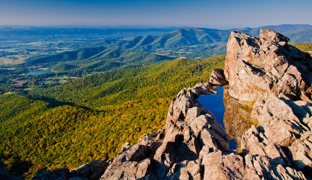
蓝岭山脉切萨皮克湾是弗吉尼亚州地理和气候的分界线,有许多动植物在这里栖息、繁殖。

弗吉尼亚州总人口近800万。里士满是本州的首府,弗吉尼亚比奇是全州人口最多的城市,联邦政府的部分行政机构设立在费尔法克斯县,是全州人口最为稠密的地区[5]

弗吉尼亚州政府是美国立法机构之源,被多次评为全美最具效率的政府机关[6]。该州的行政手法独特,对待所有县市一视同仁,甚至在州域道路的管理上也能体现它独特的行政特色。州法律还规定州长不得连任。

圣纳度河谷等地区的农业颇为发达;设于该州北部的联邦机构(国防部和中央情报局等)和位于该地区最大的港口群——汉普顿锚地的军事设施也拉动了该地区的经济;此外,该州多所公立大专院校在媒体技术和电脑技术方面具有雄厚的实力,这使得电脑芯片制造业成为该州的支柱产业之一[7]。体育方面,弗吉尼亚没有专业体育赛事的举办权,但它是几个重要大学体育项目的所在地。

Virginia (engl. Aussprache Zum Anhören bitte klicken!Abspielen [vɚˈd͡ʒɪnjə]), offiziell Commonwealth of Virginia, ist ein Bundesstaat der Vereinigten Staaten von Amerika, der Teile der südatlantischen Küstenebene, des Piedmont und der Südappalachen umfasst. Nach über 150 Jahren als englisch-britische Kolonie erlangte die Colony of Virginia zusammen mit zwölf anderen Kolonien die Unabhängigkeit. 1788 war Virginia der zehnte Staat, der die Verfassung der USA ratifizierte. Während des amerikanischen Bürgerkriegs spalteten sich die nordwestlichen Bezirke ab und wurden 1862 zum eigenständigen Bundesstaat West Virginia.

Der Beiname des Staates ist Old Dominion („Altes Herrschaftsgebiet“). Auch wird er Mother of the Presidents genannt, weil acht US-Präsidenten von hier stammten. Die Hauptstadt Virginias ist Richmond.

Virginia liegt an der Atlantikküste der Vereinigten Staaten etwa mittig zwischen der nördlichen (Maine) und südlichen (Florida) Ausdehnung der US-Küste. Von der Atlantischen Küstenebene entlang der Chesapeake Bay bis zu den Höhen der Blue Ridge Mountains in den Appalachen im Westen des Bundesstaats weist der Bundesstaat eine topografische Vielfalt auf. Die Südgrenze zu North Carolina und Tennessee ist eine fast gerade Ost-West-Linie, während die Nordgrenze zu Maryland und dem District of Columbia vom Potomac River gebildet wird. Kentucky und West Virginia sind auf der Westseite der Appalachen ebenfalls direkte Nachbarstaaten.

Virginia teilt sich mit dem Nachbarstaat Maryland jeweils knapp eine Hälfte des ausgedehnten städtischen Ballungsraumes um den Bundesdistrikt Washington, D.C. Dazu gehört neben dem Flughafen Dulles International auch Arlington County, in dem sich eine Vielzahl amerikanischer Bundesbehörden, darunter das Pentagon, befinden. Im westlichen Teil des Landes befindet sich der höchste Berg Virginias, der 1746 Meter hohe Mount Rogers. Ebenfalls in den Appalachen befindet sich der Shenandoah-Nationalpark.

バージニア州: Commonwealth of Virginia略号: VA[2][3], Va.[2][3][4])は、アメリカ合衆国東部[3][5][6]大西洋岸の南部に位置するコモンウェルス)である。2010年国勢調査による人口は8,001,024人だった。アメリカ合衆国50州の中で、陸地面積では第35位、人口では第12位である。ヴァージニア州とも表記される。

イギリス独立戦争をした13州のうちの一つである[4][5]南北戦争では南部連邦側に属し[5]、激戦地となった。

州都リッチモンド市[3][4][5][6]、人口最大都市バージニアビーチ市である[4]。 ジェームズタウン2007年は、ジェームズタウン植民地設立、すなわちバージニアの始まりから400周年を祝った催しだった。この行事では、バージニアの歴史を形作る際に少なからぬ役割を果たしたインディアン、ヨーロッパ人、アフリカ人の貢献に焦点を当てた[7][8]。これらの人々を巻き込む戦争も常に重要だった。フレンチ・インディアン戦争アメリカ独立戦争南北戦争から冷戦テロとの戦いまで、バージニアが舞台になってきた[9] 。歴史上の人物、例えばポカホンタスジョン・スミスジョージ・ワシントンの子供時代などの話や、南北戦争前の奴隷社会におけるプランテーション特権階級を取り巻く話も州の歴史に神話を作り、州のイデオロギーに理論的解釈を与えている[10]

Virginia (/vərˈɪniə/ (About this soundlisten)), officially the Commonwealth of Virginia, is a state in the Southeastern[4] and Mid-Atlantic[5] regions of the United States between the Atlantic Coast and the Appalachian Mountains. The geography and climate of the Commonwealth are shaped by the Blue Ridge Mountains and the Chesapeake Bay, which provide habitat for much of its flora and fauna. The capital of the Commonwealth is Richmond; Virginia Beach is the most-populous city, and Fairfax County is the most-populous political subdivision. The Commonwealth's estimated population as of 2019 is over 8.54 million.[6]

The area's history begins with several indigenous groups, including the Powhatan. In 1607 the London Company established the Colony of Virginia as the first permanent English colony in the New World. Virginia's state nickname, the Old Dominion, is a reference to this status. Slave labor and the land acquired from displaced Native American tribes each played a significant role in the colony's early politics and plantation economy. Virginia was one of the 13 Colonies in the American Revolution. In the American Civil War, Virginia's Secession Convention resolved to join the Confederacy while the First Wheeling Convention resolved to remain in the Union, leading to a split that created West Virginia. Although the Commonwealth was under one-party rule for nearly a century following Reconstruction, both major national parties are competitive in modern Virginia.[7]

Virginia's state legislature is the Virginia General Assembly, which was established in 1619 and is the oldest continuous law-making body in North America. It is made up of a 40-member Senate and a 100-member House of Delegates.[8] The state government is unique in how it treats cities and counties equally, manages local roads, and prohibits governors from serving consecutive terms. Virginia's economy has many sectors: agriculture in the Shenandoah Valley; federal agencies in Northern Virginia, including the headquarters of the U.S. Department of Defense and Central Intelligence Agency; and military facilities in Hampton Roads, the site of the region's main seaport.

La Virginie, officiellement le Commonwealth de Virginie (en anglais : Virginia /vɚˈdʒɪn.iə/2 et Commonwealth of Virginia) est un État des États-Unis. Il s'agit de l'un des quatre États des États-Unis à porter le titre de Commonwealth. Historiquement rattaché au Sud des États-Unis, sa capitale actuelle est Richmond. Il est limitrophe, au nord, du Maryland et du district de Columbia, au sud, de la Caroline du Nord et du Tennessee, à l'ouest, du Kentucky et de la Virginie-Occidentale, et est bordée à l'est par la baie de Chesapeake et l'océan Atlantique.

Son nom vient de la reine Élisabeth Ire d'Angleterre (1533-1603), dite la « reine vierge » (Virgin Queen) parce qu'elle ne s'est jamais mariée. La colonie de Virginie, fondée le 14 mai 16073, est administrée par la compagnie de Londres jusqu'en 1624, puis devient une colonie royale. Elle établit sa prospérité sur les plantations et le commerce du tabac. Vers 1770, la Virginie est l'une des premières colonies à contester la tutelle britannique. Plusieurs Virginiens jouèrent un grand rôle dans la guerre d'indépendance, au premier rang desquels figure George Washington. Elle est connue comme « le Vieux Dominion » (The Old Dominion) ou encore comme la « mère des présidents » (Mother of Presidents), parce que huit présidents américains y sont nés.

Sur le plan politique, la Virginie, État confédéré durant la guerre de Sécession, se range dans les régions conservatrices du Sud, bien que l’État soit disputé entre les républicains et les démocrates4.

La Virginie se place au 35e rang des États américains pour sa superficie et au 12e rang pour sa population, avec plus de 8 millions d'habitants. La ville la plus peuplée est Virginia Beach. Le comté le plus peuplé est celui de Fairfax dans le nord et la ville la plus étendue est celle de Suffolk, qui comprend une grande partie du grand marais lugubre. La majorité de la population est d'origine européenne, en particulier du nord de l'Europe, mais plus d'un cinquième est constitué d'Afro-Américains. La première religion est le baptisme.

Aujourd'hui, l'économie virginienne est diversifiée. Elle repose notamment sur les emplois fédéraux et militaires dans le nord et à Hampton Roads, où se trouvent respectivement le plus grand bâtiment de bureaux du pays et, à Norfolk, la plus grande base navale du monde. Le « Triangle historique de la Virginie coloniale » (Historic Triangle of Colonial Virginia (en)) comprend Jamestown, Yorktown et Williamsburg, qui attirent des milliers de touristes. Le réseau urbain est connecté par le troisième plus grand réseau d’autoroutes du pays5.En 2019, sa population s'élève à 8 535 519 habitants6.


La Virginia, ufficialmente Commonwealth of Virginia, è uno Stato federato degli Stati Uniti d'America. Trae origine da una delle Tredici Colonie, che si ribellarono al dominio britannico e, dopo la guerra di indipendenza americana, fu uno degli Stati fondatori degli Stati Uniti d'America, nel 1776.

Viene generalmente considerato uno Stato del sud, ed è uno dei quattro Stati degli Stati Uniti ad utilizzare la denominazione Commonwealth. Deve il suo nome alla regina d'Inghilterra Elisabetta I, che non essendosi mai sposata era conosciuta come la "regina vergine"[3]. Colonia inglese dal 1607, fu amministrata da un Consiglio governativo con sede a Londra e da un Consiglio locale fino al 1788.

Fu la prima colonia inglese dell'America settentrionale. Infatti, nel 1606 la Compagnia di Londra, una associazione mercantile, ricevette dal re Giacomo I una concessione per la costituzione di insediamenti britannici nel continente. Il 13 maggio 1607 una spedizione britannica della Compagnia di Londra raggiunse la costa degli Stati Uniti, in quello che oggi è lo Stato della Virginia, con 104 uomini e tre navi (Susan Constant, Godspeed e Discovery) per costruire il primo insediamento stabile inglese nel Nuovo Mondo. La prima colonia che fondarono fu Jamestown, sul fiume James. I primi coloni erano per lo più proprietari terrieri o figli di agiati mercanti, tutti volevano arricchirsi maggiormente e velocemente.

Le condizioni climatiche e la scarsa lungimiranza negli approvvigionamenti mise a serio repentaglio la vita della colonia, tanto che nei primi tre anni di insediamento da 500 arrivarono a 60 superstiti, sopravvissuti grazie ai rifornimenti dalla madrepatria. Nel 1609 la Compagnia di Londra si diede un nuovo assetto nella Virgin Company. La colonia divenne nel 1776 uno dei tredici Stati originari degli Stati Uniti. Fra il Seicento e il Settecento furono adottate le strutture sociali dell'Inghilterra, vi erano dunque: grandi proprietari terrieri, che producevano tabacco e una fiorente agricoltura, clero anglicano, dotato di prestigio e potere; piccoli braccianti, piccoli proprietari ed affittuari terrieri. Venne soprannominata "il vecchio dominio" (The Old Dominion) dal re Carlo II per la sua apparente lealtà alla monarchia inglese durante la guerra civile inglese del XVII secolo.

Gli attuali Stati di Kentucky e Virginia Occidentale erano parte integrante della Virginia all'epoca della fondazione degli Stati Uniti (25 giugno 1788), ma il primo venne ammesso negli Stati Uniti come Stato autonomo nel 1792, mentre il secondo si separò dalla Virginia durante la guerra di secessione americana nel 1861 diventando così parte integrante dell'Unione.

Virginia, oficialmente Mancomunidad de Virginia (en inglés Commonwealth of Virginia), es uno de los cincuenta estados que, junto con Washington D. C., forman los Estados Unidos de América. Su capital es Richmond y su ciudad más poblada, Virginia Beach.

Está ubicado en la región Sur del país, división Atlántico Sur, limitando al noroeste con Virginia Occidental, al noreste con el río Potomac que lo separa de Maryland y Washington D. C., al sur con Carolina del Norte, al suroeste con Tennessee y al oeste con Kentucky. Fue admitido en la Unión el 25 de junio de 1788, como el estado número 10.

Recibe su nombre por la reina Isabel I de Inglaterra, quien, al no haber contraído nunca matrimonio, era conocida como «la reina virgen». El estado es conocido por el apodo de «Viejo Dominio» (Old Dominion) y a veces por el de «Madre de Presidentes», por ser el lugar de nacimiento de ocho presidentes estadounidenses (incluidos cuatro de los cinco primeros).

Las raíces de la Virginia moderna se remontan a la fundación de la Colonia de Virginia en 1607 por la Compañía de Virginia de Londres. La agricultura, el colonialismo y la esclavitud desempeñaron papeles significativos en su economía y su política durante los primeros tiempos. Fue la primera colonia inglesa en el Nuevo Mundo y una de las trece colonias que participarían en la Guerra de Independencia, y posteriormente se convirtió en el corazón de la Confederación en la Guerra Civil estadounidense.

La capital de la commonwealth es Richmond, mientras que Virginia Beach es la ciudad más populosa y el condado de Fairfax es la subdivisión política con mayor población. De acuerdo con el Censo de los Estados Unidos de 2010, la población del estado era de 8.001.024 habitantes.3​ Aunque tradicionalmente conservadora e históricamente parte del Sur, la moderna Virginia es un estado políticamente competitivo para los dos principales partidos políticos nacionales.4

Virginia tiene una economía con varios asentamientos importantes, que incluyen El Pentágono del Departamento de Defensa y diversas agencias federales en el Norte del estado, bases militares en Hampton Roads, así como una producción agrícola significativa. El llamado «Triángulo Histórico» incluye los populares destinos turísticos de la historia estadounidense de Jamestown, Yorktown y el museo vivo de Colonial Williamsburg.5​ El crecimiento del sector tecnológico ha hecho de los chips la principal exportación del estado, con la industria basada en la solidez de sus escuelas públicas y de sus universidades.6​ Las áreas donde el estado necesita mejorar incluyen la asistencia sanitaria y la protección del medio ambiente.

Вирги́ния[1][2][3], также Вирджи́ния[2] (англ. Virginia, американское произношение: [vərˈdʒɪniə] (Звук слушать)), официально — Содру́жество Вирги́нии (англ. Commonwealth of Virginia) — штат[4] на востоке США, один из так называемых Южно-Атлантических штатов. В составе государства он является 10-м штатом. Население — 8.5 млн человек (2015; 12-е место в США).

Столица — Ричмонд, крупнейший город — Верджиния-Бич, другие крупные города — Александрия, Линчберг, Норфолк, Ньюпорт-Ньюс, Портсмут, Роанок, Хамптон, Чесапик. Административно Виргиния разделена на 95 округов и 38 «независимых городов»[en], которые не входят ни в один округ и являются полностью самостоятельными административно-территориальным единицами второго уровня[5][6].

Полное официальное название штата — Содружество Виргинии (Commonwealth of Virginia).

Официальные прозвища — «Старый доминион» (Old Dominion), «Мать президентов» (Mother of Presidents).

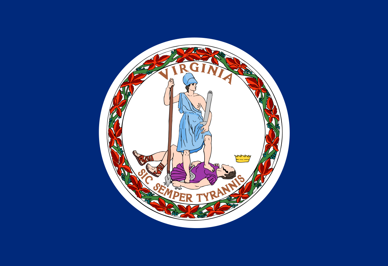
Официальный девиз — «Такова участь тиранов!» (лат. Sic semper tyrannis!).

В честь Виргинии назван астероид (50) Виргиния, открытый в 1857 году.

Dieses Bild, Video oder Audio ist eventuell urheberrechtlich geschützt. Es wird nur für Bildungszwecke genutzt. Wenn Sie es finden, benachrichtigen Sie uns bitte per und wir werden es sofort entfernen.
弗吉尼亚联邦大学
 
 
http://www.net4info.de/photos/cpg/albums/userpics/10002/Virginia_Commonwealth_University.jpg


Dieses Bild, Video oder Audio ist eventuell urheberrechtlich geschützt. Es wird nur für Bildungszwecke genutzt. Wenn Sie es finden, benachrichtigen Sie uns bitte per und wir werden es sofort entfernen.
弗吉尼亚国际赛道
http://www.net4info.de/photos/cpg/albums/userpics/10002/Virginia_International_Raceway.jpg
Dieses Bild, Video oder Audio ist eventuell urheberrechtlich geschützt. Es wird nur für Bildungszwecke genutzt. Wenn Sie es finden, benachrichtigen Sie uns bitte per und wir werden es sofort entfernen.
弗吉尼亚国际军乐节
Das Virginia International Tattoo ist eine militärische Tätowierung, die 1997 ins Leben gerufen wurde und das Markenzeichen des Virginia Arts Festival ist. Das jährlich in Norfolk, Virginia, stattfindende Tattoo ist eine Ausstellung von Militärkapellen, Massed Pipes and Drums, militärischen Exerziergruppen, keltischen Tänzern und Chören. Es wird in Zusammenarbeit mit der NATO und dem Norfolk NATO Festival veranstaltet.
Dieses Bild, Video oder Audio ist eventuell urheberrechtlich geschützt. Es wird nur für Bildungszwecke genutzt. Wenn Sie es finden, benachrichtigen Sie uns bitte per und wir werden es sofort entfernen.
维吉尼亚军事学院
 
 
http://www.net4info.de/photos/cpg/albums/userpics/10002/Virginia_Military_Institute.jpg
Dieses Bild, Video oder Audio ist eventuell urheberrechtlich geschützt. Es wird nur für Bildungszwecke genutzt. Wenn Sie es finden, benachrichtigen Sie uns bitte per und wir werden es sofort entfernen.