
漢德百科全書 | 汉德百科全书
 International cities


Johannesburg, auch iGoli/eGoli (isiZulu für ‚Ort des Goldes‘) oder iRhawutini (isiXhosa), umgangssprachlich oft Joburg oder Jozi, ist die Hauptstadt der Provinz Gauteng in Südafrika.
Mit 957.441 Einwohnern (Volkszählung 2011) ist Johannesburg die größte Stadt und der gesamte Großraum City of Johannesburg Metropolitan Municipality mit etwa 4,43 Millionen Einwohnern die größte Metropolregion im südlichen Afrika. Hauptstadt Südafrikas ist allerdings das rund 50 Kilometer nördlich gelegene Pretoria. Bürgermeister der Stadt ist seit 2016 Herman Mashaba (Democratic Alliance).
约翰内斯堡(南非语、英语:Johannesburg;科萨语:eGoli;祖鲁语:iGoli),简称约堡(英语:Jo'burg)[1],是南非最大的城市与经济、文化中心,同时也是为世界上最大的50个城市之一[6]。约翰内斯堡为豪登省首府和最大城市,也是该省最富裕的地区[7]。虽然约翰内斯堡不是南非三个首都城市之一,但它是宪法法院的所在地。这城市位于富含矿物的维瓦特斯兰山脉中,是世界上最大规模黄金和钻石贸易的中心。
这座大都市是全球化与世界城市研究网络列出的全球城市之一。2011年,约翰内斯堡市的人口为4,434,827,成为南非人口最多的城市[8]。同年,大约翰内斯堡都会区人口为7,860,781[9]。但都会区的面积达1,645平方公里(635平方英里),较其他主要城市大,所以人口密度为较适中的2,364/平方公里(6,120平方英里)。
这城市成立于1886年,当时在农场发现了黄金。由于威特沃特斯兰德发现了极大规模的金矿,这座城市通常被形容为现代的黄金国[10]。该名称源于参与建立城市的三名男子中的一人或全部。在十年来,人口增长达到10万。
从20世纪70年代末到1994年,索韦托是一个独立的城市,现在则为约翰内斯堡的一部分。索韦托最初是“South-Western Townships”的首字母缩写,其起源于约翰内斯堡郊区的一系列定居点,主要由来自黄金采矿业的非洲本地工人居住。索韦托虽然最终被并入约翰内斯堡,但已经被分开作为黑人的住宅区,他们不被允许居住在约翰内斯堡。兰萨尼亚主要由讲英语的印度裔南非人居住。根据南非白人政府的种族隔离政策,这些地区被指定为非白人地区。
ヨハネスブルグ(Johannesburg、アフリカーンス語: [juˈɦɑnəsbœrx, juɦɑnəsˈbœrx]、英語: [dʒoʊˈhænɪsbɜrɡ]、南アフリカ英語: [ʤəˈhænəsbøːg]、ズールー語: IGoli)[1]は、南アフリカ共和国ハウテン州にある都市(都市圏)、同州の州都である。同国最大の都市であり、人口は2011年で約443万人[2]。2011年の近郊を含む都市圏人口は755万人であり、同国第1位、アフリカでは第4位である[3]。
アフリカを代表する世界都市の一つであり、アメリカのシンクタンクが2017年に発表した総合的な世界都市ランキングにおいて、世界53位の都市と評価された[4]。アフリカの都市では首位である。また、2016年に発表された「世界の都市総合力ランキング」では、世界42位と評価された[5]。都市のGDPは1100億ドルで、南部アフリカ第1位である[6]。アフリカ最大の証券取引所であるJSEの所在地でもあり、アフリカ最高の金融センターと評価されている[7]。ヨハネスバーグとも表記される[8]。
Johannesburg (/dʒoʊˈhænɪsbɜːrɡ/; Afrikaans: [jʊəˈɦanəsbœrχ]; also known as Jozi, Jo'burg, and eGoli)[1] is the largest city in South Africa and one of the 50 largest urban areas in the world.[10] It is the provincial capital and largest city of Gauteng, which is the wealthiest province in South Africa.[11] While Johannesburg is not one of South Africa's three capital cities, it is the seat of the Constitutional Court. The city is located in the mineral-rich Witwatersrand range of hills and is the centre of large-scale gold and diamond trade.
The metropolis is an alpha global city as listed by the Globalization and World Cities Research Network. In 2011, the population of the city of Johannesburg was 4,434,827, making it the most populous city in South Africa.[12] In the same year, the population of Johannesburg's urban agglomeration was put at 7,860,781.[5] The land area of the municipal city (1,645 km2 (635 sq mi)) is large in comparison with those of other major cities, resulting in a moderate population density of 2,364/km2 (6,120/sq mi).
The city was established in 1886 following the discovery of gold on what had been a farm. The city is commonly interpreted as the modern day El Dorado[by whom?] due to the extremely large gold deposit found along the Witwatersrand.[13] In ten years, the population grew to 100,000 inhabitants.
A separate city from the late 1970s until 1994, Soweto is now part of Johannesburg. Originally an acronym for "South-Western Townships", Soweto originated as a collection of settlements on the outskirts of Johannesburg, populated mostly by native African workers from the gold mining industry. Soweto, although eventually incorporated into Johannesburg, had been separated as a residential area for Blacks, who were not permitted to live in Johannesburg proper. Lenasia is predominantly populated by English-speaking South Africans of Indian descent. These areas were designated as non-white areas in accordance with the segregationist policies of the South African government known as Apartheid.
Johannesbourg (Johannesburg en afrikaans et en anglais) est une métropole d'Afrique du Sud, fondée en 1886 au Transvaal. Elle est l'actuelle capitale de la province de Gauteng, la plus riche du pays. L'agglomération de Johannesbourg-Pretoria se classe parmi les trente plus grandes régions métropolitaines du monde, avec plus de 12 millions d'habitants, et est l'une des six villes mondiales d'Afrique.
Située sur le gisement aurifère du Witwatersrand, Johannesbourg est considérée comme la capitale économique du pays ; elle abrite ainsi la bourse d'Afrique du Sud. La ville est également hôte de la Cour Constitutionnelle, qui y a son siège dans le quartier de Braamfontein.
Elle accueille environ, en 2000, 710 000 habitants (4 434 827 habitants dans la municipalité1), ce qui en fait, de loin, la ville la plus peuplée du pays. Avec son agglomération, elle est la troisième ville la plus peuplée d'Afrique. La ville a été hôte du Sommet de la Terre 2002, le second sommet de la Terre dit « sommet de Johannesbourg » pour les associations et ONG qui y tenaient un sommet parallèle à celui des États, dix ans après le « sommet de Rio » de 1990.
Johannesburg è una città del Sudafrica, capoluogo della provincia di Gauteng.
È la città più popolosa del Sudafrica e la terza più popolosa dell'Africa subsahariana dopo Lagos (Nigeria) e Kinshasa (Repubblica Democratica del Congo). Viene anche informalmente chiamata Joburg, Jozi e eGoli; quest'ultimo nome, che significa "luogo d'oro" in zulu, può essere riferita all'attività mineraria nella zona o alla ricchezza economica della città. Johannesburg non è la capitale del Sudafrica; le capitali dello stato sono tre: Pretoria (amministrativa), Città del Capo (legislativa) e Bloemfontein (giudiziaria).
Johannesburgo (en afrikáans e inglés: Johannesburg, en zulú: Igoli, 'lugar de oro'2) es la ciudad más grande y poblada de Sudáfrica. Es la capital de la provincia de Gauteng, la más rica de dicho país y la cuarta economía más grande del África austral. Coloquialmente los sudafricanos le llaman Joburg, Jozi,3 o JHB. Así mismo es considerada el principal centro económico y financiero del país.
Esta ciudad es una de las 40 áreas metropolitanas más grandes del mundo4 y una de las únicas tres de África oficialmente denominadas "ciudad global" (clasificada como una ciudad de clase mundial); las otras dos son El Cairo y Ciudad del Cabo.5
Erróneamente, se le confunde con la capital de Sudáfrica (este país posee tres ciudades capitales oficiales, de las cuales Johannesburgo no forma parte). Sin embargo, allí se ubica la Corte Constitucional, la corte de mayor rango de todo Sudáfrica.
En Johannesburgo existe comercio a gran escala de oro y diamantes, debido a su ubicación privilegiada en el área de las colinas de Witwatersrand muy ricas en minerales.
Johannesburgo recibe visitantes por medio del Aeropuerto Internacional O.R. Tambo, el más grande y con mayor circulación en África y puerta aérea al resto del sur de África.
Es una de las pocas grandes ciudades del mundo que ni están en la costa, ni poseen un río importante o canal que la comunique con el mar (como Madrid o Berlín). Los cambios en las fronteras municipales llevadas al efecto en el año 2000, han hecho que la población alcanzara los 3 millones (5.61 millones en 2013).
La población del área metropolitana (que incluye los otros municipios del Gauteng excepto Pretoria) se estima actualmente en unos 9 millones de habitantes.
Eso la convierte en la tercera ciudad más poblada de África tras El Cairo y Lagos.
Johannesburgo es una ciudad con un contraste muy fuerte entre la minoría de blanca (17%) que vive con parámetros de país desarrollado y una población de negra (73%) con unos niveles de vida tercermundistas.
La ciudad se halla en la línea divisoria de aguas entre los océanos Atlántico e Índico.
Йоха́ннесбург (англ. Johannesburg [dʒoʊˈhænɪsbɜrɡ], африк. Johannesburg [joˈhɑnəsbʏrx], зулу iGoli, коса iRhawutini) — самый крупный по численности жителей город в ЮАР. Местные жители называют его «Йобург», «Йози» и «Еголи». Йоханнесбург — центр провинции Гаутенг, самой богатой провинции в ЮАР. В 2010 году в Йоханнесбурге проводились матчи Чемпионата Мира по футболу.
Население муниципалитета на конец 2011 года составляло 4 434 827 жителей[4], а всей агломерации — 7 860 781 человек. Однако если считать с окрестностями метрополии, население превышает восемь миллионов жителей.
Территория, подчинённая городу, достаточно большая. К Йоханнесбургу на юго-западе непосредственно примыкает город Соуэто, в котором сосредоточено большое количество мигрантов и сезонных рабочих.
В 2000 году из города Йоханнесбург и окружающих его территорий была сформирована новая административная единица — городской округ Йоханнесбург.
В Йоханнесбурге расположен Конституционный Суд ЮАР.
В 2002 году в городе состоялась встреча на высшем уровне по вопросам устойчивого развития. Йоханнесбург — центр широкомасштабной торговли золотом и алмазами, которые добывают в окрестных горах.
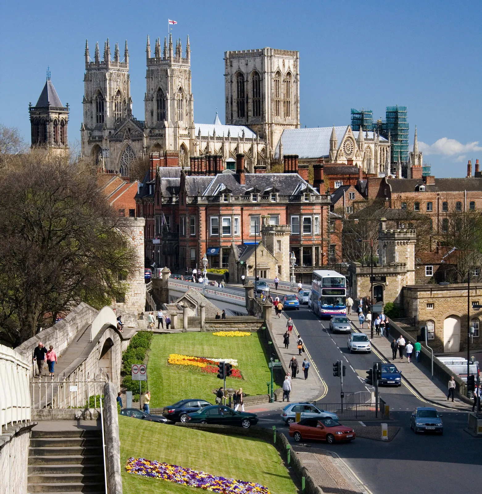
York ist eine Stadt im Norden von England am River Ouse nahe der Mündung des River Foss. York war bereits in der Römerzeit ein bedeutendes Zentrum und später die Residenzstadt der Grafschaft Yorkshire. Heute ist die City of York eine selbständige Verwaltungseinheit (Unitary Authority), die nur zu zeremoniellen Anlässen zur Grafschaft North Yorkshire gehört.
约克(英语:York,当地 ![]() i/ˈjɔːrk/),位于英国英格兰约克郡-亨伯区域北约克郡,英格兰的城市、单一管理区,位于乌斯河畔、利兹东北偏东,起初为盖尔人的居点,后为罗马人、盎格鲁人、丹麦人和诺曼人占领。中世纪该城是繁荣的羊毛市场和教育中心,其大主教地位仅次于坎特伯雷大主教。
i/ˈjɔːrk/),位于英国英格兰约克郡-亨伯区域北约克郡,英格兰的城市、单一管理区,位于乌斯河畔、利兹东北偏东,起初为盖尔人的居点,后为罗马人、盎格鲁人、丹麦人和诺曼人占领。中世纪该城是繁荣的羊毛市场和教育中心,其大主教地位仅次于坎特伯雷大主教。

Sapporo (jap. 札幌市, -shi, aus Ainu sat poro (pet), dt. „trockener, großer (Fluss)“[1]) ist mit 1,9 Millionen Einwohnern die größte Stadt von Hokkaidō, der nördlichsten der vier japanischen Hauptinseln.
Sapporo ist der Verwaltungssitz der Präfektur Hokkaidō sowie der Unterpräfektur Ishikari.
Sapporo wurde 1869 als Sitz der Kolonialverwaltung Hokkaidōs gegründet, das seit dem 19. Jahrhundert zu Japan gehört. Erst in den 1950er Jahren löste es das nahegelegene und deutlich ältere Otaru als bevölkerungsreichste Stadt Hokkaidōs ab. Die Stadt wurde, ähnlich wie Kyōto oder viele amerikanische Städte, in einem Schachbrettmuster geplant.
Sapporos landwirtschaftliche Universität, die ebenfalls 1869 gegründet wurde und anfangs in Tokio beheimatet war, ist vor allem durch ihren ersten Präsidenten, William Smith Clark, bekannt geworden. Er wurde von der japanischen Regierung als Berater in Erziehungsfragen eingeladen. Vor allem die Abschiedsworte an seine Studenten, von denen er viele zum Christentum bekehrt hatte, haben einen bleibenden Eindruck hinterlassen: Boys, be ambitious! (dt. „Jungs, seid ehrgeizig!“).
In Sapporo fanden die Olympischen Winterspiele 1972 statt, die ersten Olympischen Winterspiele in Asien. Seitdem verbindet eine Städtepartnerschaft Sapporo mit München, dem Austragungsort der Olympischen Sommerspiele desselben Jahres.
札幌市(日语:札幌市/さっぽろし Sapporo shi */?)是位于日本北海道道央地区的都市,为北海道首府、以及石狩振兴局本部所在地,也是政令指定都市之一[1]。其拥有超过190万人口,是北海道最大都市、以及日本人口第五大都市,集中了北海道35%的人口,而札幌都市圈更集中了北海道约半数的人口。虽然地理位置位于北海道西部,但却是北海道铁路、高速公路、航空路线的放射点,因此在交通上也是北海道的中心。
札幌市的历史开始于1869年日本设立开拓使时在此设置札幌本府[1]。札幌的建设计划由时任开拓判官岛义勇提出,他参考京都规划了棋盘状城市,以创成桥东侧为基点,将创成川作为南北轴,渡岛通(现南1条通)作为东西轴[2][3]。而大通公园则是现在札幌市的东西主干线[4]。1972年,札幌市举办了亚洲首届冬季奥运会[5]。此后札幌市举办了多种国际体育赛事。札幌市还是日本著名的观光都市,并且在日本的魅力城市排行榜中亦排名前列[6]。2013年,札幌市加入了联合国教科文组织全球创意城市网络中的媒体艺术城市,是世界第二个和亚洲首个加盟城市[7][8]。
札幌市的市徽外观是一个六角形,代表冰晶(雪花)的形状,是北海道的象征。在六角型内侧的圆形其实是汉字“札”字的变体,而整个圆形又可视为是日文片假名“ロ”字的变形,是札幌的日语片假名写法“サッポロ”中的一部分。市徽中央的五芒星代表北斗星,是北方的象征。并且五芒星的形状又与日文片假名字母“ホ”近似,是日语中“北方”或“北海道”的拼音字首[1]。
札幌市(さっぽろし)は、北海道の政令指定都市。道庁所在地および石狩振興局所在地。
日本最北の政令指定都市であり、全国の市の中では横浜市、大阪市、名古屋市に次ぐ4番目の人口を有しており、北海道全体の人口の約3割強(約36%)を占めている。北海道のプライメイトシティであり、札幌都市圏を形成している。アイヌの人々が暮らしていた蝦夷地は1869年(明治2年)に北海道と改称され開拓使が置かれて札幌本府の建設が始まった[1]。1875年(明治8年)に最初の屯田兵が入植。札幌の建設計画は当時の開拓判官島義勇によって構想され、京都を参考にした街づくりは創成橋東側のたもとを基点に東西の基軸を創成川、南北の基軸を渡島通(現在の南1条通)として区画割を進めていった[2][3][4](現在の南北の基軸は大通公園となっている[5])。その後、周辺町村を編入・合併して市域を拡大していった。
1972年(昭和47年)にはアジア初となる冬季オリンピック(札幌オリンピック)を開催[6]。その後も国際スキー連盟の各種国際大会やアジア冬季競技大会、国際大学スポーツ連盟主催の冬季ユニバーシアード競技大会、FIFAワールドカップ、FIBAバスケットボール・ワールドカップ、世界ラリー選手権など数多くの国際大会が開催されている。札幌市としても各種イベントや展示会、企業の会議や報奨旅行などの誘致・開催 (MICE) への積極的な取り組みを行っており[7]、「国際会議観光都市」に認定されている。毎年1,300万人前後の観光客が訪れる観光都市となっており[8]、市町村の魅力度ランキング調査でも毎年上位にランクインしている都市である[9]。2013年(平成25年)にはユネスコ(国際連合教育科学文化機関)により創設された創造都市ネットワークの「メディアアーツ都市」分野に世界で2都市目に(アジアでは初めて)認定された[10][11]。2026年冬季オリンピック開催地に立候補することを表明して誘致活動を行っていたが[12][13]、立候補および誘致活動を2030年大会に変更する意向を示した。
Sapporo (札幌市 Sapporo-shi) is the fifth largest city of Japan by population, and the largest city on the northern Japanese island of Hokkaido. It is the capital city of Hokkaido Prefecture and Ishikari Subprefecture. It is an ordinance-designated city.
Sapporo hosted the 1972 Winter Olympics (the first ever held in Asia). Its annual Sapporo Snow Festival draws more than 2 million tourists from abroad.[2]
Sapporo (札幌市, Sapporo-shi) est la cinquième ville japonaise en nombre d'habitants et la troisième en superficie. Située dans l'île de Hokkaidō, dont elle est la capitale régionale, elle est traversée par la rivière Toyohira.
Sapporo (札幌市 Sapporo-shi?, ) è una città giapponese di circa 1 910 000 abitanti, capoluogo della prefettura di Hokkaidō e quinta città per grandezza del Giappone. Fa parte della sottoprefettura di Ishikari, situata nella zona sud-occidentale dell'isola di Hokkaidō.
Sapporo è nota fuori dal Giappone per aver ospitato le Olimpiadi Invernali del 1972, le prime tenutesi in Asia, e per il famoso Festival della neve che attira oltre 2 milioni di turisti da tutto il mondo. La città è anche conosciuta per le birrerie Sapporo, che prendono il nome dalla città stessa, e dai biscotti Shiroi Koibito, il classico souvenir acquistato da chi visita la città.
Sapporo (en japonés: 札幌市; Sapporo-shi) (![]() escuchar) es una ciudad de Japón, situada en la parte suroeste interior de la isla de Hokkaidō. Es la capital de la prefectura homónima y su población supera los 1,9 millones de habitantes, lo que la convierte en la quinta localidad más grande del país. El área total del territorio es de 1121 km².
escuchar) es una ciudad de Japón, situada en la parte suroeste interior de la isla de Hokkaidō. Es la capital de la prefectura homónima y su población supera los 1,9 millones de habitantes, lo que la convierte en la quinta localidad más grande del país. El área total del territorio es de 1121 km².
Fue fundada en 1869 como capital de la nueva prefectura de Hokkaidō tras la colonización de la isla durante la era Meiji, en sustitución de Hakodate. Al levantarla de cero, las autoridades niponas recurrieron a consejeros occidentales —en su mayoría, estadounidenses— que tuvieron gran influencia sobre la planificación urbana, el establecimiento de industrias, el estilo arquitectónico y los centros educativos. Se encuentra rodeada por cadenas montañosas y, pese a su crecimiento demográfico, ha mantenido numerosas zonas verdes tanto en el núcleo urbano como en las afueras; cuenta con un total de 2.700 parques,3 algunos tan importantes como el Jardín Botánico y el parque nacional Shikotsu-Tōya.
Presenta temperaturas más bajas que el resto de ciudades japonesas debido a su clima continental húmedo, con continuas nevadas en los meses de invierno y tiempo suave durante el verano. Por esta razón, es un destino turístico especializado en deportes invernales. Durante el siglo XX han surgido eventos que le han dotado de fama internacional, siendo el más importante de ellos el Festival de la nieve de Sapporo que se celebra cada mes de febrero. Dispone de una red desarrollada de transporte por carretera y ferrocarril, con un aeropuerto propio para vuelos regionales (Okadama) y otro internacional en las cercanías (Nuevo Aeropuerto de Chitose), que es el tercero mayor de Japón en número de pasajeros.
Cuenta además con una amplia oferta cultural y educativa. La Universidad de Hokkaidō, fundada por William S. Clark en 1876 como Escuela de Agricultura y reconvertida en 1918 en la actual institución, es una de las siete universidades nacionales de Japón. Tiene un total de 11.600 alumnos de grado y 6.300 de posgrado.4
Sapporo ha organizado los XI Juegos Olímpicos de Invierno de 1972. Además fue una de las sedes de la Copa Mundial de Fútbol de 2002.
Са́ппоро (яп. 札幌市 Саппоро-си, слушать ) — пятый по величине город Японии, важнейший экономический, промышленный, образовательный и культурный центр Хоккайдо, город государственного значения Японии, административный центр губернаторства Хоккайдо. Площадь города составляет 1121,12 км²[2], население — 1 933 787 человек (30 июня 2014)[3], плотность населения — 1724,87 чел./км². В городе расположен университет Хоккайдо.
Саппоро — столица Зимних Олимпийских игр 1972 года и трёх Зимних Азиатских игр 1986, 1990 и 2017 годов. Саппоро — курортное место, в его окрестностях имеется множество горячих источников. Здесь ежегодно проводится Снежный фестиваль, который привлекает более 2 миллионов туристов со всего мира.
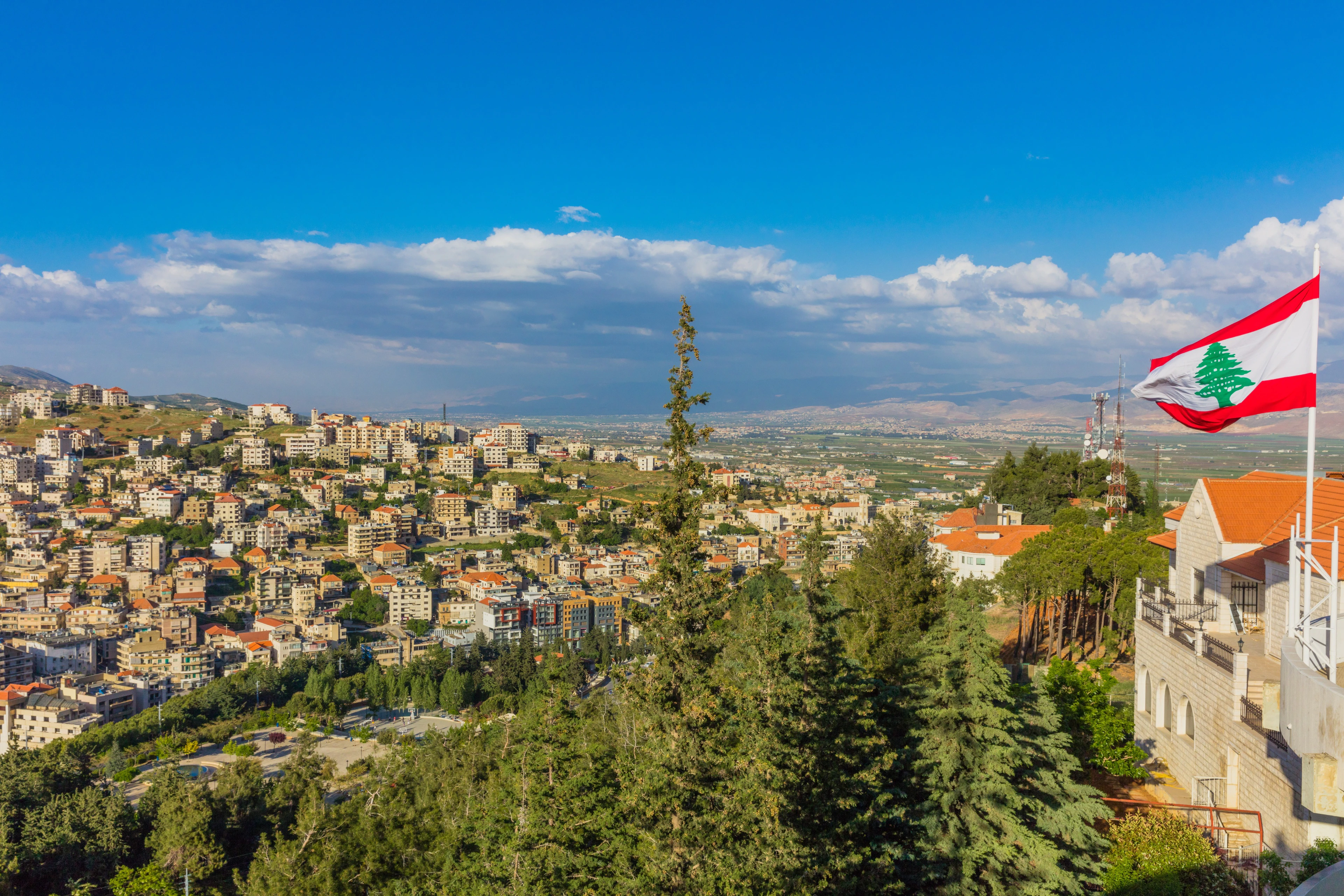
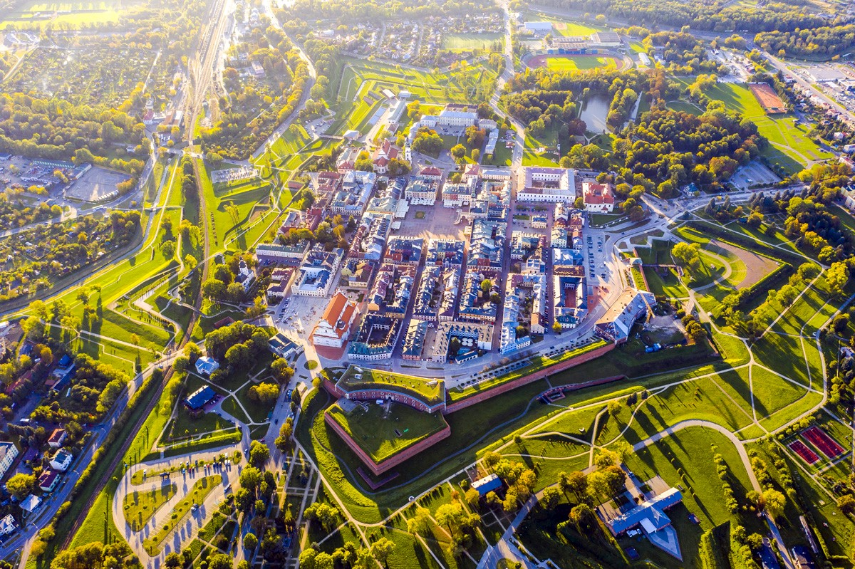

Zamość [ˈzamɔɕt͡ɕ] ist eine Stadt in der Woiwodschaft Lublin im südöstlichen Teil Polens. Sie liegt rund 240 km südöstlich der Hauptstadt Warschau und 110 km nordwestlich von Lemberg (Ukraine) in der Landschaft Roztocze.
Die kreisfreie Stadt ist Sitz des Landkreises Zamość, der eigenständigen Landgemeinde Zamość und war Hauptstadt der gleichnamigen Woiwodschaft.
Die Stadt wurde ab 1578 unter der Leitung des venezianischen Baumeisters Bernardo Morando als Idealstadt erbaut, was ihr den Namen Padua des Nordens einbrachte. Die Altstadt gehört seit 1992 zum Weltkulturerbe der UNESCO.
扎莫希奇(波兰语:Zamość)是波兰东南部一座城市,属于卢布林省管辖。其古城为波兰贵族扬·扎莫厄斯基在16世纪建造。由意大利建筑师贝尔南多·莫兰多设计。至今古城还保留着最初的规划,建筑上结合了传统的意大利和中欧的风格。1992年,扎莫希奇古城被联合国教科文组织列入世界遗产名录。

 *Yellow river
 China
China
 Chinese Super League 2019
 Henan Sheng-HA
 Shanghai Cooperation Organization

 Vacation and Travel
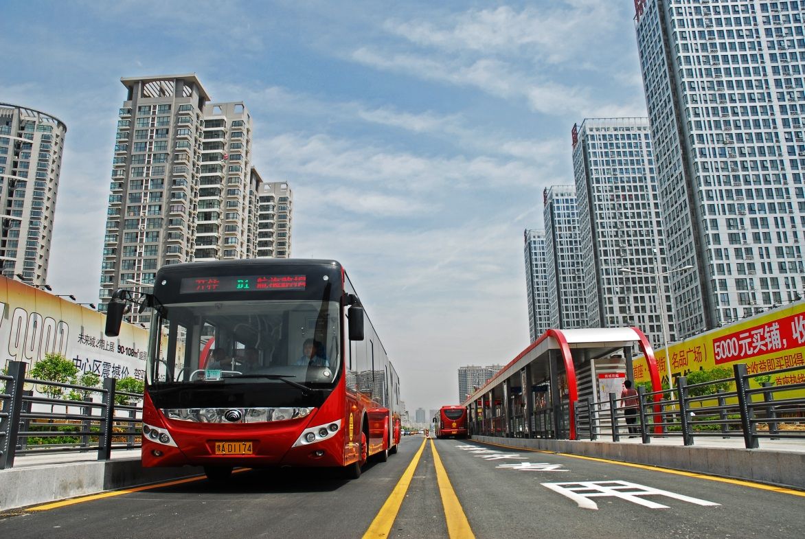
Zhengzhou Einführung
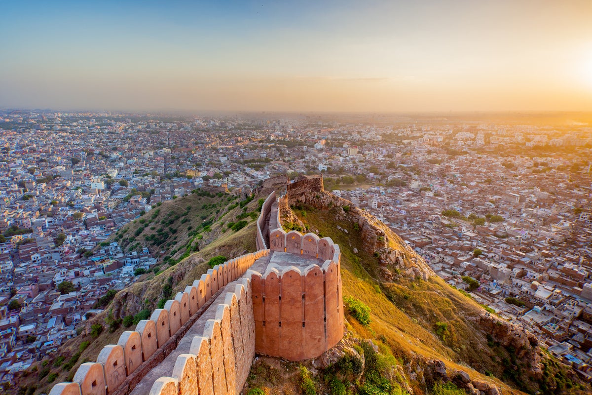
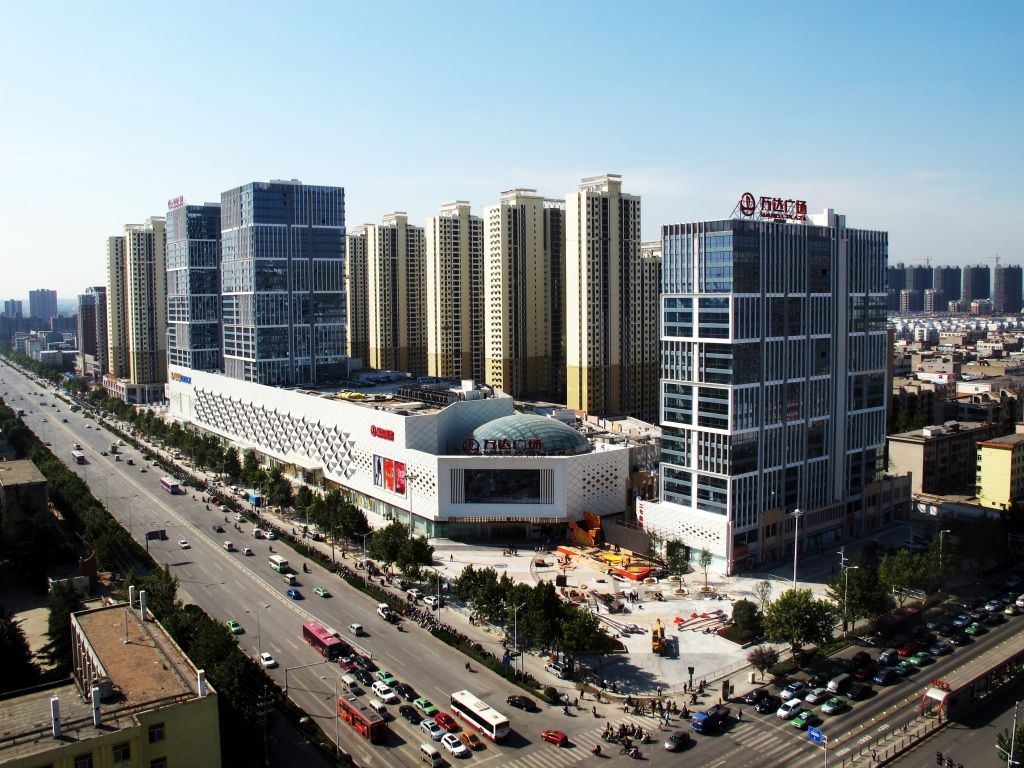
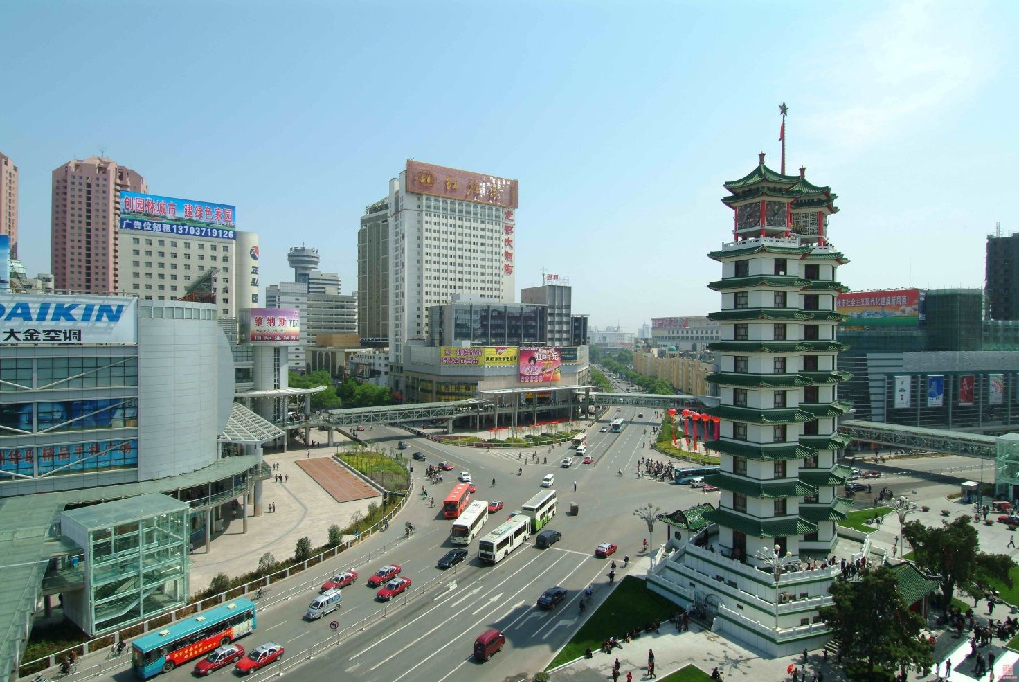
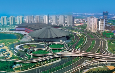
Zhengzhou ist die Hauptstadt der Provinz Henan und liegt in der Mitte Chinas. Die Entfernung nach Süd Beijings beträgt in etwa 760 km und 480 Kilometer Richtung Osten nach Xi´ans. Sie befindet sich nördlich des Zentrums der Provinz und im Süden des gelben Flusses. Zhengzhou grenzt an Luoyang zum Westen hin, Jiaozuo zum Nordwesten, Xinxiang zum Nordosten, Kaifeng zum Osten, Xuchang zum Südosten, und Pingdingshan zum Südwesten.Die alte Stadt war das Kapital der Shang Dynastie im 11. bis 16. Jahrhundert v. Chr., also vor 3,500 Jahren. Zu dieser Zeit wurde die Herstellung von Porzellan und die Technik der Bronzeverhüttung in China entwickelt. Ein grüner keramischer in Zhengzhou ausgegrabener Politur-Topf ist gezeigt worden, das wohl das älteste Porzellan in China ist. Eine lange Geschichte hat Zhengzhou, mit vielen kulturellen und historischen Ereignissen. Am Fuß von Mt Song liegt der Tempel der Shaolin. Er ist die Wiege des Shaolin Kung Fu. Wenn Sie sich für den chinesischen Kung Fu, den Tempel und die Aufführung interessieren, müssen Sie hierher kommen.(Quelle:http://www.chinarundreisen.com/zhengzhou/zhengzhou-reisefuehrer.htm)
Zhengzhou (chinesisch 鄭州市 / 郑州市, Pinyin Zhèngzhōu Shì, W.-G. Chengchow Shih, veraltet nach Stange Tschengtschau Schi, Abk.: 鄭 / 郑 Pinyin Zhèng) ist die Hauptstadt der Provinz Henan in der Volksrepublik China. Zhengzhou ist eine bezirksfreie Stadt mit einem Verwaltungsgebiet von 7.507 km² und 8.626.505 Einwohnern (Stand: 1. Januar 2010). Die engere Kernstadt beherbergt auf ihren rund 500 km² etwa 3,5 Millionen Einwohner. Ihr Zentrum liegt ca. 20 Kilometer südlich des Gelben Flusses (Huáng Hé). Zhengzhou ist eine bedeutende Industriestadt (Baumwoll-, Glas-, Aluminiumindustrie, Maschinenbau), sie ist ein überregionaler Verkehrsknotenpunkt (Eisenbahn, Flughafen), ein Handels-, Finanz- und Informationszentrum, eine Messestadt und kultureller Mittelpunkt mit einem großen Einzugsgebiet.
郑州市是中国河南省的省会,中国八大古都之一,国家历史文化名城,中国国家中心城市[1][2]和国家重要的综合交通枢纽。[3]郑州位于河南省中部偏北,黄河下游。现辖6个市辖区、5个县级市、1个县,全市总面积7,567.18平方公里,其中市区面积1,078.07平方公里,2012年市区建成区面积373平方公里。2015年,全市常住人口956.9万,其中市区常住人口470.08万。居民以汉族为主,母语为中原官话的郑州方言。[4]
郑州曾是包括出生于新郑[註 2]的中华人文始祖轩辕氏[註 3]所领的有熊国[註 4]以及夏朝、商朝、管国、郑国和韩国在内的这些部落联盟或国家部分时期建政或建都所在地,因此被列为中国八大古都之一。[5]从商代亳都算起,郑州已经有3600多年的城建史。考古人员于1995年在郑州北郊邙岭余脉发现的西山古城遗址又把郑州地区城市出现时间提前到距今约5300年的仰韶文化晚期,被视为中国城市文明的源头。[6]清末,朝廷大臣盛宣怀奉旨勘察芦汉铁路时来到郑州,将郑州站辟为甲等火车站,直接影响了郑州近代发展进程。[7]
郑州古代为“豫州”和“中州”的一部分,自古至今均为交通要塞,有“九州之中,十省通衢”之称,[8]如今郑州北站仍是中国最大的铁路编组站之一。[9]因商朝早期的都城在如今的郑州境内,[10]郑州有“商都”的雅号。[11]同时,郑州被认为是中国商业的发源地之一,[12]又是中国国务院确立的商贸中心试点城市之一,[13]因此“商都”也具有了“商业之都”的含义。郑州以打造都市区,建设国家中心城市为目标,远景規劃到2020年,市区总人口达到1500万以上,建成区面积达到800平方公里。[14]
鄭州市(ていしゅうし、中文表記: 郑州市、英文表記: Zhengzhou City)は、中華人民共和国河南省に位置する地級市。河南省の省都である。中国の中原地区第一大都市である。京津冀首都圏と珠江デルタを結ぶ南北陸上交通路と、黄海北部の港湾と中国西北部を結ぶ東西陸上交通路が交わる交通結節点となっており、中国における道路・鉄道の重要拠点のひとつである。殷の時代より3,500年の歴史をもつ国家歴史文化名城である。商の時代中国の首都であった、中国八大古都(北京、南京、杭州、西安、洛陽、開封、安陽、鄭州)である。
Zhengzhou is the capital of Henan Province in the central part of the People's Republic of China.[2] It is one of the National Central Cities in China,[3] and serves as the political, economic, technological, and educational center of the province, as well as a major transportation hub in China (highway, railway, aviation, communication).[4] The Zhengzhou metropolitan area (including Zhengzhou and Kaifeng) is the core area of the Central Plains Economic Zone.[5][6]
Zhengzhou is a National Civilized City, State-list Famous Historical and Culture City, one of the Eight Ancient Capital Cities and one of the birthplaces of Chinese Civilization,[7] and the birthplace of the Yellow Emperor. Historically, Zhengzhou was the capital of China for a thousand years (five times).[8] Currently, there are two World Cultural Heritage Sites (including 15 places) in Zhengzhou.[9] The Chinese Zhengzhou Commodity Exchange (CZCE) is China's first futures exchange,[10] Zhengzhou Airport Economy Zone is China's first Airport Economy Zone.[11]
The city lies on the southern bank of the Yellow River, and is one of the Eight Great Ancient Capitals of China.[12] As a center of China's national transportation network, there are railways connecting Zhengzhou and Europe,[13] and a bustling international airport[14] (Asia, Europe, Africa, America, Oceania).[15]
Zhengzhou has a population of 9,378,000 inhabitants,[16] GDP 913 billion in 2017.[17] The city is one of the main built-up areas of Henan region.[18] Greater Zhengzhou was named as one of the 13 emerging mega-cities in China in a July 2012 report by the Economist Intelligence Unit,[19] and officially named as the eighth National Central City in 2017 by the central government in Beijing.[20]
In 2011, a Journeyman documentary showcased the developments of the new district of Zhengzhou as a ghost city. However, by 2017, the buildings were found to be occupied in a thriving community.[21]
Zhengzhou (郑州 ; pinyin : Zhèngzhōu ; prononciation : [jŭng-jō] ; ancienne transcription française : Tcheng-Tchéou) est la capitale de la province chinoise du Henan, elle est une des « Huit grandes anciennes capitales de la Chine ». Elle possède le statut de ville-préfecture.
Zhengzhou (in cinese: 鄭州, in pinyin Zhèngzhōu) è una città della Cina, capitale della provincia di Henan. Precedentemente era conosciuta con il nome di Zhengxian. La sua prefettura si estende su una superficie di 7.446,2 km² e possiede una popolazione (2006) di 7.243.000 abitanti.
L'area urbana della città invece si estende su una superficie di 1.010,3 km² e possiede una popolazione di 4.362.000 abitanti con una densità di oltre 4.318 abitanti per km². Si tratta di una città industriale dalle strade che si intersecano perpendicolarmente, con due grandi parchi situati nella zona centrale ed un parco hi-tech nella zona nord. La città si trova a circa 700 km da Pechino e a 1000 da Shanghai, raggiungibili attraverso il sistema di ferrovie (treno ad altissima velocità) di cui ZhengZhou è un nodo importante nella regione.
Recentemente[quando?] è stato costruito un nuovo quartiere residenziale, chiamato "Zhengzhou New District" nella zona sud della città. Tuttavia, a causa degli alti prezzi delle case, è rimasto in buona parte vuoto.
Zhengzhóu (chino tradicional: 鄭州, chino simplificado: 郑州, pinyin: Zhèngzhōu, transcripción antigua: Chengchow) es la ciudad más grande y capital de la provincia de Henan en la República Popular China. Localizada cerca del río Amarillo, la ciudad ocupa un área de 1024 km² y cuenta con una población de 4 253 627 habs.2 Es cabecera del municipio nivel prefectura de Zhengzhóu el cual cuenta con una población de 9,19 millones (2012) en una superficie de 7507 km².
Чжэнчжо́у (кит. трад. 鄭州, упр. 郑州, пиньинь: Zhèngzhōu) — городской округ в провинции Хэнань КНР, место размещения правительства провинции. Название означает «область Чжэн»; так называлась административная единица, существовавшая в этих местах в Средние века.
 FIFA Fussball-Weltmeisterschaft 1994

 Financial
 ***Global Financial Center
 Women's Soccer World Cup 1999

 History
 N 2000 - 2100 AD

 History
 M 1500 - 2000 AD

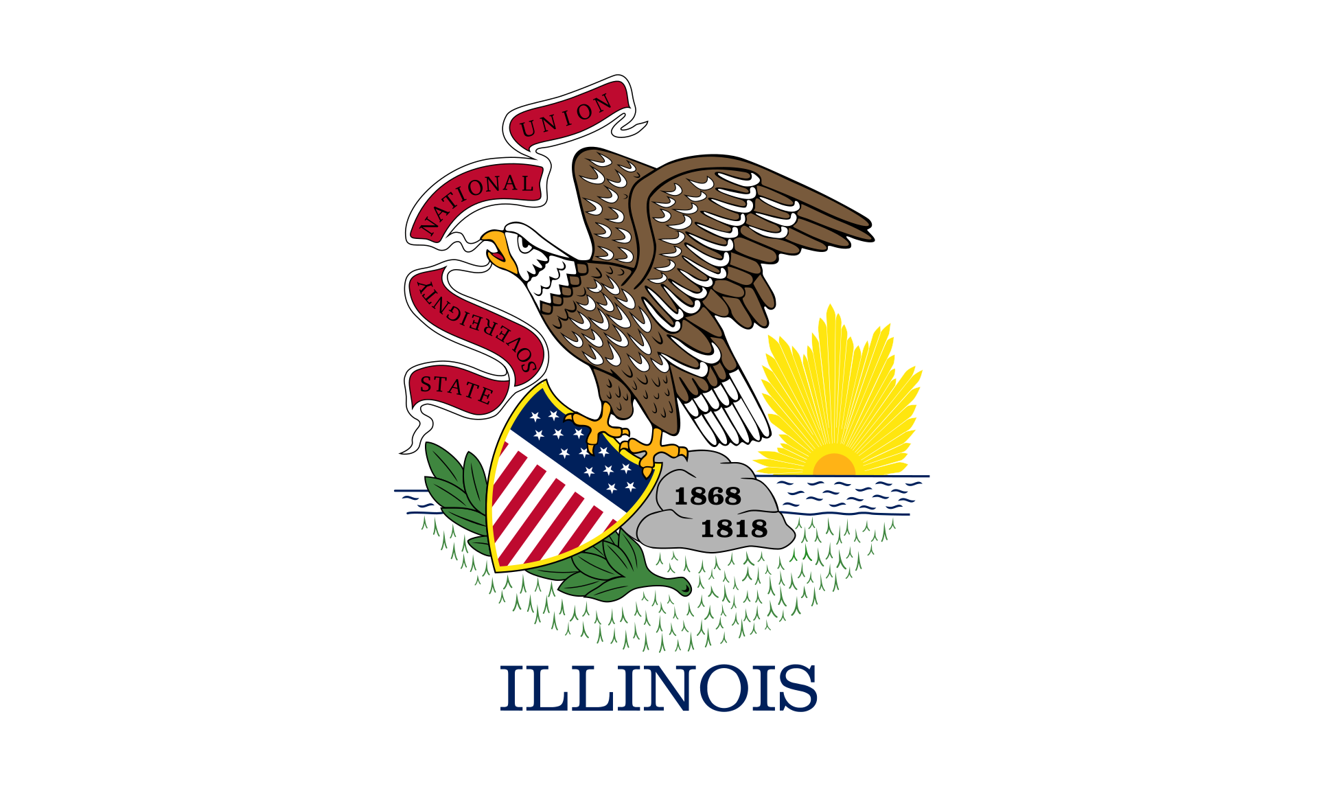 Illinois-IL

 International cities
 ***Global Urban Economic Competitiveness
 ITU World Championship Series

 Sport
Sport
 Triathlon
 United States

Wie die meisten amerikanischen Städte ist Chicago am Reißbrett entworfen worden. Das Schachbrettmuster kann man z.B. von der Aussichtsplattform des Sears-Towers gut erkennen. Die Aussicht von diesem Punkt aus ist atemberaubend. Genießen Sie das Panorama des Lake Michigan und beobachten Sie die Flugzeuge die am Chicago-International-Airport landen.
Chicago (deutsche Schreibweise: Chikago,[1] Aussprache: [ʃɪˈkɑːgoʊ]; ) ist eine Stadt am Südwestufer des Michigansees im Bundesstaat Illinois in den Vereinigten Staaten von Amerika. Mit einer Einwohnerzahl von 2.722.389 (2014)[2] ist sie die drittgrößte Stadt der Vereinigten Staaten. In der Agglomeration leben 8,7 Millionen, in der Metropolregion Chicago 9,7 Millionen Menschen (2007).[3]
Chicago ist seit der Mitte des 19. Jahrhunderts eine wichtige Handelsstadt in den Vereinigten Staaten. Diese Funktion wird durch ihre Eigenschaft als Eisenbahnknotenpunkt und ihre Lage an der Mündung des Illinois Waterways begünstigt. Die Stadt liegt an wichtigen Eisenbahnstrecken, die die Ost- mit der Westküste verbinden und ist über die Großen Seen und den Sankt-Lorenz-Seeweg bzw. den Eriekanal mit dem Atlantik und mit New York City verbunden. Der Illinois Waterway stellt über den Mississippi die Verbindung zum Golf von Mexiko her.
Chicago ist Sitz der Chicago Mercantile Exchange, der größten Warenterminbörse der Vereinigten Staaten, und der Chicago Board of Trade, der größten Rohstoff-, Futures- und Optionsbörse der Vereinigten Staaten. Außerdem befindet sich hier die größte Regionalbörse der Vereinigten Staaten, die Chicago Stock Exchange.
Die Metropolregion von Chicago erbrachte 2016 eine Wirtschaftsleistung von 651,2 Milliarden US-Dollar.[4] Bei einer Studie aus dem Jahr 2014 belegte Chicago Platz 9 unter den wirtschaftsstärksten Metropolregionen weltweit und Platz 3 innerhalb der Vereinigten Staaten.[5]
十七世纪时为法国皮毛商交易地,后归美国。1834年建市。1848年伊利诺伊·密歇根运河开通和铁路相继修建后,发展极速。全国最大的铁路 枢纽,32条干线交会于此。现为全国性的重要农畜产品贸易市场和钢铁冶炼基地。肉类加工、面粉、罐头、冷冻食品加工等发达。此外还有农机制造、机车、货 车、电话机、电视机、收音机、印刷、塑料等。包括卫星城市格里、南芝加哥,为美国第二个重工业地带。多大银行、商业企业,有芝加哥大学(1891年建)与 科学研究机构等。
芝加哥市内保存着早期传统式的西欧古建筑,又有壮观巍峨的现代摩天大楼。市区沿着宽阔壮丽的大道连绵数十公里,规划布局井井有条。现在的城市是 1871年的大火之后重建的,新城各种形状新奇、色彩各异的高层建筑使其成为一建筑艺术博物馆。芝加哥市区内摩天大楼之多,仅次于纽约。
芝加哥市内保存着早期传统式的西欧古建筑,又有壮观巍峨的现代摩天大楼。市区沿着宽阔壮丽的大道连绵数十公里,规划布局井井有条。现在的城市是1871年 的大火之后重建的,新城各种形状新奇、色彩各异的高层建筑使其成为一建筑艺术博物馆。芝加哥市区内摩天大楼之多,仅次于纽约。当今全世界5座最高的摩天大 楼有3座在芝加哥,市中心的西尔斯大厦是美国第一高楼,有110层,高443米。
19世纪开通的伊利诺伊-密歇根运河,把处于内陆的芝加哥同五大湖和大西洋连接起来,变为港口城市。海洋巨轮从加拿大的圣劳伦斯湾直驶芝加哥码 头。芝加哥是美国的铁路枢纽,几十条铁路交汇于此,连接美国各大城市;它还有世界上最繁忙国际机场之一的奥黑尔国际机场;因此,芝加哥可以称得上美国东西 交通、水、陆、空运输的中心。
シカゴ(英: Chicago [ʃɨˈkɑːɡoʊ, ʃɨˈkɔːɡoʊ, tʃɨˈkɑːɡoʊ] (![]() 音声ファイル)))は、アメリカ合衆国イリノイ州にある都市。同州最大の都市であり、国内では、ニューヨーク、ロサンゼルスに次ぐ人口を持つ。
音声ファイル)))は、アメリカ合衆国イリノイ州にある都市。同州最大の都市であり、国内では、ニューヨーク、ロサンゼルスに次ぐ人口を持つ。
シカゴはクック郡内にあり、同郡の郡庁所在地である。同郡には他にアーリントンハイツなどが含まれる。2012年の人口は271万人。
19世紀後半から20世紀中盤まで、アメリカ国内における鉄道・航空・海運の拠点として、また五大湖工業地帯の中心として発展し、ニューヨークに次ぐアメリカ第2の都市となっていた歴史を持つ。摩天楼がそびえ立つアメリカ型都市の発祥とされ、ダウンタウンの高層建築は、シカゴ派として知られ、近代建築史における重要局面をなした。1973年に建てられたシアーズ・タワー(現在はウィリス・タワーに改称)は、1998年まで世界一の高層建築であった。マコーミック・プレイスコンプレックスは、北米最大のコンベンション・センターであり、オヘア空港は全米有数の過密な空港として知られる。
アメリカのシンクタンクが2017年に発表した総合的な世界都市ランキングにおいて、世界12位の都市と評価された[1]。アメリカの都市ではニューヨーク、ロサンゼルスに次ぐ3位である。2017年3月の調査によると、世界7位の金融センターである[2]。2014年の都市の経済規模(GDP)では、世界9位となっている[3]。
日本語の漢字表記は「市俄古」。また、シカゴに住む人々は「Chicagoans(シカゴアンズ)」と呼ばれている[4]。
Chicago (/ʃɪˈkɑːɡoʊ/ (![]() listen), locally also /-ˈkɔː-/), officially the City of Chicago, located on the shores of freshwater Lake Michigan, is the third most populous city in America after New York and Los Angeles. As of the 2017 census-estimate, Chicago has a population of 2,716,450, which makes it the most populous city in both the state of Illinois and the Midwestern United States. It is the county seat of Cook County, the second most populous county in the U.S. Chicago is the principal city of the Chicago metropolitan area, which is often referred to as "Chicagoland." The Chicago metropolitan area has nearly 10 million people, is the third-largest in the United States, the fourth largest in North America, and the third largest metropolitan area in the world by land area. Chicago is the birthplace of the skyscraper, and considered the most influential architectural city of the 20th century.[6] In finance, the city saw the creation of the first standardized futures contracts at the Chicago Board of Trade; which today is the largest and most diverse derivatives market in the world, generating 20% of all volume in commodities and financial futures.[7]
listen), locally also /-ˈkɔː-/), officially the City of Chicago, located on the shores of freshwater Lake Michigan, is the third most populous city in America after New York and Los Angeles. As of the 2017 census-estimate, Chicago has a population of 2,716,450, which makes it the most populous city in both the state of Illinois and the Midwestern United States. It is the county seat of Cook County, the second most populous county in the U.S. Chicago is the principal city of the Chicago metropolitan area, which is often referred to as "Chicagoland." The Chicago metropolitan area has nearly 10 million people, is the third-largest in the United States, the fourth largest in North America, and the third largest metropolitan area in the world by land area. Chicago is the birthplace of the skyscraper, and considered the most influential architectural city of the 20th century.[6] In finance, the city saw the creation of the first standardized futures contracts at the Chicago Board of Trade; which today is the largest and most diverse derivatives market in the world, generating 20% of all volume in commodities and financial futures.[7]
Chicago was incorporated as a city in 1837 near a portage between the Great Lakes and the Mississippi River watershed and grew rapidly in the mid-nineteenth century.[8] After the Great Chicago Fire of 1871, which destroyed several square miles and left more than 100,000 homeless, the city made a concerted effort to rebuild.[9] The construction boom accelerated population growth throughout the following decades, and by 1900 Chicago was one of the five largest cities in the world.[10] During this period, Chicago made noted contributions to urban planning and zoning standards, which included creating new construction styles (including the Chicago School of architecture), the development of the City Beautiful Movement, and the steel-framed skyscraper.[11]
Positioned along Lake Michigan, the city is an international hub for finance, commerce, industry, technology, telecommunications, and transportation. O'Hare International Airport is the one of the busiest airports in the world, and the region also has the largest number of U.S. highways and railroad freight.[12] In 2012, Chicago was listed as an alpha global city by the Globalization and World Cities Research Network,[13] and it ranked seventh in the entire world in the 2017 Global Cities Index.[14] Chicago has the fourth-largest gross metropolitan product in the world — generating about $670.5 billion according to September 2017 estimates — ranking it after the metropolitan areas of Tokyo, New York City, and Los Angeles, and ranking ahead of number five London and number six Paris.[15] Chicago has one of the world's largest and most diversified and balanced economies, not being dependent on any one industry, with no single industry employing more than 14% of the workforce.[16]
Chicago was the second most visited city in the United States with 55 million domestic and international visitors,[17][18] not far behind the 62 million visitors to New York City in 2017.[19] The city ranked first place in the 2018 Time Out City Life Index, a global quality of life survey of 15,000 people in 32 cities.[20][21][22][23][24] Landmarks in the city include Millennium Park, Navy Pier, the Magnificent Mile, the Art Institute of Chicago, Museum Campus, the Willis (Sears) Tower, the Museum of Science and Industry, and Lincoln Park Zoo. Chicago's culture includes the visual arts, literature, film, theater, comedy (especially improvisational comedy), food, and music, particularly jazz, blues, soul, hip-hop, gospel,[25] and electronic dance music including house music. There are many colleges and universities in the Chicago area, of which the University of Chicago, Northwestern University, and the University of Illinois at Chicago are classified as "highest research" doctoral universities.
Chicago has professional sports teams in each of the major professional leagues, including two Major League Baseball teams. The city has had several nicknames throughout its history such as the Windy City, Chi-Town, Second City, and the City of the Big Shoulders, referring to its numerous towers and skyscrapers.[26]
Chicago (en anglais [ʃɪˈkɑːɡoʊ] ou [ʃɪˈkɔːɡoʊ]) est la troisième ville des États-Unis par sa population et se situe dans le nord-est de l'État de l'Illinois. C'est la plus grande ville de la région du Midwest, dont elle forme le principal centre économique et culturel2. Chicago se trouve sur la rive sud-ouest du lac Michigan, un des cinq Grands Lacs d'Amérique du Nord. Les rivières Chicago et Calumet traversent la ville.
Comptoir commercial fondé à la fin du XVIIIe siècle par Jean Baptiste Pointe du Sable, un mulâtre d'origine française, Chicago devient une municipalité en 18333 et acquiert officiellement le statut de ville en 18374. Elle est le siège du comté de Cook. Chicago est aussi le siège d'une paroisse catholique francophone, signe de son histoire liée à la France5.
La ville de Chicago compte 2 716 450 habitants et s'étend sur une superficie de 606 km2. Ses habitants s'appellent les Chicagoans6 (ou plus rarement Chicagolais7). Troisième ville des États-Unis par sa population, l'agglomération de Chicago est également la troisième du pays avec une population de 8 711 000 habitants s'étendant sur 5 498 km2. L'aire métropolitaine de Chicago (Chicago metropolitan area), communément appelée « Chicagoland », compte 9 526 434 habitants et s'étend sur 28 163 km28,9 à travers trois États (Illinois, Indiana et Wisconsin), ce qui en fait la quatrième aire urbaine d'Amérique du Nord après Mexico, New York et Los Angeles10.
Chicago est une ville de classe mondiale alpha11. Elle constitue le deuxième centre industriel des États-Unis et appartient à la « Ceinture des industries » (Manufacturing Belt), mais la ville est aussi une des principales places financières du monde12 et la première bourse de matières premières agricoles au monde13. C'est à Chicago que sont fixés les prix du blé et du soja aux États-Unis14. La ville se classe au troisième rang national pour le nombre d'entreprises implantées dans son agglomération15, dont les plus importantes sont Motorola, Boeing, United Airlines, McDonald's, Sears, Kraft Foods, Mondelēz ou encore les laboratoires Abbott. D'autres entreprises y ont été créées, comme Hertz, l'une des plus grandes enseignes de location de voitures. L'industrie emploie plus d'un million de personnes dans l'agglomération de Chicago15.
Grâce à sa situation exceptionnelle, la ville constitue un centre de communication majeur de voies terrestres (l'un des plus importants en Amérique du Nord), et de transports aériens avec ses deux aéroports internationaux, O'Hare et Midway. Elle acquiert une grande renommée culturelle grâce à son architecture moderne de gratte-ciel16 et attire des millions de visiteurs chaque année17. En effet, la Willis Tower (appelée « Sears Tower » jusqu'au mois de juillet 2009) a été de 1973 à 1998, le plus haut gratte-ciel du monde18 et est à ce jour le deuxième immeuble le plus haut du continent américain après le One World Trade Center à New York. Enfin, la ville compte de nombreux établissements d'enseignement supérieur, des musées prestigieux, des théâtres réputés et un orchestre symphonique de renommée mondiale.
Chicago (AFI: /ʧiˈkaɡo/[4]; in inglese /ʃɪˈkɑɡoʊ/) è la più grande città dell'Illinois, la più grande metropoli dell'entroterra statunitense e la terza per popolazione di tutti gli Stati Uniti d'America dopo New York e Los Angeles, con i suoi 2.722.389 abitanti.[3] La sua area metropolitana (detta Chicagoland) conta 9.554.598 abitanti distribuiti in un'ampia area pianeggiante situata lungo le rive del lago Michigan. Trasformatasi da cittadina in una importante metropoli, Chicago è stata definita come una delle 10 città più influenti al mondo. Oggi è una città multietnica, nonché un importante centro finanziario e industriale ed uno dei maggiori centri fieristico/espositivi mondiali.
Il centro della città (denominato "the Loop") è dominato da imponenti grattacieli che arrivano anche ai 108 piani (per un'altezza di 442 m) della Willis Tower. Questa tipologia architettonica è nata proprio a Chicago che, se da tempo ha dovuto perdere il primato di città con più grattacieli nel paese a favore di New York, vanta ancora oggi il secondo grattacielo più alto statunitense (dopo il nuovo World Trade Center) e tre grattacieli nella classifica dei primi 15 al mondo. Venti dei suoi grattacieli superano i 200 metri d'altezza e ben 240 superano i 100 metri. La città si estende per 50 km sul lago Michigan da nord a sud.
Chicago è la città con il maggior numero di ponti mobili al mondo (attualmente 45) ed è un punto di riferimento mondiale per il blues.
La città di Chicago ha diversi soprannomi, tra i quali "Windy City" e "Second City".
Chicago, conocida coloquialmente como «la Segunda Ciudad» o «la Ciudad de los Vientos», es la tercera ciudad con mayor número de habitantes en Estados Unidos, detrás de Nueva York y Los Ángeles.
Chicago se encuentra en el estado de Illinois, a lo largo de la costa suroeste del lago Míchigan, y es la sede del condado de Cook.2 Forma parte del área metropolitana de Chicago, una conurbación integrada además por los condados periféricos.
Чика́го (англ. Chicago, МФА: [ʃɪˈkɑːgoʊ] или [ʃɪˈkɔːgoʊ]) — третий по числу жителей (после Нью-Йорка и Лос-Анджелеса) город США, второй по значимости финансовый центр страны (после Нью-Йорка) и крупнейший транспортный узел Северной Америки. Расположен на юго-западном побережье озера Мичиган в штате Иллинойс; административный центр округа Кук.
Население Чикаго (по данным переписи 2010 года) составляет 2 695 000 человек. Агломерация Чикаго (с различными пригородами) называется «Большой Чикаго» или «Страна Чикаго» (англ. Chicagoland; название предложено газетой Chicago Tribune в начале XX века); в ней проживает более 9 млн человек. Агломерация Чикаго занимает 37-е место в мире по числу жителей.
Чикаго по праву считается экономической, промышленной, транспортной и культурной столицей Среднего Запада. Неофициально его иногда также называют «Второй Город» и «Город ветров». Впервые Чикаго был назван «Городом ветров» в статье в Chicago Tribune за 1858 год.

朱拜勒(阿拉伯语:جبيل ),古称比布鲁斯(希腊语:Βύβλος),是黎巴嫩历史悠久的古城之一,位于地中海岸边,贝鲁特以北30公里,为黎巴嫩山省朱拜勒区首府。该城自新石器时代便已建城,约有7000年人类连续居住历史,被认为是“延续至今的最古老城市之一”。在《圣经》中,该城依照腓尼基语被称为迦巴勒(Gebal)。
Byblos (altgriechisch Βύβλος, akkadisch Gubla, altägyptisch Kbn (Kubna) später Kpn (Kupna),[1][2] arabisch جبيل Dschubail, DMG Ǧubail, auch Jbeil) ist eine Hafenstadt an der Mittelmeerküste nördlich von Beirut im Libanon. Sie gehört zu den ältesten permanent besiedelten Orten der Erde. Ihr Hafen war in phönizischer und römischer Zeit sowie während der Kreuzzüge im Mittelalter von besonderer Bedeutung.
 Medieval cities in Europe
 Cities founded by the Romans
 Ski vacation
 World Heritage
 Alaska-AK