Deutsch-Chinesische Enzyklopädie, 德汉百科

       
German — Chinese
Catalog Geography

盎格鲁美洲/Anglo-America


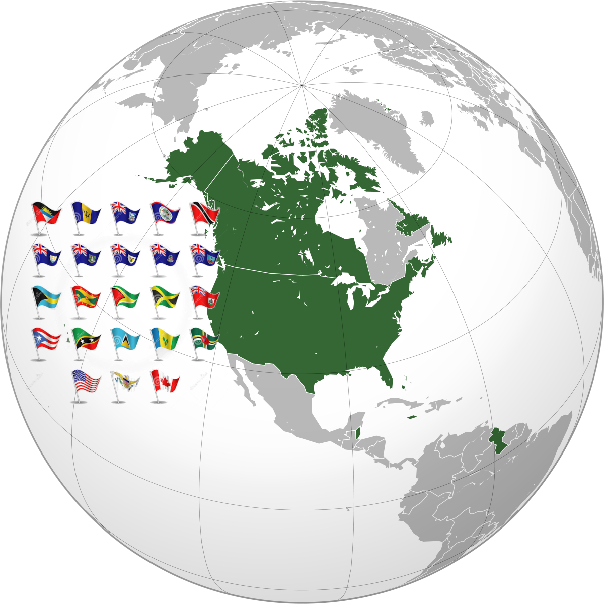
盎格鲁美洲英语Anglo-America),又称英语美洲,用作描述以英语为主要语言,或者与英格兰英伦三岛在历史、语言或文化上有密切关系的美洲地区,也可以指英语世界的美洲部分,与操罗曼语族诸语的拉丁美洲区分。

具体而言,英语美洲包括北美洲美国加拿大[2],而Anglophone America一词也可以用于较阔的定义,当中包括中美洲伯利兹巴拿马加勒比海牙买加南美洲圭亚那北大西洋上的百慕大以及几个靠近南美洲的加勒比海国家。注意苏里南阿鲁巴岛荷属安地列斯由于以荷兰语为通用语,并不属本区范围。在南大西洋福克兰群岛以英语为官方语言。


Das Adjektiv angloamerikanisch bezieht sich im Allgemeinen auf das englischsprachige Amerika, das in Abgrenzung zu Lateinamerika bisweilen als Angloamerika bezeichnet wird.[1] Es ist zu unterscheiden von dem mit Bindestrich geschriebenen Kopulativkompositum anglo-amerikanisch, das so viel bedeutet wie „Großbritannien und (das englischsprachige) Nordamerika gleichermaßen betreffend.“ Analog bezeichnet Angloamerikaner die Bürger der Vereinigten Staaten und Kanadas (oder zumindest die englischsprachigen), Anglo-Amerikaner hingegen „Briten und Nordamerikaner“.[2]

Bei der Unterscheidung von Rechtskreisen meint anglo-amerikanisches Recht (oder angelsächsisches Recht) das Common Law, das in vielen englischsprachigen Ländern geltende Recht, das sich mehr auf richterliche Urteile der Vergangenheit (Präzedenzfälle) als auf Gesetze stützt. Teile des Common Law gelten noch in zahlreichen Ländern, die früher Kolonien der englischen Krone waren, beispielsweise in den USA, Kanada, Australien und Neuseeland.


This image, video or audio may be copyrighted. It is used for educational purposes only. If you find it, please notify us byand we will remove it immediately.
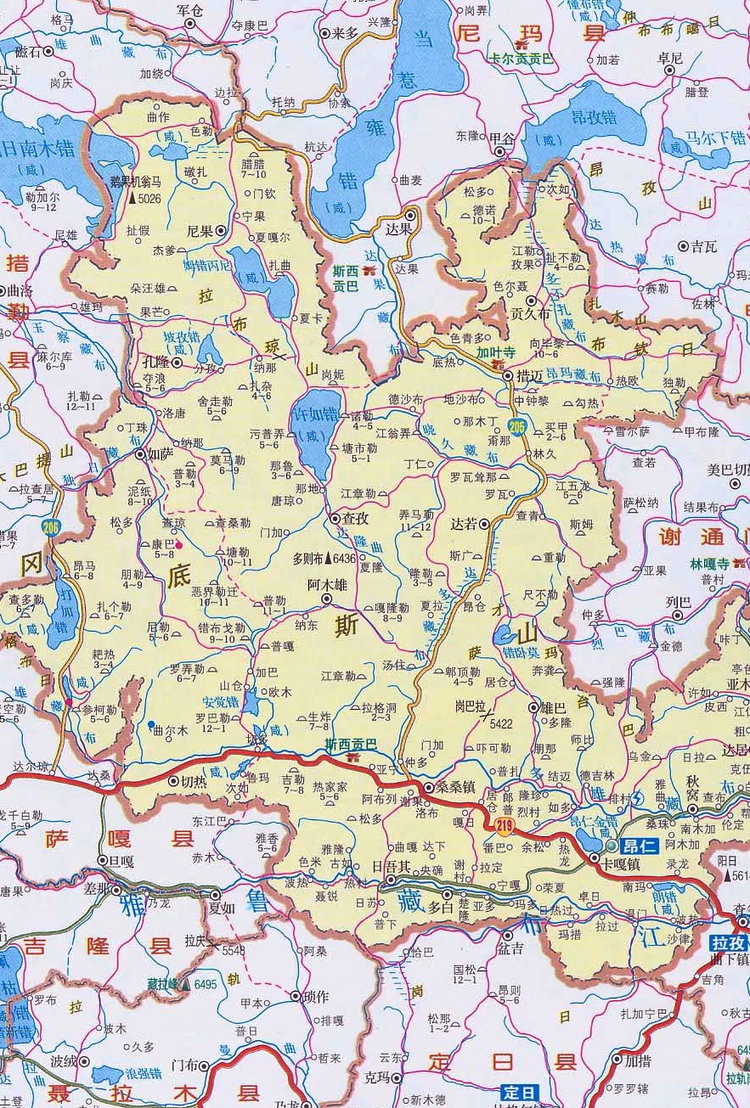
昂仁 昂仁
昂仁县隶属日喀则市,位于日喀则西偏北,雅鲁藏布江上游,岗底斯山脉中脊线上。东邻谢通门县和拉孜县两县,西接措勤和萨嘎两县,南靠聂拉木和定日两县,北依申扎县。拉(孜)普(兰)公路(219国道)横贯境域南部。县域平均海拔4513米,面积2.746万平方公里。昂仁县下辖2个镇、15个乡:卡嘎镇、桑桑镇、切热乡、秋窝乡、达居乡、亚木乡、贡久布乡、达若乡、措迈乡、尼果乡、孔隆乡、如沙乡、阿木雄乡、查孜乡、日吾其乡、多白乡、雄巴乡。
This image, video or audio may be copyrighted. It is used for educational purposes only. If you find it, please notify us byand we will remove it immediately.
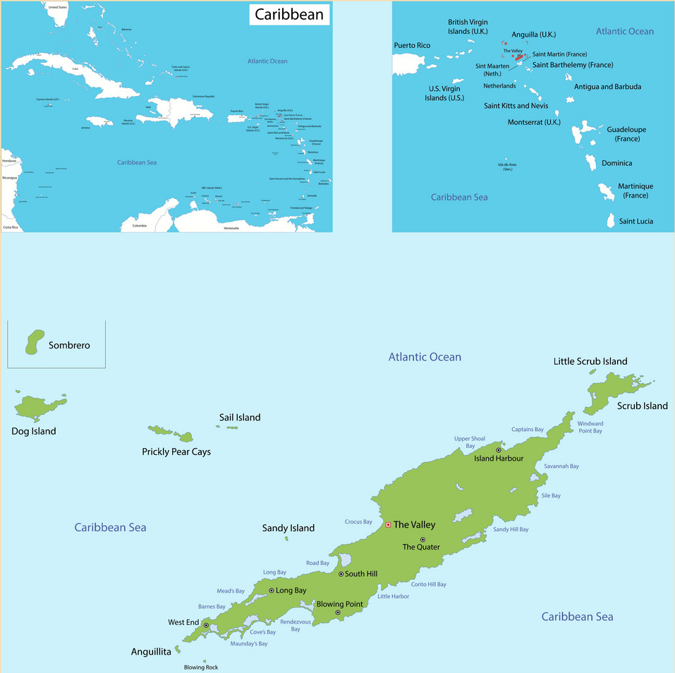
安圭拉
This image, video or audio may be copyrighted. It is used for educational purposes only. If you find it, please notify us byand we will remove it immediately.
阿兰国家公园/Национальный парк-Алания
http://www.net4info.de/photos/cpg/albums/userpics/10002/Nacionalnyy_park-Alaniya.jpg
This image, video or audio may be copyrighted. It is used for educational purposes only. If you find it, please notify us byand we will remove it immediately.
安納布爾納峰 安纳布尔纳峰
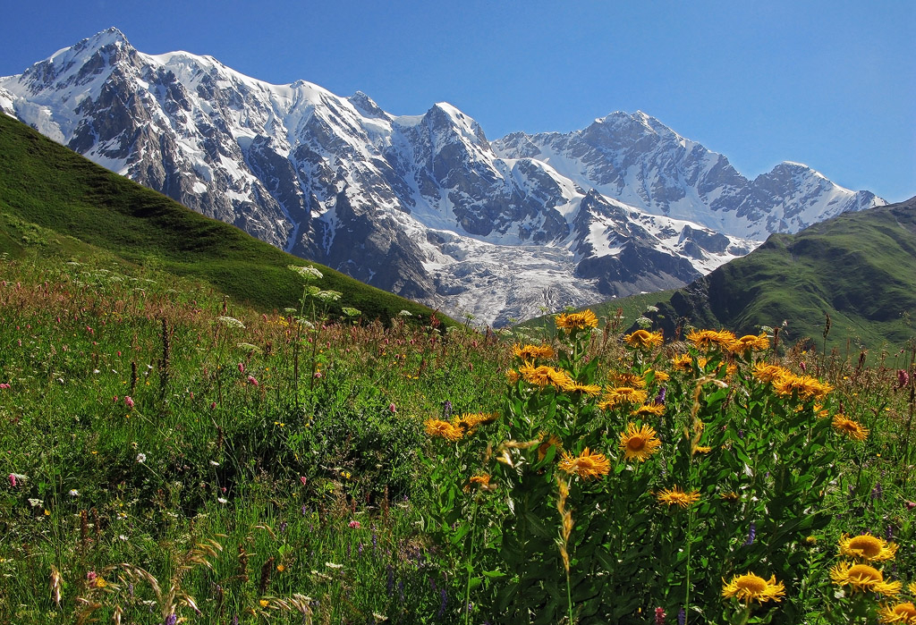
Das Annapurna Himal ist ein bis zu 8091 Meter hohes Gebirgsmassiv in Nepal. Es ist Teil des Himalayas; zu ihm gehören mit den Bergen Annapurna und Annapurna II (7937 m) zwei der höchsten 16 Berge der Erde. Die Umrundung des Annapurna Himal auf dem Annapurna Circuit ist eine beliebte Trekkingreise.

 
世界第十峰,海拔8093米,位于喜马拉雅山脉中段尼泊尔境内。安纳布尔纳峰有一系列山峰构成,除了主峰之外,还有多座独立命名的山峰,包括著名的鱼尾峰 (Machhapuchhre)。1950年6月3日,法国登山队的莫里斯。埃尔佐格和路易斯。拉什耐尔2人首次登上顶峰,这也是人类首次登上海拔 8000米以上的独立山峰。Annapurana在当地语中有粮食供给者或收成之神的意思,因此安纳布尔峰也称为大粮谷。
This image, video or audio may be copyrighted. It is used for educational purposes only. If you find it, please notify us byand we will remove it immediately.
安顺龙宫喀斯特
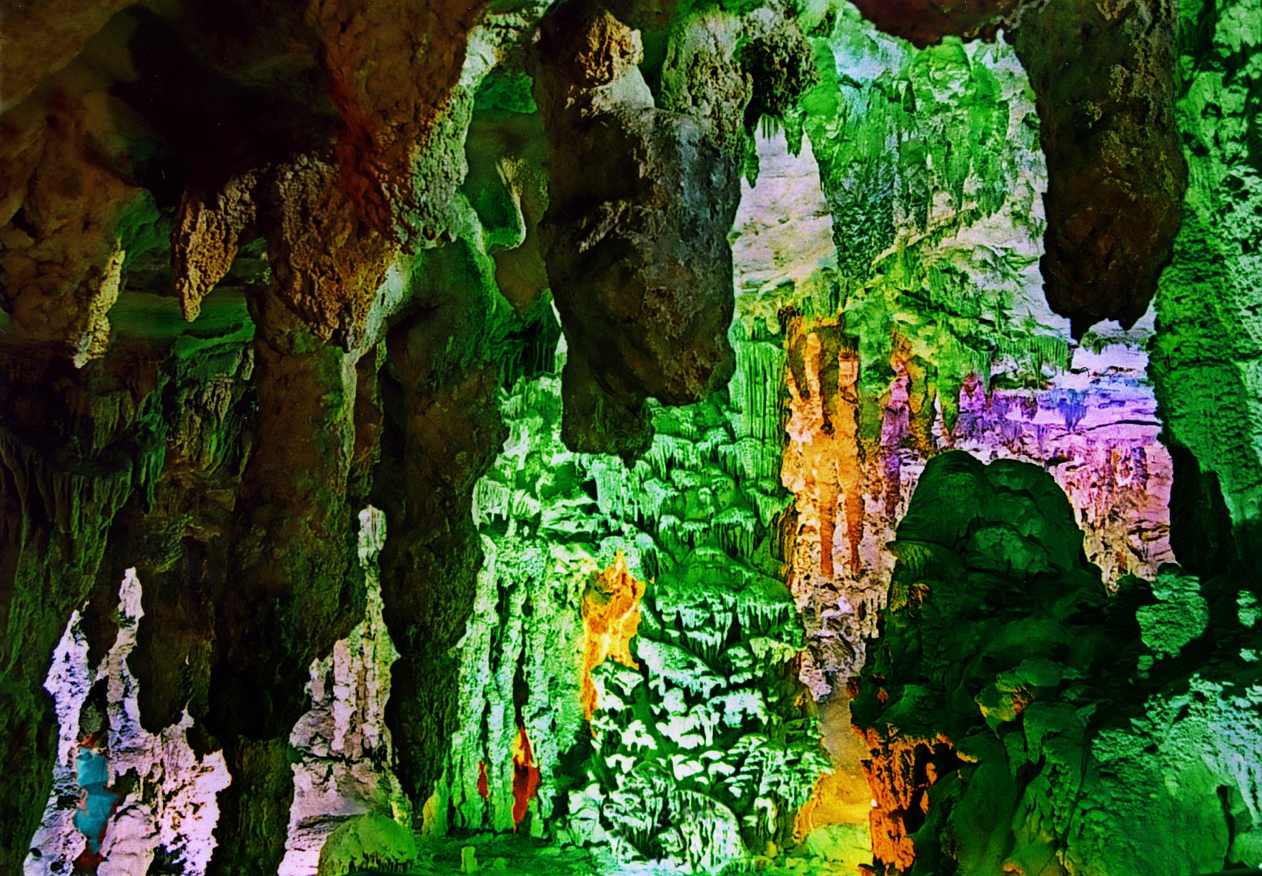
龙宫景区位于贵州省安顺市南郊,距安顺城区27公里,距贵阳116公里,距享誉中外的黄果树大瀑布仅30公里。景区开放于1984年,总面积60平方公里,核心游览区面积约18平方公里。景区集溶洞、峡谷、瀑布、峰林、绝壁、溪河、石林、漏斗、暗河等多种喀斯特地质地貌景观于一体,是喀斯特地貌形态展示最为集中全面的景区,被誉为“天下喀斯特,尽在龙宫”。龙宫景区由龙潭秘境和通漩田园两大主题片区组成,拥有中国最长最美水溶洞(一、二进龙宫)、中国最大洞中佛堂(观音洞)、中国最大洞中岩溶瀑布(龙门飞瀑)、中国原子能机构测定的世界天然辐射率最低的地方,世界最大的水旱溶洞集群,世界上最大植物汉字“龙”字田等得天独厚的自然资源,和以布依、苗族为主的多样民族文化等多种旅游资源;其丰富的喀斯特地质地貌,奇妙的自然景观,多彩的民族风情旷世稀有;独特的龙文化、淳朴的宗教信仰,清新的田园气息交相辉映,绘就一幅怡然自得的人间仙境画卷。
/assets/contentimages/An20Shun20Long20Gong20.jpg
This image, video or audio may be copyrighted. It is used for educational purposes only. If you find it, please notify us byand we will remove it immediately.
南极洲
/assets/contentimages/Antarktis.jpg
 
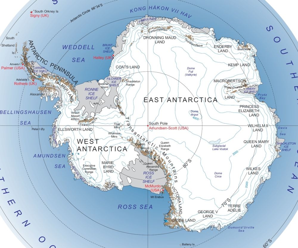
 【概况】 名称 南极洲。是人类最后到达的大陆,也叫“第七大陆。”
位置 位于地球最南端,土地几乎都在南极圈内,四周濒太平洋、印度洋和大西洋。是世界上地理纬度最高的一个洲。
面积 总面积约1 400万平方千米,约占世界陆地总面积的9.4%。
范围 由围绕南极的大陆、陆缘冰和岛屿组成,其中大陆面积1 239.3万平方千米,陆缘冰面积158.2万平方千米,岛屿面积7.6万平方千米。
地理分区 南极洲分东南极洲和西南极洲两部分。东南极洲从西经30°向东延伸到东经170°,包括科茨地、毛德皇后地、恩德比地、威尔克斯地、乔治五世海岸、维多利 亚地、南极高原和极点。面积1 018万平方千米。西南极洲位于西经50°-160°之间,包括南极半岛、亚历山大岛、埃尔斯沃思地以及伯德地(玛丽.伯德地)等,面积229万平方千 米。
居民 南极洲仅有一些来自其它大陆的科学考查人员和捕鲸队,无定居居民。
This image, video or audio may be copyrighted. It is used for educational purposes only. If you find it, please notify us byand we will remove it immediately.
南极;南极地带;南极圈;
This image, video or audio may be copyrighted. It is used for educational purposes only. If you find it, please notify us byand we will remove it immediately.
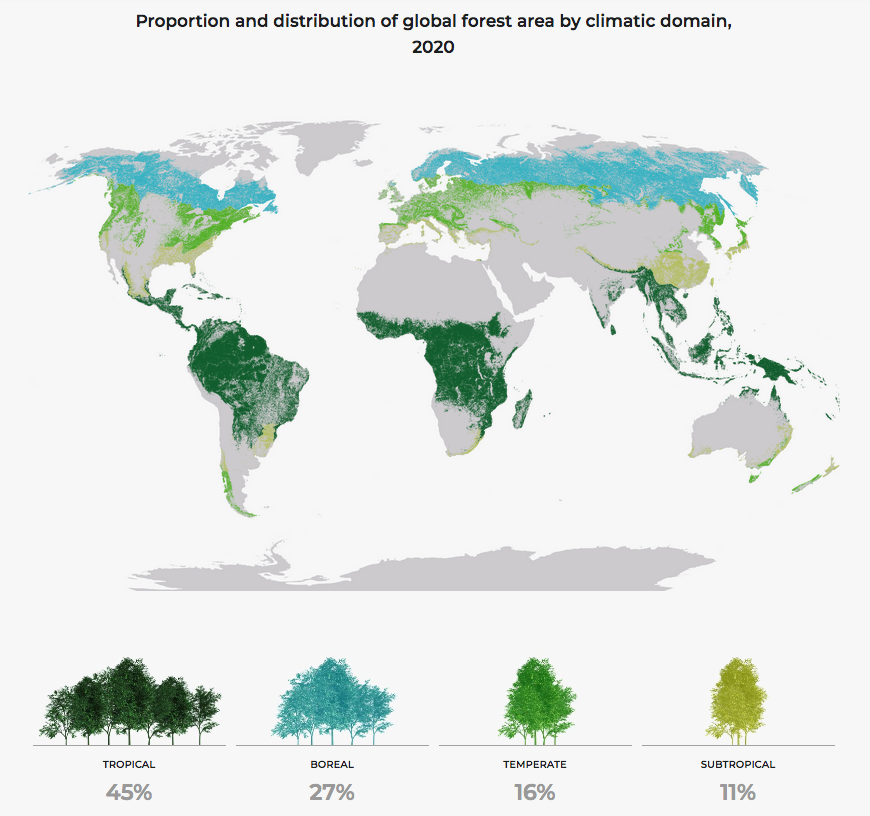
气候区域下全球森林面积比例和分布/Proportion and distribution of global forest area by climatic domain
This image, video or audio may be copyrighted. It is used for educational purposes only. If you find it, please notify us byand we will remove it immediately.
羚羊峡谷
/assets/contentimages/Antelope_Canyon.jpg

羚羊峡谷英语Antelope Canyon),是世界上著名的狭缝型峡谷之一,也是知名的摄影景点。其位于美国亚利桑纳州北方,最靠近的城市为佩吉市,属于纳瓦荷族保护区。羚羊峡谷在地形上分为两个独立的部份,称为上羚羊峡谷英语Upper Antelope Canyon)与下羚羊峡谷英语Lower Antelope Canyon)。

是谁第一次发现羚羊峡谷的记录已不可考。据纳瓦荷族的历史传述,该地过去是叉角羚羊栖息处,峡谷里也常有羚羊漫步,这也是此峡谷名为羚羊峡谷的由来。老一辈的纳瓦荷族曾将此地视为静思与大灵沟通的栖息地。

 
This image, video or audio may be copyrighted. It is used for educational purposes only. If you find it, please notify us byand we will remove it immediately.
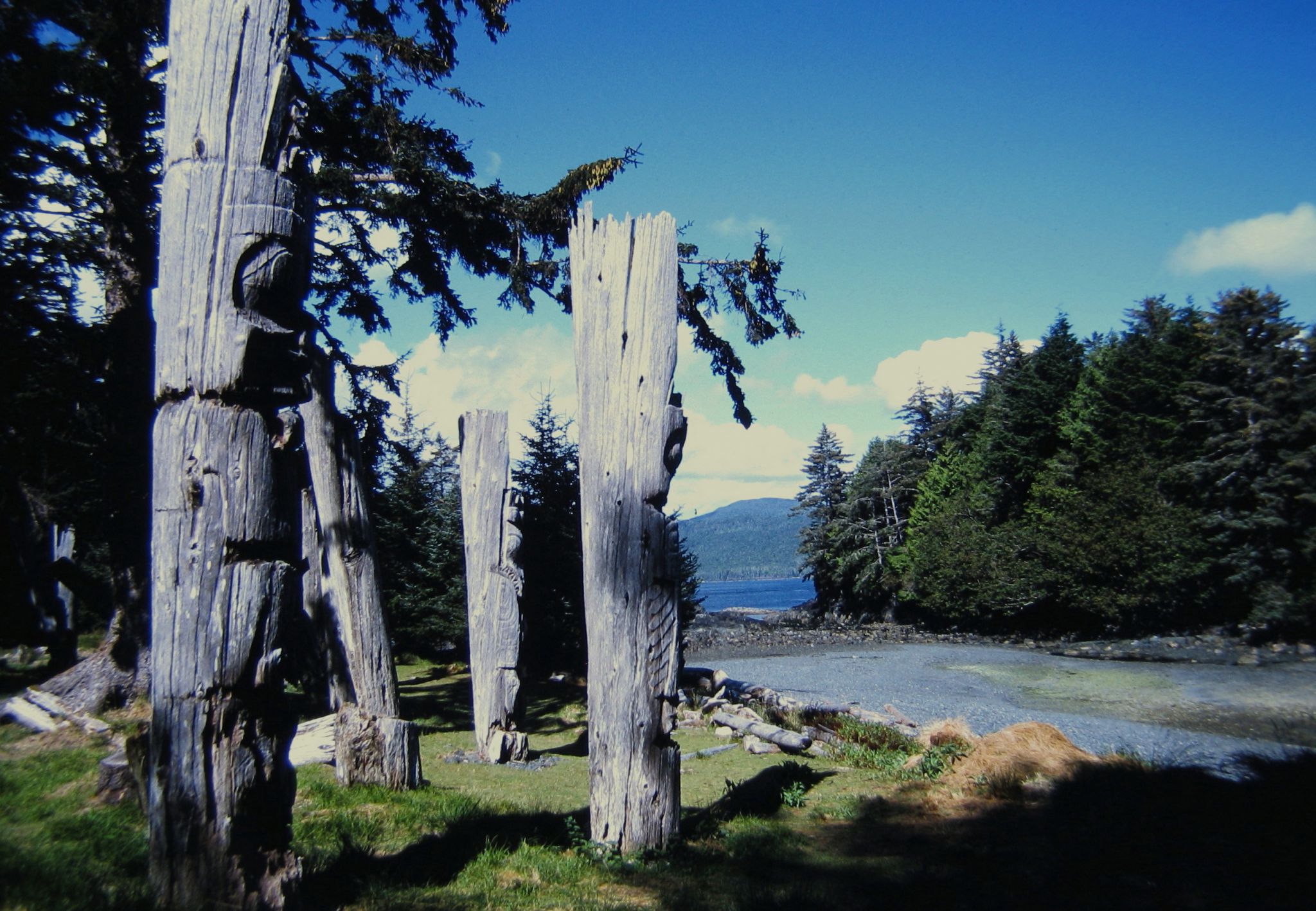
安东尼岛
/assets/contentimages/anthony_island.jpg
This image, video or audio may be copyrighted. It is used for educational purposes only. If you find it, please notify us byand we will remove it immediately.
安提瓜和巴布达
/assets/contentimages/normal_Flag_of_Antigua_and_Barbuda.png /assets/contentimages/normal_Coat_of_arms_of_Antigua_and_Barbuda.png
This image, video or audio may be copyrighted. It is used for educational purposes only. If you find it, please notify us byand we will remove it immediately.