漢德百科全書 | 汉德百科全书
 Ethiopia
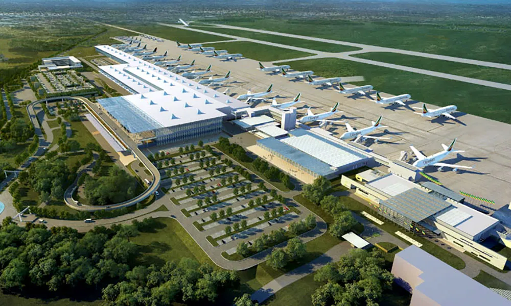
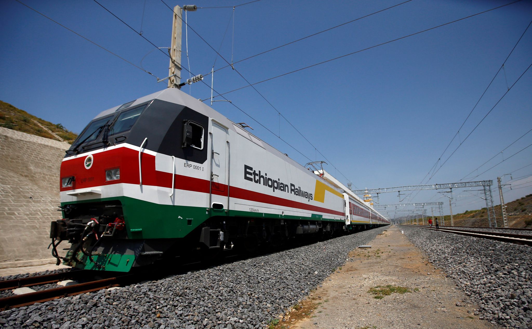
 Transport and traffic
Egypt
Algeria
Angola
Equatorial Guinea
Ethiopia
Botsuana
Burkina Faso
Côte d´Ivoire
Eritrea
Ghana
Cameroon
Kenya
Libya
Transport and traffic
Egypt
Algeria
Angola
Equatorial Guinea
Ethiopia
Botsuana
Burkina Faso
Côte d´Ivoire
Eritrea
Ghana
Cameroon
Kenya
Libya
 Aerospace
Madagaskar
Malawi
Mali
Morocco
Mauritius
Mosambik
Namibia
Republik Kongo
Republic of the Sudan
Ruanda
Seychellen
Simbabwe
South Africa
Tansania
Tschad
Tunisia
Aerospace
Madagaskar
Malawi
Mali
Morocco
Mauritius
Mosambik
Namibia
Republik Kongo
Republic of the Sudan
Ruanda
Seychellen
Simbabwe
South Africa
Tansania
Tschad
Tunisia
 African Union
 Alpha Condé
African Union
Bingu wa Mutharika
African Union
Denis Sassou Nguesso
African Union
Hailemariam Desalegn
African Union
Idriss Déby
African Union
Jakaya Kikwete
African Union
Joaquim Chissano
African Union
John Agyekum Kufuor
African Union
Mohamed Ould Abdel Aziz
African Union
Muammar al-Gaddafi
African Union
Olusegun Obasanjo
African Union
Robert Mugabe
African Union
Teodoro Obiang Nguema Mbasogo
African Union
Thabo Mbeki
African Union
Thomas Boni Yayi
African Union
Paul Kagame
African Union
Abd al-Fattah as-Sisi
African Union
Moussa Faki
African Union
Nkosazana Dlamini-Zuma
African Union
Jean Ping
African Union
Alpha Oumar Konaré
African Union
Amara Essy
African Union
Mohamed Ould Ghazouani
African Union
Azali Assoumani
African Union
Macky Sall
African Union
Félix Tshisekedi
Egypt
Algeria
Angola
Equatorial Guinea
Ethiopia
Benin
Botsuana
Burkina Faso
Burundi
Côte d´Ivoire
Demokratische Arabische Republik Sahara
Demokratische Republik Kongo
Djibouti
Eritrea
Gabun
Gambia
Alpha Condé
African Union
Bingu wa Mutharika
African Union
Denis Sassou Nguesso
African Union
Hailemariam Desalegn
African Union
Idriss Déby
African Union
Jakaya Kikwete
African Union
Joaquim Chissano
African Union
John Agyekum Kufuor
African Union
Mohamed Ould Abdel Aziz
African Union
Muammar al-Gaddafi
African Union
Olusegun Obasanjo
African Union
Robert Mugabe
African Union
Teodoro Obiang Nguema Mbasogo
African Union
Thabo Mbeki
African Union
Thomas Boni Yayi
African Union
Paul Kagame
African Union
Abd al-Fattah as-Sisi
African Union
Moussa Faki
African Union
Nkosazana Dlamini-Zuma
African Union
Jean Ping
African Union
Alpha Oumar Konaré
African Union
Amara Essy
African Union
Mohamed Ould Ghazouani
African Union
Azali Assoumani
African Union
Macky Sall
African Union
Félix Tshisekedi
Egypt
Algeria
Angola
Equatorial Guinea
Ethiopia
Benin
Botsuana
Burkina Faso
Burundi
Côte d´Ivoire
Demokratische Arabische Republik Sahara
Demokratische Republik Kongo
Djibouti
Eritrea
Gabun
Gambia
 Geography
Ghana
Guinea
Guinea-Bissau
Cameroon
Kap Verde
Kenya
Comoros
Lesotho
Liberia
Libya
Madagaskar
Malawi
Mali
Morocco
Mauritania
Mauritius
Mosambik
Namibia
Niger
Nigeria
Geography
Ghana
Guinea
Guinea-Bissau
Cameroon
Kap Verde
Kenya
Comoros
Lesotho
Liberia
Libya
Madagaskar
Malawi
Mali
Morocco
Mauritania
Mauritius
Mosambik
Namibia
Niger
Nigeria
 Party and government
Group of the twenty most important industrial and emerging countries
Republik Kongo
Republic of the Sudan
Republik Südsudan
Ruanda
Sambia
Sao Tome und Principe
Senegal
Seychellen
Sierra Leone
Simbabwe
South Africa
Swasiland
Tansania
Togo
Tschad
Tunisia
Uganda
Party and government
Party and government
Group of the twenty most important industrial and emerging countries
Republik Kongo
Republic of the Sudan
Republik Südsudan
Ruanda
Sambia
Sao Tome und Principe
Senegal
Seychellen
Sierra Leone
Simbabwe
South Africa
Swasiland
Tansania
Togo
Tschad
Tunisia
Uganda
 Important International Organizations
 Economy and trade
Central African Republic
Economy and trade
Central African Republic

Die Afrikanische Union (arabisch الاتحاد الأفريقي, DMG al-Ittiḥād al-Ifrīqī, englisch African Union, französisch Union africaine, portugiesisch União Africana)[2] ist eine Internationale Organisation, die 2002 die Nachfolge der Organisation für Afrikanische Einheit (OAU) angetreten hat und sich für Kooperation auf allen Gebieten einsetzen soll. Sie ist ein Zusammenschluss von anfangs 53 afrikanischen Staaten (Westsahara ist Mitglied der Afrikanischen Union, sein völkerrechtlicher Status allerdings umstritten).
Der Hauptsitz der Organisation befindet sich im äthiopischen Addis Abeba, das Panafrikanische Parlament im südafrikanischen Midrand. Mitgliedstaaten der AU sind alle international allgemein anerkannten afrikanischen Staaten, einschließlich Westsaharas. Geplant ist in der AU unter anderem ein Afrikanischer Gerichtshof. Marokko wurde am 30. Januar 2017 nach 33 Jahren Abwesenheit wieder in die Afrikanische Staatengemeinschaft aufgenommen.[3]
非洲联盟(法语:Union Africaine; 英语:African Union),简称非盟(UA或AU),是一个包涵了55个非洲国家的联盟,是属于集政治、经济和军事于一体的全非洲性政治实体。非洲联盟于未来有计划统一使用货币、联合防御力量、以及成立跨国家的机关,这包括一个管理非洲联盟的内阁政府。此联盟的主要目的是帮助发展及稳固非洲的民主、人权、以及能永续发展的经济,除此之外亦希望减少非洲内部的武装战乱及创造一个有效的共同市场,最终目标是建立“非洲合众国”。
前身是1963年在埃塞俄比亚首都亚的斯亚贝巴成立的“非洲统一组织”。2002年7月在南非改组。[6]2017年在第28届非盟首脑会议上,摩洛哥获得了54个成员国中的42国同意,时隔33年重新成为该组织成员国,至此非洲联盟已涵盖所有非洲主权国家。[7]
アフリカ連合(アフリカれんごう)は、アフリカの国家統合体。アフリカ統一機構 (OAU) が、2002年に発展改組して発足した[3]。エチオピアのアディスアベバに本部を置いている。
1963年に創設されたアフリカ統一機構は、モロッコを除くアフリカ大陸の53か国(当時)全てが加入する世界最大の地域統合であったが、「統一機構」という名とは裏腹に各国間の内政不干渉を原則としており、各国で頻発する内戦やクーデターといった危機に対して有効な手段をとることができておらず、機能不全に陥っていた[4]。また、各国間の経済統合なども遅々として進んでいなかった。こうした状況に一石を投じたのが、1991年に締結されたアブジャ条約である。この条約では、アフリカ各国は2028年までに大陸統一通貨「アフロ」を導入し、アフリカ経済共同体(AEC)を創設することが謳われた。これによりアフリカ大陸が経済統合の方向に向かう中、より一層のアフリカ大陸の統合を進めるために新しい機構の創設が求められるようになった。
こうしたなか、アフリカ統一機構により強い権限を持たせ、政治・経済的統合を進めて最終的に欧州連合的な形態にアフリカ大陸を持っていくことを目的として、旧統一機構をアフリカ連合へと改組することを提案したのが、リビアの元首だったムアンマル・アル=カッザーフィーであった。カッザーフィーは1997年以降急速にアラブからアフリカへと外交重心を転換させていたが、1999年9月のスルトにおけるOAU首脳会談においてAUへの移行がリビアによって正式提案された[5]。この提案は各国に受け入れられ、アフリカ統一機構からアフリカ連合への移行のため、2000年7月のロメOAU首脳会議でアフリカ連合制定法(アフリカ連合を創設するための条約)が採択され、各国の批准を待って、2001年に発効した[6]。2002年7月のダーバン首脳会議を経て、アフリカ連合は正式に発足した。
アフリカ連合は、アフリカの一層高度な政治的経済的統合の実現及び紛争の予防解決への取組強化のため発足した地域統合体である。アフリカ諸国と諸国民間の一層の統一性及び連帯性の強化、アフリカの政治的経済的社会的統合の加速化、アフリカの平和と域内紛争や独裁政治の根絶、安全保障及び安定の促進、民主主義原則と国民参加統治の促進、持続可能な開発の促進、教育及び科学等での協力、グローバリゼーション時代におけるアフリカ諸国の国際的な地位向上、等を目指している。また、欧州連合(EU)をモデルとした地域統合を目標に掲げており、将来的には統一した国家へ発展させ、アフリカ合衆国を創ることも視野に入れている。
2001年にはアフリカ開発のための新パートナーシップ(NEPAD)を採択し、アフリカ大陸の開発のための指針を表明した。また、これに基づいて、各国が加盟国のガバナンスなどの状況を審査するアフリカン・ピア・レビュー・メカニズム(アフリカにおける相互審査システム、APRM)が創設され、2005年にはガーナの、2006年にはルワンダの報告書が作成された[7]。
The African Union (AU) is a continental union consisting of 55 member states located on the continent of Africa, with exception of various territories of European possessions located in Africa. The bloc was founded on 26 May 2001 in Addis Ababa, Ethiopia and launched on 9 July 2002 in South Africa.[6] The intention of the AU is to replace the Organisation of African Unity (OAU), established on 25 May 1963 in Addis Ababa by 32 signatory governments. The most important decisions of the AU are made by the Assembly of the African Union, a semi-annual meeting of the heads of state and government of its member states. The AU's secretariat, the African Union Commission, is based in Addis Ababa.
In result of its geographical location, the African Union has an area of around 29 million km2 (11 million sq mi) and includes popular world landmarks, including the Sahara and the Nile.[7] They have adopted a gold, green and red based emblem and flag to represent the continental union, where they held a competition for citizens to design a flag in which they chose a submission to replace the old flag. Their main celebration occurs on Africa Day on 25 May. The primary languages spoken include Arabic, English, French and Portuguese and the languages of Africa. Within the African Union, there are official bodies such as the Peace and Security Council and the Pan-African Parliament.
L'Union africaine (UA) est une organisation d'États africains créée en 2002, à Durban en Afrique du Sud, en application de la déclaration de Syrte du 9 septembre 1999. Elle a remplacé l'Organisation de l'unité africaine2 (OUA). La mise en place de ses institutions (Commission, Parlement panafricain et Conseil de paix et de sécurité) a eu lieu en juillet 2003 au sommet de Maputo au Mozambique.
Son premier président a été le Sud-Africain Thabo Mbeki, précédemment président de l'OUA.
Ses buts sont d'œuvrer à la promotion de la démocratie, des droits de l'Homme et du développement à travers l'Afrique, surtout par l'augmentation des investissements extérieurs par l'intermédiaire du programme du Nouveau partenariat pour le développement de l'Afrique (NEPAD). Ce programme considère que la paix et la démocratie sont des préalables indispensables au développement durable.
Les objectifs de l'UA comportent la création d'une banque centrale de développement.
L'Unione africana (UA) è un'organizzazione internazionale comprendente tutti gli Stati africani, con sede ad Addis Abeba, in Etiopia. Les objectifs de l'UA comportent la création d'une banque centrale de développement.
Si tratta di un'organizzazione internazionale molto giovane, nata ufficialmente con il primo vertice dei capi di Stato e di governo del 9 luglio 2002 a Durban, in Sudafrica, durante il quale ne assunse la presidenza Thabo Mbeki, presidente sudafricano. Nel corso del vertice, al quale presenziava tra gli altri il segretario generale delle Nazioni Unite Kofi Annan, furono sottoscritti i primi atti riguardanti gli organi dell'Unione, ovvero il protocollo relativo allo stabilimento del Consiglio di pace e sicurezza e lo statuto della commissione, e furono stabilite regole e procedure per l'Assemblea, il consiglio esecutivo e il comitato dei rappresentanti permanenti.
Le fasi del processo di sviluppo precedenti al vertice di Durban avvennero all'interno dell'Organizzazione dell'unità africana. Nella sessione straordinaria del 1999 a Sirte, in Libia, (luogo di nascita del Leader libico Mu'ammar Gheddafi promotore dell'organizzazione, anche con cospicui capitali) l'Organizzazione decise la nascita della nuova Unione.
Il Sahara Occidentale è ammesso come Repubblica democratica araba Sahrawi, pur non essendo a tutti gli effetti indipendente trattandosi di un territorio conteso con il Marocco.
Nel 2000 fu adottato l'atto costitutivo, che entrò in vigore il 26 maggio 2001, un mese esatto dopo la sottoscrizione della Nigeria, il trentaseiesimo Stato ad averlo ratificato. Come previsto dall'atto per un anno vi fu coesistenza tra le due organizzazioni.
Il 15 agosto 2002 le è stato riconosciuto lo status di osservatore dell'Assemblea generale delle Nazioni Unite.
La Unión Africana (por su acrónimo UA, o AU en inglés u otras de sus lenguas oficiales) es una unión política formada por 55 Estados africanos. La UA se creó el 26 de mayo de 2001 en Adís Abeba y comenzó a funcionar el 9 de julio de 2002 en Durban (Sudáfrica),2 reemplazando a la Organización para la Unidad Africana (OUA). Las decisiones más importantes de la UA son tomadas por la Asamblea de la Unión Africana, una reunión semestral de jefes de Estado y de gobierno de sus Estados miembros. El secretariado de la UA, la Comisión de la Unión Africana, tiene su sede en Adís Abeba, capital de Etiopía.
Африка́нский сою́з (сокращённо АС, АфроСоюз) — международная межправительственная организация, объединяющая 55 государств Африки, правопреемник Организации африканского единства (ОАЕ). Основана 9 июля 2002 года[4]. Важнейшие решения в рамках организации принимаются на Ассамблее Африканского союза — собрании глав государств и правительств государств — членов организации, которое проводится раз в полгода. Секретариат Африканского союза и Комиссия Африканского союза расположены в Аддис-Абебе, столице Эфиопии. В феврале 2009 года было принято решение о преобразовании Комиссии Африканского союза в Полномочный орган Африканского союза (англ. African Union Authority)[5].
Egypt
Algeria
Ethiopia
Benin
Burkina Faso
Djibouti
Eritrea
Gambia
Ghana
Cameroon
Kap Verde
 Agriculture, forestry, livestock, fishing
Libya
Mali
Mauritania
Niger
Nigeria
Republic of the Sudan
Senegal
Somalia
Tschad
Tunisia
Agriculture, forestry, livestock, fishing
Libya
Mali
Mauritania
Niger
Nigeria
Republic of the Sudan
Senegal
Somalia
Tschad
Tunisia
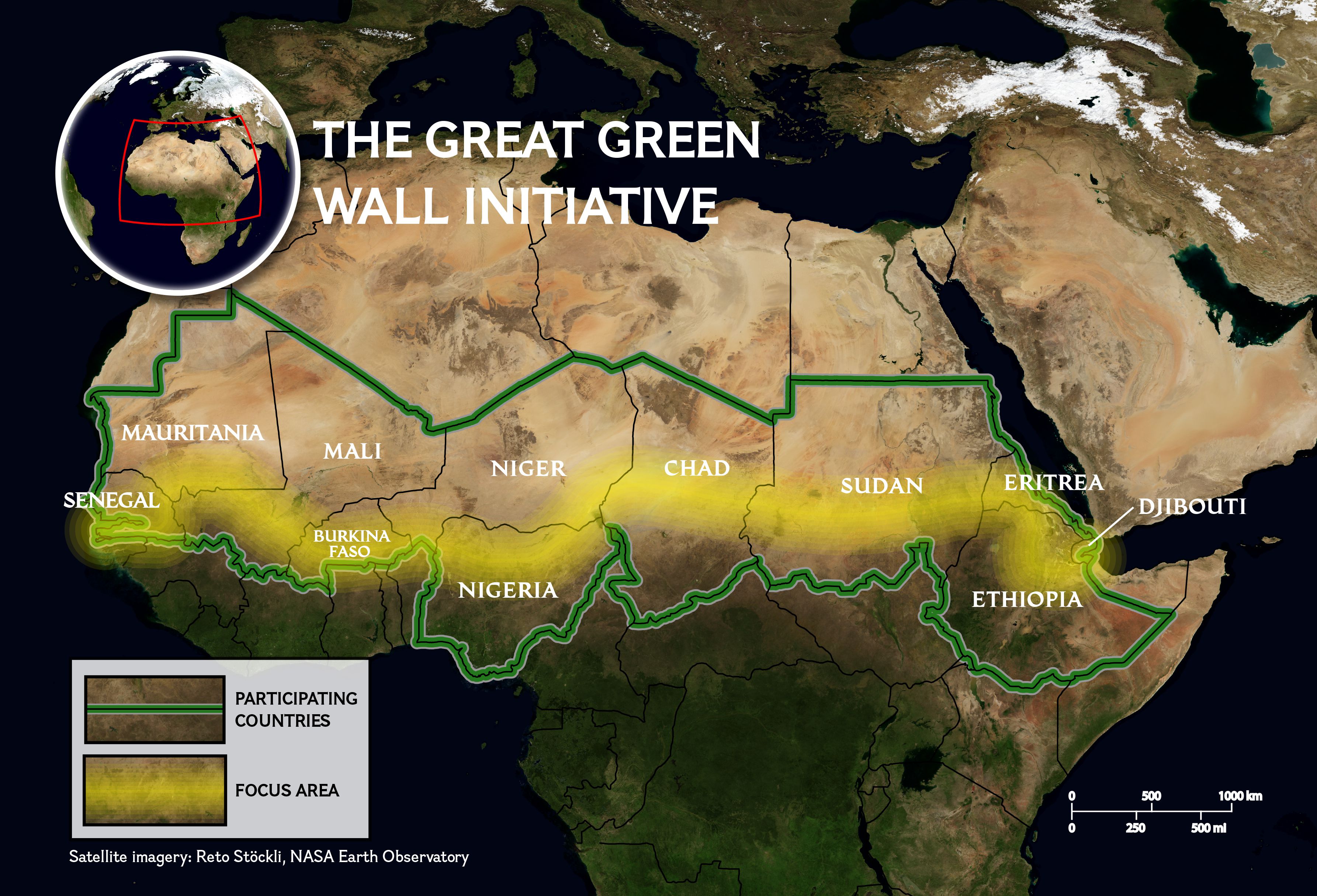
Afrikas Grüne Mauer (englisch Great Green Wall) oder auch Initiative Große Grüne Mauer der Sahara und des Sahel (kurz GGWSSI; englisch Great Green Wall of the Sahara and the Sahel Initiative) genannt, ist Afrikas Vorzeigeinitiative, um die Effekte des Klimawandels und der Desertifikation zu bekämpfen. Die Initiative wird von der Afrikanischen Union geführt. Das Ziel ist die Erschaffung eines großen Mosaiks aus grüner und produktiver Landschaft, das sich über Nordafrika, die Sahelzone und das Horn von Afrika erstreckt. Mittel dazu sind u. a. Aufforstungsprojekte und die Wiederherstellung degradierter Böden. Grund ist die Verhinderung weiterer Desertifikation in der Sahelzone.
非洲绿色长城(英语:Great Green Wall)为沿着撒哈拉沙漠南缘的萨赫尔地区种植跨越非洲大陆的树墙,是一项防止沙漠化的计划。这项计划由非洲联盟主导,概念起自于绿色前线、中国的三北防护林等大型绿色工程计划,以解决撒赫尔和撒哈拉地区在土地退化和沙漠化后所导致的社会、经济、环境的不利影响。
 International cities
 World Heritage
 Egypt
Ethiopia
Brazil
BRICS summit
China
Egypt
Ethiopia
Brazil
BRICS summit
China
 Hand in Hand
India
Iran
Russia
South Africa
United Arab Emirates
Important International Organizations
Economy and trade
Hand in Hand
India
Iran
Russia
South Africa
United Arab Emirates
Important International Organizations
Economy and trade

金砖国家,简称金砖国,原称金砖四国(英语:BRIC)、金砖五国(英语:BRICS),现指九个主要的新兴市场国家,分别为巴西、俄罗斯、印度、中华人民共和国、南非、埃及、埃塞俄比亚、伊朗及阿拉伯联合酋长国。
金砖国家人口和国土面积在全球占有重要份额,是世界经济增长的主要动力之一。[1]组织中国家的共同点为领土面积大、人口多、发展中国家以及被认为有一定甚至巨大的发展潜力。所以可以说在可见的未来里,这个组织或者组织中某个或多个国家会一定程度上的影响甚至领导全球经济。
2010年12月23日,南非作为正式成员加入金砖国家。2023年金砖国家峰会后,南非总统宣布邀请阿根廷(后撤回加入申请)、埃及、埃塞俄比亚、伊朗、沙特阿拉伯(后搁置加入申请)、阿拉伯联合酋长国成为金砖国家的正式成员[2]。
BRICS is the acronym coined by British Economist Jim O’Neill meant for an association of five major emerging national economies: Brazil, Russia, India, China and South Africa. Originally the first four were grouped as "BRIC" (or "the BRICs"), before the induction of South Africa in 2010.[4] The BRICS members are known for their significant influence on regional affairs; all are members of G20.[5] Since 2009, the BRICS nations have met annually at formal summits. China hosted the 9th BRICS summit in Xiamen on September 2017,[6] while South Africa will do so for the 10th BRICS summit in July 2018. The term does not include countries such as South Korea, Mexico and Turkey for which other acronyms and group associations were later created.
In 2015, the five BRICS countries represent over 3.1 billion people, or about 41% of the world population; four out of five members (excluding South Africa at #24) are in the top 10 of the world by population. As of 2018, these five nations have a combined nominal GDP of US$18.6 trillion, about 23.2% of the gross world product, combined GDP (PPP) of around US$40.55 trillion (32% of World's GDP PPP) and an estimated US$4.46 trillion in combined foreign reserves.[7][8] Overall the BRICS are forecasted to expand 4.6% in 2016, from an estimated growth of 3.9% in 2015. The World Bank expects BRICS growth to pick up to 5.3% in 2017.[9] The BRICS have received both praise and criticism from numerous commentators.[10][11][12] Bilateral relations among BRICS nations have mainly been conducted on the basis of non-interference, equality, and mutual benefit.[13]
BRICS est un acronyme anglais pour désigner un groupe de cinq pays qui se réunissent depuis 2011 en sommets annuels : Brésil, Russie, Inde, Chine et Afrique du Sud (en anglais : Brazil, Russia, India, China, South Africa).
Avant l'ajout de l'Afrique du Sud en 2011, le groupe était appelé BRIC, terme initial inventé en 2001 et qui a conduit à l'organisation des premiers sommets à quatre pays en 2009. Rarement utilisés, les équivalents français de cet acronyme - après l'adhésion de l'Afrique du Sud - sont ABRIC (Afrique du Sud, Brésil, Russie, Inde et Chine1), BRASIC ou encore BRICA2.
L'acronyme BRICSAM (en anglais : Brazil, Russia, India, China, South Africa, Mexico) est également utilisé pour y adjoindre le Mexique, sans qu'il ne soit membre du groupe.
Il BRICS in economia internazionale è un'associazione di cinque paesi tra le maggiori economie emergenti. Il nome è l'acronimo delle iniziali dei cinque stati:
Tali economie si propongono di costruire un sistema commerciale globale attraverso accordi bilaterali che non siano basati esclusivamente sul petrodollaro. Il termine ha avuto origine dal precedente BRIC, con l'aggiunta della S relativa al Sudafrica.
En economía internacional,1 se emplea la sigla BRICS para referirse conjuntamente a Brasil, Rusia, India, China y Sudáfrica,2 aunque en este artículo se hará más referencia al BRIC, que excluye este último país, el que se unió al grupo en 2011. En términos generales, BRICS es el acrónimo de una asociación económica-comercial de las cinco economías nacionales emergentes más importantes del mundo. Los BRICS son considerados el paradigma de la cooperación Sur-Sur, aunque recientemente esta interpretación fue puesta en cuestión dadas las contradicciones entre los intereses de China y los demás miembros.3
Todas estas naciones tienen en común una gran población (China e India por encima de los mil cien millones, Brasil y Rusia por encima de los ciento cuarenta millones), un enorme territorio (casi 38,5 millones km²), lo que les proporciona dimensiones estratégicas continentales, una gigantesca cantidad de recursos naturales y, lo más importante, las enormes cifras que han presentado de crecimiento de su producto interno bruto (PIB) y de participación en el comercio mundial en los últimos años, lo que los hace atractivos como destino de inversiones.4
México y Corea del Sur son los únicos países comparables a los BRIC, pero sus economías se excluyeron debido a que ya son miembros de la OCDE.5 Estos países, Brasil, China, India y Sudáfrica, exceptuando a Rusia que pertenece al G-8, también forman parte del G-5. Argentina, en tanto, fue invitada a la cumbre de Fortaleza, junto a los miembros de la Unión de Naciones Suramericanas realizada en julio de 2014.
Em economia, BRICS é um acrônimo que se refere aos países membros fundadores (o grupo BRIC: Brasil, Rússia, Índia e China), que juntos formam um grupo político de cooperação. Em 14 de abril de 2011,[1] o "S" foi oficialmente adicionado à sigla BRIC para formar o BRICS, após a admissão da África do Sul (em inglês: South Africa) ao grupo.[2][3][4] Os membros fundadores e a África do Sul estão todos em um estágio similar de mercado emergente, devido ao seu desenvolvimento econômico. É geralmente traduzido como "os BRICS" ou "países BRICS" ou, alternativamente, como os "Cinco Grandes".
Apesar de o grupo ainda não ser um bloco econômico ou uma associação de comércio formal, como no caso da União Europeia,[5] existem fortes indicadores de que os quatro países do BRIC têm procurado formar um "clube político" ou uma "aliança", e assim converter "seu crescente poder econômico em uma maior influência geopolítica."[6][7] Desde 2009, os líderes do grupo realizam cúpulas anuais.[8]
A sigla (originalmente "BRIC") foi criada por Jim O'Neill em um estudo de 2001 intitulado "Building Better Global Economic BRICs".[9][10][11] Desde então, a sigla passou a ser amplamente usada como um símbolo da mudança no poder econômico global, distanciando-se das economias desenvolvidas do G7 em relação ao mundo em desenvolvimento.
De acordo com um artigo publicado em 2005, o México e a Coreia do Sul seriam os únicos outros países comparáveis aos BRICS, mas suas economias foram inicialmente excluídas por serem consideradas mais desenvolvidas, uma vez que já eram membros da Organização para a Cooperação e Desenvolvimento Econômico.[12] As relações bilaterais entre os países dos BRICS tem sido conduzidas principalmente com base nos princípios de não-interferência, igualdade e benefício mútuo.[13]
ब्रिक्स (BRICS) उभरती राष्ट्रीय अर्थव्यवस्थाओं के एक संघ का शीर्षक है। इसके घटक राष्ट्र ब्राज़ील, रूस, भारत, चीन और दक्षिण अफ्रीका हैं। इन्हीम देशों के अंग्रेज़ी में नाम के प्रथमाक्षरों B, R, I, C व S से मिलकर इस समूह का यह नामकरण हुआ है।[1] मूलतः, २०१० में दक्षिण अफ्रीका के शामिल किए जाने से पहले इसे "ब्रिक" के नाम से जाना जाता था। रूस को छोडकर[2], ब्रिक्स के सभी सदस्य विकासशील या नव औद्योगीकृत देश हैं जिनकी अर्थव्यवस्था तेजी से बढ़ रही है। ये राष्ट्र क्षेत्रीय और वैश्विक मामलों पर महत्वपूर्ण प्रभाव डालते हैं। वर्ष २०१३ तक, पाँचों ब्रिक्स राष्ट्र दुनिया के लगभग 3 अरब लोगों का प्रतिनिधित्व करते हैं और एक अनुमान के अनुसार ये राष्ट्र संयुक्त विदेशी मुद्रा भंडार में ४ खरब अमेरिकी डॉलर का योगदान करते हैं। इन राष्ट्रों का संयुक्त सकल घरेलू उत्पाद १५ खरब अमेरिकी डॉलर का है।[3] वर्तमान में, दक्षिण अफ्रीका ब्रिक्स समूह की अध्यक्षता करता है।
БРИКС (англ. BRICS — сокращение от Brazil, Russia, India, China, South Africa) — группа из пяти стран: Бразилия, Россия, Индия, Китай, Южно-Африканская Республика.
Сокращение БРИК (BRIC) было впервые предложено аналитиком Джимом О’Нилом в ноябре 2001 года в аналитической записке банка «Goldman Sachs» Building Better Global Economic BRICs (Кирпичи для новой экономики)[1][2]. До 2011 года по отношению к организации использовалась аббревиатура БРИК. В связи с присоединением ЮАР к БРИК 18 февраля 2011 года, по заявлению индийского министра финансов с этого времени группа стала носить название BRICS[3].
Последовательность букв в слове определяется не только благозвучием, но и тем, что само слово в английской транскрипции BRICS очень похоже на английское слово bricks — «кирпичи»[4], таким образом, данный термин используется в качестве обозначения группы стран, за счёт роста которых во многом будет обеспечиваться будущий рост мировой экономики.
Организация была основана в июне 2006 года, в рамках Петербургского экономического форума (ПЭФ) с участием министров экономики Бразилии, России, Индии, Китая. Помимо саммитов, встречи проходят на уровне глав МИД, министров финансов и др.
Эксперты не предполагали наличия координации экономических политик между странами БРИК. Тем более не предполагалось, что страны БРИК образуют некий экономический блок или официальную торговую ассоциацию, как Европейский союз. Однако со временем появились признаки, что «четыре страны БРИК стремятся сформировать политический клуб» или «союз», и таким образом преобразовать «свою растущую экономическую власть в большее геополитическое „влияние“». С сентября 2006 года началось налаживание политических связей в рамках БРИК: во время 61-й сессии ООН была проведена встреча министров иностранных дел четырёх стран. Главы государств БРИК впервые встретились 9 июля 2008 года в Тояко-Онсэн (Хоккайдо, Япония) в рамках 34-го саммита G8 и договорились о проведении полноформатного саммита, который состоялся в Екатеринбурге 16 июня 2009 года[5]. [источник не указан 1284 дня]
 History
 Architecture
 Religion

 United Nations
 *Mediterranean Sea
Egypt
*Mediterranean Sea
Egypt
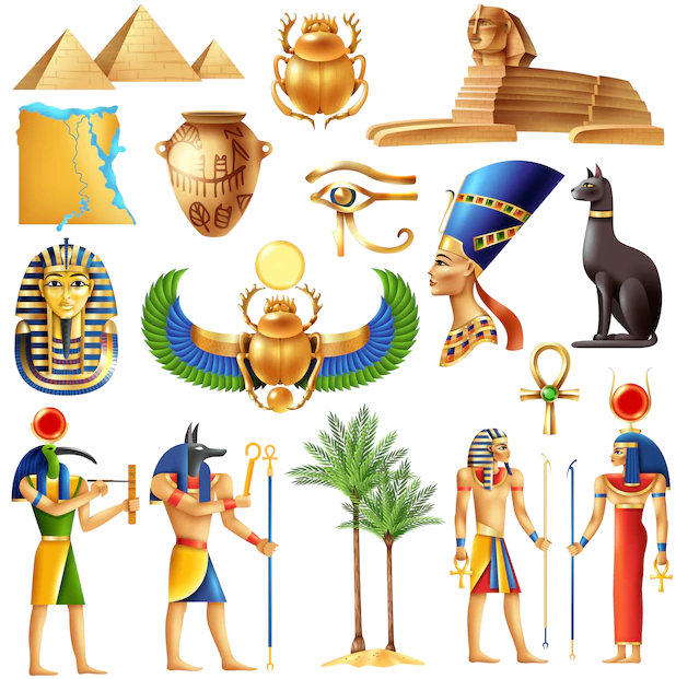 Ancient Egypt
Ethiopia
Burundi
Demokratische Republik Kongo
Kenya
Republic of the Sudan
Republik Südsudan
Ruanda
Tansania
Uganda
Ancient Egypt
Ethiopia
Burundi
Demokratische Republik Kongo
Kenya
Republic of the Sudan
Republik Südsudan
Ruanda
Tansania
Uganda

尼罗河(英语:Nile,阿拉伯语:النيل,埃及语:Ḥ'pī / iteru,科普特语:ⲫⲓⲁⲣⲟ / phiaro)是一条流经非洲东部与北部的河流,与中非地区的刚果河以及西非地区的尼日尔河并列非洲最大的四个河流系统。尼罗河长6650千米,是世界上第一长的河流[2]。2007年虽有来自巴西的学者宣称亚马逊河长度更胜一筹,但尚未获全球地理学界的普遍认同[3]。尼罗河有两条主要的支流,白尼罗河和蓝尼罗河。发源于埃塞俄比亚高原的青尼罗河是尼罗河下游大多数水和营养来源,但白尼罗河则是两条支流中最长的。它源于非洲中部的大湖地区,其最远的源头位于卢旺达( 2°16′55.92″S 29°19′52.32″E / 2.2822000°S 29.3312000°E),向北它流经坦桑尼亚并注入维多利亚湖,再从此湖中溢出注入艾伯特湖,往北流入乌干达和苏丹共和国南部,并于后者处形成大面积沼泽湿地。蓝尼罗河源于埃塞俄比亚的塔纳湖(12°2′8.8″N 37°15′53.11″E / 12.035778°N 37.2647528°E),从东南流入苏丹。在苏丹首都喀土穆附近,白尼罗河蓝尼罗河相汇,形成尼罗河。
尼罗河从苏丹首都向北穿过苏丹和埃及,所经过的地方均是沙漠。从古代开始埃及的文明就依靠尼罗河而形成和兴旺。除海港和海岸附近的城市外埃及所有的城市和大多数居民住在阿斯旺以北的尼罗河畔,几乎所有的古埃及遗址均位于尼罗河畔。在其入海口尼罗河形成一个巨大的三角洲,在这里它注入地中海。
一般にはヴィクトリア湖を源流だとする約5,760kmの大河だと思われているが、ヴィクトリア湖には多数の流入河川が存在し、一方でヴィクトリア湖からの流出河川はナイル川しか存在しないため、ヴィクトリア湖をナイル川水系に含み、そこに流れ込む河川の長さもナイル川の長さに加算するのが普通である。ヴィクトリア湖に流れ込む河川のうちで最大最長のものは、ルワンダに源を持ち、ルワンダとブルンジやタンザニアの国境をなし、さらにタンザニアとウガンダの国境をなした後タンザニアのブコバ市北方でヴィクトリア湖に流れ込むカゲラ川である。そのカゲラ川の支流のうちでもっとも長いものは、ブルンジ南部のブルリ県を水源とするルヴィロンザ川(Ruvyironza)であり、これがナイル川の最上流であるとされる。
ヴィクトリア湖(標高1134m)は赤道直下のサバナ気候であり、降水量も多い。ヴィクトリア湖から下流はヴィクトリアナイルとも呼ばれその長さは約5,760kmである。ヴィクトリア湖からのナイル川の流出口は湖北部のジンジャであり、流出口には記念碑が建てられているほか、オーエン・フォールズ・ダムが建設され、発電をおこなっている。ヴィクトリア湖から約500km下流に行くとキオガ湖を経て、120mの高さのあるマーチソン・フォールズをとおり、アルバート湖(標高619m)に着く[1]。アルバート湖には、ほかにもウガンダ南西部のジョージ湖からカジンガ水路、エドワード湖を通って流れてきたセムリキ川が注いでいる。アルバート湖からはアルバートナイルとも呼ばれる。南スーダンに入り、急流を一つ越えると首都ジュバである。ジュバからは勾配が非常に緩やかとなり、少し北のモンガラ市周辺からはスッドの影響を受けるようになる。支流のバハル・エル=ガザル川(Bahr el Ghazal)とノ湖で合流し、そこからは白ナイル川とよばれる。このあたりはスッドと呼ばれる大湿原となっており、ここで蒸発して流量が激減する。帆船時代はここは複雑な流路と生い茂る水草によって南北の交通を阻む障壁となってきたが、蒸気船の登場以後は航路が設定されるようになった。さらに、スッドの出口であるマラカル市の南でソバト川を合わせる。マラカルからハルツームまでの800kmの標高差は12mにすぎず、非常に緩やかな流れとなる[2]。
白ナイル川はスーダンのハルツームで、エチオピアのタナ湖から流れてくる青ナイル川と合流する。ハルツームを過ぎて80kmほどで、ナイル川には再び急流が出現する。これは北から数えて6番目の急流のため、第6急流と呼ばれる。ここからエジプトのアスワンまでの間にある6つの急流は、エジプトとスーダンの間の舟運を拒み、交通の障害となってきた。しかし、この急流の区間は古くからエジプトの影響を受け、ヌビアと呼ばれて独自の古代王国を築いていた。第6急流の北、200kmほどのところには古代のクシュ王国の都であったメロエ(Meroë)がある。さらにその北、ハルツームから約300km下流のアトバラで支流のアトバラ川と合流する。これ以北は完全な砂漠気候であり、ナイル河谷を除いてほとんど人は住まなくなる。また、これ以北ではナイルに注ぎ込む常時水流のある支流は存在せず、わずかに降水時に水の流れるワジが点在するのみとなる。第4急流付近には、メロエ以前にクシュの首都であったナパタ(ゲベル・バルカル)がある。この付近に2009年メロウェダム(Merowe Dam)が完成し、大規模な発電を開始した。エジプトに入ると、アスワン・ハイ・ダムとそれによって出来たナセル湖がある。ナセル湖の長さは550kmに及び、その南端はスーダン最北の町ワジハルファを越えさらに南まで延びている。アスワン以北は古くからの「エジプト」であり、幅5kmほどのナイル河谷に人が集住するようになる。アスワンからカイロまでは上エジプトと呼ばれる。この区間ではナイル川はほぼ一本の河川であるが、北西へと流れる支流があり、カイロ南西にファイユーム・オアシスを作ってカルーン湖に注ぎ込む。それからさらに北へ流れ、カイロから北は三角州が発達している。ナイル川三角州は下エジプトとも呼ばれる。三角州はアレクサンドリアからポートサイドまで約240kmの幅を持ち、東のロゼッタ支流と西のダミエッタ支流という二つの主流と多くの分流に別れ、地中海に注いでいる。
The Nile (Arabic: النيل, romanized: an-Nīl, Arabic pronunciation: [an'niːl], Bohairic Coptic: ⲫⲓⲁⲣⲟ Pronounced [pʰjaˈro][4], Nobiin: Áman Dawū[5]) is a major north-flowing river in northeastern Africa, and is the longest river in Africa and the disputed longest river in the world,[6][7] as the Brazilian government says that the Amazon River is longer than the Nile.[8][9] The Nile is about 6,650 km (4,130 mi)[n 1] long and its drainage basin covers eleven countries: Tanzania, Uganda, Rwanda, Burundi, the Democratic Republic of the Congo, Kenya, Ethiopia, Eritrea, South Sudan, Republic of the Sudan, and Egypt.[11] In particular, the Nile is the primary water source of Egypt and Sudan.[12]
The Nile has two major tributaries – the White Nile and the Blue Nile. The White Nile is considered to be the headwaters and primary stream of the Nile itself. The Blue Nile, however, is the source of most of the water, containing 80% of the water and silt. The White Nile is longer and rises in the Great Lakes region of central Africa, with the most distant source still undetermined but located in either Rwanda or Burundi. It flows north through Tanzania, Lake Victoria, Uganda and South Sudan. The Blue Nile begins at Lake Tana in Ethiopia[13] and flows into Sudan from the southeast. The two rivers meet just north of the Sudanese capital of Khartoum.[14]
The northern section of the river flows north almost entirely through the Sudanese desert to Egypt, then ends in a large delta and flows into the Mediterranean Sea. Egyptian civilization and Sudanese kingdoms have depended on the river since ancient times. Most of the population and cities of Egypt lie along those parts of the Nile valley north of Aswan, and nearly all the cultural and historical sites of Ancient Egypt are found along river banks.
Le Nil (prononcé [nil]) est un fleuve d'Afrique. Avec une longueur d'environ 6 700 km, c'est avec le fleuve Amazone, le plus long fleuve du mondenotes 1. Il est issu de la rencontre du Nil Blanc et du Nil Bleu. Le Nil blanc (Nahr-el-Abiad) prend sa source au lac Victoria (Ouganda, Kenya, Tanzanie) ; le Nil bleu (Nahr-el-Azrak) est issu du lac Tana (Éthiopie). Ses deux branches s'unissant à Khartoum, capitale du Soudan actuel, le Nil se jette dans la Méditerranée en formant un delta au nord de l'Égypte. En comptant ses deux branches, le Nil traverse le Rwanda, le Burundi, la Tanzanie, l'Ouganda, l'Éthiopie, le Soudan du Sud, le Soudan et l'Égypte. Il longe également le Kenya et la République démocratique du Congo (respectivement avec les lacs Victoria et Albert), et son bassin versant concerne aussi l'Érythrée grâce à son affluent du Tekezé.
Le Nil est la voie qu'empruntaient les Égyptiens pour se déplacer. Il apporte la vie en fertilisant la terre et garantit l'abondance. Il joua un rôle très important dans l'Égypte antique, du point de vue économique, social (c'était autour de lui que se trouvaient les plus grandes villes), agricole (grâce au précieux limon des crues) et religieux. Fleuve nourricier de cette civilisation, il fut divinisé sous le nom d'Hâpynotes 2, personnifiant la crue du Nil dans la mythologie égyptienne.
La crue du Nil, qui avait lieu chaque été et qui apportait le limon noir permettant la culture de ses rives, est restée longtemps un phénomène inexpliqué. C'est de ce limon noir que vient le nom antique de l'Égypte, Kemet, qui veut dire « la terre noire ».
De nos jours, les eaux limoneuses du Nil sont captées et redistribuées sur les terres agricoles grâce aux barrages de Ziftah, d'Assiout, d'Hammadi, d'Esna et surtout aux deux barrages géants d'Assouan, l'ancien et le grand barrage, dont la construction dans les années 1970 a nécessité le déplacement de plusieurs temples dont ceux d'Abou Simbel, qui auraient été noyés dans la retenue du lac Nasser.
Il Nilo (in arabo: نهر النيل, Nahr al-Nīl) è un fiume africano lungo 6 852 Km. Tradizionalmente considerato il fiume più lungo del mondo, contende il primato della lunghezza al Rio delle Amazzoni.[1]
Possiede due grandi affluenti, il Nilo Bianco e il Nilo Azzurro; quest'ultimo contribuisce con un maggior apporto di acqua e di limo fertile, ma il primo è il più lungo. Il Nilo Bianco nasce convenzionalmente dal Lago Vittoria a Jinja in Uganda, ma le sue fonti si spingono fino al Ruanda ed al Burundi; scorre poi verso nord in Uganda e in Sudan meridionale. Il Nilo Azzurro invece nasce convenzionalmente dal Lago Tana in Etiopia, e scorre attraverso il Sudan sud-orientale. I due fiumi s'incontrano e si fondono presso la capitale sudanese Khartum.
La sezione settentrionale del fiume scorre quasi interamente attraverso il Sahara, dal Sudan all'Egitto, un paese la cui civiltà è dipesa dal fiume fin dai tempi antichi e più remoti. La maggior parte della popolazione egiziana e tutte le sue città (con l'eccezione di quelle situate lungo la costa) si trovano lungo la valle del Nilo a nord di Assuan, e quasi tutti i siti storici e culturali dell'Antico Egitto si trovano lungo le sponde del fiume.
Alla fine il Nilo si dirama in un grande delta e sfocia nel Mar Mediterraneo.
Dalle sorgenti al delta il Nilo attraversa sette paesi africani: Burundi, Ruanda, Tanzania, Uganda, Sudan del Sud, Sudan ed Egitto, ma il suo bacino idrografico include porzioni della Repubblica Democratica del Congo, Kenya, Etiopia ed Eritrea.
El río Nilo (en árabe: النيل, alnayl) es el mayor río de África, que fluye en dirección norte a través de diez países —Burundi, Ruanda, Tanzania, Uganda, Kenia, República Democrática del Congo, Sudán del Sur, Sudán, Egipto y Etiopía— hasta desaguar en el extremo sureste del mar Mediterráneo, formando el gran delta del Nilo, sobre el que están situadas las ciudades de El Cairo y Alejandría. Tiene una longitud de 6853 km, el segundo río más largo del mundo, tras el Amazonas.
Durante siglos fue considerado el río más largo del mundo;2 sin embargo, mediciones de los años 2007 y 2008 han redefinido el nacimiento del Amazonas en la cuenca del río Apurimac al sur del Perú, designándolo como el río más largo del mundo.34
La fuente más lejana del lago Victoria es el río Kagera, localizado al oeste de Tanzania. Si se considera este como fuente del Nilo, su nacimiento sería el curso de agua más largo de los que desembocan en el Mediterráneo, siendo el Nilo-Kagera el segundo río más largo del mundo, con una longitud de 6853 kilómetros.5
El Nilo tomó su actual configuración al final de la Era Terciaria. Está ubicado al nordeste del continente. Nace en Burundi y tiene dos ramales o fuentes principales: el Nilo Blanco y el Nilo Azul. El primero atraviesa los Grandes Lagos de África, teniendo su fuente más distante en Ruanda, y fluye hacia el norte por Tanzania, el lago Victoria, Uganda, Sudán del Sur y Sudán, mientras que el Nilo Azul nace en el lago Tana, en Etiopía, y cruza el sudeste de Sudán. Ambos se encuentran cerca de la capital sudanesa, Jartum.
La parte del norte del río fluye casi completamente por el desierto, entre Sudán y Egipto, una zona cuya civilización ha dependido del río desde hace milenios. La mayor parte de la población de Egipto y todas sus ciudades —a excepción de las del delta del Nilo y los oasis— se encuentran a lo largo del valle del Nilo (al norte de Asuán), y la mayoría de los lugares de interés cultural e histórico se hallan en las riberas del río. La desembocadura del río conforma el delta del Nilo, a orillas del mar Mediterráneo.
Нил (араб. النيل, Эн-Ниль[1]; англ. Nile, егип. jtrw Ятрау или ḥꜥpj Хапи, копт. Ⲫⲓⲁⲣⲟ (p(h)iaro)) — река в Африке, одна из величайших по протяжённости речных систем в мире. Слово «Нил» происходит от греческого названия реки «Нейлос» (Νεῖλος).
Река берёт начало на Восточно-Африканском плоскогорье и впадает в Средиземное море, образуя дельту площадью 24 тыс. км²[2]. Среднегодовой расход воды в устье Нила 2900 м³/сек[3]. В верхнем течении принимает крупные притоки — Эль-Газаль (левый) и Асуа, Собат, Голубой Нил и Атбара (правые). Ниже устья правого притока Атбары Нил течёт по полупустыне, не имея притоков на протяжении последних 3000 км[4].
Водная система Нила считается самой длинной на Земле[5]. Однако, по мнению бразильских исследователей, самая длинная речная система у Амазонки — по этим данным, её длина составляет 6992 километра, в то время как длина системы Нила — 6852 километра[6]. Площадь бассейна реки Нил составляет 3349 тыс. км²[5]. Исток находится в Руанде, это река Рукарара, впадающая в реку Кагера. Сток воды сильно и резко изменяется в течение года. Суммарная длина судоходных участков составляет 3,2 тыс. км. Воды реки используются для орошения и производства электроэнергии. В дельте и долине Нила проживает почти все население и базируется почти вся экономика Египта. Крупнейшими городами являются Каир, Хартум, Асуан, Александрия[2].
Ethiopia
Brazil
China
Columbia
Costa Rica
Côte d´Ivoire
 Eat and Drink
Guatemala
Honduras
India
Indonesia
Mexico
Peru
Uganda
Vietnam
Ethiopia
Bangladesh
Belgium
Brazil
China
Cuba
Denmark
Hunan Sheng-HN
India
Eat and Drink
Guatemala
Honduras
India
Indonesia
Mexico
Peru
Uganda
Vietnam
Ethiopia
Bangladesh
Belgium
Brazil
China
Cuba
Denmark
Hunan Sheng-HN
India
 Iowa-IA
Israel
Mexico
Switzerland
Sierra Leone
United States
United Kingdom
Iowa-IA
Israel
Mexico
Switzerland
Sierra Leone
United States
United Kingdom