
Deutsch-Chinesische Enzyklopädie, 德汉百科
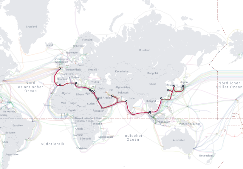
 Indien
 Ägypten
 China
China
 Indien


 IT-Times
 Spätklassik, Romantik (Früh, Mittel, Spät)
 Italien
 Japan
Japan
 Jordanien
 Malaysia
 Republik Korea
 Saudi-Arabien
 Shanghai Shi-SH
 Spanien
 Thailand
 Vereinigte Arabische Emirate
 Vereinigtes Königreich
 Zhejiang Sheng-ZJ

 Aserbaidschan
 Australien
 Bahrain
 Belgien
 Brasilien
 China
China
 Deutschland
 Formel-1-Weltmeisterschaft 2017
 Formel-1-Weltmeisterschaft 2018
 Frankreich
 Indien
 Italien
 Japan
Japan
 Kanada
 Mexiko
 Monaco
 Österreich
 Russland
 Schweiz
 Singapur
 Spanien

 Sport
Sport
 Ungarn
 Vereinigte Arabische Emirate
 Vereinigte Staaten
 Vereinigtes Königreich
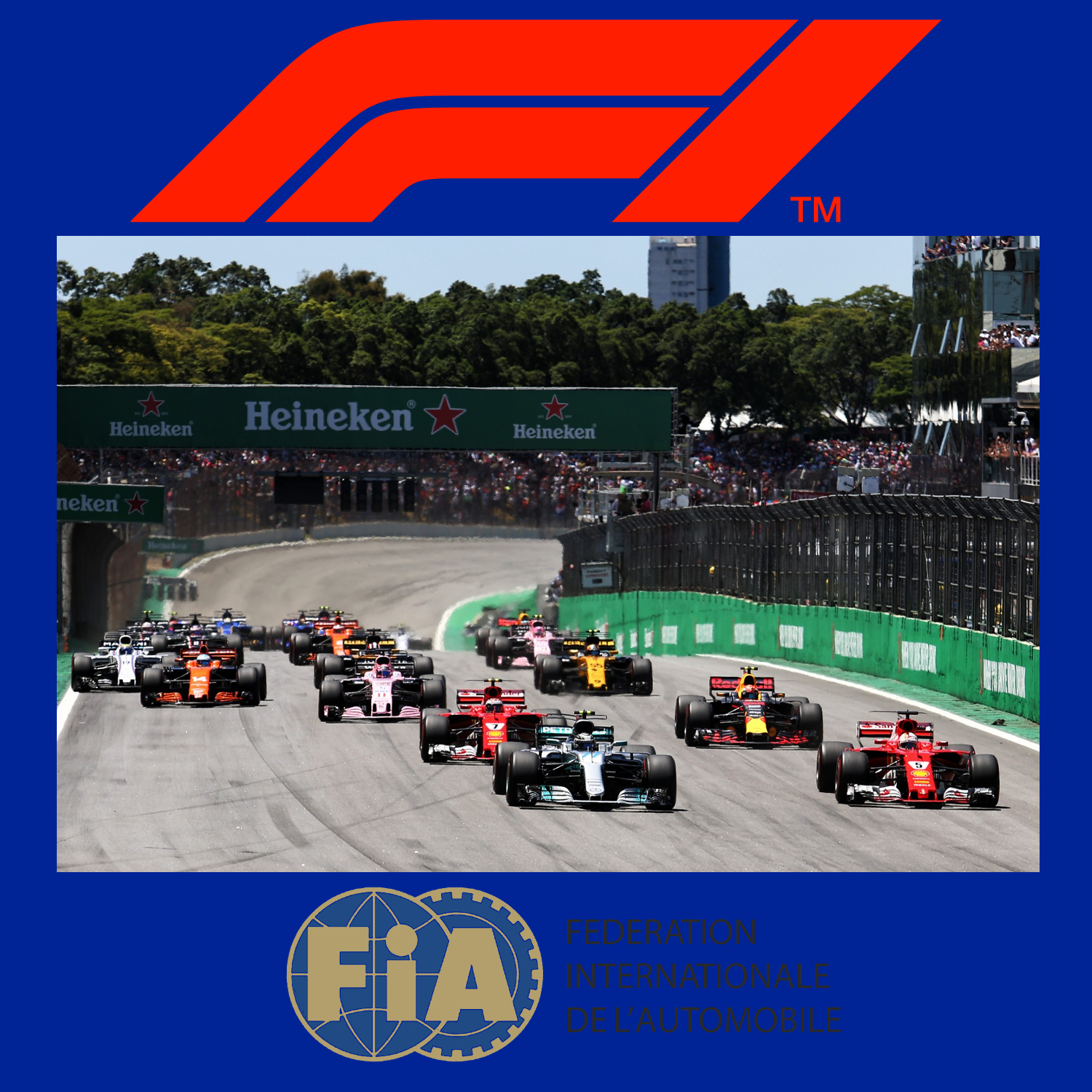
一级方程式赛车(英语:Formula One,也叫Formula 1或者F1)是由国际汽车联盟举办的最高等级的年度系列场地方程式赛车比赛,正式名称为“国际汽车联合会世界一级方程式锦标赛”。名称中“方程式”是指一组所有参赛车辆都必须遵守的规则[1]。F1赛季包括一系列的比赛,而这些所谓的“大奖赛”(Grand Prix,出自法语,本意Great Prizes)的场地是全封闭的专门赛道或者是临时封闭的普通公路。每场比赛的结果算入积分系统并以此确定两个年度世界冠军:一个给车手和另一个给制造商。F1的车手、制造商、组织者以及赛道都必须持有FIA超级驾驶执照,这是国际汽联颁发的最高级别执照。
一级方程式赛车通过产生大量的空气动力学下压力达到非常高的过弯速度,是风靡全球的赛车运动。发动机性能限制在每分钟最多15000转时,其比赛最高速度就可以超过360公里/小时。赛车过弯的横向加速度超过5个标准重力。F1赛车的性能非常依赖电子系统(牵引力控制系统和其他辅助驾驶装置自2008年已被禁止)、空气动力学、悬挂和轮胎。
Die Formel 1 ist eine vom Automobil-Dachverband Fédération Internationale de l’Automobile (FIA) festgelegte Formelserie. Hersteller konstruieren Autos, die den Formel-1-Regeln entsprechen. Diese Autos treten im Rahmen der Formel-1-Weltmeisterschaft zu Rennen in ungefähr 20 Orten pro Jahr an. Am Ende der Saison wird der Fahrer mit den meisten Punkten F1 Fahrerweltmeister und der Hersteller mit den meisten Punkten Konstrukteursweltmeister.
Die Formel 1 ist die höchstrangige von der FIA veranstaltete Rennserie des Formelsports. Sie wird als Königsklasse des Automobilsports bezeichnet, da sie den Anspruch erhebt, die höchsten technischen, fahrerischen, aber auch finanziellen Anforderungen aller Rennserien an Fahrer und Konstrukteure zu stellen. Sie wird auch kurz F1 genannt. Die F1 Weltmeisterschaft heißt offiziell FIA Formula One World Championship, bis 1980 hat sie Automobil-Weltmeisterschaft geheissen.
Formula One (also Formula 1 or F1) is the highest class of single-seater auto racing sanctioned by the Fédération Internationale de l'Automobile (FIA) and owned by the Formula One Group. The FIA Formula One World Championship has been one of the premier forms of racing around the world since its inaugural season in 1950. The "formula" in the name refers to the set of rules to which all participants' cars must conform.[2] A Formula One season consists of a series of races, known as Grands Prix (French for "grand prizes" or "great prizes"), which are held worldwide on purpose-built circuits and public roads.
The results of each race are evaluated using a points system to determine two annual World Championships: one for drivers, the other for constructors. Drivers must hold valid Super Licences, the highest class of racing licence issued by the FIA.[3] The races are required to be held on tracks graded "1" (formerly "A"), the highest grade rating issued by the FIA.[3] Most events are held in rural locations on purpose-built tracks, but there are several events in city centres throughout the world, with the Monaco Grand Prix being the most well-known.
Formula One cars are the fastest regulated road course racing cars in the world, owing to very high cornering speeds achieved through the generation of large amounts of aerodynamic downforce. The cars underwent major changes in 2017,[4] allowing wider front and rear wings, and wider tyres, resulting in cornering forces closing in on 8g and top speeds of up to approximately 375 km/h (230 mph).[5] The hybrid engines are currently limited in performance to a maximum of 15,000 rpm and the cars are very dependent on electronics—although traction control and other driving aids have been banned since 2008—and also on aerodynamics, suspension, and tyres.
While Europe is the sport's traditional base, the championship is truly global, with 11 of the 21 races in the 2018 season taking place outside Europe. With the annual cost of running a mid-tier team—designing, building, and maintaining cars, pay, transport—being US$120 million,[6] Formula One has a significant economic and job-creation effect, and its financial and political battles are widely reported. Its high profile and popularity have created a major merchandising environment, which has resulted in large investments from sponsors and budgets (in the hundreds of millions for the constructors). On 8 September 2016, it was announced that Liberty Media had agreed to buy Delta Topco, the company that controls Formula One, from private equity firm CVC Capital Partners for $4.4 billion in cash, stock, and convertible debt.[7] On 23 January 2017, it was confirmed that the acquisition had been completed, for $8 billion.[8]
La Formule 1, communément abrégée en F1, est une discipline de sport automobile considérée comme la catégorie reine de ce sport. Elle a pris au fil des ans une dimension mondiale et elle est, avec les Jeux olympiques et la Coupe du monde de football, l'un des événements sportifs les plus médiatisés.
Chaque année depuis 1950, un championnat mondial des pilotes est organisé, complété depuis 1958 par un championnat mondial des constructeurs automobiles. La compétition est basée sur des Grands Prix, courses à bord de voitures monoplaces disputées sur circuits routiers fermés permanents mais parfois tracés en ville et temporaires, comme à Monaco, Valence, Singapour, et Bakou.
Cette discipline sportive, régie par la Fédération internationale de l'automobile (FIA), est gérée par la Formula One Administration (FOA) et un ensemble de sociétés satellites contrôlées par Liberty Media. Après l'ère des artisans des années 1960 et 1970, elle a peu à peu attiré les grands constructeurs automobiles mondiaux qui y investissent des sommes élevées, en espérant tirer profit des retombées médiatiques d'éventuels succès. La Formule 1 est considérée comme la vitrine technologique de l'industrie automobile qui y expérimente des nouveautés techniques, parfois issues de la technologie spatiale et susceptibles d'être adaptées ensuite sur les voitures de série.
Outre la compétition, le terme Formule 1 désigne l'ensemble des règles techniques des voitures monoplaces qui sont mises à jour tous les ans par la FIA. Ces règles sont très strictes sur les dimensions des voitures, la cylindrée des moteurs, les technologies mises en œuvre ; elles définissent également les mesures de sécurité des voitures pour assurer la protection du pilote. Les monoplaces de course répondant aux caractéristiques de la réglementation de la Formule 1 sont généralement désignées sous le terme générique de Formules 1.
La Formula 1 o Formula Uno,[1] in sigla F1, è la massima categoria (in termini prestazionali) di vetture monoposto a ruote scoperte da corsa su circuito definita dalla Federazione Internazionale dell'Automobile (FIA).
La categoria è nata nel 1948 (in sostituzione della Formula A, a sua volta sorta solo qualche anno prima, nel 1946), diventando poi a carattere mondiale nella stagione 1950. Inizialmente definita dalla Commissione Sportiva Internazionale (CSI) dell'Associazione Internazionale degli Automobil Club Riconosciuti (AIACR), associazione antesignana della Federazione Internazionale dell'Automobile, oggi la Formula Uno è regolata dal Consiglio Mondiale degli Sport Motoristici (in inglese: World Motor Sport Council, WMSC) della Federazione Internazionale dell'Automobile.
Il termine "formula", presente nel nome, fa riferimento a un insieme di regole alle quali tutti i partecipanti, le macchine e i piloti, devono adeguarsi; esse introducono un numero di restrizioni e specifiche nelle auto, al fine di evitare le eccessive disparità tecniche tra le auto, di porre dei limiti al loro sviluppo e di ridurre i rischi di incidenti. La formula ha avuto molti cambiamenti durante la sua storia. Ad esempio, ci sono stati differenti tipi di motori, con schemi da quattro fino a sedici cilindri e con cilindrate da 1,5 a 4,5 l.
La Fórmula 1, abreviada como F1 y también denominada la «categoría reina del automovilismo»1 o «la máxima categoría del automovilismo»,23 es la competición de automovilismo internacional más popular y prestigiosa, superando a categorías de automovilismo como la NASCAR, el Campeonato Mundial de Rally, el Campeonato Mundial de Turismos o la Fórmula E, entre otras.4 A cada carrera se le denomina Gran Premio y el torneo que las agrupa se denomina Campeonato Mundial de Fórmula 1. La entidad que la dirige es la Federación Internacional del Automóvil (FIA). El Formula One Group es controlado por la empresa estadounidense Liberty Media desde septiembre de 2016.5
Los automóviles utilizados son monoplazas con la última tecnología disponible, siempre limitadas por un reglamento técnico; algunas mejoras que fueron desarrolladas en la Fórmula 1 terminaron siendo utilizadas en automóviles comerciales, como el freno de disco.6 La mayoría de los circuitos de carreras donde se celebran los Grandes Premios son autódromos, aunque también se utilizan circuitos callejeros y anteriormente se utilizaron circuitos ruteros.
El inicio de la Fórmula 1 moderna se remonta al año 1950, en el que participaron escuderías como Ferrari, Alfa Romeo y Maserati. Algunas fueron reemplazadas por otras nuevas como McLaren, Williams, Red Bull y Renault, que se han alzado varias veces con el Campeonato Mundial de Constructores. Las escuderías tienen que planear sus fichajes y renovación de contratos 2 o 3 carreras antes del fin de la temporada. Por su parte, los pilotos deben contar con la superlicencia de la FIA para competir, que se obtiene sobre la base de resultados en otros campeonatos.
 Abd al-Fattah as-Sisi
 Alberto Ángel Fernández
 Andrés Manuel López Obrador
 Anthony Albanese
 António Guterres
 Asian Development Bank,ADB
 Asian Development Bank,ADB
 Masatsugu Asakawa
 Azali Assoumani
 Charles Michel
 Cyril Ramaphosa
 Emmanuel Macron
 Fumio Kishida
 Giorgia Meloni

 Hand in Hand
 Hasina Wajed
 Indien
 Internationaler Währungsfonds
 Internationaler Währungsfonds
 Kristalina Georgiewa
 Joe Biden
 Joko Widodo
 Justin Trudeau
 Kristalina Georgiewa
 Lee Hsien Loong
 Li Qiang
 Luiz Inácio Lula da Silva
 Mark Rutte
 Mohammad bin Salman bin Abdulaziz Al Saud
 Muhammad bin Zayid Al Nahyan
 Narendra Modi
 National Capital Territory
 Olaf Scholz
 Pedro Sánchez
 Recep Tayyip Erdoğan
 Rishi Sunak
 Tedros Adhanom
 Ursula von der Leyen
 Weltbank
 Weltbank
 Ajay Banga
 World Trade Organization
 World Trade Organization
 Ngozi Okonjo-Iweala
 Yoon Suk-yeol

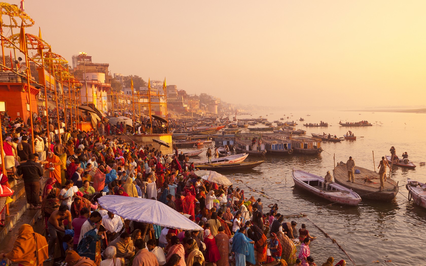
恒河(梵语:गङ्गा,印地语:गंगा,乌尔都语:گنگا(Ganga)国际音标发音:[ˈɡəŋɡaː] ![]() 聆听;泰米尔语:கங்கை,孟加拉语:গঙ্গা Gônga,玄奘译为殑伽河)是南亚的一条主要河流,流经印度北部及孟加拉。恒河源头帕吉勒提河和阿勒格嫩达河发源自印度北阿坎德邦的根戈德里等冰川,它横越北印度平原(即恒河平原),流经北方邦,会合其最大支流亚穆纳河,再流经比哈尔邦、西孟加拉邦,最后它分为多条分流注入孟加拉湾,其中一条是加尔各答附近的胡格利河,另外一条是进入孟加拉国的博多河,博多河进入孟加拉国后,会合布拉马普特拉河(中国境内为雅鲁藏布江)在孟加拉国境内的下游贾木纳河,注入孟加拉湾,其入海河段称为梅格纳河。支流布拉马普特拉河及其以上部分不算在内,恒河长为2,510公里,流域面积91万平方公里,达印度国土面积的三分之一,恒河也为世界河水流量前20大的河流之一[4]。恒河流域为世界上最多人口居住的河流流域,共有4亿以上人口居住于恒河流域,人口密度达每平方英里1000人以上[5]。
聆听;泰米尔语:கங்கை,孟加拉语:গঙ্গা Gônga,玄奘译为殑伽河)是南亚的一条主要河流,流经印度北部及孟加拉。恒河源头帕吉勒提河和阿勒格嫩达河发源自印度北阿坎德邦的根戈德里等冰川,它横越北印度平原(即恒河平原),流经北方邦,会合其最大支流亚穆纳河,再流经比哈尔邦、西孟加拉邦,最后它分为多条分流注入孟加拉湾,其中一条是加尔各答附近的胡格利河,另外一条是进入孟加拉国的博多河,博多河进入孟加拉国后,会合布拉马普特拉河(中国境内为雅鲁藏布江)在孟加拉国境内的下游贾木纳河,注入孟加拉湾,其入海河段称为梅格纳河。支流布拉马普特拉河及其以上部分不算在内,恒河长为2,510公里,流域面积91万平方公里,达印度国土面积的三分之一,恒河也为世界河水流量前20大的河流之一[4]。恒河流域为世界上最多人口居住的河流流域,共有4亿以上人口居住于恒河流域,人口密度达每平方英里1000人以上[5]。
恒河被印度教徒视为圣河,也是河流周边居民维持日常生活所需的命脉[6]。印度教中也有称为“恒河女神”的神祇[7]。许多过去的省会及帝国首都曾设于恒河沿岸,如巴连弗邑[8]、曲女城[8]、瓦拉纳西、安拉阿巴德、穆尔斯希达巴德、蒙格埃尔、巴哈拉姆普尔、加尔各答等。
ガンジス川(ガンジスがわ、英語: Ganges)は、ヒマラヤ山脈の南側、インド亜大陸の北東部を流れる大河である。全長は約2525km[1]、流域面積は約173万km2(ただしブラフマプトラ川水系を除くと約84万km2)。
The Ganges (/ˈɡændʒiːz/ GAN-jeez), or Ganga (Hindustani: [ˈɡəŋɡaː], is a trans-boundary river of the Indian subcontinent which flows through the nations of India and Bangladesh. The 2,525 km (1,569 mi) river rises in the western Himalayas in the Indian state of Uttarakhand, and flows south and east through the Gangetic Plain of North India. After entering West Bengal, it divides into two rivers: the Hooghly and the Padma River. The Hooghly, or Adi Ganga, flows through several districts of West Bengal and into the Bay of Bengal near Sagar Island. The other, the Padma, also flows into and through Bangladesh, and joins the Meghna river which ultimately empties into the Bay of Bengal.
The Ganges is one of the most sacred rivers to Hindus.[4] It is also a lifeline to millions of Indians who live along its course and depend on it for their daily needs. It is worshipped in Hinduism and personified as the goddess Gaṅgā.[5] It has also been important historically, with many former provincial or imperial capitals (such as [6] Kannauj, Kampilya, [6] Kara, Prayag or Allahabad, Kashi, Pataliputra or Patna, Hajipur, Munger, Bhagalpur, Baranagar, Murshidabad, Baharampur, Nabadwip, Saptagram and Kolkata) located on its banks.


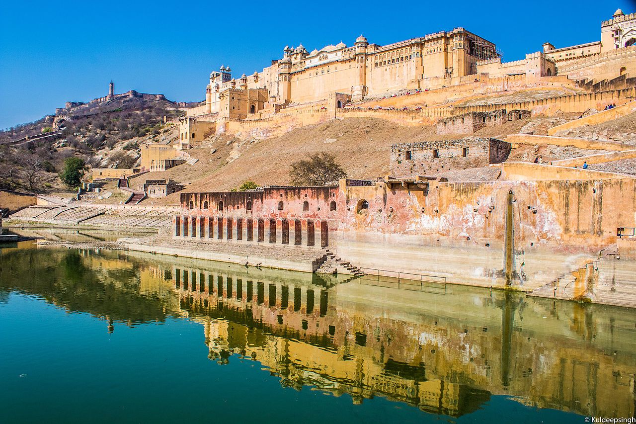
印度门(马拉特语:भारताचे प्रवेशद्वार;英语:Gateway of India),是建于20世纪初的拱门式纪念碑,位于印度马哈拉施特拉邦的孟买市。它是为了纪念第一位莅临印度的英国国王而建造的。1911年12月,印度皇帝-英王乔治五世和玛丽皇后到达孟买时,纪念门尚未修建,只以纸板结构来迎接君主。1914年,建筑师乔治·维特(George Wittet)结合了16世纪古吉拉特的建筑元素,以印度撒拉逊风格设计的纪念门,得到认可,并于1924年完成。由玄武岩制成的纪念门,高26米(85英尺)。
印度门位于海滨的一角,俯瞰阿拉伯海,对面是具有百年历史,豪华的泰姬玛哈酒店。自建成后,就成为殖民地官员进入英属印度仪式的一个入口,它被称为纪念英国殖民历史的“征服和殖民”(conquest and colonization)的象征,也是1948年印度独立后,最后一批英军离开印度的纪念碑。今天,这座门是孟买市的代名词,并且是主要的旅游景点之一,是当地人、街头小贩和摄影师的聚集地。自2003年以来,它也是光明节庆祝活动的场所,对当地的犹太社区具有重要意义。入口处有5个码头,其中2个用于商业渡轮。
Das Gateway of India ist ein Monument in Form eines mittig erhöhten und durch Pfeiler verstärkten Triumphbogens am Thane Creek in Mumbai, Indien. Es ist eines der Wahrzeichen des Landes.Die drei Portale des im indo-sarazenischen Stil errichteten ca. 50 m breiten und 26 m hohen Bauwerks sind unterschiedlich breit und hoch. Der erhöhte mittlere Teil wird durch 4 kleine Ecktürmchen zusätzlich betont; sein Durchgang wird von einer Kuppel mit einem Durchmesser von ca. 14,50 m und einer Scheitelhöhe von ca. 25 m überspannt. Die beiden seitlichen Öffnungen sind durch Steingitter (jalis) verkleinert; die Kuppeln im Innern sind kleiner und niedriger. Optisch und ästhetisch bedeutsam für die Außenwirkung sind die horizontalen Gesimse mit ihren stützenden Konsolen.
 Aljaksandr Lukaschenka
 Aserbaidschan
 Belarus
 China
China
 Emomalij Rahmon
 Indien
 Iran
Iran
 Kasachstan
 Kirgisistan
 Mohammad Mokhber

 Mongolei
 Pakistan
 Qassym-Schomart Toqajew
 Russland
 Sadyr Dschaparow
 Shavkat Mirziyoyev
 Shehbaz Sharif
 Tadschikistan
 Türkei
 Turkmenistan
 Usbekistan

 Wirtschaft und Handel
 Wladimir Wladimirowitsch Putin
 Xi Jingping

The 2024 SCO summit was the 24th annual summit of heads of state of the Shanghai Cooperation Organisation held between 3 and 4 July 2024 in Astana, Kazakhstan.
2024 年上海合作组织峰会是上海合作组织第二十四次元首年度峰会,于 2024 年 7 月 3 日至 4 日在哈萨克斯坦阿斯塔纳举行。

孟加拉湾(印地语:बंगाल की खाड़ी、孟加拉语:বঙ্গোপসাগর、缅甸语:ဘင်္ဂလားပင်လယ်အော်)是印度洋北部的一个海湾,西临印度半岛,东临中南半岛,北临缅甸和孟加拉国,南在斯里兰卡至苏门达腊岛一线与印度洋本体相交,经马六甲海峡与暹罗湾和南海相连。宽约1600公里,面积217万平方公里;水深2000-4000米,南部较深;盐度30-34‰。
沿岸国家有印度、孟加拉国、缅甸、泰国、斯里兰卡、马来西亚和印度尼西亚。
印度和缅甸的一些主要河流均流入孟加拉湾,著名的大河有:恒河、布拉马普特拉河、伊洛瓦底江、萨尔温江、克里希纳河等等。孟加拉湾中著名的岛屿包括斯里兰卡岛、安达曼群岛、尼科巴群岛、普吉岛等。
孟加拉湾沿岸贸易发达,主要港口有:印度的加尔各答、金奈、本地治里、孟加拉国的吉大港、缅甸的仰光、毛淡棉、泰国的普吉、马来西亚的槟榔屿、印度尼西亚的班达亚齐、斯里兰卡的贾夫纳等等。
Der Golf von Bengalen (bengalisch বঙ্গোপসাগর baṅgopasāgar; indonesisch Teluk Benggala;malaiisch Teluk Bengal; thailändisch อ่าวเบงกอล; seltene deutsche Bezeichnungen: Bengalischer Golf, Bengalischer Meerbusen, Bai von Bengalen[1][2][3][4]) ist ein nordöstliches Randmeer des Indischen Ozeans mit einer Fläche von rund 2.171.000 km². Er ist 2090 km lang und bis zu 1610 km breit und hat grob gesehen die Form eines Dreiecks. Der Golf ist durchschnittlich 2600 Meter und maximal 4694 Meter tief. Er trennt die Landmasse des indischen Subkontinents von der Halbinsel Hinterindien. Das Klima ist vom Monsun geprägt. Besonderheiten der Region sind insbesondere eine Reihe von Schlammvulkanen sowie die größten Mangrovenwälder der Erde, wie die Sundarbans.
Der Golf von Bengalen wird im Westen von Sri Lanka und Indien, im Norden von der namensgebenden Region Bengalen, bestehend aus dem Staat Bangladesch und dem indischen Bundesstaat Westbengalen sowie im Osten von Myanmar, Thailand und Indonesien begrenzt. Im Süden ist er mit dem Indischen Ozean verbunden. Als ungefähre Abgrenzung des Golfes kann eine gedachte Linie zwischen der Südspitze Sri Lankas und der Nordspitze der zu Indonesien gehörenden Insel Sumatra angenommen werden.
ベンガル湾(ベンガルわん、Bay of Bengal)は、インド洋の北東部分の湾。湾はほぼ三角形で、南方に開けた形となっている。東にマレー半島、西にインド亜大陸、北に名前の元となったインドの西ベンガル州およびバングラデシュに面している。南端はスリランカとアンダマン・ニコバル諸島連邦直轄地に面している。同諸島の東側の海域はアンダマン海と呼ばれる。
インドやバングラデシュの多くの川がベンガル湾に流れ込んでいる。北からはガンジス川、メグナ川とブラマプトラ川が流れ込み、南西の沿岸であるオリッサ州からはマハナディ川、ゴータヴァリー川、クリシュナ川、カヴェリ川が流れ込んでいる。湾の北端のインド領には、スンダルバンス国立公園があり、豊かなマングローブの林がある。ミャンマーのエーヤワディー川もベンガル湾に流れ込んでいる。
チェンナイ(旧名マドラス)やコルカタ(旧名カルカッタ)といった大都市がベンガル湾に接しており、古くから交易拠点として栄えてきた。
The Bay of Bengal is the northeastern part of the Indian Ocean, bounded on the west and northwest by India, on the north by Bangladesh, and on the east by Myanmar and the Andaman and Nicobar Islands of India. Its southern limit is a line between Sangaman Kanda, Sri Lanka and the north westernmost point of Sumatra (Indonesia). It is the largest water region called a bay in the world. There are countries dependent on the Bay of Bengal in South Asia and Southeast Asia. In ancient India, Bay of Bengal was known as Kalinga Sagar. Later during the British India, it came forth as the Bay of Bengal after the historic Bengal region, as the Port of Kolkata served as the gateway to the Crown rule in India. Cox's Bazar, the longest sea beach in the world and Sundarbans, the largest mangrove forest and the natural habitat of the Bengal tiger, are located along the bay.
The Bay of Bengal occupies an area of 2,600,000 square kilometres (1,000,000 sq mi). A number of large rivers flow into the Bay of Bengal: the Ganges–Hooghly, the Padma, the Brahmaputra–Jamuna, the Barak–Surma–Meghna, the Irrawaddy, the Godavari, the Mahanadi, the Brahmani, the Baitarani, the Krishna and the Kaveri. Among the important ports are Chennai, Ennore, Chittagong, Colombo, Kolkata-Haldia, Mongla, Paradip, Port Blair, Thoothukudi, Visakhapatnam and Dhamra. Among the smaller ports are Gopalpur Port, Kakinada and Payra.
Le golfe du Bengale (bengali : বঙ্গপসাগর, anglais : Bay of Bengal) est une mer qui forme la partie du nord-est de l'océan Indien. Elle a la forme d'un triangle encadré à l'est par les côtes birmanes jusqu'au cap Negrais puis par les archipels Andaman et Nicobar, et à l'ouest par le sous-continent indien. Au nord du golfe, on trouve l'état indien du Bengale-Occidental et le Bangladesh, d'où provient son nom. Ses limites méridionales sont le pont d'Adam puis une ligne ouest-est ayant son origine à la pointe sud de l'île de Sri Lanka, et finissant à la pointe nord de l'île indonésienne de Breueh (Pulau Breueh), non loin de Sumatra.
Il golfo del Bengala (বঙ্গোপসাগর in bengalese, ဘင်္ဂလားပင်လယ်အော် in birmano, बंगाल की खाड़ी in hindi e බෙංගාල බොක්ක in singalese) è l'insenatura più ampia del mondo e, per le sue dimensioni (2.172.000 km² di superficie), al punto che può essere considerato un mare vero e proprio. Di forma approssimativamente triangolare, costituisce la parte nordorientale dell'Oceano Indiano ed è collocato fra il Subcontinente indiano a ovest e l'Indocina ad est.
El Golfo de Bengala es un mar en el área noreste del océano Índico. Su forma se parece a un triángulo. Limita al este con la península de Malaca, al oeste con el subcontinente indio. El extremo norte del golfo limita con el estado indio de Bengala Occidental y con Bangladés. Los extremos del sur están limitados por la isla de Sri Lanka y el territorio indio de las Islas Andamán y Nicobar. Estas últimas islas separan el golfo de Bengala del mar de Andamán (también mar de Birmania).
Muchos de los ríos principales de la India desembocan desde el oeste en la bahía de Bengala: en el norte el río Ganges (o Ganga), el río Meghna y el río Brahmaputra. Al sur el Mahanadi, el Godavari, el Krishna y el Kaveri (también escrito Cauvery). El bosque de mangle llamado los Sundarbans está situado en el delta que forman los ríos Ganges, Brahmaputra y Meghna en el golfo de Bengala.
Los puertos indios más importantes del golfo son Madrás, Vishakhapatnam, Calcuta y Pondicherry.
Бенга́льский зали́в (бенг. বঙ্গোপসাগর, там. வங்காள விரிகுடா, хинди बंगाल की खाड़ी, англ. Bay of Bengal[1]) — морской залив, расположенный в северо-восточной части Индийского океана, омывает берега Индии, Бангладеш, Мьянмы и Шри-Ланки. На западе ограничен полуостровом Индостан, на востоке — побережьем Мьянмы и островными дугами Андаманских и Никобарских островов. У северной оконечности залива располагается историческая область Бенгалия (включающая современную Бангладеш и индийский штат Западная Бенгалия), давшая ему название. Является самым большим заливом в мире, его площадь — 2191 тысяча км²[2] (по другим данным 2173 тысячи км²[1]). Наибольшая глубина — 4519 м[2], средняя — 2600 м[1].
В Бенгальский залив впадают многие крупные реки — Ганг, Брахмапутра и Мегхна (общий эстуарий), Кришна, Годавари, Кавери, Маханади, Иравади.
На северо-восточном побережье залива, у города Кокс-Базар (Бангладеш) расположен самый протяжённый в мире пляж (120 км).
По гидрологическому, гидрохимическому и прочим параметрам Бенгальский залив относится к морям.
 Geographie
 Unternehmen
 Leben und Style
 Motorsport
 Weltkulturerbe
 Parteien und Regierung
 Architektur