Deutsch-Chinesische Enzyklopädie, 德汉百科
 UEFA European Championship 2020
Belgium
Eurovision Song Contest,ESC
UEFA European Championship 2020
UEFA European Championship 2020
Belgium
Eurovision Song Contest,ESC
UEFA European Championship 2020
 History
 International cities
 *European Capital of Culture
 World Heritage
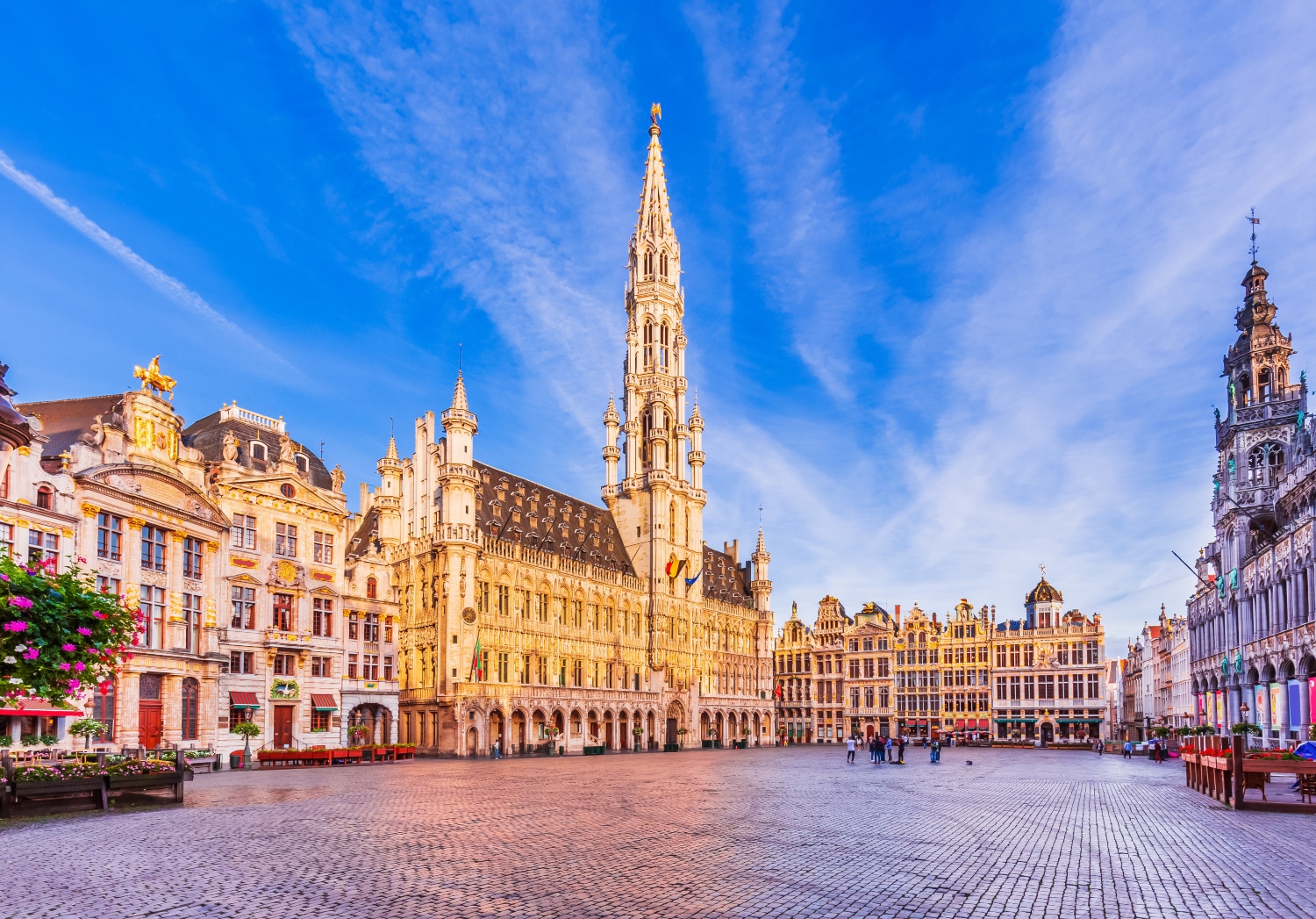

布鲁塞尔(法语:Bruxelles;荷兰语:Brussel)是比利时的首都和最大的城市,也是欧洲联盟的主要行政机构所在地。位于布鲁塞尔首都区的布鲁塞尔市,[1]。 在不同的语境中,布鲁塞尔有着不同的外延。她可能代表布鲁塞尔市(比利时的布鲁塞尔首都区中最大的地方自治体及首府,常住人口140,000),也可能代表布鲁塞尔首都区(据2008年2月1日统计,常住人口为1,067,162),或者也可能用于表示布鲁塞尔城市圈(常住人口1,350,000[2])。
欧洲联盟三个主要的机构当中,欧盟委员会和欧盟部长理事会位于布鲁塞尔,另一个重要机构欧洲议会在布鲁塞尔也有分处(全体议会在法国斯特拉斯堡),所以它有欧洲首都的美誉。另外,北大西洋公约组织的总部也设在布鲁塞尔。
布鲁塞尔是一个双语城市,通用法语和荷兰语,法语的使用者占较多数。另外,土耳其语、阿拉伯语等语言被布鲁塞尔的穆斯林广泛使用。
Mit Brüssel (französisch Bruxelles [bryˈsɛl], niederländisch Brussel [brɵsəɫ]) kann entweder eine Stadt in Belgien gemeint sein oder die größere Hauptstadtregion mit 19 Gemeinden beziehungsweise das gesamte städtische Gebiet der Hauptstadtregion.
Die zweisprachige Region Brüssel-Hauptstadt (französisch Région de Bruxelles-Capitale, niederländisch Brussels Hoofdstedelijk Gewest) ist neben Flandern und der Wallonischen Region eine von drei Regionen im föderalen belgischen Staatsaufbau. Die Region hat über eine Million Einwohner und besitzt eine höhere Bevölkerungsdichte als irgendeine deutsche Großstadt.[1] Sie ist daher nicht mit den weit ins Umland reichenden Metropolregionen vergleichbar, die in den letzten Jahren rund um viele europäische, unter anderem auch deutsche Großstädte definiert wurden. Der Ballungsraum Brüssel ist noch einmal wesentlich größer als die Region Brüssel.
Die Stadt Brüssel ist die Haupt- und Residenzstadt des Königreichs Belgien. Sie bildet das Zentrum der Region Brüssel-Hauptstadt, ist eine ihrer 19 Gemeinden und hat etwa 180.000 Einwohner. Dort haben mehrere föderale Institutionen ihren Sitz: Die Stadt Brüssel ist Verwaltungssitz der Region Brüssel-Hauptstadt. Hier befindet sich darüber hinaus der Verwaltungssitz der Französischen Gemeinschaft Belgiens, während die Wallonische Region ihren Sitz in Namur hat. Die Organe der Region Flandern und der Flämischen (niederländischsprachigen) Gemeinschaft sind fusioniert und haben ihren Sitz ebenfalls in der Stadt Brüssel. Zudem stellt die Stadt den Hauptsitz der Europäischen Union sowie den Sitz der NATO, ferner den des ständigen Sekretariats der Benelux-Länder und von EUROCONTROL dar.
Im Jahre 996 erstmals urkundlich erwähnt und im Mittelalter zur Hauptstadt des Herzogtums Brabant aufgestiegen, wurde Brüssel mit der Unabhängigkeit Belgiens 1830 zu dessen Hauptstadt erhoben. Zusammen mit seinen umliegenden Gemeinden ist Brüssel heute als Industrie- und Handelsstadt mit zwei Universitäten, mehreren Hochschulen, Akademien, Bibliotheken, Museen und Bühnen ein bedeutendes Wirtschafts-, Wissenschafts- und Kulturzentrum sowie ein wichtiger Verkehrsknotenpunkt im Zentrum des Landes.
Der Artikel Region Brüssel-Hauptstadt behandelt vor allem die Themen Politik, Verwaltung und Sprachensituation. Weitere und übergreifende Themen werden nachfolgend behandelt.
ブリュッセル市(ブリュッセルし、フランス語: Ville de Bruxelles [ˈvil də bʀyˈsɛl] または Bruxelles-Ville、オランダ語: Stad Brussel [s̪t̪ɑt̪ ˈbrʏ.s̪əl̪] または Brussel-Stad)は、ブリュッセル首都圏地域を構成する最大の基礎自治体である。ベルギーの憲法上の首都である[2]が、実際にはブリュッセル首都圏地域全体で首都としての機能を果たしている。主としてブリュッセルの歴史的中心部から成り、ロンドンにおけるシティにたとえることができる。
ブリュッセル市は、ブリュッセルの歴史的な中心市街地に加えて、ブリュッセル首都圏地域内のいくつかの地区、すなわち北部のアレン、ラーケンおよびネデル=オヴェル=エンベーク、ならびに南部のルイーズ大通りおよびカンブルの森から構成される。
ブリュッセル市の総面積は32.61 km2、2014年9月1日現在の総人口は173,540人で、人口密度は5,321.68人/km2である[1]。また2014年時点で、ブリュッセル市の人口約17万人のうち、約6万人が外国人(うち3万6千人がEU市民、2万4千人が非EU市民)となっている[3]。
The City of Brussels (French: Ville de Bruxelles [vil də bʁysɛl] or alternatively Bruxelles-Ville [bʁysɛl vil], Dutch: Stad Brussel [stɑd ˈbrɵsəl][2] or Brussel-Stad) is the largest municipality and historical centre of the Brussels-Capital Region, and the de jure capital of Belgium.[3] Besides the strict centre, it also covers the immediate northern outskirts where it borders municipalities in Flanders. It is the administrative centre of the European Union, thus often dubbed, along with the region, the EU's capital city.
The City of Brussels is a municipality consisting of the central historic town and certain additional areas within the greater Brussels-Capital Region, namely Haren, Laeken and Neder-Over-Heembeek to the north, and Avenue Louise/Louizalaan and the Bois de la Cambre/Ter Kamerenbos park to the south.
On 1 January 2017, the City of Brussels had a total population of 176,545. The total area is 32.61 km2 (12.59 sq mi) which gives a population density of 5,475 inhabitants per square kilometre (14,180/sq mi). As of 2007, there were approximately 50,000 registered non-Belgians in the City of Brussels.[4] In common with all the Brussels municipalities, it is legally bilingual (French–Dutch).
Bruxelles (prononcé [bʁy.sɛl]1 Écouter ; Brussel [ˈbrʏ.səl] Écouter en néerlandais ; Brüssel en allemand ; parfois aussi appelé aire urbaine de Bruxelles, Stedelijk gebied van Brussel en néerlandais, ou Grand Bruxelles2) est une agglomération de Belgique qui s'étend au-delà des limites administratives de la Région de Bruxelles-Capitale pour englober des parties du Brabant wallon et l'arrondissement de Hal-Vilvorde, et au centre de laquelle se trouve la ville de Bruxelles proprement dite.
La plupart des institutions de l’Union européenne, ainsi que de nombreuses organisations internationales entre autres lobbyistes, dont l’OTAN, ont leur siège en Région de Bruxelles-Capitale. Par extension, on dit donc « Bruxelles » pour désigner, en général et par métonymie, les institutions européennes (le plus souvent, la Commission européenne).
L'initiative Brussels Metropolitan, lancée en 2008, vise à mieux coordonner la ville et son arrière-pays pour valoriser le Grand Bruxelles en tant que métropole économique attrayante au cœur de l'Europe3, lui donner plus de poids sur le plan mondial et y stimuler la croissance et la création d'emplois4. Cette plateforme de coopération implique la participation de quatre organisations patronales - la FEB, BECI, le Voka et l'UWE4.
Bruxelles (nome francese; pronuncia /bʀy'sɛl/ o, meno correttamente, /bʀyk'sɛl/, italianizzata in /brukˈsɛl/[1]; in olandese Brussel, in tedesco Brüssel; in italiano storico Brusselle[2] o Borsella[3]) è un'area metropolitana del Belgio che ospita all'incirca 2,6 milioni di abitanti.[4]
Il comune di Bruxelles è uno dei 19 comuni della regione amministrativa di "Bruxelles-capitale", con cui non dovrebbe essere confuso. Questa regione è una delle tre regioni amministrative del Belgio, con la Regione vallone e la Regione fiamminga. L'area metropolitana di Bruxelles si estende oltre i confini amministrativi della Regione di Bruxelles in quanto comprende molti comuni situati nella regione fiamminga. Questa situazione è all'origine del conflitto linguistico in Belgio poiché molti residenti di Bruxelles, per lo più francofoni, sono stabiliti nella regione fiamminga di lingua olandese.
Bruxelles è considerata la capitale de facto dell'Unione europea in quanto sede di varie istituzioni, tra cui la Commissione europea, il Consiglio dell'Unione europea e parzialmente il Parlamento europeo (ufficialmente con sede a Strasburgo). Ad Evere ha inoltre sede il quartier generale della NATO. Bruxelles ospita anche il Comitato delle Regioni e il Comitato economico e sociale.
Gran parte dell'area metropolitana di Bruxelles è amministrata dalla regione di Bruxelles-Capitale, suddivisa in 19 comuni, tra cui quello del centro storico, il Comune di Bruxelles (Ville de Bruxelles/Brussel-stad). La città si estende però anche al di là dei confini della regione: vari comuni della periferia brussellese, amministrativamente parte della regione delle Fiandre, sono parte integrante del tessuto urbano di Bruxelles.[5] Tra questi Zaventem (sede dell'aeroporto internazionale), Kraainem (capolinea della metropolitana) e Tervuren (quartiere residenziale).
Bruselas (en francés: Bruxelles ![]() [bʁysɛl] (?·i), en neerlandés: Brussel
[bʁysɛl] (?·i), en neerlandés: Brussel ![]() [ˈbrɵsəl] (?·i) y en alemán: Brüssel) es la capital de Bélgica,1 y la principal sede administrativa de la Unión Europea (UE).
[ˈbrɵsəl] (?·i) y en alemán: Brüssel) es la capital de Bélgica,1 y la principal sede administrativa de la Unión Europea (UE).
Bruselas es un municipio situado en la región administrativa "Bruselas-Capital" que es una de las tres regiones de Bélgica, con la Región Valona y la Región flamenca.
Como capital del Estado, Bruselas es la sede del gobierno y el Parlamento. Alberga también, el Castillo de Laeken la residencia de Su Majestad el rey Felipe de Bélgica y la familia real belga.
Брюссе́льский столи́чный регио́н (фр. Région de Bruxelles-Capitale, ʁe'ʒjɔ̃ də bʁy'sɛlkapi'tal ![]() слушать, нидерл. Brussels Hoofdstedelijk Gewest, ˈbrʏsəɫs ɦoːft'steːdələk xəʋɛst
слушать, нидерл. Brussels Hoofdstedelijk Gewest, ˈbrʏsəɫs ɦoːft'steːdələk xəʋɛst ![]() слушать, а также просто фр. Bruxelles, bʁysɛl
слушать, а также просто фр. Bruxelles, bʁysɛl ![]() слушать; нидерл. Brussel, ˈbrʏsəɫ
слушать; нидерл. Brussel, ˈbrʏsəɫ ![]() слушать) — один из трёх регионов Бельгии, субъект федерации наравне с Фламандским и Валлонским регионами. Крупнейшая городская зона-агломерация в Бельгии[1], состоящая из 19 муниципалитетов, каждый со своим бургомистром, ратушей и т. д. Фактически они являются районами одного города (часто граница проходит посередине улицы). Формально название Брюссель относится только к одному из вышеуказанных муниципалитетов, но на практике его употребляют ко всей агломерации. Одним из муниципалитетов является Брюссель, который де-юре является столицей Бельгии, и в котором находятся Французское и Фламандское сообщества[2]. Де-факто, в силу того что столичные учреждения распределены по различным муниципалитететам Брюссельского столичного региона, регион считается столицей Бельгии, столицей Европейского союза[3].
слушать) — один из трёх регионов Бельгии, субъект федерации наравне с Фламандским и Валлонским регионами. Крупнейшая городская зона-агломерация в Бельгии[1], состоящая из 19 муниципалитетов, каждый со своим бургомистром, ратушей и т. д. Фактически они являются районами одного города (часто граница проходит посередине улицы). Формально название Брюссель относится только к одному из вышеуказанных муниципалитетов, но на практике его употребляют ко всей агломерации. Одним из муниципалитетов является Брюссель, который де-юре является столицей Бельгии, и в котором находятся Французское и Фламандское сообщества[2]. Де-факто, в силу того что столичные учреждения распределены по различным муниципалитететам Брюссельского столичного региона, регион считается столицей Бельгии, столицей Европейского союза[3].
Брюссель начинался как город-крепость в 10 веке, основанный Карлом I[4]. Население региона составляет 1,1 миллион человек, а всё население метрополии — более 1,8 миллионов, занимая таким образом первое место по этому показателю в Бельгии[5][6]. Со времён окончания Второй мировой войны Брюссель является одним из главных центров мировой политики. Будучи местом расположения институтов Европейского союза[7] и штаб-квартиры НАТО, Брюссель стал многоязыковым домом для многочисленных международных организаций, политиков и дипломатов[8].
Исторически нидерландоязычный, Брюссель со времён обретения Бельгией независимости в 1830 году, превратился почти полностью во франкоязычный регион. На сегодняшний день официальными считаются оба языка. Все дорожные знаки, названия улиц и большая часть рекламы и названий услуг приводятся на двух языках[9]. Языковой вопрос остаётся острым в Брюсселе, законы, затрагивающие его, являются предметом неутихающих обсуждений в Бельгии.
UEFA European Championship 2020
History
ITU World Championship Series
Silk road
 Sport
Triathlon
Hungary
Sport
Triathlon
Hungary
 Cities founded by the Romans
World Heritage
Cities founded by the Romans
World Heritage


ブダペストまたはブダペシュト(ハンガリー語: Budapest, 英語:[ˈbuːdəpɛst], [ˈbuːdəpɛʃt] or [ˈbʊdəpɛst]; ハンガリー語発音: [ˈbudɒpɛʃt] (![]() 音声ファイル))は、ハンガリーの首都であり、同国最大の都市である[2]。
音声ファイル))は、ハンガリーの首都であり、同国最大の都市である[2]。
「ブダペスト」として一つの市でドナウ川の両岸を占めるようになったのは1873年11月17日に西岸のブダとオーブダ、東岸のペストが合併してからである[3][4]。
ドナウ川河畔に位置し、ハンガリーの政治、文化、商業、産業、交通の一大中心都市で[5]、東・中央ヨーロッパ (en) では最大、欧州連合の市域人口では8番目に大きな都市である。しばしばハンガリーのプライメイトシティとも表現される[6]。
ブダペストの市域面積は525km2 (202.7 sq mi)[3]で、2011年の国勢調査によるブダペストの人口は174万人[7]、ピークであった1989年の210万人より減少している[8]。これは、ブダペスト周辺部の郊外化によるものである[9]。ブダペスト都市圏(通勤圏)の人口は330万人である[10][11]。
ブダペストの歴史の始まりはローマ帝国のアクインクムとしてで、もともとはケルト人の集落であった[12][13]。アクインクムは古代ローマの低パンノニア属州の首府となっている[12]。マジャル人がブダペスト周辺にやって来たのは[14]9世紀頃である。最初の集落は1241年から1242年にかけてモンゴルの襲来 (en) により略奪された[15]。15世紀に[16]町が再建されるとブダペストはルネサンス期の人文主義者文化の中心となった[17]。続いてモハーチの戦いが起こり、オスマン帝国による150年間の支配が続き[18]、18世紀、19世紀に新しい時代に入ると町は発展し繁栄する。ブダペストは1873年にドナウ川を挟んだ都市の合併が行われると、世界都市となる[19]。また、1848年から1918年の第一次世界大戦勃発まで列強に含まれたオーストリア=ハンガリー帝国のウィーンに続く第二の首都であった。1920年のトリアノン条約によりハンガリーは国土の72%を失い、ハンガリーの文化や経済をブダペストがすべてを占めるようになった。ブダペストはその大きさや人口で圧倒的に優位に立ち、ハンガリーの他の都市を小さく見せていた[20]。ブダペストはハンガリー革命 (1848年)や1919年のハンガリー評議会共和国、1944年のパンツァーファウスト作戦、1945年のブダペスト包囲戦、1956年のハンガリー動乱など数々の歴史的な舞台の場でもあった。
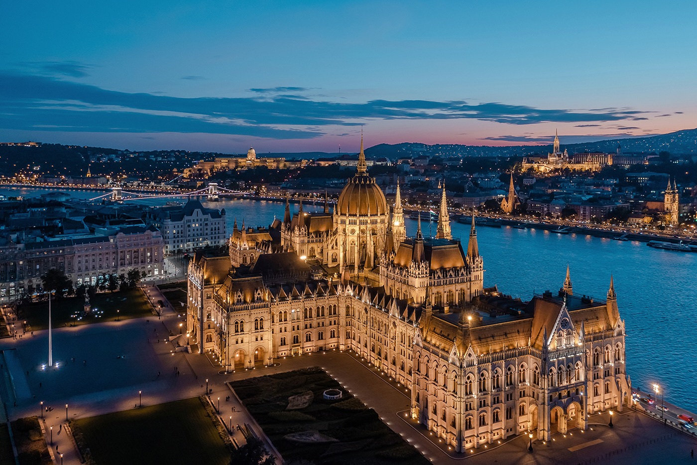
ブダペストはヨーロッパでも最も美しい街の一つで[2][21][22]、ドナウ川河岸を含め世界遺産が広がりブダ城やアンドラーシ通り、英雄広場は良く知られている。ブダペスト地下鉄1号線Millenniumi Földalatti Vasútはロンドン地下鉄に次いで世界で2番目に古い地下鉄である[21][23]。ブダペストの他のハイライトはセーチェーニ温泉を含めた80の温泉で[24]世界でも最大の地下熱水系統がある[25]。世界で3番目に大きなシナゴーグであるドハーニ街シナゴーグや国会議事堂などもブダペストの見所である。ブダペストの観光客数は年間270万人に上り、ロンドンにある民間調査機関ユーロモニターによればブダペストは世界で37番目に旅行者が多い観光地であるとされている[26]。
Budapest /ˈbuːdəpɛst/ is the capital and the most populous city of Hungary, and the tenth-largest city in the European Union by population within city limits.[9][10][11] The city had an estimated population of 1,752,704 in 2016 distributed over a land area of about 525 square kilometres (203 square miles).[12] Budapest is both a city and county, and forms the centre of the Budapest metropolitan area, which has an area of 7,626 square kilometres (2,944 square miles) and a population of 3,303,786, comprising 33 percent of the population of Hungary.[13][14]
The history of the city began when an early Celtic settlement transformed into a Roman town of Aquincum,[15][16] the capital of Lower Pannonia.[15] The Hungarians arrived in the territory in the late 9th century.[17] By the 11th century, Buda and Óbuda (Old Buda) became the names of their settlements on the west bank of the river Danube, with a formerly Slavic and then German settlement Pest on the opposite side.[3][18] The area was pillaged by the Mongols in 1241.[18] The Battle of Mohács in 1526 was followed by nearly 150 years of Ottoman rule.[19] After the reconquest of Buda in 1686, the region entered a new age of prosperity. Pest-Buda became a global city with the unification of Buda, Óbuda, and Pest on November 17, 1873, with the name 'Budapest' given to the new capital.[12][20] Budapest also became the co-capital of the Austro-Hungarian Empire,[21] a great power that dissolved in 1918, following World War I. The city was the focal point of the Hungarian Revolution of 1848, the Battle of Budapest in 1945, and the Hungarian Revolution of 1956.[22][23]
Budapest is a Beta+ global city with strengths in commerce, finance, media, art, fashion, research, technology, education, and entertainment.[24][25] It is Hungary's financial centre[26] and the highest ranked Central and Eastern European city on Innovation Cities Top 100 index,[27][28][29] as well ranked as the second fastest-developing urban economy in Europe.[30] Budapest is host to many major international organization's regional offices, including the United Nations and ICDT,[31] furthermore it is the headquarters of the European Institute of Innovation and Technology,[32] the European Police College[33] and the first foreign office of the China Investment Promotion Agency.[34] Over 40 colleges and universities are located in Budapest, including the Eötvös Loránd University, Semmelweis University and the notable Budapest University of Technology and Economics.[35][36] Opened in 1896,[37] the city's subway system, the Budapest Metro, serves 1.27 million, while the Budapest Tram Network serves 1.08 million passengers daily.[38]
Budapest is cited as one of the most beautiful cities in Europe,[9][39][40] ranked as "the world's second best city" by Condé Nast Traveler,[41] and "Europe's 7th most idyllic place to live" by Forbes.[42] Among Budapest's important museums and cultural institutions is the Museum of Fine Arts. Further famous cultural institutions are the Hungarian National Museum, House of Terror, Franz Liszt Academy of Music, Hungarian State Opera House and National Széchényi Library. The central area of the city along the Danube River is classified as a UNESCO World Heritage Site and has many notable monuments, including the Hungarian Parliament, Buda Castle, Fisherman's Bastion, Gresham Palace, Széchenyi Chain Bridge, Matthias Church and the Liberty Statue.[43] Other famous landmarks include Andrássy Avenue, St. Stephen's Basilica, Heroes' Square, the Great Market Hall, the Nyugati Railway Station built by the Eiffel Company of Paris in 1877 and the second-oldest metro line in the world, the Millennium Underground Railway.[39] The city also has around 80 geothermal springs,[44] the largest thermal water cave system,[45] second largest synagogue, and third largest Parliament building in the world.[46] Budapest attracts 4.4 million international tourists per year, making it a popular destination in Europe.[47]
Budapest (prononcé [by.da.ˈpɛst] , hongrois : Budapest [ˈbu.dɒ.pɛʃt] Écouter ; allemand : Budapest ou anciennement Ofen-Pesth) est la plus grande ville et la capitale de la Hongrie. Elle se situe en aval du coude du Danube entre le massif de Transdanubie et l'Alföld. Ses habitants sont les Budapestois (en hongrois, budapesti, -ek).
La ville actuelle est créée en 1873 par la fusion de Buda — alors capitale de la Hongrie — de Pest et d'Óbuda1. Elle a pour origine le site d'Aquincum2, un point de peuplement celte3 devenu capitale de la Pannonie inférieure pendant l'époque romaine3. Les Magyars arrivent dans la région au IXe siècle. Leur premier point d'implantation est pillé par les Mongols en 1241-12424. La ville est reconstruite et devient l'un des centres de la culture humaniste de la Renaissance5 au XVe siècle6. Après près de 150 ans de domination ottomane, elle poursuit son développement et connaît son apogée avec l'épanouissement de l'ère industrielle aux XVIIIe et XIXe siècles. Après la fusion de 1873 et l'accession de la ville au rang de seconde capitale de l'Autriche-Hongrie, Budapest atteint les proportions et les caractéristiques d'une ville mondiale7. Marquée par les différentes traces léguées par l'histoire, Budapest a notamment été l'épicentre de la révolution hongroise de 1848, de la République des conseils de Hongrie de 1919, de l'opération Panzerfaust en 1944, de la bataille de Budapest de 1945 et de l'insurrection de 1956.
Considérée comme l'une des plus belles villes d'Europe et comme la « perle » du Danube8,1,9, son panorama, le quartier du château de Buda, l'avenue Andrássy et le métropolitain du Millénaire figurent au patrimoine mondial de l'UNESCO8,10. Destination touristique importante, la ville attire plus de 4,3 millions de visiteurs par an11.
Plus grande ville du pays, elle en est le principal centre politique, culturel, commercial et industriel. Elle abrite le Parlement hongrois, les bâtiments ministériels et les ambassades du pays ainsi que les sièges sociaux des entreprises installées en Hongrie. Son ancien statut de cocapitale de l'Autriche-Hongrie lui confère un rayonnement important dans la Mitteleuropa. La partition du royaume de Hongrie à la suite du traité de Trianon en 1920 en fait une ville démesurée pour la Hongrie dans ses frontières actuelles. La macrocéphalie dont est atteinte la ville se concrétise par la convergence de la plupart des réseaux routiers et ferroviaires du pays en son centre et des écarts démographiques et économiques disproportionnés entre la capitale et la province12 (près de 20 % de la population hongroise est budapestoise). Avec ses 1 702 297 habitants13 (l'aire urbaine en compte 2 524 697), Budapest est également la ville la plus peuplée d'Europe centrale (si l'on exclut Berlin de l'Europe centrale). Elle en est également considérée du point de vue des échanges économiques comme une importante plaque tournante14. Budapest abrite le siège de l'Institut européen d'innovation et de technologie (IET)15.
Budapest (IPA: [ˈbudɒpɛʃt]; pronuncia italiana moderna: /ˈbudapest/[1]) è la capitale e la maggiore città dell'Ungheria.
Amministrata come un comune autonomo, costituisce inoltre il centro primario del Paese per la vita politica, economica e culturale; al 2016 conta 1 759 407 abitanti, mentre la popolazione residente nell'area metropolitana ammonta a oltre 3 300 000 persone.
Budapest nacque ufficialmente nel 1873 dall'unione delle città storiche di Buda e Óbuda, ubicate sulla sponda destra del Danubio, con l'abitato di Pest, situato sulla riva opposta del fiume e anch'esso di antiche origini; fino al 1918 fu una delle due capitali dell'Impero austro-ungarico, dissoltosi al termine della prima guerra mondiale.
Nel XXI secolo, Budapest è diventata una metropoli globale e si è affermata come una popolare destinazione turistica: nel 2011, secondo i dati forniti da Euromonitor International, la capitale ungherese è stata la 25ª città più visitata del mondo[2].
Budapest (![]() /ˈbudɒpɛʃt/ (?·i)) es la capital y ciudad más poblada de Hungría,2 así como su principal centro industrial, comercial y de transportes.3 La ciudad posee 1,74 millones de habitantes (2011),4 una disminución significativa respecto de los casi 2,1 millones con que contaba a mediados de los años 1980,5 que representan un quinto de la población total de Hungría. Es la ciudad más poblada de Europa central-oriental y la séptima de la Unión Europea. La ciudad ocupa una superficie de 525 km²6 y su área metropolitana cuenta con una población de 2,38 millones de habitantes. Budapest se convirtió en una única ciudad cuando ocupó las dos orillas del río Danubio, unificando las ciudades de Buda y Óbuda, en la orilla oeste, con Pest, en la orilla este, el 17 de noviembre de 1873.67
/ˈbudɒpɛʃt/ (?·i)) es la capital y ciudad más poblada de Hungría,2 así como su principal centro industrial, comercial y de transportes.3 La ciudad posee 1,74 millones de habitantes (2011),4 una disminución significativa respecto de los casi 2,1 millones con que contaba a mediados de los años 1980,5 que representan un quinto de la población total de Hungría. Es la ciudad más poblada de Europa central-oriental y la séptima de la Unión Europea. La ciudad ocupa una superficie de 525 km²6 y su área metropolitana cuenta con una población de 2,38 millones de habitantes. Budapest se convirtió en una única ciudad cuando ocupó las dos orillas del río Danubio, unificando las ciudades de Buda y Óbuda, en la orilla oeste, con Pest, en la orilla este, el 17 de noviembre de 1873.67
La historia de Budapest comenzó con Aquincum, originalmente un asentamiento celta89 que se convirtió en la capital romana de Panonia Inferior.8 Los húngaros llegaron al territorio en el siglo IX.10 Su primer asentamiento fue saqueado por los mongoles en 1241-42.11 La ciudad restablecida se convirtió en uno de los centros de la cultura del Renacimiento humanista en el siglo XV.1213 Después de la batalla de Mohács y tras casi 150 años de dominio otomano,14 el desarrollo de la región entró en una nueva era de prosperidad en los siglos XVIII y XIX, y Budapest se convirtió en una ciudad global después de la unificación de 1873.15 También se convirtió en la segunda capital de Austria-Hungría, una gran potencia que se disolvió en 1918. Budapest fue el punto focal de la revolución húngara de 1848, la República Soviética Húngara de 1919, la Operación Panzerfaust en 1944, la batalla de Budapest de 1945 y la Revolución de 1956.
Considerada como una de las ciudades más bellas de Europa,21617 Budapest cuenta con varios sitios que son Patrimonio de la Humanidad, entre los que se incluyen, a orillas del Danubio, el barrio del Castillo de Buda, la avenida Andrássy, la Plaza de los Héroes y el Metropolitano del Milenio, el segundo más antiguo del mundo.1618 Otros puntos destacados incluyen un total de 80 manantiales geotérmicos,19 el mayor sistema de cuevas de aguas termales del mundo,20 la segunda sinagoga más grande y el tercer edificio del Parlamento más grande del mundo. La ciudad atrae a alrededor de 4,3 millones de turistas al año, convirtiéndola en la 25.ª ciudad más popular del mundo, según Euromonitor.21
Budapest es, también, un importante centro financiero de Europa Central. La ciudad se situó tercera (de un total de 65 ciudades) en el Índice de Mercados Emergentes elaborado por Mastercard,22 y clasificada como la ciudad mejor habitable de Europa Central y Europa del Este por índice de calidad de vida según Economist Intelligence Unit.2324 También se clasificó como el "séptimo lugar idílico de Europa para vivir" por la revista Forbes,25 y como la novena ciudad más bella del mundo por UCityGuides.26 Es, también, la mejor ciudad de Europa Central y del Este en el índice Innovation Cities' Top 100.2728
Будапе́шт (венг. Budapest [ˈbudɒpɛʃt]) — столица Венгрии и самый крупный город страны. По численности населения, составлявшей на январь 2014 года 1,745 млн жителей[2], в Европейском союзе Будапешт занимает восьмое место. Город образовался в 1873 году в результате слияния нескольких венгерских городов: Пешта, расположенного на восточной стороне реки Дунай, Буды и Обуды, занимающих западный берег Дуная.
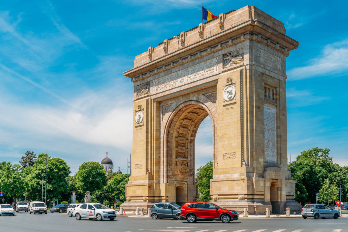
布加勒斯特(罗马尼亚语:București),罗马尼亚首都,位于罗马尼亚东南部,瓦拉几亚平原中部,多瑙河支流登博维察河畔。有“小巴黎”之称。面积约228平方公里,人口近200万。它是罗马尼亚最大的城市,也是政治、经济、文化中心。若以以人口计算,布加勒斯特是欧盟第六大都市。
据历史记载,该市已有500多年的历史。1459年,布加勒斯特成为罗马尼亚要塞,1574年发展成为城市,1659年起成为瓦拉几亚公国首都。1862年成为统一的罗马尼亚国家首都。1877年5月9日罗马尼亚在此宣布独立。1947年为罗马尼亚人民共和国首都。1977年发生地震。1989年爆发革命,成为新罗马尼亚的首都。此后,经济不断发展,成为罗马尼亚具有代表性的城市。该市行政划分为六个区,设市长一名,各区区长一名,均由市民选举产生。布加勒斯特有两支著名的足球强队——布加勒斯特迪纳摩和布加勒斯特星队。位于布加勒斯特的罗马尼亚人民宫号称是世界第二大建筑物。
Bukarest (rumänisch: București [bukuˈreʃtʲ]; ) ist die Hauptstadt Rumäniens. Sie ist mit fast 1,9 Millionen Einwohnern[1] und einer urbanen Agglomeration von 2,2 Millionen Einwohnern die siebtgrößte Stadt der Europäischen Union.
Nachdem Bukarest 1659 Târgoviște als Landeshauptstadt endgültig abgelöst hatte, wurde es zum politischen, wirtschaftlichen und kulturellen Mittelpunkt der Walachei und später von Rumänien. Die Stadt verfügt über mehrere Universitäten, verschiedene andere Hochschulen sowie zahlreiche Theater, Museen und weitere Kultureinrichtungen.
Die kosmopolitische Hochkultur und der dominierende französische Einfluss der neubarocken Architektur der Stadt brachten ihr den Beinamen Micul Paris („Kleines Paris“, auch „Paris des Ostens“) ein.[2] In der Amtszeit des rumänischen Diktators Nicolae Ceaușescu wurden weiträumig historische Stadtviertel zerstört, um dem monumentalen Zuckerbäckerstil des Staatsoberhaupts Platz zu machen.
Bukarest wurde einer Legende nach von einem Hirten namens Bucur gegründet.[11] Bucurie bezeichnet im Rumänischen glückhafte Freude, und Bucur ist ein verbreiteter Familienname. Im etymologischen Sinn bedeutet București: Du bist froh.[12] Eine weitere Erzählung berichtet von dem getischen König Dromichaites,[13] der Freudenstadt errichtete.
Bukarest wird in einer auf den 20. September 1459 datierten Urkunde erstmals erwähnt.[14] Die Urkunde wurde von dem Woiwoden und Feldherrn Vlad Țepeș, mit dem Beinamen Drăculea, ausgestellt.
In der zweiten Hälfte des 15. Jahrhunderts entwickelte sich Bukarest, wo sich schon nach 1400 eine Handwerkersiedlung mit Schmiede, Töpferei und Gerberei nachweisen lässt, zum Curtea (Fürstensitz) der Walachei. Fürst Radu der Schöne bezeichnete am 14. Oktober 1465 Bukarest in einer Urkunde als Fürstensitz.[15] Die Stadt erlangte ihre zentralstädtische Bedeutung als fürstliches Macht- und Handelszentrum, das in einem Verdichtungsraum von Siedlungen lag. Zwischen 1459 und 1625 erscheinen allein 41 Siedlungen auf dem Gebiet des heutigen Bukarest.
Nachfolgend war Bukarest abwechselnd mit Tîrgoviște Hauptstadt der Walachei. Der Hauptmarkt entstand um die Lipscani-Straße.
ブカレスト/ブクレシュティ(ルーマニア語: București、マジャル語・標準ドイツ語: Bukarest)は、ルーマニアの首都で同国最大の都市である。ブカレストはルーマニア南東部にあり、ドゥンボヴィツァ川河畔の都市でルーマニアの文化、産業、金融の中心都市である。
Bucharest (/ˈb(j)uːkərɛst/; Romanian: București [bukuˈreʃtʲ] (![]() listen)) is the capital and largest city of Romania, as well as its cultural, industrial, and financial centre. It is located in the southeast of the country, at 44°25′57″N 26°06′14″ECoordinates:
listen)) is the capital and largest city of Romania, as well as its cultural, industrial, and financial centre. It is located in the southeast of the country, at 44°25′57″N 26°06′14″ECoordinates:  44°25′57″N 26°06′14″E, on the banks of the Dâmbovița River, less than 60 km (37.3 mi) north of the Danube River and the Bulgarian border.
Bucharest was first mentioned in documents in 1459. It became the capital of Romania in 1862 and is the centre of Romanian media, culture, and art. Its architecture is a mix of historical (neo-classical), interbellum (Bauhaus and art deco), communist-era and modern. In the period between the two World Wars, the city's elegant architecture and the sophistication of its elite earned Bucharest the nickname of "Little Paris" (Micul Paris).[9] Although buildings and districts in the historic city centre were heavily damaged or destroyed by war, earthquakes, and above all Nicolae Ceaușescu's program of systematization, many survived. In recent years, the city has been experiencing an economic and cultural boom.[10] In 2016, the historical city centre was listed as "endangered" by the World Monuments Watch.[11]
According to the 2011 census, 1,883,425 inhabitants live within the city limits,[6] a decrease from the 2002 census.[3] Adding the satellite towns around the urban area, the proposed metropolitan area of Bucharest would have a population of 2.27 million people.[12] According to Eurostat, Bucharest has a functional urban area of 2,412,530 residents (as of 2015).[5] Bucharest is the sixth-largest city in the European Union by population within city limits, after London, Berlin, Madrid, Rome, and Paris.
Economically, Bucharest is the most prosperous city in Romania[13] and is one of the main industrial centres and transportation hubs of Eastern Europe. The city has big convention facilities, educational institutes, cultural venues, traditional "shopping arcades", and recreational areas.
The city proper is administratively known as the "Municipality of Bucharest" (Municipiul București), and has the same administrative level as that of a national county, being further subdivided into six sectors, each governed by a local mayor.
Bucarest (en roumain București ![]() ? /bu.kuˈreʃtʲ/ [Fiche], ou Municipiul București en version longue) est la capitale de la Roumanie.
? /bu.kuˈreʃtʲ/ [Fiche], ou Municipiul București en version longue) est la capitale de la Roumanie.
La ville est mentionnée pour la première fois en 1459 comme marché fortifié au carrefour des routes commerciales entre Târgoviște, alors capitale de la Valachie, Brașov en Transylvanie, et le port de San-Giorgio fondé par les Génois sur le Danube. Ce marché s'est rapidement développé et, au XVIIe siècle, il devient la capitale de la principauté de Valachie, puis, en 1859, de la Roumanie.
Lors du dernier recensement de 2011, la municipalité comptait 1 883 425 habitants, en diminution par rapport à 2002 et 1992. Bucarest reste la plus grande ville de Roumanie.
Bucarest (AFI: [ˈbuːkarest];[3] in romeno: București, pronuncia [bukuˈreʃtʲ]) è la capitale e la città più popolosa della Romania ed è la sesta più popolosa dell'Unione Europea. Posta nel sud del Paese, sul fiume Dâmbovița, è il maggiore centro industriale e commerciale del paese. Il territorio della città è interamente circondato dal distretto di Ilfov, pur non facendone parte, in quanto il municipio è l'unico della Romania a fare distretto di per sé.
Bucarest è la 6ª città per popolazione dell'Unione europea. Secondo le stime degli specialisti, Bucarest raccoglie più di tre milioni di persone al giorno e nei prossimi cinque anni questo numero supererà i quattro milioni. A questo si aggiungono le località intorno alla città, che fanno parte della futura area metropolitana, hanno una popolazione di circa 430.000.[4]
La prima menzione della località appare nel 1459. Nel 1862 divenne la capitale dei Principati Uniti; da allora ha subito cambiamenti continui, diventando il centro della scena artistica, culturale e mediatica rumena. L'architettura elegante e l'atmosfera urbana le portarono durante la Belle Époque il soprannome di "Piccola Parigi"[5], anche se diversi edifici e quartieri del centro storico furono danneggiati o interamente distrutti dalla guerra, dai terremoti e dal programma di sistemazione di Nicolae Ceausescu. Negli ultimi anni, la città ha vissuto un boom economico e culturale[6].
Secondo i dati preliminari del censimento del 2011, 1.677.985 abitanti vivono entro i limiti della città,[7] inferiore alla cifra registrata nel censimento del 2002.[8] L'area urbana si estende oltre Bucarest, con una popolazione di 1,93 milioni.[9] Con l'aggiunta di città satellitari attorno all'area urbana, l'area metropolitana di Bucarest avrebbe una popolazione di 2,2 milioni.[10] Secondo Eurostat, Bucarest ha un'area urbana più grande di 2.151.880 residenti.[11] Secondo dati non ufficiali, la popolazione è di oltre 3 milioni. Bucarest è la città più grande della Romania e la sesta nell'Unione europea secondo la popolazione entro i limiti della città.
Da un punto di vista economico, Bucarest è la città più prospera in Romania,[12] ed è uno dei principali centri industriali e dei nodi di trasporto nell'Europa orientale. La città dispone di strutture per convegni, istituti scolastici, aree culturali, centri commerciali e aree ricreative.
La città, avente lo stesso livello amministrativo dei distretti, è suddivisa in sei settori e amministrata dal Municipio di Bucarest.
Bucarest (en rumano: București, ![]() /bu.kuˈreʃtʲ/ (?·i)) es la capital y ciudad más poblada de Rumania, así como su principal centro industrial, comercial y cultural. Está situada en el sureste del país, a orillas del río Dâmbovița. La ciudad cuenta con 2.400.000 habitantes, según datos del censo de 2016,1 lo que la convierte, además, en la décima ciudad más poblada de la Unión Europea.3
/bu.kuˈreʃtʲ/ (?·i)) es la capital y ciudad más poblada de Rumania, así como su principal centro industrial, comercial y cultural. Está situada en el sureste del país, a orillas del río Dâmbovița. La ciudad cuenta con 2.400.000 habitantes, según datos del censo de 2016,1 lo que la convierte, además, en la décima ciudad más poblada de la Unión Europea.3
La ciudad fue mencionada por primera vez en documentos escritos a comienzos de 1459. Desde entonces ha pasado por muchos cambios, pero el más notable fue convertirse en la capital de Rumania en 1862, por lo que se consolidó como el centro nacional de la comunicación, cultural y económico. Su ecléctica arquitectura mezcla estilos neoclásico, de entreguerras (Bauhaus y Art Deco), comunista y moderno. En el periodo de entreguerras, la arquitectura de la ciudad y la sofisticación de sus elites le valieron a Bucarest el apodo de "Pequeña París" (Micul Paris).4 Pese a que muchos edificios y distritos del centro fueron dañados o destruidos por la guerra, terremotos y el programa de sistematización de Nicolae Ceaușescu, la mayoría permanecieron en pie.
Económicamente, la ciudad es la más próspera de Rumania5 y es uno de los principales centros industriales y de transporte de Europa del Este. Como ciudad más desarrollada del país, Bucarest tiene también una amplia gama de instalaciones educativas. La superficie total de Bucarest es de 226 km². Hasta 1989, las zonas circundantes eran principalmente rurales, pero tras la Revolución Rumana se comenzaron a construir nuevos vecindarios alrededor de la ciudad. De hecho, la ciudad en sí administrativamente se conoce como Municipio de Bucarest (Municipiul București) y tiene el mismo nivel administrativo que un distrito, siendo dividida la ciudad en seis sectores.
Bulgaria
UEFA European Championship 2020
Group A
Sport
(F)UEFA Nations League
UEFA Nations League
UEFA Nations League C - Group 3
 Denmark
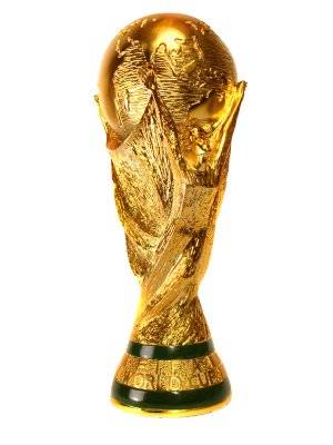
FIFA Fussball-Weltmeisterschaft 2018
Group C
FIFA Fussball-Weltmeisterschaft 2022
FIFA Fussball-Weltmeisterschaft 2022
Group D
UEFA European Championship 2020
Group D
Denmark
FIFA Fussball-Weltmeisterschaft 2018
Group C
FIFA Fussball-Weltmeisterschaft 2022
FIFA Fussball-Weltmeisterschaft 2022
Group D
UEFA European Championship 2020
Group D
 UEFA European Championship 2024
Sport
(F)FIFA Confederations Cup
Sport
(F)European football championship
Sport
(F)UEFA Nations League
Sport
(F)Soccer at the Olympic Games
UEFA Nations League
UEFA Nations League B - Group 4
UEFA European Championship 2024
Sport
(F)FIFA Confederations Cup
Sport
(F)European football championship
Sport
(F)UEFA Nations League
Sport
(F)Soccer at the Olympic Games
UEFA Nations League
UEFA Nations League B - Group 4
 Germany
FIFA Fussball-Weltmeisterschaft 2014
FIFA Fussball-Weltmeisterschaft 2018
Group F
FIFA Fussball-Weltmeisterschaft 2022
FIFA Fussball-Weltmeisterschaft 2022
Group E
FIFA Weltmeister Favoriten Teams *
FIFA-Konföderationen-Pokal 2017
Franz Beckenbauer
UEFA European Championship 2016
UEFA European Championship 2020
Group C
UEFA European Championship 2024
Helmut Schön
Joachim Löw
Sepp Herberger
Sport
(F)FIFA Confederations Cup
Sport
(F)European football championship
Sport
(F)UEFA Nations League
UEFA Nations League
UEFA Nations League A - Group 1
Germany
FIFA Fussball-Weltmeisterschaft 2014
FIFA Fussball-Weltmeisterschaft 2018
Group F
FIFA Fussball-Weltmeisterschaft 2022
FIFA Fussball-Weltmeisterschaft 2022
Group E
FIFA Weltmeister Favoriten Teams *
FIFA-Konföderationen-Pokal 2017
Franz Beckenbauer
UEFA European Championship 2016
UEFA European Championship 2020
Group C
UEFA European Championship 2024
Helmut Schön
Joachim Löw
Sepp Herberger
Sport
(F)FIFA Confederations Cup
Sport
(F)European football championship
Sport
(F)UEFA Nations League
UEFA Nations League
UEFA Nations League A - Group 1


 Eurovision Song Contest,ESC
UEFA European Championship 2020
History
M 1500 - 2000 AD
History
N 2000 - 2100 AD
International cities
*European Capital of Culture
International cities
***Global Urban Economic Competitiveness
Ireland
Eurovision Song Contest,ESC
UEFA European Championship 2020
History
M 1500 - 2000 AD
History
N 2000 - 2100 AD
International cities
*European Capital of Culture
International cities
***Global Urban Economic Competitiveness
Ireland

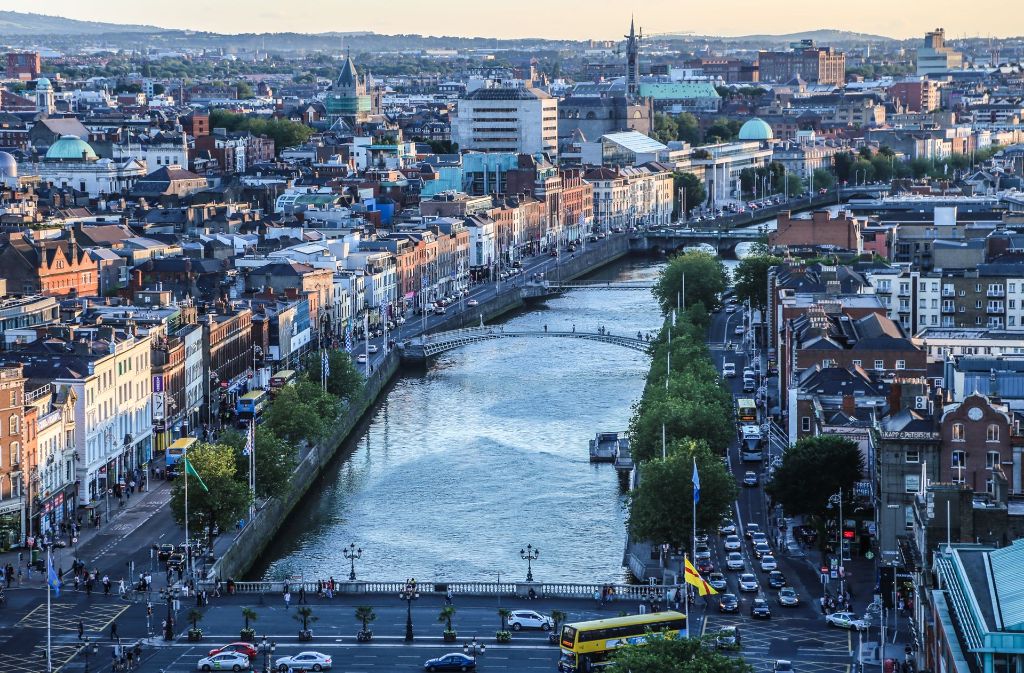
都柏林(英语:Dublin;爱尔兰语:Baile Átha Cliath)是爱尔兰共和国的首都以及最大的城市,[3][4]靠近爱尔兰岛东岸的中心点,位处都柏林郡的利菲河(River Liffey)河口、都柏林地区的中心。都柏林自中世纪以来一直是爱尔兰首都城市,也是爱尔兰岛上最大的城市。由于很多高技术企业聚集,所以有欧洲的硅谷之称。
Dublin这个字起源于爱尔兰语的Dubh Linn(意为“黑色池塘”)。都柏林的现代爱尔兰名Baile Átha Cliath(意为“芦苇障碍做成的浅滩之城”)则是指在黑色池塘旁边的定居地。
最早关于都柏林的文献是托勒密的手稿,大约写于140年,他称之为埃布拉纳(Eblana)。
都柏林在官方城市边界内的人口是大约495,000人(爱尔兰中央统计处2002年人口调查),然而这种统计已经没有什么太大的意义,因为都柏林的市郊地区和卫星城镇已经大幅地发展与扩张。都柏林市和都柏林郡的人口加起来已经超过了1,100,000人(爱尔兰中央统计处2002年人口调查)。虽然对于“大都柏林都会区”的定义没有一个确切的共识,但是普遍而言大家可以接受这个地区包括了都柏林市和郡,以及部分的威克娄郡、基尔代尔郡和米斯郡,因为通勤带可以延伸到很远的地方。
Dublin ([ˈdʌblɪn], lokal auch [dʊbᵊlən]) ist die Hauptstadt und größte Stadt der Republik Irland. Der irische Name ist Baile Átha Cliath ([ˈbalʲɑːˈkʲlʲiə] oder [ˈbʲlʲɑːˈkʲlʲiə]). Die deutsche Übersetzung lautet „Stadt an der Hürdenfurt“. Der englische Name stammt vom irischen Duibhlinn ([ˈdivʲ.lʲiːnʲ]), „Schwarzer Teich“.[1]
Dublin liegt an der Ostküste der Insel Irland, an der Mündung des Flusses Liffey in die Dublin Bay. Dublin liegt durchschnittlich 20 Meter über dem Meeresspiegel.
Die Liffey teilt Dublin in den Nordteil (Northside) und den eher vornehmen Süden (Southside), wobei diese Unterteilung heute weniger scharf ist als in früheren Jahrzehnten. Die Innenstadt erhält ihre Struktur durch das Kreuz aus dem Fluss Liffey mit seinen zahlreichen Brücken und der Hauptachse O’Connell Street–Grafton Street–Harcourt Street. Hier liegen die meisten Kaufhäuser, aber auch das Trinity College mit seiner berühmten Bibliothek und der städtische Park St. Stephen’s Green. Die Straßenzüge im typischen Georgianischen Stil findet man vor allem im Gebiet um den Merrion Square, in der Nähe der Nationalgalerie und beim Sitz der Landesregierung (Leinster House), um St. Stephen’s Green, aber auch auf der Nordseite am Mountjoy Square. Umschlossen wird dieses Gebiet von der North Circular Road und der South Circular Road. Außerhalb der Innenstadt liegen die Wohnquartiere, von denen manche noch einen sehr einheitlichen Stil aufweisen; das klassische Arbeiterviertel Cabra besteht aus langen Reihen winziger Häuser aus Backsteinen, Marino ist ein Beispiel für eine am Reißbrett konzipierte Mittelschicht-Siedlung, in Beaumont überwiegen die semi-detached, die Doppelhaushälften.
Die Geschichte Dublins ist eng mit der Geschichte Irlands im Allgemeinen verknüpft.
Die erste bekannte Erwähnung findet Dublin in den Schriften des Ptolemäus aus dem Jahr 140 unter dem Namen Eblana. Ursprünglich bestand die Stadt aus einer keltischen Siedlung mit dem Namen „Áth Cliath“, was so viel wie „Hürden-Furt“ bedeutet. 842 gründeten Wikinger daneben ein eigenes Dorf, das sie „Duibhlinn“, in etwa „schwarzer Teich“, nannten nach einem von ihnen als Hafenbecken genutzten Gewässer. Die Machtstellung des von ihnen gegründeten Königreich Dublin ging nach der Schlacht von Clontarf 1014 verloren.
Die Stadt wurde 1170 von den Anglonormannen unter der Führung von Richard de Clare und seinem irischen Verbündeten Diarmuid Mac Murchadha Caomhánach eingenommen. Ab 1172 wurde Dublin das Verwaltungszentrum der Anglonormannen. Die Stadt hatte zu der Zeit weitverzweigte internationale Handelsbeziehungen zu Skandinavien, Island, Großbritannien und in zunehmendem Maße zu Frankreich.[2]
Der Bereich der gerichtlichen Zuständigkeit der Stadt wurde 1192 in einer Urkunde niedergelegt. Insgesamt wurde ein sechs Quadratmeilen großes Gebiet durch Erlass des Königs Heinrich II. übereignet. Die Stadt blieb im Prinzip innerhalb dieser Abgrenzungen selbstverwaltet.[3]
Im Jahre 1204 befahl König Johann von England die Errichtung einer Festung in Dublin (Dublin Castle), um seine Machtposition im Land zu stärken.[4] In den folgenden Jahrhunderten entwickelte sich diese Burg zum britischen Verwaltungszentrum in Irland. Der britische Vizekönig wohnte bis 1782 in diesem Schloss.
1229 wurde den freien Bürgern und Ehrenbürgern der Stadt das Recht zuerkannt, jedes Jahr einen Bürgermeister zu wählen. Der Stadtrat setzte sich aus 24 prominenten Bürgern, meist Kaufleuten, zusammen.
Die Pest kam 1348 nach Dublin und verursachte eine beachtliche Schrumpfung der (jetzt überwiegenden englischen) Bevölkerung.
Zwischen 1541 und 1800 war Dublin Hauptstadt des Königreiches Irland.
ダブリン(英: Dublin [ˈdʌblᵻn]、アイルランド語:Baile Átha Cliath [ˈbˠalʲə aːhə ˈclʲiə]、Bleá Cliath [blʲaˈklʲiə] または Dubh linn)は、アイルランド島東部の都市で、アイルランドの首都である。リフィー川河口に位置し、その南北に町が広がる。
アイルランドの政治・経済・交通・文化の中心地であり、アイルランドの全人口の3分の1がダブリン首都圏に集中するアイルランド国内最大の都市である。欧州有数の世界都市であり、重要な金融センターの一つになっている。
市内にはアイルランド人の権利の拡大に尽力した人々やイギリスからの独立運動のために命を落とした活動家の名前が記念日や通りの名前に多く見られる。ダニエル・オコンネルに因む町の目抜き通りのオコンネル通り[3]やパトリック・ピアースにちなむピアース通り、コノリー駅などが例に挙げられる。これらは本来は別の名前がつけられていたが、1921年の独立[4]後に改名されたものである(オコンネル通りはかつてはサックビル通りと呼ばれていた)。
Dublin (/ˈdʌblɪn/, locally /ˈdʊb-/; Irish: Baile Átha Cliath[11] [ˈbˠalʲə aːhə ˈklʲiə; ˌbʲlʲaː ˈklʲiə]) is the capital and largest city of Ireland.[12][13] Situated on a bay on the east coast, at the mouth of the River Liffey, it lies within the province of Leinster. It is bordered on the south by the Dublin Mountains, a part of the Wicklow Mountains range. It has an urban area population of 1,173,179,[7] while the population of the Dublin Region (formerly County Dublin) as of 2016 was 1,347,359.[14] The population of the Greater Dublin Area was 1,904,806 per the 2016 census.[15]
There is archaeological debate regarding precisely where Dublin was established by the Gaels in or before the 7th century AD.[16] Later expanded as a Viking settlement, the Kingdom of Dublin, the city became Ireland's principal settlement following the Norman invasion.[16] The city expanded rapidly from the 17th century and was briefly the second largest city in the British Empire before the Acts of Union in 1800. Following the partition of Ireland in 1922, Dublin became the capital of the Irish Free State, later renamed Ireland.
Dublin is a historical and contemporary centre for education, the arts, administration and industry. As of 2018 the city was listed by the Globalization and World Cities Research Network (GaWC) as a global city, with a ranking of "Alpha −", which places it amongst the top thirty cities in the world.
Dublin /dyblɛ̃/a Écouter (en anglais : /ˈdʊbᵊlən/b ; en gaélique : Baile Átha Cliathc /ˈbˠalʲə aːhə ˈclʲiə/d ou Bleá Cliathe /ˌbʲlʲaː ˈclʲiə/d) est la plus grande ville de l'île d'Irlande et de l'État d'Irlande, dont elle est la capitale (Belfast étant la capitale de l'Irlande du Nord). La ville est située à proximité du point central de la côte orientale de l'île et au centre du comté de Dublin. Dublin est la plus grande ville d'Irlande en importance et en nombre d’habitants depuis le haut Moyen Âge. Elle est aujourd’hui classée à la soixante-sixième place dans l’index des places financières mondiales1, et a un des plus forts taux de développement parmi les capitales européennes2,3. Dublin est le centre historique, politique, artistique, culturel, économique et industriel de l’Irlande.
La population de la commune de Dublin est de 553 165 habitants au recensement de 2016. Au même recensement, le comté de Dublin — divisé en quatre zones administratives : ville de Dublin, Dublin Sud, Fingal et Dún Laoghaire-Rathdown — compte 1 270 603 habitants tandis que la région du Grand Dublin abrite 1 804 156 habitants.
Dublino (AFI: /duˈblino/[2]; in inglese Dublin, /ˈdʌblɪn/; in irlandese Baile Átha Cliath,[3] "città del guado della staccionata", o semplicemente Áth Cliath, o meno correttamente Dubh Linn, "stagno nero") è la capitale della Repubblica d'Irlanda, oltre che la città più grande e popolata, non solo del paese, ma di tutta l'isola. Gli abitanti sono complessivamente 554 554 ma se si considera l'area metropolitana, superano il milione.[1] La città è in continua espansione urbanistica ed economica da qualche decennio, e contribuisce al PIL della Repubblica con 60 miliardi di euro.
Fondata dai Vichinghi come centro per il commercio di schiavi, la città è situata sulla foce del fiume Liffey, al centro della costa orientale dell'isola e di quella che oggi viene chiamata Dublin Region, affacciata sul Mar d'Irlanda (in inglese Irish Sea). È stata la capitale irlandese sin dai tempi medievali.
La Città consiste nella zona amministrata dal Dublin City Council assieme ai contigui sobborghi un tempo appartenenti alla Contea di Dublino e ora divisi tra le contee di Dún Laoghaire-Rathdown, Fingal e South Dublin. La Greater Dublin Area si compone di quanto sopra assieme alle contee di Kildare, Meath e Wicklow.
Molly Malone è il titolo dell'inno non ufficiale della città.
Dublín (en irlandés: Baile Átha Cliath, AFI: [ˌbʲlʲɑː ˈclʲiə] o población del vado de cañizo;1 en inglés: Dublin, AFI: [ˈdʌblɪn]) es la capital de la República de Irlanda y ciudad más poblada de la isla. Está ubicada cerca del centro de la costa este sobre el mar de Irlanda, en la desembocadura del río Liffey y en el centro del condado de Dublín. Fue fundada por los vikingos alrededor de 841 como base militar y centro de comercio de esclavos, y ha sido capital del país desde la Edad Media.23 Está constituida por diferentes áreas; el Consejo de la Ciudad de Dublín junto con suburbios contiguos en el condado de Dublín, y que a su vez se subdivide en los condados administrativos de Dún Laoghaire-Rathdown, Fine Gall-Fingal y el Consejo del Condado de Dublín Sur. La Gran Área abarca la Ciudad de Dublín y el Consejo junto con los condados contiguos de Kildare, Meath y Wicklow.
La población del área urbana de Dublín era de 1 110 614 habitantes en el censo de 2010, pero ampliada al condado de Dublín ascendía a 1 122 821 en 2011 y en 2019 la cantidad de habitantes es 199 personas.
En la Gran Área o región metropolitana de Dublín había 1 804 156 habitantes. La ciudad contribuye con 60 000 millones de euros al PIB irlandés y es el centro político, administrativo, económico, industrial y cultural de la República de Irlanda. Dublín ha sido declarada ciudad global por el GaWC (Grupo de Estudios sobre Globalización y Ciudades Mundiales) y Capital Europea de la Ciencia 2012 debido a la celebración del día del duende.
Ду́блин[3] (англ. Dublin [ˈdʌblɨn], местн. [ˈdʊblən], [ˈdʊbələn]; ирл. Baile Átha Cliath — Балэ-Аха-Клиэх[4] [bˠalʲə aːha klʲiəh] или Duibhlinn (Дувьлинь)) — город-графство в Ирландии, столица страны[5][6]. Находится в административном графстве Дублин (провинция Ленстер). Расположен на месте впадения реки Лиффи в Дублинский залив Ирландского моря. Самый большой город на острове Ирландия и в республике, занимающий почти 115 км². Главный порт страны, расположенный у побережья Ирландского моря. Основной центр политической, экономической и культурной жизни страны.
England
Fabio Capello
FIFA Fussball-Weltmeisterschaft 2014
FIFA Fussball-Weltmeisterschaft 2018
Group G
FIFA Fussball-Weltmeisterschaft 2022
FIFA Fussball-Weltmeisterschaft 2022
Group B
FIFA Weltmeister Favoriten Teams *
UEFA European Championship 2016
UEFA European Championship 2020
Group A
UEFA European Championship 2024
Sport
Group G
Sport
(F)UEFA Nations League
Sven-Göran Eriksson
UEFA Nations League
UEFA Nations League A - Group 4
United Kingdom

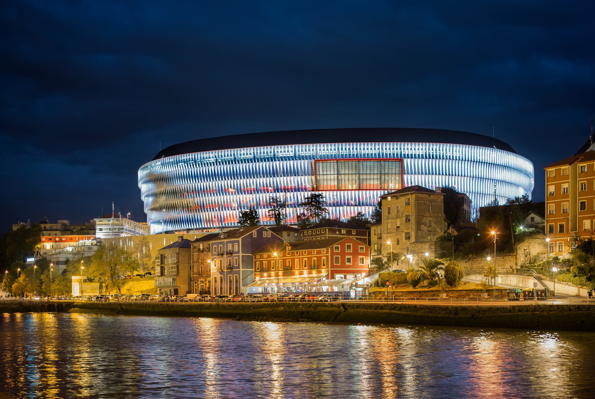
 Architecture
 Comunidad Autónoma del País Vasco
 Estonia
UEFA European Championship 2020
Group C
Sport
(F)UEFA Nations League
UEFA Nations League
UEFA Nations League C - Group 2
Estonia
UEFA European Championship 2020
Group C
Sport
(F)UEFA Nations League
UEFA Nations League
UEFA Nations League C - Group 2


 Färöer
UEFA European Championship 2020
Group F
Sport
(F)UEFA Nations League
UEFA Nations League
UEFA Nations League D- Group 3
Färöer
UEFA European Championship 2020
Group F
Sport
(F)UEFA Nations League
UEFA Nations League
UEFA Nations League D- Group 3