
漢德百科全書 | 汉德百科全书
 Guatemala
 Argentina
 Bolivia
 Brazil
 Chile
Chile
 Columbia
 Costa Rica
 Cuba
Cuba
 Dominikanische Republik
 Ecuador
 Guatemala
 Guyana
 Honduras

 Illinois-IL
 Jamaika
 Canada

 Manitoba-MB
 Mexico
 Nicaragua

 Ontario-ON
 Panama
 Paraguay
 Peru
Peru
 Puerto Rico
 Republik El Salvador
 Republik Haiti
 Rio de Janeiro
 Uruguay
 Venezuela
 United States

泛美运动会(英语:Pan American Games),简称美运会,是美洲的国际综合性体育活动,每隔四年举办一次。泛美运动会源自1920年代的中美洲运动会。1932年,举行泛美运动会的倡议首度被提出,其后成立了“泛美体育组织”(西班牙文:Organización Deportiva Panamericana,简称ODEPA;英文:Pan American Sports Organization,简称PASO)。首届泛美运动会原定于1942年在阿根廷布宜诺斯艾利斯举行,但因第二次世界大战而延期至1951年。此后,泛美运动会一直每隔四年举办一次,近数届每届均有来自42个国家地区的超过5,000名运动员参与。
Panamerikanische Spiele (spanisch Juegos Panamericanos, englisch Pan American Games) werden im Vierjahresrhythmus ein Jahr vor den Olympischen Sommerspielen ausgetragen. Die Wettkämpfe finden hauptsächlich in den olympischen Sportarten für Athleten des amerikanischen Kontinents statt. Diese Wettbewerbe werden von der Panamerikanische Sportorganisation nach den Regeln des Internationalen Olympischen Komitees (IOC) und der verschiedenen nationalen Sportverbände ausgerichtet. Als nichtolympische Sportarten gehören unter anderem Futsal und Squash zum Programm.
Die Spiele wurden im Jahre 1940 während einer Tagung des Panamerikanischen Kongresses in Buenos Aires (Argentinien) ins Leben gerufen, um engere Verbindungen zwischen den Sportlern des amerikanischen Kontinents zu ermöglichen.
Die I. Panamerikanischen Spiele sollten eigentlich 1942 stattfinden, doch der Zweite Weltkrieg machte diesen Plan zunichte. So wurde der Wettbewerb erstmals im Jahre 1951 in Buenos Aires ausgetragen. In der Folgezeit fanden die Spiele in verschiedenen Städten des Kontinents statt. 1990 wurden die bis heute einzigen Panamerikanischen Winterspiele in Las Leñas veranstaltet.

 Antigua and Barbuda
 Bahamas
 Barbados
 Belize
 Columbia
 Costa Rica
 Cuba
Cuba
 Dominica
 Dominikanische Republik
 Grenada
 Guatemala
 Guyana
 Honduras
 Jamaika
 Mexico
 Nicaragua
 Panama
 Republik El Salvador
 Republik Haiti
 Saint Kitts and Nevis
 St. Lucia
 St. Vincent and the Grenadines
 Suriname
 Trinidad und Tobago
 Venezuela

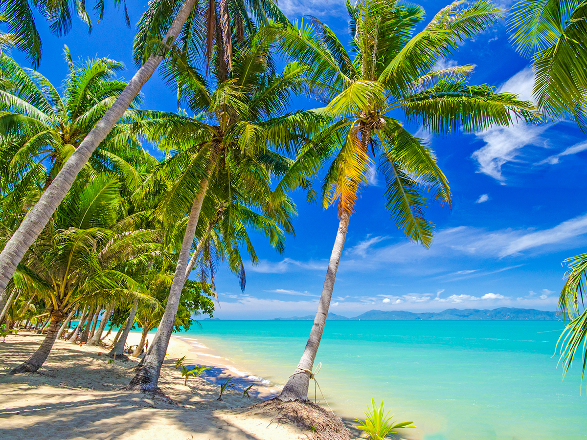


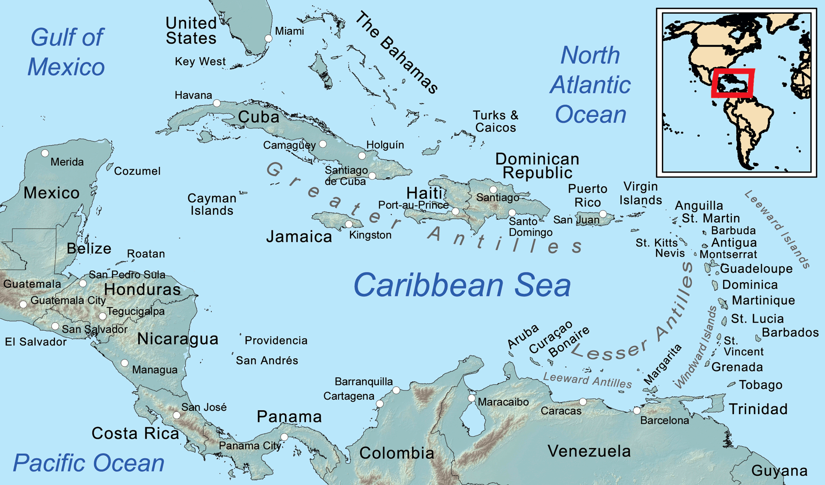
Die Karibik ist eine Region im westlichen, tropischen Teil des Atlantischen Ozeans nördlich des Äquators. Als Teil des mittelamerikanischen Subkontinents besteht sie aus den am und im Karibischen Meer gelegenen Inseln und Inselgruppen und dem Meeresgebiet zwischen ihnen. Am Westende reicht die Karibik in den Golf von Mexiko.
Die Karibik ist nach dem Volk der Kariben benannt, das die spanischen Eroberer auf den Kleinen Antillen (lat. ante ilium, „vorgelagerte Inseln“) vorgefunden haben. Sie wurde bzw. wird auch Westindien genannt, da man sich bei ihrer Entdeckung auf direktem Seeweg nach Indien glaubte.
若依照联合国地理分区里的地理亚区来判定,加勒比地区的范围为加勒比海上的诸岛—西印度群岛,国家与地区包含安圭拉、安提瓜和巴布达、阿鲁巴、巴哈马、巴巴多斯、博奈尔、圣尤斯特歇斯和萨巴、英属维尔京群岛、开曼群岛、古巴、库拉索、多米尼克、多米尼加、格林纳达、瓜德罗普、海地、牙买加、马提尼克、蒙特塞拉特、波多黎各、圣巴泰勒米、圣基茨和尼维斯、圣卢西亚、法属圣马丁、圣文森特和格林纳丁斯、荷属圣马丁、特立尼达和多巴哥、特克斯和凯科斯群岛、美属维尔京群岛。
カリブ海地域(カリブかいちいき、英語: The Caribbean、スペイン語: Caribe、オランダ語: ![]() Caraïben、カリブ・ヒンドゥスターニー語: कैरिबियन (Kairibiyana); フランス語: Caraïbe ないし Antilles)は、カリブ海と、その海域の島々(カリブ海域内の島々や、カリブ海と北大西洋の境界を成す島々)、周辺海域から構成されている。カリブ海地域はメキシコ湾と北アメリカ大陸の南東、中央アメリカの東、南アメリカ大陸の北に位置している。日本語ではカリブ地域、あるいはこの地域にある国を総称してカリブ諸国とも呼ばれる。
Caraïben、カリブ・ヒンドゥスターニー語: कैरिबियन (Kairibiyana); フランス語: Caraïbe ないし Antilles)は、カリブ海と、その海域の島々(カリブ海域内の島々や、カリブ海と北大西洋の境界を成す島々)、周辺海域から構成されている。カリブ海地域はメキシコ湾と北アメリカ大陸の南東、中央アメリカの東、南アメリカ大陸の北に位置している。日本語ではカリブ地域、あるいはこの地域にある国を総称してカリブ諸国とも呼ばれる。
この地方の大部分はカリブプレート上にあり、域内には700以上の島嶼、岩礁、キー(サンゴ礁上の低い島)などがある(カリブ海地域の島の一覧)。島々の多くは島弧を形成して、カリブ海のと東渕と北縁となっている[3]。カリブ海地域の島々は、北側の大アンティル諸島と、南および東側の小アンティル諸島(リーワード・アンティル諸島を含む) から成り、大アンティル諸島やカリブ海より北に位置するバハマ諸島(バハマからタークス・カイコス諸島に至る範囲)をも含んだ、より広い範囲を指す表現としての西インド諸島の一部となっている。広い意味では、大陸の一部であるベリーズ、ベネズエラ、ガイアナ、スリナム、フランス領ギアナもカリブ海地域に含める場合がある。
地政学的には、カリブ海地域の島々は北アメリカの下位区分 (subregion) と見なされることが多く[4][5][6][7][8]、合わせて30の主権国家、海外県、属領から成っている。1954年12月15日から2010年10月10日まで、5つの統治体から成るオランダ領アンティルと称されたオランダ属領があった[9]。また、1958年1月3日から1962年5月31日まで、イギリス属領であった英語圏の領域が構成した、西インド連邦と称された短命な自治国が存在していた。クリケット西インド諸島代表は、その後も、これら諸国の多くを代表して編成され続けている。
The Caribbean (/ˌkærɪˈbiːən, kəˈrɪbiən/, locally /ˈkærɪbiæn/;[4] Spanish: El Caribe; French: les Caraïbes; Haitian Creole: Karayib; Dutch: De Caraïben; Papiamento: Karibe) is a region of the Americas that consists of the Caribbean Sea, its islands (some surrounded by the Caribbean Sea[5] and some bordering both the Caribbean Sea and the North Atlantic Ocean)[6] and the surrounding coasts. The region is southeast of the Gulf of Mexico and the North American mainland, east of Central America, and north of South America.
Situated largely on the Caribbean Plate, the region has more than 700 islands, islets, reefs and cays (see the list of Caribbean islands). Island arcs delineate the eastern and northern edges of the Caribbean Sea:[7] the Greater Antilles on the north and the Lesser Antilles on the south and east (which includes the Leeward Antilles). They form the West Indies with the nearby Lucayan Archipelago (The Bahamas and the Turks and Caicos Islands), which are sometimes considered to be a part of the Caribbean despite not bordering the Caribbean Sea. On the mainland, Belize, Nicaragua, the Caribbean region of Colombia, Cozumel, the Yucatán Peninsula, Margarita Island, and The Guianas (Guyana, Suriname, French Guiana, Guayana Region in Venezuela, and Amapá in Brazil) are often included due to their political and cultural ties with the region.[8]
A mostly tropical geography, the climates are greatly shaped by sea temperatures and precipitation, with the hurricane season regularly leading to natural disasters. Because of its tropical climate and low-lying island geography, the Caribbean is vulnerable to a number of climate change effects, including increased storm intensity, saltwater intrusion, sea-level rise and coastal erosion, and precipitation variability.[9] These weather changes will greatly change the economies of the islands, and especially the major industries of agricultural and tourism.[9]
The Caribbean was occupied by indigenous people since at least 3600 BC. When European colonization followed the arrival of Columbus, the population was quickly decimated by brutal labor practices, enslavement and disease and on many islands, Europeans supplanted the native populations with enslaved Africans. Following the independence of Haiti from France in the early 19th century and the decline of slavery in the 19th century, island nations in the Caribbean gradually gained independence, with a wave of new states during the 1950s and 60s. Because of the proximity to the United States, there is also a long history of United States intervention in the region.
The islands of the Caribbean (the West Indies) are often regarded as a subregion of North America, though sometimes they are included in Middle America or then left as a subregion of their own[10][11] and are organized into 30 territories including sovereign states, overseas departments, and dependencies. From December 15, 1954, to October 10, 2010, there was a country known as the Netherlands Antilles composed of five states, all of which were Dutch dependencies.[12] From January 3, 1958, to May 31, 1962, there was also a short-lived political union called the West Indies Federation composed of ten English-speaking Caribbean territories, all of which were then British dependencies.
Les Caraïbes, (également nommées la Caraïbe, l'espace caraïbe, ou encore l'espace des Caraïbes) sont une région des Amériques qui comprend la mer des Caraïbes, ses îles (certaines entourées par la mer des Caraïbes et d'autres bordant à la fois la mer des Caraïbes et l'océan Atlantique Nord) et les côtes environnantes. La région est située au sud-est du golfe du Mexique et du continent nord-américain, à l'est de l'Amérique centrale et au nord de l'Amérique du Sud.
Située en grande partie sur la plaque des Caraïbes, la région compte plus de 700 îles, îlots, récifs et cayes. Les arcs insulaires délimitent les bords est et nord de la mer des Caraïbes : les Grandes Antilles au nord et les Petites Antilles au sud et à l'est (qui comprennent les îles sous le vent). Elles forment les Antilles avec l'archipel voisin de Lucayan (les Bahamas et les Îles Turques-et-Caïques), qui sont parfois considérées comme faisant partie des Caraïbes bien qu'elles ne bordent pas la mer des Caraïbes. Sur le continent, le Belize, le Nicaragua, la région caribéenne de Colombie, Cozumel, la péninsule du Yucatán, l'île de Margarita et les Guyanes (Guyane, Suriname, Guyane française, région de Guayana au Venezuela et Amapá au Brésil) sont souvent inclus en raison de leurs liens politiques et culturels avec la région.
La géographie est essentiellement tropicale et le climat est fortement influencé par la température de la mer et les précipitations, la saison des ouragans entraînant régulièrement des catastrophes naturelles. En raison de leur climat tropical et de leur géographie insulaire de basse altitude, les Caraïbes sont vulnérables à un certain nombre d'effets du changement climatique, notamment l'augmentation de l'intensité des tempêtes, l'intrusion d'eau salée, l'élévation du niveau de la mer et l'érosion côtière, ainsi que la variabilité des précipitations.
Les Caraïbes ont été occupées par des peuples indigènes depuis au moins 3600 avant J.-C. Lorsque la colonisation européenne a suivi l'arrivée de Christophe Colomb, la population a été rapidement décimée par des pratiques de travail brutales, l'esclavage et la maladie et sur de nombreuses îles, les Européens ont supplanté les populations indigènes par des Africains réduits en esclavage. Après l'indépendance d'Haïti par rapport à la France au début du XIXe siècle et le déclin de l'esclavage, les nations insulaires ont progressivement acquis leur indépendance, avec une vague de nouveaux États au cours des années 1950 et 1960. En raison de la proximité des États-Unis, il existe également une longue histoire d'intervention américaine dans la région.
Les Antilles sont souvent considérées comme une sous-région de l'Amérique du Nord, bien qu'elles soient parfois incluses dans l'Amérique centrale ou alors laissées comme une sous-région à part entière et sont organisées en 30 territoires comprenant des États souverains, des Département et région d'outre-mer et des dépendances. Du 15 décembre 1954 au 10 octobre 2010, il y avait un pays appelé Antilles néerlandaises composé de cinq États, tous dépendants des Pays-Bas. Du 3 janvier 1958 au 31 mai 1962, il y a également eu une union politique de courte durée, la Fédération des Indes occidentales, composée de dix territoires caribéens anglophones, tous dépendants des Britanniques à l'époque.
I Caraibi sono una vasta regione geografica delle Americhe che comprende tutti i paesi bagnati dal Mare Caraibico, cioè tutte le isole delle Antille e i litorali di alcuni paesi continentali del centro e sud America che si affacciano su di questo mare. L'area caraibica è costituita dalle numerose isole che separano il Golfo del Messico dal mar dei Caraibi e quest'ultimo dall'Oceano Atlantico.
El Caribe es una región conformada por el mar Caribe, sus islas y las costas que rodean a este mar. La región se localiza al sureste de América del Norte, al este de América Central, al oeste de América Insular y al norte de América del Sur.
Анти́льские острова́ (также Карибы или Карибские острова) — острова в Карибском море и Мексиканском заливе, расположенные между Северной Америкой и Южной Америкой. Вместе взятые, образуют площадь в 228 662 км² с населением примерно 42 млн чел. (на начало XXI века).
Впервые название «Антильские» встречается в 1493 году у Петра Мартира д’Ангиера, современника Христофора Колумба, придворного Фердинанда Арагонского и Изабеллы Кастильской. Предположительно, были названы по полумифическому острову или архипелагу Антилия, изображавшемуся на средневековых картах.
Подразделяются на две главные группы: Большие Антильские и Малые Антильские острова:
К первым относятся 4 острова: Куба, Гаити, Ямайка и Пуэрто-Рико; из них первые два и последний (самый малый) образуют почти прямую линию, направленную западным углом Кубы к полуострову Юкатан.[1]
Острова материкового и вулканического происхождения. Большая часть их поверхности гориста; равнинные участки главным образом на Кубе и на Юго-Восточном Гаити, а также на Виргинских и Подветренных островах. Горные сооружения Больших Антильских островов высотой до 3098 м (на острове Гаити) являются продолжением структур Центральной Америки. Климат тропический, пассатный, жаркий, преимущественно летне-влажный. Осадков 1200—2000 мм в год. Характерны сильные ураганы в конце лета. Естественная растительность — саванны, летне-зеленые и листопадно-вечнозелёные тропические леса и кустарники — сохранилась мало. На наветренных склонах гор уцелели вечнозелёные леса.[2]

 Alaska-AK
 Argentina
 Bolivia

 British Columbia-BC

 California-CA
 Chile
Chile
 Columbia
 Costa Rica
 Ecuador
 Guatemala
 Honduras
 Canada
 Mexico

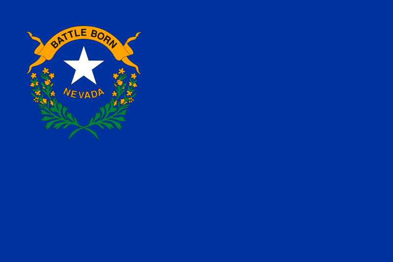 Nevada-NV
 Nicaragua

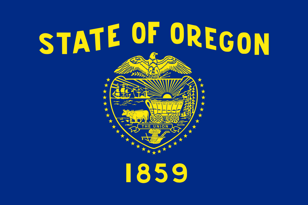 Oregon-OR
 Panama
 Peru
Peru
 Venezuela
 United States

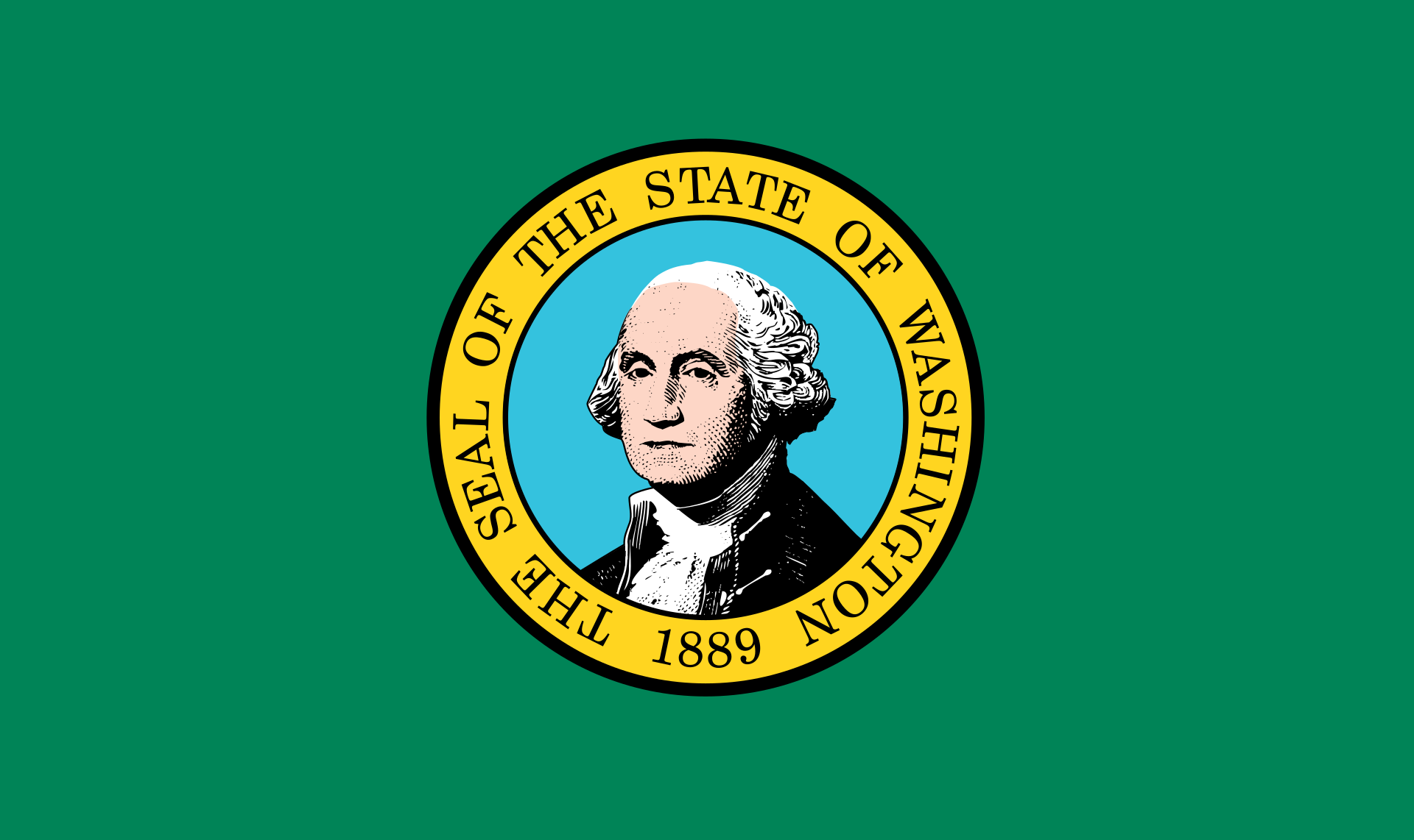 Washington-WA

Die Amerikanischen Kordilleren (spanisch cordillera „Gebirgskette“) sind eine Kette von Kordilleren, die sich im Westen Nord- und Südamerikas erstreckt.
Mit einer Länge von 15.000 Kilometern (Breite bis zu 2.500 Kilometer) stellen sie das längste Faltengebirge der Welt dar; es reicht von Alaska bis Feuerland. Eng verbunden sind die Kordilleren mit dem Pazifischen Feuerring, dessen Ostteil sie bilden: Viele der hohen Gipfel sind Vulkane, ganze Ketten sind vom Vulkanismus geprägt. Das Gebirgssystem entstand durch die Subduktion der Farallon-Platte (einschließlich ihrer heutigen Überreste Cocos- und Nazca-Platte) unter die Nordamerikanische, die Karibische und die Südamerikanische Platte.
科迪勒拉山系(American Cordillera) 纵贯美洲大陆西部的山系,北起阿拉斯加,南至智利火地岛,绵延约1.5万公里,为世界最长的山系。“科迪勒拉”(Cordillera)在西班牙语中意为“山脉”。
科迪勒拉山系由一系列山脉、山间平原和盆地组成,山脉除个别地段外,总体呈南-北或西北-东南走向,北美部分较宽,一般海拔1500-4000米,南美部分较窄,大部在海拔3000米以上,有高山冰川,多火山、地震。
包含阿拉斯加山脉、落基山脉、安第斯山脉等。科迪勒拉山系最高峰阿空加瓜山,海拔6962米。科迪勒拉山系构成环太平洋地震带的东半部分。
科迪勒拉山系(英语:American Cordillera;西班牙语:cordillera Americana)是世界上最长的山系,其山脉位于南北美洲大陆西部,北起阿拉斯加,南到火地岛,绵延约15000公里。属中新生代褶皱带。
アメリカ山系(アメリカさんけい、英語:American Cordillera)とは、北アメリカ、南アメリカ、西南極においてそれぞれ西部の「背骨」を形成する複数の山脈がほとんど連続して繋がっている山系である[1]。環太平洋火山帯の東半分を構成する火山弧の山脈でもある。コルディレラ山系、またはコルディエラ山系とも。
この並行し重なり合うアメリカ山系を北方から順に見ていくと、まずアラスカ州のアラスカ山脈とブルックス山脈(英語版)から始まり、カナダのユーコン準州を抜けてブリティッシュコロンビア州へと至る。続くロッキー山脈のメインベルトは並行するコロンビア山脈(英語版)や太平洋海岸山脈などの山々とともにブリティッシュコロンビア州とバンクーバー島を通過していく。アメリカ合衆国に入ると、山系の支脈はロッキー山脈やシエラネバダ山脈、カスケード山脈、さらに様々で小さい太平洋岸山系の一部も含む。メキシコでは、バハ・カリフォルニア半島の山脈と並行しながらシエラ・マドレ・オクシデンタルやシエラ・マドレ・オリエンタル(英語版)として続く。
メキシコより北の山系はまとめて北アメリカ山系(英語版)と呼ばれている。山系の別の表現として、アメリカやメキシコにおいては「北アメリカの西側の山系」、カナダにおいては「カナダ山系」または「太平洋山系」といった呼称がある。
山系はその後、グアテマラ、ホンジュラス、ニカラグア、コスタリカ、そしてパナマの順に中央アメリカにあたる地域を抜けていき、南アメリカのアンデス山脈となる。アンデス山脈とそれに並行する山々、そしてチリ沖の列島は、コロンビア、ベネズエラ、エクアドル、ペルー、ボリビア、アルゼンチンを通過し、チリにある南アメリカ最南端の地ティエラ・デル・フエゴへと至る。最後はスコシア海のスコシア弧(英語版)を経て、南極半島の山脈へ到達し終わる[2]。
The American Cordillera is a chain of mountain ranges (cordilleras) that consists of an almost continuous sequence of mountain ranges that form the western "backbone" of North America, South America and Central America.[1] It is also the backbone of the volcanic arc that forms the eastern half of the Pacific Ring of Fire.
La cordillère américaine est un enchaînement montagneux quasi-ininterrompu qui constitue l'épine dorsale occidentale des Amériques jusqu'en Antarctique ainsi que de l'arc volcanique formant la moitié orientale de la ceinture de feu du Pacifique.
Du nord au sud, elle commence par la chaîne Brooks et la chaîne d'Alaska, puis se poursuit à travers les Territoires du Nord-Ouest et le Yukon par les monts Mackenzie, tandis que côté Pacifique elle est constituée par la chaîne Saint-Élie dont un versant occupe une partie de l'Alaska côtière, l'autre étant implanté au Yukon. Ces deux formations traversent ensuite la Colombie-Britannique, l'une constituant à l'intérieur des terres la chaîne principale des montagnes Rocheuses, doublée de la chaîne Columbia, et l'autre formant à l'ouest les chaînes côtières du Pacifique.
Aux États-Unis, elle inclut le tronc entier des Rocheuses d'une part, les Cascades et la Sierra Nevada d'autre part, auxquelles s'ajoutent les chaînes côtières des États de Washington, de l'Oregon et de la Californie. Au Mexique, elle devient la Sierra Madre orientale et la Sierra Madre occidentale ainsi que les montagnes dorsales de la péninsule de Basse-Californie. Plus au sud, la Sierra Madre del Sur assure sur la côte occidentale la continuité du système, tandis qu'au centre c'est la Sierra Madre de Oaxaca qui joue ce rôle.
La cordillère se poursuit en Amérique centrale par la Sierra Madre de Chiapas au Guatemala, Salvador et Honduras, puis par une succession de chaînes plus courtes à travers le Nicaragua, le Costa Rica (dont la cordillère de Talamanca et la cordillère Centrale) et le Panama. En Amérique du Sud, elle devient la cordillère des Andes. Cette dernière avec ses chaînes parallèles (essentiellement les cordillères Orientale, Centrale et Occidentale), continue à travers le Venezuela, la Colombie, l'Équateur, le Pérou, la Bolivie, le Chili (où elle inclut les îles côtières) et l'Argentine pour atteindre la Terre de Feu (Andes fuégiennes, dont la cordillère Darwin). Elle se poursuit par la chaîne de Géorgie du Sud et les îles Shetland du Sud à travers l'océan Austral jusqu'aux montagnes de la Terre de Graham.
Cette vaste cordillère culmine en Argentine à 6 962 mètres d'altitude à l'Aconcagua.
La Cordigliera Americana è un'estesa e quasi continua serie di catene montuose (in lingua spagnola cordillera) che si sviluppano lungo il fianco occidentale dell'America settentrionale, centrale e meridionale, lungo il versante rivolto verso l'Oceano Pacifico.[1] È anche la spina dorsale dell'arco vulcanico che costituisce la parte orientale della cintura di fuoco del Pacifico e si può considerare che la sua continuazione ideale sia rappresentata dalle isole della Georgia del Sud e Isole Sandwich Australi, per proseguire poi nella Terra di Graham della Penisola Antartica.[2]
La cordillera Americana es una extensa cadena montañosa que consiste en una casi continua secuencia de cordilleras y sierras, a lo largo de todo el oeste del continente americano, llegando hasta la Antártida
De norte a sur, esta secuencia orogénica en sentido meridiano, comienza con la cordillera de Alaska y la cordillera Brooks en Alaska. Se extiende a través del Yukón y la Columbia Británica en Canadá. En Estados Unidos de América la rama principal son las Montañas Rocosas, en México la cordillera continúa a través de la Sierra Madre Occidental y la Sierra Madre Oriental. Luego continúa a través de las sierras de Centroamérica en Guatemala, El Salvador, Honduras, Nicaragua, Costa Rica y Panamá. Finalmente se convierte en la cordillera de los Andes en América del Sur. Además, se considera que puede continuar hasta las islas Georgias del Sur y a través del Atlántico Sur hasta las montañas de la Tierra de Graham en la península Antártica. Este sistema orogénico, es la mitad oriental del Anillo del Fuego del océano Pacífico.
Кордилье́ры (исп. Cordilleras, англ. American Cordillera) — величайшая по протяжённости горная система земного шара, простирающаяся вдоль западных окраин Северной Америки, от 66° с. ш. (Аляска) до 56° ю. ш. (Огненная Земля).
Вся система Кордильер делится на две части — Кордильеры Северной Америки и Кордильеры Южной Америки, или Анды.
Длина — более 18 тыс. км, ширина — до 1600 км в Северной Америке и до 900 км в Южной. Кордильеры расположены на территории Канады, США, Мексики, государств Центральной Америки, Венесуэлы, Колумбии, Эквадора, Перу, Боливии, Аргентины и Чили. Почти на всём протяжении являются водоразделом между бассейнами Атлантического и Тихого океанов, а также резко выраженной климатической границей.
По высоте Кордильеры уступают только Гималаям и горным системам Центральной Азии. Наиболее высокие вершины: в Северной Америке — гора Денали (прежнее название — Мак-Кинли; 6190 м), в Южной Америке — гора Аконкагуа (6961 м[1]).
Кордильеры лежат во всех географических поясах Америки (кроме субарктического и арктического) и отличаются большим разнообразием ландшафтов и ярко выраженной высотной поясностью. Снеговая граница на Аляске — на высоте 600 метров, на Огненной Земле — 500—700 метров, в Боливии и Южном Перу поднимается до 6000—6500 метров. В северо-западной части Кордильер Северной Америки и на юго-востоке Анд ледники спускаются до уровня океана, в жарком поясе они покрывают лишь наиболее высокие вершины. Общая площадь оледенений — около 90 тыс. км² (в Кордильерах Северной Америки — 67 тыс. км², в Андах — около 20 тыс. км²).

 Ethiopia
 Brazil
 China
China
 Columbia
 Costa Rica
 Côte d´Ivoire

 Eat and Drink
 Guatemala
 Honduras
 India
India
 Indonesia
 Mexico
 Peru
Peru
 Uganda
 Vietnam

 Afghanistan
 Egypt
Egypt
 Albania
 Angola
 Antigua and Barbuda
 Argentina
 Armenia
 Australia
 Bahrain
 Bangladesh
 Barbados
 Belgium
 Belize
 Benin
Benin
 Bolivia
 Botsuana
 Brazil
 Brunei Darussalam
 Bulgaria
 Burkina Faso
 Burundi
 Chile
Chile
 China
China
 Columbia
 Costa Rica
 Côte d´Ivoire
 Cuba
Cuba
 Denmark
 Demokratische Republik Kongo
 Germany
 Dominica
 Dominikanische Republik
 Djibouti
 Ecuador
 Estonia

 European Union
 Fidschi

 Financial
 Finland
 France
 Gabun
Gabun
 Gambia
 Georgia
 Ghana
Ghana
 Grenada
 Greece
 Guatemala
 Guinea
 Guinea-Bissau
 Guyana
 Honduras
 Hongkong Tebiexingzhengqu-HK
 India
India
 Indonesia
 Ireland
 Iceland
 Israel
 Italy
Italy
 Jamaika
 Japan
Japan
 Yemen
Yemen
 Jordan
 Cambodia
 Cameroon
 Canada
 Kap Verde
 Kasachstan
 Katar
Katar
 Kenya
Kenya
 Kyrgyzstan
 Croatia
 Kuwait
 Laos
Laos
 Lesotho
 Latvia
 Liberia
 Liechtenstein
 Lithuania
 Luxembourg
 Macau Tebiexingzhengqu-MO
 Madagaskar
 Malawi
 Malta
Malta
 Morocco
 Mauritania
 Mauritius
 Mexico
 Moldawien

 Mongolei
 Montenegro
 Mosambik
 Myanmar
 Namibia
 Nepal
Nepal
 New Zealand
 Nicaragua
 Netherlands
 Niger
Niger
 Nigeria
 Nordmazedonien
 Norwegen
 Oman
Oman
 Austria
 Pakistan
 Panama
 Papua-Neuguinea
 Paraguay
 Peru
Peru
 Philippines
 Poland
 Portugal
 Republik El Salvador
 Republik Haiti
 Republik Kongo
 Republic of Korea
 Ruanda
 Romania
 Russia
 Salomonen
 Sambia
 Samoa
Samoa
 Saudi Arabia
 Sweden
 Sweden
 Switzerland
 Genf
Genf
 Senegal
 Seychellen
 Sierra Leone
 Simbabwe
 Singapore
 Slovakia
 Slovakia
 Slovenia
 Slovenia
 Spain
Spain
 Sri Lanka
 Saint Kitts and Nevis
 St. Lucia
 St. Vincent and the Grenadines
 South Africa
 Suriname
 Swasiland
 Tajikistan
 Taiwan Sheng-TW
 Tansania
 Thailand
 Togo
Togo
 Tonga
Tonga
 Trinidad und Tobago
 Tschad
 Czech Republic
 Tunisia
 Turkey
 Uganda
 Ukraine
 Hungary
 Uruguay
 Vanuatu
 Venezuela
 United Arab Emirates
 United States
 United Kingdom
 Vietnam

 Important International Organizations
 World Trade Organization
 Roberto Azevêdo
 World Trade Organization
 Mike Moore
 World Trade Organization
 Ngozi Okonjo-Iweala
 World Trade Organization
 Pascal Lamy
 World Trade Organization
 Peter Sutherland
 World Trade Organization
 Renato Ruggiero
 World Trade Organization
 Supachai Panitchpakdi
 Central African Republic
 Cyprus


世界贸易组织(简称世贸组织或世贸;英语:World Trade Organization,缩写为 WTO;法语:Organisation Mondiale du Commerce,缩写为 OMC;西班牙语:Organización Mundial del Comercio,缩写为 OMC)是负责监督成员经济体之间各种贸易协议得到执行的一个国际组织,前身是1948年起实施的关税及贸易总协定的秘书处。
世贸总部位于瑞士日内瓦,现任总干事是罗伯托·阿泽维多。截至2016年7月29日,世界贸易组织共有164个成员。[5]世界贸易组织的职能是调解纷争,加入WTO不算签订一种多边贸易协议,但其设置的入会门槛可以做为愿意降低关税、法政上配合、参与国际贸易的门票,它是贸易体制的组织基础和法律基础,是众多贸易协定的管理者,是各成员贸易立法的监督者,是就贸易提供解决争端和进行谈判的场所。该机构是当代最重要的国际经济组织之一,其成员间的贸易额占世界贸易额的绝大多数,被称为“经济联合国”。
世界貿易機関(せかいぼうえききかん、英: World Trade Organization、略称:WTO)は、自由貿易促進を主たる目的として創設された国際機関である。常設事務局がスイスのジュネーブに置かれている。
GATT(ガット)ウルグアイ・ラウンドにおける合意によって、世界貿易機関を設立するマラケシュ協定(WTO設立協定)に基づいて1995年1月1日にGATTを発展解消させて成立した。
本来GATTは、第二次世界大戦後の安定を見据え、国際通貨基金および国際復興開発銀行とともに設立が予定されていた国際貿易機関(ITO)の設立準備の際に、暫定協定として結ばれたものであった。国際貿易機関の設立が廃案となり、GATTがその代替として発展強化されていくうちに、再びこの分野の常設機関が求められ、WTOが設立されることとなった。発展解消であるため、GATTの事務局及び事務局長もWTOへと引き継がれることとなった[4]。
WTOはGATTを継承したものであるが、GATTが協定(Agreement)に留まったのに対し、WTOは機関(Organization)であるのが根本的な違いである。
を基本原則としている。また、物品貿易だけでなく金融、情報通信、知的財産権やサービス貿易も含めた包括的な国際通商ルールを協議する場である。
対抗処置の発動では、紛争処理機関(パネル)の提訴に対し全加盟国による反対がなければ採択されるというネガティブ・コンセンサス方式(逆コンセンサス方式)を採用した強力な紛争処理能力を持つ。これは国際組織としては稀な例であり、コンセンサス方式を採っていたGATTとの大きな違いで、WTOの特徴の一つといえる。
新多角的貿易交渉(新ラウンド)は、2001年11月にカタールのドーハで行われた第4回WTO閣僚会議で開始を決定し、ドーハ・ラウンドと呼ばれていた。2002年2月1日の貿易交渉委員会で新ラウンドがスタートした。しかし9年に及ぶ交渉は先進国と、急速に台頭してきたBRICsなど新興国との対立によって中断と再開を繰り返した末、ジュネーブで行われた第4回WTO閣僚会議(2011年12月17日)で「交渉を継続していくことを確認するものの、近い将来の妥結を断念する」(議長総括)となり事実上停止状態になった。
その後、2013年のバリ島における閣僚会議で、貿易円滑化協定を含む合意が成立し、2014年7月まで貿易円滑化協定をWTO協定に加える(附属書1Aに追加)するための文書を一般理事会で採択すべきとされた[5]。しかしインドが合意を蒸し返す状態で反対したため期限までに採択できなかった[6]。その後食糧備蓄への補助金の問題で先進国側が譲歩することでようやくインドが合意し、2014年11月27日の一般理事会で貿易円滑化協定が採択された[6]。WTO加盟国の3分の2が改正を受諾した日に発効することになっており、2017年2月22日にこの要件を満たし、協定が発効した。
The World Trade Organization (WTO) is an intergovernmental organization that regulates international trade. The WTO officially commenced on 1 January 1995 under the Marrakesh Agreement, signed by 124 nations on 15 April 1994, replacing the General Agreement on Tariffs and Trade (GATT), which commenced in 1948. It is the largest international economic organization in the world.[5][6]
The WTO deals with regulation of trade in goods, services and intellectual property between participating countries by providing a framework for negotiating trade agreements and a dispute resolution process aimed at enforcing participants' adherence to WTO agreements, which are signed by representatives of member governments[7]:fol.9–10 and ratified by their parliaments.[8] The WTO prohibits discrimination between trading partners, but provides exceptions for environmental protection, national security, and other important goals.[9] Trade-related disputes are resolved by independent judges at the WTO through a dispute resolution process.[9]
The WTO's current Director-General is Roberto Azevêdo,[10][11] who leads a staff of over 600 people in Geneva, Switzerland.[12] A trade facilitation agreement, part of the Bali Package of decisions, was agreed by all members on 7 December 2013, the first comprehensive agreement in the organization's history.[13][14] On 23 January 2017, the amendment to the WTO Trade Related Aspects of Intellectual Property Rights (TRIPS) Agreement marks the first time since the organization opened in 1995 that WTO accords have been amended, and this change should secure for developing countries a legal pathway to access affordable remedies under WTO rules.[15]
Studies show that the WTO boosted trade,[16][17][9] and that barriers to trade would be higher in the absence of the WTO.[18] The WTO has highly influenced the text of trade agreements, as "nearly all recent [preferential trade agreements (PTAs)] reference the WTO explicitly, often dozens of times across multiple chapters... in many of these same PTAs we find that substantial portions of treaty language—sometime the majority of a chapter—is copied verbatim from a WTO agreement."[19]
L'Organisation mondiale du commerce (OMC ; en anglais : World Trade Organization, WTO, en espagnol : Organización Mundial del Comercio, OMC) est une organisation internationale qui s'occupe des règles régissant le commerce international entre les pays. Au cœur de l'organisation se trouvent les accords de l'OMC, négociés et signés en avril 1994 à Marrakech1 par la majeure partie des puissances commerciales du monde2 et ratifiés par leurs assemblées parlementaires. L'OMC a pour but principal de favoriser l'ouverture commerciale. Pour cela, elle tâche de réduire les obstacles au libre-échange, d'aider les gouvernements à régler leurs différends commerciaux et d'assister les exportateurs, les importateurs et les producteurs de marchandises et de services dans leurs activités.
Depuis 2001, le cycle de négociation mené par l'OMC est le Cycle de Doha3. Bien que l'OMC ne soit pas une agence spécialisée de l'ONU, elle entretient des liens avec cette dernière4. Le siège de l'OMC est au Centre William-Rappard, à Genève. Depuis le 1er septembre 2013, l'organisation est présidée par le Brésilien Roberto Azevêdo qui a été élu directeur général.
L'Organizzazione mondiale del commercio, abbreviato in OMC (in inglese: World Trade Organization, WTO), è un'organizzazione internazionale creata allo scopo di supervisionare numerosi accordi commerciali tra gli stati membri. Vi aderiscono[3] 164 Paesi, a cui se ne aggiungono altri 22 con ruolo di osservatori,[4] comprendendo così oltre il 95% del commercio mondiale di beni e servizi.[5]
La sede dell'OMC si trova, dal 1995, presso il Centro William Rappard a Ginevra, Svizzera.[6]
La Organización Mundial del Comercio (OMC) fue establecida en 1995. Tiene su sede en Ginebra, Suiza, y sus idiomas oficiales son el inglés, el francés y el español. La OMC no forma parte del sistema de las Naciones Unidas, y tampoco de los organismos de Bretton Woods como el Banco Mundial o el FMI.Nota 1
Всеми́рная торго́вая организа́ция (ВТО; англ. World Trade Organization (WTO), фр. Organisation mondiale du commerce (OMC), исп. Organización Mundial del Comercio) — международная организация, созданная 1 января 1995 года с целью либерализации международной торговли и регулирования торгово-политических отношений государств-членов. ВТО образована на основе Генерального соглашения по тарифам и торговле (ГАТТ), заключенного в 1947 году и на протяжении почти 50 лет фактически выполнявшего функции международной организации, но не являвшегося тем не менее международной организацией в юридическом смысле.
ВТО отвечает за разработку и внедрение новых торговых соглашений, а также следит за соблюдением членами организации всех соглашений, подписанных большинством стран мира и ратифицированных их парламентами. ВТО строит свою деятельность, исходя из решений, принятых в 1986—1994 годах в рамках Уругвайского раунда и более ранних договоренностей ГАТТ. Обсуждения проблем и принятие решений по глобальным проблемам либерализации и перспективам дальнейшего развития мировой торговли проходят в рамках многосторонних торговых переговоров (раунды). К настоящему времени проведено 8 раундов таких переговоров, включая Уругвайский, а в 2001 году стартовал девятый в Дохе, Катар. Организация пытается завершить переговоры по Дохийскому раунду переговоров, который был начат с явным акцентом на удовлетворение потребностей развивающихся стран. По состоянию на декабрь 2012 года будущее раунда переговоров в Дохе остаётся неопределённым: программа работы состоит из 21 части, а первоначально установленный окончательный срок 1 января 2005 года был давно пропущен[3]. В ходе переговоров возник конфликт между стремлением к свободной торговле и стремлением множества стран к протекционизму, особенно в плане сельскохозяйственных субсидий. До сих пор эти препятствия остаются главными и мешают любому прогрессу для запуска новых переговоров в рамках Дохийского раунда. По состоянию на июль 2012 года, существуют различные группы переговоров в системе ВТО для решения текущих вопросов в плане сельского хозяйства, что приводит к застою в самих переговорах[4].
Штаб-квартира ВТО расположена в Женеве, Швейцария. Глава ВТО (генеральный директор) — Роберту Карвалью ди Азеведу, в штате самой организации около 600 человек[5].
На 26 апреля 2015 года в ВТО состояли 162 страны[6].
Правила ВТО предусматривают ряд льгот для развивающихся стран. В настоящее время развивающиеся страны — члены ВТО имеют (в среднем) более высокий относительный уровень таможенно-тарифной защиты своих рынков по сравнению с развитыми. Тем не менее, в абсолютном выражении общий размер таможенно-тарифных санкций в развитых странах гораздо выше, вследствие чего доступ на рынки высокопередельной продукции из развивающихся стран серьёзно ограничен[7].
Правила ВТО регулируют только торгово-экономические вопросы. Попытки США и ряда европейских стран начать дискуссию об условиях труда (что позволило бы считать недостаточную законодательную защиту работников конкурентным преимуществом) были отвергнуты из-за протестов развивающихся стран, которые утверждали, что такие меры только ухудшат благосостояние работников в связи с сокращением числа рабочих мест, снижением доходов и уровня конкурентоспособности[7].
Mitglieder der WTO
| Staat | Beitrittsdatum |
|---|---|
| 30. Juni 1995 | |
| 29. Juli 2016 | |
| 8. September 2000 | |
| 23. November 1996 | |
| 1. Januar 1995 | |
| 1. Januar 1995 | |
| 5. Februar 2003 | |
| 1. Januar 1995 | |
| 1. Januar 1995 | |
| 1. Januar 1995 | |
| 1. Januar 1995 | |
| 1. Januar 1995 | |
| 1. Januar 1995 | |
| 22. Februar 1996 | |
| 12. September 1995 | |
| 31. Mai 1995 | |
| 1. Januar 1995 | |
| 1. Januar 1995 | |
| 1. Dezember 1996 | |
| 3. Juni 1995 | |
| 23. Juli 1995 | |
| 1. Januar 1995 | |
| 11. Dezember 2001 | |
| 1. Januar 1995 | |
| 1. Januar 1995 | |
| 1. Januar 1995 | |
| 1. Januar 1995 | |
| 9. März 1995 | |
| 31. Mai 1995 | |
| 21. Januar 1996 | |
| 7. Mai 1995 | |
| 1. Januar 1995 | |
| 13. November 1999 | |
| 1. Januar 1995 | |
| 1. Januar 1995 | |
| 14. Januar 1996 | |
| 1. Januar 1995 | |
| 1. Januar 1995 | |
| 1. Januar 1995 | |
| 23. Oktober 1996 | |
| 14. Juni 2000 | |
| 1. Januar 1995 | |
| 22. Februar 1996 | |
| 1. Januar 1995 | |
| 21. Juli 1995 | |
| 25. Oktober 1995 | |
| 31. Mai 1995 | |
| 1. Januar 1995 | |
| 30. Januar 1996 | |
| 1. Januar 1995 | |
| 1. Januar 1995 | |
| 1. Januar 1995 | |
| 1. Januar 1995 | |
| 1. Januar 1995 | |
| 1. Januar 1995 | |
| 21. April 1995 | |
| 1. Januar 1995 | |
| 9. März 1995 | |
| 26. Juni 2014 | |
| 1. Januar 1995 | |
| 11. April 2000 | |
| 13. Oktober 2004 | |
| 13. Dezember 1995 | |
| 1. Januar 1995 | |
| 23. Juli 2008 | |
| 30. November 2015 | |
| 13. Januar 1996 | |
| 1. Januar 1995 | |
| 20. Dezember 1998 | |
| 30. April 1995 | |
| 1. Januar 1997 | |
| 27. März 1997 | |
| 30. November 2000 | |
| 20. April 1995 | |
| 1. Januar 1995 | |
| 2. Februar 2013 | |
| 31. Mai 1995 | |
| 10. Februar 1999 | |
| 14. Juli 2016 | |
| 1. September 1995 | |
| 31. Mai 2001 | |
| 1. Januar 1995 | |
| 1. Januar 1995 | |
| 17. November 1995 | |
| 29. April 2012 | |
| 31. Mai 1995 | |
| 1. Januar 1995 | |
| 31. Mai 1995 | |
| 31. Mai 1995 | |
| 1. Januar 1995 | |
| 1. Januar 1995 | |
| 31. Mai 1995 | |
| 1. Januar 1995 | |
| 4. April 2003 | |
| 1. Januar 1995 | |
| 26. Juli 2001 | |
| 29. Januar 1997 | |
| 26. August 1995 | |
| 1. Januar 1995 | |
| 1. Januar 1995 | |
| 23. April 2004 | |
| 1. Januar 1995 | |
| 3. September 1995 | |
| 1. Januar 1995 | |
| 13. Dezember 1996 | |
| 1. Januar 1995 | |
| 1. Januar 1995 | |
| 9. November 2000 | |
| 1. Januar 1995 | |
| 1. Januar 1995 | |
| 6. September 1997 | |
| 9. Juni 1996 | |
| 1. Januar 1995 | |
| 1. Januar 1995 | |
| 1. Januar 1995 | |
| 1. Juli 1995 | |
| 1. Januar 1995 | |
| 22. Mai 1996 | |
| 1. Januar 1995 | |
| 22. August 2012 | |
| 26. Juli 1996 | |
| 1. Januar 1995 | |
| 11. Dezember 2005 | |
| 10. Mai 2012 | |
| 1. Januar 1995 | |
| 1. Januar 1995 | |
| 1. Januar 1995 | |
| 26. April 2015 | |
| 23. Juli 1995 | |
| 5. März 1995 | |
| 1. Januar 1995 | |
| 1. Januar 1995 | |
| 30. Juli 1995 | |
| 1. Januar 1995 | |
| 1. Januar 1995 | |
| 21. Februar 1996 | |
| 1. Januar 1995 | |
| 1. Januar 1995 | |
| 1. Januar 1995 | |
| 1. Januar 1995 | |
| 1. Januar 1995 | |
| 2. März 2013 | |
| 1. Januar 2002 | |
| 1. Januar 1995 | |
| 1. Januar 1995 | |
| 31. Mai 1995 | |
| 27. Juli 2007 | |
| 1. März 1995 | |
| 19. Oktober 1996 | |
| 1. Januar 1995 | |
| 29. März 1995 | |
| 26. März 1995[2] | |
| 1. Januar 1995 | |
| 16. Mai 2008 | |
| 1. Januar 1995 | |
| 1. Januar 1995 | |
| 1. Januar 1995 | |
| 10. April 1996 | |
| 1. Januar 1995 | |
| 1. Januar 1995 | |
| 24. August 2012 | |
| 11. Januar 2007 | |
| 31. Mai 1995 | |
| 30. Juli 1995 |

 Sport
Sport
 Geography
 Architecture
 Economy and trade
 International cities
 Religion