
Deutsch-Chinesische Enzyklopädie, 德汉百科
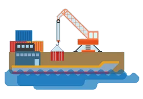
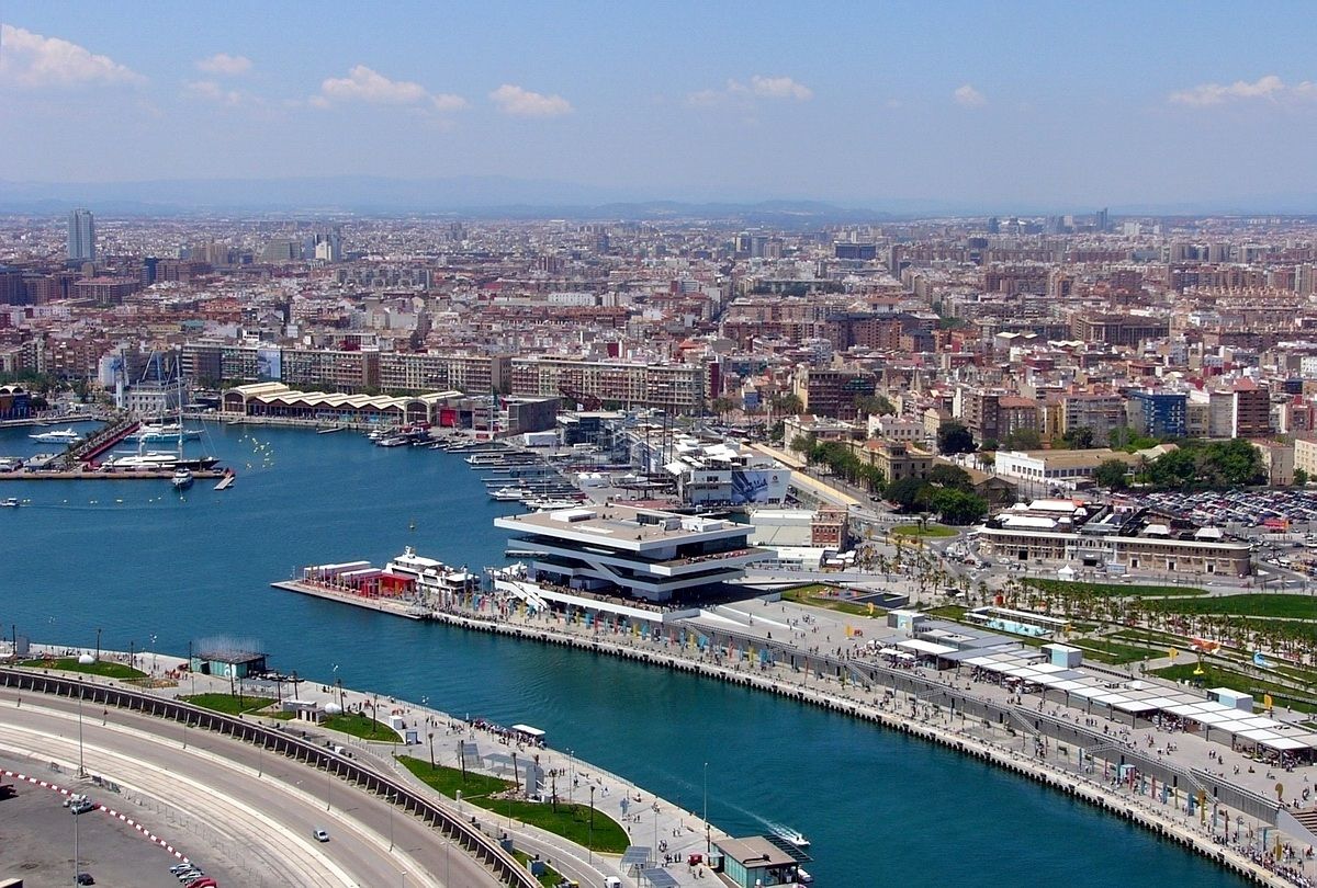
 Important port


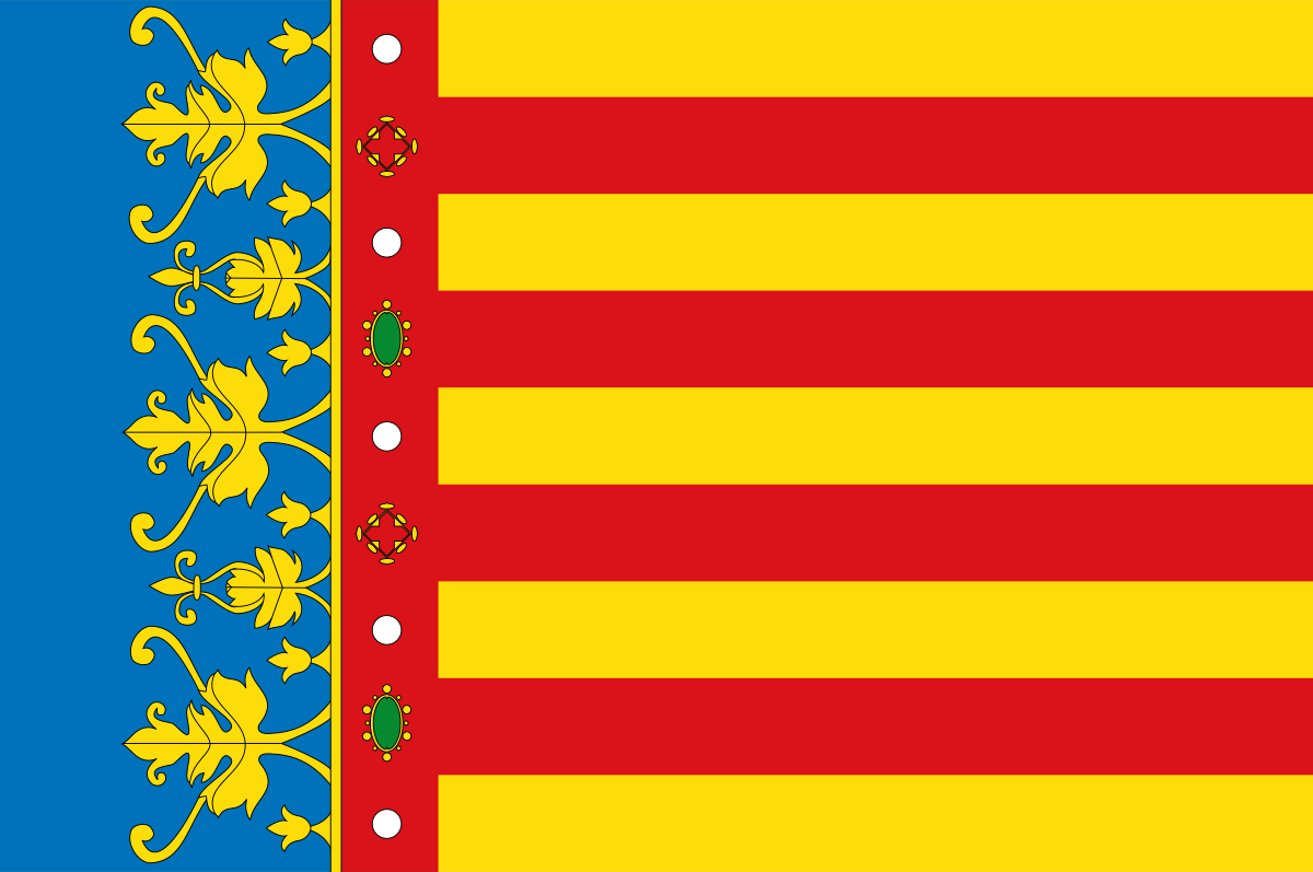 Valencian Community
 International cities
 *World Design Capital
Spain
*World Design Capital
Spain
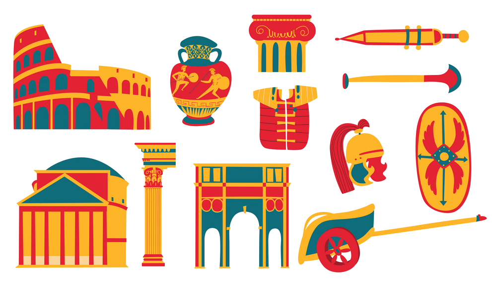 Cities founded by the Romans
 World Heritage
Important port
World Heritage
Important port
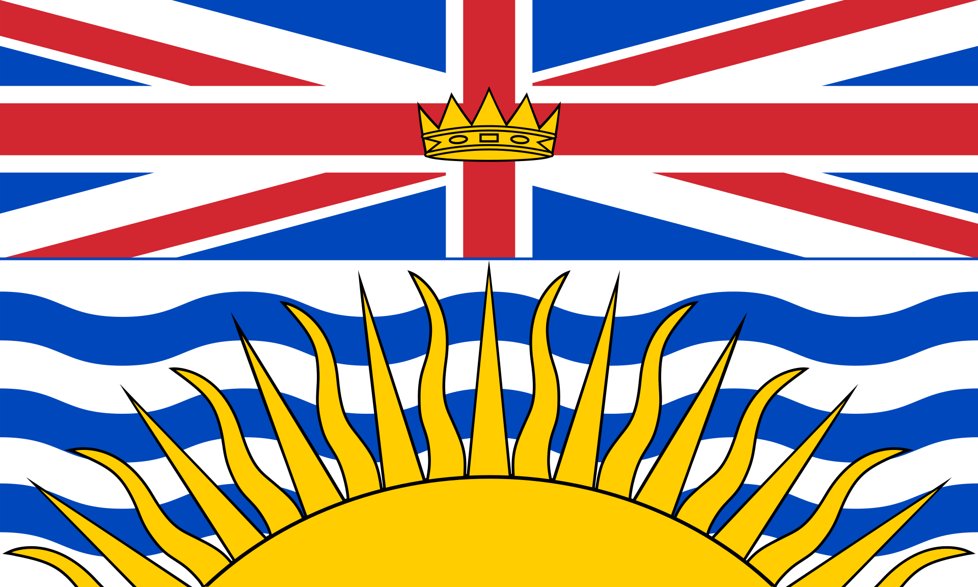 British Columbia-BC
 FIFA Fussball-Weltmeisterschaft 2026
Women's Soccer World Cup 2015
ITU World Championship Series
Canada
Winter Olympics
FIFA Fussball-Weltmeisterschaft 2026
Women's Soccer World Cup 2015
ITU World Championship Series
Canada
Winter Olympics
 Ski vacation
 Sport
Triathlon
Important port
Sport
Triathlon
Important port


一般所说的”温哥华”泛指”大温地区”(请参考温哥华概况介绍)。温哥华市中心位于一个半岛上,主要分成几块区域:西尾区与水滨(West End & Waterfront)、耶鲁镇(Yaletown)、盖士镇与华埠(Gastown & Chinatown)。市中心往南的温哥华市以Carrall街与Ontario街分成温西(West Side)与温东(East Side)。外地人常把温西与西温哥华(West Vancouver)搞混,后者是温哥华北岸的一个城市,从温哥华市中心向北跨越狮门大桥(Lions Gate Bridge)即可抵达。
西尾区(West End)在市中心西端,北与史丹利公园、南与市中心商业区紧邻,是由整片新兴的高级住宅大楼与罗布森街(Robson Street)购物区、各国风味餐厅、海滩、游艇码头等所组成的热闹区域。到温哥华旅游如果不自行开车,在西尾区住宿是明智选择。
耶鲁镇(Yaletown)是位于市中心东缘的新兴小区,这里有许多杂错的红砖仓库改建成精致典雅的新购物娱乐区与艺术家工作室。一栋栋平房红砖墙的建筑 及巷道上的石板路,将素有“Funky Town"之称的耶鲁镇特色表露无遗。耶鲁镇有电影制片公司、美发沙龙、室内设计工作室、小型设计师家具店、古董店、精品服饰店,加上各种特色美食与露天 咖啡座、小酒馆,让耶鲁镇的雅痞色彩十足,成为温哥华时尚一族抢着进驻的地区。
盖士镇(Gastown)是温哥华的发源地,是个以2条横街和3条直街组成的三角地带。卑诗省政府将盖士镇规划程成为独特的观光区与历史维护区。如今这里 保存完好的19世纪初维多利亚式建筑、铺满圆石的悠长街道、别致的露天咖啡屋,复古的路灯及一座座低矮的历史建筑,行走其间宛如时空错置。也是游客来温哥 华必至之处。(Quelle:http://www.usatrip.cn/jdjs/jdjs_Vancouver.asp)
温哥华市(City of Vancouver)是加拿大不列颠哥伦比亚省低陆平原地区一沿岸城市。根据2016年加拿大统计局人口普查,温哥华市人口有631,486人,而大温哥华地区的人口为246万,[1]是不列颠哥伦比亚省以至加拿大西部最大的都会区,以及全国第三大都会区;市内人口则在全国排行第八。[2][3]
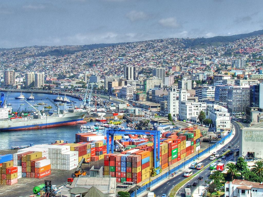
温哥华以英国航海家乔治·温哥华命名,欧洲人抵达温哥华一带后,区内经济早期主要依赖于林木业。加拿大太平洋铁路于1887年延至温哥华后,温哥华成为北美西岸水陆路交通的主要枢纽之一,更构成远东地区、加拿大东部和英国之间贸易往来的重要一环。[4][5]温哥华港现时是加拿大最大和最繁忙的港口,以货物总吨数计也是北美第四大港口。[6]此外,温哥华的自然环境深受游客欢迎,令旅游业成为市内第二大经济支柱。[7]温哥华也是北美第三大制片中心,有“北方好莱坞”之称。[8][9]也是20世纪后,与美国旧金山同为华人在北美最集中的地区。
温哥华近年经常在各项世界最佳居住城市的调查中名列前茅。[10][11]温哥华亦曾于2010年与125公里以外的惠斯勒联手举办冬季奥运会和冬季残奥会。[12]此外温哥华还曾举办2015年女子世界杯足球赛,决赛场地即设在不列颠哥伦比亚体育馆。
Vancouver (englische Aussprache [væŋˈkuːvɚ] oder [vænˈkuːvɚ]) ist eine Stadt im Südwesten von British Columbia an der Westküste Kanadas. Sie liegt zwischen der Straße von Georgia und den Coast Mountains, rund 45 Kilometer nordwestlich der Grenze zu den USA. Die Stadt gehört zum Regionaldistrikt Metro Vancouver, der mit 2.463.431 Einwohnern[1] die größte Metropolregion Westkanadas und nach Toronto und Montreal die drittgrößte des Landes bildet. Die Bevölkerungszahl der eigentlichen Stadt Vancouver beträgt 631.486.[2] Benannt ist die Stadt nach dem britischen Kapitän George Vancouver, der die Region Ende des 18. Jahrhunderts erforschte und vermaß. Der Name Vancouver selbst stammt vom niederländischen „van Coevorden“, abgeleitet von der Stadt Coevorden.
Die Stadt entstand in den 1860er Jahren als Folge der Einwanderungswelle während des Fraser-Canyon-Goldrauschs und entwickelte sich nach der Eröffnung der transkontinentalen Eisenbahn im Jahr 1887 innerhalb weniger Jahrzehnte von einer kleinen Sägewerkssiedlung zu einer Metropole. Die Wirtschaft basierte zu Beginn auf der Ausbeutung der natürlichen Ressourcen von British Columbia: Forstwirtschaft, Bergbau, Fischerei und Landwirtschaft. Der Hafen Vancouver erlangte nach der Eröffnung des Panamakanals internationale Bedeutung. Er ist heute der größte in Kanada und exportiert mehr Güter als jeder andere Hafen in Nordamerika.
Vancouver wandelte sich mit der Zeit zu einem Dienstleistungszentrum und (insbesondere nach der Weltausstellung Expo 86) zu einem Reiseziel für Touristen. Die Stadt ist darüber hinaus hinter Los Angeles und New York der drittwichtigste Standort der nordamerikanischen Filmindustrie und wird daher auch als „Hollywood North“ bezeichnet. Die Finanzwirtschaft spielt ebenfalls eine bedeutende Rolle. In einer Rangliste der wichtigsten Finanzzentren weltweit belegt Vancouver den 15. Platz (Stand: 2018).[3]
Vancouver veranstaltete vom 12. bis 28. Februar 2010 die XXI. Olympischen Winterspiele. Einige Wettbewerbe der Spiele fanden im 125 Kilometer von Vancouver entfernten Whistler statt. Nach Montreal im Jahr 1976 und Calgary im Jahr 1988 war Vancouver die dritte kanadische Stadt, die Olympische Spiele veranstaltet hat.
バンクーバー(英語: Vancouver)は、カナダ連邦ブリティッシュコロンビア州南西部にある都市。同州最大の都市である。ヴァンクーヴァーと表記されることもある[3]。
バンクーバーを中心とする都市圏人口は210万人とカナダ国内第3位の都市圏を形成している[4]。バンクーバー市のみの人口では同国内で第8位の約64万人[5]である。民族や言語が多様で、人口のおよそ52%は第一言語が同州の公用語にあたる英語ではない[6]。北米有数の世界都市であり、2016年に発表された「世界の都市総合力ランキング」では、世界28位と評価された[7]。
1867年に製材所ができ、これらを中心とする入植地であったギャスタウンは発展を続け、グランビルとして町は拡大した。東カナダから続く鉄道の終着駅が町まで敷かれることになった1886年に町はバンクーバーとして改名され市政となる。
林業が同市最大の産業で、都市部ながら自然に囲まれた都市として知られていることから、観光業が発達しており、同市第2の産業となっている[8]。同市にあるメトロバンクーバー港は同国最大の港であり、北米においても積載量で第4位の規模を持つ[9]。同市および隣のバーナビー市には、主要な各映画製作会社が拠点を置いており、ロサンゼルス、ニューヨークに続く北米第3位の規模となる映画製作拠点となっている。このため、通称ハリウッドノースとも呼ばれる[10][11]。国際会議や国際競技が数多く開催されており、2010年には第21回冬季オリンピック(バンクーバーオリンピック)が開催された。
Vancouver (/vænˈkuːvər/ ( listen)) is a coastal seaport city in western Canada, located in the Lower Mainland region of British Columbia. As the most populous city in the province, the 2016 census recorded 631,486 people in the city, up from 603,502 in 2011. The Greater Vancouver area had a population of 2,463,431 in 2016, making it the third-largest metropolitan area in Canada. Vancouver has the highest population density in Canada with over 5,400 people per square kilometre,[5][6] which makes it the fifth-most densely populated city with over 250,000 residents in North America behind New York City, Guadalajara, San Francisco,[7] and Mexico City according to the 2011 census. Vancouver is one of the most ethnically and linguistically diverse cities in Canada according to that census; 52% of its residents have a first language other than English.[8][9] Roughly 30% of the city's inhabitants are of Chinese heritage.[10] Vancouver is classed as a Beta global city.
Vancouver is consistently named as one of the top five worldwide cities for livability and quality of life,[11][12] and the Economist Intelligence Unit acknowledged it as the first city ranked among the top-ten of the world's most well-living cities[13] for five consecutive years.[14] Vancouver has hosted many international conferences and events, including the 1954 British Empire and Commonwealth Games, UN Habitat I, Expo 86, the World Police and Fire Games in 1989 and 2009; and the 2010 Winter Olympics and Paralympics which were held in Vancouver and Whistler, a resort community 125 km (78 mi) north of the city.[15] In 2014, following thirty years in California, the TED conference made Vancouver its indefinite home. Several matches of the 2015 FIFA Women's World Cup were played in Vancouver, including the final at BC Place.[16]
The original settlement, named Gastown, grew up on clearcuts on the west edge of the Hastings Mill logging sawmill's property, where a makeshift tavern had been set up on a plank between two stumps and the proprietor, Gassy Jack, persuaded the curious millworkers to build him a tavern, on July 1, 1867. From that first enterprise, other stores and some hotels quickly appeared along the waterfront to the west. Gastown became formally laid out as a registered townsite dubbed Granville, B.I. ("B.I" standing for "Burrard Inlet"). As part of the land and political deal whereby the area of the townsite was made the railhead of the Canadian Pacific Railway (CPR), it was renamed "Vancouver" and incorporated shortly thereafter as a city, in 1886. By 1887, the Canadian Pacific transcontinental railway was extended westward to the city to take advantage of its large natural seaport to the Pacific Ocean, which soon became a vital link in a trade route between the Orient / East Asia, Eastern Canada, and Europe.[17][18] As of 2014, Port Metro Vancouver is the third-largest port by tonnage in the Americas (recently displacing New York City), 27th in the world,[19] the busiest and largest in Canada, and the most diversified port in North America.[20] While forestry remains its largest industry, Vancouver is well known as an urban centre surrounded by nature, making tourism its second-largest industry.[21]
Major film production studios in Vancouver and nearby Burnaby have turned Greater Vancouver and nearby areas into one of the largest film production centres in North America,[22][23] earning it the nickname "Hollywood North".[24][25][26]
Vancouver /vãkuvaɛ̯ʁ/a Écouter ou /vɑ̃kuvɛʁ/b (en anglais : /væŋˈkuvɚ/c Écouter) est une cité1 portuaire du pourtour du Pacifique située dans les basses-terres continentales de la province de Colombie-Britannique, au Canada. Avec 631 486 habitants selon le recensement du Canada de 2016, elle est la huitième plus grande municipalité canadienne3. Son agglomération de 2 463 431 est la troisième aire urbaine du pays, et la plus peuplée de l'Ouest canadien. Vancouver est une des villes les plus cosmopolites du Canada, 52 % des résidents ont une autre langue maternelle que l'anglais4. Vancouver est considérée comme une ville mondiale de classe beta. La superficie de Vancouver est de 114,97 km2, donnant une densité de population de 5 493 au kilomètre carré, faisant d'elle la municipalité canadienne la plus densément peuplée et la quatrième en Amérique du Nord, après New York, San Francisco et Mexico5. Elle est la vingt-troisième ville la plus peuplée d'Amérique du Nord6.
Le premier établissement, nommé Gastown, s'est développé autour d'une scierie appelé Hastings Mills, en 1867. Le site fut renommé Vancouver et incorporé comme cité en 1886. En 1887, le chemin de fer transcontinental a été étendu jusqu'à elle pour profiter de son grand port naturel, qui est rapidement devenu un maillon essentiel d'une route commerciale entre la côte est du Canada, l'Orient et l'Europe7,8. En 2009, Port Metro Vancouver est le port le plus grand et le plus achalandé du Canada, et le plus diversifié d'Amérique du Nord9. Même si l'exploitation forestière demeure sa plus grande industrie, Vancouver est réputée pour être un centre urbain entouré par la nature, faisant du tourisme sa deuxième industrie10. Les studios de production cinématographique de Vancouver et de Burnaby ont fait de la métropole l'un des plus grands centres cinématographiques en Amérique du Nord11,12, ce qui lui a valu le surnom de Hollywood North13,14,15.
Vancouver est régulièrement citée comme l'une des cinq meilleures villes au monde pour sa qualité de vie16,17, et l'Economist Intelligence Unit l'a classée parmi les dix villes les plus agréables durant cinq années consécutives18,19. Vancouver fut l'hôte de nombreux évènements internationaux, comme les Jeux de l'Empire britannique et du Commonwealth de 1954, la conférence Habitat I par l'Organisation des Nations unies en 1976, l'Exposition internationale de 1986 et les Jeux olympiques d'hiver de 201020. En 2015, elle a accueilli la finale de la Coupe du monde féminine de football21. La ville accueillera en 2018 le Congrès ornithologique international.
Vancouver (AFI: [vanˈkuver][1]) è una città canadese, sulla costa Pacifica della provincia canadese della Columbia Britannica (British Columbia). È situata nella parte meridionale della provincia e rappresenta uno dei maggiori porti dell'Oceano Pacifico. È delimitata dallo Stretto di Georgia (Georgia Strait), dal fiume Fraser, e dalla catena montuosa delle Montagne Costiere. Il nome è in onore del capitano George Vancouver, esploratore britannico.
La popolazione della città è di 603 502 abitanti, mentre l'area urbana ne conta 2 135 201. Vancouver fa parte della regione metropolitana, conosciuta come la "Greater Vancouver Regional District" (GVRD) o Metro Vancouver, nella quale vivono 2 463 700 (stima del 2012)[2]. Questo la rende la più grande area metropolitana nel Canada occidentale, e la terza più grande nel paese. Come in buona parte del Canada, anche Vancouver etnicamente è molto diversificata, basti pensare che il 52% dei residenti[3][4] della città e il 43% dell'area metropolitana hanno come prima lingua un idioma diverso dall'inglese[5].
La popolazione metropolitana è proiettata a raggiungere i 3 milioni di abitanti entro il 2021[6]. La densità di popolazione è tra le più alte del Nord America, e la pone al quarto posto dopo New York, San Francisco e Città del Messico. Il trend porta a stimare che possa raggiungere il secondo posto entro il 2021[7].
L'economia di Vancouver ha tradizionalmente fatto leva sulle risorse della Columbia Britannica: forestali, minerarie, pesca e agricoltura. Ma tuttavia è andata diversificandosi nel tempo, ed oggi Vancouver ha un'importante e vitale industria nel settore dei servizi e del turismo. La città è diventata il terzo più grande polo di produzione cinematografico del Nord America dopo Los Angeles e New York, tanto da guadagnarsi il soprannome di Hollywood del Nord[8][9][10]. Vancouver ha avuto un'espansione nell'industria dell'high-tech, in particolare nello sviluppo dei videogiochi.
Vancouver è costantemente classificata fra le prime tre città più vivibili del mondo[11][12][13]. Secondo il rapporto 2010 della Mercer Human Resource Consulting, ad esempio, Vancouver è considerata la prima città al mondo per qualità della vita. Nel 2007 Vancouver era la seconda città più cara del Canada dopo Toronto e la 89ª a livello globale.
Nel 2010 Vancouver, insieme a Whistler, situata 125 km a nord della città, ha ospitato i Giochi olimpici invernali e i Giochi Paralimpici invernali.
Vancouver (en inglés: /væŋ'ku:vɚ/ (?·i), en español /baŋ'kuβ̞eɾ/) es una ciudad de la costa pacífica de Canadá, ubicada en el suroeste de la provincia de Columbia Británica, entre el estrecho de Georgia y las Montañas Costeras. La ciudad fue llamada así en honor del capitán George Vancouver, un explorador inglés.
Es parte del área metropolitana del Distrito Regional del Gran Vancouver, el cual, con una población de 2 313 328 habitantes (2011),1 constituye el área metropolitana más grande del oeste canadiense y la tercera en el país después de Toronto y Montreal.2 Vancouver en sí mismo cuenta con 603 502 habitantes.1 El gentilicio utilizado para referirse a los residentes de Vancouver es vancuverita o vancouverense,3 (en inglés Vancouverite).
Vancouver, en los últimos años, siempre ha sido considerada como una de las cinco ciudades con mejor calidad de vida en el mundo.4567 En 2013, obtuvo el puesto 21º entre las ciudades en que es más caro vivir y resultó ser la más cara de Norteamérica. 8 También es una de las ciudades más seguras del mundo, debido a sus bajísimas tasas de criminalidad.
Los Juegos Olímpicos y Paralímpicos de invierno de 2010 se llevaron a cabo en Vancouver y en la cercana localidad de Whistler.91011
Ванку́вер (англ. Vancouver) — город на западе Канады, крупнейший населённый пункт провинции Британская Колумбия и третий по величине в Канаде. В 2010 году в Ванкувере проводились XXI зимние Олимпийские игры. Исследовательская группа Economist Intelligence Unit (EIU) британского издания The Economist трижды — в 2005, 2007, 2009 годах — присваивала Ванкуверу звание «лучшего города Земли»[2][3][4].
Население самого города — 631 486 чел. (на 2016 год). В агломерации Большой Ванкувер (англ.)русск. проживает свыше 2 463 431 чел. (на 2016 год) — это третья по величине агломерация в Канаде. Ванкувер является наиболее этнически и лингвистически разнообразным городом страны — 52 % его жителей считают своим родным языком не английский[5].
 History
 Medieval cities in Europe
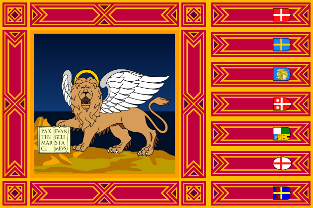 Veneto

威尼斯(威尼斯语︰Venezsia;意大利语︰Venezia;弗留利语︰Vignesie;拉丁语︰Venetia;英文:Venice)是意大利东北部著名的旅游与工业城市,也是威尼托地区的首府。威尼斯城由被运河分隔并由桥梁相连[1]的118座小岛组成。[2]威尼斯潟湖是位于波河与皮亚韦河河口之间的一个封闭的海湾,威尼斯城就坐落在威尼斯潟湖的浅滩上。威尼斯以其优美的环境、建筑和艺术品珍藏而闻名。[1]潟湖和城市的一部分被列为世界遗产。[1]Luigi Barzini曾在纽约时报形容它“无疑是最美丽的人造都市”[3],时代线上也称赞威尼斯是欧洲最浪漫的城市之一。
2014年,共有264,579人居住在威尼斯市镇,其中约55,000人居住在老城区。威尼斯与帕多瓦和特雷维索一起,组成了帕多瓦-特雷维索-威尼斯大都市区(PATREVE),总人口260万。PATREVE只是一个统计学意义上的大都市区,不是行政区划的等级。[4]
威尼斯这个名字源于公元前十世纪居住在该地区的古威尼蒂人。[5][6]这个城市历史上曾经是威尼斯共和国的首府。威尼斯同时被誉为“主之城”、“尊贵之城”、“亚得里亚王后”、“水之都”、“面具之城”、“桥梁之城”、“漂浮之都”、“运河之城”。
威尼斯共和国是中世纪和文艺复兴时期的主要金融和海运力量,是十字军东征和勒班陀战役的集结地,也是从13世纪直到17世纪末的一个非常重要的商业(特别是丝绸,粮食和香料)和艺术中心。[7] 威尼斯市被认为是第一个真正的国际金融中心,9世纪逐渐形成,14世纪达到了顶峰。这使威尼斯在其大部分历史中成为一座极为富裕的城市。[8]后来因为土耳其人对地中海东边的控制促使欧洲国家寻找其他航线的欲望,威尼斯因此失去了大部分的重要性与影响力。
它同样因为几次特别是文艺复兴时期的重要的艺术运动而众所周知的。在拿破仑战争和维也纳会议之后,共和国被奥地利帝国所吞并,直到1866年,由于第三次意大利独立战争而举行的全民公投,威尼斯成为意大利王国的一部分。威尼斯在交响乐和歌剧音乐史上也起着重要的作用,它是安东尼奥·维瓦尔第的诞生地。[9]2016年,威尼斯被评为世界上最美丽的城市。[10]
Venedig (italienisch Venezia [veˈnɛʦːi̯a], venezianisch Venesia[2] [veˈnɛzi̯a] oder [veˈnɛzja]) ist eine Stadt im Nordosten Italiens. Sie ist die Hauptstadt der Region Venetien, Metropolitanstadt Venedig und trägt den Beinamen La Serenissima („Die Durchlauchtigste“).[3] Ihr historisches Zentrum (centro storico) liegt auf einigen größeren Inseln in der Lagune von Venedig.
Die Gesamtfläche Venedigs beträgt 414,6 km², davon entfallen 257,7 km² auf Wasserflächen.[4] Am 31. Dezember 2016 zählte die Stadt 261.905 Einwohner, davon 181.883 in den Stadtteilen auf dem Festland, 58.901 im historischen Zentrum und 29.674 innerhalb der Lagune.[5] In der Lagune befinden sich 118 Inseln.[6] Sie erstreckt sich über etwa 50 km zwischen den Mündungen der Flüsse Adige (Etsch) im Süden und Piave im Norden in die Adria.
Venedig war bis 1797 Hauptstadt der Republik Venedig und mit über 180.000 Einwohnern eine der größten europäischen Städte. Bis ins 16. Jahrhundert war sie eine der größten Handelsstädte, über die der Handel zwischen Westeuropa und dem östlichen Mittelmeer abgewickelt wurde. Venedig unterhielt die meisten Handels- und Kriegsschiffe. Ihr Adel profitierte vom Handel mit Luxuswaren, Gewürzen, Salz und Weizen. Venedig entwickelte sich zum größten Finanzzentrum und dominierte ein Kolonialreich, das von Oberitalien bis Kreta und zeitweise bis nach Zypern reichte.[7] Nach französischer und österreichischer Herrschaft zwischen 1798 und 1866 wurde Venedig ein Teil Italiens. 1929 wurde der Industriekomplex Mestre-Marghera in die Comune di Venezia eingemeindet. Der jüdische Anteil der Bevölkerung wurde während des Zweiten Weltkriegs vernichtet. In den Jahren 1965 bis 1970 erreichte die Stadt mit knapp 370.000 Einwohnern die höchste Bevölkerungszahl, die seitdem wieder um etwa 100.000 Einwohner zurückgegangen ist.
Venedig und seine Lagune stehen seit 1987 auf der UNESCO-Liste des Weltkulturerbes.[8] Sie inspirierten besonders die Künstler und Venedig wurde zu einer der von Touristen meistbesuchten Städte. Seit einem Jahrhundert ist die wirtschaftliche Struktur der Altstadt einseitig auf den Tourismus ausgerichtet, während sich die industrielle Tätigkeit vor allem um Mestre und Marghera auf dem westlichen Festland konzentriert.
ヴェネツィア(イタリア語: Venezia (![]() 音声ファイル)[5])は、イタリア共和国北東部に位置する都市で、その周辺地域を含む人口約26万人の基礎自治体(コムーネ)。ヴェネト州の州都、ヴェネツィア県の県都である。ヴの表記によりベネチアと表記されることもある。
音声ファイル)[5])は、イタリア共和国北東部に位置する都市で、その周辺地域を含む人口約26万人の基礎自治体(コムーネ)。ヴェネト州の州都、ヴェネツィア県の県都である。ヴの表記によりベネチアと表記されることもある。
中世にはヴェネツィア共和国の首都として栄えた都市で、「アドリア海の女王」・「水の都」・「アドリア海の真珠」[要出典]などの別名をもつ。英語では「Venice」と呼ばれ、これに由来して日本語でもヴェニス、ベニスと呼ばれることもある。
古来はラテン語でウェネティ人の土地を意味し、ウェネティ人が住んでいたアドリア海の奥に拡がる土地をウェネティア (Venetia) と呼んだことから来ている。この綴りをそのままイタリアでのラテン語の読み方に従うと、ヴェネツィア(ヴェネツャ)となる。英語でヴェニス (Venice)、フランス語でヴニーズ (Venise)、ドイツ語でヴェネーディヒ (Venedig) と呼ばれる。ヴェネツィア方言では、古語は Venexia、現代語では Venessia(まれに Venezsia)と表記され、ヴェネーシアとヴェネースィアの中間に近い音で発音される。
日本語の表記では、イタリア語から来たものでもヴェネーツィアを始めとして、ヴェネチア、ベネチア、ベネツィアなどもある。英語由来の日本語表記では、ヴェニス、ベニスなどと書かれることもある。
英語での形容詞形"Venetian"はヴィニーシャンとヴェニーシャンの中間に近い発音だが、これの日本語表記は「ヴェネチアン」または「ベネチアン」となることが多く、また、綴りは異なるがイタリア語の影響から「ヴェネツィアン」と表記されることもしばしば。
Venice (/ˈvɛnɪs/, VEN-iss; Italian: Venezia [veˈnɛttsja] (![]() listen); Venetian: Venesia, Venexia [veˈnɛsja]) is a city in northeastern Italy and the capital of the Veneto region. It is situated across a group of 118 small islands[1] that are separated by canals and linked by 400 bridges.[2][3] The islands are located in the shallow Venetian Lagoon, an enclosed bay that lies between the mouths of the Po and the Piave rivers (more exactly between the Brenta and the Sile). Parts of Venice are renowned for the beauty of their settings, their architecture, and artwork.[2] The lagoon and a part of the city are listed as a UNESCO World Heritage Site.[2]
listen); Venetian: Venesia, Venexia [veˈnɛsja]) is a city in northeastern Italy and the capital of the Veneto region. It is situated across a group of 118 small islands[1] that are separated by canals and linked by 400 bridges.[2][3] The islands are located in the shallow Venetian Lagoon, an enclosed bay that lies between the mouths of the Po and the Piave rivers (more exactly between the Brenta and the Sile). Parts of Venice are renowned for the beauty of their settings, their architecture, and artwork.[2] The lagoon and a part of the city are listed as a UNESCO World Heritage Site.[2]
In 2014, 264,579 people resided in Comune di Venezia, of whom around 55,000 live in the historic city of Venice (Centro storico). Together with Padua and Treviso, the city is included in the Padua-Treviso-Venice Metropolitan Area (PATREVE), with a total population of 2.6 million. PATREVE is only a statistical metropolitan area.[4]
The name is derived from the ancient Veneti people who inhabited the region by the 10th century BCE.[5][6] The city was historically the capital of the Republic of Venice. Venice has been known as the "La Dominante", "Serenissima", "Queen of the Adriatic", "City of Water", "City of Masks", "City of Bridges", "The Floating City", and "City of Canals."
The Republic of Venice was a major financial and maritime power during the Middle Ages and Renaissance, and a staging area for the Crusades and the Battle of Lepanto, as well as a very important center of commerce (especially silk, grain, and spice) and art in the 13th century up to the end of the 17th century. The city-state of Venice is considered to have been the first real international financial center which gradually emerged from the 9th century to its peak in the 14th century.[7] This made Venice a wealthy city throughout most of its history.[8]
It is also known for its several important artistic movements, especially the Renaissance period. After the Napoleonic Wars and the Congress of Vienna, the Republic was annexed by the Austrian Empire, until it became part of the Kingdom of Italy in 1866, following a referendum held as a result of the Third Italian War of Independence. Venice has played an important role in the history of symphonic and operatic music, and it is the birthplace of Antonio Vivaldi.[9] Venice has been ranked the most beautiful city in the world as of 2016.[10] The city is facing some major challenges, however, including financial difficulties, erosion, pollution, subsidence, an excessive number of tourists in peak periods and problems caused by oversized cruise ships sailing close to the banks of the historical city.[11][12][13]
Venise (italien : Venezia /veˈnɛtʦja/, vénitien : Venexia /veˈnɛˑsja/) est une ville portuaire du nord-est de l'Italie, sur les rives de la mer Adriatique. Elle s'étend sur un ensemble de 118 petites îles séparées par un réseau de canaux et reliées par des ponts. Située au large de la lagune vénète, entre les estuaires du Pô et du Piave, Venise est renommée pour cette particularité, ainsi que pour son architecture et son patrimoine culturel — elle et sa lagune sont inscrites au patrimoine mondial de l'UNESCO.
Venise est la capitale de la région de la Vénétie. En 2012, la commune compte 269 810 habitants, dont 58 666 intra-muros (Centro storico)1. 176 000 résident sur les rives (Terraferma), pour la plupart dans les frazioni de Mestre et Marghera, et les 31 000 habitants restants résident dans d'autres îles de la lagune. Avec Padoue et Trévise, Venise constitue l'aire métropolitaine Padoue-Trévise-Venise (PATREVE), une entité statistique de 1 600 000 habitants.
Fondée peu après 528, elle fut la capitale pendant onze siècles (697-1797) de la République de Venise. Durant le Moyen Âge et la Renaissance, la ville fut une grande puissance maritime, à l'origine de la Quatrième croisade et victorieuse lors de la bataille de Lépante en 1571 contre l'Empire ottoman. Grâce à ses liens avec l'Asie et le Proche-Orient, dont le marchand et explorateur Marco Polo fut l'initiateur, elle devint également l'une des principales places commerciales d'Europe, notamment de la soie, des céréales et des épices. Enfin, elle est un centre culturel majeur, du XIIIe à la fin du XVIIe siècle, dont les peintres de l’École vénitienne (dont Titien, Véronèse et Le Tintoret), Carlo Goldoni et Antonio Vivaldi sont les principaux représentants.
Son nom provient du peuple qui habitait la région avant le Xe siècle, les Veneti. Dénommée Venetiae en latin, elle est parfois surnommée la « Cité des Doges », la « Sérénissime », la « Reine de l'Adriatique », la « Cité des Eaux », la « Cité des Masques », la « Cité des Ponts » ou encore la « Cité flottante ». La ville est aujourd'hui célèbre pour ses canaux — notamment le Grand Canal — et ses gondoles, ses nombreuses églises, la place Saint-Marc, le palais des Doges, le Pont des Soupirs, sa Biennale ainsi que son carnaval.
Venezia (AFI: /veˈnɛʦja/[5], ; [veˈnɛːsja][Nota 3]) è un comune italiano di 260 923 abitanti, il cui centro storico (limitato ai sestieri della città lagunare) ne conta invece 53 976[6] [7], capoluogo dell'omonima città metropolitana e della regione Veneto. È il primo comune della regione per popolazione, undicesimo in Italia[8] e primo in Veneto per superficie[9]. Il comune di Venezia comprende sia territori insulari sia di terraferma ed è articolato attorno ai due principali centri di Venezia (al centro dell'omonima laguna) e di Mestre (nella terraferma).
La città di Venezia è stata per più di un millennio capitale della repubblica di Venezia ed è conosciuta a questo riguardo come la Serenissima, la Dominante e la Regina dell'Adriatico. Per le peculiarità urbanistiche e per il suo patrimonio artistico, Venezia è universalmente considerata una tra le più belle città del mondo ed è annoverata, assieme alla sua laguna, tra i siti italiani patrimonio dell'umanità dall'UNESCO[10]: questo fattore ha contribuito a farne la terza città italiana (dopo Roma e Milano) con il più alto flusso turistico[11], in gran parte proveniente da fuori Italia.
Venecia (en italiano: Venezia [veˈnɛʦːi̯a] y en véneto: Venessia o Venesia [veˈnɛsi̯a]) es una ciudad ubicada en el noreste de Italia. Es también la capital de la región véneta y de la provincia de Venecia. Su centro histórico, declarado Patrimonio de la Humanidad por la Unesco,2 está situado en un conjunto de islas en la laguna de Venecia, en el norte del mar Adriático.
La ciudad está construida sobre un archipiélago de 118 pequeñas islas unidas entre sí por 455 puentes, si incluimos las islas de Murano y Burano. Se llega a Venecia desde tierra firme por el Puente de la Libertad, que desde la vecina ciudad de Mestre accede al Piazzale Roma. En el interior de la ciudad no hay tráfico rodado, siendo, a excepción de la navegación por los canales que separan a las islas, una ciudad totalmente peatonal. El transporte colectivo se realiza mediante embarcaciones transbordadoras conocidas como vaporettos. Están a cargo de la empresa municipal ACTV.3
Sus canales componen un gran entramado a modo de calles que parten del Gran Canal, gran vía por donde discurren multitud de embarcaciones, grandes y pequeñas, las más conocidas de las cuales son las llamadas góndolas.
Вене́ция (итал. Venezia [veˈnɛttsia] ![]() слушать, вен. Venesia) — город на северо-востоке Италии. Административный центр области Венеция и провинции Венеция. Образует коммуну, разделённую на 6 самоуправляемых районов. Покровителем города считается апостол Марк, евангелист, чьи мощи хранятся здесь же в Соборе Св. Марка, в связи с чем в город всегда приезжало много паломников-христиан со всего мира.
слушать, вен. Venesia) — город на северо-востоке Италии. Административный центр области Венеция и провинции Венеция. Образует коммуну, разделённую на 6 самоуправляемых районов. Покровителем города считается апостол Марк, евангелист, чьи мощи хранятся здесь же в Соборе Св. Марка, в связи с чем в город всегда приезжало много паломников-христиан со всего мира.
Население — 261 905 человек (31 декабря 2016 года)[1]. Расположена на материке (после объединения с городом Местре в 1926 году) и 118 островах Венецианской лагуны Адриатического моря. Подвержена осенним наводнениям от нагонной волны со стороны моря.
Крупный туристический и научно-образовательный центр. В материковой части — морской порт и международный аэропорт Марко Поло, нефтеперерабатывающий и другие заводы. Место проведения Венецианского карнавала и Венецианского кинофестиваля.
Архитектурный облик города сформировался в период расцвета Венецианской республики в XIV—XVI веках. Вместе с Венецианской лагуной внесён в список Всемирного наследия ЮНЕСКО.
Во времена античности район Венеции населяли венеты (отсюда название города). Островной город с IX века. В Средние века — центр Венецианской республики с многочисленными колониями в Средиземном море. Рост Османской империи привёл к упадку Венеции в XVII—XVIII веках; во время Наполеоновских войн попала под власть Австрии. В 1866 году вошла в состав Италии.
 Transport and traffic
 Architecture
 Financial
*Brazil economic data
Financial
*China economic data
Financial
*Germany economic data
Financial
*European Union economic data
Financial
*France economic data
Financial
*India economic data
Financial
*Indonesia economic data
Financial
*Italy economic data
Financial
*Japan economic data
Financial
*Canada economic data
Financial
*Russia economic data
Financial
*United States economic data
Financial
*United Kingdom economic data
Important port
Financial
Financial
*Brazil economic data
Financial
*China economic data
Financial
*Germany economic data
Financial
*European Union economic data
Financial
*France economic data
Financial
*India economic data
Financial
*Indonesia economic data
Financial
*Italy economic data
Financial
*Japan economic data
Financial
*Canada economic data
Financial
*Russia economic data
Financial
*United States economic data
Financial
*United Kingdom economic data
Important port

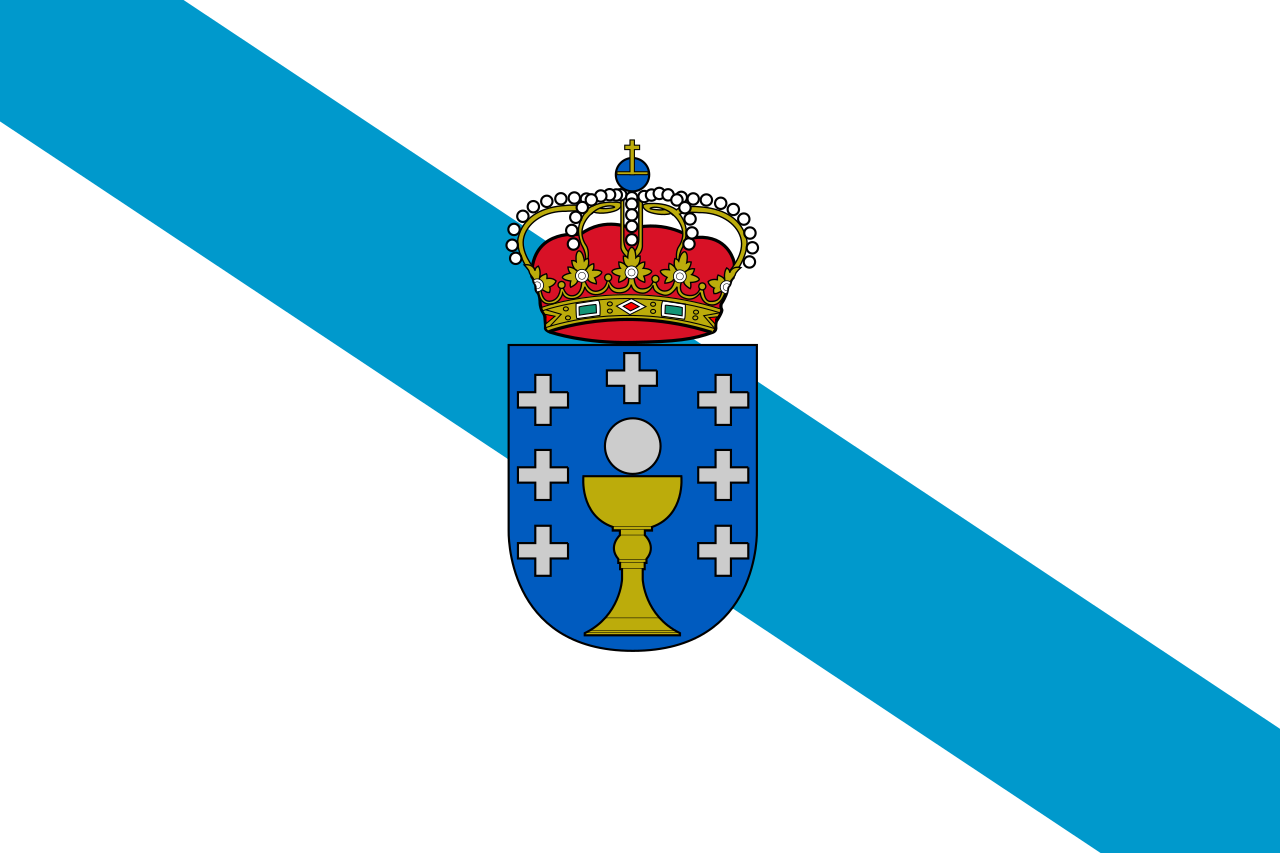 Galicia
 Women's Soccer World Cup 2023
ITU World Championship Series
New Zealand
Sport
Triathlon
Important port
Women's Soccer World Cup 2023
ITU World Championship Series
New Zealand
Sport
Triathlon
Important port

惠灵顿(英语:Wellington、毛利语:Te Whanganui-a-Tara 或 Poneke)是新西兰的首都,位于新西兰北岛南端,人口约四十万。它是新西兰的第二大城市,与悉尼和墨尔本一起成为大洋洲的文化中心。许多艺术家在此定居或活动,它还有许多艺术咖啡馆和生动的夜生活。
惠灵顿位于北岛的南端,与南岛隔库克海峡相望。在晴朗的日子里,人们可以隔海峡看到南岛上凯库拉岭的雪峰。城市北面是卡培提市的金色海岸。城市东面的里姆塔卡山将城市与盛产葡萄酒的怀拉拉帕平原隔开。
惠灵顿是世界最南方的首都,其纬度高达41度。由于港口和周围山脉之间的可用地带有限,它比新西兰其它城市的人口密度要高。由于它位于纬度40度的咆哮西风带,以及库克海峡对风的影响,他在当地有“多风的惠灵顿”之称号。
惠灵顿市中心的商业区是它的最重要部分,约6.2万人在那里工作(比较:奥克兰的居民数是惠灵顿的三倍,而它的中心商业区工作人员的数目仅比惠灵顿多4千)。惠灵顿的艺术和夜生活主要集中在中心商业区的南部,Te Aro区是新西兰最大的娱乐中心。
惠灵顿以其美丽的自然港口和绿色的山坡而著称。山坡上点缀着殖民时期遗留下来的盖瓦洋房。城市的中心商业区位于港口的附近。惠灵顿的尼可森海港的走向沿着一个活跃的地质断层。向西地势骤然高起,因此惠灵顿的许多市区高于市中心。
惠灵顿的南端是密拉马半岛,它与北岛的其它部分通过一条狭窄的地峡相连。惠灵顿国际机场也在这里。
Wellington, offizielle Bezeichnung: Wellington City (Māori Te Whanganui-a-Tara, wobei damit der Wellington Harbour und seine Umgebung gemeint ist), ist die Hauptstadt von Neuseeland und stellt zusammen mit den angrenzenden Städten Lower Hutt, Upper Hutt und Porirua nach Auckland den zweitgrößten Ballungsraum des Landes dar. Die Stadt Wellington selbst hat rund 190.000 Einwohner.
Wellington City liegt am südlichen Ende der Nordinsel. Die Stadt verfügt über eine reine Landfläche von 290 km² und zählte zum Census im Jahr 2013 190.959 Einwohner.[2] Damit ist die Stadt zwar flächenmäßig die zweitkleinste Stadt der vier eigenständigen Städte in der Region Wellington, ist aber mit 658,7 Einwohner pro km² die Stadt mit der dritthöchsten Bevölkerungsdichte des Landes, hinter Hamilton und Tauranga.
Im Norden und Nordosten der Stadt bilden die Stadtgebiete von Porirua City und Hutt City die Grenze, im Westen tut dies die Küstenlinie der Tasmansee, im Süden die Küstenlinie der Cook Strait und im Osten der Wellington Harbour.[3] Der westliche Teil der Stadt ist durch eine Berglandschaft geprägt, die mit dem 537 m hohen Outlook Hill an der Südspitze ihre Höhepunkt findet.
Die Gegenden im Westen des bebauten Gebiets von Wellington steigen relativ steil zu einer hügeligen Mittelgebirgskette an, so dass die dort gelegenen Stadtteile mitunter um einiges höher als das Stadtzentrum liegen. Aufgrund seiner geographischen Beschaffenheit wird Wellington oft mit San Francisco verglichen. Der südlich des Stadtzentrums gelegene Mount Victoria ist ein beliebter Aussichtspunkt und eine der markantesten geographischen Besonderheiten der Stadt. Die Miramar Peninsula (spanisch; Seeblick) bildet den östlichsten Punkt der Stadt. Auf dem zu dieser Halbinsel führenden Isthmus befindet sich der Internationale Flughafen der Stadt und direkt östlich dieser Halbinsel die Hafeneinfahrt in den Wellington Harbour mit dem berüchtigten Barrett-Riff, dem schon zahlreiche Schiffe zum Opfer fielen. Die Wahine, die 1968 an dem Riff gesunken ist und 52 Menschen in den Tod gerissen hat, ist das wohl bekannteste Opfer. Im Naturhafen selbst gibt es die drei Inseln Matiu/Somes Island, Ward (Makaro) und Mokopuna, von denen nur die erste bewohnt ist. Im Norden mündet einer der großen Flüsse der Nordinsel, der Hutt River in die Bucht. In seinem Tal, dem Hutt Valley befinden sich die Städte Upper Hutt im Norden und Lower Hutt südlich davon. Die beiden Städte werden westlich von den Bergen des Akatarawa Forest als Ausläufer der Tararua Range und östlich von der Rimutaka Range eingegrenzt.
Bekannte Sehenswürdigkeiten sind das ältere neuseeländischen Parlamentsgebäude und das 1979 fertiggestellte Regierungsgebäude, Beehive (Bienenstock) genannt, in dem der Prime Minister und die Minister des Kabinetts ihre Büros haben und das Kabinett tagt; das historische Wellington Cable Car und der dadurch an die City angeschlossene Botanische Garten mitsamt Aussichtspunkt oberhalb der Victoria University of Wellington; das Old Government Building als größtes Holzgebäude der Südhalbkugel (heute die juristische Fakultät der Universität) sowie Mount Victoria als einer der besten Aussichtspunkte der Stadt. Old Saint Paul’s, die erste anglikanische Kathedrale, wurde ab 1855 als Holzkirche in neugotischen Formen errichtet. 1964 ging ihre Funktion an die neu erbaute Cathedral of Saint Paul über. Bischofskirche des römisch-katholischen Erzbistums Wellington ist die 1901 vollendete Sacred Heart Cathedral.
Während der Stadtentwicklung sind um den Beginn des 20. Jahrhunderts eine Reihe von Profanbauten entstanden, welche das Bild der Innenstadt mitbestimmen. Dazu zählen die Aida Konditorei und das Barber Building in der Cuba Street, das Thistle Inn als einer der ältesten Pubs Neuseelands, das Albemarle Hotel in der Ghuznee Street, das Antrim House inmitten höherer moderner Gebäude, Alcohol and Drug Dependence Centre Building, das Appraisal House in der Willis Street, das Ashleigh Court Private Hotel sowie der Aqua Vitae Bottle Store, als seltenes Zeugnis der frühen kolonialen Bebauung.
ウェリントン(英語: Wellington、マオリ語: Te Whanga-nui-a-Tara)は、ニュージーランドの首都。同国2番目の都市圏で、オセアニアの首都の中では最も人口が多い。オセアニア有数の世界都市でもある。ウェリントン広域自治体(Wellington Region)に属し、ニュージーランド北島の南端にあり、ちょうど同国の国土の中央に位置する。マオリ語ではテ・ワンガヌイ=ア=タラあるいはポネケ(Poneke)という。
ニュージーランドの主要な金融機関はウェリントンとオークランドに分かれ、幾つかの企業は本社を両都市に置いている。ウェリントンはニュージーランドの政治の中心地であり、ニュージーランド議会とすべての行政機関の本庁舎が置かれている。
またウェリントンは、ニュージーランドの映画・演劇産業の中心地である。テ・パパ(Te Papa ニュージーランド国立博物館)、ニュージーランド交響楽団 (New Zealand Symphony Orchestra)、そしてロイヤル・ニュージーランド・バレエ団 (Royal New Zealand Ballet) が本拠地を置いている。隔年でニュージーランド国際アートフェスティバル (New Zealand International Arts Festival) も開催される。
小さくまとまった都心部では、都市の大きさのわりに大規模なアートシーンやカフェ文化、ナイトライフが展開されている。
ウェリントンの名前は、ワーテルローの戦いでナポレオン1世に勝利した初代ウェリントン公爵アーサー・ウェルズリーに敬意を表してつけられたものである。そしてその「ウェリントン」の爵号は、イングランド・サマセット州のウェリントンという町の名に由来する。
マオリ語ではウェリントンは2つの名前で呼ばれる。「テ・ワンガヌイ=ア=タラ (Te Whanganui-a-Tara)」はウェリントン港を指すもので、「タラ(ポリネシアの神話に登場する女神)の大いなる港」を意味する。もう一つの名称の「ポネケ」の方は、港のかつての名称「ポート・ニコルソン (Port Nicholson)」を縮めた愛称である「ポート・ニック (Port Nick)」の音訳でしかないと信じられているため、必ずしもマオリ語名とは言えないとされることも多い。
ウェリントンの都市圏は単独の地方自治体の境界を大きく越えて広がっている。「大ウェリントン (Greater Wellington)」あるいは「ウェリントン地方 (Wellington Region)」と呼ばれるのは、都市圏全体に加え、それを構成する市の市街地以外の部分、カピティ海岸 (Kapiti Coast)、それにリムタカ山脈 (Rimutaka Range) を挟んでワイララパ (Wairarapa) に至る範囲である。
Wellington (Māori: Te Whanganui-a-Tara [tɛ ˈfaŋanʉi a taɾa]) is the capital city and second most populous urban area of New Zealand, with 418,500 residents.[3] It is located at the south-western tip of the North Island, between Cook Strait and the Remutaka Range. Wellington is the major population centre of the southern North Island, and is the administrative centre of the Wellington Region, which also includes the Kapiti Coast and Wairarapa. Its latitude is 41°17′S, making it the world's southernmost capital of a sovereign state.[4] Wellington features a temperate maritime climate and is the world's windiest city, with an average wind speed of over 26 km/h (16 mph).[5]
The Wellington urban area comprises four local authorities: Wellington City, on the peninsula between Cook Strait and Wellington Harbour, contains the central business district and about half the population; Porirua on Porirua Harbour to the north is notable for its large Māori and Pacific Island communities; Lower Hutt and Upper Hutt are largely suburban areas to the northeast, together known as the Hutt Valley.
Situated near the geographic centre of the country, Wellington was well placed for trade. In 1839 it was chosen as the first major planned settlement for British immigrants coming to New Zealand. The settlement was named in honour of Arthur Wellesley, the first Duke of Wellington and victor of the Battle of Waterloo.
As the nation's capital since 1865, the New Zealand Government and Parliament, Supreme Court and most of the public service are based in the city. Architectural sights include the Government Building—one of the largest wooden buildings in the world—as well as the iconic Beehive. Wellington is also home to several of the largest and oldest cultural institutions in the nation such the National Archives, the National Library, the Museum of New Zealand Te Papa Tongarewa, and numerous theatres. It plays host to many artistic and cultural organisations, including the New Zealand Symphony Orchestra and Royal New Zealand Ballet. One of the world's most liveable cities, the 2014 Mercer Quality of Living Survey ranked Wellington 12th in the world.[6]
Wellington's economy is primarily service-based, with an emphasis on finance, business services, and government. It is the centre of New Zealand's film and special effects industries, and increasingly a hub for information technology and innovation,[7] with two public research universities. Wellington is one of New Zealand's chief seaports and serves both domestic and international shipping. The city is served by Wellington International Airport, the third busiest airport in the country. Wellington's transport network includes train and bus lines which reach as far as the Kapiti Coast and Wairarapa, and ferries connect the city to the South Island.
Wellington est la capitale de la Nouvelle-Zélande depuis 1865 et la deuxième ville la plus peuplée du pays. Elle est située à l'extrémité sud de l'île du Nord, dans la région de Wellington, au centre du pays. Cette situation en fait la capitale de pays la plus australe. Comme beaucoup de villes, l'aire urbaine de Wellington s'étend au-delà des frontières de son administration territoriale. Le Grand Wellington ou la région de Wellington comprend toute l'aire urbaine ainsi que les villes, les régions rurales, le Kapiti Coast, la chaine des monts Rimutaka et la Wairarapa.
Les principales institutions financières néo-zélandaises sont réparties entre Wellington et Auckland, et certaines organisations ont des bureaux dans les deux villes. Wellington est en revanche le centre politique de la Nouvelle-Zélande, le siège du parlement, des ministères et des départements d'État. Son centre-ville dense est le foyer d'une scène artistique, d'une culture des cafés et d'une vie nocturne que pourraient lui envier bon nombre de villes de taille similaire. Elle accueille également une industrie cinématographique d'échelle mondiale, ainsi qu'une scène théâtrale importante, Te Papa Tongarewa (le musée national), l'Orchestre symphonique de Nouvelle-Zélande et le Ballet national de Nouvelle-Zélande.
Wellington è la capitale della Nuova Zelanda, ed è la seconda città del paese, dopo Auckland.
Wellington è situata sulla punta sud-occidentale dell'isola del Nord e si trova tra lo Stretto di Cook e la zona di Rimutaka. È la città capitale più meridionale del mondo, ed è nel contempo anche la più remota capitale poiché lontana da qualsiasi altra.
L'area urbana di Wellington è il centro principale del sud dell'Isola del Nord, ed è il capoluogo della Regione di Wellington, che oltre alla zona urbana copre la costa Kapiti e Wairarapa.
La zona metropolitana della città comprende quattro quartieri: "Wellington City", sulla penisola tra lo stretto di Cook ed il porto, "Porirua City", a nord, "Lower Hutt City" e Upper Hutt City.
Wellington, inoltre, ha tre isole: Matiu, Makaro e Mokopuna. La prima di queste isole è stata usata come luogo di quarantena per le persone e gli animali, e anche come campo di internamento durante i due conflitti mondiali; oggi è un luogo di conservazione, in cui vengono protette specie in pericolo, proprio come Kapiti, che si trova più avanti rispetto alla costa. È possibile raggiungere queste isole tramite il traghetto Dominion Post.
Wellington ha subito gravi danni in una serie di terremoti nel 1848 (8,2 della scala Richter) e nel 1855. Questi terremoti trasformarono l'area intorno al porto in una palude; la zona è stata successivamente recuperata ed oggi vi si trova il Central Business District, il quartiere degli affari.
Una leggenda maori racconta che il grande navigatore polinesiano Kupe scoprì ed esplorò intorno al X secolo la zona dove sorge la città.
Il primo insediamento europeo si stabilì con l'arrivo dei coloni a bordo della nave Tory, il 20 settembre 1839; altre 150 persone arrivarono sulla nave Aurora il 22 gennaio 1840. I coloni costruirono le loro case alla foce della zona pianeggiante del fiume Hutt.
Nel 1865 Wellington divenne la capitale della Nuova Zelanda, in sostituzione di Auckland, dove William Hobson, l'aveva posta nel 1841. Il primo ministro della Nuova Zelanda, Alfred Domett, presentò al Parlamento una proposta di legge, in cui si esprimeva la necessità di trasferire la capitale in una località adatta.
Wellington (en maorí: Te Whanganui-a-Tara o Pōneke) es la capital de Nueva Zelanda, así como de la región de Wellington. Está localizada al sur de la isla Norte (North Island en inglés), en la que Wellington es la ciudad principal. Con 179 463 habitantes en 2006,1 es la tercera ciudad más poblada del país, después de Auckland y Christchurch.
Como muchas otras grandes ciudades y capitales, la ciudad se extiende más allá de los límites de su término municipal, y su área metropolitana o Gran Wellington incluye las poblaciones y áreas rurales cercanas, la costa de Kapiti y los montes Rimutaka hasta la región de Wairarapa. El área urbana incluye cuatro ciudades: Wellington, entre el estrecho de Cook y el puerto de Wellington, abarca la mitad de la población de todas las áreas y por lo tanto es su centro económico; al norte se encuentra Porirua, se caracteriza por su gran afluencia de maoríes y procedentes de las islas del pacífico; Lower Hutt y Upper Hutt al noreste, situadas junto al valle de Hutt.
La ciudad es un importante centro financiero y de negocios en el país. Es también un importante centro cultural, que alberga el museo Te Papa ("nuestro lugar" en lengua maorí), el ballet, la orquesta sinfónica y la producción cinematográfica en Nueva Zelanda. Fue fundada a finales de 1830 y se convirtió en la capital de Nueva Zelanda en 1865, en sustitución de Auckland. La ciudad está situada a 41 grados latitud sur y es la capital nacional más austral en el mundo.
Веллингто́н, Уэ́ллингтон (англ. Wellington) — столица Новой Зеландии, второй по численности населения город страны с учётом агломерации, крупнейшая столица среди стран Океании и самая южная столица в мире[2]. Город расположен в регионе Веллингтон в южной части острова Северный. Маорийское название Веллингтона — Те Фанауи-а-Тара (маори Te Whanganui-a-Tara). В начале XIX века начался процесс захвата европейцами земель коренного населения маори. В 1839 году полковник Уильям Уэйкфилд, служивший в Новозеландской компании, основал город немного северней его современного расположения. Однако в 1840 году сильные разливы реки Хатт заставили переселиться южнее. Первые переселенцы назвали город Веллингтоном в честь фельдмаршала герцога Артура Уэлсли Веллингтона, командующего объединёнными англо-голландскими войсками, в благодарность за ту помощь, которую он оказал первым переселенцам. Сильное землетрясение 1848 года вызвало серьёзные разрушения в городе, а в 1854 году по той же причине погибло много людей. В 1865 году Веллингтон стал столицей Новой Зеландии, которой остается и поныне. Веллингтон — красивый и уютный город, с большим количеством мостов, виадуков, тоннелей, парков и скверов. Многообразен его архитектурный облик: эклектические сооружения, относящееся к XIX — первой половине XX веков, на улицах города сочетаются со зданиями современного стиля и массовой деревянной застройкой. Одной из интереснейших построек столицы является круглое здание парламента, которое горожане называют ульем. Напротив парламента расположен бывший дворец правительства, являющейся второй в мире по величине постройкой из дерева. Также привлекает внимание собор Святого Павла. Впечатляет столичный ботанический сад, который расположился на склоне высокой горы. Особой гордостью города можно также считать зоопарк, в котором животные размещаются чаще всего не в клетках, а в просторных открытых вольерах.

温州市(普通话发音:Wēnzhōu,温州话发音:[ʔy33-11 tɕiɤu33-32],浙南闽语发音:Vo'e Jeu)是中华人民共和国浙江省下辖的地级市,位于浙江省东南部,瓯江下游南岸,为沿海港口城市,亦是中华人民共和国沿海开放城市,古称瓯。旧城为东晋著名学者郭璞根据风水思想而建。当时,郭璞登上南岸的西郭山,见数峰错立,状如北斗,华盖山锁“北斗之口”,以此设计温州城。故而温州有“山如北斗城似锁”之美称,别称“斗城”[2]。传说筑城时,有白鹿衔花而过,人们视为瑞兆,故温州又别称“鹿城”[3]。是浙江第三大城市。温州是国家历史文化名城 ,素有“东南山水甲天下”之美誉。 温州古为瓯地,也称东瓯,公元323年建郡,为永嘉郡,传说建郡城时有白鹿衔花绕城一周,故名鹿城。 唐朝时(公元675年)始称温州 ,至今已有2000余年的建城历史。温州是中国民营经济发展的先发地区与改革开放的前沿阵地,在改革开放初期,以“南有吴川,北有温州”享誉全国。温州文化属瓯越文化,温州人属江浙民系使用吴语,温州话被评为中国最难懂方言之一。温州是中国数学家的摇篮、中国南戏的故乡、中国海鲜鸡蛋之乡,温州人被国人称之为东方犹太人。
Wenzhou (温州) ist eine bezirksfreie Stadt im Süden der Provinz Zhejiang in der Volksrepublik China. Wenzhou liegt in einer gebirgigen Region am Fluss Ou (Ou Jiang), ca. 30 km von der Küste zum Ostchinesischen Meer entfernt und ist das wirtschaftliche und kulturelle Zentrum Süd-Zhejiangs. Die Stadt hat eine verwaltete Fläche von 11.784 km² und ca. 7,44 Millionen Einwohner (Ende 2003). Der geschlossene Siedlungskern Wenzhous beherbergt auf einer Fläche von 1188 km² rund 1,4 Millionen Einwohner mit stark wachsender Tendenz.(Quelle:Wikipedia)
温州市(おんしゅうし/うんしゅうし、英: Wenzhou、温州語:[y tɕiɤu])は中華人民共和国浙江省東南沿海に位置する地級市。商才に長けた温州人は「中国のユダヤ人」と称されることがある。
浙江省東南部に位置し、北部は同省台州市、西部は同省麗水市、南部は福建省に接する。東は東シナ海である。温州港は古くから浙江省南部山間地帯の物産の積出港として栄えた。
Wenzhou (pronounced [wə́n.ʈʂóu] (listen); Wenzhounese: [ʔy33-11 tɕiɤu33-32], Chinese: 温州) is a prefecture-level city in southeastern Zhejiang province in the People's Republic of China. Wenzhou is located at the extreme south east of Zhejiang Province with its borders connecting to Lishui on the west, Taizhou on the north, and Fujian to the south. It is surrounded by mountains, the East China Sea, and 436 islands, while its lowlands are almost entirely along its East China Sea coast, which is nearly 355 kilometres (221 miles) long. Most of Wenzhou's area is mountainous as almost 76 percent of its 11,784-square-kilometre (4,550 sq mi) surface area is classified as mountains and hills.[3] It is said that Wenzhou has 7/10 mountains, 1/10 water, and 2/10 farmland.[4] At the time of the 2010 Chinese census, 3,039,500 people lived in Wenzhou's urban area;[1] the area under its jurisdiction (which includes two satellite cities and six counties) held a population of 9,122,100 of which 31.16% are non-local residents from outside of Wenzhou.[5]
Originally known as Yongjia (Chinese: 永嘉),[6] Wenzhou was a prosperous foreign treaty port, which remains well-preserved today. It is situated in a mountainous region and, as a result, has been isolated for most of its history from the rest of the country, making the local culture and language very distinct not only from the rest of China but from neighbouring areas as well. It is also known for its emigrants who leave their native land for Europe and the United States, with a reputation for being entrepreneurs who start restaurants, retail and wholesale businesses in their adopted countries. Wenzhou people make up a large number of ethnic Chinese residents of Italy (where they comprise 90% of all Chinese residents), France, and Spain.
Wenzhou (chinois simplifié : 温州 ; chinois traditionnel : 溫州 ; pinyin : Wēnzhōu ; Wade : Wen¹chou¹ ; cantonais Jyutping : Wan¹zau¹ ; cantonais Yale : wānjāu, prononciation ; wenzhounais : [ʔy33-11 tɕiɤu33-32] (iu ciou)) est une ville-préfecture dans l'extrême sud-est de la province du Zhejiang en Chine. C'est une ville historiquement industrielle et considérée par les chinois comme une ville riche où l'on pouvait trouver du travail facilement. Cette affirmation vient du fait que cette ville était principalement composée de commerçants qui voyageaient dans la Chine entière, pour vendre des produits en tout genre. Se trouvant à 400 km au sud de Shanghai, la ville portuaire de Wenzhou partage ses frontières avec Lishui à l'ouest, Taizhou au nord et le Fujian au sud. Il est entouré de montagnes, de la mer de Chine orientale et de 436 îles, tandis que ses plaines sont presque entièrement sur le long de la côte de la mer de Chine orientale, soit près de 355 kilomètres de long. La majeure partie de la région de Wenzhou est montagneuse, car près de 76 % de sa superficie de 11 784 kilomètres carrés y est classée en tant que montagnes et collines2.
Lors du recensement national de 2010, la municipalité de Wenzhou compte 9,1 millions d'habitants dont 3 039 439 dans la ville elle-même; 31.16 % de ces 9,1 millions de personnes sont des résidents venant de l'extérieur de Wenzhou3.
Wenzhou, qui se traduit par « une terre douce et agréable », tire son nom de son climat, car il ne fait ni extrêmement chaud en été ni extrêmement froid en hiver.
À l'origine connu sous le nom de Yongjia (chinois : 永嘉 ; pinyin : Yǒngjiā ; Wade : Yung³chia¹)4, Wenzhou était un port prospère de traité étranger, qui reste bien préservé de nos jours. Situé dans une région montagneuse et, par conséquent, la ville a été isolée pour la plupart de son histoire du reste du pays, ce qui rend la culture et le langage locaux très distincts, non seulement du reste de la Chine, mais aussi des régions avoisinantes, dont on y parle une forme très particulière du wu. Il est également connu pour ses émigrants qui quittent leur pays d'origine pour l'Europe et les États-Unis, avec une réputation d'être des entrepreneurs qui commencent les restaurants, les commerces au détail et en gros dans leurs pays d'accueil. Les Wenzhou forment un grand nombre de résidents d'origine chinoise d'Italie (où ils représentent une majorité des résidents chinois), de France et d'Espagne.
Wenzhou (溫州T, 温州S, Wēn ZhōuP) in mandarino o Ou (甌T, 瓯S, ŌuP) di origine è una città-prefettura situata nella parte sud-orientale della provincia cinese dello Zhejiang. Ha una popolazione di 3,039,500 abitanti (2010). Ha una superficie di 1.082 km quadrati.
Confina a ovest con Lishui, a nord con Taizhou e a est si affaccia sul Mar Cinese Orientale.
Wenzhóu (en chino tradicional: 溫州, en chino simplificado: 温州, pinyin: Wēnzhōu, transcripción antigua: Wenchow) es una ciudad-prefectura situada en Zhejiang en la República Popular China. La prefectura ocupa un área total de 11 784 km²; la ciudad propiamente dicha tiene 1,42 millones habitantes y el área metropolitana, 9,12 millones. En torno al 11% de la población es cristiana. La lengua local no es el mandarín sino una variedad de chino wu (吳語, wúyǔ).
Fue un importante puerto de comercio internacional que hoy en día sigue bastante bien conservado. La ciudad es también conocida ya que es el lugar de origen de numerosos emigrantes que viven en Europa y en los Estados Unidos. Los habitantes de esta ciudad son gente emprendedora que regenta restaurantes o tiendas en sus países de adopción.
Вэньчжóу (кит. трад. 溫州, упр. 温州, пиньинь: Wēnzhōu) — городской округ в провинции Чжэцзян КНР. Он граничит с городами Лишуй на западе, Тайчжоу на севере, с востока омывается Восточно-Китайским морем. Площадь города 11 784 км² на суше и 11 000 км² на море, береговая линия 255 километров. ВВП на душу населения составляет 20 779 юаней (2005).
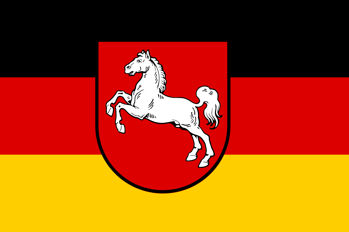 Lower Saxony
 Vacation and Travel

Wilhelmshaven […ˈhaːfən] (niederdeutsch Willemshaven) ist eine kreisfreie Stadt im Nordwesten Deutschlands. Sie liegt an der Nordwestküste des Jadebusens, einer etwa 190 km² großen Meeresbucht an der Nordsee. Die Mittelstadt hat 75.027 Einwohner und ist ein Oberzentrum. Seit 2006 gehört Wilhelmshaven zur Metropolregion Nordwest, einer von insgesamt elf europäischen Metropolregionen in Deutschland.
Die Stadtgeschichte ist seit der Einweihung als „erster deutscher Kriegshafen an der Jade“ am 17. Juni 1869 eng mit der Geschichte der Deutschen Marine verbunden. Die Stadt ist heute der größte Standort der Deutschen Marine, seit Umsetzung des Stationierungskonzepts 2011 der Bundeswehr auch der größte Standort der Bundeswehr[2][3] und einer der größten Marinestützpunkte in Westeuropa.[4]
Wilhelmshaven hat den Tiefwasserhafen mit der größten Wassertiefe in Deutschland und ist der größte Erdölumschlaghafen des Landes. 72 Prozent des Rohölumschlags aller deutschen Seehäfen und fast 27 Prozent des deutschen Rohölimports werden über Wilhelmshaven abgewickelt.[5] Von hier führen Pipelines zu Erdölraffinerien im Rhein-Ruhr-Gebiet und nach Hamburg. Das tiefe Fahrwasser der Jade prägt die Wirtschaft und ist die Basis für Ansiedlungen von Großbetrieben der Petrochemie, der chemischen Industrie, der stromerzeugenden Industrie, der Logistik-Industrie und weiterer maritimer Wirtschaftszweige (Reparaturwerften, Schiffsausrüstungen etc.). Mit dem im September 2012 eröffneten JadeWeserPort erhielt Wilhelmshaven ein von der Tide unabhängiges Containerterminal, das auch die größten Containerschiffe voll beladen abfertigen kann.
Die Nordseestadt ist Standort der Jade Hochschule sowie wissenschaftlicher Forschungseinrichtungen, wie die Senckenberg Gesellschaft für Naturforschung, das Niedersächsische Instituts für historische Küstenforschung, das Institut für Vogelforschung, das Deutsche Windenergie-Instituts und das Institut für Chemie und Biologie des Meeres.
Wilhelmshaven profitiert vom Tourismus an der Nordseeküste (siehe hierzu: Die Nordsee). Die Stadt zieht mit ihren Einkaufsmöglichkeiten und ihren touristischen Einrichtungen Feriengäste der umliegenden Badeorte an.
威廉港(德语:Wilhelmshaven,德语:[vɪlhɛlmsˈhaːfn̩] (![]() 聆听))人口大约8万人,是德国北海亚德湾沿岸的一个中型城市,也是德国第二大联邦州下萨克森的一座非县辖城市。威廉港市是下萨克森州的中心城市之一,2006年加入了德国西北部的城市合作联盟“不来梅-奥尔登堡大都市圈”。
聆听))人口大约8万人,是德国北海亚德湾沿岸的一个中型城市,也是德国第二大联邦州下萨克森的一座非县辖城市。威廉港市是下萨克森州的中心城市之一,2006年加入了德国西北部的城市合作联盟“不来梅-奥尔登堡大都市圈”。
威廉港是德国天然水深最深的港口和德国最大的石油转运港。亚德湾的深水优势是来自石化、电力、物流和修船等其它海事相关行业的大型企业选择在威廉港落户的原因。通过威廉港运输的原油占到德国港口原油转运量的72%和德国原油进口量的27%。石油管道从威廉港延伸至莱茵卢尔地区和汉堡市的炼油厂。2012年9月,JadeWeserPort(亚德港)集装箱港区建成投产,这是超大型船舶唯一能够不受潮汐限制、全天候满载挂靠的德国集装箱港口。
威廉港从德国北海沿岸的旅游业中受益匪浅。这一地区的沿海浅滩是下萨克森国家浅滩公园(Nationalpark Niedersächsisches Wattenmeer)的一部分。这里的购物中心、旅游设施和通往沿海岛屿的轮渡吸引了在周边地区度假的人们前来参观。
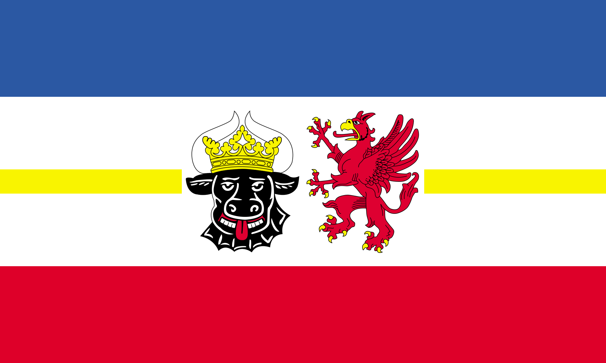 Mecklenburg-Vorpommern

维斯马和施特拉尔松德是梅克伦堡-前波莫瑞州濒临东海的两座城市,风景优美,都有着辉煌的历史。如果任其败落,将是人类文化的一大损失。维斯马在保护其港口和运河一直做得相当好,而施特拉尔松德的历史中心自13世纪以来几乎没有任何变化。
14世纪,施特拉尔松德和吕北克是德国东海地区最重要的两个城市。但它随着汉萨同盟的衰亡而衰落了,直到完全丧失它的经济地位。约翰内斯修道院和港口是旅游者必到的地方。
有82公顷面积的施特拉尔松德市老城是汉萨同盟时代自由城市发展的又一座纪念碑,市容景观极富特色。市政厅是该市的象征。临街一面的建筑物体现了不同时期的建筑特征。居民表面楼富丽堂皇的装饰证明了这座汉萨城市曾经的富有。(Quelle:中国航空旅游网)
维斯马(德语:Wismar),是德国北部梅克伦堡-前波美拉尼亚州的一个市镇。属于汉萨同盟,2002年六月二十七日维斯马老城与施特拉尔松德为联合国教科文组织指定世界文化遗产。
维斯马是德国北部港市。在波罗的海维斯马湾南岸。1167年见于史籍。1229年建市。1266年加入“汉萨同盟”。2002年六月二十七日维斯马老城与施特拉尔松为联合国教科文组织指定世界文化遗产。
Die Hansestadt Wismar liegt an der Ostseeküste Mecklenburg-Vorpommerns am südlichen Ende der durch die Insel Poel geschützten Wismarer Bucht. Sie ist die sechstgrößte Stadt und das größte der 18 Mittelzentren des Landes Mecklenburg-Vorpommern. Zudem ist Wismar Kreisstadt des Landkreises Nordwestmecklenburg.
Wismar war früh Mitglied des Handelsbundes der Hanse und blühte im Spätmittelalter auf, was noch heute im Stadtbild durch viele gotische Baudenkmale nachvollziehbar ist. Nach dem Dreißigjährigen Krieg kam Wismar 1648 unter die bis zum Jahr 1803 (de jure 1903) dauernde schwedische Herrschaft, woran das jährliche Schwedenfest erinnert. Danach gehörte die Stadt zu Mecklenburg-Schwerin. Im Zweiten Weltkrieg wurde die Stadt durch mehrere Bombenangriffe getroffen, worunter vor allem das Gotische Viertel mit den Hauptkirchen St. Marien und St. Georgen sowie der Alten Schule litt. Im Jahr 2002 wurden die Altstädte von Wismar und Stralsund als Historische Altstädte Stralsund und Wismar in die UNESCO-Welterbeliste aufgenommen.
Vor allem aufgrund ihrer kulturhistorischen Bedeutung mit wertvollem Stadtbild und dank der Lage an der Ostsee ist Wismar ein beliebtes Tourismusziel, zunehmend auch für Kreuzfahrten. Wirtschaftlich bedeutend sind auch die industrielle Hafen- und Schiffswirtschaft etwa mit den MV Werften, diverse Maschinenbauunternehmen, die Holzverarbeitung und die Solarindustrie. Seit der Gründung 1881 befindet sich in Wismar zudem das Stammhaus der Warenhauskette Karstadt.
ヴィスマール (Wismar ドイツ語発音: [ˈvɪsmaɐ]) はドイツ北部、バルト海に面した小都市である。2017年12月31日現在の人口は約4.3万人(1905年の人口は21,902人であるため、100年間で人口が倍増したことになる)。かつてハンザ同盟都市の一つであった。現在はドイツのメクレンブルク=フォアポンメルン州ノルトヴェストメクレンブルク郡の郡都。ヴィスマルとも表記される。
45キロメートル西にリューベック、30キロメートル南にシュヴェリーンがあり、ヴィスマール湾に面した天然の良港を持っている。 教会ならびに市内の建造物は「ハンザ同盟都市の煉瓦建築」を代表し、2002年にシュトラールズントともに「シュトラールズント歴史地区とヴィスマール歴史地区」としてUNESCOの世界遺産に登録された。
なお、この街は1922年の映画『吸血鬼ノスフェラトゥ』のロケ地として撮影に使用された。 ヴィスマール1229年に都市権を獲得したと言われ、 1301年にメクレンブルクの領地となった。1259年、バルト海を横行する海賊から都市と船舶を守るためリューベック及びロストックと協定を結び、それが後にハンザ同盟へと発展した。13世紀から14世紀にかけてこの町は毛織物を主産業として繁栄するハンザ都市であった。1376年に疫病によって1万人もの死者を出したにも関わらず、16世紀まで栄えたようである。
Wismar (German pronunciation: [ˈvɪsmaʁ]) is a port and Hanseatic city in Northern Germany on the Baltic Sea, in the state of Mecklenburg-Vorpommern. It is located about 45 kilometres (28 miles) east of Lübeck and 30 kilometres (19 miles) north of Schwerin, and is part of the Hamburg Metropolitan Region. Its natural harbour, located in the Bay of Wismar, is protected by a promontory. The population was 42,219 in 2013. It is the capital of the district of Nordwestmecklenburg.
With its origins as a Slavic settlement, Wismar's recorded history began in the 12th century. At various times, Wismar has been part of Mecklenburg, Sweden or Germany, including East Germany. It became part of Germany in 1871, though Sweden officially renounced its claims to the city only much later, in 1903. A unique representative of the Hanseatic League city type, with its Brick Gothic constructions and many patrician gable houses, Wismar has been included in the UNESCO list of World Heritage Sites since 2002, together with the historical core of Stralsund.
Wismar est une ville hanséatique du Mecklembourg-Poméranie-Occidentale, dans le nord-est de l'Allemagne, au bord de la baie de Wismar sur la mer Baltique. Elle compte 42 433 habitants (au 31 décembre 2013). Sa population est en constante diminution. C'est le chef-lieu de l'arrondissement du Mecklembourg-du-Nord-Ouest.
La ville accueille une université de technologie, économie et stylisme.
Le 29 juin 2002, sa vieille ville a été inscrite sur la liste du Patrimoine mondial de l'UNESCO conjointement avec celle de Stralsund.
Wismar (in basso tedesco Wismer) è una città che si trova sulle coste del Mar Baltico, nel Land del Meclemburgo-Pomerania Anteriore, in Germania. Essa si trova circa 45 chilometri ad est di Lubecca e 30 chilometri a nord di Schwerin.
In considerazione del suo passato e dell'architettura tipica del gotico baltico, nel 2002 Wismar è stata inserita nell'elenco dei Patrimoni dell'umanità dell'UNESCO, insieme alla vicina città di Stralsund.
La ciudad hanseática de Wismar es la ciudad capital del distrito de Mecklemburgo Noroccidental, en el estado federado de Mecklemburgo-Pomerania Occidental, Alemania. Está situada a orillas del mar Báltico en la bahía de Wismar, que goza de la protección de la isla de Poel. Cuenta con una población de 44 484 personas.1
El centro histórico de la ciudad fue declarado Patrimonio de la Humanidad por la Unesco en el año 2002 junto con el centro histórico de Stralsund, destacando los edificios de ladrillo en estilo gótico báltico de ambas ciudades.
Ви́смар (нем. Wismar [ˈvɪsmaʁ], н.-нем. Wismer) — город-порт на берегу Балтийского моря в Германии (земля Мекленбург-Передняя Померания). Входит в состав района Северо-Западный Мекленбург. Как один из первых и наиболее благополучных городов Ганзы гордится историческим центром с особняками и храмами в стиле кирпичной готики, состоящим под охраной ЮНЕСКО.