
Deutsch-Chinesische Enzyklopädie, 德汉百科
 Liaoning Sheng-LN
 Fujian Sheng-FJ
 Guangdong Sheng-GD
 Guangxi Zhuangzu Zizhiqu-GX
 Hainan Sheng-HI
 Hebei Sheng-HE
 Jiangsu Sheng-JS
 Liaoning Sheng-LN
 Shandong Sheng-SD
 Shanghai Shi-SH
 Tianjin Shi-TJ
 Zhejiang Sheng-ZJ

抚顺市,简称抚,是中华人民共和国辽宁省下辖的地级市,国务院批准的较大的市,位于辽宁省东部。市境南接本溪市,西邻沈阳市,北界铁岭市、吉林省辽源市,东连吉林省通化市。地处长白山脉南段,辽河平原东缘,东北部为吉林哈达岭。浑河发源于市境东部,向西横贯,于中部纳苏子河;太子河发源于市境南部。全市总面积11,271平方公里,2020年常住人口173.19万,市人民政府驻顺城区。抚顺是距离省会沈阳最近的城市,中华人民共和国建国初期,曾被誉为“煤都”。目前抚顺已发展成为一个以煤炭、石油、化工、冶金、机械、电子、轻工、纺织、建材工业为支柱,以大中型企业为骨干,以能源、原材料为主的,门类比较齐全,实力相对雄厚的综合性重工业城市,在中国占有重要地位[3]。
2015年2月5日,由中华人民共和国住建部和辽宁省住建厅专家、学者组成的部省联合审查工作组对《抚顺市城市总体规划(2013-2020年)纲要》进行审查,时任抚顺市市长栾庆伟在审查会议上发表的致辞中将抚顺的城市性质定义为以石化、装备为主导的国家产业基地,以山水生态、工业遗产为特色的文化旅游名城[4]。
抚顺,别称“煤都” ,是辽宁省辖地级市,国务院批复确定的辽宁重要的工业基地 。截至2021年,全市下辖4个区、3个县,总面积11271.5平方千米 ,常住人口为1861372人。
抚顺位于辽宁东部,是沈阳都市圈副中心城市。抚顺东与吉林省接壤,西接沈阳,北与铁岭毗邻,南与本溪相望。地理坐标为东经123°55',北纬41°52',境内平均海拔80米,地处中温带,属温带大陆性季风气候,市区位于浑河冲积平原上,三面环山。
抚顺是清朝的发祥地,是雷锋的第二故乡和雷锋精神的发祥地。抚顺地处长白山余脉,呈东南高、西北低之势,是辽宁省重要水源保护地,是国内重要的老工业基地。 抚顺是中国最具幸福感城市,中国优秀旅游城市和国家森林城市
Fushun (chin. 抚顺市/撫順市 Fǔshùn Shì) ist eine bezirksfreie Stadt in der nordostchinesischen Provinz Liaoning, welche 2.138.090 Einwohner (2010) zählt und eine Fläche von 11.271 km² hat. Unter den 14 bezirksfreien Städten der Provinz steht Fushun nach der Bevölkerungszahl an zehnter Stelle. In Fushun leben viele Angehörige des Volkes der Mandschu.
 China
China
 Democratic People's Republic of Korea
 Jiangxi Sheng-JX
 Liaoning Sheng-LN
 Republic of Korea
 Shandong Sheng-SD

Das Gelbe Meer ist ein Teil des Chinesischen Meeres und ein von der Volksrepublik China und der Koreanischen Halbinsel umgebenes Randmeer des Pazifischen Ozeans. Der Golf von Bohai und die Koreabucht im Norden sind Teile des Gelben Meeres. Im Süden schließt sich das Ostchinesische Meer an.
Das Gelbe Meer misst 960 Kilometer von Nord nach Süd und ist 700 Kilometer breit. Die Flächenausdehnung beträgt 380.000 km². Es ist durchschnittlich 44 Meter und maximal 152 Meter tief. Damit ergibt sich ein Wasservolumen von 16.720 km³. Das Gelbe Meer ist ein flaches Meer, vergleichbar mit der Nordsee am anderen Ende des eurasischen Kontinents. Seine Wattflächen sind ein bedeutendes Rastgebiet für Watvögel.
Seine charakteristische Farbe, die zur Namensgebung führte, erhält es von dem nährstoffhaltigen gelben Schwemmsand, dem Löss, den der Gelbe Fluss und andere Flüsse an ihrer Mündung in das Gelbe Meer hineintragen und dort ablagern.
黄海(こうかい、英語:Yellow Sea)は、中国大陸と朝鮮半島の間にある海[1][2]。 黄河から運ばれる黄土により黄濁している部分があることから黄海と呼ばれている。フランスの地図製作者ダンヴィルが1737年に作成した『中国新地図帳』に黄海 (Hoang Hai ou Mer Jaune) と表記したことで国際的にも認知されるようになった。
The Yellow Sea is a marginal sea of the Western Pacific Ocean located between mainland China and the Korean Peninsula, and can be considered the northwestern part of the East China Sea. It is one of four seas named after common colour terms (the others being the Black Sea, the Red Sea and the White Sea), and its name is descriptive of the phenomenon whereby fine sand grains from the Gobi Desert sand storms, that descend annually from the northwest, turn the surface of its waters a golden yellow.
The innermost bay of northwestern Yellow Sea is called the Bohai Sea (previously Pechihli Bay or Chihli Bay), into which flow some of the most important rivers of northern China, such as the Yellow River (through Shandong province and its capital Jinan), the Hai River (through Beijing and Tianjin) and the Liao River (through Liaoning province). Sand and silt carried down by these rivers contribute further to the sea's colour. The northern extension of the Yellow Sea is called the Korea Bay, into which flow the Yalu River, the Chongchon River and the Taedong River.
La mer Jaune est un bras de mer de l'océan Pacifique qui sépare la Chine de la péninsule coréenne. Elle s'ouvre au sud sur la mer de Chine orientale qui la borde. Son nom provient du sable et des sédiments apportés par le vent soufflant depuis le désert de Gobi et par les fleuves, en particulier le fleuve Jaune et le Hai He qui lui donnent une couleur jaune1. En Corée, elle est aussi appelée la mer de l'Ouest. Sa partie septentrionale est appelée golfe de Corée et communique avec le golfe de Bohai qui se trouve de l'autre côté des péninsules du Liaodong et du Shandong. Cette dernière partie est aussi incluse dans la mer Jaune. Celle-ci mesure 960 km du nord au sud et 700 km de l'est à l'ouest pour une superficie de 380 000 km2, le golfe de Bohai non compris2. Reposant sur le plateau continental, c'est une mer peu profonde : la profondeur moyenne est de 44 m pour un maximum de 152 m. Cette mer est récente puisqu'elle a été formée à la fin du dernier âge glaciaire, il y a près de 10 000 ans lorsque le niveau des eaux monta de 120 mètres. Le fond de la mer descend lentement du côté de la Chine et remonte plus rapidement du côté de la Corée. La côte de Corée du Sud est très découpée, comprenant de nombreuses îles telles que celles de Ganghwa, Jeju et Yeonpyeong. Les plus grands fleuves proviennent de Chine et débouchent dans le Bohai (le fleuve Jaune, le Hai He et le Liao). Au niveau de la péninsule coréenne, le Yalou et le Taedong se jettent dans le golfe de Corée tandis que le fleuve Han arrive dans la mer Jaune proprement dite.
Il mar Giallo (in cinese 黄海S, Huáng HǎiP e in coreano: 황해, Hwanghae) è una porzione dell'Oceano Pacifico posta a settentrione del mar Cinese Orientale, tra la costa cinese e la penisola coreana. Copre una superficie di circa 417000 km² e sulle sue acque si affacciano la Cina, la Corea del Nord e la Corea del Sud.
Il mar Giallo è chiamato mare Occidentale nelle due Coree. Il suo nome deriva dai sedimenti di colore giallo che colorano le sue acque, apportati da vari fiumi, in particolare dal fiume Giallo (Huáng Hé).
La parte più interna del mar Giallo è costituita dal golfo di Bohai che è compreso tra le penisole di Liaodong a nord e dello Shandong a sud.
È un mare poco profondo con una profondità massima di 105 metri, ma nonostante ciò è molto trafficato con importanti porti sia sulla costa cinese sia su quella coreana. La parte settentrionale del mare gela in inverno.
El mar Amarillo (en chino simplificado, 黄海; pinyin, huáng hǎi, en coreano, 황해 [Hwang Hae]) es la parte norte del mar de la China Oriental que se convierte en parte del océano Pacífico. Es un amplio mar, ocupando un área de cerca de 417 000 km², aunque es poco profundo, con una profundidad máxima de 105 metros.
Está situado entre la China continental y la península de Corea. Su nombre proviene de las partículas de arena que le dan ese color al agua, originalmente del río Amarillo, Huang he. Se conoce también localmente, en Corea del Sur, con el nombre de mar del Oeste.
La inmensa bahía que forma el fondo del mar Amarillo recibe el nombre de mar de Bohai (conocido anteriormente como bahía de Zhili). En ella desemboca el río Amarillo, después de cruzar la provincia de Shandong y su capital, Jinan, así como el río Hai que cruza Pekín y Tianjin.
La bahía de Corea, entre la provincia china de Liaoning y el noroeste de Corea del Norte, forma parte también del mar Amarillo. El mar de Bohai y la península de Corea están separadas por la península de Liaodong, con la ciudad de Dalian situada en su extremo sur.
Жёлтое мо́ре (кит. упр. 黄海, пиньинь Huánghǎi, кор. 황해 хванхэ, в КНДР известно как 조선서해, 朝鮮西海 чосон-сохэ — «Западно-Корейское море») — мелководное шельфовое полузамкнутое окраинное море Тихого океана у восточного побережья Азии к западу от Корейского полуострова. Название дано по цвету воды, вызванному наносами китайских рек и в меньшей степени пыльными бурями. Весной жёлтые пыльные бури бывают настолько сильны, что судам приходится прекращать движение.

 Architecture
 Beijing Shi-BJ
 China
China
 Chinesische Mauer
 Gansu Sheng-GS
 Hebei Sheng-HE
 Heilongjiang Sheng-HL
 Henan Sheng-HA
 Jilin Sheng-JL
 Liaoning Sheng-LN
 Nei Mongol Zizhiqu-NM
 Ningxia Huizu Zizhiqu-NX
 Qinghai Sheng-QH
 Shaanxi Sheng-SN
 Shandong Sheng-SD
 Shanxi Sheng-SX
 Tianjin Shi-TJ

 World Heritage
 Xinjiang Uygur Zizhiqu-XJ

 Civilization


长城(Great Wall),又称万里长城,是中国古代的军事防御工程,是一道高大、坚固而连绵不断的长垣,用以限隔敌骑的行动。长城不是一道单纯孤立的城墙,而是以城墙为主体,同大量的城、障、亭、标相结合的防御体系。
长城修筑的历史可上溯到西周时期,发生在首都镐京(今陕西西安)的著名的典故“烽火戏诸侯”就源于此。春秋战国时期列国争霸,互相防守,长城修筑进入第一个高潮,但此时修筑的长度都比较短。秦灭六国统一天下后,秦始皇连接和修缮战国长城,始有万里长城之称 。明朝是最后一个大修长城的朝代,今天人们所看到的长城多是此时修筑。
长城资源主要分布在河北、北京、天津、山西、陕西、甘肃、内蒙古、黑龙江、吉林、辽宁、山东、河南、青海、宁夏、新疆等15个省区市。期中陕西省是中国长城资源最为丰富的省份,境内长城长度达1838千米 。根据文物和测绘部门的全国性长城资源调查结果,明长城总长度为8851.8千米,秦汉及早期长城超过1万千米,总长超过2.1万千米。
1961年3月4日,长城被国务院公布为第一批全国重点文物保护单位 。1987年12月,长城被列入世界文化遗产。
长城(蒙古语:ᠴᠠᠭᠠᠨ
ᠬᠡᠷᠡᠮ,西里尔字母:Цагаан хэрэм;满语:ᡧᠠᠩᡤᡳᠶᠠᠨ
ᠵᠠᠰᡝ,穆麟德转写:šanggiyan jase),是中国古代为抵御不同时期塞北游牧帝国或部落联盟的侵袭,在西北方所修筑规模浩大的隔离墙或军事工程的统称。长城虽为城墙,但不做为完全单一条绝对隔离线,而是多层检查通行的边防口,实际上还主动发挥指导经贸交流的两手策略[1][2],东西段与前后关卡加总起来可绵延上万华里(约4500-6000千公尺),因此又称作万里长城。
现存的长城遗迹主要为始建于14世纪的明长城,西起嘉峪关,东至虎山长城,长城遗址跨越吉林、辽宁、北京、天津、山西、陕西、宁夏、甘肃等15个省市自治区,总计有43,721处长城遗产,长城也是自人类文明以来最巨大的建筑物。1961年起,一批长城重要点段被陆续公布为全国重点文物保护单位。1987年,长城被联合国教科文组织列为世界文化遗产,该遗产目前不仅包含上述15个省、市、自治区境内的长城,还额外包括了湖南和四川境内的苗疆长城(南长城)等[3]。
Die Chinesische Mauer ist eine Schutzanlage zur Grenzsicherung, die während der Ming-Dynastie (1368–1644) im Norden Chinas errichtet wurde.[1][2] Der chinesische Ausdruck ist 萬里長城 / 万里长城, Wànlǐ Chángchéng – „10.000-Li-Mauer, besser: zehntausende Li lange (Schutz-)Mauer“ oder kurz 長城 / 长城, Chángchéng, Jyutping Coeng4sing4anhören (kantonesisch)ⓘ/? – „Lange Mauer“, auch mit „Große Mauer“ (vgl. Englisch: „Great Wall“) übersetzt.
Die Anlage ist in Abschnitten zu unterschiedlichen Zeiten mit unterschiedlichen Bautechniken in der Ming-Dynastie gebaut worden.[3][4] Breite, begehbare Mauern im Norden Pekings aus der zweiten Hälfte des 16. Jahrhunderts bilden das ikonische Bild der Chinesischen Mauer und sind zu einem Sinnbild Chinas geworden. In anderen Abschnitten, besonders im Westen, ist die Befestigung oftmals aus festgeklopftem Lehm erbaut worden.[2] Die Länge der Schutzanlage wird mit 6260 Kilometern angegeben.[5]
万里の長城(ばんりのちょうじょう、中国語: 万里长城、拼音: Wànlǐ Chángchéng ワンリー ツァンツェン、モンゴル語: Цагаан хэрэм、ᠴᠠᠭᠠᠨ
ᠬᠡᠷᠡᠮ、満州語: ᡧᠠᠩᡤᡞᠶᠠᠨ
ᠵᠠᠰᡝ[1]、šanggiyan jase)は、中華人民共和国に存在する城壁の遺跡である。ユネスコの世界遺産(文化遺産)に登録されており、2007年には新・世界七不思議にも選ばれている[2]。中国には他にも長く連なった城壁、いわゆる長城は存在するが、万里の長城が規模的にも歴史的にも圧倒的に巨大なため、単に長城と言えば万里の長城のことを指す。現存する人工壁の延長は6,259.6kmである[3]。
匈奴のような北方の異民族が侵攻してくるのを迎撃するために、秦代の紀元前214年に始皇帝によって建設された。長城は始皇帝によって建設されたと一般には考えられているが、実際にはその後いくつかの王朝によって修築と移転が繰り返され、現存の「万里の長城」の大部分は明代に作られたものである。この現存する明代の長城線は秦代に比べて遥かに南へ後退している。
よく「農耕民族と遊牧民族の境界線」と言われるが、秦・漢代の長城は草原の中に建っているところが多い。これは両王朝が遊牧民族に対し優位に立ち、勢力圏を可能な限り北方へと広げようとしたためである。それに対し明代の長城は防衛を容易にするために中国本土に近いところに建設されており、とくに首都北京付近においてその傾向が強く、北京付近の長城は北京から100kmも離れていない稜線上に設けられている。万里の長城は南北両勢力の境界線として機能したが、北方の遊牧民族も南方の農耕民族もお互いの物産を必要としており、長城沿いには交易所がいくつも設けられ、盛んに取引が行われていた。交易はいつもうまくいっていたわけではなく、北方民族側の思うとおりにいかない場合もあった。その交易を有利にするための威嚇として、明の力が弱い時期に北方民族は長城を越えて侵入を繰り返していた。また、長城は観念上においても両勢力の境界線として機能し、たとえば中原の諸王朝が北方遊牧民族を指す場合、「塞外」(塞は城塞の意味で、この場合万里の長城を指す)という言葉が用いられることも多かった。
万里の長城は建設後常に維持・利用されていたわけではなく、積極的に長城を建設・維持する王朝と、まったく長城防衛を行わない王朝の2種が存在し、各王朝の防衛戦略によって長城の位置も大きく変動している。始皇帝による建設以後においては、秦・前漢・北魏・北斉・隋・金・明は大規模な長城建設を行ったのに対し、後漢・魏・晋・五胡十六国の諸王朝・唐・五代の各王朝・宋・元・清は長城防衛をほとんど、あるいはまったく行わなかった。長城の建設位置に関しても、秦・前漢・金は中原から遠く離れた草原地帯に長城を建設したのに対し、北魏・北斉・明は中原に近い山岳地帯を中心に長城を建設した。
なお、「宇宙から肉眼で見える唯一の建造物」と言われ、中華人民共和国の教科書にも掲載されていたが、実際には幅が細い上、周囲の色と区別が付きにくいため、視認することは出来ない。2003年に中国初の有人宇宙船「神舟5号」に搭乗した宇宙飛行士である楊利偉が、「万里の長城は見えなかった」と証言したため、中華人民共和国の教科書から、この節は正式に削除された[4]。2004年には、中国系アメリカ人の宇宙飛行士であるリロイ・チャオが、国際宇宙ステーション(ISS)より180ミリ望遠レンズを付けたデジタルカメラで「万里の長城」を写真撮影することに成功したが、肉眼では見えなかったと証言している[5]。
The Great Wall of China is a series of fortifications made of stone, brick, tamped earth, wood, and other materials, generally built along an east-to-west line across the historical northern borders of China to protect the Chinese states and empires against the raids and invasions of the various nomadic groups of the Eurasian Steppe with an eye to expansion. Several walls were being built as early as the 7th century BC;[2] these, later joined together and made bigger and stronger, are collectively referred to as the Great Wall.[3] Especially famous is the wall built in 220–206 BC by Qin Shi Huang, the first Emperor of China. Little of that wall remains. The Great Wall has been rebuilt, maintained, and enhanced over various dynasties; the majority of the existing wall is from the Ming Dynasty (1368–1644).
Apart from defense, other purposes of the Great Wall have included border controls, allowing the imposition of duties on goods transported along the Silk Road, regulation or encouragement of trade and the control of immigration and emigration. Furthermore, the defensive characteristics of the Great Wall were enhanced by the construction of watch towers, troop barracks, garrison stations, signaling capabilities through the means of smoke or fire, and the fact that the path of the Great Wall also served as a transportation corridor.
The frontier walls built by different dynasties have multiple courses. Collectively, they stretch from Dandong in the east to Lop Lake in the west, from present-day Sino-Russian border in the north to Qinghai in the south; along an arc that roughly delineates the edge of Mongolian steppe. A comprehensive archaeological survey, using advanced technologies, has concluded that the walls built by the Ming dynasty measure 8,850 km (5,500 mi).[4] This is made up of 6,259 km (3,889 mi) sections of actual wall, 359 km (223 mi) of trenches and 2,232 km (1,387 mi) of natural defensive barriers such as hills and rivers.[4] Another archaeological survey found that the entire wall with all of its branches measures out to be 21,196 km (13,171 mi).[5] Today, the Great Wall is generally recognized as one of the most impressive architectural feats in history.[6]
La Grande Muraille1 (chinois simplifié : 长城 ; chinois traditionnel : 長城 ; pinyin : Chángchéng ; Wade : Ch'ang²ch'eng² ; littéralement « la longue muraille »), aussi appelé « Les Grandes Murailles » est un ensemble de fortifications militaires chinoises construites, détruites et reconstruites en plusieurs fois et à plusieurs endroits entre le IIIe siècle av. J.-C. et le XVIIe siècle pour marquer et défendre la frontière nord de la Chine. C'est la structure architecturale la plus importante jamais construite par l’Homme à la fois en longueur, en surface et en masse.
Populairement, on désigne sous le nom de « Grande Muraille » la partie construite durant la dynastie Ming qui part de Shanhaiguan sur le territoire de la ville de Qinhuangdao dans la province du Hebei à l’est pour arriver à Jiayuguan dans la province du Gansu à l’ouest. Sa longueur varie selon les sources. Selon un rapport de 1990, la longueur totale des murs serait de 6 259,6 km2. En raison de sa longueur, elle est surnommée en chinois « La longue muraille de dix mille li » (chinois simplifié : 万里长城 ; chinois traditionnel : 萬里長城 ; pinyin : Wànlǐ Chángchéng ; Wade : Wan⁴li³ Ch'ang²ch'eng²), le li étant une ancienne unité de longueur chinoise et dix mille symbolisant l’infini en chinois. Ce surnom peut cependant être pris dans son sens littéral par approximation, 6 700 km faisant 11 632 li dans sa valeur généralement considérée de 576 m ou 13 400 li dans sa valeur actuelle d’exactement 500 m. En moyenne, la muraille mesure 6 à 7 m de hauteur, et 4 à 5 m de largeur. En avril 2009, l'Administration d'État chargée du patrimoine culturel, ayant utilisé des technologies de mesure plus récentes3, révise cette mesure et déclare une longueur de 8 851,8 km dont 6 259,6 km de murs, 359,7 km de tranchées et 2 232,5 km de barrières naturelles, telles des montagnes ou des rivières. Le même service a publié en juin 2012 une mise à jour de son étude, et estime désormais à 21 196,18 km la longueur totale de la Grande Muraille4,5. Cette nouvelle estimation prend en compte des parties actuellement détruites.
Depuis 1987, la Grande Muraille est classée au patrimoine mondial de l'UNESCO sous le numéro 4386. En 2015, le constat est fait d'une nette dégradation de l'état général de la Grande Muraille due principalement aux conditions climatiques et aux activités humaines, et de la nécessité d'intervenir rapidement pour assurer sa sauvegarde7.
La Grande Muraglia (長城T, 长城S, ChángchéngP), nata come Wanli changcheng (萬里長城T, 万里长城S, Wànlǐ ChángchéngP, Grande muraglia di 10.000 Lǐ[1]), consiste in una lunghissima serie di mura situate nell'odierna Cina.
Costruita a partire dal 215 a.C. circa per volere dell'imperatore Qin Shi Huang (秦始皇S, Qín Shǐ HuángP, Ch'in Shih-huangW, letteralmente "Primo Imperatore della dinastia Qin") - lo stesso a cui si deve il cosiddetto Esercito di terracotta di Xi'an - la sua lunghezza è stata considerata, fino a poco tempo fa, di 6.350 chilometri con altezze variabili.
Dalle misurazioni effettuate nel 2009 con più recenti strumentazioni tecnologiche (raggi infrarossi, GPS), la Grande Muraglia risulterebbe lunga 8.850 chilometri, circa 2.500 in più di quelli stimati[2] (di cui circa 350 km di trincee e circa 2250 km di difese naturali).
È stata dichiarata dall'UNESCO patrimonio dell'umanità nel 1987 e inserita nel 2007 fra le sette meraviglie del mondo moderno.
La Gran Muralla (en el idioma original 长城, changcheng) es una antigua fortificación china construida y reconstruida entre el siglo V a. C. y el siglo XVI (Edad Moderna) para proteger la frontera norte del Imperio chino durante las sucesivas dinastías imperiales de los ataques de los nómadas xiongnu de Mongolia y Manchuria.
Contando sus ramificaciones y construcciones secundarias, se calcula que tiene sobre unos 21 200 kilómetros de largo,1 desde la frontera con Corea, al borde del río Yalu, hasta el desierto de Gobi, a lo largo de un arco que delinea aproximadamente el borde sur de Mongolia Interior, aunque hoy solo se conserva un 30 % de ella.2En promedio, mide de 6 a 7 metros de alto y de 4 a 5 metros de ancho.
La muralla fue designada Patrimonio de la Humanidad por la Unesco en 1987.3
El 26 de enero de 2007 se dio a conocer que la muralla china fue elegida como una de las ganadoras en la lista de Las Nuevas Siete Maravillas del Mundo Moderno.[cita requerida]
La Gran Muralla está hermanada con la muralla romana de Lugo, Galicia (España), también designada Patrimonio de la Humanidad.
Великая Китайская стена (кит. трад. 長城, упр. 长城, пиньинь: Chángchéng, буквально: «Длинная стена» или кит. трад. 萬里長城, упр. 万里长城, пиньинь: Wànlǐ Chángchéng, буквально: «Длинная стена в 10 000 ли») — разделительная стена длиной почти 9000 км (полная длина 21,2 тыс. км), построенная в древнем Китае. Крупнейший памятник архитектуры.
Проходит по северному Китаю на протяжении 8851,9 км[2][3], а на участке Бадалин проходит в непосредственной близости от Пекина (это длина последнего сооружения эпохи Минской династии, причём сюда входят 6259 км собственно стен, 359 км рвов, 2232 км естественных защитных рубежей в виде холмов и рек).
Длина стены со всеми ответвлениями составляет 21 196 километров[4].
Толщина Великой стены в основном около 5-8 метров, а высота чаще всего около 6-7 метров (на некоторых участках высота достигает 10 метров)[источник не указан 681 день].
Стена идёт вдоль горной цепи Иньшань, огибая все отроги, преодолевая как высокие подъёмы, так и весьма значительные ущелья.
На протяжении многих столетий, стена меняла названия. Изначально называлась «Барьером», «Разгулом» или «Крепостью», позднее стена обрела более поэтичные названия, такие, как «Пурпурная граница» и «Земля драконов». Только в конце XIX века она получила название, которое известно нам и по сей день.

 Beijing Shi-BJ
 Chinesische Mauer
 Gansu Sheng-GS
 Hebei Sheng-HE
 Liaoning Sheng-LN
 Ningxia Huizu Zizhiqu-NX
 Qinghai Sheng-QH
 Shaanxi Sheng-SN
 Shanxi Sheng-SX
 Tianjin Shi-TJ

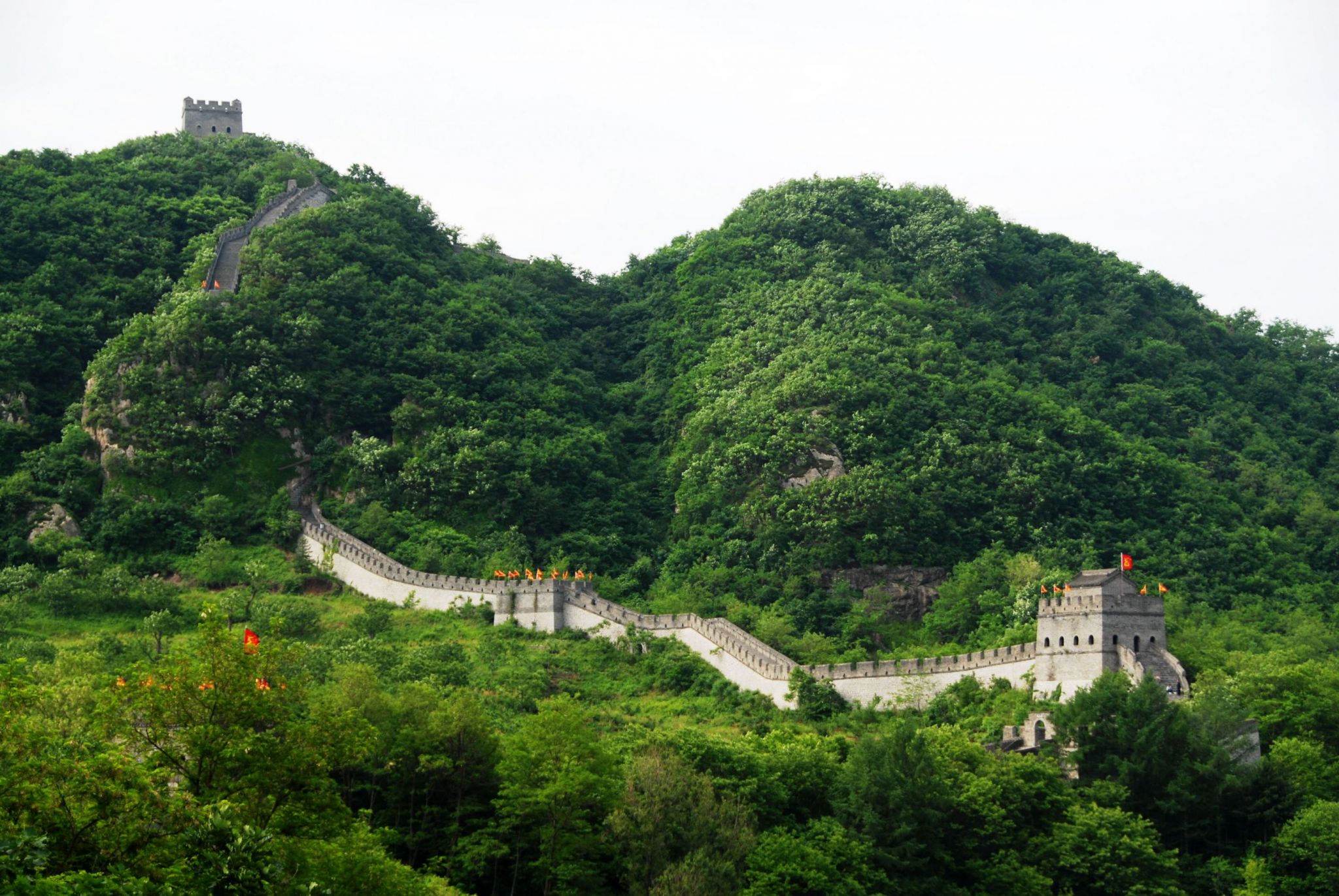
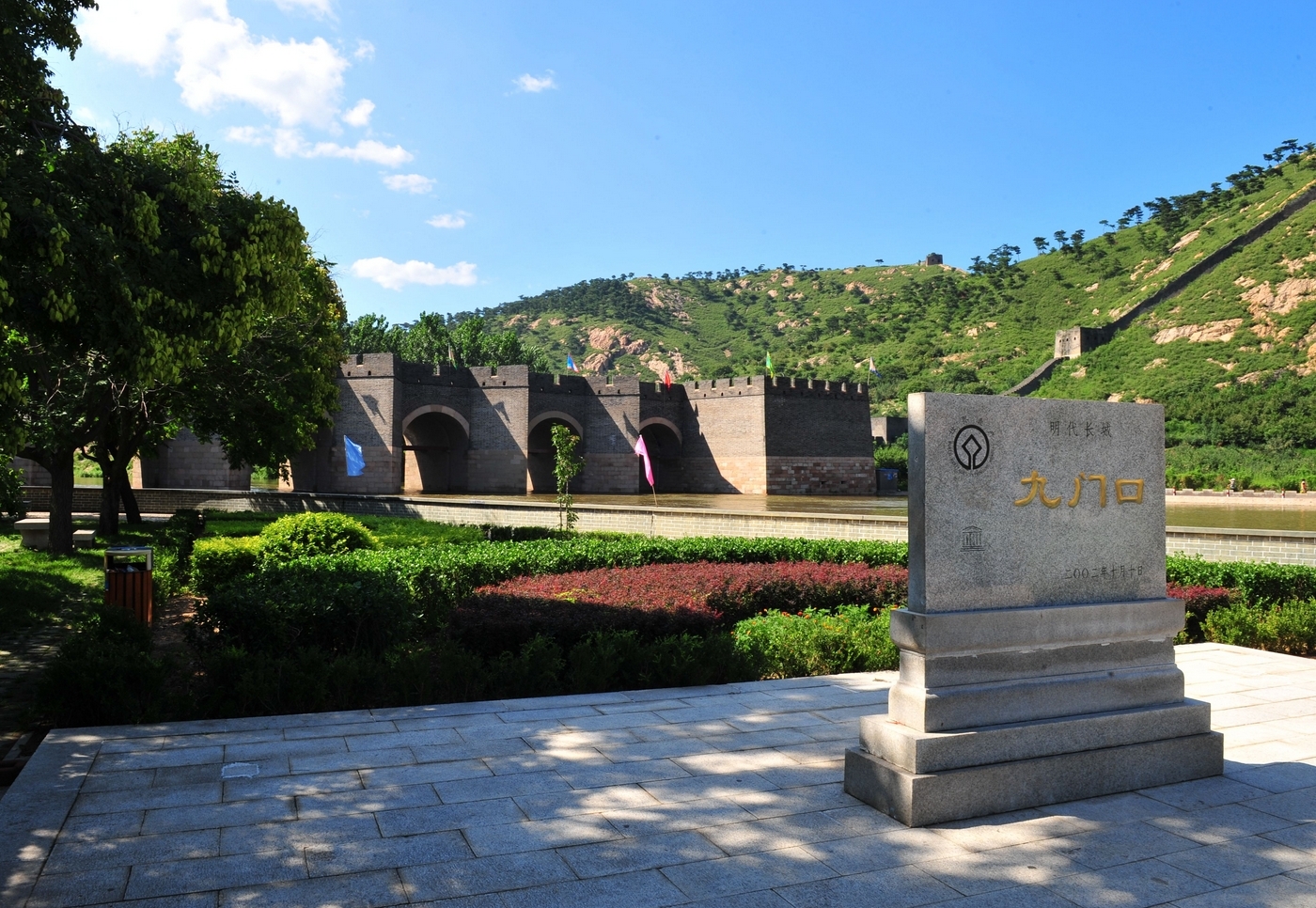
Die Große Mauer der Ming-Dynastie (chinesisch: 明長城; pinyin: Ming changcheng), die von der Ming-Dynastie (1368-1644) erbaut wurde, ist heute der sichtbarste Teil der Chinesischen Mauer. Eine umfassende archäologische Untersuchung, bei der modernste Technologien zum Einsatz kamen, ergab, dass die Ming-Mauer eine Länge von 8 850 km vom Jiayu-Pass im Westen bis zum Meer am Shanhai-Pass hat und dann in einer Schleife in der Mandschurei an der Großen Mauer von Hushan endet. Diese besteht aus 6.259 km (3.889 Meilen) Abschnitten der eigentlichen Mauer, 359 km (223 Meilen) Gräben und 2.232 km (1.387 Meilen) natürlichen Verteidigungsbarrieren wie Hügeln und Flüssen.[1]
Während die Ming-Mauern in der heutigen Zeit im Allgemeinen als "Große Mauer" (changcheng) bezeichnet werden, wurden sie in der Ming-Zeit von den Chinesen als "Grenzbarrieren" (邊牆; bianqiang) bezeichnet, da der Begriff changcheng Bilder der Tyrannei von Qin Shi Huang (260-210 v. Chr.) hervorrufen sollte und mit der Großen Mauer von Qin in Verbindung gebracht wurde.
明长城(中文名:明长城,拼音:Ming changcheng)由明朝(1368-1644 年)修建,是今天中国长城最明显的部分。利用先进技术进行的全面考古调查得出结论,明长城西起嘉峪关,东至山海关的海边,全长 8850 公里(5500 英里),然后绕行到满洲里的虎山长城。它由 6,259 公里(3,889 英里)的实墙、359 公里(223 英里)的壕沟和 2,232 公里(1,387 英里)的天然防御屏障(如山丘和河流)组成。
虽然明代城墙在现代一般被称为 "长城"(changcheng),但在明代,它们被中国人称为 "边墙"(bianqiang),因为据说 "长城 "一词会让人联想到秦始皇(公元前 260-210 年)的暴政,并与秦长城联系在一起。
 Geography


 International cities
 History