
漢德百科全書 | 汉德百科全书
 FIFA Fussball-Weltmeisterschaft 2026


 British Columbia-BC

 California-CA

 FIFA Fussball-Weltmeisterschaft 2026

 Florida-FL

 Georgia-GA
 Canada

 Massachusetts-MA
 Mexico

 Missouri-MO

 New jersey-NJ

 New York-NY

 Ohio-OH

 Ontario-ON

 Pennsylvania-PA

 Texas-TX
 United States

 Washington-WA

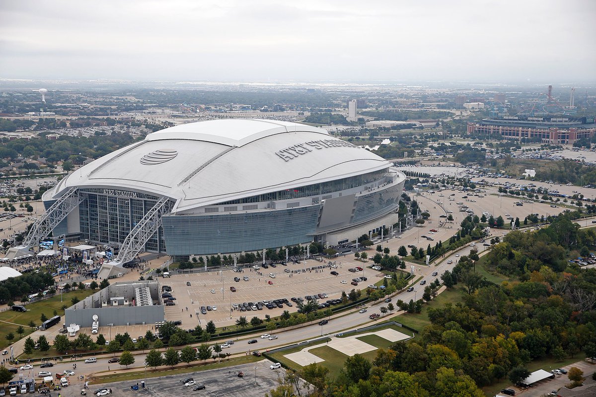

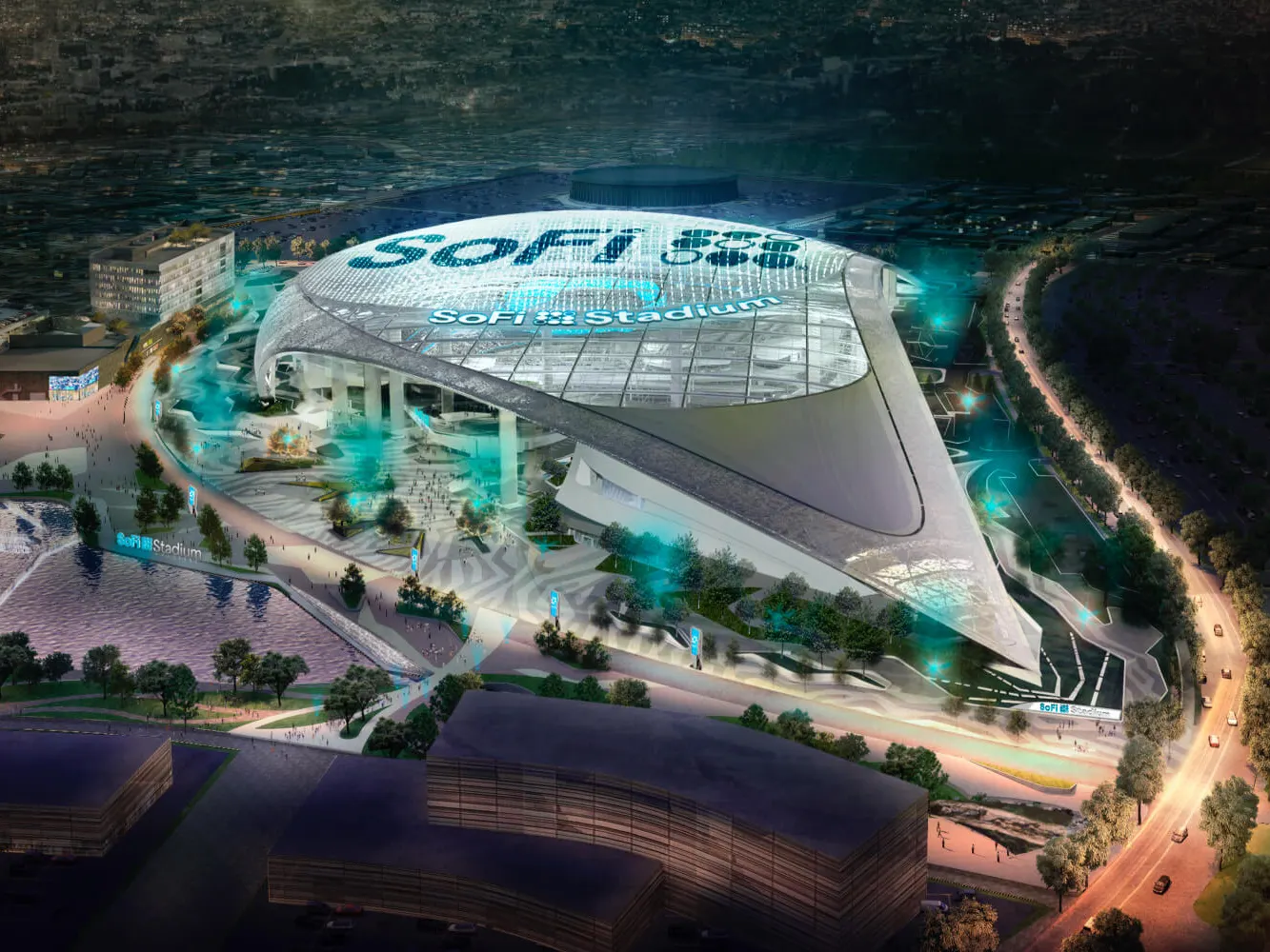

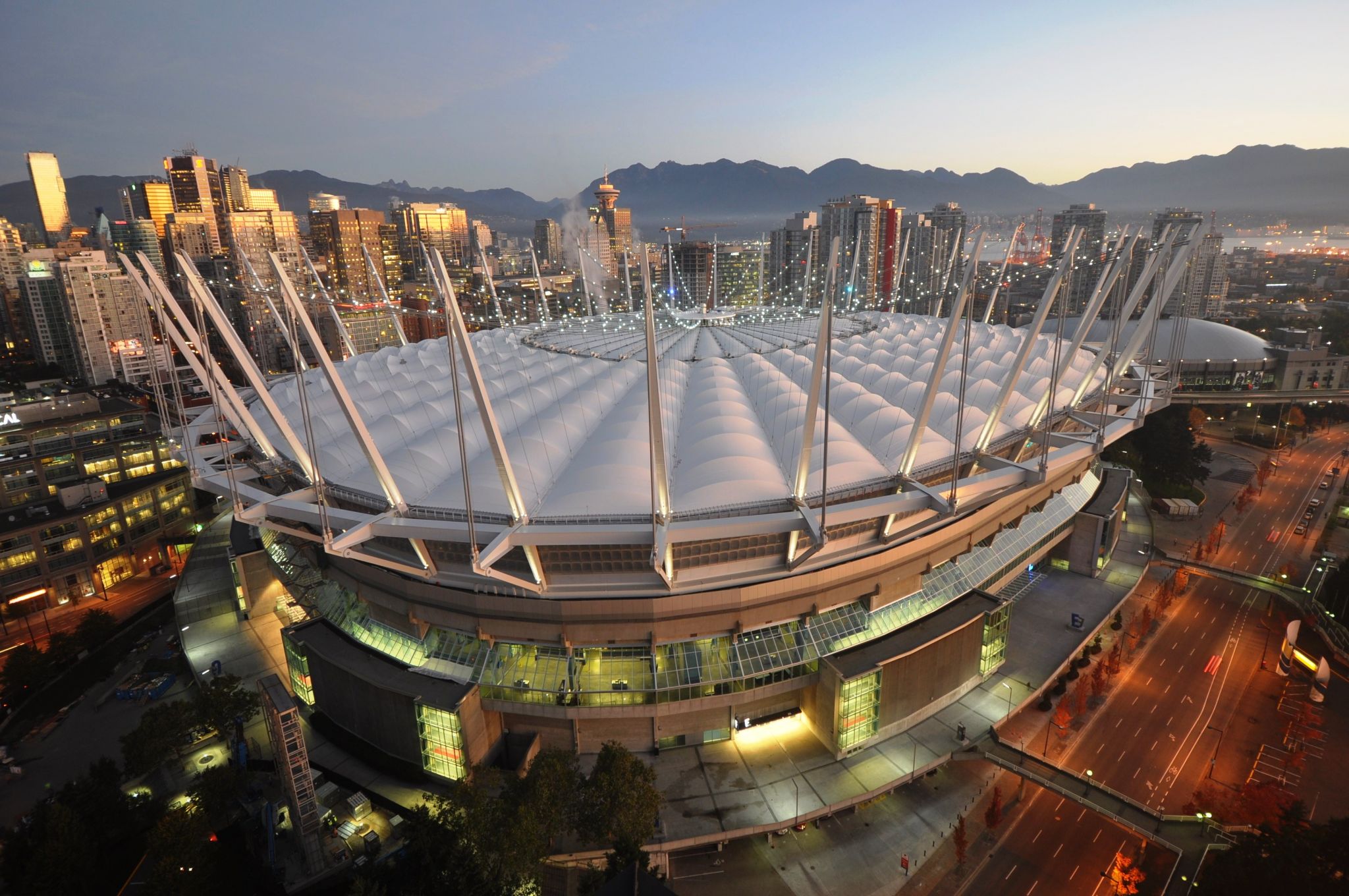

 FIFA Fussball-Weltmeisterschaft 2026

 Financial
 ***Global Financial Center

 History
 M 1500 - 2000 AD

 History
 N 2000 - 2100 AD

 International cities
 ***Global Urban Economic Competitiveness

 Massachusetts-MA
 United States

 Important port
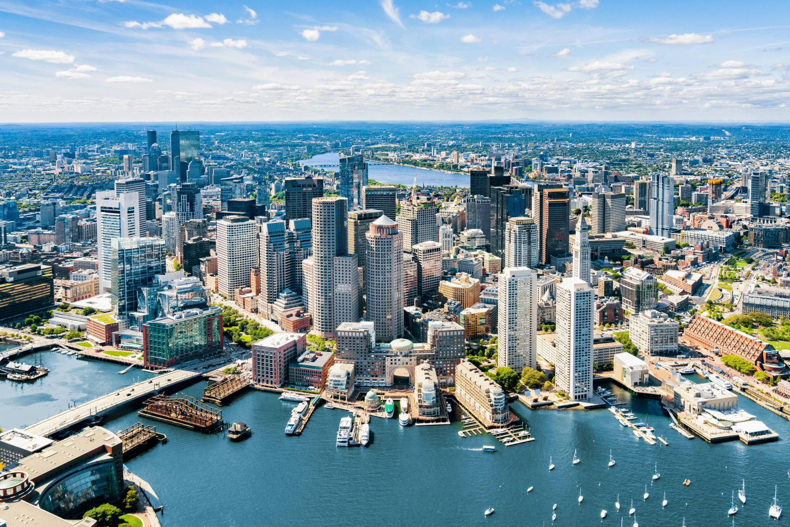
Boston [ˈbɔstən] ist die größte Stadt in Neuengland, einem Gebiet im Nordosten der USA, und Hauptstadt des Bundesstaates Massachusetts an der Ostküste der Vereinigten Staaten. Das U.S. Census Bureau hat bei der Volkszählung 2020 eine Einwohnerzahl von 675.647[2] ermittelt.
Die Metropole ist eine der ältesten, wohlhabendsten und kulturell reichsten Städte der USA. Im kulturellen Bereich sind die Symphony Hall und das in ihr residierende Boston Symphony Orchestra weltbekannt. Die Wirtschaftskraft der Region wird hauptsächlich durch Bildungseinrichtungen, Gesundheitswesen, Finanzwirtschaft und Technologie bestimmt.
波士顿(英语:Boston)是美国马萨诸塞州的首府和最大城市,也是新英格兰地区的最大城市,也是(2008年)在人口上美国的第21大的城市。该市位于美国东北部大西洋沿岸,创建于1630年,是美国最古老、最有文化价值的城市之一。波士顿是美国革命期间一些重要事件的发生地点,曾经是一个重要的航运港口和制造业中心。今天,该市是高等教育和医疗保健的中心,它的经济基础是科研、金融与技术—特别是生物工程,并被认为是一个全球性城市或世界性城市。
该市位于大波士顿都会区的中心,这个都会区包括萨福克县的全部和剑桥、昆西、牛顿、萨默维尔、里维尔和切尔西等城市,以及一些小镇和远离波士顿的郊区,还包括了新罕布什尔州的一部分。
波士顿(英语:Boston)是美国马萨诸塞州首府及最大城市[8],占地面积48.4平方英里(125平方千米)[9],2018年居民总数为694,583人,是马萨诸塞乃至新英格兰地区人口最多的城市[2][3],也是全美第24大城市。其为大波士顿(大都市统计区)的经济与文化中心,并于1999年7月1日前,为沙福克县县政府的代表议席[10]。2016年的人口普查结果显示,以波士顿领衔的大波士顿拥有480万人口,乃全美第十大的大都会区[11];以波士顿为中心的联合统计区则拥有820万人口,乃全美第六大[12]。
波士顿为美国最古老的都市之一,于1630年由迁移美洲的清教徒在邵马特半岛上建立。[13][14]美国独立战争前夕及期间,多场重要事件均发生于此,如波士顿大屠杀、波士顿倾茶事件、邦克山战役及波士顿之围等。美国脱离大不列颠王国独立后,波士顿继续作为其不可或缺的港口、制造业基地以及教育文化中心。[15][16]该市后来以填海及市区吞并的形式扩张土地,范围不再规限于半岛本身。波士顿深厚的历史底蕴吸引不少旅客慕名而来,仅法尼尔厅每年便有2千万人次到访。[17]波士顿于美国创下诸多领域之先河,包括全美首个公众公园(1634年成立的波士顿公园)、首间公立或州立学校(1635年成立的波士顿拉丁学校)及首个地铁系统(1897年建立的特莱蒙街地铁)。[18]
波士顿其多所著名的学府使之成为国际高等教育中心[19],为医学、工程、法律、商学重镇,同时具有近5,000家初创企业。[20][21][22]波士顿的经济发展亦建基于金融、专业商业服务、生物技术、资讯科技及政治活动。[23][24]当地居民之平均博爱精神获评为全美最高[25];商业机构之环境可持续发展投资亦领衔全国[26]。波士顿曾经历士绅化[27],现在的生活成本在全美最高之列[28][29],但仍获评为全球最宜居的地方之一[30]。
 FIFA Fussball-Weltmeisterschaft 1994

 FIFA Fussball-Weltmeisterschaft 2026

 International cities
 ***Global Urban Economic Competitiveness

 Texas-TX
 United States

Dallas ([ˈdæləs]) ist die drittgrößte Stadt im Bundesstaat Texas und die neuntgrößte Stadt der Vereinigten Staaten. Die Stadt hat eine Fläche von 997,1 km2 und ist auch Verwaltungssitz des gleichnamigen Countys.[1] Dallas hat 1,3 Millionen Einwohner (Stand 2016) und ist das kulturelle und ökonomische Zentrum des zwölf Countys umfassenden Großraums Dallas-Fort-Worth-Arlington. Dallas ist eine von elf Weltstädten der USA.[2]
Die 1841 gegründete Stadt war durch ihre strategische Lage an zahlreichen Eisenbahnlinien ein wichtiges Zentrum der Öl- und Baumwollindustrie. Heute ist die Wirtschaft hauptsächlich von der Telekommunikations-, Computer-, Finanzdienstleistungs- und Transportbranche bestimmt.
达拉斯(英语:Dallas),是美国德克萨斯州第三大城市,美国第九大城市,达拉斯县首府,城市面积共385平方英里(997平方千米)。美国人口普查显示,至2006年7月1日,达拉斯的人口为1,248,810人。达拉斯与沃斯堡、阿灵顿组成达拉斯-沃斯堡-阿灵顿城市群,覆盖12个县,总人口615万人(2007年数据),是美国第四大城市群。1999年,达拉斯被拉夫堡大学的全球化与世界级城市研究小组与网络列为第三类世界级城市,即小型世界级城市。
ダラス(英語: Dallas)は、アメリカ合衆国テキサス州北部にある都市。アメリカ合衆国南部有数の世界都市であり、州内ではヒューストン、サンアントニオに次いで人口が多い。しかし、2000年国勢調査でフォートワースやアーリントンなどを含めたダラス・フォートワース都市圏の人口は5,161,520人で全米5位、広域都市圏(合同統計地域(CSA))では5,487,956人で全米8位で、都市圏人口としてはヒューストンを凌いで州内で最も多い。エルム川とウェスト川の両河川の合流地帯に位置し、古くから交通の拠点として発展し、今日でも金融および経済の中枢として機能している。
Dallas (/ˈdæləs/) is a city in the U.S. state of Texas. It is the most populous city in the Dallas–Fort Worth metroplex, which is the fourth most populous metropolitan area in the United States. The city's population ranks ninth in the U.S. and third in Texas after Houston and San Antonio.[8][9] The bulk of the city is in Dallas County, of which it is the county seat; however, sections of the city are in Collin, Denton, Kaufman, and Rockwall counties. According to the 2010 United States Census, the city had a population of 1,197,816. The United States Census Bureau's one-year estimate for the city's population increased to 1,341,075 as of July 1, 2017.[10] The Dallas-Fort Worth-Arlington MSA population estimate for 2017 is 7,399,662.[2]
Dallas is one of the fastest-growing cities in the United States. From 2010 to 2016, Dallas recorded the highest net domestic migration in the country, in excess of 300,000.[11] Overall, the Dallas–Fort Worth metro area had the second largest population increase among metro areas in the U.S., which recorded a population of 7,233,323 as of July 1, 2016, an increase of 807,000 people since the 2010 census.[12] Located in North Texas, Dallas is the main core of the largest metropolitan area in the South and the largest inland metropolitan area in the United States that lacks any navigable link to the sea.[13]
Dallas and nearby Fort Worth were developed due to the construction of major railroad lines through the area allowing access to cotton, cattle, and later oil in North and East Texas. The construction of the Interstate Highway System reinforced Dallas's prominence as a transportation hub, with four major interstate highways converging in the city and a fifth interstate loop around it. Dallas developed as a strong industrial and financial center, and a major inland port, due to the convergence of major railroad lines, interstate highways, and the construction of Dallas/Fort Worth International Airport, one of the largest and busiest airports in the world.[14]
Dallas is rated a "beta(+)" global city. The economy of Dallas is considered diverse, with dominant sectors including defense, financial services, information technology, telecommunications, and transportation.[15] It serves as the headquarters for 9 Fortune 500 companies within the city limits. The Dallas–Fort Worth metroplex hosts additional Fortune 500 companies, including American Airlines (Fort Worth), ExxonMobil (Irving), and J.C. Penney (Plano). The city has a population from a myriad of ethnic and religious backgrounds and the sixth-largest LGBT population in the United States.[16]
Dallas ([ˈdæl.əs] ou [ˈdæl.ʊs] en anglais) est une ville de l'État du Texas, aux États-Unis. Elle couvre une surface de 997 km2 et comptait 1 241 162 habitants en 2012 (9e ville des États-Unis). Avec la ville voisine de Fort Worth, Dallas fait partie d'une vaste aire urbaine de 6 371 773 habitants, le Dallas/Fort Worth Metroplex, ou simplement « the Metroplex », la quatrième aire urbaine du pays. Dallas est classée comme ville mondiale beta+ par l'université de Loughborough de Londres. La ville de Dallas est le siège du comté de Dallas.
Dallas a été fondée en 1841 et incorporée comme ville le 2 février 1856. Troisième ville du Texas après Houston et San Antonio, dont elle est concurrente, « Big D » est un grand centre industriel spécialisé dans le domaine des technologies de l'industrie pétrolière, des télécommunications, de l'information, des banques et des transports. C'est le noyau de la plus grande zone métropolitaine intérieure aux États-Unis car elle ne dispose d'aucun lien navigable avec la mer, toutefois son importance historique, en tant que centre des industries pétrolières et d'exploitation du coton, vient de sa position le long des lignes de chemin de fer.
Dallas è una città dello Stato del Texas. È la città più popolosa della Dallas-Fort Worth Metroplex, che risulta essere la quarta area metropolitana più popolosa degli Stati Uniti. La popolazione della città è al nono posto negli Stati Uniti e la terza nel Texas dopo Houston e San Antonio.[1][2] La maggior parte della città si trova nella contea di Dallas, di cui è capoluogo; tuttavia, alcune sezioni della città si trovano nelle contee di Collin, Denton, Kaufman e Rockwall. Secondo il censimento del 2010, la città aveva una popolazione di 1.197.816 abitanti. Le stime dello United States Census Bureau per la popolazione della città sono aumentate a 1.341.075 abitanti a partire dal 1º luglio 2017.[3]
Dallas è una delle città in più rapida crescita negli Stati Uniti. Dal 2010 al 2016, Dallas ha registrato la migrazione nazionale netta più elevata nel paese, superiore a 300.000.[4] Nel complesso, l'area metropolitana di Dallas-Fort Worth ha avuto il secondo più grande aumento di popolazione tra le aree metropolitane degli Stati Uniti, che ha registrato una popolazione di 7.233.323 unità a partire dal 1º luglio 2016, con un aumento di 807.000 persone rispetto al censimento del 2010.[5] Situata nel Texas settentrionale, Dallas è il nucleo principale della più grande area metropolitana del Sud e della più grande area metropolitana interna degli Stati Uniti che non ha collegamenti navigabili con il mare.[6]
Dallas e la vicina Fort Worth si sono sviluppate a causa della costruzione di importanti linee ferroviarie attraverso l'area per consentire l'accesso a cotone, bovini e successivamente petrolio nel Texas settentrionale e orientale. La costruzione dell'Interstate Highway System rafforzò l'importanza di Dallas come nodo di trasporto con quattro principali autostrade interstatali convergenti nella città e un quinto anello interstatale attorno ad esso. Dallas si è sviluppata come forte centro industriale e finanziario, nonché importante porto interno, grazie alla convergenza delle principali linee ferroviarie, autostrade interstatali e alla costruzione dell'Aeroporto Internazionale di Dallas-Fort Worth, uno degli aeroporti più grandi e più trafficati del mondo.[7]
Dallas è classificata come città globale "beta (+)". L'economia di Dallas è considerata diversa, con settori dominanti tra cui la difesa, i servizi finanziari, l'informatica, le telecomunicazioni e i trasporti.[8] Serve come quartier generale per 9 aziende di Fortune 500 entro i confini della città. La Dallas-Fort Worth Metroplex ospita altre aziende di Fortune 500 tra cui ExxonMobil (Irving), J. C. Penney (Plano) e American Airlines (Fort Worth). La città ha una popolazione da una miriade di origini etniche e religiose ed è riconosciuta per avere la sesta più grande popolazione LGBT negli Stati Uniti.[9]
Dallas (en inglés /ˈdæləs/) es una ciudad ubicada en el condado de Dallas y algunas partes de la ciudad se sitúan en los condados de Collin, Denton, Kaufman y Rockwall en el estado estadounidense de Texas. En el Censo de 2010 contaba con una población de 1.197.816 habitantes y una densidad poblacional de 1.198,61 personas por km²,3 lo cual la constituyó en la ciudad más poblada del área metropolitana con un total de 6.810.913 habitantes a partir del 1 de julio de 2013. La ciudad es la tercera más grande de Texas, después de Houston y San Antonio; su área metropolitana es la más grande en el estado texano y la más grande del país después de las áreas metropolitanas de Nueva York, Los Ángeles y Chicago.
Dallas es la ciudad más grande en los Estados Unidos sin conexión al mar debido a su ubicación central y a su gran industria en tecnologías de la información. El Aeropuerto Internacional de Dallas-Fort Worth (DFW) es el más grande del estado, el segundo más grande de los Estados Unidos, y el tercero más grande del mundo; en términos de tráfico, es el séptimo del mundo.4 Dallas también es conocida por ser el lugar del asesinato del presidente John F. Kennedy acontecido el 22 de noviembre de 1963.
Dallas es el principal destino de visitantes de Texas, ello lo confirma el hecho de haber figurado en 2014 entre las 3 ciudades en los Estados Unidos más visitadas por viajeros según el informe Resonancy Consultancy que ha analizado el ámbito de los negocios y ocio de las ciudades.5 Este destacamento se debe gracias a la inversión en nuevos proyectos urbanos, la celebración de enormes acontecimientos en la ciudad, su dinámica escena artística, su accesibilidad por dos aeropuertos de gran importancia, su campaña «Big Things Happen Here» o su equivalente «Aquí Suceden Grandezas», entre otros factores.6
La ciudad de Dallas pretende consolidarse, al igual que posicionarse como uno de los mejores destinos para los visitantes. Cabe destacar que la ciudad cuenta con el mayor distrito urbano de arte de los Estados Unidos y más de 160 museos en su zona metropolitana,7 ello la convierte en una ciudad con enorme potencial cultural.8
La parte norteña de Dallas es la más desarrollada y la sureña la menos, sin embargo, se están poniendo en obra iniciativas para igualar la ciudad de Dallas, prueba de ello, la iniciativa «GrowSouth»9 o en español «Desarrollo del Sur».10 A diferencia de muchas ciudades en Latinoamérica, el centro de Dallas es principalmente para trabajar —los dalasitas tienden a vivir sobre todo en los suburbios—, se están haciendo inversiones en nuevos edificios para viviendas residenciales en el centro de Dallas. El barrio de Uptown en el centro está habitado mayormente por ejecutivos mientras que en Highland Park existe una muy notable concentración de gente adinerada.
Se espera próximamente el traslado a los suburbios de Dallas de varias compañías importantes provenientes de California, así como la apertura de instalaciones de otras compañías: Toyota11 de California se instalará en Plano; Trend Micro12 de Silicon Valley en Irving; FedEx,13 construcción de instalaciones en Plano; New Liberty Mutual Insursance14 construirá unas instalaciones en Plano. State Farm está construyendo instalaciones en Richardson. Muchas empresas se encuentran en Richardson y Plano lo cual las convierte en excelentes ciudades suburbanas para vivir con numerosas oportunidades laborales.
En abril de 2016 Dallas fue la ciudad anfitriona de la Cumbre Mundial de Turismo o World Travel & Tourism Council.15 En 2017 se inaugurará el primer Cinépolis de Texas en el Parque de la Victoria.16
Да́ллас (англ. Dallas) — город в США, расположенный в северо-восточной части штата Техас на реке Тринити. Административный центр округа Даллас. Вместе с Форт-Уэртом и другими городами агломерации (Арлингтон, Данканвилл, Гарленд, Дентон, Ирвинг, Мескит и Плейно) Даллас составляет конурбацию «Даллас—Форт-Уэрт». Даллас является третьим (с учётом пригородов — первым) по численности городом Техаса и 9-м по США (1 197 816 человек по данным на 2010 год[1]); сама конурбация «Даллас—Форт-Уэрт» является 4-й по численности среди агломераций США (6,3 млн чел.).

 FIFA Fussball-Weltmeisterschaft 2026
 National Football League 2018

 New jersey-NJ

 Sport
Sport
 United States

 FIFA Fussball-Weltmeisterschaft 1994

 FIFA Fussball-Weltmeisterschaft 2026
 Women's Soccer World Cup 1999


Toronto (englische Aussprache [təˈɹɒn(t)oʊ̯]; regional auch  [təˈɹɒnə] oder [ˈtɹɒnoʊ̯]) ist mit 2,6 Millionen Einwohnern[2] die größte Stadt Kanadas und die Hauptstadt der Provinz Ontario. Sie liegt im Golden Horseshoe (Goldenes Hufeisen), einer Region mit über 8,1 Millionen Einwohnern, die sich halbkreisförmig um das westliche Ende des Ontariosees bis zu den Niagarafällen erstreckt. Rund ein Drittel der Bevölkerungszunahme des ganzen Landes lebte in den letzten Jahren in diesem Großraum. Die Einwohnerzahl der Metropolregion (Census Metropolitan Area) stieg von 4,1 Millionen im Jahr 1992 auf 5,6 Millionen im Jahr 2011.[3] Die Greater Toronto Area hatte 2010 über 6,2 Millionen Einwohner.[4]
Die Stadt liegt am nordwestlichen Ufer des Ontariosees, dem mit 18.960 km² Fläche[5] kleinsten der fünf Großen Seen. Durch die Eingemeindung einer Reihe von Vorstädten, die bereits mit Toronto verschmolzen waren (Etobicoke, Scarborough, York, East York und North York), wurde Toronto Ende der 1990er Jahre mehrfach vergrößert. Das Zentrum mit dem Einkaufs- und Bankendistrikt befindet sich in der Nähe des Sees. Die Haupteinkaufsstraße ist die Yonge Street. Toronto ist seit ungefähr den 1970er Jahren, nachdem Montreal über Jahrzehnte hinweg diese Rolle zugefallen war, Kanadas Wirtschaftszentrum und weltweit einer der führenden Finanzplätze.
多伦多(英语/法语:Toronto),是北美洲国家加拿大安大略省首府,加拿大的最大城市。
多伦多坐落在安大略湖西北岸的南安大略地区。根据2012年七月的加拿大人口普查,多伦市人口达2,790,060,为加拿大最大城市。多伦多市是大多伦多地区的心脏地区,也是安大略省南部人口稠密区(称作“金马蹄地区”)的一部分。[1][2][3]城市区有5,132,794名居民。[4]在2011年人口普查中,多伦多人口普查区有5,583,064名居民,而覆盖范围较广的大多伦多地区则有6,054,191名居民。[2]
作为加拿大的经济中心,多伦多是一个世界级城市,[5]也是世界上最大的金融中心之一。[6][7] 多伦多在经济上的领先地位在于金融、商业服务、电信、航太、交通运输、媒体、艺术、电影、电视制作、出版、软件、医药研究、教育、旅游、体育等产业。[8][9]多伦多证券交易所是世界第七大交易所,总部设于市内,有多数加拿大公司在这里上市。
多伦多的国际性人口[10] 体现出它是前往加拿大移民的重要落脚点。[11]而市内49%的人口是在加拿大以外诞生[12],也造就多伦多成为世上种族最多样化的城市之一。目前多伦多的低犯罪率、洁净的环境、高生活水准、以及对多样文化的包容性,令该市被多个经济学智囊团列为世界上最宜居的城市之一。[13][14]另一方面,多伦多于2006年被列为加拿大生活成本最高的城市。[15]
大约1/3的加拿大人居住在距多伦多两小时车程的郊区。加拿大大约1/6的就业机会在该市。
多伦多当地的华侨及华裔人口多达四十万,相当于加拿大全国约百分之一的人口,该城市也是加拿大华人最多的城市。除此之外也有大量世界各地的移民,加拿大安大略省多伦多市的人口统计资料使多伦多成为世界上最多元文化和多种族的城市之一。2016年,该市居民的51.5%属于明显的少数族裔,而2011年这一比例为49.1%,和1981年为13.6%。多伦多还建立了多个社区,例如唐人街,意大利的Corso,小意大利,小印度,希腊城,韩国城,小牙买加,小葡萄牙和朗塞瓦勒,以庆祝该市的多元文化主义的成功。
多伦多[注 1](英语:Toronto)是加拿大安大略省首府,也是加拿大最大的城市,坐落在安大略湖西北岸的南安大略地区。根据2021年的加拿大人口普查,多伦多市人口达2,794,356人,为加拿大最大城市。多伦多市是大多伦多地区的核心地区,也是安大略省南部人口稠密区(称作“金马蹄地区”)的一部分。[9][10][11]都会区有6,202,225名居民,[12]而覆盖范围较广的大多伦多地区则有9,765,188名居民。[10]作为加拿大的经济中心,多伦多是一个世界级城市,[13]也是世界上最大的金融中心之一。[14][15]多伦多在经济上的领先地位在于金融、商业服务、电信、航太、交通运输、媒体、艺术、电影、电视制作、出版、软件、医药研究、教育、旅游、体育等产业。[16][17]多伦多证券交易所是世界第七大交易所,总部设于市内,有多数加拿大公司在这里上市。
多伦多的国际性人口[18]体现出它是前往加拿大移民的重要落脚点。[19]而市内49%的人口是在加拿大以外诞生[20],也造就多伦多成为世上种族最多样化的城市之一。目前多伦多的低犯罪率、洁净的环境、高生活水准、以及对多样文化的包容性,令该市被多个经济学智囊团列为世界上最宜居的城市之一。[21][22]另一方面,多伦多于2006年被列为加拿大生活成本最高的城市。
トロント(英語: Toronto、標準音:[təˈɹɒntoʊ]、現地音:[ˈtɹɒnoʊ, təˈɹɒnoʊ])は、カナダのオンタリオ州の州都であり、同国最大の都市である。オンタリオ湖岸の北西に位置し、2016年の統計で人口273万人[1]。
国際影響力の強い世界都市であり、2016年の都市圏人口は624万人[2]。またヒューロン語で「集まる場所」という意味がある。
オンタリオ湖西岸を囲むゴールデン・ホースシュー(Golden Horseshoe)と呼ばれる都市化された地域の人口はおよそ924万人とされ、カナダ随一の金融センターとしてその中心を成している。1834年までの旧名はヨーク(Town of York)。
Toronto is the provincial capital of Ontario and the most populous city in Canada, with an estimated population of 2,956,024 (2018) and an estimated population of 6,341,935 in the Toronto Region (2018.)[14] Located on the shores of the western end of Lake Ontario, Toronto is also the anchor of the Golden Horseshoe, an urban agglomeration of 9,245,438 (2016)[15] that accounts for a significant portion of Canada's economic activity and more than 20% of Canada's population. Toronto is an international centre of business, finance, arts, and culture. Its large population of immigrants from around the globe has also made Toronto one of the most multicultural and cosmopolitan cities in the world.[16][17][18]
People have travelled through and inhabited the Toronto area, located on a broad sloping plateau interspersed with rivers, deep ravines, and urban forest, for more than 10,000 years.[19] After the broadly disputed Toronto Purchase, when the Mississauga surrendered the area to the British Crown,[20] the British established the town of York in 1793 and later designated it as the capital of Upper Canada.[21] During the War of 1812, the town was the site of the Battle of York and suffered heavy damage by American troops.[22] York was renamed and incorporated in 1834 as the city of Toronto. It was designated as the capital of the province of Ontario in 1867 during Canadian Confederation.[23] The city proper has since expanded past its original borders through both annexation and amalgamation to its current area of 630.2 km2 (243.3 sq mi).
The diverse population of Toronto reflects its current and historical role as an important destination for immigrants to Canada.[24][25] More than 50 percent of residents belong to a visible minority population group,[26] and over 200 distinct ethnic origins are represented among its inhabitants.[27] While the majority of Torontonians speak English as their primary language, over 160 languages are spoken in the city.[28]
Toronto is a prominent centre for music,[29] theatre,[30] motion picture production,[31] and television production,[32] and is home to the headquarters of Canada's major national broadcast networks and media outlets.[33] Its varied cultural institutions,[34] which include numerous museums and galleries, festivals and public events, entertainment districts, national historic sites, and sports activities,[35] attract over 43 million tourists each year.[36][37] Toronto is known for its many skyscrapers and high-rise buildings,[38] in particular the tallest free-standing structure in the Western Hemisphere, the CN Tower.[39]
The city is home to the Toronto Stock Exchange, the headquarters of Canada's five largest banks,[40] and the headquarters of many large Canadian and multinational corporations.[41] Its economy is highly diversified with strengths in technology, design, financial services, life sciences, education, arts, fashion, aerospace, environmental innovation, food services, and tourism.[42][43][44]
Toronto (/tɔ.ʁɔ̃.to/1 ; en anglais : /təˈɹɒntoʊ̯/2 Écouter voire localement /təˈɹɒnə/ ou /ˈtɹɒnoʊ̯/ Écouter) est la plus peuplée des villes du Canada et la capitale de la province de l'Ontario. Elle se situe dans le Sud-Est du Canada, sur la rive nord-ouest du lac Ontario. Selon le recensement de 2016, Toronto compte plus de 2,7 millions d'habitants, faisant d'elle la quatrième ville la plus peuplée en Amérique du Nord. Son aire métropolitaine compte 5,9 millions d'habitants, et la mégalopole du Golden Horseshoe, dont elle est le cœur, plus de 8,7 millions d'habitants en 2011, soit le quart de la population canadienne. Ville mondiale, Toronto est le centre bancaire, financier, commercial et artistique du Canada anglophone, et l'une des villes les plus multiculturelles et cosmopolites au monde.
La région de Toronto, située sur un vaste plateau en pente jalonné de rivières, de ravins et de forêts, est habitée depuis plus de 10 000 ans. Après la brève installation d'un fort par les Français puis l’achat contesté de la région au peuple Mississauga par la Couronne britannique, les colons anglais fondent en 1793 la ville d'York, qui devient la capitale du Haut-Canada. Pendant la guerre de 1812, la ville est le théâtre de la bataille d'York et subit de lourds dégâts par les troupes américaines. York est renommée Toronto en 1834. Elle est désignée capitale de la province de l'Ontario en 1867 par la Confédération canadienne. La ville s'est depuis étendue au-delà de ses frontières d'origine, à la suite de plusieurs fusions, jusqu'à atteindre la superficie actuelle de 630,2 km2.
La population particulièrement cosmopolite de Toronto reflète son rôle historique de destination des immigrants au Canada. Plus de 50 % des résidents appartiennent à un groupe de minorités visibles et plus de 200 origines ethniques distinctes sont représentées parmi ses habitants. Bien que la majorité des Torontois parlent l'anglais principalement, plus de 160 langues sont parlées dans la ville.
Toronto est devenu un important centre de musique, théâtre, de production cinématographique et télévisuelle. Elle abrite le siège des principaux réseaux de diffusion et des médias nationaux du Canada. Ses institutions culturelles variées, qui comprennent de nombreux musées et galeries d'art, des festivals et événements publics, des quartiers de divertissement, des lieux historiques nationaux et des activités sportives, attirent plus de 25 millions de touristes chaque année. Toronto est connue pour ses nombreux gratte-ciel, en particulier la plus haute structure autoportante de l' hémisphère occidental, la tour CN.
La ville abrite la Bourse de Toronto, le siège des cinq plus grandes banques du Canada et de nombreuses autres grandes sociétés canadiennes et multinationales, de tous les secteurs économiques. Elle abrite aussi de nombreux établissements d'enseignement supérieur réputés, dont l'université de Toronto qui figure parmi les plus réputées au monde.
Toronto apparaît régulièrement dans les classements des meilleures villes en termes de qualité de vie, malgré un coût de la vie important. Ses habitants s'appellent les Torontois.
Toronto (IPA: [təˈɹɒntoʊ̯]; pronuncia locale: [ˈtrɒnoʊ] oppure [təˈɹɒnə], ascolta[?·info]) è una città dell'estremo Sud-Est del Canada, capoluogo della provincia dell'Ontario e centro più popoloso del Canada con i suoi 3 120 668 abitanti[1] (5 928 040 nell'area metropolitana[2]).
Motore economico del Canada, Toronto è, assieme a Montréal, la città del paese nordamericano più conosciuta nel mondo, seguita da Ottawa. Caratteristica della città è quella di essere una delle più multiculturali nel mondo, con circa il 36% degli abitanti di origine non canadese. Per dare un'idea di ciò basti pensare che il 911 (numero telefonico di emergenza) di Toronto è attrezzato per rispondere in oltre 150 lingue[3]. La seconda più grande comunità, superata da qualche anno da quella cinese, è costituita dagli italiani che hanno dato un enorme contributo allo sviluppo di questo paese. Si stima che le persone di origine italiana residenti a Toronto siano superiori a 500 000. Il primo quartiere dove si insediarono gli italiani fu quello di College, successivamente si spostarono a Saint Clair denominata col nome aggiuntivo di Corso Italia[4] dal 1988.
Toronto è suddivisa in 240 quartieri all'interno dei suoi confini, raggruppati in sei distretti (Old Toronto, East York, Etobicoke, Scarborough, North York e York (dove si trova anche il quartiere di Weston). Nella parte centrale di Toronto (Downtown Toronto) c'è una città sotterranea, chiamata PATH (in inglese: il sentiero o il percorso), costituita da una rete di collegamenti che mettono in collegamento i grattacieli della città. Il percorso è lungo più di 30 km. Secondo il Guinness dei primati, con i suoi 371600 m² di estensione, il PATH è più esteso centro commerciale sotterraneo del mondo.[5]
I residenti considerano questi 27 km di strade sotterranee come parte della città stessa, come se la città iniziasse non dal suolo, ma dal piano -3. Venne creata agli inizi degli anni sessanta perché in inverno, spazzata da venti nordici, Toronto è molto fredda in rapporto alla latitudine, mentre sotto ci si può muovere in abiti primaverili, sulle strade superiori, durante straordinarie irruzioni gelide ci possono essere temperature di −25/−30 °C al primo mattino o di sera. Di notte si può scendere un po' più in basso ed in tali casi le massime rimangono spesso a -20 sotto lo zero. Ovviamente il traffico automobilistico convenzionale è bandito nella città sotterranea, gli spostamenti sono previsti a piedi o con mezzi per disabili, ma il path ha numerosi punti di contatto con la viabilità esterna (parcheggi) o, molto più frequentemente, con una fitta rete di stazioni del trasporto pubblico di superficie o sotterraneo (subway).
Per muoversi nella parte sotterranea è molto importante fare riferimento a elementi di identificazione degli incroci (come elementi architettonici, facciate di banche, negozi tipici, ecc.), dato che non sempre il percorso sotterraneo (pedonale) corrisponde a quello (stradale) di superficie; o meglio, se non si è pratici, bisogna usare la mappa. La città sotterranea è completamente attrezzata come una città comune: ci sono banche, uffici postali, locali pubblici, ristoranti, uffici e supermercati. Le maggiori istituzioni (stazioni ferroviarie, aziende pubbliche, aziende commerciali, ecc.) hanno accesso multiplo: di superficie e sotterraneo.
Toronto (pronunciación en inglés: /tʲəˈɹɑntʲoʊ/ (![]() escuchar), localmente /tʲəˈɹɑnoʊ/, /ˈtʲɹɑnoʊ/) es la capital de la provincia de Ontario3 y, con una población de 2 615 060 habs.4 es la ciudad más grande de Canadá,5 además del centro financiero de dicho país.
escuchar), localmente /tʲəˈɹɑnoʊ/, /ˈtʲɹɑnoʊ/) es la capital de la provincia de Ontario3 y, con una población de 2 615 060 habs.4 es la ciudad más grande de Canadá,5 además del centro financiero de dicho país.
Localizada en la orilla noroeste del lago Ontario,6 es la quinta ciudad más grande de Norteamérica.7 Toronto se encuentra en el corazón del Área Metropolitana de Toronto (Greater Toronto Area en inglés y abreviado como GTA), la mayor área metropolitana de Canadá, y es parte de una región densamente poblada en el centro-sur de Ontario conocida como Golden Horseshoe (Herradura Dorada), donde residen ocho millones de habitantes.8910
Al ser la capital económica de Canadá, Toronto es considerada una ciudad global y una de las principales ciudades financieras del mundo.11 Lidera los sectores económicos de finanzas, servicios empresariales, telecomunicaciones, transporte, medios de comunicación, arte, cine, investigación médica, educación, y turismo de Canadá.1213 El Toronto Stock Exchange es la mayor bolsa de valores del país y la séptima del mundo.12
Toronto es famosa por la Torre CN, con 553 metros de altura. La ciudad se considera el centro de la cultura canadiense anglófona y es la anfitriona de muchas celebraciones nacionales.
La población de Toronto es cosmopolita,1415 y es un importante destino para muchos inmigrantes a Canadá.16 Toronto es la mayor ciudad del mundo en porcentaje de residentes no nacidos en el propio país; sobre un 49 % de los habitantes de la ciudad no ha nacido en Canadá.141516 Debido al bajo índice de criminalidad,17 el cuidado medio ambiente y el alto nivel de vida, Toronto, es considerada con asiduidad una de las ciudades mejor habitables del mundo.1819 Además, en 2006 fue clasificada como la ciudad más cara de Canadá.20 Los nacidos en Toronto reciben el gentilicio de torontonianos.21
En enero de 2005, Toronto fue escogida por el gobierno canadiense como una de las capitales culturales de Canadá. Toronto posee una de las mejores calidades de vida de América del Norte, y es considerada por muchos como una de las mejores metrópolis del mundo para vivir.22 Es una de las ciudades más seguras de América —su tasa de criminalidad es menor que la de cualquier gran ciudad del continente, y una de las menores de Canadá.23
En la ciudad vecina de Mississauga está el Aeropuerto Internacional Toronto Pearson. Además, en 'las islas de Toronto' dentro de la ciudad está el Billy Bishop Toronto City Airport, que es más pequeño.
Торо́нто (англ. Toronto [təˈrɒntoʊ], местн. [təˈrɒnoʊ], [ˈtrɒnoʊ], [-nə]) — крупнейший город Канады, административный центр провинции Онтарио. Население — 2 731 571 чел. (2016); вместе с городами Миссиссога, Брамптон, Маркем и другими образует агломерацию Большой Торонто с населением 5928 тыс. жителей.
Торонто является частью «золотой подковы» — густонаселённого региона вокруг западной части озера Онтарио с населением около 7 млн человек. Приблизительно одна треть всего населения Канады живёт в радиусе 500 км от Торонто. Около шестой части всех рабочих мест Канады находятся в пределах городской черты.
Город Торонто известен также как «экономический двигатель» Канады, считается одним из ведущих мегаполисов мира и имеет большой вес как в регионе, так и на государственном и международном уровне. В ежегодном рейтинге Global Liveability Ranking журнала The Economist, оценивающем совокупное качество жизни, Торонто занимает четвёртое место в мире среди 140 городов — участников рейтинга[1].
В Торонто располагается главный офис Всемирного конгресса украинцев. В июне 2010 года в Торонто прошла встреча глав государств и правительств «Большой двадцатки».
К северо-востоку от Торонто в городе Пикеринг находится атомная электростанция АЭС Пикеринг с восемью ядерными реакторами.
 Architecture