
Deutsch-Chinesische Enzyklopädie, 德汉百科
 Suriname
 Geography
Amazonas
Bolivia
Brazil
Columbia
Ecuador
Ecuador
Geography
Amazonas
Bolivia
Brazil
Columbia
Ecuador
Ecuador
 Agriculture, forestry, livestock, fishing
Peru
Suriname
Agriculture, forestry, livestock, fishing
Peru
Suriname
 Animal world
Venezuela
Animal world
Venezuela
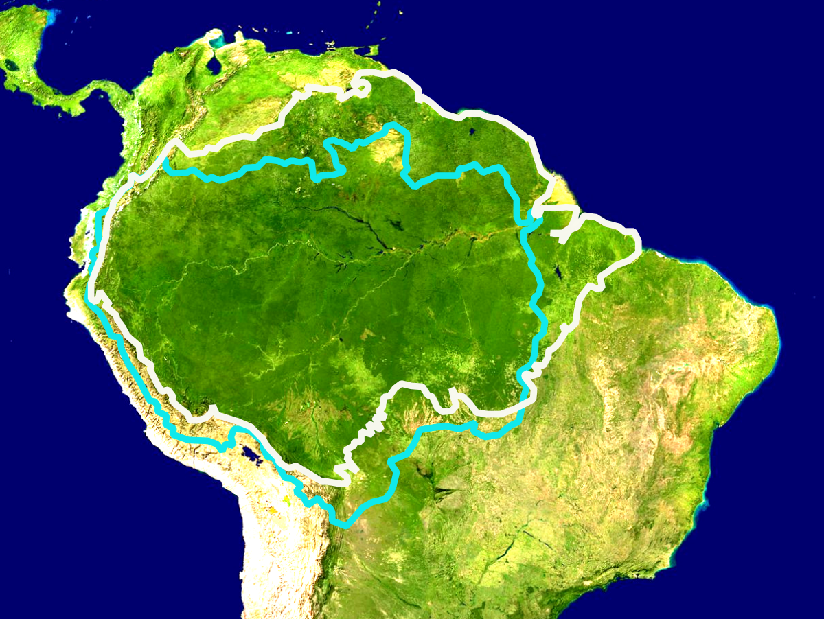
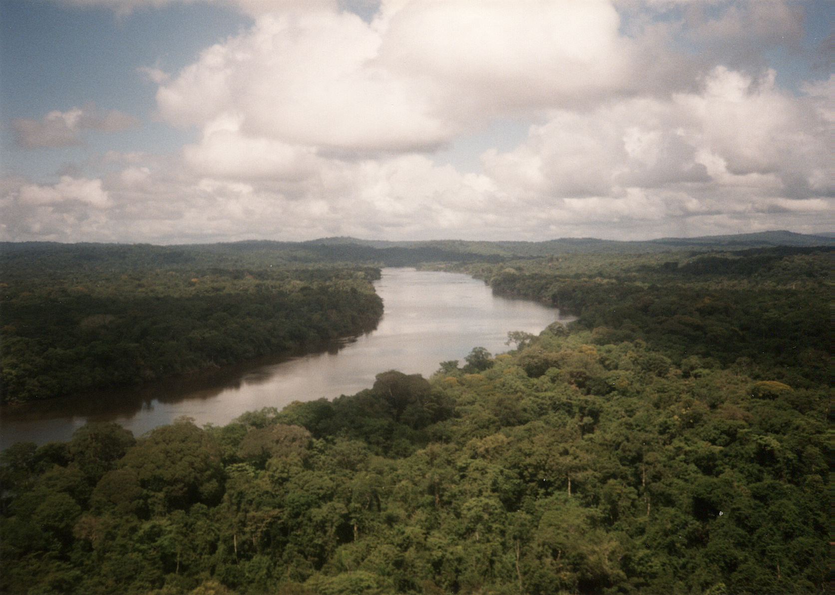
Der Amazonas-Regenwald bedeckt große Teile des Amazonasbeckens in Südamerika, welches sechs Millionen Quadratkilometer in neun Ländern umfasst. Der weitaus größte Teil des Waldes (etwa 60 Prozent) befindet sich in Brasilien. Weitere 13 Prozent befinden sich in Peru, 10 Prozent in Kolumbien sowie kleinere Teile in Venezuela, Ecuador, Bolivien, Guyana, Suriname sowie Französisch-Guyana. Bundesstaaten und Verwaltungseinheiten von vier Ländern tragen den Namen Amazonas.
Der Amazonas-Regenwald umfasst mehr als die Hälfte des weltweit verbliebenen Tropenwaldes und weist die größte Biodiversität aller tropischen Wälder auf. Amazonien ist eines der sechs großen Biome Brasiliens und nimmt rund 49 Prozent des brasilianischen Territoriums ein.[1] Es erstreckt sich über drei der fünf statistischen Regionen des Landes (Norte, Nordeste und Centro-Oeste). Ein 52.000 km² großes Gebiet im zentralen Amazonas-Regenwald, das den Nationalpark Jaú umfasst, wurde von der UNESCO 2000 (mit Erweiterung 2003) zum Welterbe erklärt.[2] Sozialgeographisch ist das Amazonasbecken in Brasilien der Region Amazônia Legal zugeordnet. Zum Zweck der wirtschaftlichen Entwicklung der Region wurde 1966 die Superintendência do Desenvolvimento da Amazônia (SUDAM) geschaffen.
Die langfristige Fortexistenz des Amazonas-Regenwald im Anthropozän steht im Konflikt mit den Interessen einer mächtigen Agrarindustrie:[3] Alleine der brasilianische Regenwald schrumpfte nach Regierungsangaben durch Raubbau zwischen August 2017 und Juli 2018 um insgesamt 7900 km² Wald, was der Fläche von mehr als einer Million Fußballfeldern entspricht.
アマゾン熱帯雨林(アマゾンねったいうりん、英: Amazon Rainforest、西: Selva Amazónica、葡: Floresta Amazônica)とは、南アメリカ大陸アマゾン川流域に大きく広がる、世界最大面積を誇る熱帯雨林である。2019年の大火事で10%の面積を焼失したとされる。[要出典]森林破壊が原因と見られる、木が大量に枯死する等の現象が多発しており、焼き畑と合わせて二酸化炭素大量放出の原因になっており問題になっている。
The Amazon rainforest,[a] alternatively, the Amazon Jungle, also known in English as Amazonia, is a moist broadleaf tropical rainforest in the Amazon biome that covers most of the Amazon basin of South America. This basin encompasses 7,000,000 km2 (2,700,000 sq mi), of which 5,500,000 km2 (2,100,000 sq mi) are covered by the rainforest. This region includes territory belonging to nine nations.
The majority of the forest is contained within Brazil, with 60% of the rainforest, followed by Peru with 13%, Colombia with 10%, and with minor amounts in Bolivia, Ecuador, French Guiana, Guyana, Suriname, and Venezuela. Four nations have "Amazonas" as the name of one of their first-level administrative regions and France uses the name "Guiana Amazonian Park" for its rainforest protected area. The Amazon represents over half of the planet's remaining rainforests,[2] and comprises the largest and most biodiverse tract of tropical rainforest in the world, with an estimated 390 billion individual trees divided into 16,000 species.
La forêt amazonienne (en portugais floresta amazônica ; en espagnol selva amazónica ; en anglais Amazon rainforest), également connue sous le nom d'« Amazonie » ou « jungle amazonienne », est une forêt équatoriale d'Amérique du Sud couvrant la totalité du bassin versant du fleuve Amazone ainsi que des zones périphériques comme le plateau des Guyanes. Elle s'étend sur 9 Pays, principalement au Brésil (63%).
Avec près de 390 milliards d'arbres (16 000 espèces ; 13% des arbres de la planète ; près de 60 fois plus d'arbres « adultes » dans la forêt amazonienne que d'êtres humains sur l'ensemble de la planète)2, c'est l'une des trois plus importantes forêts primaires du monde3. Elle est souvent qualifiée de « poumon de la terre » bien qu'en réalité les océans produisent bien plus d'oxygène4 ; elle produirait entre 20% 5 et plus probablement 6% de l'oxygène6.
C'est le plus grand réservoir de biodiversité au monde, menacé par le réchauffement7, l'orpaillage et la déforestation (depuis 1970, environ 18 % de la forêt originelle a disparu). Elle abrite trois grandes aires protégées : le complexe de conservation de l'Amazonie centrale8 au Brésil, le parc national de Manú9 au Pérou et le parc national Noel Kempff Mercado10 en Bolivie ; inscrites sur la liste du patrimoine mondial par l'organisation des Nations unies pour l'éducation, la science et la culture (UNESCO). Le Parc Amazonien de Guyane, en Guyane française, est le plus grand parc national français mais aussi le plus grand parc de l'Union Européenne11. Couvrant près de 34 000 km², il constitue, avec le Parc National des montagnes du Tumucumaque qui lui est adjacent, l'un des plus grands espaces naturels protégés au monde.
L'Amazzonia è una vasta regione geografica del sud-America caratterizzata da una foresta pluviale, detta foresta amazzonica, che copre gran parte dell'omonimo bacino amazzonico, estendendosi su una superficie di sei milioni di chilometri quadrati suddivisi in nove paesi; la stragrande maggioranza della foresta (circa il 60%) si trova in Brasile; un altro 13% si trova in Perù, il 10% in Colombia e parti più piccole in Venezuela, Ecuador, Bolivia, Guyana, Suriname e Guyana francese: stati e unità amministrative di quattro di questi paesi sono appunto denominati Amazonas.
La Amazonia, también denominada Amazonía1 (en portugués: Amazônia, en francés: Amazonie, en inglés: Amazonia, en neerlandés: Amazone), es una vasta región de la parte horizontal y septentrional de América del Sur que comprende la selva tropical de la cuenca del río Amazonas. Las adyacentes regiones de las Guayanas y el Gran Chaco también poseen selvas tropicales, por lo que muchas veces se las considera parte de la Amazonia.
Esta selva amazónica es el bosque tropical más extenso del mundo.2 Se considera que su extensión llega a los 7 000 000 km² (siete millones de kilómetros cuadrados) repartidos entre nueve países, de los cuales Brasil y Perú poseen la mayor extensión, seguidos por Bolivia, Colombia, Venezuela, Ecuador, Guayana Francesa y Surinam. La Amazonia se destaca por ser una de las ecorregiones con mayor biodiversidad en el planeta.[cita requerida] Además, la Amazonia apoya a la regulación del ciclo de carbono y del cambio climático. Las anomalías que suceden en cuanto a aumento en la tasa de 
Дождевые леса Амазонии — обширный регион влажнотропических вечнозелёных широколиственных лесов — самый крупный в мире тропический лес, расположенный на обширной, почти плоской, равнине, охватывающей почти весь бассейн реки Амазонки. Собственно лес занимает 5,5 миллиона квадратных километров — половину общей площади оставшихся на планете тропических лесов. Захватывает территорию девяти государств: (Бразилия, Перу, Колумбия, Венесуэла, Эквадор, Боливия, Гайана, Суринам, Французская Гвиана).
 Hand in Hand
Antigua and Barbuda
Bahamas
Barbados
Belize
Caribbean Community and Common Market,CARICOM
Hand in Hand
Antigua and Barbuda
Bahamas
Barbados
Belize
Caribbean Community and Common Market,CARICOM
 Andrew Holness
Dominica
Grenada
Guyana
Jamaika
Montserrat
Republik Haiti
Saint Kitts and Nevis
St. Lucia
St. Vincent and the Grenadines
Suriname
Trinidad und Tobago
Andrew Holness
Dominica
Grenada
Guyana
Jamaika
Montserrat
Republik Haiti
Saint Kitts and Nevis
St. Lucia
St. Vincent and the Grenadines
Suriname
Trinidad und Tobago


南美洲进步论坛[1][2](西班牙語:Foro para el Progreso de América del Sur、葡萄牙語:Fórum para o Progresso da América do Sul,简称Prosur)是于2019年3月22日由阿根廷、巴西、智利、哥伦比亚、厄瓜多尔、巴拉圭、秘鲁等七国总统和圭亚那驻智利大使通过联合签署《圣地亚哥宣言》而成立的南美洲地区一体化机制[3]。南美洲进步论坛将用于取代南美洲国家联盟[4][5]。南美洲进步论坛将是“南美公共政策协调机制,捍卫民主、权力独立、市场经济、议程社会,具有可持续性和适当应用”[7]。
Das Forum für den Fortschritt und die Integration von Südamerika (span: Foro para el Progreso e Integración de América del Sur, PROSUR; Portugiesisch: Fórum para o Progresso e Desenvolvimento da América do Sul, PROSUL, niederländisch: Forum voor de Vooruitgang en Integratie van Zuid-Amerika, FVIZA) ist eine Initiative von Sebastián Piñera und Iván Duque zur Schaffung eines Integrationsgremiums, das die Union Südamerikanischer Nationen ersetzen soll.
Antigua and Barbuda
Bahamas
Barbados
Belize
Columbia
Costa Rica
Cuba
Dominica
Dominikanische Republik
Grenada
Guatemala
Guyana
Honduras
Jamaika
Mexico
Nicaragua
Panama
Republik El Salvador
Republik Haiti
Saint Kitts and Nevis
St. Lucia
St. Vincent and the Grenadines
Suriname
Trinidad und Tobago
Venezuela


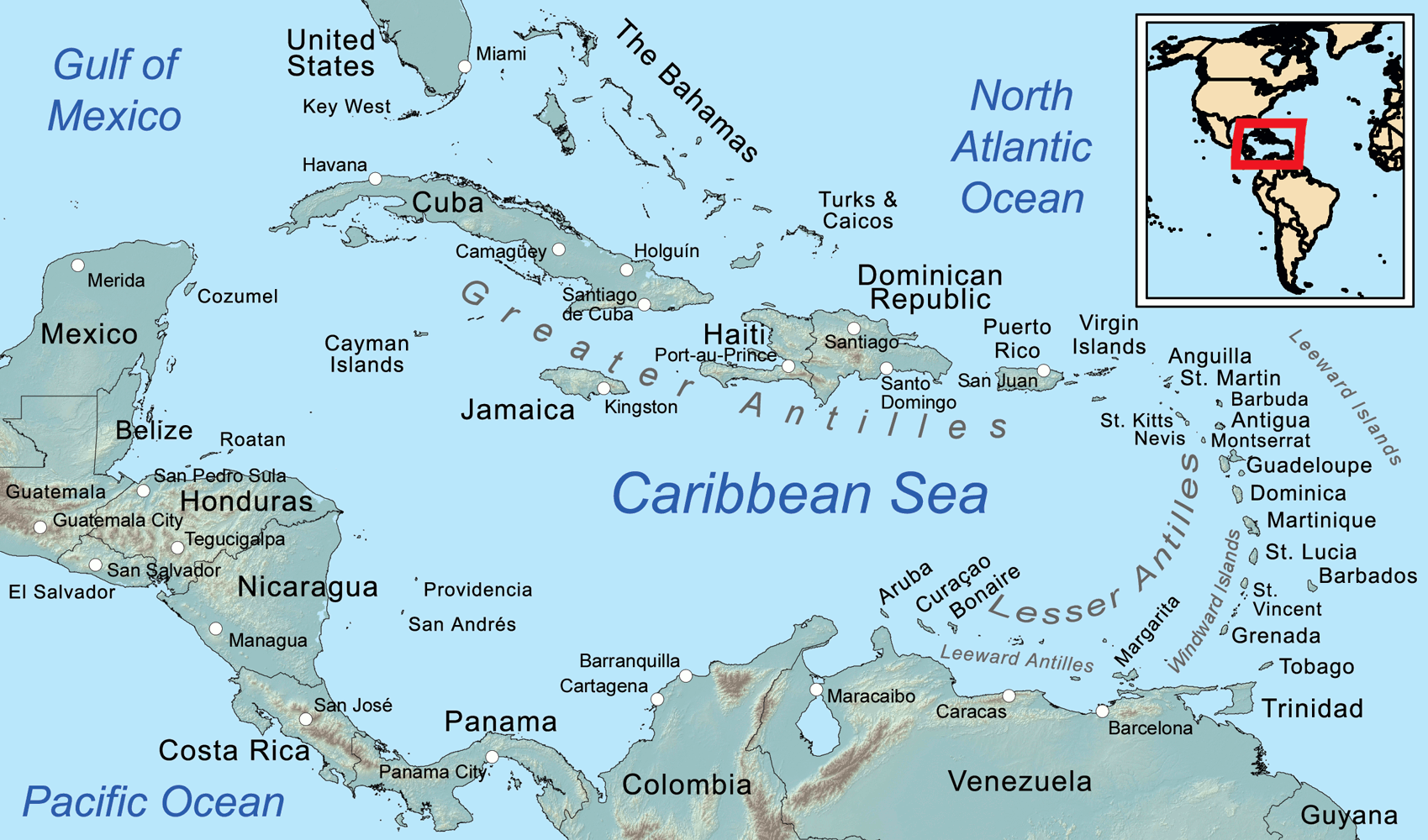
Die Karibik ist eine Region im westlichen, tropischen Teil des Atlantischen Ozeans nördlich des Äquators. Als Teil des mittelamerikanischen Subkontinents besteht sie aus den am und im Karibischen Meer gelegenen Inseln und Inselgruppen und dem Meeresgebiet zwischen ihnen. Am Westende reicht die Karibik in den Golf von Mexiko.
Die Karibik ist nach dem Volk der Kariben benannt, das die spanischen Eroberer auf den Kleinen Antillen (lat. ante ilium, „vorgelagerte Inseln“) vorgefunden haben. Sie wurde bzw. wird auch Westindien genannt, da man sich bei ihrer Entdeckung auf direktem Seeweg nach Indien glaubte.
カリブ海地域(カリブかいちいき、英語: The Caribbean、スペイン語: Caribe、オランダ語: ![]() Caraïben、カリブ・ヒンドゥスターニー語: कैरिबियन (Kairibiyana); フランス語: Caraïbe ないし Antilles)は、カリブ海と、その海域の島々(カリブ海域内の島々や、カリブ海と北大西洋の境界を成す島々)、周辺海域から構成されている。カリブ海地域はメキシコ湾と北アメリカ大陸の南東、中央アメリカの東、南アメリカ大陸の北に位置している。日本語ではカリブ地域、あるいはこの地域にある国を総称してカリブ諸国とも呼ばれる。
Caraïben、カリブ・ヒンドゥスターニー語: कैरिबियन (Kairibiyana); フランス語: Caraïbe ないし Antilles)は、カリブ海と、その海域の島々(カリブ海域内の島々や、カリブ海と北大西洋の境界を成す島々)、周辺海域から構成されている。カリブ海地域はメキシコ湾と北アメリカ大陸の南東、中央アメリカの東、南アメリカ大陸の北に位置している。日本語ではカリブ地域、あるいはこの地域にある国を総称してカリブ諸国とも呼ばれる。
この地方の大部分はカリブプレート上にあり、域内には700以上の島嶼、岩礁、キー(サンゴ礁上の低い島)などがある(カリブ海地域の島の一覧)。島々の多くは島弧を形成して、カリブ海のと東渕と北縁となっている[3]。カリブ海地域の島々は、北側の大アンティル諸島と、南および東側の小アンティル諸島(リーワード・アンティル諸島を含む) から成り、大アンティル諸島やカリブ海より北に位置するバハマ諸島(バハマからタークス・カイコス諸島に至る範囲)をも含んだ、より広い範囲を指す表現としての西インド諸島の一部となっている。広い意味では、大陸の一部であるベリーズ、ベネズエラ、ガイアナ、スリナム、フランス領ギアナもカリブ海地域に含める場合がある。
地政学的には、カリブ海地域の島々は北アメリカの下位区分 (subregion) と見なされることが多く[4][5][6][7][8]、合わせて30の主権国家、海外県、属領から成っている。1954年12月15日から2010年10月10日まで、5つの統治体から成るオランダ領アンティルと称されたオランダ属領があった[9]。また、1958年1月3日から1962年5月31日まで、イギリス属領であった英語圏の領域が構成した、西インド連邦と称された短命な自治国が存在していた。クリケット西インド諸島代表は、その後も、これら諸国の多くを代表して編成され続けている。
The Caribbean (/ˌkærɪˈbiːən, kəˈrɪbiən/, locally /ˈkærɪbiæn/;[4] Spanish: El Caribe; French: les Caraïbes; Haitian Creole: Karayib; Dutch: De Caraïben; Papiamento: Karibe) is a region of the Americas that consists of the Caribbean Sea, its islands (some surrounded by the Caribbean Sea[5] and some bordering both the Caribbean Sea and the North Atlantic Ocean)[6] and the surrounding coasts. The region is southeast of the Gulf of Mexico and the North American mainland, east of Central America, and north of South America.
Situated largely on the Caribbean Plate, the region has more than 700 islands, islets, reefs and cays (see the list of Caribbean islands). Island arcs delineate the eastern and northern edges of the Caribbean Sea:[7] the Greater Antilles on the north and the Lesser Antilles on the south and east (which includes the Leeward Antilles). They form the West Indies with the nearby Lucayan Archipelago (The Bahamas and the Turks and Caicos Islands), which are sometimes considered to be a part of the Caribbean despite not bordering the Caribbean Sea. On the mainland, Belize, Nicaragua, the Caribbean region of Colombia, Cozumel, the Yucatán Peninsula, Margarita Island, and The Guianas (Guyana, Suriname, French Guiana, Guayana Region in Venezuela, and Amapá in Brazil) are often included due to their political and cultural ties with the region.[8]
A mostly tropical geography, the climates are greatly shaped by sea temperatures and precipitation, with the hurricane season regularly leading to natural disasters. Because of its tropical climate and low-lying island geography, the Caribbean is vulnerable to a number of climate change effects, including increased storm intensity, saltwater intrusion, sea-level rise and coastal erosion, and precipitation variability.[9] These weather changes will greatly change the economies of the islands, and especially the major industries of agricultural and tourism.[9]
The Caribbean was occupied by indigenous people since at least 3600 BC. When European colonization followed the arrival of Columbus, the population was quickly decimated by brutal labor practices, enslavement and disease and on many islands, Europeans supplanted the native populations with enslaved Africans. Following the independence of Haiti from France in the early 19th century and the decline of slavery in the 19th century, island nations in the Caribbean gradually gained independence, with a wave of new states during the 1950s and 60s. Because of the proximity to the United States, there is also a long history of United States intervention in the region.
The islands of the Caribbean (the West Indies) are often regarded as a subregion of North America, though sometimes they are included in Middle America or then left as a subregion of their own[10][11] and are organized into 30 territories including sovereign states, overseas departments, and dependencies. From December 15, 1954, to October 10, 2010, there was a country known as the Netherlands Antilles composed of five states, all of which were Dutch dependencies.[12] From January 3, 1958, to May 31, 1962, there was also a short-lived political union called the West Indies Federation composed of ten English-speaking Caribbean territories, all of which were then British dependencies.
Les Caraïbes, (également nommées la Caraïbe, l'espace caraïbe, ou encore l'espace des Caraïbes) sont une région des Amériques qui comprend la mer des Caraïbes, ses îles (certaines entourées par la mer des Caraïbes et d'autres bordant à la fois la mer des Caraïbes et l'océan Atlantique Nord) et les côtes environnantes. La région est située au sud-est du golfe du Mexique et du continent nord-américain, à l'est de l'Amérique centrale et au nord de l'Amérique du Sud.
Située en grande partie sur la plaque des Caraïbes, la région compte plus de 700 îles, îlots, récifs et cayes. Les arcs insulaires délimitent les bords est et nord de la mer des Caraïbes : les Grandes Antilles au nord et les Petites Antilles au sud et à l'est (qui comprennent les îles sous le vent). Elles forment les Antilles avec l'archipel voisin de Lucayan (les Bahamas et les Îles Turques-et-Caïques), qui sont parfois considérées comme faisant partie des Caraïbes bien qu'elles ne bordent pas la mer des Caraïbes. Sur le continent, le Belize, le Nicaragua, la région caribéenne de Colombie, Cozumel, la péninsule du Yucatán, l'île de Margarita et les Guyanes (Guyane, Suriname, Guyane française, région de Guayana au Venezuela et Amapá au Brésil) sont souvent inclus en raison de leurs liens politiques et culturels avec la région.
La géographie est essentiellement tropicale et le climat est fortement influencé par la température de la mer et les précipitations, la saison des ouragans entraînant régulièrement des catastrophes naturelles. En raison de leur climat tropical et de leur géographie insulaire de basse altitude, les Caraïbes sont vulnérables à un certain nombre d'effets du changement climatique, notamment l'augmentation de l'intensité des tempêtes, l'intrusion d'eau salée, l'élévation du niveau de la mer et l'érosion côtière, ainsi que la variabilité des précipitations.
Les Caraïbes ont été occupées par des peuples indigènes depuis au moins 3600 avant J.-C. Lorsque la colonisation européenne a suivi l'arrivée de Christophe Colomb, la population a été rapidement décimée par des pratiques de travail brutales, l'esclavage et la maladie et sur de nombreuses îles, les Européens ont supplanté les populations indigènes par des Africains réduits en esclavage. Après l'indépendance d'Haïti par rapport à la France au début du XIXe siècle et le déclin de l'esclavage, les nations insulaires ont progressivement acquis leur indépendance, avec une vague de nouveaux États au cours des années 1950 et 1960. En raison de la proximité des États-Unis, il existe également une longue histoire d'intervention américaine dans la région.
Les Antilles sont souvent considérées comme une sous-région de l'Amérique du Nord, bien qu'elles soient parfois incluses dans l'Amérique centrale ou alors laissées comme une sous-région à part entière et sont organisées en 30 territoires comprenant des États souverains, des Département et région d'outre-mer et des dépendances. Du 15 décembre 1954 au 10 octobre 2010, il y avait un pays appelé Antilles néerlandaises composé de cinq États, tous dépendants des Pays-Bas. Du 3 janvier 1958 au 31 mai 1962, il y a également eu une union politique de courte durée, la Fédération des Indes occidentales, composée de dix territoires caribéens anglophones, tous dépendants des Britanniques à l'époque.
I Caraibi sono una vasta regione geografica delle Americhe che comprende tutti i paesi bagnati dal Mare Caraibico, cioè tutte le isole delle Antille e i litorali di alcuni paesi continentali del centro e sud America che si affacciano su di questo mare. L'area caraibica è costituita dalle numerose isole che separano il Golfo del Messico dal mar dei Caraibi e quest'ultimo dall'Oceano Atlantico.
El Caribe es una región conformada por el mar Caribe, sus islas y las costas que rodean a este mar. La región se localiza al sureste de América del Norte, al este de América Central, al oeste de América Insular y al norte de América del Sur.
Анти́льские острова́ (также Карибы или Карибские острова) — острова в Карибском море и Мексиканском заливе, расположенные между Северной Америкой и Южной Америкой. Вместе взятые, образуют площадь в 228 662 км² с населением примерно 42 млн чел. (на начало XXI века).
Впервые название «Антильские» встречается в 1493 году у Петра Мартира д’Ангиера, современника Христофора Колумба, придворного Фердинанда Арагонского и Изабеллы Кастильской. Предположительно, были названы по полумифическому острову или архипелагу Антилия, изображавшемуся на средневековых картах.
Подразделяются на две главные группы: Большие Антильские и Малые Антильские острова:
К первым относятся 4 острова: Куба, Гаити, Ямайка и Пуэрто-Рико; из них первые два и последний (самый малый) образуют почти прямую линию, направленную западным углом Кубы к полуострову Юкатан.[1]
Острова материкового и вулканического происхождения. Большая часть их поверхности гориста; равнинные участки главным образом на Кубе и на Юго-Восточном Гаити, а также на Виргинских и Подветренных островах. Горные сооружения Больших Антильских островов высотой до 3098 м (на острове Гаити) являются продолжением структур Центральной Америки. Климат тропический, пассатный, жаркий, преимущественно летне-влажный. Осадков 1200—2000 мм в год. Характерны сильные ураганы в конце лета. Естественная растительность — саванны, летне-зеленые и листопадно-вечнозелёные тропические леса и кустарники — сохранилась мало. На наветренных склонах гор уцелели вечнозелёные леса.[2]
 Afghanistan
Egypt
Albania
Algeria
Azerbaijan
Bahrain
Bangladesh
Benin
Brunei Darussalam
Burkina Faso
Côte d´Ivoire
Djibouti
Gabun
Gambia
Guinea
Guinea-Bissau
Guyana
Indonesia
Iraq
Iran
Yemen
Jordan
Cameroon
Kasachstan
Katar
Kyrgyzstan
Comoros
Kuwait
Libanon
Libya
Malaysia
Malediven
Mali
Morocco
Mauritania
Mosambik
Niger
Nigeria
Oman
Pakistan
Palestine
Republic of the Sudan
Saudi Arabia
Senegal
Sierra Leone
Somalia
Suriname
Syria
Tajikistan
Togo
Tschad
Tunisia
Turkey
Turkmenistan
Uganda
Uzbekistan
United Arab Emirates
Afghanistan
Egypt
Albania
Algeria
Azerbaijan
Bahrain
Bangladesh
Benin
Brunei Darussalam
Burkina Faso
Côte d´Ivoire
Djibouti
Gabun
Gambia
Guinea
Guinea-Bissau
Guyana
Indonesia
Iraq
Iran
Yemen
Jordan
Cameroon
Kasachstan
Katar
Kyrgyzstan
Comoros
Kuwait
Libanon
Libya
Malaysia
Malediven
Mali
Morocco
Mauritania
Mosambik
Niger
Nigeria
Oman
Pakistan
Palestine
Republic of the Sudan
Saudi Arabia
Senegal
Sierra Leone
Somalia
Suriname
Syria
Tajikistan
Togo
Tschad
Tunisia
Turkey
Turkmenistan
Uganda
Uzbekistan
United Arab Emirates
 Important International Organizations
伊斯兰合作组织(阿拉伯语:منظمة التعاون الإسلامي;英语:Organisation of Islamic Cooperation;法语:Organisation de la coopération islamique)原名伊斯兰会议组织,是一个伊斯兰世界的政府间国际组织,为联合国大会观察员;该组织由遍及西亚(中东)、中亚、西非、北非、印度次大陆和东南亚的57个国家组成,覆盖的人口约为16亿。秘书处设在沙特阿拉伯王国的吉达市;现任秘书长是原沙特社会事务大臣Yousef Al-Othaimeen(从2016年开始)。
组织的宗旨是促进各成员国之间在经济、社会、文化和科学等方面的合作;努力消除种族隔离和种族歧视,反对一切形式的殖民主义;支持巴勒斯坦人民恢复民族权利和重返家园的斗争;支持穆斯林保障其尊严、独立和民族权利的斗争。
但要注意的是并非每个成员国是伊斯兰国家,如圭亚那、苏里南、莫桑比克、喀麦隆、乌干达和加蓬等国,伊斯兰反而是极少数人的信仰,阿尔巴尼亚则是唯一加入该组织的欧洲大陆的主权国家和联合国会员国,2011年脱离苏丹独立的南苏丹也在独立后脱离该组织的势力范围。
Die Organisation für Islamische Zusammenarbeit (arabisch منظمة التعاون الإسلامي, DMG Munaẓẓamat at-Taʿāwun al-islāmī; englisch Organization of Islamic Cooperation, OIC; französisch L’Organisation de Coopération Islamique, OCI; früher Organisation der Islamischen Konferenz) ist eine zwischenstaatliche internationale Organisation von derzeit 56 Staaten,[2] in denen der Islam Staatsreligion, Religion der Bevölkerungsmehrheit oder Religion einer nennenswerten Minderheit ist. Die Organisation nimmt für sich in Anspruch, den Islam zu repräsentieren. Mehrere größere Mitgliedsstaaten (Saudi-Arabien, Ägypten, die Türkei und der Iran) erheben hinter den Kulissen Führungsansprüche; die jeweils anderen Staaten bestreiten deren Recht dazu. Infolge dieser Rivalitäten ist die OIC seit 2017 kaum handlungsfähig.[3]
イスラム協力機構(イスラムきょうりょくきこう、アラビア語: منظمة التعاون الاسلامي、略称OIC; 英語: Organisation of Islamic Cooperation、略称OCI; フランス語: Organisation de la coopération Islamique)は、イスラム諸国をメンバーとして構成され、国際連合に対する常任代表を有する国際機構。公用語はアラビア語、英語、フランス語。かつてはイスラム諸国会議機構(منظمة المؤتمر الإسلامي、英語: Organisation of the Islamic Conference、フランス語: Organisation de la Conférence Islamique)という名称であったが、2011年6月にカザフスタンのアスタナでの会議で「イスラム協力機構」への変更と紋章が決定された[1]。
イスラム諸国の政治的協力、連帯を強化すること、イスラム諸国に対する抑圧に反対し、解放運動を支援することを目的とする。
加盟国はムスリム(イスラム教徒)が国民の多数を占める西アジア、北アフリカ、西アフリカ、東アフリカ、中央アジア、南アジア、東南アジアなどの57か国、オブザーバーが5ヵ国・8組織(国連など)からなり、世界13億人のムスリムの大部分を代表する。
加盟条件としては、国内でムスリムが大多数を占めることを必ずしも条件としているわけではなく、南アメリカのいくつかの国のようにマイノリティとしてある程度のムスリム人口を抱えているだけであっても、外相会議における審査で承認されればイスラム諸国のひとつとして機構に加盟することができる。イスラム教徒が多数派を占める国はほとんど参加しているが、イスラム教徒比率の高い国のうちエチオピア(30~50%)とタンザニア(約30%)が加盟していない。イスラム教徒人口の多い国で言えばインド(約1億5000万人)や中国(約2000万人)も加盟していない。逆にイスラム教徒比率の低い国ではガボン、ウガンダ、スリナム、ガイアナなどが加盟している(それぞれ10%未満)。
The Organisation of Islamic Cooperation (OIC; Arabic: منظمة التعاون الإسلامي; French: Organisation de la coopération islamique), formerly the Organisation of the Islamic Conference, is an international organization founded in 1969, consisting of 57 member states, with a collective population of over 1.8 billion as of 2015 with 53 countries being Muslim-majority countries. The organisation states that it is "the collective voice of the Muslim world" and works to "safeguard and protect the interests of the Muslim world in the spirit of promoting international peace and harmony".[1]
The OIC has permanent delegations to the United Nations and the European Union. The official languages of the OIC are Arabic, English, and French.
L’Organisation de la coopération islamique (OCI), en arabe : منظمة التعاون الإسلامي (Munaẓẓamat at-Taʿāwun al-islāmī), en anglais : Organisation of Islamic Cooperation (OIC), appelée jusqu'en 2011 Organisation de la conférence islamique (en arabe : منظمة المؤتمر الإسلامي, en anglais : Organisation of the Islamic Conference), est une organisation intergouvernementale créée le 25 septembre 1969. Son siège se situe à Djeddah en Arabie saoudite et elle possède une délégation permanente aux Nations unies.
Regroupant 57 États membres, sa vocation est de promouvoir la coopération dans les domaines économiques, sociaux, culturels et scientifiques (grâce notamment à la Banque islamique de développement), mais aussi la sauvegarde des lieux saints de l'islam ou encore le soutien au peuple palestinien. À l'échelle mondiale, il n'existe pas d'autre organisation confessionnelle dont les membres signataires soient des États.
Ses trois langues officielles sont l'arabe, l'anglais et le français2.
L'Organizzazione della cooperazione islamica (in arabo: منظمة التعاون الإسلامي, Munaẓẓamat al-taʿāwun al-islāmī; in inglese: Organization of the Islamic Cooperation, OIC; in francese: Organisation de la coopération islamique, OCI) è un'organizzazione internazionale con una delegazione permanente presso le Nazioni Unite. Rappresenta 56 Stati dell'Europa, Vicino Oriente, Medio Oriente, America meridionale, Africa, Asia centrale e del Subcontinente indiano.[1]
L'organizzazione, fondata a Rabat, in Marocco, il 25 settembre 1969 con il nome Organisation of the Islamic Conference, in arabo: منظمة المؤتمر الإسلامي, Munaẓẓamat al-muʾtamar al-islāmī; (FR) Organisation de la conférence islamique, mutato nell'attuale nel 2011.[2]
Ha come finalità la salvaguardia degli interessi e lo sviluppo delle popolazioni musulmane nel mondo.
Il 10 ottobre 1975 le è stato riconosciuto lo status di osservatore dell'Assemblea generale delle Nazioni Unite.
La Organización para la Cooperación Islámica (Árabe:منظمة التعاون الاسلامي); (Francés: Organisation de la Coopération Islamique); (Inglés: Organisation of Islamic Cooperation) es un organismo internacional que agrupa a los estados de confesión musulmana, creado en 1969 durante la Conferencia de Rabat y formalizada dos años después.
Su sede está en Yidda, ciudad costera de Arabia Saudí a orillas del Mar Rojo. Sus miembros son países con mayoría de población musulmana o con una comunidad significativa en ellos, con Estados miembros y observadores de África, Asia, Europa y América del Sur. El 28 de junio de 2011 se oficializó el cambio de nombre,1 anteriormente se llamó: Organización de la Conferencia Islámica (Árabe:منظمة المؤتمر الإسلامي); (Francés: Organisation de la Conférence Islamique); (Inglés:Organization of the Islamic Conference).
Sus acciones se circunscriben a la actividad colaborativa entre sus miembros, sobre todo en la lucha contra el imperialismo, el neocolonialismo y por la emancipación de Palestina. Históricamente se celebraron diversos congresos que contribuyeron con su desarrollo: Lahore (1974), La Meca (1981), Casablanca (1984), Kuwait (1987), Dakar (1991). Sus repercusiones son menores que las de la Liga Árabe.
Организация исламского сотрудничества (англ. Organisation of Islamic Cooperation (OIC), араб. منظمة التعاون الاسلامي) — международная организация исламских стран (до 2011 года называлась Организация Исламская конференция (ОИК).
 Energy resource
 Climate
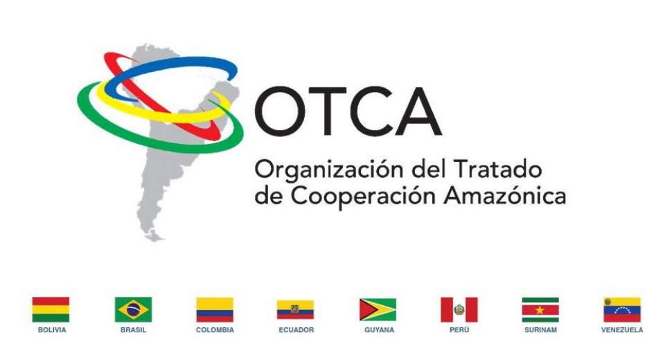
Die OTCA (port.: Organização do Tratado de Cooperação Amazônica / span.: Organización del Tratado de Cooperación Amazónica / engl.: Amazon Cooperation Treaty Organization (ACTO) / niederl.: De Organisatie van de Overeenkomst voor Amazonische Samenwerking (OOAS) ) – tratado heißt im Spanischen und Portugiesischen so viel wie „Staatsvertrag“ – ist die am 2. September 2003 aus dem Amazonaspakt (Tratado de Cooperación Amazonica, TCA) hervorgegangene Organisation der acht Amazonas-Anrainerstaaten.
Der Amazonaspakt wurde 1978 ins Leben gerufen um die Zusammenarbeit der Amazonasländer zu stärken, damals in erster Linie mit dem Ziel, die jeweilige nationale Souveränität über die amazonischen Territorien gegenüber internationalen Interessen durchzusetzen. Später rückte der Gedanke der nachhaltigen Entwicklung Amazoniens immer stärker in den Vordergrund der Aktivitäten des Bündnisses.
Sitz ist seit der Gründung Brasília.
亚马逊合作条约组织是一个旨在促进亚马逊盆地可持续发展的国际组织。其成员国有:玻利维亚、巴西、哥伦比亚、厄瓜多尔、圭亚那、秘鲁、苏里南和委内瑞拉。[1]
《亚马逊合作条约》(Amazon Cooperation Treaty,ACT) 于1978年7月3日签署, 1998年修订。为了监督该条约的实施,1995年,亚马孙合作条约组织成立。2002年,该组织在巴西利亚设立了秘书处。
 International cities


 Sport
Sport


Die Union Südamerikanischer Nationen (spanisch Unión de Naciones Suramericanas UNASUR, portugiesisch União das Nações Sul-Americanas UNASUL, englisch Union of South American Nations, niederländisch Unie van Zuid-Amerikaanse Naties) ist eine internationale Organisation südamerikanischer Staaten. Der Gründungsvertrag wurde am 23. Mai 2008 in Brasília (Brasilien) unterzeichnet. Das Hauptsekretariat der Staatenunion hat seinen Sitz in Quito (Ecuador), die Mitgliederversammlung in Cochabamba (Bolivien). Beobachterstatus besitzen Mexiko und Panama. Zahlreiche Staaten haben 2018 ihren Austritt aus der UNASUR angekündigt. Um UNASUR zu ersetzen, gründeten die Präsidenten von acht südamerikanischen Staaten im Jahr 2019 das Foro para el Progreso de América del Sur (PROSUR).[1]
南美洲国家联盟(葡萄牙语:União Sul-Americana de Nações;西班牙语:Unión de Naciones Suramericanas;荷兰语:Unie van Zuid-Amerikaanse Naties;英语:Union of South American Nations)是根据《库斯科宣言》于2004年12月8日成立的主权国家联盟。联盟原名南美洲国家共同体,2007年4月16日改为现名[3]。目前成员国只剩下玻利维亚、苏里南、圭亚那和委内瑞拉。