
漢德百科全書 | 汉德百科全书
 Transport and traffic

 Berlin
 Companies

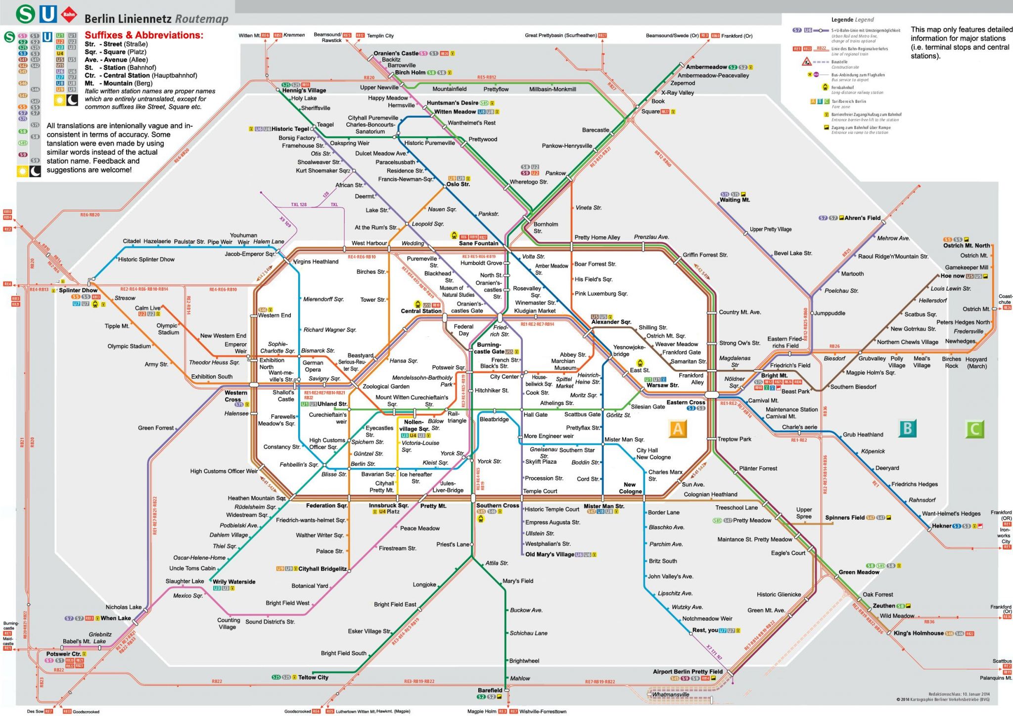
Die Berliner Verkehrsbetriebe (kurz: BVG,[6] ehemals Berliner Verkehrs-Aktiengesellschaft) sind ein Verkehrsunternehmen für den Öffentlichen Personennahverkehr (ÖPNV) in Berlin in der Rechtsform einer Anstalt des öffentlichen Rechts. In Berlin sowie im Umland (Agglomeration Berlin) betreibt die BVG die U-Bahn Berlin, die Straßenbahn Berlin, den Busverkehr in Berlin und den Fährverkehr in Berlin. Die BVG ist Mitglied im Verkehrsverbund Berlin-Brandenburg (VBB) und im Verband Deutscher Verkehrsunternehmen (VDV).
柏林公共交通公司(德语:Berliner Verkehrsbetriebe),简称BVG,负责营运德国柏林的地铁、电车及巴士服务。BVG曾于1984年至1991年间曾营运西柏林的城铁,及于1989年至1991年间曾营运磁悬浮铁路(M-Bahn)。BVG也是柏林-勃兰登堡交通集团的成员公司之一。


 Bavaria

 China
Chongqing Shi-CQ
Hunan Sheng-HN
Nei Mongol Zizhiqu-NM
Shaanxi Sheng-SN
Sichuan Sheng-SC
China
Chongqing Shi-CQ
Hunan Sheng-HN
Nei Mongol Zizhiqu-NM
Shaanxi Sheng-SN
Sichuan Sheng-SC
 Vacation and Travel


 Education and Research
 Financial
 Law
Law
 Medical, Pharmaceutical, Rehabilitation
 Important disciplines


 Aerospace

 Automobile
 *Self-driving car
China
Flugzeugträger
Admiral-Kusnezow-class
Flugzeugträger
Type 001A
Flugzeugträger
Type 002
Flugzeugträger
Fregatten
Type 056A frigate NATO-Jiangdao II
Fregatten
Type 056 frigate NATO-Jiangdao
Fregatten
Type 054A frigate NATO-Jiangkai II
Fregatten
Type 054 frigate NATO-Jiangkai I
Fregatten
Type 053H3 frigate NATO-Jiangwei II
*Self-driving car
China
Flugzeugträger
Admiral-Kusnezow-class
Flugzeugträger
Type 001A
Flugzeugträger
Type 002
Flugzeugträger
Fregatten
Type 056A frigate NATO-Jiangdao II
Fregatten
Type 056 frigate NATO-Jiangdao
Fregatten
Type 054A frigate NATO-Jiangkai II
Fregatten
Type 054 frigate NATO-Jiangkai I
Fregatten
Type 053H3 frigate NATO-Jiangwei II

 IT-Times
 Agriculture, forestry, livestock, fishing


 Military, defense and equipment
Navigation Satellite System
Military, defense and equipment
Navigation Satellite System
 Ships and Nautics
Transport and traffic
Ships and Nautics
Transport and traffic
 Science and technology
Destroyer
Type 055
Destroyer
Type 052D NATO-Luyang III
Destroyer
Type 052C NATO-Luyang II
Destroyer
Type 052B NATO-Luyang I
Destroyer
Type 052 NATO-Luhu
Destroyer
Type 051C NATO-Luzhou
Destroyer
Type 051B NATO-Luhai
Science and technology
Destroyer
Type 055
Destroyer
Type 052D NATO-Luyang III
Destroyer
Type 052C NATO-Luyang II
Destroyer
Type 052B NATO-Luyang I
Destroyer
Type 052 NATO-Luhu
Destroyer
Type 051C NATO-Luzhou
Destroyer
Type 051B NATO-Luhai

北斗卫星导航系统(英语:Beidou Navigation Satellite System,簡稱BDS)是中华人民共和国独立自主建设的一个卫星导航系统[5],北斗卫星导航系统由两个独立的部分组成,一个是2000年开始运作的区域实验系统,另一个是已经开始面向全球服务的全球导航系统[6]。
第一代北斗系统,官方名称为北斗卫星导航试验系统,也被称作北斗一号,由三颗卫星提供区域定位服务。从2000年开始,该系统主要在中国境内提供导航服务。
第二代北斗系统,官方名称为北斗卫星导航系统,也被称为北斗二号。北斗二号建成后,将是一个包含16颗卫星的全球卫星导航系统,分别为6颗静止轨道卫星、6颗倾斜地球同步轨道卫星、4颗中地球轨道卫星。截止2011年11月,北斗二代包含了10颗卫星,开始在中国投入服务[7]。2012年11月,第二代北斗系统开始在亚太地区为用户提供区域定位服务[8]。
北斗卫星导航系统(BDS)、美国全球定位系統(GPS)、俄罗斯全球导航衛星系統(GLONASS)和欧盟伽利略定位系統(Galileo)為联合国卫星导航委员会认定的全球卫星导航系统四大核心供应商[9]。
2015年中期,中国开始建设第三代北斗系统(北斗三号),进行全球卫星组网。北斗卫星第三代导航系统空间段计划由35颗卫星组成,包括5颗静止轨道卫星、27颗中地球轨道卫星、3颗倾斜同步轨道卫星。第一颗三代卫星于2017年11月5日发射升空[10]。2018年进行高强度第三代北斗系统的发射任务,本年度共发射17颗北斗三号卫星,并且全部成功。截止2018年11月,已发射了19颗第三代在轨导航卫星。按照计划,该系统将在2018年覆盖“一带一路”国家,2020年完成建设提供全球定位服务,2035年建成以北斗为核心的综合定位、导航、授时体系。
据中国日报报道,北斗系统第一颗卫星发射15年后,它每年为几家大型企业产生的营业额高达3150万美元,其中包括中国航天科工集团,高德软件有限公司和中国兵器工业集团公司[11]。
北京时间2018年12月27日,国务院新闻发布会宣布,北斗三号正式提供全球服务。[12]
Beidou (chinesisch 北斗, Pinyin Běidǒu ‚Großer Bär‘, Abkürzung BDS) ist ein chinesisches Satellitennavigationssystem. Die regionale Version des Systems ging Ende Dezember 2011 offiziell in Betrieb.[1] Das globale System befindet sich noch im Aufbau. Beidou soll die chinesische Abhängigkeit vom US-amerikanischen Global Positioning System (GPS) verringern.
Die Satelliten trugen während der Projektentwicklungsphase (bis Ende 2012) auch den Arbeitstitel Compass. Nach Fertigstellung des globalen Systems wird es aus vier geostationären Satelliten, zwölf Satelliten auf geneigten geosynchronen Bahnen und neun Satelliten mit Flugbahnen in 22.000 km Höhe bestehen. Als Genauigkeit für die öffentliche Nutzung werden mit 10 m für die Position und 0,2 m/s (≈ 0,7 km/h) für die Geschwindigkeit angegeben.
Beidou-1A und -1B wurden am 30. Oktober und 20. Dezember 2000 gestartet, Beidou-1C ist seit dem 24. Mai 2003 im All. Erst die Satelliten der Serie 2 sind Bestandteil des Navigationssystems. Sie nehmen die Positionen über dem asiatisch-pazifischen Raum auf 58,75°O, 80°O, 110,5°O und 140°O ein. Bis April 2012 wurden insgesamt 13 Beidou-2-Satelliten ins All geschossen.
Am 27. Dezember 2011 wurde das System offiziell in Betrieb genommen, zunächst im Testbetrieb. Es wird chinesischen und ausländischen Unternehmen zur Verfügung gestellt und ist seit Ende 2012 in der Phase II-Konstellation (5 GEO, 5 IGSO, 4 MEO) in großen Teilen Asiens und des Pazifikraums in Funktion.[2] Bis ins Jahr 2020 soll die Zahl der Satelliten für das chinesische Navigationssystem auf 35 steigen.[3][1]
北斗衛星導航系統(ほくとえいせいどうこうけいとう、簡体字: 北斗卫星导航系统、英語: BeiDou Navigation Satellite System、北斗衛星測位システムとも言う)とは、中華人民共和国が独自に開発を行なっている衛星測位システム(GNSS)である。2012年12月27日にアジア太平洋地域での運用を開始[1]。2018年12月27日、全世界向けのサービス開始を発表した[2]。
中華人民共和国はアメリカ合衆国のGPSに依存しない、独自システムの構築にこだわってきた[1]。最初の北斗システムは公式には北斗衛星航法実験システムと呼ばれ、北斗-1として知られる3機の人工衛星で構成されており、2000年から中国と周辺国で航法に提供されていた。
第二世代のシステムはコンパスまたは北斗-2として知られ、完成時には35機の衛星で構成される全地球測位システムになる予定。2018年12月時点では衛星33機を運用しており、位置情報誤差は10メートル。2020年までに北斗2号を1機、北斗3号11機に追加で打ち上げ、完成させる計画である[2]。北斗測位システムの主任設計者は孫家棟。
The BeiDou Navigation Satellite System (BDS) (Chinese: 北斗卫星导航系统; pinyin: běi dǒu wèi xīng dǎo háng xì tǒng [pèi tòu wêi ɕíŋ tàu xǎŋ ɕî tʰʊ̀ŋ]) is a Chinese satellite navigation system. It consists of two separate satellite constellations. The first BeiDou system, officially called the BeiDou Satellite Navigation Experimental System and also known as BeiDou-1, consists of three satellites which since 2000 has offered limited coverage and navigation services, mainly for users in China and neighboring regions. Beidou-1 was decommissioned at the end of 2012.
The second generation of the system, officially called the BeiDou Navigation Satellite System (BDS) and also known as COMPASS or BeiDou-2, became operational in China in December 2011 with a partial constellation of 10 satellites in orbit.[3] Since December 2012, it has been offering services to customers in the Asia-Pacific region.[4] On December 27, 2018, Beidou-3 officially began to provide global services.[5][6]
In 2015, China started the build-up of the third generation BeiDou system (BeiDou-3) in the global coverage constellation. The first BDS-3 satellite was launched on 30 March 2015.[7] As of January 2018, nine BeiDou-3 satellites have been launched.[8] BeiDou-3 will eventually consist of 35 satellites and is expected to provide global services upon completion in 2020. When fully completed, BeiDou will provide an alternative global navigation satellite system to the United States owned Global Positioning System (GPS),[9][10] the Russian GLONASS or European Galileo systems and is expected to be more accurate than these.[11] It was claimed in 2016 that BeiDou-3 will reach millimeter-level accuracy (with post-processing), which is ten times more accurate than the finest level of GPS.[10]
According to China Daily, in 2015, fifteen years after the satellite system was launched, it was generating a turnover of $31.5 billion per annum for major companies such as China Aerospace Science and Industry Corp, AutoNavi Holdings Ltd, and China North Industries Group Corp.[12]
On 27 December 2018, BeiDou Navigation Satellite System started to provide global services.[13]
Beidou (chinois simplifié : 北斗, pinyin : běidǒu), également nommé COMPASS est un système de navigation et de positionnement par satellites chinois en cours de déploiement qui devrait devenir complètement opérationnel en 2020. Une première version de Beidou comportant trois satellites et baptisée Beidou-1 a commencé à être déployé en 2000 et a été déclaré opérationnel en 2003. Ce système régional permettait de déterminer sa position uniquement en Chine et dans les régions avoisinantes avec une précision d'environ 100 mètres. Une deuxième génération du système, Beidou-2, annoncée en 2006 doit assurer à la fin de son déploiement en 2020 une couverture mondiale. Celle-ci est assurée par trois types de satellites : 5 satellites en orbite géostationnaire, trois en orbite géosynchrone inclinée (55°) et 27 en orbite moyenne. Beidou-2 est opérationnel depuis fin 2012 avec une couverture comprenant la Chine et les pays alentour. Une quinzaine de satellites étaient en orbite début 2015. Les performances à terme de Beidou-2 seront comparables aux trois autres systèmes mondiaux opérationnels (GPS et GLONASS) ou en cours de déploiement (Galileo).
BeiDou (in cinese 北斗 (běidǒu), ovvero “mestolo del nord”, l'asterismo della costellazione dell'Orsa Maggiore conosciuto in Occidente come Grande Carro) è un sistema di posizionamento satellitare sviluppato dalla Repubblica popolare cinese, nato inizialmente per una copertura regionale, ma successivamente implementato per una copertura globale.
Nato per uso militare, recentemente è stata annunciata l'apertura ad uso commerciale.[1]
Nel novembre 2014 il Comitato per la sicurezza marittima dell'Organizzazione marittima internazionale ha approvato l'uso del sistema BeiDou nella navigazione marittima.
Beidou es un proyecto desarrollado por la República Popular de China para obtener un sistema de navegación por satélite. "Beidou" es el nombre chino para la constelación de la Osa Mayor. La primera generación, BeiDou-1, ya está operativa desde el 2000 y es un sistema de posicionamiento por satélite local dando servicio a China y a sus países vecinos. La segunda generación, también llamada Compass o BeiDou-2, será un sistema de posicionamiento global con un funcionamiento similar al GPS.
Según informaciones oficiales ofrecerá dos tipos de servicios: el primero será abierto y podrá dar una posición con un margen de 10 metros de distancia, 0,2 metros por segundo de velocidad y 0,000005 segundos de tiempo. El segundo servicio será autorizado solo para determinados clientes y ofrecerá servicios más precisos y con mayores medidas de seguridad.
A diferencia de los sistemas GPS, GLONASS, y GALILEO, que utilizan satélites en órbitas bajas y ofrecen servicio global, la primera generación, Beidou-1 usa satélites en órbita geoestacionaria. Esto implica que el sistema no requiera una gran constelación de satélites, pero limita su cobertura sobre la tierra a la visible por los satélites, China en este caso. Otra gran diferencia de BeiDou-1 es que calcula las coordenadas únicamente con dos satélites y una estación en tierra. Esto implica la necesidad de enviar una señal desde el dispositivo remoto, cosa que no es necesaria con GPS o GLONASS.
Se prevé que Compass, la segunda generación, cuente con entre 12 y 14 satélites entre 2011 y 2015. Para 2020, ya plenamente operativo deberá contar con 30 satélites. De momento (diciembre, 2012), ya tienen 14 en órbita.
China está también asociada con el sistema de posicionamiento Galileo, que en diciembre de 2016 la Comisión Europea, propietaria del sistema, informó que Galileo comenzó sus operaciones y que los satélites ya envían información de posicionamiento, navegación y determinación de la hora a usuarios de todo el mundo.
Навигацио́нная систе́ма «Бэйдо́у» (кит. трад. 北斗導航系統, упр. 北斗导航系统, пиньинь: Běidǒu dǎoháng xìtǒng, палл.: Бэйдоу даохан ситун) или Спу́тниковая навигацио́нная систе́ма «Бэйдо́у» (кит. трад. 北斗衛星導航系統, упр. 北斗卫星导航系统, пиньинь: Běidǒu wèixīng dǎoháng xìtǒng, палл.: Бэйдоу вэйсин даохан ситун, сокращенно — BD) — китайская спутниковая система навигации. Планируется, что космический сегмент навигационной спутниковой системы Бэйдоу будет состоять из 5 спутников на геостационарной орбите, 3 спутников на геосинхронной орбите (с наклонением 55°) и 27 спутников на средней околоземной орбите (~21 500 км)[1][2].
Система была запущена в коммерческую эксплуатацию 27 декабря 2012 как региональная система позиционирования, при этом спутниковая группировка составляла 16 спутников[3][4]. Планируется, что на полную мощность система выйдет к 2020 году[5][6]. Китайские представители также отметили, что ещё предстоит урегулировать вопросы, касающиеся частотных диапазонов, с российской, американской и европейской сторонами, которые также владеют спутниковыми навигационными группировками. А пока китайская система работает на частоте сигнала B1, также отмеченного Евросоюзом как E2, с частотой 1559,052 — 1591,788 МГц. Обе стороны до сих пор не достигли окончательной договорённости по вопросам совместимости своих будущих спутниковых навигационных систем, несмотря на продолжающиеся с 2009 года переговоры по вопросу наложения специальных сигналов системы Compass на специальные сигналы PRS системы Galileo (1563—1591 МГц для гражданского сигнала).
Предположительные будущие частоты
B2: 1166,22 — 1217,37 МГц,
B3: 1250,618 — 1286,423 МГц.

Der Flughafen Peking-Daxing (IATA-Code und ICAO-Code sind noch offen) ist ein chinesisches Infrastrukturprojekt. In Ergänzung zum bisherigen Flughafen Peking im Norden der Stadt, der an seine Grenzen stößt, soll ein weiterer Flughafen im Süden der Hauptstadt Peking entstehen.
Der bisherige Flughafen Pekings war drei Jahre in Folge der Flughafen mit den zweitmeisten Passagieren weltweit nach dem Flughafen Atlanta und erreicht seine Kapazitätsgrenze. Im Süden der Hauptstadt befindet sich bereits heute der Flughafen Peking-Nanyuan, der lediglich über eine Startbahn verfügt.
Die Genehmigung wurde im Januar 2013 erteilt; die Baumaßnahmen sollen 2014 unter Leitung der ADPI beginnen; er soll bereits 2018[1] eröffnet werden.
Laut Internetseite des Flughafenplaners Netherlands Airport Consultants B.V. (NACO) wird der neue Großflughafen über insgesamt acht Start- und Landebahnen verfügen, von denen eine für rein militärische Zwecke reserviert ist. Für die erste Ausbaustufe, die eine Kapazität von 45 Millionen Fluggästen haben wird, sind vier Start- und Landebahnen geplant. Damit sollen bis zu 650.000 Flugbewegungen pro Jahr abgewickelt werden können.[2]
In der letzten Ausbaustufe soll der Flughafen sieben Landebahnen haben[3] und für bis zu 130 Millionen Passagiere ausgelegt sein. Er hätte damit eine Startbahn mehr als der Flughafen Denver, der über sechs Bahnen verfügt. 2011 sprach man sogar von neun Landebahnen.[4]
Der Flughafen Peking-Daxing soll ausschließlich von der Allianz SkyTeam genutzt werden, der gleich drei chinesische Fluggesellschaften angehören. Die Maschinen der Star Alliance, der auch Lufthansa angehört, sollen weiterhin den bisherigen Flughafen Peking anfliegen.[2] Hierdurch entstehen zwei vollwertige Hubs in Peking, statt z. B. den Inlands- und Auslandsverkehr auf zwei Flughäfen aufzuspalten.

北京地铁是服务于中华人民共和国北京市的城市轨道交通系统。截至2022年7月,北京地铁共有27条运营线路(包括22条地铁线路、1条中低速磁浮交通线路、2条现代有轨电车线路和2条机场轨道)[参8],组成覆盖北京市12个市辖区和河北省廊坊市广阳区[参2]、拥有463座运营车站[参3][注3][注4]、总长783千米运营线路的轨道交通系统[参3]。
以运营里程计算,截至2021年12月北京地铁是世界上规模第二大的城市地铁系统。2014年以来,北京地铁的工作日日均客运量在1,000万人次以上[参9],并且在2019年7月12日创下单日客运量最高值,达到1375.38万人次[参4]。
北京地铁的规划始于1953年,始建于1965年,最早的线路竣工于1969年,是大中华地区首个地铁系统[参10]。北京地铁由多个国有或公私合营的企业分别运营不同的线路,其中京港地铁公司运营的4号线也是中国大陆首条采用政府和社会资本合作(PPP)模式建设和运营的轨道交通线路[参11]。目前,北京地铁正在进行大规模建设。预计到2025年底,北京地铁运营总里程将达到1,000千米[参12]。
|
线路名称 |
标识色 |
起止站点 |
站数 |
长度 |
编组 |
首段开通日期 |
|---|---|---|---|---|---|---|
|
(含北京地铁八通线) |
红色 |
35 |
52.7 |
6准B |
1971年1月15日 |
|
|
蓝色 |
西直门站—西直门站 |
18 |
23.1 |
6准B |
1971年1月15日 |
|
|
(含北京地铁大兴线) |
青绿色 |
35 |
50.0 |
6B |
2009年9月28日 |
|
|
紫红色 |
23 |
27.6 |
6B |
2007年10月7日 |
||
|
土黄色 |
33 |
53.1 |
8B |
2012年12月30日 |
||
|
浅橙色 |
北京西站—环球度假区站 |
30 |
40.3 |
8B |
2014年12月28日 |
|
|
绿色 |
34 |
51.6 |
6B |
2008年10月9日 |
||
|
浅绿色 |
13 |
16.5 |
6B |
2011年12月31日 |
||
|
天蓝色 |
巴沟站—巴沟站 |
45 |
57.1 |
6B |
2008年7月19日 |
|
|
西柚色 |
金安桥站—新首钢站 |
3 |
2.5 |
4A |
2021年12月31日 |
|
|
藤黄色 |
西直门站—东直门站 |
17 |
41.5 |
6准B |
2002年9月28日 |
|
|
淡粉色 |
33 |
50.8 |
6A |
2013年5月5日 |
||
|
紫罗兰色 |
20 |
41.4 |
6B |
2010年12月30日 |
||
|
草绿色 |
16 |
31.9 |
8A |
2016年12月31日 |
||
|
蓝绿色 |
7 |
15.8 |
8A |
2021年12月31日 |
||
|
暗粉色 |
10 |
20.9 |
8A |
2021年12月31日 |
||
|
桃红色 |
宋家庄站—亦庄火车站 |
14 |
23.2 |
6B |
2010年12月30日 |
|
|
橙色 |
16 |
32.0 |
6B |
2010年12月30日 |
||
|
橙色 |
阎村东站—燕山站 |
9 |
14.4 |
4B |
2017年12月30日 |
|
|
粉红色 |
13 |
33.4 |
6B |
2010年12月30日 |
||
|
棕色 |
8 |
10.2 |
6M |
2017年12月30日 |
||
|
银灰色 |
5 |
29.8 |
4L |
2008年7月19日 |
||
|
深蓝色 |
3 |
41.4 |
4D/8D |
2019年9月26日 |
||
|
朱红色 |
巴沟站—香山站 |
6 |
9.4 |
5准C |
2017年12月30日 |
|
|
朱红色 |
定海园站—屈庄站 |
14 |
13.25 |
5准C |
2020年12月31日 |
|
线路名称 |
起点站 |
终点站 |
首班车发车/到达时刻 |
末班车发车/到达时刻 (不包括延长运营的班次) |
|---|---|---|---|---|
|
1号线(含八通线) |
古城 |
环球度假区 |
04:57-06:23(86分钟) |
22:51-00:16(85分钟) (以到达行进方向为准) |
|
复兴门 |
05:13-06:14(61分钟) |
|||
|
土桥 |
04:59-05:05(6分钟) |
|||
|
环球度假区 |
古城 |
05:09-06:34(85分钟) |
22:55-00:20(85分钟) (以到达行进方向为准) |
|
|
四惠东 |
05:04-05:55(51分钟) |
|||
|
四惠 |
04:56-05:44(48分钟) |
|||
|
复兴门 |
05:08-05:34(26分钟) |
|||
|
古城 |
四惠东 |
(非全程车不展现该项目) |
23:33-00:24(51分钟) |
|
|
2号线外环 (逆时针) |
西直门 |
积水潭 |
05:10-05:51(41分钟) |
23:00-23:41(41分钟) (以到达行进方向为准) |
|
北京站 |
05:15-05:35(20分钟) |
|||
|
2号线内环 (顺时针) |
积水潭 |
西直门 |
05:04-05:45(41分钟) |
23:04-23:45(41分钟) (以到达行进方向为准) |
|
北京站 |
05:12-05:33(21分钟) |
|||
|
4号线(含大兴线) |
安河桥北 |
天宫院 |
05:00-06:21(81分钟) |
22:20-23:41(81分钟) |
|
天宫院 |
安河桥北 |
05:30-06:50(80分钟) |
22:38-23:58(80分钟) (以到达行进方向为准) |
|
|
公益西桥 |
05:10-05:58(48分钟) |
|||
|
安河桥北 |
公益西桥 |
(非全程车不展现该项目) |
22:45-23:35(50分钟) |
|
|
5号线 |
天通苑北 |
宋家庄 |
05:00-05:49(49分钟) |
22:48-23:37(49分钟) |
|
宋家庄 |
天通苑北 |
05:20-06:09(49分钟) |
23:11-00:00(49分钟) |
|
|
6号线 |
金安桥 |
潞城 |
05:08-06:32(84分钟) |
22:25-23:49(84分钟) (以到达行进方向为准) |
|
草房 |
05:23-05:41(18分钟) |
|||
|
潞城 |
金安桥 |
04:52-06:17(85分钟) |
22:49-00:14(85分钟) (以到达行进方向为准) |
|
|
草房 |
04:57-06:02(65分钟) |
|||
|
海淀五路居 |
04:47-05:01(14分钟) |
|||
|
金安桥 |
草房 |
(非全程车不展现该项目) |
23:36-00:41(65分钟) |
|
|
7号线 |
北京西站 |
环球度假区 |
05:29-06:38(69分钟) |
22:59-00:08(69分钟) (以到达行进方向为准) |
|
双合 |
05:29-05:56(27分钟) |
|||
|
环球度假区 |
北京西站 |
05:09-06:17(68分钟) |
22:59-00:07(68分钟) (以到达行进方向为准) |
|
|
焦化厂 |
05:09-05:53(44分钟) |
|||
|
北京西站 |
高楼金 |
(非全程车不展现该项目) |
23:14-00:18(64分钟) |
|
|
8号线 |
朱辛庄 |
瀛海 |
05:09-06:34(85分钟) |
22:40-00:05(85分钟) (以到达行进方向为准) |
|
回龙观东大街 |
04:39-05:55(76分钟) |
|||
|
瀛海 |
朱辛庄 |
05:06-06:32(86分钟) |
23:01-00:27(86分钟) (以到达行进方向为准) |
|
|
中国美术馆 |
05:26-06:12(46分钟) |
|||
|
回龙观东大街 |
04:51-05:00(9分钟) |
|||
|
9号线 |
郭公庄 |
国家图书馆 |
05:00-05:31(31分钟) |
22:40-23:11(31分钟) |
|
国家图书馆 |
郭公庄 |
05:39-06:10(31分钟) |
23:19-23:50(31分钟) |
|
|
10号线外环 (逆时针) |
巴沟 |
苏州街 |
04:49-06:33(104分钟) |
22:44-00:26(102分钟) (运行区间为慈寿寺-车道沟) |
|
成寿寺 |
05:27-06:19(52分钟) |
|||
|
10号线内环 (顺时针) |
车道沟 |
慈寿寺 |
04:47-06:29(102分钟) |
22:34-00:16(102分钟) (运行区间为苏州街-巴沟) |
|
宋家庄 |
05:35-06:13(38分钟) |
|||
|
11号线 |
金安桥 |
新首钢 |
05:58-06:03(5分钟) |
21:58-22:03(5分钟) |
|
新首钢 |
金安桥 |
06:10-06:15(5分钟) |
22:10-22:15(5分钟) |
|
|
13号线 |
西直门 |
东直门 |
05:35-06:31(56分钟) |
22:42-23:38(56分钟) (以到达行进方向为准) |
|
霍营 |
05:00-05:26(26分钟) |
|||
|
东直门 |
西直门 |
05:35-06:32(57分钟) |
22:50-23:47(57分钟) (以到达行进方向为准) |
|
|
霍营 |
05:00-05:31(31分钟) |
|||
|
西直门 |
霍营 |
(非全程车不展现该项目) |
23:55-00:25(30分钟) |
|
|
东直门 |
回龙观 |
(非全程车不展现该项目) |
23:45-00:14(29分钟) |
|
|
14号线 |
张郭庄 |
善各庄 |
04:55-06:20(85分钟) |
22:30-23:55(85分钟) |
|
善各庄 |
张郭庄 |
04:55-06:20(85分钟) |
22:30-23:55(85分钟) (以到达行进方向为准) |
|
|
西局 |
(非全程车不展现该项目) |
|||
|
15号线 |
清华东路西口 |
俸伯 |
05:42-06:38(56分钟) |
23:15-00:11(56分钟) (以到达行进方向为准) |
|
马泉营 |
05:30-05:57(27分钟) |
|||
|
俸伯 |
清华东路西口 |
05:30-06:28(58分钟) |
22:11-23:09(58分钟) (以到达行进方向为准) |
|
|
马泉营 |
05:07-05:36(29分钟) |
|||
|
俸伯 |
马泉营 |
(非全程车不展现该项目) |
23:18-23:47(29分钟) |
|
|
16号线 |
北安河 |
玉渊潭东门 |
05:15-06:06(51分钟) |
22:30-23:11(51分钟) |
|
玉渊潭东门 |
北安河 |
05:37-06:27(50分钟) |
22:42-23:32(50分钟) |
|
|
17号线 |
十里河 |
嘉会湖 |
05:55-06:14(19分钟) |
22:30-22:49(19分钟) |
|
嘉会湖 |
十里河 |
05:30-05:49(19分钟) |
22:30-22:49(19分钟) |
|
|
19号线 |
牡丹园 |
新宫 |
05:30-05:56(26分钟) |
23:10-23:36(26分钟) |
|
新宫 |
牡丹园 |
05:30-05:57(27分钟) |
23:25-23:52(27分钟) |
|
|
亦庄线 |
宋家庄 |
亦庄火车站 |
06:00-06:35(35分钟) |
23:20-23:55(35分钟) |
|
亦庄火车站 |
宋家庄 |
05:20-05:54(34分钟) |
22:40-23:14(34分钟) |
|
|
房山线 |
东管头南 |
阎村东 |
05:47-06:32(45分钟) |
23:14-23:59(45分钟) |
|
阎村东 |
东管头南 |
05:03-05:48(45分钟) |
22:19-23:04(45分钟) (以到达行进方向为准) |
|
|
苏庄 |
05:00-05:42(42分钟) |
|||
|
燕房线 |
阎村东 |
燕山 |
05:05-05:25(20分钟) |
22:30-22:50(20分钟) |
|
燕山 |
阎村东 |
05:30-05:50(20分钟) |
22:55-23:15(20分钟) |
|
|
昌平线 |
清河站 |
昌平西山口 |
05:17-06:03(46分钟) |
23:33-00:21(48分钟) (以到达行进方向为准) |
|
朱辛庄 |
05:14-06:44(30分钟) |
|||
|
昌平西山口 |
清河站 |
05:19-06:07(48分钟) |
22:50-23:35(45分钟) (以到达行进方向为准) |
|
|
朱辛庄 |
05:04-05:19(15分钟) |
|||
|
昌平西山口 |
朱辛庄 |
(非全程车不展现该项目) |
23:35-00:05(30分钟) |
|
|
S1线 |
苹果园 |
石厂 |
05:51-06:10(19分钟) |
22:32-22:51(19分钟) |
|
石厂 |
苹果园 |
05:24-05:43(19分钟) |
23:06-23:25(19分钟) |
|
|
首都机场线 |
北新桥 |
3号航站楼 |
05:56-06:19(23分钟) |
22:26-22:49(23分钟) |
|
2号航站楼 |
05:56-06:33(38分钟) |
22:26-23:07(37分钟) |
||
|
2号航站楼 |
北新桥 |
06:36-07:05(29分钟) |
23:10-23:38(28分钟) |
|
|
大兴机场线 |
草桥 |
大兴机场 |
06:00-06:19(19分钟) |
22:30-22:49(19分钟) |
|
大兴机场 |
草桥 |
06:00-06:19(19分钟) |
23:00-23:19(19分钟) |
|
|
西郊线 |
巴沟 |
香山 |
05:30-06:02(32分钟) |
22:30-23:02(32分钟) |
|
香山 |
巴沟 |
06:00-06:32(32分钟) |
23:00-23:32(32分钟) |
|
|
亦庄T1线 |
定海园 |
屈庄 |
06:00-06:55(55分钟) |
22:00-22:55(55分钟) |
|
屈庄 |
定海园 |
06:00-06:55(55分钟) |
22:00-22:55(55分钟) |