
漢德百科全書 | 汉德百科全书
 Wales
Wales
 Sport
Sport


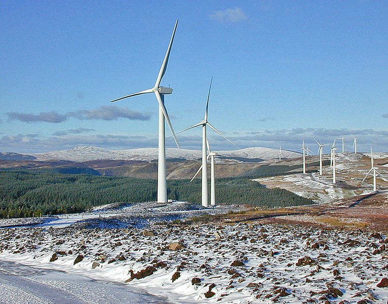
 Energy resource
Energy resource
Energy resource
 *Electrical power
Energy resource
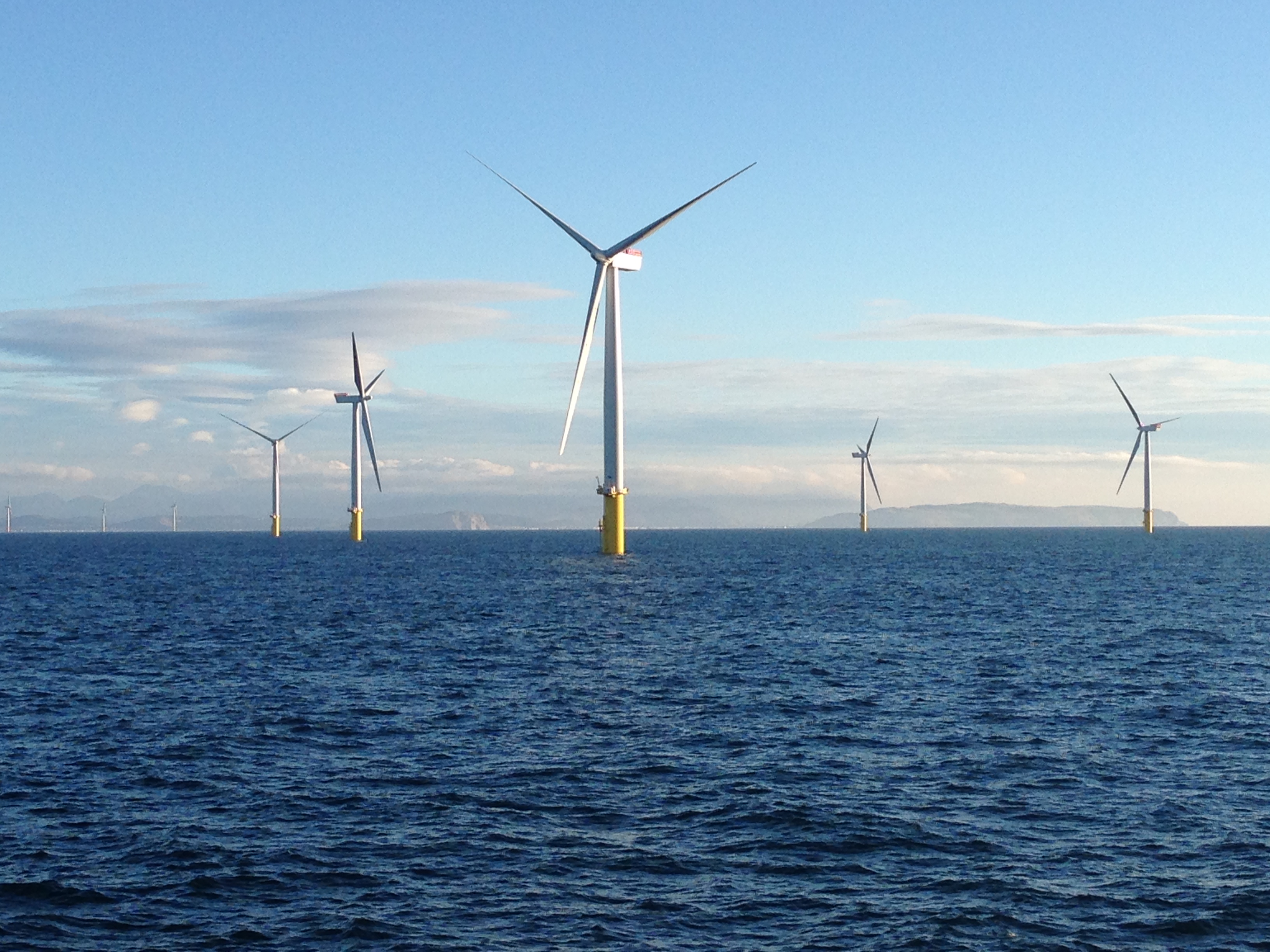
Onshore and offshore wind farms
Erneuerbare Energie
Windenergie
Wales
*Electrical power
Energy resource
Onshore and offshore wind farms
Erneuerbare Energie
Windenergie
Wales
 Energy resource
*Electrical power
Energy resource
Onshore and offshore wind farms
Erneuerbare Energie
Windenergie
Wales
Energy resource
Energy resource
*Electrical power
Energy resource
Onshore and offshore wind farms
Erneuerbare Energie
Windenergie
Wales
 Geography
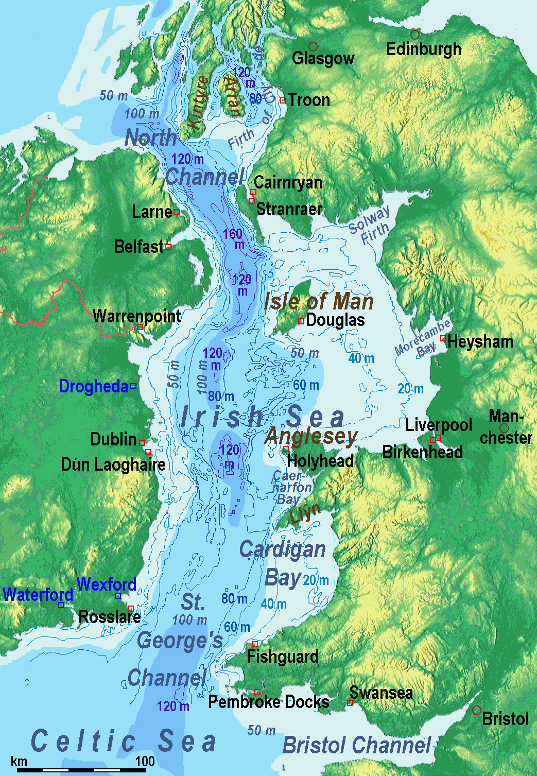
爱尔兰海(英语:Irish Sea、爱尔兰语:Muir Éireann)位于英国不列颠岛和爱尔兰岛之间;它南端的圣乔治海峡处于爱尔兰和威尔士之间,北端的北海海峡处于爱尔兰和苏格兰之间,两者都与大西洋相通。
爱尔兰海面积10万平方公里,平均水深61米,西北部最深处达272米。
不列颠岛和爱尔兰岛之间经爱尔兰海的交通连接包括由斯旺西(Swansea)至科克(Cork)、费什加德(Fishguard)及彭布洛克(Pembroke)至罗斯莱尔(Rosslare)、荷利赫德(Holyhead)至当莱瑞(Dún Laoghaire)、斯特兰拉尔(Stranraer)至贝尔法斯特及拉恩(Larne)、和凯安雷恩(Cairnryan)至拉恩的路线。另外还有利物浦经马恩岛往贝尔法斯特的路线。
 Colleges and Universities in Europe
Nobel prize
University/Institute
Nobel prize
Nobel Prize in Physiology or Medicine
Universities in the UK
Colleges and Universities in Europe
Nobel prize
University/Institute
Nobel prize
Nobel Prize in Physiology or Medicine
Universities in the UK

 Music
Music
 Architecture

Die Insel Großbritannien liegt im Atlantischen Ozean, zwischen der Irischen See und dem Nordatlantik im Westen, der Nordsee im Osten und dem Ärmelkanal im Südosten, an der nordwestlichen Küste des europäischen Kontinents.[2]
Mit einer Fläche von 229.850 km²[1] ist die Hauptinsel die neuntgrößte Insel der Welt[3] sowie die größte Insel Europas und der Britischen Inseln, zu denen unter anderem auch Irland und die Isle of Man gehören. England und Wales bildeten im Altertum die römische Provinz Britannia.
Ein alter Name für die Insel Großbritannien ist „Albion“. Dieser Name, von Alfred Holder (Alt-Keltischer Sprachschatz, 1896) als „Weißland“ übersetzt, könnte sich auf die weißen Kreideklippen von Dover beziehen, die man bei klarer Sicht bereits vom europäischen Festland aus über die engste Stelle des Ärmelkanals hinweg sehen kann (Straße von Dover). Ein historischer Name im Gälischen für Schottland ist Alba.
Politisch ist Großbritannien seit dem Act of Union 1707 eine Einheit, die aus den Staaten England, Wales (seit 1542 englisch) und Schottland gebildet wurde. Die Hebriden, die Orkney und die Shetlandinseln werden als Teil Schottlands ebenfalls politisch zu Großbritannien gerechnet. Diese Staaten Großbritanniens und schottischen Nebeninseln bilden zusammen mit der Provinz Nordirland das Vereinigte Königreich Großbritannien und Nordirland, das im Deutschen oft ebenfalls Großbritannien genannt wird, auch wenn es vom Staatsgebiet wesentlich größer als die geographische Insel Großbritannien ist.
Die direkt der britischen Krone unterstehenden Kanalinseln und die Isle of Man sind kein Teil des Vereinigten Königreichs Großbritannien und Nordirland;[4] die Isle of Man und auch ganz Irland gehören jedoch geographisch zu den Britischen Inseln, die Kanalinseln dagegen nicht.
大不列颠岛(英语:Great Britain;苏格兰盖尔语:Breatainn Mhòr;威尔士语:Prydain Fawr;康瓦尔语:Breten Veur)是一个位于欧洲西北部的岛屿[1],面积209,331平方千米(80,823平方英里),是全世界第九大岛屿,也是不列颠群岛最大的岛屿。2008年中统计人口共5,960万[2],在各岛屿中排名第三,仅次于印尼的爪哇岛和日本的本州岛。
整个岛屿都是属于英国统治,并且联合王国的大部分领土都在大不列颠岛,所以“大不列颠”有时被用来指代整个联合王国。英格兰、苏格兰和威尔士以及它们的首府伦敦、爱丁堡及加的夫都在岛上。
安妮女王时期的1707年5月1日,英格兰王国和苏格兰王国合并组成了大不列颠王国,直到1801年大不列颠王国又和爱尔兰王国合并为大不列颠及爱尔兰联合王国。1922年爱尔兰自由邦从中独立,王国又变成了大不列颠及北爱尔兰联合王国,即是现在的英国。