漢德百科全書 | 汉德百科全书
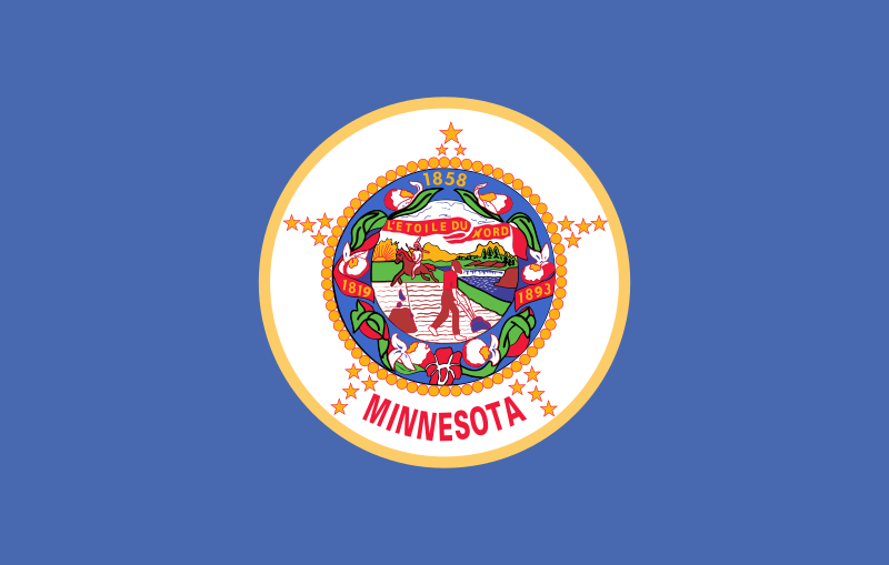
 Minnesota-MN

美国合众银行(U.S. Bancorp),商业名全美银行[4](U.S. Bank),或直译为合众银行,是一家美国银行控股公司,总部位于明尼苏达州明尼阿波利斯,并在特拉华州注册成立[5]。它是合众银行全国协会(U.S. Bank National Association)的母公司、美国第五大银行[6],有三千多家分行,主要分布于美国西部和中西部。被金融稳定委员会评定为系统重要性金融机构。
U.S. Bancorp ist ein Finanzunternehmen aus den Vereinigten Staaten mit Firmensitz in Minneapolis, Minnesota. Das Unternehmen ist im Aktienindex S&P 500 gelistet und ist die fünftgrößte Bank in den Vereinigten Staaten. Die Gesamtsumme der Einlagen liegt bei $341 Milliarden.
*United States Political System
 California-CA
Federal Reserve System,Fed
California-CA
Federal Reserve System,Fed
 Financial
 *United States economic data
Financial
*Brazil economic data
Financial
*China economic data
Financial
*Germany economic data
Financial
*European Union economic data
Financial
*France economic data
Financial
*India economic data
Financial
*Indonesia economic data
Financial
*Italy economic data
Financial
*Japan economic data
Financial
*Canada economic data
Financial
*Russia economic data
Financial
*United Kingdom economic data
*United States economic data
Financial
*Brazil economic data
Financial
*China economic data
Financial
*Germany economic data
Financial
*European Union economic data
Financial
*France economic data
Financial
*India economic data
Financial
*Indonesia economic data
Financial
*Italy economic data
Financial
*Japan economic data
Financial
*Canada economic data
Financial
*Russia economic data
Financial
*United Kingdom economic data
 Georgia-GA
 Illinois-IL
 Massachusetts-MA
Minnesota-MN
Massachusetts-MA
Minnesota-MN
 Missouri-MO
 New York-NY
 Ohio-OH
 Pennsylvania-PA
 Texas-TX
 Companies
United States
Companies
United States
 Virginia-VA
 Washington, D.C.
 Economy and trade
Economic and political research
Economy and trade
Economic and political research
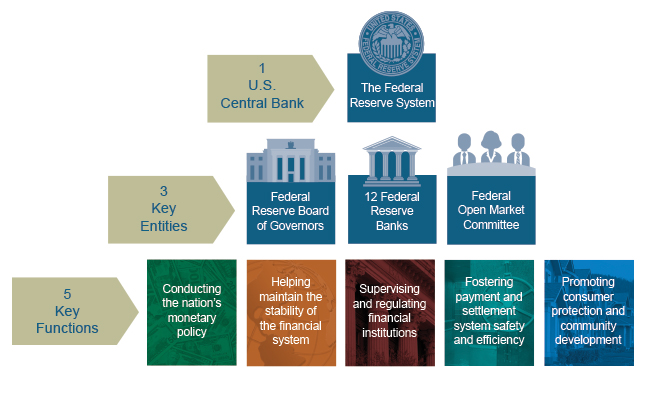


Das Federal Reserve System [ˈfɛdə˞əl rɪˈzɜ˞ːv ˈsɪstəm], oft auch Federal Reserve oder einfach die Fed (als US-Notenbank), ist das Zentralbank-System der Vereinigten Staaten. Es besteht aus dem Board of Governors, zwölf regionalen Federal Reserve Banken, dem Federal Open Market Committee (FOMC), einer Vielzahl von Mitgliedsbanken (Mitgliedspflicht ab einer bestimmten Größe) und anderen Institutionen.
Die Fed berichtet regelmäßig an den Kongress der Vereinigten Staaten über ihre Aktivitäten und ihre Pläne zur Geldpolitik. Das Tagesgeschäft und die operativen Entscheidungen der Fed werden von ihr frei und eigenständig entschieden. Der Kongress hat allerdings die Befugnis, die Gesetze betreffend die Geschäftstätigkeit der Fed zu ändern.[1]
联邦储备系统(英语:Federal Reserve System(Fed),简称美联储)是美国的中央银行体系,依据美国国会通过的1913年《联邦储备法案》而创设,以避免再度发生类似1907年的银行危机。整个系统包括联邦储备委员会、联邦公开市场委员会、联邦储备银行、三千家会员银行、及3个咨询委员会(Advisory Councils)。
連邦準備制度(れんぽうじゅんびせいど、英語: Federal Reserve System, FRS)は、アメリカ合衆国の中央銀行制度である。ワシントンD.C.にある連邦準備制度理事会(Federal Reserve Board, FRB)が全国の主要都市に散在する連邦準備銀行(Federal Reserve Bank, FRB)を統括する。連邦準備制度理事会は連邦議会の下にある政府機関であるが、予算の割当や人事の干渉を受けない。各連邦準備銀行は株式を発行する法人(body corporate)である。
The Federal Reserve System (also known as the Federal Reserve or simply the Fed) is the central banking system of the United States of America. It was created on December 23, 1913, with the enactment of the Federal Reserve Act, after a series of financial panics (particularly the panic of 1907) led to the desire for central control of the monetary system in order to alleviate financial crises.[list 1] Over the years, events such as the Great Depression in the 1930s and the Great Recession during the 2000s have led to the expansion of the roles and responsibilities of the Federal Reserve System.[5][10][11]
The U.S. Congress established three key objectives for monetary policy in the Federal Reserve Act: maximizing employment, stabilizing prices, and moderating long-term interest rates.[12] The first two objectives are sometimes referred to as the Federal Reserve's dual mandate.[13] Its duties have expanded over the years, and currently also include supervising and regulating banks, maintaining the stability of the financial system, and providing financial services to depository institutions, the U.S. government, and foreign official institutions.[14] The Fed also conducts research into the economy and provides numerous publications, such as the Beige Book and the FRED database.
The Federal Reserve System is composed of several layers. It is governed by the presidentially appointed board of governors or Federal Reserve Board (FRB). Twelve regional Federal Reserve Banks, located in cities throughout the nation, regulate and oversee privately owned commercial banks.[15][16][17] Nationally chartered commercial banks are required to hold stock in, and can elect some of the board members of, the Federal Reserve Bank of their region. The Federal Open Market Committee (FOMC) sets monetary policy. It consists of all seven members of the board of governors and the twelve regional Federal Reserve Bank presidents, though only five bank presidents vote at a time (the president of the New York Fed and four others who rotate through one-year voting terms). There are also various advisory councils. Thus, the Federal Reserve System has both public and private components.[list 2] It has a structure unique among central banks, and is also unusual in that the United States Department of the Treasury, an entity outside of the central bank, prints the currency used.[22]
The federal government sets the salaries of the board's seven governors, and it receives all the system's annual profits, after a statutory dividend of 6% on member banks' capital investment is paid, and an account surplus is maintained. In 2015, the Federal Reserve earned a net income of $100.2 billion and transferred $97.7 billion to the U.S. Treasury.[23] Although an instrument of the US Government, the Federal Reserve System considers itself "an independent central bank because its monetary policy decisions do not have to be approved by the President or anyone else in the executive or legislative branches of government, it does not receive funding appropriated by Congress, and the terms of the members of the board of governors span multiple presidential and congressional terms."[24]
La Réserve fédérale (officiellement Federal Reserve System, souvent raccourci en Federal Reserve ou Fed) est la banque centrale des États-Unis. Elle est créée en décembre 1913, durant les fêtes, par le Federal Reserve Act dit aussi Owen-Glass Act, à la suite de plusieurs crises bancaires, dont la panique bancaire américaine de 1907. Son rôle évolue depuis et elle renforce son indépendance lors de l'instabilité monétaire des années 1975 et 1985.
Le Congrès des États-Unis définit trois objectifs de politique monétaire dans le Federal Reserve Act : plein emploi, stabilité des prix, et taux d'intérêt à long terme modérés1. Les deux premiers sont souvent appelés le « double objectif » ou « double mandat » de la Fed2. Outre la politique monétaire, la Fed est maintenant chargée de superviser et réguler le système bancaire, de maintenir la stabilité du système financier, et d'offrir des prestations financières aux organismes de dépôt, au gouvernement fédéral, et aux institutions financières étrangères3. Elle étudie de surcroît l'économie américaine, et publie de nombreux rapports, tels que le livre beige, un résumé des conditions économiques dans chaque région.
La Réserve fédérale se compose d'un conseil des gouverneurs (dont Jerome Powell est le président depuis 2018), du Federal Open Market Committee (FOMC), de douze banques régionales (Federal Reserve Banks), des banques membres, et de plusieurs conseils consultatifs4,5. Le FOMC est le comité responsable de la politique monétaire ; il se compose des sept membres du bureau des gouverneurs et des douze présidents des banques régionales (dont cinq seulement ont le droit de vote à un moment donné). La Réserve fédérale comporte ainsi des aspects publics et privés : cette structure est unique au monde pour une banque centrale, et correspond à une volonté de répondre à la fois à l'intérêt public et à ceux, privés, des banques membres. Une autre particularité du système monétaire américain est que ce n'est pas la banque centrale mais le département du Trésor qui crée la monnaie fiduciaire6.
La Fed est une banque centrale indépendante : ses décisions ne sont pas sujettes à l'autorisation du président des États-Unis ou d'une autre partie du gouvernement fédéral, elle ne reçoit pas de budget du Congrès, et les mandats des gouverneurs sont beaucoup plus longs que ceux des élus fédéraux. Le gouvernement peut cependant exercer un contrôle : l'autorité de la Fed est définie par le Congrès et celui-ci peut exercer son droit de surveillance (congressional oversight). Les membres du bureau des gouverneurs, y compris le président et le vice-président, sont nommés par le président des États-Unis et confirmés par le Sénat. Le gouvernement nomme également les hauts fonctionnaires de la banque et fixe leur salaire. Toutes les banques commerciales autorisées à exercer en dehors d'un seul État sont obligatoirement membres de la Réserve fédérale régionale où se trouve leur siège et détiennent des parts dans celle-ci, ce qui autorise ces banques à élire une partie des membres du bureau de chaque Réserve fédérale régionale. Le gouvernement fédéral reçoit tous les profits de la Fed, hormis un dividende de 6 % versé aux banques membres.
Il Federal Reserve System, conosciuto anche come Federal Reserve (it. Riserva federale) ed informalmente come la Fed, è la banca centrale degli Stati Uniti d'America.
El Sistema de la Reserva Federal (en inglés, Federal Reserve System, también conocido como Reserva Federal o informalmente Fed) es el banco central de los Estados Unidos.1 Es un consorcio publico-privado que controla la estructura organizativa en la cual participa una agencia gubernamental, conocida como Junta de Gobernadores, con sede en Washington D. C.2 Así, algunos consideran esto como el aspecto público del sistema, y los 12 Bancos de la Reserva de todo el país el aspecto privado.3 Está encargada de custodiar parte de las reservas de los "bancos miembros" estadounidenses: los federales, y los estatales asociados voluntariamente.4
La Junta de Gobernadores del Sistema de la Reserva Federal es una agencia gubernamental independiente, sin embargo está sujeta a la Ley de Libertad de Información (Freedom of Information Act). Como muchas de las agencias independientes, sus decisiones no tienen que ser aprobadas por el Presidente o por alguna persona del poder ejecutivo o legislativo: son decisiones de carácter unilateral. La Junta de Gobernadores no recibe dinero del Congreso, y su mandato tiene una duración que abarca varias legislaturas. Una vez que el presidente designa a un miembro de la junta, este actúa con "independencia", aunque puede ser destituido por el presidente según lo establecido en la sección 242, Título 12, del Código de Estados Unidos.5
El Sistema de la Reserva Federal fue creado el 23 de diciembre de 1913 por la Ley de la Reserva Federal (Federal Reserve Act). Todos los bancos nacionales tuvieron que unirse al sistema. Los billetes de la Reserva Federal (Federal Reserve Notes) fueron creados para tener una oferta monetaria "flexible".6
Федера́льная резе́рвная систе́ма (Federal Reserve System, ФРС, Федеральный резерв, FED) — специально созданное 23 декабря 1913 года независимое федеральное агентство для выполнения функций центрального банка и осуществления централизованного контроля над коммерческой банковской системой Соединённых Штатов Америки. В ФРС входят 12 федеральных резервных банков, расположенных в крупнейших городах, около трёх тысяч коммерческих так называемых банков-членов, назначаемый президентом Совет управляющих, Федеральный комитет по операциям на открытом рынке и консультационные советы. Основанием для создания является Закон о Федеральном резерве. В управлении ФРС определяющую роль играет государство, хотя форма собственности капитала является частной — акционерная с особым статусом акций.
С точки зрения управления, ФРС является независимым органом в правительстве США. Как национальный центральный банк, ФРС получает полномочия от Конгресса США. Независимость в работе обеспечивается тем, что принимаемые решения о кредитно-денежной политике не должны быть одобрены президентом США или кем-либо иным из исполнительной или законодательной ветвей власти. ФРС не получает финансирование от Конгресса. Срок полномочий членов Совета управляющих Федеральной резервной системы охватывает несколько сроков президентских полномочий и членов Конгресса. В то же время ФРС подконтрольна Конгрессу, который часто анализирует деятельность ФРС и может изменить обязанности ФРС законодательным образом[1].
С 2006 по 2014 год пост председателя совета управляющих ФРС занимал Бен Бернанке. В феврале 2014 года его сменила Джанет Йеллен, которая в течение двух лет работала его заместителем[2]. С 5 февраля 2018 года главой Федеральной резервной системы является Джером Пауэлл.
 Geography
Illinois-IL
Geography
Illinois-IL
 Indiana-IN
 Michigan-MI
Minnesota-MN
Missouri-MO
Michigan-MI
Minnesota-MN
Missouri-MO
 Nebraska-NE
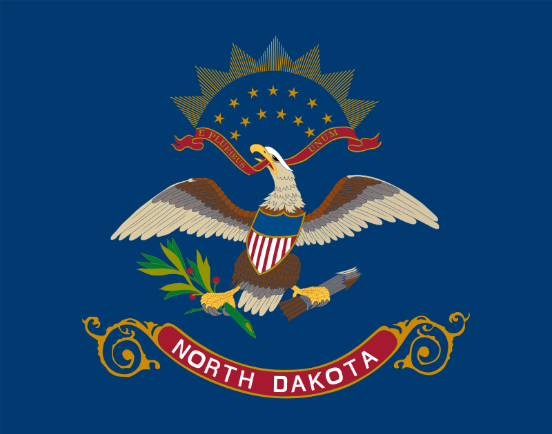 North Dakota-ND
Ohio-OH
North Dakota-ND
Ohio-OH
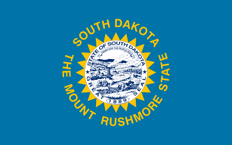 South Dakota-SD
 Wisconsin-WI

Der Mittlere Westen (englisch the Midwest) ist eine Region der Vereinigten Staaten. Der Name entstand im 19. Jahrhundert aus dem Bedürfnis, sich von der Ostküste abzugrenzen, daher „Westen“ – aber eben nicht so weit im Westen wie die damalige Frontier (Wilder Westen).
美国中西部(英语:Midwest)通常指的是美国地理上中北部的州,包括俄亥俄州、印第安纳州、密歇根州、伊利诺伊州、威斯康星州、艾奥瓦州、堪萨斯州、密苏里州、明尼苏达州、内布拉斯加州、北达科他州及南达科他州。美国地理中心(位于肯萨斯州)及人口中心(位于密苏里州)都位居中西部。美国人口调查局将这个区域再细分为中北部东方(基本上指的是五大湖地区)及中北部西方(基本上指的是大平原区)。
 Arkansas-AR
 Iowa-IA
 Kentucky-KY
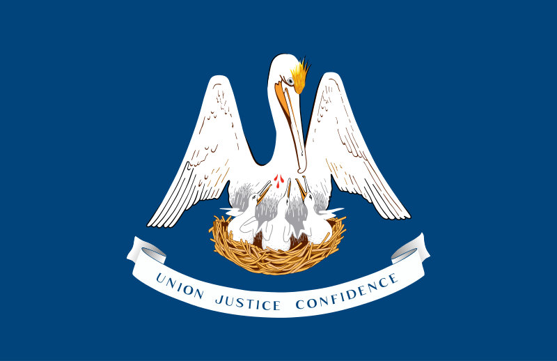 Louisiana-LA
Minnesota-MN
Mississippi River
Louisiana-LA
Minnesota-MN
Mississippi River
 Mississippi-MS
Missouri-MO
Mississippi-MS
Missouri-MO
 Tennessee-TN
United States
Wisconsin-WI
Tennessee-TN
United States
Wisconsin-WI

Der Mississippi[2] [ˌmɪsɪˈsɪpɪ] (engl.: Mississippi River[3]) ist ein 3778 Kilometer langer Strom in den Vereinigten Staaten. Er entspringt dem Lake Itasca im nördlichen Minnesota und mündet rund 160 Kilometer südlich von New Orleans in den Golf von Mexiko.
Der größte Nebenfluss Missouri ist bis zur Mündung in den Mississippi deutlich länger als der Mississippi. Missouri und Unterlauf des Mississippis bilden als Mississippi-Missouri mit 6051 Kilometern Länge das viertlängste Flusssystem der Erde.
Auf seinem Weg durchquert der Mississippi nahezu das gesamte Staatsgebiet der USA von Nord nach Süd und fließt durch acht US-Bundesstaaten: Minnesota, Illinois, Missouri, Kentucky, Arkansas, Tennessee, Mississippi, Louisiana und bildet die Grenze von Wisconsin und Iowa. Bei St. Louis vereinigt er sich mit dem Missouri sowie dem Meramec und bei Cairo, Illinois, mit dem Ohio. Bis auf das Gebiet um die Großen Seen entwässert der Fluss das gesamte Gebiet zwischen den Rocky Mountains im Westen und den Appalachen im Osten. Das Delta bei New Orleans bildet eines der größten Mündungsgebiete weltweit.
密西西比河[4](英语:Mississippi River),位于北美洲中南部,是北美最大的水系[5][6],流域面积约为300万平方千米[7]。它也是北美最长的河流,源头在美国明尼苏达州西北部海拔446米的艾塔斯卡湖(Lake Itasca),流经中央大平原,向南注入墨西哥湾。最长支流密苏里河的源头雷德罗克湖,全长3767千米[7]。如果按照密西西比河的支流——密苏里河的源头计算,则全长为6021千米,居世界河流的第4位[7],其集水范围可以作为美国中西部的分界。
密西西比河的名称源自于美国北部威斯康辛州的印第安阿尔贡金人,因为它支流众多,美国人又尊称为“老人河”,与尼罗河、亚马逊河和长江合称世界四大长河,是北美大陆流域面积最广的水系,两岸多湖泊和沼泽。河流年均输沙量4.95亿吨。流域属世界三大黑土区之一。
ミシシッピ川(ミシシッピがわ、Mississippi River)は、北アメリカ大陸を流れる河川の1つである。アメリカ合衆国のミネソタ州を源流とし、メキシコ湾へと注いでいる。全長は3779kmで、アメリカ合衆国で2番目に長い川である[2]。
高低差が少なく流れが緩やかなため大型船舶の通行や水運に適し、開拓時代から重要な交通路であり、現代においてもアメリカ中央部における輸送の大幹線となっている。
主な支流にはモンタナ州を源流とするミズーリ川(アメリカ合衆国最長)やペンシルベニア州を源流とするオハイオ川などがある。ミズーリ川源流からミシシッピ川河口までの長さは5,971kmで、北アメリカ最大の水系をなす。ミズーリ川は治水のために多くのダムが建設されてダム湖により多くの蛇行がなくなり、500km以上も川の長さは短くなっている。その分ミシシッピ川全体の長さも短くなった。本流の全流路が構造平野であるアメリカの中央平原を流れており、そのため流路の勾配が緩い。水源のイタスカ湖に降った雨が河口に達するまで約90日を要する。
「ミシシッピ」の名は、オジブワ族インディアンの言語で「偉大な川」を意味するmisi-ziibiまたは「大きな川」を意味するgichi-ziibiからの転訛である。オハイオ川との合流地点より北を上ミシシッピ、それより南の河口までを下ミシシッピと称している。かつては川に沿った地域はフランス領であったため、セントポールからニューオーリンズまでフランス人の築いた町が多く存在する。
周辺の気候は、ミズーリ州中央部以北は冷帯湿潤気候、それ以南は温暖湿潤気候となっている[3]。
The Mississippi River is the second-longest river and chief river of the second-largest drainage system on the North American continent, second only to the Hudson Bay drainage system.[14][15] From its traditional source of Lake Itasca in northern Minnesota, it flows generally south for 2,320 miles (3,730 km)[15] to the Mississippi River Delta in the Gulf of Mexico. With its many tributaries, the Mississippi's watershed drains all or parts of 32 U.S. states and two Canadian provinces between the Rocky and Appalachian mountains.[16] The main stem is entirely within the United States; the total drainage basin is 1,151,000 sq mi (2,980,000 km2), of which only about one percent is in Canada. The Mississippi ranks as the fourth-longest river and fifteenth-largest river by discharge in the world. The river either borders or passes through the states of Minnesota, Wisconsin, Iowa, Illinois, Missouri, Kentucky, Tennessee, Arkansas, Mississippi, and Louisiana.[17][18]
Native Americans have lived along the Mississippi River and its tributaries for thousands of years. Most were hunter-gatherers, but some, such as the Mound Builders, formed prolific agricultural societies. The arrival of Europeans in the 16th century changed the native way of life as first explorers, then settlers, ventured into the basin in increasing numbers.[19] The river served first as a barrier, forming borders for New Spain, New France, and the early United States, and then as a vital transportation artery and communications link. In the 19th century, during the height of the ideology of manifest destiny, the Mississippi and several western tributaries, most notably the Missouri, formed pathways for the western expansion of the United States.
Formed from thick layers of the river's silt deposits, the Mississippi embayment is one of the most fertile regions of the United States; steamboats were widely used in the 19th and early 20th centuries to ship agricultural and industrial goods. During the American Civil War, the Mississippi's capture by Union forces marked a turning point towards victory, due to the river's strategic importance to the Confederate war effort. Because of substantial growth of cities and the larger ships and barges that replaced steamboats, the first decades of the 20th century saw the construction of massive engineering works such as levees, locks and dams, often built in combination. A major focus of this work has been to prevent the lower Mississippi from shifting into the channel of the Atchafalaya River and bypassing New Orleans.
Since the 20th century, the Mississippi River has also experienced major pollution and environmental problems – most notably elevated nutrient and chemical levels from agricultural runoff, the primary contributor to the Gulf of Mexico dead zone.
Le Mississippi (Mississippi River en anglais) est un fleuve situé en Amérique du Nord traversant la partie centrale des États-Unis. Il coule du nord du Minnesota au golfe du Mexique et son cours a une orientation méridienne. Le Mississippi a une longueur de 3 780 km : seul l'un de ses affluents, le Missouri, est plus long en Amérique du Nord. La longueur cumulée de ces deux cours d'eau, qui dépasse les 6 800 km, et la superficie du bassin versant font du Mississippi l'un des fleuves les plus importants du monde et du Missouri-Mississippi l'un des bassins fluviaux les plus grands du monde4,1,5. Pendant l'époque précolombienne, le Mississippi constitue déjà une voie de navigation dont le cours supérieur est appelé par les Ojibwés misi-ziibi, qui signifie « grand fleuve »6, repris en 1666 en français sous la forme Messipi. Supervisé par la Mississippi Valley Division et une commission fédérale créée en 1879, le fleuve reste encore aujourd'hui un élément fondamental de l'économie et de la culture américaine.
Il Mississippi (AFI: /missisˈsippi/[4]) è un fiume dell'America settentrionale.
Il fiume nasce in Minnesota, poco ad ovest del Lago Superiore, in un territorio costituito da una serie di alture moreniche, intervallate da alcuni piccoli laghi. Da uno di questi, il Lago Itasca, prende il via il corso del fiume, che nel suo primo tratto è talora incassato tra i cordoni morenici e spesso presenta rapide e cascate. Il fiume ben presto raggiunge i 220 m s.l.m. dopo le cascate di St Anthony (24 m) vicino a Minneapolis. Riceve da sinistra le acque dei fiumi Wisconsin ed Illinois e giunto a Saint Louis riceve da destra il Missouri. Presso Cairo riceve da sinistra l'Ohio, proseguendo verso sud il fiume riceve da destra l'apporto di altri due importanti affluenti, il fiume Arkansas ed il fiume Red River. Giunge quindi a New Orleans dove sfocia nel Golfo del Messico formando un ampio delta.
Si può dividere il corso del fiume in due sezioni: la parte superiore del Mississippi, dalla sorgente alla confluenza con l'Ohio, e la parte inferiore, dalla confluenza con il fiume Ohio alla foce. Il fiume descrive numerosi meandri, soprattutto tra Memphis e il delta. È questa la regione della grande pianura alluvionale del Mississippi, con una coltre di sedimenti che va via via sempre più aumentando nel tempo, sopra i terrazzi fluviali, obbligando le acque del fiume a straripare, specialmente nei periodi delle piene primaverili. Le periodiche inondazioni che si verificano nel basso corso, dove appunto il fiume è pensile, lasciano ai lati delle sponde zone permanentemente umide e acquitrinose (cypress swamps). Il fiume avanza lento, formando ora sinuosi meandri, ora abbandonando vecchi bracci o intagliando isolotti sabbiosi, o addirittura formando distinti rami laterali (bayous).
El Misisipi o Misisipí1 es un largo río del centro de Estados Unidos que fluye en dirección sur a través de diez estados —Minesota, Wisconsin, Iowa, Misuri, Illinois, Kentucky, Tennessee, Arkansas, Misisipi y Luisiana— hasta desaguar en el golfo de México (océano Atlántico), cerca de Nueva Orleans. Tiene una longitud de 3734 km, pero si se considera el sistema Misisipi-Misuri alcanza los 6275 km, que lo sitúan como el cuarto más largo del mundo, tras los ríos Amazonas, Nilo y Yangtsé.23
Drena una cuenca de 3 238 000 km², la cuarta más extensa del mundo, por detrás de las del Amazonas (6 145 000 km²), Congo (3 700 000 km²) y Nilo (3 255 000 km²).
Durante la época precolombina ya constituía una importante vía de navegación y los amerindios lo llamaban «Meschacebé»4 que significa «padre de las aguas». Hoy en día, constituye un elemento fundamental de la economía y de la cultura estadounidense.
El 11 de septiembre de 1997 el presidente Bill Clinton designó dos secciones de este río, el Alto y Bajo Misisipí, como uno de los catorce ríos que integran el sistema de ríos del patrimonio estadounidense.
Миссисипи (англ. Mississippi, МФА: [ˌmɪsəˈsɪpi]; на языке оджибве misi-ziibi или gichi-ziibi — «большая река») — река в США, одна из величайших[прояснить] рек мира. Миссисипи — главная река крупнейшей речной системы в Северной Америке[1][2]. Протекает исключительно на территории Соединённых Штатов Америки, хотя её бассейн распространяется и на Канаду.
Истоком Миссисипи считается либо ручей Николетт-Крик[3], либо озеро Айтаска[4], в которое он впадает. Исток расположен в штате Миннесота на высоте примерно 530 м над уровнем моря. Река в основном течёт в южном направлении и достигает длины в 3770[2] километров[5][6], заканчиваясь обширной дельтой в Мексиканском заливе. Сама река протекает по территории 10 штатов, а её бассейн охватывает 31 штат от Скалистых гор до горной системы Аппалачи. Миссисипи занимает тринадцатую позицию в списке длиннейших рек мира, а речная система Миссисипи-Миссури — третью, и девятую — в списке по полноводности. Миссисипи является частью границ или же пересекает штаты Миннесота, Висконсин, Айова, Иллинойс, Миссури, Кентукки, Теннесси, Арканзас, Миссисипи и Луизиана.
Индейцы жили на берегах Миссисипи и её притоков с древнейших времён. Большинство из них были охотниками и собирателями, но некоторые, такие как строители курганов, образовывали развитые сельскохозяйственные общины. Прибытие европейцев в 1500-х годах навсегда изменило исконный образ жизни аборигенов. Первоначально река выступала в роли барьера, формируя границы Новой Испании и Новой Франции, а также ранних Соединённых Штатов, а затем став важной транспортной артерией и средством сообщения. В XIX веке, во время апофеоза идеи Явного предначертания, Миссисипи и некоторые западные её притоки, главным образом Миссури, послужили путями западной экспансии Соединённых Штатов.
Покрытая толстым слоем иловых отложений, долина реки является одним из плодороднейших регионов США, что послужило развитию легендарной эры пароходов на Миссисипи. Во время Гражданской войны захват Миссисипи силами Союза послужил поворотной точкой в противостоянии в силу важности реки как торгового и транспортного пути. По мере устойчивого роста городов и появления на реке больших кораблей и барж, которые вытеснили прежние маломерные суда, с начала XX века начинаются масштабные гидротехнические работы, в результате которых на реке появилось множество дамб, плотин, шлюзов и прочих гидротехнических сооружений.
Современное развитие бассейна Миссисипи привело к ряду экологических проблем, среди которых одной из крупнейших является проблема загрязнения вод реки сельскохозяйственными стоками, что привело к возникновению так называемой «мёртвой зоны»[en] Мексиканского залива. В последние годы отмечено неуклонное смещение Миссисипи к рукаву Атчафалайа в дельте реки, что может привести к катастрофическим последствиям для портов в дельте, таких как Новый Орлеан. Система дренажей и перемычек позволяет сдерживать этот процесс, однако из-за процессов выноса грунта и эрозии смещение год от года становится всё более явным.
 International cities

Minneapolis [ˌmɪnɪˈæpəlɪs] ist mit rund 430.000 Einwohnern die bevölkerungsreichste Stadt im US-Bundesstaat Minnesota. Zusammen mit St. Paul bildet sie die Metropolregion der Twin Cities mit über 3,6 Millionen Einwohnern (Stand 2020).
Der Name der Stadt entstammt einer Wortkombination aus zwei Sprachen, dem Wort der Dakota-Indianer für Wasser („minne“) und dem griechischen Wort für Stadt („polis“).
明尼阿波利斯(英语:Minneapolis)是美国明尼苏达州最大的城市,该州东南部亨内平县的县治[4]。该市位于密西西比河的两岸,明尼苏达河与密西西比河汇流点以北,紧邻明尼苏达州首府圣保罗,两市合称“双子城”,一同构成明尼阿波利斯—圣保罗都会区的核心。该都会区拥有约380万居民,位列美国第14大都市区[1]。在2014年,明尼阿波利斯城市人口估计为407,207人,是美国第46大城市和明尼苏达州最大的城市[5]。
明尼阿波利斯是一个水资源丰富的城市,拥有20处湖泊和湿地、密西西比河河滨,以及众多的溪流与瀑布。
明尼阿波利斯在历史上曾是世界的面粉工业之都和重要的伐木业中心,如今,该市仍然是芝加哥与西雅图之间广阔区域最重要的商业中心。[6]明尼阿波利斯也拥有众多吸引着创作者与观众的文化机构,涉及戏剧、视觉艺术、文学和音乐各个领域,其中著名的格斯里剧院是纽约百老汇以外的地方剧院的先驱。该市还拥有多样化的人口,长期以来形成了通过公共社会改良规划或私人的善举来支持慈善事业的传统。明尼阿波利斯也是公共园林系统的典范,每个家庭到公园的距离都在800米之内。
该市名称“Minneapolis”的命名者是该市第一位学校教师,他将拉科塔语中表示水的词“mni”和希腊语表示城市的词“polis”组合成该市的名称。[7][8]明尼阿波利斯的绰号是“湖城(City of Lakes)”和“面粉城(Mill City)”[6]。
 Transport and traffic

 Art
Art
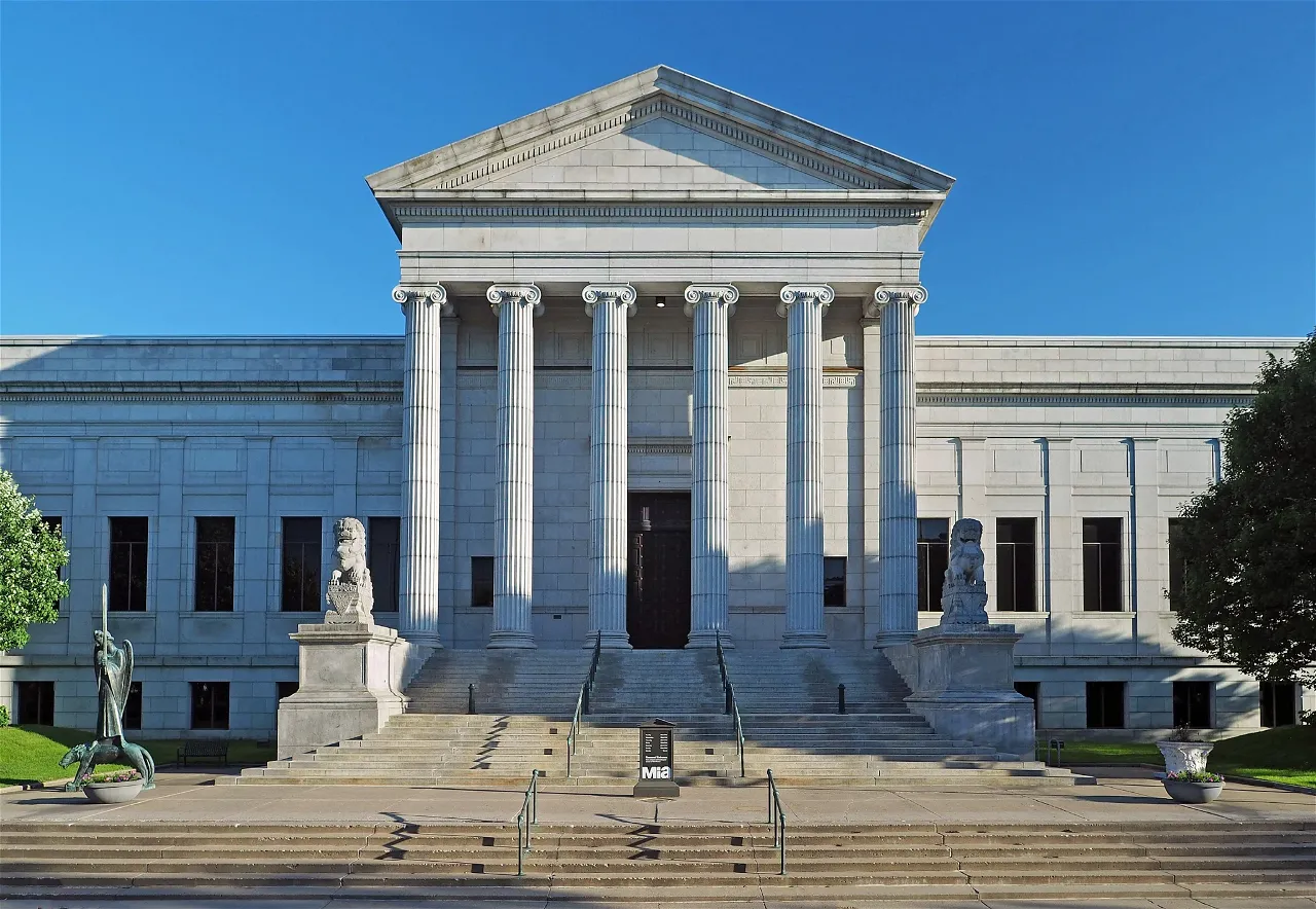
 Museum

 Science and technology
American Public Colleges & Universities
Minnesota-MN
Nobel prize
Nobel Prize in Chemistry
Nobel prize
Nobel Peace Prize
Nobel prize
Nobel Prize in Literature
Nobel prize
Nobel Prize in Physics
Nobel prize
Nobel Prize in Physiology or Medicine
Nobel prize
Nobel Memorial Prize in Economic Sciences
Nobel prize
University/Institute
Public Ivy
Science and technology
American Public Colleges & Universities
Minnesota-MN
Nobel prize
Nobel Prize in Chemistry
Nobel prize
Nobel Peace Prize
Nobel prize
Nobel Prize in Literature
Nobel prize
Nobel Prize in Physics
Nobel prize
Nobel Prize in Physiology or Medicine
Nobel prize
Nobel Memorial Prize in Economic Sciences
Nobel prize
University/Institute
Public Ivy
 Universities in the USA

 Religion

 Sport
Minnesota-MN
National Football Conference NFC
North
National Football League 2015
National Football League 2016
National Football League 2017
National Football League 2018
National Football Conference,NFC
National Football League 2018
NFC North
Sport
Minnesota-MN
National Football Conference NFC
North
National Football League 2015
National Football League 2016
National Football League 2017
National Football League 2018
National Football Conference,NFC
National Football League 2018
NFC North
 *Capitols in the United States
*United States Political System
*Capitols in the United States
*United States Political System
 Architecture
Neo-Renaissance architecture
Architecture
Beaux Art
Minnesota-MN
United States
Architecture
Neo-Renaissance architecture
Architecture
Beaux Art
Minnesota-MN
United States