
Deutsch-Chinesische Enzyklopädie, 德汉百科
 Ski vacation

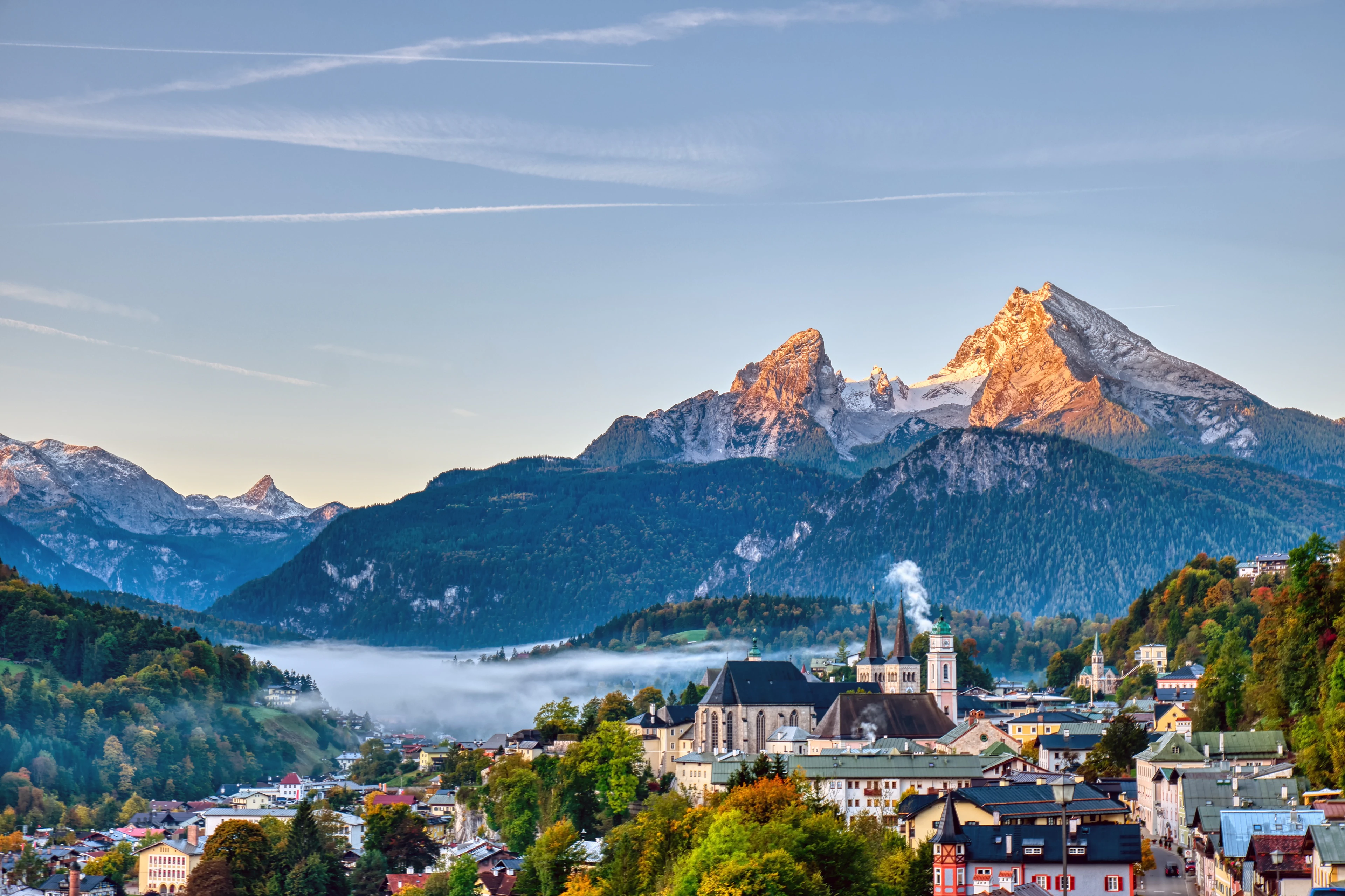
Berchtesgaden ist ein Markt im Landkreis Berchtesgadener Land im äußersten Südosten Oberbayerns. Als Mittelzentrum des südlichen Teiles des Landkreises Berchtesgadener Land gehört es regionalplanerisch zur Planungsregion Südostoberbayern, in der die Kreisstadt Bad Reichenhall gemeinsam mit Freilassing das nächste Oberzentrum bildet; das grenznahe österreichische Salzburg nimmt teilweise oberzentrale Funktionen wahr.
贝希特斯加登(Berchtesgaden)位于德国巴伐利亚州东南部的阿尔卑斯山脚下,距离奥地利萨尔茨堡20千米,人口约8千。贝希特斯加登于1978年建立了国家公园,其中包括湖水清澈翠绿的国王湖和德国的第二高峰瓦茨曼山。贝希特斯加登也以希特勒的“鹰巢”而闻名。




 Geography

 Geography
 *World's Most Livable Cities

 International cities

 International cities
 North American city
 Canada
 Winter Olympics

卡尔加里(Calgary,发音: /ˈkælɡəri/,当地华人及港澳台均译为卡加利,又译卡加立[1]、卡技利,简称卡城)是一座位于加拿大阿尔伯塔省南部洛矶山脉的城市,亦是该省的最大城市。该市面积789.9平方公里,海拔约1048米。
地理位置上,卡尔加里是位于加拿大第三大城市温哥华以东和第一大城市多伦多以西之间最大的城市,根据2016年的人口普查,市内人口有1239000人,较2006年的人口988,812人增长了10.9%[2]。卡尔加里是阿尔伯塔省的经济、金融和文化中心。卡尔加里的工程师密度是全加第一。多次被评为“世界上最干净的城市”[3]。1988年第15届冬奥会在这里举行。2009年第40届国际技能竞赛在这里举行。
カルガリー(英語: Calgary [ˈkælɡri] (![]() 音声ファイル))は、カナダ西部のアルバータ州にある都市である。周辺を含めた都市圏人口は140万人で同州最大の都市。アルバータ州の南部、カナディアンロッキー山麓から東におよそ80kmの高原地帯に位置する。
音声ファイル))は、カナダ西部のアルバータ州にある都市である。周辺を含めた都市圏人口は140万人で同州最大の都市。アルバータ州の南部、カナディアンロッキー山麓から東におよそ80kmの高原地帯に位置する。
カルガリーからエドモントンを結ぶ地域は人口密度が高くカルガリー・エドモントン街道と呼ぶ。都市の近郊にあるいくつものマウンテン・リゾートを含め、ウィンタースポーツとエコツーリズムが盛んな場所として知られる。代表的な年間行事にカルガリー・スタンピード、フォーク・ミュージック・フェスティバル、ライラック・フェスティバル、グローバルフェスト、カリブ系の祭りとしては国内で2番目の規模を持つカリフェストなどが開催される。
カルガリー・スタンピードで有名であることから「スタンピード・シティ」(The Stampede City)の愛称をもつ。アルバータ牛でも知られ、牛の街「カウタウン」(Cowtown)とも呼ばれる。
Calgary (/ˈkælɡri/ (![]() listen)) is a city in the western Canadian province of Alberta. It is situated at the confluence of the Bow River and the Elbow River in the south of the province, in an area of foothills and prairie, about 80 km (50 mi) east of the front ranges of the Canadian Rockies, roughly 299 km (186 mi) south of the provincial capital of Edmonton and approximately 240 km (150 mi) north of the Canada–United States border. The city anchors the south end of the Statistics Canada-defined urban area, the Calgary–Edmonton Corridor.[14]
listen)) is a city in the western Canadian province of Alberta. It is situated at the confluence of the Bow River and the Elbow River in the south of the province, in an area of foothills and prairie, about 80 km (50 mi) east of the front ranges of the Canadian Rockies, roughly 299 km (186 mi) south of the provincial capital of Edmonton and approximately 240 km (150 mi) north of the Canada–United States border. The city anchors the south end of the Statistics Canada-defined urban area, the Calgary–Edmonton Corridor.[14]
The city had a population of 1,285,711 in 2019, making it Alberta's largest city. It is the third-largest municipality in Canada (after Toronto and Montreal), and the largest in western Canada. Also in 2016, Calgary had a metropolitan population of 1,392,609, making it the fourth-largest census metropolitan area (CMA) in Canada and second-largest in western Canada (after Vancouver).
Calgary's economy includes activity in the energy, financial services, film and television, transportation and logistics, technology, manufacturing, aerospace, health and wellness, retail, and tourism sectors.[15] The Calgary CMA is home to Canada's second-highest number of corporate head offices among the country's 800 largest corporations.[16] In 2015 Calgary had the highest number of millionaires per capita of any major Canadian city.[17] In 1988 it became the first Canadian city to host the Winter Olympic Games.
The Economist Intelligence Unit ranked Calgary the most livable city in North America in both 2018 and 2019. Calgary has been a top 5 contender for this title for the last 10 years.[18] Calgary was also ranked the best city in the world for drivers in 2019.[19]
Calgary (prononcé : /ˈkæl.ɡə.ɹi/ écouter en anglais canadien et /kal.ɡa.ʁe/ en français canadien) est la plus grande ville de la province canadienne de l'Alberta. Elle est située dans le sud de la province, dans une région de collines et de plateaux à environ 45 km à l'est-sud-est des montagnes Rocheuses. Elle se trouve à 281 km au sud d'Edmonton, à 669 km à l'ouest de Regina, à 673 km à l'est-nord-est de Vancouver et à 2 708 km à l'ouest-nord-ouest de Toronto.Troisième ville du Canada par le nombre d'habitants, elle comptait, selon le recensement de 2014, 1 195 1942 habitants (1 406 7003 avec son agglomération en 2014, ce qui la place au quatrième rang des agglomérations canadiennes). Sa région économique compte quant à elle 1 511 800 habitants, ce qui en fait la première d'Alberta devant Edmonton4. Le « corridor Calgary-Edmonton » est la région urbaine la plus peuplée entre Toronto et Vancouver. Elle tire son nom d'une plage située sur l'île de Mull en Écosse. Les habitants de Calgary sont appelés « Calgariens ».
La ville de Calgary est une destination bien connue pour les sports d'hiver et l'écotourisme ; un grand nombre de stations de vacances importantes se situent près de la ville. L'économie de Calgary est surtout centrée sur l'industrie pétrolière ; toutefois, l'agriculture, le tourisme et la haute technologie contribuent également au développement économique rapide de la ville. Calgary est également l'hôte de plusieurs festivals annuels majeurs, dont le Stampede de Calgary, le Folk Music Festival, le Lilac Festival, le GlobalFest et le deuxième festival de culture des Caraïbes en importance du pays (Carifest). En 1988, Calgary devint la première ville canadienne à accueillir les Jeux olympiques d'hiver.
Calgary è la città più grande della provincia canadese dell'Alberta. Sorge nel settore meridionale della provincia, in una regione in cui si alternano colline e altopiani a un'ottantina di chilometri a oriente delle Montagne Rocciose. Terza città del Canada in termini di popolazione municipale, contava, secondo il censimento del 2016, più di 1 239 220 abitanti. Considerandone invece l'agglomerato urbano, essa giunge a quota 1 079 310 abitanti, configurandosi così come la quinta area urbana del paese. Calgary è il polo principale del corridoio urbano dell'Alberta e intrattiene stretti legami con la capitale Edmonton. Il sistema creato dalle due città e dalle rispettive aree metropolitane rappresenta l'apice di antropizzazione delle Praterie canadesi, costituendo la regione più popolata tra Toronto e Vancouver.
Gli elementi che rendono celebre questa città sono l'ecoturismo e gli sport invernali e nei dintorni sorgono un gran numero di stazioni di villeggiatura. A conferma di tale vocazione la città fu la prima in Canada ad essere designata come sede dei giochi olimpici invernali, nella loro quindicesima edizione del 1988.
Altra peculiarità di Calgary è la sua specializzazione nell'industria petrolifera, su cui si regge l'economia cittadina, non a caso la più prospera del paese. L'universo produttivo della città più ricca del Canada è completato da un settore agricolo particolarmente redditizio e dalla recente installazione di industrie d'alta tecnologia. Simbolo della città riconosciuto a livello internazionale è la Calgary Tower.
Calgary ![]() /ˈkælg(ə)ɹɪ/ (?·i) es la mayor ciudad de la provincia de Alberta, Canadá. Se encuentra ubicada en una región de colinas y altiplanicies, aproximadamente 80 km al este de las Montañas Rocosas. Tercera ciudad de Canadá en términos de población, contaba según el censo de 2011 con 1 096 833 habitantes.2 La población estimada de su área metropolitana era de 1 214 839 habitantes (véase Región Calgary), lo que la convierte en la quinta mayor de Canadá. El Corredor Calgary-Edmonton es la región urbana más poblada después de Toronto y Vancouver.3 El gentilicio en inglés para los habitantes de Calgary es «Calgarian».4
/ˈkælg(ə)ɹɪ/ (?·i) es la mayor ciudad de la provincia de Alberta, Canadá. Se encuentra ubicada en una región de colinas y altiplanicies, aproximadamente 80 km al este de las Montañas Rocosas. Tercera ciudad de Canadá en términos de población, contaba según el censo de 2011 con 1 096 833 habitantes.2 La población estimada de su área metropolitana era de 1 214 839 habitantes (véase Región Calgary), lo que la convierte en la quinta mayor de Canadá. El Corredor Calgary-Edmonton es la región urbana más poblada después de Toronto y Vancouver.3 El gentilicio en inglés para los habitantes de Calgary es «Calgarian».4
La economía de Calgary se centra sobre todo en la industria petrolífera, aunque la agricultura, el turismo y la alta tecnología también contribuyen al rápido desarrollo económico de la ciudad. Es igualmente un destino muy conocido por ser un lugar donde practicar el ecoturismo y deportes de invierno: cerca de la ciudad se sitúan importantes lugares de vacaciones y en 1988, Calgary se convirtió en la primera ciudad canadiense en acoger los Juegos Olímpicos de Invierno. Calgary es además la anfitriona de varios festivales anuales, como el Calgary Stampede, el Festival de Música Folk de Calgary, el Festival Lilac, el GlobalFest y el segundo festival de cultura caribeña en importancia del país, el Carifest.
Calgary ha clasificado bastante alto en algunas encuestas sobre calidad de vida, como en la Mercer Quality of Living, encuesta que puso a Calgary en el puesto 25 en 2006 y en el número 32 en 2012.5 De forma más reciente, el informe para 2012 y 2013 de la Unidad de Inteligencia de The Economist señaló que Calgary junto con la ciudad australiana de Adelaida empataron por el quinto lugar como el mejor sitio del mundo para vivir.6 Además, el estudio «Mejores lugares para vivir en Canadá en 2013» realizado por Money Senses, ubica a Calgary como la ciudad número uno a nivel general.7 La ciudad también fue calificada como la más limpia del mundo en una encuesta realizada por la revista Forbes en 2007.8
Ка́лгари (англ. Calgary [ˈkælɡ(ə)ri]) — город в провинции Альберта в Канаде. Расположен на юге провинции, в области предгорий и прерий, примерно в 80 км к востоку от водораздела Канадских Скалистых гор. Город расположен также в зоне сенокосных угодий Альберты.
В 2016 население Калгари составляло 1 235 171 жителя, и город стал третьим по численности населения в стране и крупнейшим в Альберте, а так же самым северным миллионным городом в Канаде и в Северной Америке. С пригородами в 2011 население составляло 1 214 839 человек, и Калгарийская агломерация стала пятой по величине в Канаде.
Расположен в 294 км к югу от Эдмонтона, а густонаселённая зона между этими городами известна как «Коридор Калгари — Эдмонтон».
Деловая активность в Калгари в основном связана с нефтяной промышленностью, сельским хозяйством и туризмом. В 1988 г. Калгари стал первым канадским городом, в котором прошли Зимние Олимпийские игры.

霞慕尼勃朗峰(法语:Chamonix-Mont-Blanc)是法国东南方接近瑞士与意大利国界的一个山中小镇,处于罗纳-阿尔卑斯大区上萨瓦省的勃朗峰山脚下,常住居民约9830人,是法国人口第865名的城镇[1],由16个村庄组成。
1091年日内瓦的伯爵把周边的谷地赠送给位于皮埃蒙特的一座本笃会修道院,这是首次提到阿尔沃河右岸的一些小建筑,即霞慕尼的前身。它后来属于萨伏依,后来随之被合并入萨丁王国。法国大革命和拿破仑帝国后它被并入法国。1860年3月24日按照都灵条约[2]萨伏依公国正式合并入法国,由此霞慕尼也于1860年4月4日正式成为法国一镇,1921年11月21日它更名为今天的名字。
霞慕尼是法国高度最高的镇之一,欧洲最高的高峰勃朗峰(海拔4810米)位于其境内,因此它是欧洲知名滑雪胜地,一般游客和体育登山攀登勃朗峰起点,因此是一座旅游业很兴旺的镇[3],这使得这座镇显得非常世界主义。霞慕尼的面积为245.46平方公里,是法国面积第四大的镇。
在1924年,第一届冬季奥林匹克运动会曾在这个城市举行。
Chamonix-Mont-Blanc (seit 1921 der offizielle Name), meistens kurz Chamonix genannt, ist ein Skiort und Zentrum des Alpinismus in Frankreich. Die Gemeinde liegt im Département Haute-Savoie in der Region Auvergne-Rhône-Alpes. Sie erlangte weltweite Bekanntheit als Austragungsort der I. Olympischen Winterspiele.
Chamonix-Mont-Blanc wurde im Rahmen der Alpenkonvention zur Alpenstadt des Jahres 2015 gekürt.[1]
シャモニー=モン=ブラン(Chamonix-Mont-Blanc)はフランス東部、オート=サヴォワ県のコミューン。モンブランの麓にある標高1036mの登山とスキーのリゾート地である。日本では単にシャモニーと表記する場合が多い。
シャモニーはモンブランから続くモンブラン山群のふもとの渓谷の町であり、世界でも有数のスキーリゾートとして観光客を集めている。
1786年8月8日にモンブランが初登頂されてから、現在の登山というスポーツが始まったとされているため、登山発祥の地として登山家の聖地とも呼ばれている。
1924年に開催された冬季オリンピックの記念すべき第1回大会、シャモニーオリンピックがここで開催された。これにより冬季五輪・発祥の地と呼ばれる。
モンブランが西ヨーロッパ最高峰であるため、多くの登山家がここから山頂を目指した。各種クライミング、エクストリームスキー、パラグライダー、ラフティング、キャニオニング、マウンテンバイク、ウルトラトレイル(UTMB)など、その他の厳しい山岳スポーツの中心地でもある。
Chamonix-Mont-Blanc,[note 1] more commonly known as Chamonix[note 2] (formerly spelled Chamounix), is a commune in the Haute-Savoie département in the Auvergne-Rhône-Alpes region in south-eastern France. It was the site of the first Winter Olympics in 1924. The commune's population of around 8,900 ranks 1,089th within the country of France.[1]
Situated near the massive peaks of the Aiguilles Rouges and most notably the Aiguille du Midi, Chamonix is one of the oldest ski resorts in France. The north side of the summit of Mont Blanc, and therefore a summit half is part of the village of Chamonix. To the south side, the situation is different depending on the country. Italy considers that the border passes through the top. France considers that the boundary runs along the rocky Tournette under the summit cap, placing it entirely in French territory. The south side was in France, assigned to the commune of Saint-Gervais-les-Bains sharing the summit with its neighbor Chamonix. It is this situation "for France," which is found on the French IGN maps. The Chamonix commune is popular with skiers and mountain enthusiasts, and via the cable car lift to the Aiguille du Midi it is possible to access the off-piste (backcountry) ski run of the Vallée Blanche. With an area of 245 km2 (95 sq mi), Chamonix is the fourth largest commune, in area, in mainland France.
Chamonix-Mont-Blanc (prononcé [ ʃa.mɔ.ˈni mɔ̃ blɑ̃]1,Note 1) ou plus communément Chamonix, est une commune française située dans le département de la Haute-Savoie, en région Auvergne-Rhône-Alpes. La commune de Chamonix-Mont-Blanc recouvre du nord au sud seize villages ou hameaux : le Tour, Montroc, le Planet, Argentière, les Chosalets, le Lavancher, les Tines, les Bois, les Praz de Chamonix, Chamonix-Mont-Blanc, les Pècles, les Mouilles, les Barrats, les Pélerins, les Gaillands, les Bossons.
Chamonix entre dans l'histoire en 1091, lorsque le comte Aymon Ier de Genève fait dotation de la vallée à l'abbaye bénédictine de Saint-Michel de la Cluse, en Piémont. Des moines s'installent sur la rive droite de l'Arve. C'est la naissance du prieuré de Chamonix. La commune est un territoire du duché de Savoie qui fait partie des États de Savoie, eux-mêmes intégrés par la suite au royaume de Sardaigne. Puis sous la Révolution française et le Premier Empire, elle devient un territoire français. Le 24 mars 1860, par le traité de Turin, le duché de Savoie est cédé à la France. Le 4 avril 1860, la commune de Chamonix devient alors définitivement française. Elle prend le nom de Chamonix-Mont-Blanc le 21 novembre 1921 : l'extension Mont-Blanc résulte d'un accord avec la commune de Saint-Gervais-les-Bains.
Enserrée entre les massifs montagneux des Aiguilles rouges et du mont Blanc, Chamonix partage avec Saint-Gervais-les-Bains le record de la commune ayant l'altitude la plus haute de France et d'Europe occidentale (ce point fait l'objet d'une discussion transfrontalière avec l'Italie. Il n'est pas réglé à ce jour du point de vue du droit international). Elle le doit à la présence sur son territoire du sommet le plus haut des Alpes : le mont Blanc qui culmine à 4 810 mètres. La commune est très prisée des amateurs d'alpinisme et des sportifs de montagne en général. Le site du mont Blanc étant le troisième site naturel le plus visité au monde5, cet atout touristique confère un visage très cosmopolite à la ville.
Chamonix-Mont-Blanc (pronuncia: ʃa.mɔ.ni mɔ̃ blɑ̃], in arpitano savoiardo Chamônix e in grafia Conflans Shamoni, pronuncia: θamuni) è un comune francese di 9.378 abitanti situato nel dipartimento dell'Alta Savoia della regione dell'Alvernia-Rodano-Alpi. È una grande stazione sciistica conosciuta in tutto il mondo. La città ha ottenuto nel 2015 il titolo Città alpina dell'anno.
Attraverso il Traforo del Monte Bianco la città francese è collegata al comune di Courmayeur (AO), in Italia, quindi all'autostrada A5 per Torino.
Chamonix es una población y comuna francesa, en la región de Auvernia-Ródano-Alpes, departamento de Alta Saboya, en el distrito de Bonneville. Es el chef-lieu del cantón de su nombre. Se encuentra a los pies del Mont Blanc.
Шамони́-Мон-Блан[2][3][4], или просто Шамони (фр. Chamonix-Mont-Blanc [ ʃa.mɔ.ni mɔ̃ blɑ̃ ], франкопров. Chamônix) — город и коммуна на востоке Франции, в департаменте Верхняя Савойя (историческая область Савойя).
Население — 9830 жителей (1999 год).
Расположен в Альпах, в узкой долине реки Арв (приток Роны), у подножия горы Монблан, в которой у Шамони прорыт тоннель, соединяющий Францию с Италией.
Шамони — центр популярного горнолыжного региона Шамони-Монблан.
 China
China
 Democratic People's Republic of Korea

 Geography
 Mountains in Asia

 Geography
 Vulcan
 Heilongjiang Sheng-HL
 Jilin Sheng-JL
 Liaoning Sheng-LN

 Ski vacation
 China
China
长白山(满语:ᡤᠣᠯᠮᡳᠨ
ᡧᠠᠩᡤᡳᠶᠠᠨ
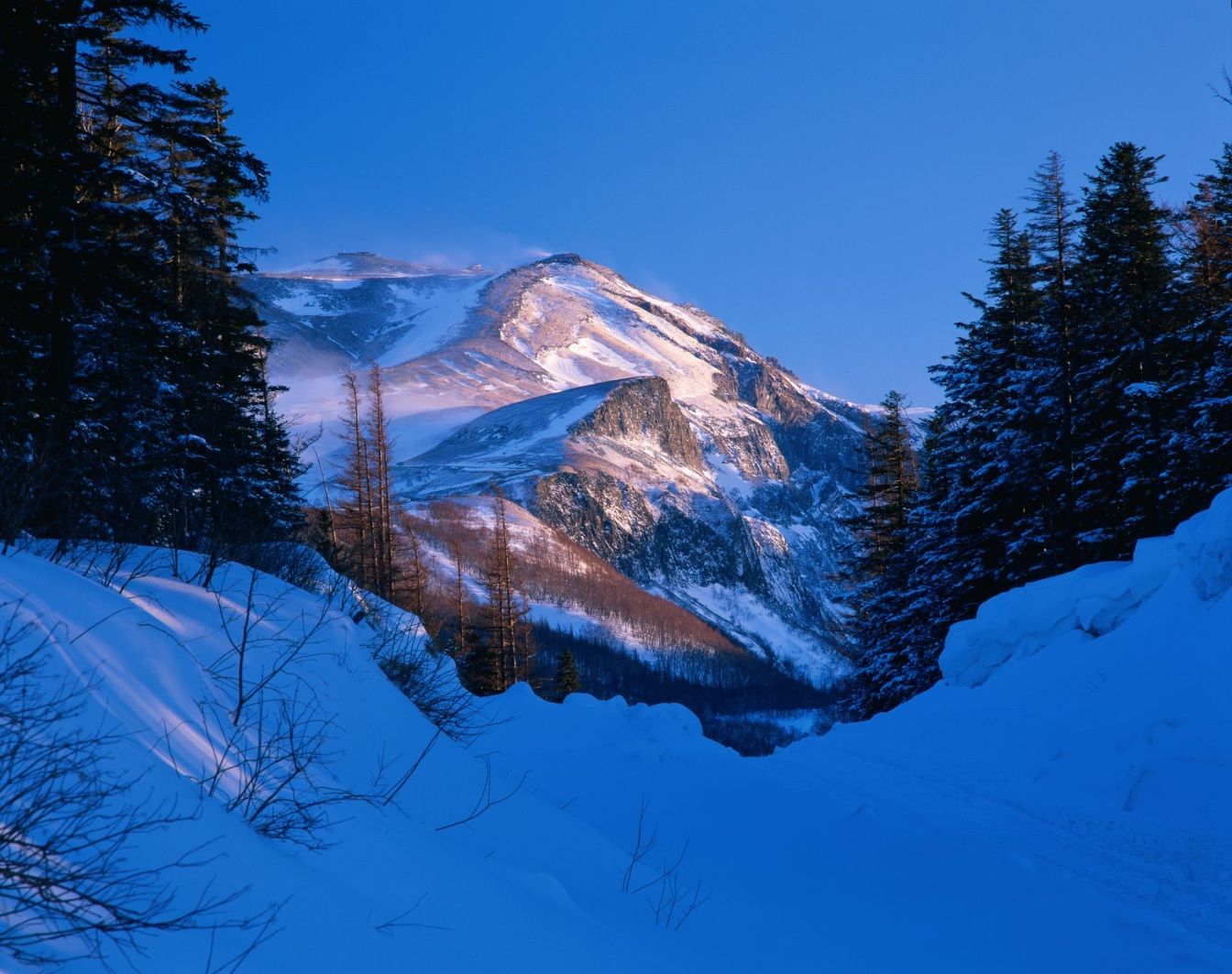
ᠠᠯᡳᠨ,穆麟德:Golmin Šanggiyan Alin,太清:Golmin Xanggiyan Alin),古名不咸山(或为白罗聂·显干之音译)、太白山,在朝鲜半岛称白头山(朝鲜语:백두산/白頭山),是位于中华人民共和国和朝鲜民主主义人民共和国边境的界山。广义的长白山是指一条西南-东北走向绵延上千千米的一系列山脉,横亘于中国吉林、辽宁、黑龙江三省的东部及北朝鲜两江道交界处。狭义上的长白山则单指其主峰长白山,是一座休眠的活火山,在清朝时曾多次喷发。主峰白头峰最高点位于火山臼形成的天池南部的朝鲜民主主义人民共和国境内,天池位于中国和北朝鲜的边界上,在中国部分,分属吉林省白山市抚松县与延边朝鲜族自治州安图县。它实际上是一个相当宽阔的环形火山口(山体相对高度1600米左右,而山体宽度则达十几千米),火山口当中为天池。 由于是中国东北最高峰,长白山在多个中国北方民族的神话传说中都被视为“神山”及朝鲜族的发祥地。长白山是大清龙脉,龙兴之地,是满族祖先世世代代居住的地方,这是一块风水宝地。
Das Gebiet Changbai Shan erstreckt sich über fast 1.000 km entlang der chinesisch – nordkoreanischen Grenze. Ein Großteil dieses Gebirges wurde 1961 zum Naturschutzgebiet erklärt. Die Gipfel erreichen Höhen über 2.500 m, der höchste Berg ist der Baitou Shan, was so viel bedeutet wie Weißkopf-Berg. Sein Gipfel erreicht eine Höhe von 2.744 m. Das Changbai Shan – Gebirge hat mit dem Baitou Shan die höchste Erhebung des ost-asiatischen Kontinents. Das Klima ist hier sehr rau, die Jahresdurchschnittstemperatur liegt gerade mal bei 3 – 7 Grad. Das ehemals vulkanisch aktive Gebiet besitzt einen sehr schönen Kratersee. Durch Ihn verläuft die Grenze zu Nordkorea. Das gesamte Gebiet wurde im Jahre 1980 unter den Schutz der UNESCO gestellt. Zu erreichen ist die Gegend im Norden des Landes am besten mit dem Zug, Endstation der Bahnlinie zum Changbai Chan ist das kleine Dorf Baihe.(Quelle:http://www.reise-ziele-online.de)
Der Paektusan (kor. Weißkopf-Berg), chinesisch Changbai Shan (immerweißer Berg) oder Baitou Shan genannt, ist die höchste Erhebung des Changbai-Gebirges an der Grenze zwischen der Volksrepublik China und Nordkorea. Die Angaben zur Höhe variieren je nach Quelle zwischen 2744 und 2750 Metern.
Der Berg liegt an der Grenze zwischen der nordkoreanischen Provinz Ryanggang-do und der chinesischen Provinz Jilin. Er ist der höchste Berg der Mandschurei, der Koreanischen Halbinsel und Nordkoreas. Auf dem Berg entspringen die Flüsse Songhua, Tumen und Yalu.
白頭山[1](はくとうさん・朝鮮名:ペクトサン)は、朝鮮民主主義人民共和国(北朝鮮)両江道と中華人民共和国(中国)吉林省の国境地帯にある標高2,744mの火山。別名、長白山[2](ちょうはくさん)。
中国吉林省と北朝鮮両江道の国境地帯にあるこの山は、古くは「不咸山」「白山」「太白山」と呼ばれた[要出典]。このうち「白山」「太白山」は中国でも朝鮮でも後世までこの山の別名としても使われた。李氏朝鮮の時代には「太白山」と呼んでいた。現在北朝鮮と大韓民国(韓国)が用いている白頭山という名称の起源は不明である。
満州民族の満州語ではゴルミン・シャンギャン・アリン(満州文字:ᡤᠣᠯᠮᡳᠨ
ᡧᠠᠩᡤᡳᠶᠠᠨ
ᠠᠯᡳᠨ、転写:golmin šanggiyan alin、漢字音写:果勒敏珊延阿林、意は「どこまでも白い山」)と金の時代より使われ始めた。 清朝では長白山(ちょうはくさん。中国語: 簡体字中国語: 长白山; 繁体字: 長白山、チャンパイシャン、Chángbáishān)と漢訳され定着している。
Paektu Mountain (Korean: 백두산, 白頭山), also known as Baekdu Mountain and in China as Changbai Mountain (simplified Chinese: 长白山; traditional Chinese: 長白山), is an active stratovolcano on the Chinese–North Korean border.[3] At 2,744 m (9,003 ft), it is the highest mountain of the Changbai and Baekdudaegan ranges. Koreans assign a mythical quality to the volcano and its caldera lake, considering it to be their country's spiritual home.[4] It is the highest mountain in Korea and Northeast China.[5]
A large crater lake, called Heaven Lake, is in the caldera atop the mountain. The caldera was formed by the VEI 7 "Millennium" or "Tianchi" eruption of 946, which erupted about 100–120 km3 (24–29 cu mi) of tephra. This was one of the largest and most violent eruptions in the last 5,000 years (alongside the Minoan eruption, the Hatepe eruption of Lake Taupo in around AD 180, the 1257 eruption of Mount Samalas near Mount Rinjani and the 1815 eruption of Tambora).
The mountain plays an important mythological and cultural role in the societies and civil religions of both contemporary Korean states. For instance, it is mentioned in both of their national anthems and is depicted on the national emblem of North Korea.
Le mont Paektu ou mont Changbai en Chine est le point culminant de l'ensemble de la Corée, à 2 744 mètres d'altitude. C'était un mont sacré pour les Coréens et les Mandchous. En 946, il a été le théâtre d'une des plus fortes éruptions de notre ère. Sa partie chinoise est protégée par la réserve naturelle du mont Changbai qui a été reconnue réserve de biosphère en 1979, et sa partie nord-coréenne par la réserve naturelle du mont Paektu, réserve de biosphère depuis 1989 (1 320 km2). Situé dans une zone inhospitalière, ses abords sont relativement peu peuplés.
Il Monte Paektu, anche noto come Baitou (in cinese 白頭山T, 白头山S, BáitóushānP) e Baekdu (백두산?, 白頭山?, PaektusanMR), è il picco più alto della penisola coreana (2.744 m), al confine fra la Corea del Nord e la Cina. Il suo nome cinese è Changbai (長白山T, 长白山S, ChángbáishānP), da cui il nome della catena montuosa a cui appartiene, il Changbai Shan.
El monte Paektu (en chosŏn'gŭl, 백두산; en hancha, 白頭山; romanización revisada del coreano, Baektu-san; McCune-Reischauer, Paektu-san), también conocido como montaña Changbai en China, es una montaña volcánica localizada en la frontera entre Corea del Norte y China. Con 2744 m, es la montaña más alta de la montañas Changbai, al norte, y de la cordillera Baekdudaegan, al sur. También es la montaña más alta de la península de Corea y de Manchuria.
Пэктуса́н[2][3], также Байтоушань[2][3] (кор. 백두산) или Чанбайша́нь (кит. 长白山) — потенциально активный вулкан на границе КНДР (провинция Янгандо) и КНР (провинция Цзилинь). Гора имеет высоту 2744 м (2750 м[2]) и является высшей точкой Маньчжуро-Корейских гор, а также всей Маньчжурии и Корейского полуострова[4].

 International cities

 International cities
 European city
 Italy
Italy
 1944 Winter Olympics
 1956 Winter Olympics
 2026 Winter Olympics

 Sport
Sport

 Veneto


Davos (German pronunciation [daˈfoːs][3] or [daˈvoːs];[4] Romansh: ![]() Tavau (help·info), archaic Italian: Tavate) is an Alpine town, and a municipality in the Prättigau/Davos Region in the canton of Graubünden, Switzerland. It has a permanent population of 11,060 (2016).[2] Davos is located on the river Landwasser, in the Rhaetian Alps, between the Plessur and Albula Range at 1,560 m (5,120 ft) above sea level.
Tavau (help·info), archaic Italian: Tavate) is an Alpine town, and a municipality in the Prättigau/Davos Region in the canton of Graubünden, Switzerland. It has a permanent population of 11,060 (2016).[2] Davos is located on the river Landwasser, in the Rhaetian Alps, between the Plessur and Albula Range at 1,560 m (5,120 ft) above sea level.
The former Alpine resort village consists of two parts: Davos Dorf (lit.: "village") to the northeast towards Klosters and further down through the Prättigau to Landquart, and Davos Platz (lit.: "place") to the southwest, which opens into the valley of the Landwasser and eventually leads to Filisur. During summer season the Flüela Pass leads south-east into the Lower Engadine.
Davos is host to the World Economic Forum (WEF), an annual meeting of global political and business elites (often referred to simply as Davos) and the home of one of Switzerland's biggest ski resorts. At the end of every year it serves as the site of the annual Spengler Cup ice hockey tournament, hosted by the HC Davos local hockey team.
Davos (prononcé en allemand : [daˈvoːs]3, walser dialecte local : Tafaas [ta'fas], romanche : Tavau, italien : Tavate) est une commune du canton des Grisons, située dans la haute vallée de la rivière Landwasser dans la région de Prättigau/Davos, dans l'est de la Suisse. La ville est connue pour accueillir chaque année le forum économique mondial (World Economic Forum, WEF), réunion des dirigeants de la planète et des élites économiques. Davos est aussi connue en tant que station de sports d'hiver, et organise des événements tels que la Coupe Spengler en hockey sur glace, à laquelle l'équipe locale, le HC Davos participe.
Davos (toponimo tedesco, pronuncia [daˈvoːs][1]; localmente Tafaas[senza fonte], in romancio Tavau, in italiano Tavate[2], desueto) è un comune svizzero di 11.060 abitanti del Canton Grigioni, nella regione Prettigovia/Davos. Il 1º gennaio 2009 ha inglobato il comune soppresso di Wiesen, diventando il più esteso del cantone e il secondo per estensione di tutta la Svizzera[3]; ha lo status di città.
La località è nota in tutto il mondo perché ospita l'annuale Forum economico mondiale, un incontro fra i principali dirigenti politici e i principali esponenti economici, ed è rinomata per gli sport invernali.
Davos (en alemán se pronuncia Davós [código AFI: da ˈvoːs]; toponimia en romanche: Tavau, en italiano: Tavate) es una ciudad y comuna Suiza del cantón de los Grisones, situada en el distrito de Prettigovia/Davos, círculo de Davos.
La localidad es conocida por ser la sede del Foro Económico Mundial (World Economic Forum), también llamado 'Foro de Davos', en el que se reúnen desde 1991 los principales líderes empresariales, así como líderes políticos internacionales, periodistas e intelectuales selectos, a efectos de analizar los problemas más apremiantes que afronta el mundo, y entre ellos, la salud y el medio ambiente.
Este lugar también es muy conocido por su estación de esquí.
Даво́с (на местном диалекте — алем. Tafaas, нем. и фр. Davos, итал. Davos, редко — Tavate, ромш. Tavau) — город в восточной Швейцарии, в кантоне Граубюнден, на реке Ландвассер. История города началась с того, что ещё в XIX веке доктора признали микроклимат высокогорной долины полезным для больных лёгочными заболеваниями. Лечившийся здесь Роберт Луис Стивенсон написал в Давосе роман «Остров сокровищ». Также город является местом действия романа «Волшебная гора» немецкого писателя Томаса Манна.
 Bavaria
 Vacation and Travel
 New hampshire-NH
 Auvergne-Rhône-Alpes
 Animal world
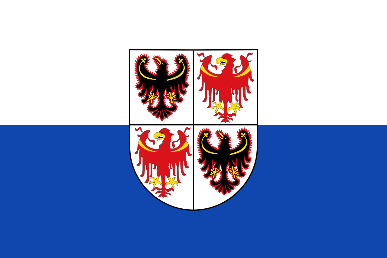 Trentino-Alto Adige