
Deutsch-Chinesische Enzyklopädie, 德汉百科
 Gansu Sheng-GS

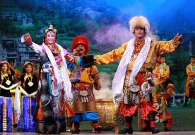
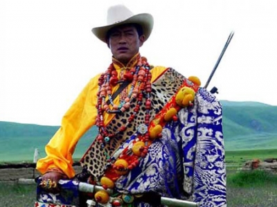

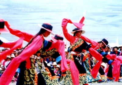
藏族(藏文:བོད་པ་ )是中国的56个民族之一,是青藏高原的原住民。在中国境内主要分布在西藏自治区、青海省和四川省西部,云南迪庆、甘肃甘南等地区,此外印度、不丹、美国、加拿大、欧洲、澳洲等地区也有藏族分布。拉萨是藏族人心中的圣地。目前全世界藏族人口约750万左右,中国境内约700万(2016年),藏裔人口保守估计在1000万以上。
藏族的历史是中国历史不可分割的一个组成部分,是中国及南亚最古老的民族之一。7世纪初期吐蕃建政之后,吐蕃与唐朝的接触日益频繁。10世纪到16世纪,是古代藏族文化兴盛时期。1951年,西藏和平解放。
藏族有自己的语言和文字。藏语属汉藏语系藏缅语族藏语支,分卫藏、康、安多三种方言。
藏族普遍信仰藏传佛教。公元七世纪佛教从天竺传入吐蕃,已有1400多年的历史。藏族人民创造了灿烂的民族文化,在文学、音乐、舞蹈、绘画、雕塑、建筑艺术等方面,留下了极为丰富的文化遗产。藏族雕刻技艺高超。此外藏戏独具特色,藏医药学也是人类重要遗产 [ 。
根据《2021中国统计年鉴》,藏族总人口为7060731人。

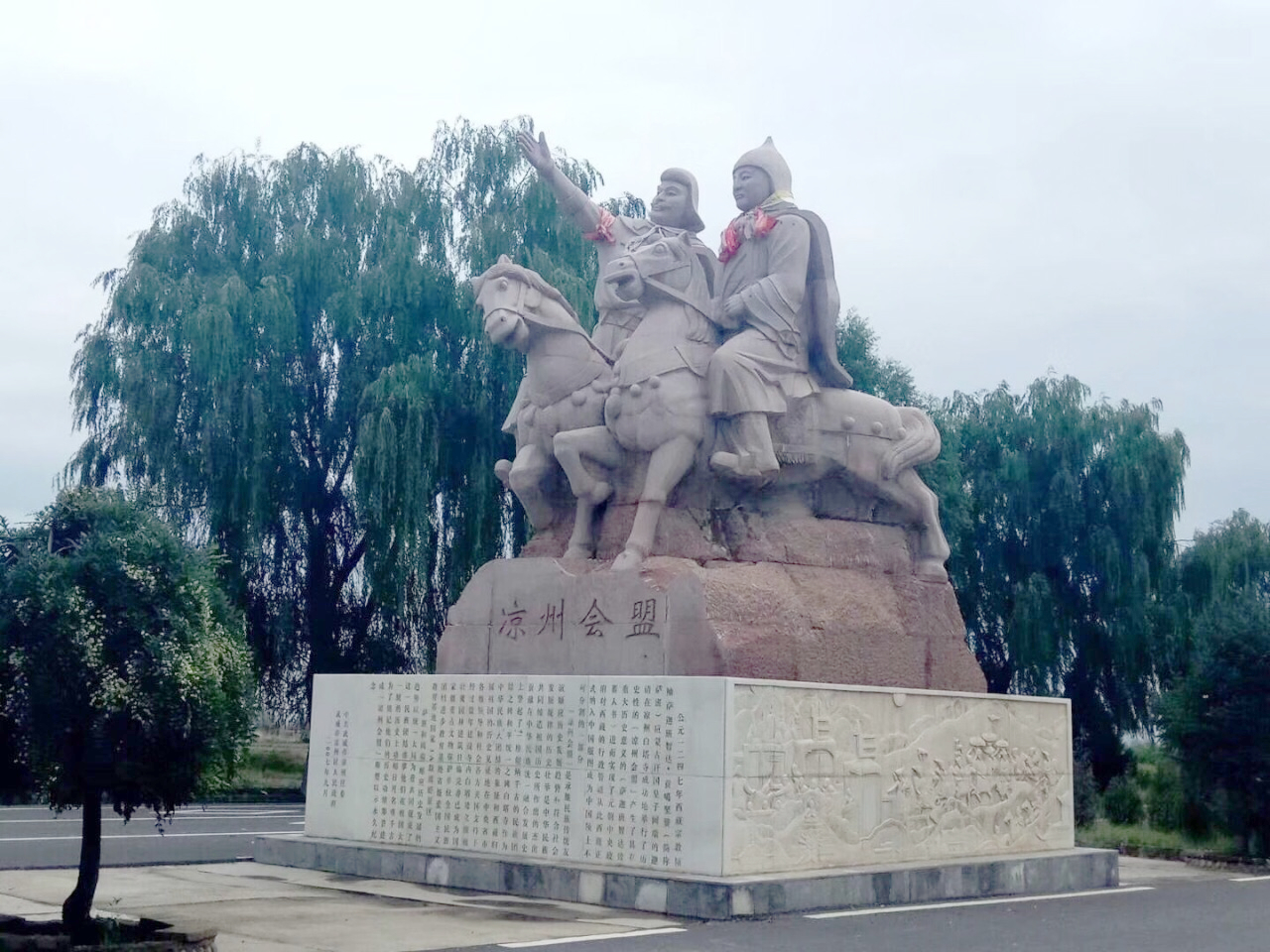
凉州会盟,是指1247年,吐蕃诸部宗教领袖萨迦·班智达与蒙古帝国阔端在凉州议定,吐蕃地区纳入大蒙古国(蒙古帝国)统治的事件。
 Anhui Sheng-AH
 Beijing Shi-BJ
 China
China
 Fujian Sheng-FJ
 Gansu Sheng-GS
 Guangdong Sheng-GD
 Guizhou Sheng-GZ
 Hebei Sheng-HE
 Heilongjiang Sheng-HL
 Henan Sheng-HA
 Hongkong Tebiexingzhengqu-HK
 Hubei Sheng-HB
 Hunan Sheng-HN
 Jiangsu Sheng-JS
 Jiangxi Sheng-JX
 Liaoning Sheng-LN
 Shaanxi Sheng-SN
 Shandong Sheng-SD
 Shanghai Shi-SH
 Shanxi Sheng-SX
 Sichuan Sheng-SC
 Tianjin Shi-TJ

 Transport and traffic
 High speed traffic
 Yunnan Sheng-YN
 Zhejiang Sheng-ZJ
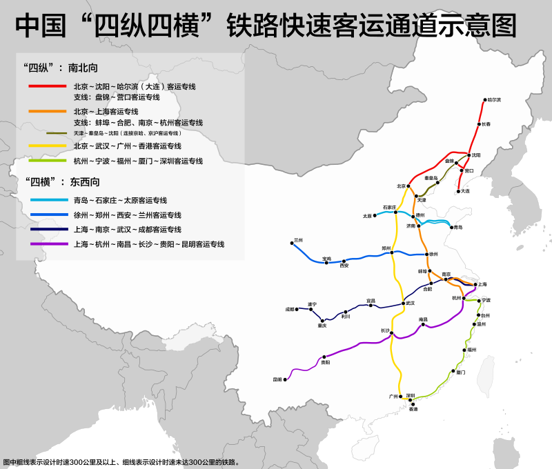
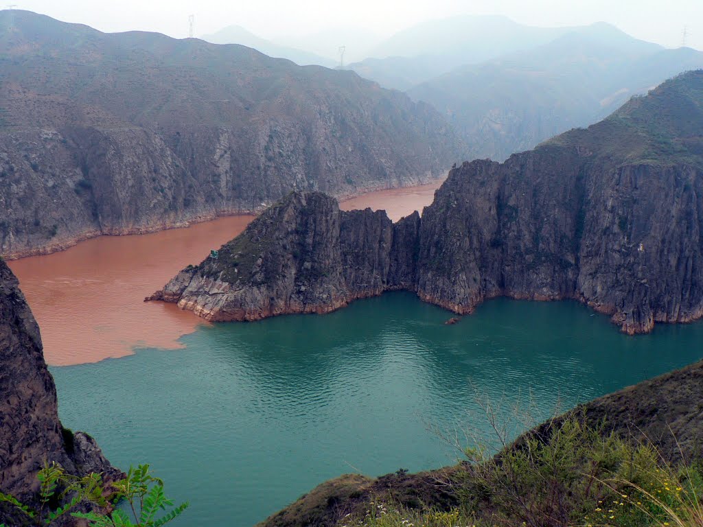
Der Wei He (Pinyin: Wèi Hé) oder Wei-Fluss (chinesisch 渭河, W.-G. Wei Ho) oder Wei Shui (Pinyin: Wèi Shuǐ) (渭水) ist der größte Nebenfluss des Gelben Flusses (Huáng Hé, 黃河 / 黄河).
Der Wei He durchfließt die Provinzen Gansu und Shaanxi. An seinem Ufer liegt die alte Kaiserstadt Xi’an (西安).
西夏(1038年-1227年),国号大夏、邦泥定国(西夏文:![]() ,拉丁转写:phôn¹ mbın² lhi̯ə tha²)或白高大夏国(西夏文:
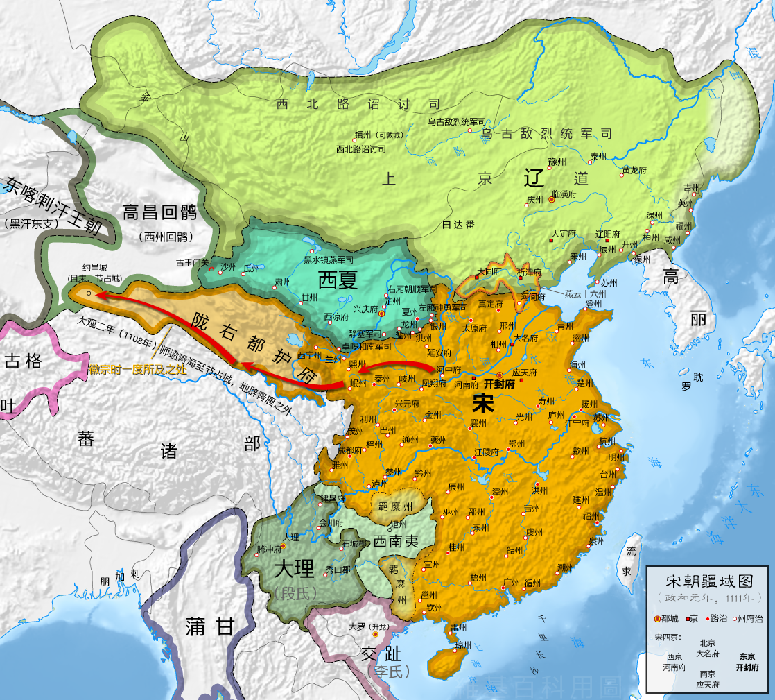
,拉丁转写:phôn¹ mbın² lhi̯ə tha²)或白高大夏国(西夏文:![]() )等[b],是中国历史上由党项族建立的一个朝代。主要以党项族为主体,包括汉族、回鹘族与吐蕃族等民族在内的国家。因位于中原地区的西北方,国土占据黄河中上游,史称西夏[5]。
)等[b],是中国历史上由党项族建立的一个朝代。主要以党项族为主体,包括汉族、回鹘族与吐蕃族等民族在内的国家。因位于中原地区的西北方,国土占据黄河中上游,史称西夏[5]。
党项族原居四川松潘高原,唐朝时迁居陕北。因平乱有功被唐帝封为夏州节度使,先后臣服于唐朝、五代诸朝与宋朝。夏州政权被北宋并吞后,由于李继迁不愿投降而再次立国,并且取得辽帝的册封。李继迁采取连辽抵宋的方式,陆续占领兰州与河西走廊地区。1038年11月10日李元昊称帝建国,即夏景宗,西夏正式立国。西夏在宋夏战争与辽夏战争中大致获胜,形成三国鼎立的局面。夏景宗去世后,大权掌握在皇帝的太后与母党手中,史称母党专政时期。西夏因为皇党与母党的对峙而内乱,北宋趁机多次伐夏。西夏抵御成功并击溃宋军,但是横山的丧失让防线出现破洞。金朝崛起并灭辽、北宋,西夏改臣服金朝,获得不少土地,两国建立金夏同盟而大致和平。夏仁宗期间发生天灾与任得敬分国事件,但经过改革后,到天盛年间出现盛世。然而漠北的蒙古帝国崛起,六次入侵西夏后拆散金夏同盟,让西夏与金朝自相残杀。西夏内部也多次发生弑君、内乱之事,经济也因战争而趋于崩溃。最后于1227年8月28日亡于蒙古[5]。
西夏属于番汉联合政治,以党项族为主导,汉族与其他族群为辅。制度由番汉两元政治逐渐变成一元化的汉法制度。西夏的皇权备受贵族、母党与权臣等势力的挑战而动荡不安[6]。由于处于列强环视的河西走廊与河套地区,对外采取依附强者,攻击弱者、以战求和的外交策略[7]。军事手段十分灵活,配合沙漠地形,采取有利则进,不利则退,诱敌设伏、断敌粮道的战术;并且有铁鹞子、步跋子与泼喜等特殊兵种辅助[8]。经济方面以畜牧业与商业为主力,对外贸易易受中原王朝的影响,垄断河西走廊与北宋的岁币为西夏经济带来很大的帮助[9]。
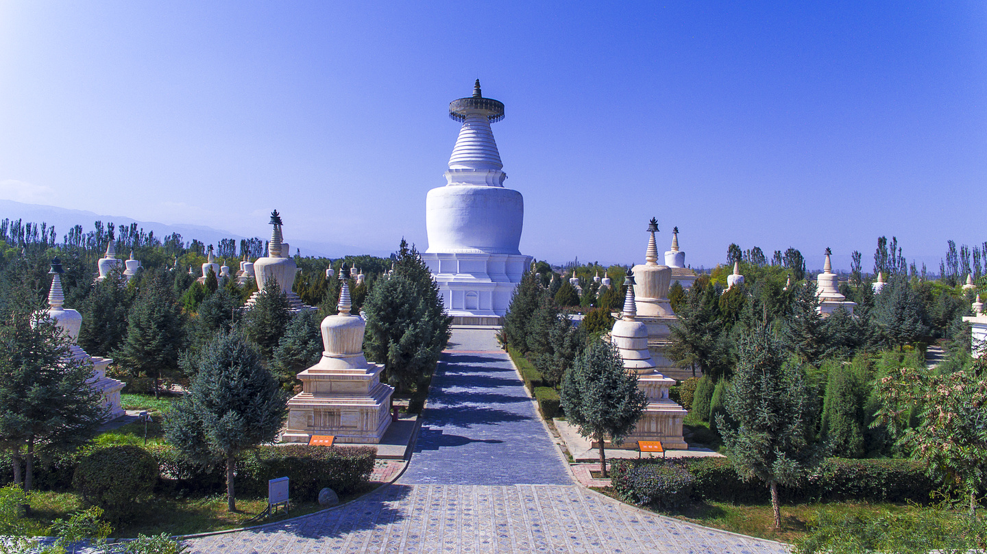
西夏是一个佛教王国,兴建大量的佛塔与佛寺,以承天寺塔最有名。然而也是崇尚儒学汉法的帝国,立国前积极汉化;虽然夏景宗为了维护本身文化而提倡党项、吐蕃与回鹘文化,并且创立西夏文、立番官、建番俗等措施;但自夏毅宗到夏仁宗后,西夏已经由番汉同行转为普遍汉化[6]。文学方面以诗歌和谚语为主。在艺术方面于敦煌莫高窟、安西榆林窟有丰富的佛教壁画,具有“绿壁画”的特色。此外在雕塑、音乐与舞蹈等方面都有独特之处[10]。
Das Reich der Westlichen Xia-Dynastie oder Xi Xia (chinesisch 西夏, Pinyin Xī Xià; tangutisch: Mi-Nyak[1]) wurde 1038 von den Tanguten auf dem Gebiet der heutigen chinesischen Provinz Gansu und des heutigen Autonomen Gebiets Ningxia, mit Zentrum bei Yinchuan, gegründet.
Es handelte sich um einen Vielvölkerstaat Chinas, mehrheitlich bewohnt von Tanguten aber auch Uiguren, Han-Chinesen, Mongolen und Tibetern. Die Führungsspitze des Staates bildeten Tanguten. Tibeter, Uiguren und Han-Chinesen waren aber in politischen Ämtern aktiv.[2] Es gab in ihrem Staat entsprechend den geographischen Gegebenheiten sowohl Ackerbauern, wie auch Karawanenhändler, Nomaden und Halbnomaden.
Das Tangutenreich war aufgrund der Schwäche der Song-Dynastie seit dem 11. Jahrhundert unabhängig, stand aber unter starkem Einfluss der chinesischen Kultur. Es vermittelte den Handel und Schmuggel entlang der Seidenstraße; Haupthandelspartner war dabei die Song-Dynastie. 1044 mussten sich die Song sogar zu Tributzahlungen (Seide, Silber, Tee) an die Tanguten verpflichten. Im Jahr 1226/1227 wurde der Staat Xi Xia von den Mongolen beseitigt.
西夏(せいか、西夏文字:![]() [*phiow¹-bjij²-lhjij-lhjij²]、1038年 - 1227年)は、タングートの首長李元昊が現在の中国西北部(甘粛省・寧夏回族自治区)に建国した王朝。国号は夏だが、中国最古の王朝夏などと区別するため、通例「西」の字を付して呼ぶ。首都は興慶(現在の銀川)。モンゴル帝国のチンギス・カンによって滅ぼされた。
[*phiow¹-bjij²-lhjij-lhjij²]、1038年 - 1227年)は、タングートの首長李元昊が現在の中国西北部(甘粛省・寧夏回族自治区)に建国した王朝。国号は夏だが、中国最古の王朝夏などと区別するため、通例「西」の字を付して呼ぶ。首都は興慶(現在の銀川)。モンゴル帝国のチンギス・カンによって滅ぼされた。
The Western Xia or Xi Xia (Chinese: 西夏; pinyin: Xī Xià; Wade–Giles: Hsi1 Hsia4), also known to the Mongols as the Tangut Empire and to the Tangut people themselves and to the Tibetans as Mi-nyak,[3] was an empire which existed from 1038 to 1227 in what are now the northwestern Chinese provinces of Ningxia, Gansu, eastern Qinghai, northern Shaanxi, northeastern Xinjiang, southwest Inner Mongolia, and southernmost Outer Mongolia, measuring about 800,000 square kilometres (310,000 square miles).[4][5][6] Its capital was Xingqing (modern Yinchuan), until its destruction by the Mongols in 1227. Most of its written records and architecture were destroyed, so the founders and history of the empire remained obscure until 20th-century research in the West and in China.
The Western Xia occupied the area round the Hexi Corridor, a stretch of the Silk Road, the most important trade route between North China and Central Asia. They made significant achievements in literature, art, music, and architecture, which was characterized as "shining and sparkling".[7] Their extensive stance among the other empires of the Liao, Song, and Jin was attributable to their effective military organizations that integrated cavalry, chariots, archery, shields, artillery (cannons carried on the back of camels), and amphibious troops for combat on land and water.[8]
La dynastie des Xia Occidentaux (chinois : 西夏 ; pinyin : ), gouvernait, de 1032 à 1227 selon l'historiographie chinoise, l'État appelé « royaume des Xia occidentaux » (Xixia) par les Chinois Han, « Empire tangoute » (Тангуд улс) par les Mongols et « Minyak » par les Tibétains1. Le territoire de cet État fondé par les Tangoutes, un peuple de langue tibéto-birmane, correspondait approximativement aux actuelles provinces chinoises du Gansu, du Shaanxi, du Ningxia, à l'est du Qinghai, au nord du Shaanxi, au nord-est du Xinjiang, au sud-ouest de la Mongolie intérieure et au sud de la Mongolie. Le tout représente une surface de 800 000 km22,3,4 et recouvre le nord-ouest de la Chine. Au XIIe siècle, la capitale est déplacée à Khara-Khoto, qui reste le centre du pouvoir jusqu'à sa destruction en 1227 par les troupes de Genghis Khan, le fondateur de l'Empire mongol. En même temps que la cité, toutes les archives écrites du royaume sont brulées, ce qui explique que l'histoire de ce royaume reste longtemps connue de l'Occident uniquement grâce aux documents chinois. Ce n'est qu'en 1907 que le site de la capitale est découvert par l'explorateur russe Piotr Kouzmitch Kozlov et que les fouilles qui s'ensuivent permettent d'en savoir plus sur ce peuple.
Le territoire des Xia occidentaux se situe autour du corridor du Hexi, une des portions de la route de la soie, qui est alors la route commerciale la plus importante entre le nord de la Chine et l'Asie centrale. Tout au long de leur existence, les Xia font des progrès importants dans la littérature, l'art, la musique et l'architecture, qui a été décrite comme étant « rayonnante et étincelante »5. Leur existence même et leur maitrise d'un territoire aussi important alors qu'ils sont frontaliers de puissants empires rivaux tels que les Liao, les Song et les Jin; s’explique par leur organisation militaire efficace qui combine cavalerie, chars, archers, fantassins protégés, artillerie (canons primitifs portés à dos de chameaux) et troupes amphibies exercées au combat sur terre et l’eau6.
La dinastia Xia Occidentale regnò dal 1038 al 1227 nell'impero Xi Xia (cinese: 西夏T, Xī XiàP, Hsi HsiaW detto anche Xia Occidentale o impero tangut, dal nome del popolo che lo componeva. Questo popolo ed il territorio in cui viveva era noto sia ai tanguti che ai tibetani anche con il nome Minyak.
L'impero tangut si spartì il territorio cinese con altre dinastie, tra le quali le principali furono quella dei Song (960-1279), dei Liao (907-1125) e dei Jīn (1115-1234).
Nel periodo di massima espansione l'impero comprendeva le attuali province cinesi del Ningxia, del Gansu, la parte orientale del Qinghai, il nord dello Shaanxi, il nord-est del Xinjiang, il sud-ovest della Mongolia interna ed il sud della Mongolia, e si estendeva per circa 800.000 chilometri quadrati.[1][2][3]
Gli Xia occidentali controllarono lo strategico corridoio di Hexi, il passaggio settentrionale della via della seta, riuscendo a resistere alle pressioni dei vicini imperi Liao, Song, e Jīn, in virtù dell'allora moderna organizzazione militare che si diedero, sfruttando al meglio la cavalleria, i carri da guerra, gli arcieri, l'artiglieria, i cui cannoni erano trasportati da cammelli, ed i mezzi anfibi.
I tangut si distinsero anche nei campi della letteratura, dando vita ad una propria scrittura, delle arti e dell'architettura, che fu definita "splendente e scintillante".[4]
El Imperio tangut, también conocido por el nombre chino de Imperio Xia Occidental o Imperio de Xi Xia (chino: 西夏, Wade-Giles: Hsi1 Hsia4, pinyin: Xī Xià) fue un estado que existió entre los años 982 y 1227 en el noroeste del territorio actual de la República Popular China.
Situado en parte del territorio ocupado en la actualidad por las provincias de Gansu y Shaanxi y por la Región Autómoma Hui de Ningxia, el estado fue fundado por los tangut, un pueblo nómada que descendía de los Tuoba o Tabgach, el pueblo que había fundado la dinastía china de los Wei del Norte. Los tangut tenían su propia lengua, el tangut, caracterizado por un complejísimo sistema de escritura compuesto por miles de caracteres, la inmensa mayoría de los cuales no ha podido ser descifrada.
Си Ся (кит. 西夏, пиньинь: Xī Xià), Западное Ся, Да Ся (кит. 大夏, пиньинь: Dà Xià), Великое Ся, Тангутское царство, Великое государство Высокой Белизны[1] (официальное название Великое государство Белого и Высокого) — государство тангутов, существовавшее в 1038—1227 годах к северо-западу от китайского царства Сун и, позднее, чжурчжэньского Цзинь на территории современных китайских провинций Шэньси и Ганьсу. Контролировало восточный отрезок Великого шёлкового пути.
 Sport
Sport
 History
 Architecture
 Art
Art
 Geography