
Deutsch-Chinesische Enzyklopädie, 德汉百科
 孟加拉国
孟加拉国
 *英国政治
*英国政治
 安提瓜和巴布达
 澳大利亚
澳大利亚
 巴哈马
巴哈马
 孟加拉国
孟加拉国
 巴巴多斯
巴巴多斯
 伯利兹
伯利兹
 博茨瓦纳
博茨瓦纳
 文莱
文莱
 英联邦国家
英联邦国家
 多米尼克
多米尼克
 加纳
加纳
 格林纳达
格林纳达
 圭亚那
圭亚那
 印度
印度
 牙买加
牙买加
 喀麦隆
喀麦隆
 加拿大
加拿大
 肯尼亚
肯尼亚
 基里巴斯
基里巴斯
 莱索托
莱索托
 马拉维
马拉维
 马来西亚
马来西亚
 马尔代夫
马尔代夫
 马耳他
马耳他
 莫桑比克
莫桑比克
 纳米比亚
纳米比亚
 瑙鲁
瑙鲁
 新西兰
新西兰
 尼日利亚
尼日利亚
 巴基斯坦
巴基斯坦
 巴布亚新几内亚
 所罗门群岛
所罗门群岛
 赞比亚
赞比亚
 萨摩亚
萨摩亚
 塞舌尔
塞舌尔
 塞拉利昂
塞拉利昂
 新加坡
新加坡
 斯里兰卡
斯里兰卡
 圣基茨和尼维斯
 圣文森特和格林纳丁斯
 南非
南非
 斯威士兰
斯威士兰
 坦桑尼亚
坦桑尼亚
 汤加
汤加
 特立尼达和多巴哥
 图瓦卢
图瓦卢
 乌干达
乌干达
 瓦努阿图
瓦努阿图
 英国
英国

 重要的国际组织
 塞浦路斯
塞浦路斯
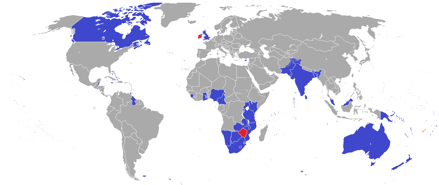
英联邦(英语:Commonwealth of Nations,新马作共和联邦,台湾作大英国协),是一个现代的国际组织,由56个英语系的主权国家联合而成。
英联邦不是一个统一的联邦国家,而是一个国际组织,英联邦也无权约束旗下任何成员国内政。英联邦元首通常由英国君主兼任,其首任元首是乔治六世,现任是查尔斯三世,但元首并无实权,秘书长才是英联邦实际上的掌权者[4][5]。该组织的成员国基本由英国及其旧殖民地组成,也以英式英语为共通语言,但英国的地位并没有凌驾于他国之上,所有成员国一律平等。目前英联邦有56个成员国,其中15个属于英联邦王国,英联邦王国的国家元首、英联邦元首均和英国的一致,即现在的查尔斯三世;另外5个属于独立君主国,它们不以英国君主为自己的元首,而是自立君主,这五国是文莱、斯威士兰、莱索托、马来西亚、汤加;其余的36个均属于共和国,没有君主。
The Commonwealth of Nations, generally known simply as the Commonwealth,[3] is a political association of 53 member states, nearly all of them former territories of the British Empire.[4] The chief institutions of the organisation are the Commonwealth Secretariat, which focuses on intergovernmental aspects, and the Commonwealth Foundation, which focuses on non-governmental relations between member states.[5]
The Commonwealth dates back to the first half of the 20th century with the decolonisation of the British Empire through increased self-governance of its territories. It was originally created as the British Commonwealth of Nations[6] through the Balfour Declaration at the 1926 Imperial Conference, and formalised by the United Kingdom through the Statute of Westminster in 1931. The current Commonwealth of Nations was formally constituted by the London Declaration in 1949, which modernised the community and established the member states as "free and equal".[7]
The human symbol of this free association is the Head of the Commonwealth, currently Queen Elizabeth II, and the 2018 Commonwealth Heads of Government Meeting appointed Charles, Prince of Wales to be her designated successor, although the position is not technically hereditary. The Queen is the head of state of 16 member states, known as the Commonwealth realms, while 32 other members are republics and five others have different monarchs.
Member states have no legal obligations to one another, but are connected through their use of the English language and historical ties. Their stated shared values of democracy, human rights and the rule of law are enshrined in the Commonwealth Charter[8] and promoted by the quadrennial Commonwealth Games.
The countries of the Commonwealth cover more than 29,958,050 km2 (11,566,870 sq mi), equivalent to 20% of the world's land area, and span all six inhabited continents.
Le Commonwealth ou Commonwealth of Nations (littéralement, la « Communauté des Nations ») est une organisation intergouvernementale composée de 53 États membres qui sont presque tous d'anciens territoires de l'Empire britannique.
Le Commonwealth a émergé au milieu du XXe siècle pendant le processus de décolonisation. Il est formellement constitué par la Déclaration de Londres de 1949 qui fait des États membres des partenaires « libres et égaux ». Le symbole de cette libre association est la reine Élisabeth II qui est chef du Commonwealth. La reine est également le chef d'État monarchique des 16 royaumes du Commonwealth. Les autres États membres sont 32 républiques et cinq monarchies dont le monarque est différent.
Les États membres n'ont aucune obligation les uns envers les autres. Ils sont réunis par la langue, l'histoire et la culture et des valeurs décrites dans la Charte du Commonwealth telles que la démocratie, les droits humains et l'état de droit.
Les États du Commonwealth couvrent 29 958 050 km2 de territoire sur les cinq continents habités. Sa population est estimée à 2,328 milliards d'habitants.
Il Commonwealth delle Nazioni o Commonwealth (acronimo CN) è un'organizzazione intergovernativa di 53 Stati membri indipendenti, tutti accomunati, eccetto il Mozambico e il Ruanda, da un passato storico di appartenenza all'Impero britannico, del quale il Commonwealth è una sorta di sviluppo su base volontaria. La popolazione complessiva degli stati che vi aderiscono è di oltre due miliardi di persone. La parola Commonwealth deriva dall'unione di common (comune) e wealth (benessere), cioè benessere comune.
In passato fu noto anche come Commonwealth britannico, benché tale definizione esistette formalmente solo dalla fondazione nel 1926 fino al 1948.
La Mancomunidad de Naciones (en inglés: Commonwealth of Nations)?, antiguamente Mancomunidad Británica de Naciones (British Commonwealth of Nations), es una organización compuesta por 53 países soberanos independientes y semi independientes que, con la excepción de Mozambique y Ruanda,1 comparten lazos históricos con el Reino Unido. Su principal objetivo es la cooperación internacional en el ámbito político y económico, y desde 1950 la pertenencia a ella no implica sumisión alguna a la Corona británica, aunque se respeta la figura de la reina del Reino Unido. Con el ingreso de Mozambique, la organización ha favorecido el término Mancomunidad de Naciones para subrayar su carácter internacionalista. Sin embargo, el adjetivo británico se sigue utilizando con frecuencia para diferenciarla de otras mancomunidades existentes a nivel internacional.
La reina Isabel II del Reino Unido es la cabeza de la organización, según los principios de la Mancomunidad, «símbolo de la libre asociación de sus miembros».
Содру́жество на́ций (англ. Commonwealth of Nations, до 1946 года — Британское Содружество наций — англ. British Commonwealth of Nations), кратко именуемое просто Содружество (англ. The Commonwealth) — добровольное объединение суверенных государств, в которое входят Великобритания и почти все её бывшие доминионы, колонии и протектораты. Членами Содружества также являются Мозамбик, Руанда, Намибия и Камерун[2].
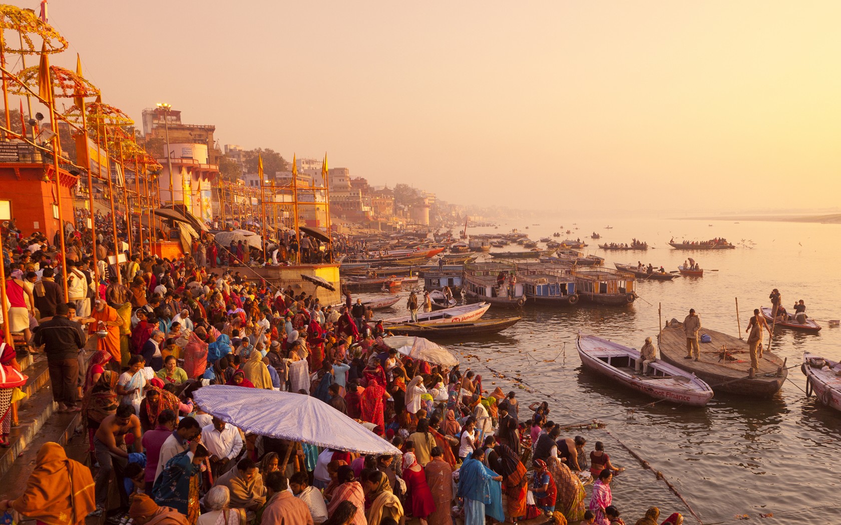
恒河(梵语:गङ्गा,印地语:गंगा,乌尔都语:گنگا(Ganga)国际音标发音:[ˈɡəŋɡaː] ![]() 聆听;泰米尔语:கங்கை,孟加拉语:গঙ্গা Gônga,玄奘译为殑伽河)是南亚的一条主要河流,流经印度北部及孟加拉。恒河源头帕吉勒提河和阿勒格嫩达河发源自印度北阿坎德邦的根戈德里等冰川,它横越北印度平原(即恒河平原),流经北方邦,会合其最大支流亚穆纳河,再流经比哈尔邦、西孟加拉邦,最后它分为多条分流注入孟加拉湾,其中一条是加尔各答附近的胡格利河,另外一条是进入孟加拉国的博多河,博多河进入孟加拉国后,会合布拉马普特拉河(中国境内为雅鲁藏布江)在孟加拉国境内的下游贾木纳河,注入孟加拉湾,其入海河段称为梅格纳河。支流布拉马普特拉河及其以上部分不算在内,恒河长为2,510公里,流域面积91万平方公里,达印度国土面积的三分之一,恒河也为世界河水流量前20大的河流之一[4]。恒河流域为世界上最多人口居住的河流流域,共有4亿以上人口居住于恒河流域,人口密度达每平方英里1000人以上[5]。
聆听;泰米尔语:கங்கை,孟加拉语:গঙ্গা Gônga,玄奘译为殑伽河)是南亚的一条主要河流,流经印度北部及孟加拉。恒河源头帕吉勒提河和阿勒格嫩达河发源自印度北阿坎德邦的根戈德里等冰川,它横越北印度平原(即恒河平原),流经北方邦,会合其最大支流亚穆纳河,再流经比哈尔邦、西孟加拉邦,最后它分为多条分流注入孟加拉湾,其中一条是加尔各答附近的胡格利河,另外一条是进入孟加拉国的博多河,博多河进入孟加拉国后,会合布拉马普特拉河(中国境内为雅鲁藏布江)在孟加拉国境内的下游贾木纳河,注入孟加拉湾,其入海河段称为梅格纳河。支流布拉马普特拉河及其以上部分不算在内,恒河长为2,510公里,流域面积91万平方公里,达印度国土面积的三分之一,恒河也为世界河水流量前20大的河流之一[4]。恒河流域为世界上最多人口居住的河流流域,共有4亿以上人口居住于恒河流域,人口密度达每平方英里1000人以上[5]。
恒河被印度教徒视为圣河,也是河流周边居民维持日常生活所需的命脉[6]。印度教中也有称为“恒河女神”的神祇[7]。许多过去的省会及帝国首都曾设于恒河沿岸,如巴连弗邑[8]、曲女城[8]、瓦拉纳西、安拉阿巴德、穆尔斯希达巴德、蒙格埃尔、巴哈拉姆普尔、加尔各答等。
ガンジス川(ガンジスがわ、英語: Ganges)は、ヒマラヤ山脈の南側、インド亜大陸の北東部を流れる大河である。全長は約2525km[1]、流域面積は約173万km2(ただしブラフマプトラ川水系を除くと約84万km2)。
The Ganges (/ˈɡændʒiːz/ GAN-jeez), or Ganga (Hindustani: [ˈɡəŋɡaː], is a trans-boundary river of the Indian subcontinent which flows through the nations of India and Bangladesh. The 2,525 km (1,569 mi) river rises in the western Himalayas in the Indian state of Uttarakhand, and flows south and east through the Gangetic Plain of North India. After entering West Bengal, it divides into two rivers: the Hooghly and the Padma River. The Hooghly, or Adi Ganga, flows through several districts of West Bengal and into the Bay of Bengal near Sagar Island. The other, the Padma, also flows into and through Bangladesh, and joins the Meghna river which ultimately empties into the Bay of Bengal.
The Ganges is one of the most sacred rivers to Hindus.[4] It is also a lifeline to millions of Indians who live along its course and depend on it for their daily needs. It is worshipped in Hinduism and personified as the goddess Gaṅgā.[5] It has also been important historically, with many former provincial or imperial capitals (such as [6] Kannauj, Kampilya, [6] Kara, Prayag or Allahabad, Kashi, Pataliputra or Patna, Hajipur, Munger, Bhagalpur, Baranagar, Murshidabad, Baharampur, Nabadwip, Saptagram and Kolkata) located on its banks.

孟加拉湾(印地语:बंगाल की खाड़ी、孟加拉语:বঙ্গোপসাগর、缅甸语:ဘင်္ဂလားပင်လယ်အော်)是印度洋北部的一个海湾,西临印度半岛,东临中南半岛,北临缅甸和孟加拉国,南在斯里兰卡至苏门达腊岛一线与印度洋本体相交,经马六甲海峡与暹罗湾和南海相连。宽约1600公里,面积217万平方公里;水深2000-4000米,南部较深;盐度30-34‰。
沿岸国家有印度、孟加拉国、缅甸、泰国、斯里兰卡、马来西亚和印度尼西亚。
印度和缅甸的一些主要河流均流入孟加拉湾,著名的大河有:恒河、布拉马普特拉河、伊洛瓦底江、萨尔温江、克里希纳河等等。孟加拉湾中著名的岛屿包括斯里兰卡岛、安达曼群岛、尼科巴群岛、普吉岛等。
孟加拉湾沿岸贸易发达,主要港口有:印度的加尔各答、金奈、本地治里、孟加拉国的吉大港、缅甸的仰光、毛淡棉、泰国的普吉、马来西亚的槟榔屿、印度尼西亚的班达亚齐、斯里兰卡的贾夫纳等等。
Der Golf von Bengalen (bengalisch বঙ্গোপসাগর baṅgopasāgar; indonesisch Teluk Benggala;malaiisch Teluk Bengal; thailändisch อ่าวเบงกอล; seltene deutsche Bezeichnungen: Bengalischer Golf, Bengalischer Meerbusen, Bai von Bengalen[1][2][3][4]) ist ein nordöstliches Randmeer des Indischen Ozeans mit einer Fläche von rund 2.171.000 km². Er ist 2090 km lang und bis zu 1610 km breit und hat grob gesehen die Form eines Dreiecks. Der Golf ist durchschnittlich 2600 Meter und maximal 4694 Meter tief. Er trennt die Landmasse des indischen Subkontinents von der Halbinsel Hinterindien. Das Klima ist vom Monsun geprägt. Besonderheiten der Region sind insbesondere eine Reihe von Schlammvulkanen sowie die größten Mangrovenwälder der Erde, wie die Sundarbans.
Der Golf von Bengalen wird im Westen von Sri Lanka und Indien, im Norden von der namensgebenden Region Bengalen, bestehend aus dem Staat Bangladesch und dem indischen Bundesstaat Westbengalen sowie im Osten von Myanmar, Thailand und Indonesien begrenzt. Im Süden ist er mit dem Indischen Ozean verbunden. Als ungefähre Abgrenzung des Golfes kann eine gedachte Linie zwischen der Südspitze Sri Lankas und der Nordspitze der zu Indonesien gehörenden Insel Sumatra angenommen werden.
ベンガル湾(ベンガルわん、Bay of Bengal)は、インド洋の北東部分の湾。湾はほぼ三角形で、南方に開けた形となっている。東にマレー半島、西にインド亜大陸、北に名前の元となったインドの西ベンガル州およびバングラデシュに面している。南端はスリランカとアンダマン・ニコバル諸島連邦直轄地に面している。同諸島の東側の海域はアンダマン海と呼ばれる。
インドやバングラデシュの多くの川がベンガル湾に流れ込んでいる。北からはガンジス川、メグナ川とブラマプトラ川が流れ込み、南西の沿岸であるオリッサ州からはマハナディ川、ゴータヴァリー川、クリシュナ川、カヴェリ川が流れ込んでいる。湾の北端のインド領には、スンダルバンス国立公園があり、豊かなマングローブの林がある。ミャンマーのエーヤワディー川もベンガル湾に流れ込んでいる。
チェンナイ(旧名マドラス)やコルカタ(旧名カルカッタ)といった大都市がベンガル湾に接しており、古くから交易拠点として栄えてきた。
The Bay of Bengal is the northeastern part of the Indian Ocean, bounded on the west and northwest by India, on the north by Bangladesh, and on the east by Myanmar and the Andaman and Nicobar Islands of India. Its southern limit is a line between Sangaman Kanda, Sri Lanka and the north westernmost point of Sumatra (Indonesia). It is the largest water region called a bay in the world. There are countries dependent on the Bay of Bengal in South Asia and Southeast Asia. In ancient India, Bay of Bengal was known as Kalinga Sagar. Later during the British India, it came forth as the Bay of Bengal after the historic Bengal region, as the Port of Kolkata served as the gateway to the Crown rule in India. Cox's Bazar, the longest sea beach in the world and Sundarbans, the largest mangrove forest and the natural habitat of the Bengal tiger, are located along the bay.
The Bay of Bengal occupies an area of 2,600,000 square kilometres (1,000,000 sq mi). A number of large rivers flow into the Bay of Bengal: the Ganges–Hooghly, the Padma, the Brahmaputra–Jamuna, the Barak–Surma–Meghna, the Irrawaddy, the Godavari, the Mahanadi, the Brahmani, the Baitarani, the Krishna and the Kaveri. Among the important ports are Chennai, Ennore, Chittagong, Colombo, Kolkata-Haldia, Mongla, Paradip, Port Blair, Thoothukudi, Visakhapatnam and Dhamra. Among the smaller ports are Gopalpur Port, Kakinada and Payra.
Le golfe du Bengale (bengali : বঙ্গপসাগর, anglais : Bay of Bengal) est une mer qui forme la partie du nord-est de l'océan Indien. Elle a la forme d'un triangle encadré à l'est par les côtes birmanes jusqu'au cap Negrais puis par les archipels Andaman et Nicobar, et à l'ouest par le sous-continent indien. Au nord du golfe, on trouve l'état indien du Bengale-Occidental et le Bangladesh, d'où provient son nom. Ses limites méridionales sont le pont d'Adam puis une ligne ouest-est ayant son origine à la pointe sud de l'île de Sri Lanka, et finissant à la pointe nord de l'île indonésienne de Breueh (Pulau Breueh), non loin de Sumatra.
Il golfo del Bengala (বঙ্গোপসাগর in bengalese, ဘင်္ဂလားပင်လယ်အော် in birmano, बंगाल की खाड़ी in hindi e බෙංගාල බොක්ක in singalese) è l'insenatura più ampia del mondo e, per le sue dimensioni (2.172.000 km² di superficie), al punto che può essere considerato un mare vero e proprio. Di forma approssimativamente triangolare, costituisce la parte nordorientale dell'Oceano Indiano ed è collocato fra il Subcontinente indiano a ovest e l'Indocina ad est.
El Golfo de Bengala es un mar en el área noreste del océano Índico. Su forma se parece a un triángulo. Limita al este con la península de Malaca, al oeste con el subcontinente indio. El extremo norte del golfo limita con el estado indio de Bengala Occidental y con Bangladés. Los extremos del sur están limitados por la isla de Sri Lanka y el territorio indio de las Islas Andamán y Nicobar. Estas últimas islas separan el golfo de Bengala del mar de Andamán (también mar de Birmania).
Muchos de los ríos principales de la India desembocan desde el oeste en la bahía de Bengala: en el norte el río Ganges (o Ganga), el río Meghna y el río Brahmaputra. Al sur el Mahanadi, el Godavari, el Krishna y el Kaveri (también escrito Cauvery). El bosque de mangle llamado los Sundarbans está situado en el delta que forman los ríos Ganges, Brahmaputra y Meghna en el golfo de Bengala.
Los puertos indios más importantes del golfo son Madrás, Vishakhapatnam, Calcuta y Pondicherry.
Бенга́льский зали́в (бенг. বঙ্গোপসাগর, там. வங்காள விரிகுடா, хинди बंगाल की खाड़ी, англ. Bay of Bengal[1]) — морской залив, расположенный в северо-восточной части Индийского океана, омывает берега Индии, Бангладеш, Мьянмы и Шри-Ланки. На западе ограничен полуостровом Индостан, на востоке — побережьем Мьянмы и островными дугами Андаманских и Никобарских островов. У северной оконечности залива располагается историческая область Бенгалия (включающая современную Бангладеш и индийский штат Западная Бенгалия), давшая ему название. Является самым большим заливом в мире, его площадь — 2191 тысяча км²[2] (по другим данным 2173 тысячи км²[1]). Наибольшая глубина — 4519 м[2], средняя — 2600 м[1].
В Бенгальский залив впадают многие крупные реки — Ганг, Брахмапутра и Мегхна (общий эстуарий), Кришна, Годавари, Кавери, Маханади, Иравади.
На северо-восточном побережье залива, у города Кокс-Базар (Бангладеш) расположен самый протяжённый в мире пляж (120 км).
По гидрологическому, гидрохимическому и прочим параметрам Бенгальский залив относится к морям.
 埃及
埃及
 阿尔及利亚
阿尔及利亚
 巴哈马
巴哈马
 孟加拉国
孟加拉国
 恰蒂斯加尔邦
 中国
中国
 西撒哈拉阿拉伯民主共和国
 广东省-粤
广东省-粤
 广西壮族自治区-桂
 古吉拉特邦
古吉拉特邦
 印度
印度
 贾坎德邦
贾坎德邦
 利比亚
利比亚
 中央邦
中央邦
 马里
马里
 毛里塔尼亚
毛里塔尼亚
 墨西哥
墨西哥
 米佐拉姆邦
米佐拉姆邦
 缅甸
缅甸
 尼日尔
尼日尔
 阿曼
阿曼
 拉贾斯坦邦
拉贾斯坦邦
 沙特阿拉伯
沙特阿拉伯
 台湾省-台
台湾省-台
 特里普拉邦
特里普拉邦
 阿拉伯联合酋长国
 西孟加拉邦
西孟加拉邦
 云南省-滇
云南省-滇

北回归线(英语:Tropic of Cancer)是太阳在北半球能够垂直射到的离赤道最远的位置点,将该点之纬度线便叫“北回归线”,在公元2018年,其位置约在北纬23°26′10.6″ (或 23.43627°)。相反,南纬23°26′10.6″ (或 23.43627°)则为“南回归线”。
地球自转会造成昼夜更替,但地球之自转轴与地球绕太阳之公转轴并非平行,而是呈“黄赤交角”。因此,地球公转时,太阳直射点并非一直正对着赤道,而是在一年之中,太阳直射在地球表面之位置不断变换,在北回归线和南回归线之间移动,才形成了四季更迭,每年北半球春分(3月21日左右)太阳直射点位于赤道,之后向北移,于夏至(6月22日左右)到达约北纬23°26′,随后便转向南移,于秋分(9月23日左右)回到赤道,并继续南移,于冬至(12月22日左右)到达南纬23°26′,随后再度转向北移动,于次年春分再度回到赤道[1]。所以太阳直射点就像是在到达北回归线和南回归线之后,立即掉头往赤道的位置回返。无论北半球或者南半球,只要每日接受太阳直接照射的时间比较长,就是该半球区域的夏季。北回归线就是北半球能够受到太阳直射的纬度上限,具有重要科学和人文意义,因为地球大部分位于海平面以上的陆地都集中在北半球,所以北回归线与人类接触更显紧密,它是北温带与热带的分界线。
二千多年前西方人观测到北回归线时,北半球夏至日位置正处在天空中黄道十二宫的巨蟹宫(Cancer)方位,从此回归远处,故称“巨蟹座回归线”(Tropic of Cancer)。但由于地球倾斜轴的岁差运动,在1989年已经移动到金牛座位置。
Auf der Erde sind die Wendekreise die beiden Besonderen Breitenkreise von je 23° 26′ 05″ (23,43472°) nördlicher (Wendekreis des Krebses) und südlicher (Wendekreis des Steinbocks) Breite. Auf ihnen steht die Sonne am Mittag des Tages der jeweiligen Sonnenwende im Zenit. Ein Tag hat dann 13,5 Stunden, während der gleiche Tag am gegenüberliegenden Wendekreis 10,5 Stunden dauert. Die Wendekreise haben vom Äquator je einen Abstand von 2.609 km und sind jeweils rund 36.700 km lang. Die solare Zone zwischen nördlichem und südlichem Wendekreis wird als Tropen bezeichnet.

 阿富汗
阿富汗
 埃及
埃及
 阿尔巴尼亚
阿尔巴尼亚
 阿尔及利亚
阿尔及利亚
 阿塞拜疆
阿塞拜疆
 巴林
巴林
 孟加拉国
孟加拉国
 贝宁
贝宁
 文莱
文莱
 布基纳法索
布基纳法索
 科特迪瓦
科特迪瓦
 吉布提
吉布提
 加蓬
加蓬
 冈比亚
冈比亚
 几内亚
几内亚
 几内亚比绍
几内亚比绍
 圭亚那
圭亚那
 印度尼西亚
印度尼西亚
 伊拉克
伊拉克
 伊朗
伊朗
 也门
也门
 约旦
约旦
 喀麦隆
喀麦隆
 哈萨克斯坦
哈萨克斯坦
 卡塔尔
卡塔尔
 吉尔吉斯斯坦
 科摩罗
科摩罗
 科威特
科威特
 黎巴嫩
黎巴嫩
 利比亚
利比亚
 马来西亚
马来西亚
 马尔代夫
马尔代夫
 马里
马里
 摩洛哥
摩洛哥
 毛里塔尼亚
毛里塔尼亚
 莫桑比克
莫桑比克
 尼日尔
尼日尔
 尼日利亚
尼日利亚
 阿曼
阿曼
 巴基斯坦
巴基斯坦
 巴勒斯坦
巴勒斯坦
 苏丹共和国
苏丹共和国
 沙特阿拉伯
沙特阿拉伯
 塞内加尔
塞内加尔
 塞拉利昂
塞拉利昂
 索马里
索马里
 苏里南
苏里南
 叙利亚
叙利亚
 塔吉克斯坦
塔吉克斯坦
 多哥
多哥
 乍得
乍得
 突尼斯
突尼斯
 土耳其
土耳其
 土库曼斯坦
土库曼斯坦
 乌干达
乌干达
 乌兹别克斯坦
 阿拉伯联合酋长国

 重要的国际组织
伊斯兰合作组织(阿拉伯语:منظمة التعاون الإسلامي;英语:Organisation of Islamic Cooperation;法语:Organisation de la coopération islamique)原名伊斯兰会议组织,是一个伊斯兰世界的政府间国际组织,为联合国大会观察员;该组织由遍及西亚(中东)、中亚、西非、北非、印度次大陆和东南亚的57个国家组成,覆盖的人口约为16亿。秘书处设在沙特阿拉伯王国的吉达市;现任秘书长是原沙特社会事务大臣Yousef Al-Othaimeen(从2016年开始)。
组织的宗旨是促进各成员国之间在经济、社会、文化和科学等方面的合作;努力消除种族隔离和种族歧视,反对一切形式的殖民主义;支持巴勒斯坦人民恢复民族权利和重返家园的斗争;支持穆斯林保障其尊严、独立和民族权利的斗争。
但要注意的是并非每个成员国是伊斯兰国家,如圭亚那、苏里南、莫桑比克、喀麦隆、乌干达和加蓬等国,伊斯兰反而是极少数人的信仰,阿尔巴尼亚则是唯一加入该组织的欧洲大陆的主权国家和联合国会员国,2011年脱离苏丹独立的南苏丹也在独立后脱离该组织的势力范围。
Die Organisation für Islamische Zusammenarbeit (arabisch منظمة التعاون الإسلامي, DMG Munaẓẓamat at-Taʿāwun al-islāmī; englisch Organization of Islamic Cooperation, OIC; französisch L’Organisation de Coopération Islamique, OCI; früher Organisation der Islamischen Konferenz) ist eine zwischenstaatliche internationale Organisation von derzeit 56 Staaten,[2] in denen der Islam Staatsreligion, Religion der Bevölkerungsmehrheit oder Religion einer nennenswerten Minderheit ist. Die Organisation nimmt für sich in Anspruch, den Islam zu repräsentieren. Mehrere größere Mitgliedsstaaten (Saudi-Arabien, Ägypten, die Türkei und der Iran) erheben hinter den Kulissen Führungsansprüche; die jeweils anderen Staaten bestreiten deren Recht dazu. Infolge dieser Rivalitäten ist die OIC seit 2017 kaum handlungsfähig.[3]
イスラム協力機構(イスラムきょうりょくきこう、アラビア語: منظمة التعاون الاسلامي、略称OIC; 英語: Organisation of Islamic Cooperation、略称OCI; フランス語: Organisation de la coopération Islamique)は、イスラム諸国をメンバーとして構成され、国際連合に対する常任代表を有する国際機構。公用語はアラビア語、英語、フランス語。かつてはイスラム諸国会議機構(منظمة المؤتمر الإسلامي、英語: Organisation of the Islamic Conference、フランス語: Organisation de la Conférence Islamique)という名称であったが、2011年6月にカザフスタンのアスタナでの会議で「イスラム協力機構」への変更と紋章が決定された[1]。
イスラム諸国の政治的協力、連帯を強化すること、イスラム諸国に対する抑圧に反対し、解放運動を支援することを目的とする。
加盟国はムスリム(イスラム教徒)が国民の多数を占める西アジア、北アフリカ、西アフリカ、東アフリカ、中央アジア、南アジア、東南アジアなどの57か国、オブザーバーが5ヵ国・8組織(国連など)からなり、世界13億人のムスリムの大部分を代表する。
加盟条件としては、国内でムスリムが大多数を占めることを必ずしも条件としているわけではなく、南アメリカのいくつかの国のようにマイノリティとしてある程度のムスリム人口を抱えているだけであっても、外相会議における審査で承認されればイスラム諸国のひとつとして機構に加盟することができる。イスラム教徒が多数派を占める国はほとんど参加しているが、イスラム教徒比率の高い国のうちエチオピア(30~50%)とタンザニア(約30%)が加盟していない。イスラム教徒人口の多い国で言えばインド(約1億5000万人)や中国(約2000万人)も加盟していない。逆にイスラム教徒比率の低い国ではガボン、ウガンダ、スリナム、ガイアナなどが加盟している(それぞれ10%未満)。
The Organisation of Islamic Cooperation (OIC; Arabic: منظمة التعاون الإسلامي; French: Organisation de la coopération islamique), formerly the Organisation of the Islamic Conference, is an international organization founded in 1969, consisting of 57 member states, with a collective population of over 1.8 billion as of 2015 with 53 countries being Muslim-majority countries. The organisation states that it is "the collective voice of the Muslim world" and works to "safeguard and protect the interests of the Muslim world in the spirit of promoting international peace and harmony".[1]
The OIC has permanent delegations to the United Nations and the European Union. The official languages of the OIC are Arabic, English, and French.
L’Organisation de la coopération islamique (OCI), en arabe : منظمة التعاون الإسلامي (Munaẓẓamat at-Taʿāwun al-islāmī), en anglais : Organisation of Islamic Cooperation (OIC), appelée jusqu'en 2011 Organisation de la conférence islamique (en arabe : منظمة المؤتمر الإسلامي, en anglais : Organisation of the Islamic Conference), est une organisation intergouvernementale créée le 25 septembre 1969. Son siège se situe à Djeddah en Arabie saoudite et elle possède une délégation permanente aux Nations unies.
Regroupant 57 États membres, sa vocation est de promouvoir la coopération dans les domaines économiques, sociaux, culturels et scientifiques (grâce notamment à la Banque islamique de développement), mais aussi la sauvegarde des lieux saints de l'islam ou encore le soutien au peuple palestinien. À l'échelle mondiale, il n'existe pas d'autre organisation confessionnelle dont les membres signataires soient des États.
Ses trois langues officielles sont l'arabe, l'anglais et le français2.
L'Organizzazione della cooperazione islamica (in arabo: منظمة التعاون الإسلامي, Munaẓẓamat al-taʿāwun al-islāmī; in inglese: Organization of the Islamic Cooperation, OIC; in francese: Organisation de la coopération islamique, OCI) è un'organizzazione internazionale con una delegazione permanente presso le Nazioni Unite. Rappresenta 56 Stati dell'Europa, Vicino Oriente, Medio Oriente, America meridionale, Africa, Asia centrale e del Subcontinente indiano.[1]
L'organizzazione, fondata a Rabat, in Marocco, il 25 settembre 1969 con il nome Organisation of the Islamic Conference, in arabo: منظمة المؤتمر الإسلامي, Munaẓẓamat al-muʾtamar al-islāmī; (FR) Organisation de la conférence islamique, mutato nell'attuale nel 2011.[2]
Ha come finalità la salvaguardia degli interessi e lo sviluppo delle popolazioni musulmane nel mondo.
Il 10 ottobre 1975 le è stato riconosciuto lo status di osservatore dell'Assemblea generale delle Nazioni Unite.
La Organización para la Cooperación Islámica (Árabe:منظمة التعاون الاسلامي); (Francés: Organisation de la Coopération Islamique); (Inglés: Organisation of Islamic Cooperation) es un organismo internacional que agrupa a los estados de confesión musulmana, creado en 1969 durante la Conferencia de Rabat y formalizada dos años después.
Su sede está en Yidda, ciudad costera de Arabia Saudí a orillas del Mar Rojo. Sus miembros son países con mayoría de población musulmana o con una comunidad significativa en ellos, con Estados miembros y observadores de África, Asia, Europa y América del Sur. El 28 de junio de 2011 se oficializó el cambio de nombre,1 anteriormente se llamó: Organización de la Conferencia Islámica (Árabe:منظمة المؤتمر الإسلامي); (Francés: Organisation de la Conférence Islamique); (Inglés:Organization of the Islamic Conference).
Sus acciones se circunscriben a la actividad colaborativa entre sus miembros, sobre todo en la lucha contra el imperialismo, el neocolonialismo y por la emancipación de Palestina. Históricamente se celebraron diversos congresos que contribuyeron con su desarrollo: Lahore (1974), La Meca (1981), Casablanca (1984), Kuwait (1987), Dakar (1991). Sus repercusiones son menores que las de la Liga Árabe.
Организация исламского сотрудничества (англ. Organisation of Islamic Cooperation (OIC), араб. منظمة التعاون الاسلامي) — международная организация исламских стран (до 2011 года называлась Организация Исламская конференция (ОИК).
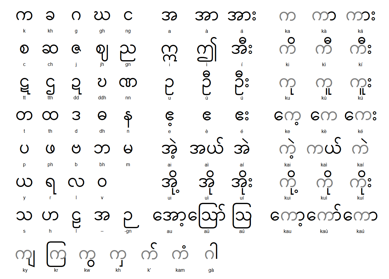
巴利语(IAST/ISO 15919: Pāḷi、पालि)是古印度语言,属于印欧语系、印度-伊朗语族、印度-雅利安语支的中古印度-雅利安语,与梵语十分相近,是印度俗语普拉克里特诸语言之一。巴利语可以用各种文字书写,比如婆罗米文、天城文,以及由巴利圣典协会的英国语言学家理斯·戴维斯所采用的适用于各种印度语言的拉丁字母转写。
Pali (පාලි pāli, deutsch ‚der Text‘ „die Zeile“) ist eine mittelindoarische Sprache. Ob Pali jemals eine gesprochene Sprache war, ist umstritten. Heute wird es eher als Literatursprache eingestuft. Pali gehört zu den Prakrit-Sprachen. Heutzutage wird Pali als Sakralsprache im südostasiatischen Buddhismus verwendet.
 地理
地理
 体育
体育


 国际城市
国际城市
 重要港口
重要港口
 建筑艺术
建筑艺术


 手拉手
手拉手