Deutsch-Chinesische Enzyklopädie, 德汉百科
 *Mediterranean Sea
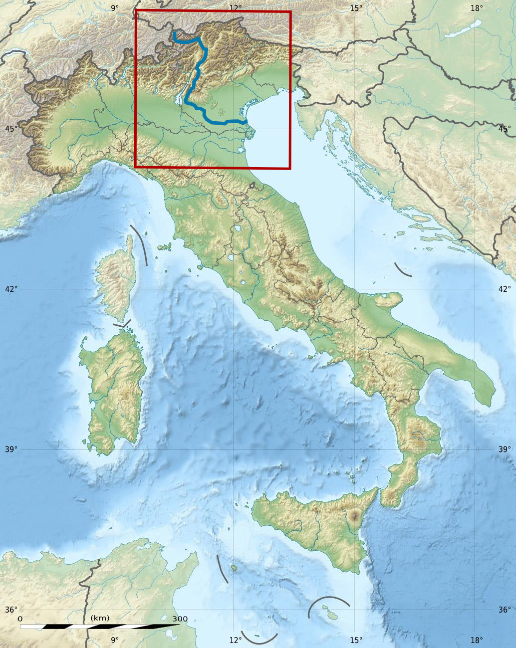
 Geography
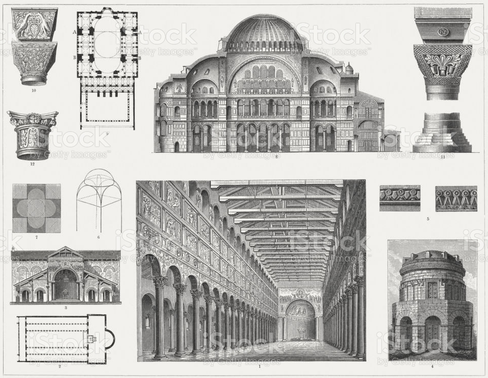
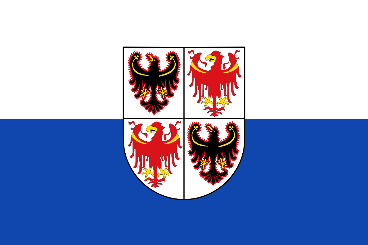 Trentino-Alto Adige
 *Mediterranean Sea
 Abruzzo
Albania
Amber Road
Bosnia Herzegovina
Abruzzo
Albania
Amber Road
Bosnia Herzegovina
 Emilia-Romagna
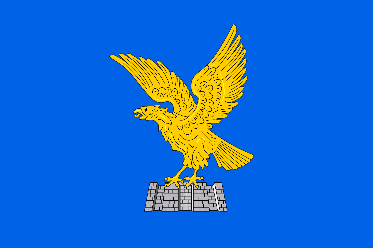 Friuli-Venezia Giulia
Italy
Croatia
Friuli-Venezia Giulia
Italy
Croatia
 Marche
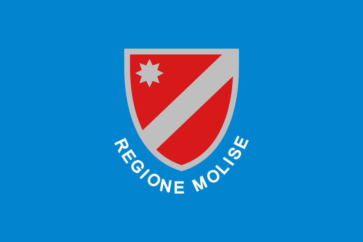 Molise
Montenegro
Molise
Montenegro
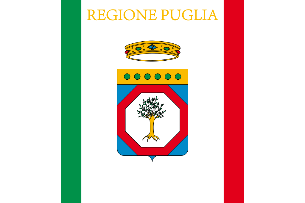 Puglia
Slovenia
Puglia
Slovenia
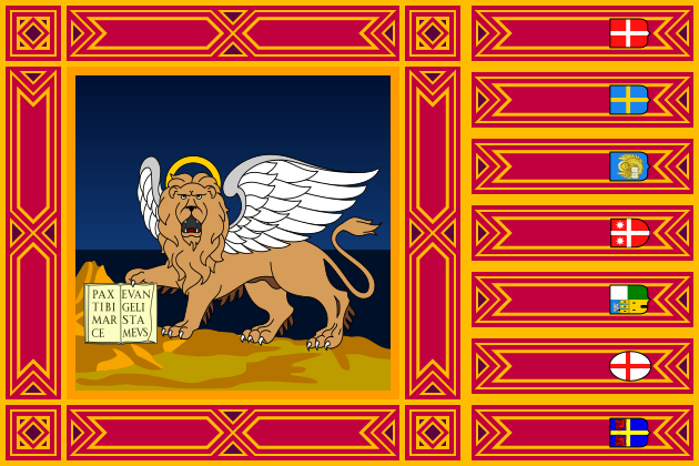 Veneto
亚得里亚海(意大利语:Mar Adriatico,斯洛文尼亚语:Jadransko morje,克罗地亚语:Jadransko more,阿尔巴尼亚语:Deti Adriatik),是地中海的一部分水域,分隔了意大利半岛(亚平宁半岛)和巴尔干半岛,也分隔了亚平宁山脉与狄那里克阿尔卑斯山脉及其临近地区。亚得里亚海西岸属于意大利,东岸则分别属于斯洛文尼亚、克罗地亚、波斯尼亚和黑塞哥维那、黑山和阿尔巴尼亚。亚得里亚海透过位于其南部的奥特朗托海峡与爱奥尼亚海相连。波河、阿迪杰河、奥凡托河等河流流入亚得里亚海;海中有近1200个岛屿,其中只有69个有人居住。
Das Adriatische Meer, kurz auch die Adria (lateinisch Mare Adriaticum; italienisch Mare Adriatico; bosnisch, kroatisch und serbisch Jadransko more oder kurz Jadran; slowenisch Jadransko morje; albanisch Deti Adriatik oder kurz Adriatiku), ist das lang gestreckte nördliche Seitenbecken des Mittelmeeres zwischen der Apenninhalbinsel und Balkanhalbinsel. Es ist nach der Stadt Adria in Italien (Provinz Rovigo) benannt. Zum Adriatischen Meer wird alles gerechnet, was nördlich der Straße von Otranto liegt.
アドリア海(アドリアかい、英: Adriatic Sea ; イタリア語: Mar Adriatico ; クロアチア語: Jadransko more)は、地中海の海域の一つ。イタリア半島とバルカン半島に挟まれている。
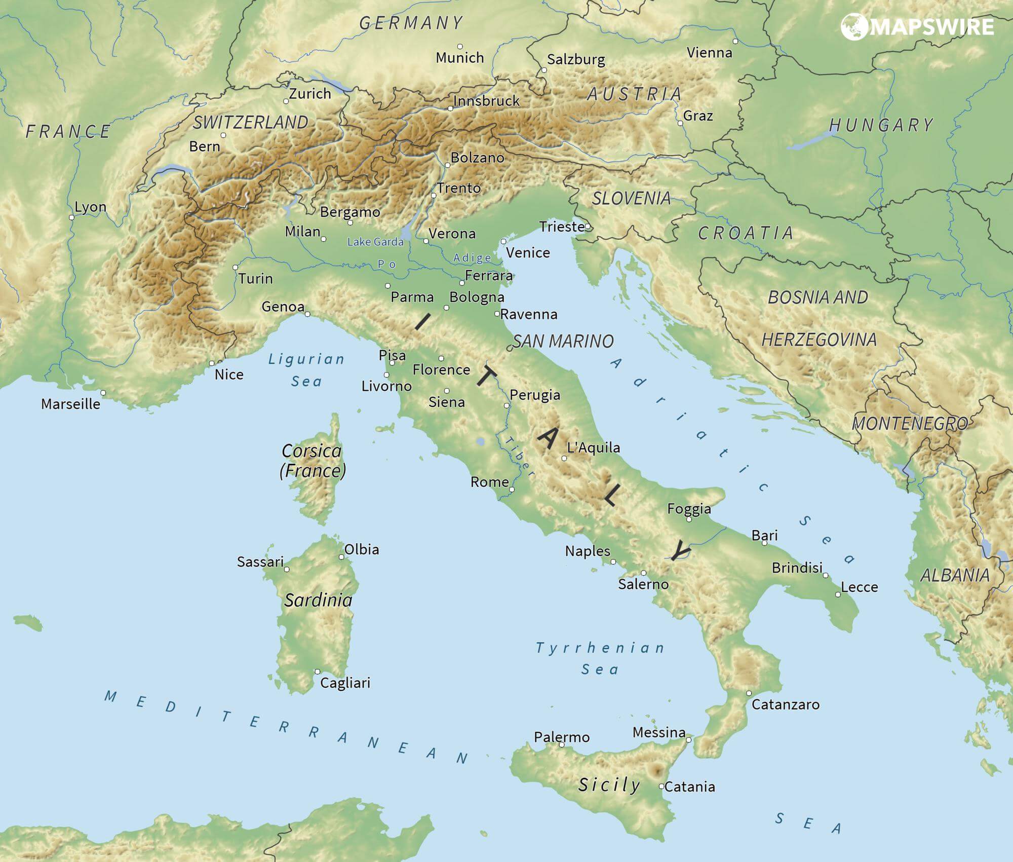
The Adriatic Sea (/ˌeɪdriˈætɪk/) is a body of water separating the Italian Peninsula from the Balkans. The Adriatic is the northernmost arm of the Mediterranean Sea, extending from the Strait of Otranto (where it connects to the Ionian Sea) to the northwest and the Po Valley. The countries with coasts on the Adriatic are Albania, Bosnia and Herzegovina, Croatia, Italy, Montenegro and Slovenia. The Adriatic contains over 1,300 islands, mostly located along the Croatian part of its eastern coast. It is divided into three basins, the northern being the shallowest and the southern being the deepest, with a maximum depth of 1,233 metres (4,045 ft). The Otranto Sill, an underwater ridge, is located at the border between the Adriatic and Ionian Seas. The prevailing currents flow counterclockwise from the Strait of Otranto, along the eastern coast and back to the strait along the western (Italian) coast. Tidal movements in the Adriatic are slight, although larger amplitudes are known to occur occasionally. The Adriatic's salinity is lower than the Mediterranean's because the Adriatic collects a third of the fresh water flowing into the Mediterranean, acting as a dilution basin. The surface water temperatures generally range from 30 °C (86 °F) in summer to 12 °C (54 °F) in winter, significantly moderating the Adriatic Basin's climate.
The Adriatic Sea sits on the Apulian or Adriatic Microplate, which separated from the African Plate in the Mesozoic era. The plate's movement contributed to the formation of the surrounding mountain chains and Apennine tectonic uplift after its collision with the Eurasian plate. In the Late Oligocene, the Apennine Peninsula first formed, separating the Adriatic Basin from the rest of the Mediterranean. All types of sediment are found in the Adriatic, with the bulk of the material transported by the Po and other rivers on the western coast. The western coast is alluvial or terraced, while the eastern coast is highly indented with pronounced karstification. There are dozens of marine protected areas in the Adriatic, designed to protect the sea's karst habitats and biodiversity. The sea is abundant in flora and fauna—more than 7,000 species are identified as native to the Adriatic, many of them endemic, rare and threatened ones.
The Adriatic's shores are populated by more than 3.5 million people; the largest cities are Bari, Venice, Trieste and Split. The earliest settlements on the Adriatic shores were Etruscan, Illyrian, and Greek. By the 2nd century BC, the shores were under Rome's control. In the Middle Ages, the Adriatic shores and the sea itself were controlled, to a varying extent, by a series of states—most notably the Byzantine Empire, the Croatian Kingdom, the Republic of Venice, the Habsburg Monarchy and the Ottoman Empire. The Napoleonic Wars resulted in the First French Empire gaining coastal control and the British effort to counter the French in the area, ultimately securing most of the eastern Adriatic shore and the Po Valley for Austria. Following Italian unification, the Kingdom of Italy started an eastward expansion that lasted until the 20th century. Following World War I and the collapse of Austria-Hungary and the Ottoman Empire, the eastern coast's control passed to Yugoslavia and Albania. The former disintegrated during the 1990s, resulting in four new states on the Adriatic coast. Italy and Yugoslavia agreed on their maritime boundaries by 1975 and this boundary is recognised by Yugoslavia's successor states, but the maritime boundaries between Slovenia, Croatia, Bosnia-Herzegovina, and Montenegro are still disputed. Italy and Albania agreed on their maritime boundary in 1992.
Fisheries and tourism are significant sources of income all along the Adriatic coast. Adriatic Croatia's tourism industry has grown faster economically than the rest of the Adriatic Basin's. Maritime transport is also a significant branch of the area's economy—there are 19 seaports in the Adriatic that each handle more than a million tonnes of cargo per year. The largest Adriatic seaport by annual cargo turnover is the Port of Trieste, while the Port of Split is the largest Adriatic seaport by passengers served per year.
La mer Adriatique (du latin : Mare Hadriaticum ou Mare Adriaticum) est une mer séparant la péninsule italienne de la péninsule balkanique. L'Adriatique est le bras de la Méditerranée situé le plus au nord en s'étendant du canal d'Otrante (où elle rejoint la mer Ionienne) jusqu'aux villes de Venise et de Trieste et à l'embouchure du Pô. Les pays côtiers sont l'Italie, la Slovénie, la Croatie, la Bosnie-Herzégovine, le Monténégro et l'Albanie, ainsi que la Grèce par l'île de Corfou.
Il mare Adriatico è l'articolazione del mar Mediterraneo orientale situata tra la penisola italiana e la penisola balcanica; suddiviso in Alto Adriatico, Medio Adriatico e Basso Adriatico, bagna sei Paesi: Italia, Slovenia, Croazia, Bosnia ed Erzegovina, Montenegro e Albania, confinando a sud-est con il Mar Ionio.
El mar Adriático (del latín, Mare Hadriaticum) es un golfo estrecho y alargado que forma parte del mar Mediterráneo. Se encuentra situado entre la península Itálica, al oeste, y la península de los Balcanes, al este, con una anchura máxima de unos 200 km, y una longitud de unos 800 km. Su extremo meridional limita con el mar Jónico, del que lo separa el canal de Otranto. Su superficie total es de, aproximadamente, 160 000 km².
Las costas occidental, septentrional, y parte de la oriental corresponden a Italia (60% de la longitud de costa del Adriático), mientras que el resto de la costa oriental corresponde a Croacia, Eslovenia, Bosnia y Herzegovina, Montenegro y Albania. Algunos de los ríos que desembocan en el Adriático son el Reno, el Po, el Adigio, el Brenta, el Piave y el Neretva.
La costa del Adriático concentra un gran número de centros turísticos, como Venecia, que recibe el nombre de «Reina del Adriático». Tras la división de Yugoslavia, la costa croata se ha convertido también en un destino turístico muy popular.
Sus aguas sostienen industria pesquera, y se llevan a cabo prospecciones petrolíferas en este mar. Durante los años 1990, varias investigaciones revelaron que sus niveles de contaminación son muy altos.
En las últimas décadas el gobierno de Italia ha intentado hacer de él una barrera contra la inmigración ilegal, en su mayor parte proveniente de Albania.
Адриати́ческое мо́ре (итал. mare Adriatico, эмил.-ром. Mèr Adriâtic, вен. Mar Adriàtico, неап. Mar Adriateco, словен. Jadransko morje, сербохорв. Jadransko more/Јадранско море, алб. Deti Adriatik, лат. mare Hadriaticum), также Адриатика — полузамкнутое море, часть Средиземного моря между Апеннинским и Балканским полуостровами. Омывает берега Италии (более 1000 км), Словении (47 км), Хорватии (1777 км), Боснии и Герцеговины (20 км), Черногории (200 км), Албании (472 км).
阿非利加洲[2](拉丁语:Africa),简称非洲,位于地球东半球西部,欧洲之南,亚洲以西,地跨赤道南北,面积为30,221,532平方公里,占全球总陆地面积的20.4%,[3]人口约为12亿(截止到2016年),[4]目前约占全球总人口16%。非洲是世界面积第二大洲,同时也是人口第二大洲和第三世界国家主要区域。
非洲多样的气候是丰富生态资源与矿产资源的宝地,同时也是世界古人类和古文明的发祥地之一。目前世界上最古老的人类化石就是在东非发现的,而非洲北部的埃及是世界文明发源地之一。
Afrika ist einer der Kontinente der Erde. Seine Fläche von 30,2 Millionen km² entspricht etwa 22 % der gesamten Landfläche des Planeten, er hat eine Bevölkerung von circa 1,3 Milliarden Menschen (2017).[2] Damit ist er sowohl nach Ausdehnung wie nach Bevölkerung der zweitgrößte Erdteil nach Asien. Nahezu alle afrikanischen Staaten sind Mitglied der Vereinten Nationen und der Afrikanischen Union. Der Kontinent ist überwiegend ländlich und durch hohe Geburtsraten geprägt, welche durch die Modernisierung sinken. Durch die seit etwa 1950 stark steigende Urbanisierung wohnen immer mehr Afrikaner in städtischen Gebieten. Einige afrikanische Städte gehören zu den weltgrößten Ballungsräumen, darunter Kairo, Lagos, Kinshasa, Johannesburg, Luanda und Alexandria.
Entsprechend der „Out-of-Africa-Theorie“ gilt Afrika als die „Wiege der Menschheit“, wo im Zuge der Hominisation die Entwicklung zum anatomisch modernen Menschen Homo sapiens stattfand. Eine der frühesten Hochkulturen der Menschheit bildete sich im Alten Ägypten. Über die Jahrtausende entstanden auf dem Kontinent verschiedene „Großreiche“ wie das Kaiserreich Abessinien. Der Sklavenhandel mit den afrikanischen Reichen seit dem 16. Jahrhundert und die spätere Kolonisation durch europäische Staaten („Wettlauf um Afrika“) führten zu einer teils Reißbrett-artigen Gebietsaufteilung. Diese wurde im Zuge der Dekolonisation ab der Mitte des 20. Jahrhunderts von vielen neu gebildeten afrikanischen Staaten übernommen. Die heterogenen Völker Afrikas hatten traditionell andere Siedlungsgebiete, was zu verschiedenen Konflikten und Kriegen um Territorial-, Rohstoff- und Machtansprüche beiträgt.
Während die meisten Länder Afrikas lange autokratisch regiert wurden, setzten sich ab dem späten 20. Jahrhundert häufiger demokratische Bewegungen durch, wobei die Region Afrika seit Beginn der Demokratiemessungen am schlechtesten abschnitt. Armut, Hungersnöte, Kindersterblichkeit und Gesundheitsprobleme konnten durch Bildung, wirtschaftliche, medizinische und infrastrukturelle Fortschritte in den letzten Jahrzehnten erheblich verringert werden. Die Bedeutung der Staaten Afrikas in der Weltwirtschaft ist nach BIP bis auf einige Ausnahmen wie Südafrika, Nigeria, Ägypten, Algerien, Angola und Marokko noch gering. Mehrere afrikanische Länder zählen seit Beginn des 21. Jahrhunderts jedoch zu den weltweit am schnellsten wachsenden Volkswirtschaften. Die Rohstoffe und die landwirtschaftlich nutzbaren Flächen des Kontinents sind von zunehmender Bedeutung für die afrikanischen Länder wie auch mit ihnen handelnde Industrie- und Schwellenländer.
Die Geographie und Natur Afrikas sind vielfältig, es gibt eine große Anzahl von naturgeschützten Nationalparks. Das afrikanische UNESCO-Welterbe ist umfassend.
アフリカ(ラテン語:Āfrica、英語:Africa[3])は、広義にはアフリカ大陸およびその周辺のマダガスカル島などの島嶼・海域を含む地域の総称で、六大州の一つ[3]。阿州。漢字表記は阿弗利加。
地理的には地中海を挟んでヨーロッパの南に位置する。 赤道を挟んで南北双方に広い面積を持つ唯一の大陸でもあり、それに伴って多様な気候領域がある[4]。面積は3020万平方キロメートルで、地球表面の6%、陸地全体の20.4%を占めるが[5]、人口は約10億人で、世界人口比では14.72%を占めるに過ぎない。2011年3月現在、島嶼を含めて54の独立国がある(西サハラを含めると55カ国)。経済成長率は2010年に約5.0%、2011年予測は5.5%である[6]。
アフリカはアフリカ単一起源説からヒトの起源とされ、エチオピアからは20万年前のホモ・サピエンスの化石が発見され[7]、世界遺産の南アフリカの人類化石遺跡群は人類の発祥の地と呼ばれている。アフリカは、かつてヨーロッパ諸国から「暗黒大陸」と未開の地のように呼ばれたが、ヨーロッパに知られていなかった(あるいはその存在を認めようとしなかった)だけで、実際にはヨーロッパより古い歴史と文明があった。
アフリカの地理的区分ではサハラ砂漠が大きな境界となり、この北側を「ホワイトアフリカ」、南側を「ブラックアフリカ」あるいは「サブサハラアフリカ」と呼び分ける場合もある。また、北アフリカ、中部アフリカ、東アフリカ、南部アフリカ、西アフリカに分ける区分もある。
Africa is the world's second-largest and second-most populous continent, after Asia. At about 30.3 million km2 (11.7 million square miles) including adjacent islands, it covers 6% of Earth's total surface area and 20% of its land area.[4] With 1.3 billion people[1][2] as of 2018, it accounts for about 16% of the world's human population. The continent is surrounded by the Mediterranean Sea to the north, the Isthmus of Suez and the Red Sea to the northeast, the Indian Ocean to the southeast and the Atlantic Ocean to the west. The continent includes Madagascar and various archipelagos. It contains 54 fully recognised sovereign states (countries), eight territories and two de facto independent states with limited or no recognition. The majority of the continent and its countries are in the Northern Hemisphere, with a substantial portion and number of countries in the Southern Hemisphere.
Africa's average population is the youngest amongst all the continents;[5][6] the median age in 2012 was 19.7, when the worldwide median age was 30.4.[7] Algeria is Africa's largest country by area, and Nigeria is its largest by population. Africa, particularly central Eastern Africa, is widely accepted as the place of origin of humans and the Hominidae clade (great apes), as evidenced by the discovery of the earliest hominids and their ancestors as well as later ones that have been dated to around 7 million years ago, including Sahelanthropus tchadensis, Australopithecus africanus, A. afarensis, Homo erectus, H. habilis and H. ergaster—the earliest Homo sapiens (modern human), found in Ethiopia, date to circa 200,000 years ago.[8] Africa straddles the equator and encompasses numerous climate areas; it is the only continent to stretch from the northern temperate to southern temperate zones.[9]
Africa hosts a large diversity of ethnicities, cultures and languages. In the late 19th century, European countries colonised almost all of Africa; most present states in Africa emerged from a process of decolonisation in the 20th century. African nations cooperate through the establishment of the African Union, which is headquartered in Addis Ababa.
L’Afrique est un continent qui couvre 6 % de la surface de la Terre et 20 % de la surface des terres émergées. Sa superficie est de 30 415 873 km2 avec les îles, ce qui en fait la troisième mondiale si l'on compte l'Amérique comme un seul continent. Avec plus de 1,2 milliard d'habitants, l'Afrique est le deuxième continent le plus peuplé après l'Asie et représente 16,4 % de la population de la planète en 2016. Le continent est bordé par la mer Méditerranée au nord, le canal de Suez et la mer Rouge au nord-est, l’océan Indien au sud-est et l’océan Atlantique à l’ouest.
L'Afrique est traversée, presque en son milieu, par l'équateur et présente plusieurs climats : chaud et humide au plus près de l'équateur, tropical dans les régions comprises entre l'équateur et les tropiques, chaud et aride autour des tropiques, tempéré dans les zones d'altitude. Le continent est caractérisé par le manque de précipitations régulières. En l'absence de glaciers ou de systèmes montagneux aquifères, il n'existe pas de moyen de régulation naturelle du climat à l’exception des côtes. Les terres arides représentent 60 % de son territoire. Son environnement est néanmoins très riche — on l'appelle le « paradis de la biodiversité » — et le continent abrite le second massif forestier continu de la planète, la forêt du bassin du Congo, mais cet environnement est menacé par la déforestation et la baisse de la biodiversité, conséquences du changement climatique et de la pression anthropique.
Le continent est considéré comme le berceau de l'humanité, là où sont apparus les ancêtres de l'Homme, puis, il y a 200 000 ans environ, l'homme moderne qui s'est ensuite répandu sur le reste du globe. Le Sahara, le plus grand désert chaud du monde, a créé un hiatus, conduisant à des évolutions historiques distinctes entre le nord et le sud. À la période historique, la civilisation de l'Égypte antique se développe le long du Nil, l'Afrique subsaharienne voit naître ses propres civilisations dans les zones de savanes et l'Afrique du Nord, rive sud de la Méditerranée, subit l'influence des Phéniciens, des Grecs et des Romains. À compter de 3000 av. J.-C. l'Afrique connaît l'expansion bantoue. Il s'agit d'un mouvement de population en plusieurs phases, orienté globalement du nord, depuis le grassland du Cameroun actuel, vers le sud, jusqu'en Afrique australe, atteinte aux débuts de l'ère chrétienne. L'expansion bantoue explique la carte ethno-linguistique actuelle de la zone subsaharienne.
La religion chrétienne s'implante en l'Afrique dès le Ier siècle, essentiellement dans l'Afrique romaine du nord du continent puis en Éthiopie. Le VIIe siècle voit les débuts de l'Islam en Afrique, lequel s'installe sur la côte est et dans le nord du continent jusqu'à la frange septentrionale de la zone subsaharienne. L'Afrique du nord est, dans le même temps, arabisée. En Afrique subsaharienne, à partir du VIIIe siècle et jusqu'au XVIIe siècle, de puissants et riches empires se succèdent. Vers la fin de cette période, au XVe siècle, les Portugais, suivis par d'autres nations européennes, installent sur la côte ouest un trafic d'esclaves, la traite atlantique, qui s'ajoute à la traite intra-africaine et à la traite orientale qui sévissent déjà sur le continent.
Le XVIIIe siècle marque le début des explorations européennes, suivies par la colonisation massive du continent entre la fin du XIXe et le début du XXe siècle. La traite esclavagiste cesse au début du XXe siècle, mais l'Afrique est presque entièrement sous domination coloniale jusqu'à la fin du XXe siècle, ce qui modèle jusqu'à aujourd'hui les frontières et les économies des pays concernés.
La plupart des États obtiennent leur indépendance entre la fin des années 1950 (Maroc, Tunisie, Ghana…) et le milieu des années 1970 (Angola, Mozambique…). L'Afrique indépendante est constituée essentiellement de « démocraties imparfaites » voire de « régimes autoritaires » et les conflits y sont nombreux. Depuis l'accession à l'indépendance du Soudan du Sud en 2011, l'Afrique, comprenant Madagascar, compte 54 États souverains (non inclus la RASD et le Somaliland).
Les pays du continent présentent la croissance démographique la plus importante de la planète et une situation sanitaire qui s'améliore nettement tout en progressant moins vite que dans les autres pays en développement.
L'Afrique repose sur une organisation sociale fondée sur la famille élargie et l'appartenance ethnique ; on recense un millier d'ethnies sur le continent. Elle possède en parallèle la diversité linguistique la plus élevée du monde avec près de 2 000 langues vivantes.
L'Afrique contemporaine est dans une situation où le poids de sa démographie est délicat à gérer (chômage, financement de l'éducation…) car elle reste le continent le moins développé économiquement malgré une forte croissance depuis le début du XXIe siècle, laquelle a permis l'émergence d'une classe moyenne moins féconde, aux revenus plus élevés. Elle est en outre confrontée aux violences terroristes parmi les plus meurtrières de la planète.
Économiquement, le commerce intercontinental est soutenu depuis l'époque antique et, à l'époque des grands empires, le continent est le fournisseur d'or de l'Occident et de l'Orient. Plus tard, la colonisation entraîne une spécialisation massive des économies coloniales qui deviennent presque exclusivement extraverties, dévolues à l'exportation des matières premières, minérales et agricoles, vers les métropoles. Sachant qu'elle possède encore d'importantes réserves minières et pétrolières, cette situation perdure au XXIe siècle, avec, en corollaire, des États rentiers et des oligarchies qui captent les revenus au détriment de populations restées pauvres. Sa place dans la mondialisation économique actuelle est minime, au contraire des siècles passés. Certains pays ont cependant amorcé un tournant économique durant la période récente grâce à la diversification économique, le développement du secteur tertiaire et la « croissance inclusive ».
L'art africain excelle dans des domaines, danse, musique et art plastique particulièrement, qui lui permettent de rayonner partout dans le monde.
L'Africa è un continente del pianeta Terra, il terzo per superficie (considerando l'America al secondo posto se intesa come un unico continente), attraversata dall'equatore e dai Tropici del Cancro e del Capricorno e quindi caratterizzata da una grande varietà di climi e ambienti, come deserti, savane e foreste pluviali. Assieme all'Eurasia, forma il cosiddetto "Continente Antico".
Confina a est con il continente asiatico, attraverso l'istmo di Suez a nord-est, dal 1869 canale artificiale di Suez, quindi bagnato dal Mar Rosso e dall'Oceano Indiano, compreso il Madagascar; a sud con l'Oceano Antartico, la cui costa antartica dista circa 5000 km dall'estrema punta sud del continente africano (Capo Agulhas); a ovest con l'Oceano Atlantico, con distanza minima dal continente americano di circa 4000 km (distanza Santo Antão, Capo Verde-Fortaleza, Brasile); a nord con il Mar Mediterraneo, che la separa dall'Europa.
África es el tercer continente más extenso, tras Asia y América. Está situado entre los océanos Atlántico, al oeste, el Índico, al este. El mar Mediterráneo lo separa al norte del continente europeo; el punto en el que los dos continentes se hallan más cercanos es el estrecho de Gibraltar de 14,4 km de ancho. El mar Rojo lo separa al este de la península arábiga y queda unido a Asia a través del istmo de Suez, en territorio egipcio. Posee una superficie total de 30 272 922 km² (621 600 km² en masa insular), que representa el 20,4 % del total de las tierras emergidas del planeta. La población es de mil millones de habitantes, menos del 15 % del total mundial. El continente se divide en 55 estados soberanos siendo dos de ellos, España y Egipto, transcontinentales, además de dos estados con reconocimiento limitado y dos territorios dependientes.А́фрика — второй по площади материк после Евразии, омывается Средиземным морем с севера, Красным — с северо-востока, Атлантическим океаном с запада и Индийским океаном с востока и юга. Африкой называется также часть света, состоящая из материка Африка и прилегающих островов. Площадь Африки без островов составляет 29,2 млн км², с островами — около 30,3 млн км²[3], покрывая, таким образом, 6 % общей площади поверхности Земли и 20,4 % поверхности суши. На территории Африки расположено 55 государств.
Население Африки составляет более миллиарда человек. Африка считается прародиной человечества: именно здесь нашли самые древние останки ранних гоминид и их вероятных предков, включая сахелантропов, Australopithecus africanus, A. afarensis, Homo erectus, H. habilis и H. ergaster.
Африканский континент пересекает экватор и имеет много климатических зон; это единственный континент, протянувшийся от северного субтропического климатического пояса до южного субтропического. Из-за недостатка постоянных осадков и орошения — равно как ледников или водоносного горизонта горных систем — естественного регулирования климата нигде, кроме побережий, практически не наблюдается.
Изучением культурных, экономических, политических и социальных проблем Африки занимается наука африканистика.
 *Mediterranean Sea
Egypt
*Mediterranean Sea
Egypt
 Ancient Egypt
 History
 D 3000 - 2500 BC
History
B 5000 - 4000 BC
History
E 2500 - 2000 BC
History
F 2000 - 1500 BC
History
G 1500 - 1000 BC
History
H 1000 - 500 BC
History
I 500 - 0 BC
History
J 0 - 500 AD
D 3000 - 2500 BC
History
B 5000 - 4000 BC
History
E 2500 - 2000 BC
History
F 2000 - 1500 BC
History
G 1500 - 1000 BC
History
H 1000 - 500 BC
History
I 500 - 0 BC
History
J 0 - 500 AD
 World Heritage
 Civilization
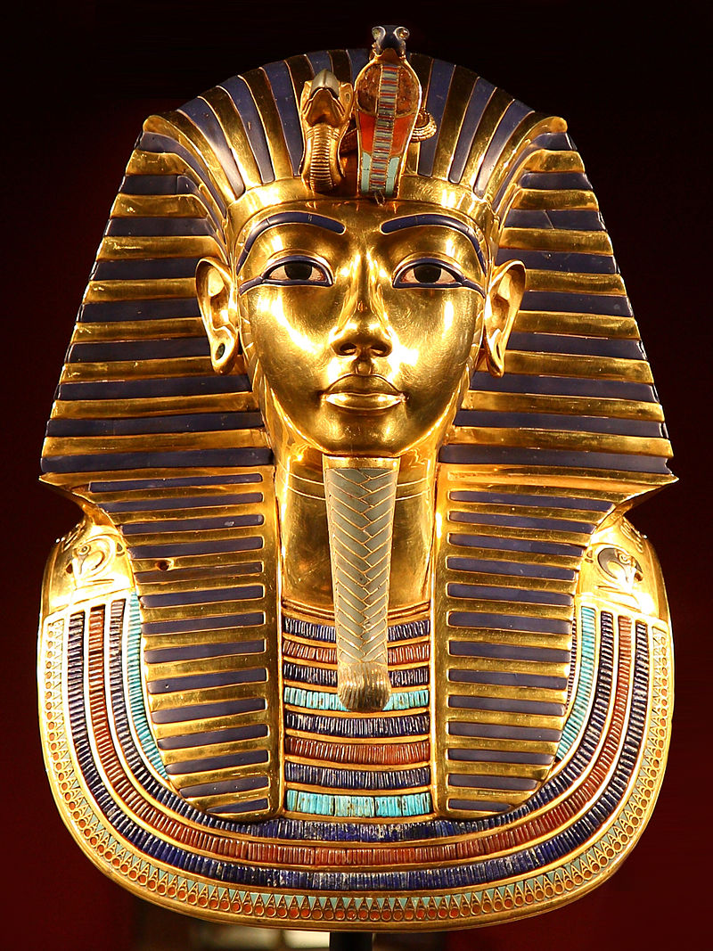
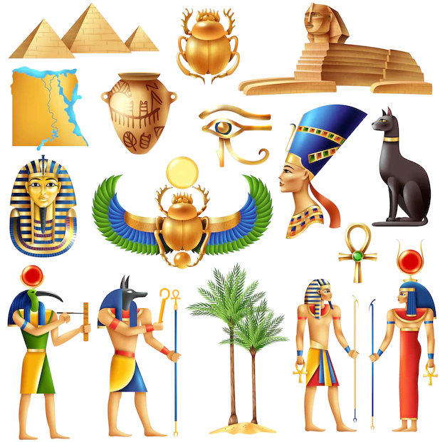
古埃及(阿拉伯语:مصر القديمة)是位于非洲东北部尼罗河中下游地区的一段时间跨度近3000年的古代文明,开始于公元前32世纪左右时美尼斯统一上下埃及建立第一王朝,终止于公元前343年波斯再次征服埃及,虽然之后古埃及文化还有少量延续,但到公元以后的时代,古埃及已经彻底被异族文明所取代,在连象形文字也被人们遗忘后,古代史前社会留给后人的是宏伟的建筑与无数谜团,1798年,拿破仑远征埃及,发现罗塞塔石碑,1822年法国学者商博良解读象形文字成功,埃及学才诞生,古埃及文明才重见天日。直到今日都还不断被挖掘出来。
古埃及的居民是由北非的土著居民和来自西亚的游牧民族塞姆人融合形成的多文化圈。约公元前6000年,因为地球轨道的运转规律性变化、间冰期的高峰过去等客观气候因素,北非茂密的草原开始退缩,人们放弃游牧而开始寻求固定的水源以耕作,即尼罗河河谷一带,公元前4千年后半期,此地逐渐形成国家,至公元前343年为止,共经历前王朝、早王朝、古王国、第一中间期、中王国、第二中间期、新王国、第三中间期、后王朝9个时期31个王朝的统治(参见“古埃及历史”一节)。其中古埃及在十八王朝时(公元前15世纪)达到鼎盛,南部尼罗河河谷地带的上埃及的领域由现在的苏丹到埃塞俄比亚,而北部三角洲地区的下埃及除了现在的埃及和部分利比亚以外,其东部边界越过西奈半岛直达迦南平原。[1]
在社会制度方面,古埃及有自己的文字系统,完善的行政体系和多神信仰的宗教系统,其统治者称为法老,因此古埃及又称为法老时代或法老埃及[2]。古埃及的国土紧密分布在尼罗河周围的狭长地带,是典型的水力帝国[来源请求]。古埃及跟很多文明一样,具有保存遗体的丧葬习俗,透过这些木乃伊的研究能一窥当时人们的日常生活,对古埃及的研究在学术界已经形成一门专门的学科,称为“埃及学”。
古埃及文明的产生和发展同尼罗河密不可分,如古希腊历史学家希罗多德所言:“埃及是尼罗河的赠礼。”古埃及时,尼罗河几乎每年都泛滥,淹没农田,但同时也使被淹没的土地成为肥沃的耕地。尼罗河还为古埃及人提供交通的便利,使人们比较容易的来往于河畔的各个城市之间。古埃及文明之所以可以绵延数千年而不间断,另一个重要的原因是其相对与外部世界隔绝的地理环境,古埃及北面和东面分别是地中海和红海,而西面则是沙漠,南面是一系列大瀑布,只有东北部有一个通道通过西奈半岛通往西亚。这样的地理位置,使外族不容易进入埃及,从而保证古埃及文明的稳定延续。相比较起来,周围相对开放的同时代的两河流域文明则经常被不同民族所主宰,两者对后世所带来的价值观也完全不同。Altes Ägypten ist die allgemeine Bezeichnung für das Land Ägypten im Altertum. Der ägyptische Name lautete Kemet und bedeutet „schwarzes Land“. Kemet bezeichnet das Delta des Nils und geht auf den schwarzen Schlamm zurück, der nach der jährlichen Nilschwemme zurückblieb und eine fruchtbare Ernte garantierte. Eine andere Bezeichnung für das Land des Altertums war Ta meri (T3 mrj), was mit „geliebtes Land“ übersetzt wird.[1]
エジプトは不毛の砂漠地帯であるが、毎年春のナイル川の増水で水に覆われる地域には河土が運ばれて堆積し、農耕や灌漑が可能になる。この氾濫原だけが居住に適しており、主な活動はナイル河畔で行われた。ナイル川の恩恵を受ける地域はケメト(黒い大地)と呼ばれ、ケメトはエジプトそのものを指す言葉として周囲に広がるデシェレト(赤い大地、ナイル川の恩恵を受けない荒地)と対比される概念だった。このケメトの範囲の幅は非常に狭く、ナイル川の本流・支流から数kmの範囲にとどまっていた。しかしながら川の周囲にのみ人が集住しているということは交通においては非常に便利であり、川船を使って国内のどの地域にも素早い移動が可能であった。この利便性は、ナイル河畔に住む人々の交流を盛んにし、統一国家を建国し維持する基盤となった。
ナイル川本流からナイル川の上流は谷合でありナイル川1本だけが流れ、下流はデルタ地帯(ナイル川デルタ)が広がっている。最初に上流地域(上エジプト)と下流地域(下エジプト)[1]でそれぞれ違った文化が発展した後に統一されたため、ファラオ(王)の称号の中に「上下エジプト王」という部分が残り、古代エジプト人も自国のことを「二つの国」と呼んでいた。
毎年のナイル川の氾濫を正確に予測する必要から天文観測が行われ、太陽暦が作られた。太陽とシリウス星が同時に昇る頃、ナイル川は氾濫したという。また、氾濫が収まった後に農地を元通り配分するため、測量術、幾何学、天文学が発達した。ヒエログリフから派生したワディ・エル・ホル文字と原シナイ文字(原カナン文字)は世界の殆どのアルファベットの起源となったされる。
エジプト文明と並ぶ最初期における農耕文明の一つであるメソポタミア文明が、民族移動の交差点にあたり終始異民族の侵入を被り支配民族が代わったのと比べ、地理的に孤立した位置にあったエジプトは比較的安定しており、部族社会が城壁を廻らせて成立する都市国家の痕跡は今の所発見されていない。
Ancient Egypt was a civilization of ancient North Africa, concentrated along the lower reaches of the Nile River in the place that is now the country Egypt. Ancient Egyptian civilization followed prehistoric Egypt and coalesced around 3100 BC (according to conventional Egyptian chronology)[1] with the political unification of Upper and Lower Egypt under Menes (often identified with Narmer).[2] The history of ancient Egypt occurred as a series of stable kingdoms, separated by periods of relative instability known as Intermediate Periods: the Old Kingdom of the Early Bronze Age, the Middle Kingdom of the Middle Bronze Age and the New Kingdom of the Late Bronze Age.
Egypt reached the pinnacle of its power in the New Kingdom, ruling much of Nubia and a sizable portion of the Near East, after which it entered a period of slow decline. During the course of its history Egypt was invaded or conquered by a number of foreign powers, including the Hyksos, the Libyans, the Nubians, the Assyrians, the Achaemenid Persians, and the Macedonians under the command of Alexander the Great. The Greek Ptolemaic Kingdom, formed in the aftermath of Alexander's death, ruled Egypt until 30 BC, when, under Cleopatra, it fell to the Roman Empire and became a Roman province.[3]
The success of ancient Egyptian civilization came partly from its ability to adapt to the conditions of the Nile River valley for agriculture. The predictable flooding and controlled irrigation of the fertile valley produced surplus crops, which supported a more dense population, and social development and culture. With resources to spare, the administration sponsored mineral exploitation of the valley and surrounding desert regions, the early development of an independent writing system, the organization of collective construction and agricultural projects, trade with surrounding regions, and a military intended to assert Egyptian dominance. Motivating and organizing these activities was a bureaucracy of elite scribes, religious leaders, and administrators under the control of a pharaoh, who ensured the cooperation and unity of the Egyptian people in the context of an elaborate system of religious beliefs.[4][5]
The many achievements of the ancient Egyptians include the quarrying, surveying and construction techniques that supported the building of monumental pyramids, temples, and obelisks; a system of mathematics, a practical and effective system of medicine, irrigation systems and agricultural production techniques, the first known planked boats,[6] Egyptian faience and glass technology, new forms of literature, and the earliest known peace treaty, made with the Hittites.[7] Ancient Egypt has left a lasting legacy. Its art and architecture were widely copied, and its antiquities carried off to far corners of the world. Its monumental ruins have inspired the imaginations of travelers and writers for centuries. A new-found respect for antiquities and excavations in the early modern period by Europeans and Egyptians led to the scientific investigation of Egyptian civilization and a greater appreciation of its cultural legacy.[8]
L'Égypte antique est une ancienne civilisation du nord-est de l'Afrique, concentrée le long du cours inférieur du Nil, dans ce qui constitue aujourd'hui l'Égypte.
La civilisation de l'Égypte antique prend forme autour de -31501 avec l'unification politique de la Haute-Égypte au sud et de la Basse-Égypte au nord sous le règne du premier roi et se développe sur plus de trois millénaires2. Son histoire est parsemée d'une série de périodes stables politiquement, entrecoupées de plusieurs périodes intermédiaires, plus troublées. L'Égypte antique atteint son apogée sous le Nouvel Empire puis entre dans une période de lent déclin. Le pays subit les assauts répétés de puissances étrangères dans cette période tardive et le règne des pharaons prend officiellement fin en -30 où l'Empire romain conquiert l'Égypte pour en faire une province3.
Le succès de la civilisation égyptienne antique découle en partie de sa capacité à s'adapter aux conditions de la vallée du Nil. L'inondation prévisible du fleuve et le contrôle de l'irrigation de la vallée produit des récoltes excédentaires qui alimentent le développement social et culturel du pays. Ce surplus agricole donne à l'administration les moyens de financer l'exploitation minière de la vallée et des régions voisines du désert. Le développement rapide d'un système d'écriture indépendant, l'organisation de constructions collectives et de projets agricoles, les relations commerciales avec les pays voisins et une armée solide permettent à l'Égypte d'affirmer sa domination sur la région. Toutes ces activités sont organisées par une bureaucratie de scribes, de dirigeants religieux et d'administrateurs sous le contrôle du pharaon qui assure l'unité du peuple égyptien dans le cadre d'un système complexe de croyances religieuses4,5.
Les nombreuses réalisations des Égyptiens de l'Antiquité comprennent l'extraction minière, l'arpentage et les techniques de construction qui facilitent la construction de pyramides monumentales, de temples et d'obélisques. On compte également à leur crédit le développement des mathématiques, de la médecine, de l'irrigation et de la production agricole, la construction des premiers navires connus, la faïence égyptienne, de nouvelles formes de littérature6. Du rassemblement des tribus primitives qui créent le premier royaume pharaonique jusqu'à son absorption au Ier siècle av. J.-C., l'Égypte antique est le théâtre d'évènements majeurs qui influencent assurément la culture et l'imaginaire des peuples lui ayant succédé. Son art et son architecture sont largement copiés et ses antiquités sont disséminées aux quatre coins du monde. Un regain d'intérêt pour la période antique au début de l'époque moderne conduit à de nombreuses investigations scientifiques de la civilisation égyptienne, notamment par des fouilles, et à une meilleure appréciation de son héritage culturel, pour l'Égypte et le monde7.
Con Antico Egitto si intende la civiltà sviluppatasi lungo la Valle del Nilo a partire dalle cateratte, a sud e al confine con l’attuale Sudan[N 1], alla foce, al delta, nel Mar Mediterraneo, per un’estensione complessiva di circa 1000 km. Benché il territorio fosse molto più vasto, comprendendo gran parte anche del Deserto Libico-Nubiano, gli insediamenti umani, fin dai tempi più remoti, si svilupparono solo nella stretta fascia verdeggiante a ridosso delle rive del fiume larga, in alcuni punti anche solo poche centinaia di metri.
Fin dal 3500 a.C., di pari passo con l'avvento dell'agricoltura, in particolare la coltivazione del grano, dell’orzo e del lino, si ha contezza di insediamenti umani specie lungo le rive del Nilo[1]. Le piene annuali del fiume, infatti, favorivano la coltivazione anche con più raccolti annui grazie ai sedimenti, particolarmente fertili (Limo), che il fiume, nel suo ritirarsi, lasciava sul terreno. Ciò comportò, fin dai tempi più remoti, conseguentemente, la necessità di controllare, incanalare e conservare le acque onde garantire il costante approvvigionamento, vuoi per il sostentamento umano, vuoi per quello del bestiame e delle piantagioni.
Non è da escludersi che proprio la complessa necessità di dover far fronte alle esigenze connesse con la gestione dell’agricoltura, e segnatamente, delle acque nilotiche, abbia favorito proprio il formarsi delle prime comunità su territori parziali tuttavia ben differenziati e politicamente e geograficamente individuabili. Tali entità, normalmente individuate con il termine greco di nomoi, ben presto si costituirono in due distinte entità geo-politiche più complesse. Tale l’importanza del fiume Nilo, che attraversava tutto il paese, che anche le denominazioni di tali due macro-aree fanno riferimento al fiume: considerando che le sorgenti del Nilo, benché all'epoca non note, dovevano essere a sud, tale sarà l’Alto Egitto, mentre, di converso, l’area del delta, verso il Mediterraneo, sarà indicato come Basso Egitto[2].
Varie culture si susseguirono nella valle nilotica fin dal 3900 a.C. in quello che viene definito Periodo Predinastico. Un’entità embrionale di Stato può riconoscersi, invece, a partire dal 3200-3100 a.C. con la I dinastia e l’unificazione delle due macro-aree che resteranno, tuttavia, sempre distinte tanto che per tutta la storia del Paese i regnanti annovereranno tra i loro titoli quello di Signore delle Due Terre.
La storia dell’Antico Egitto copre, complessivamente, circa 4000 anni, dal 3900 a.C. (con il Periodo Predinastico) al 342 a.C. (con il Periodo tardo) e comprende, dal 3200 a.C., trenta dinastie regnanti riconosciute archeo-storicamente. A queste debbono esserne aggiunte altre, dette di comodo, giacché riferite, di fatto, non a governi autoctoni, o comunque derivanti dal Paese, bensì frutto di invasioni o di raggiungimento del potere da parte di regnanti stranieri. Avremo perciò una XXXI dinastia, costituita da re persiani, una XXXII dinastia macedone, che annovera un solo sovrano, Alessandro Magno, e una XXXIII dinastia, meglio nota come Dinastia tolemaica, nata dallo smembramento dell’impero di Alessandro.
Anche molti imperatori romani, occupato l’Egitto, non disdegnarono di assumere il titolo di faraone con titolatura geroglifica.
El Antiguo Egipto fue una civilización que se originó a lo largo del cauce medio y bajo del río Nilo, y que alcanza tres épocas de esplendor faraónico en los periodos denominados Imperio Antiguo, Imperio Medio, e Imperio Nuevo. Alcanzaba desde el delta del Nilo en el norte, hasta Elefantina, en la primera catarata del Nilo, en el sur, llegando a tener influencia desde el Éufrates hasta Jebel Barkal, en la cuarta catarata del Nilo, en épocas de máxima expansión. Su territorio también abarcó, en distintos periodos, el desierto oriental y la línea costera del mar Rojo, la península del Sinaí, y un gran territorio occidental dominando los dispersos oasis. Históricamente, fue dividido en Alto y Bajo Egipto, al sur y al norte respectivamente.
La civilización egipcia se desarrolló durante más de 3000 años. Comenzó con la unificación de algunas ciudades del valle del Nilo,1 alrededor del año 3150 a. C.,2 y convencionalmente se da por terminado en el año 31 a. C., cuando el Imperio romano conquistó y absorbió el Egipto ptolemaico, que desaparece como Estado.3 Este acontecimiento no representó el primer período de dominación extranjera, pero fue el que condujo a una transformación gradual en la vida política y religiosa del valle del Nilo, marcando el final del desarrollo independiente de su cultura. Su identidad cultural había comenzado a diluirse paulatinamente tras las conquistas de los reyes de Babilonia (siglo VI a. C.) y Macedonia (siglo IV a. C.), desapareciendo su religión con la llegada del cristianismo, en la época de Justiniano I, cuando en 535 fue prohibido el culto a la diosa Isis, en el templo de File.
Egipto tiene una combinación única de características geográficas, situada en el África nororiental y confinada por Libia, Sudán, el mar Rojo y el mar Mediterráneo. El río Nilo fue la clave para el éxito de la civilización egipcia, ya que éste permitía el aprovechamiento de los recursos y ofrecía una significativa ventaja sobre otros oponentes: el légamo fértil depositado a lo largo de los bancos del Nilo tras las inundaciones anuales significó para los egipcios el practicar una forma de agricultura menos laboriosa que en otras zonas, liberando a la población para dedicar más tiempo y recursos al desarrollo cultural, tecnológico y artístico.
La vida se ordenaba en torno al desarrollo de un sistema de escritura y de una literatura independientes, así como en un cuidadoso control estatal sobre los recursos naturales y humanos, caracterizado sobre todo por la irrigación de la fértil cuenca del Nilo y la explotación minera del valle y de las regiones desérticas circundantes, la organización de proyectos colectivos como las grandes obras públicas, el comercio con las regiones vecinas de África del este y central y con las del Mediterráneo oriental y, finalmente, por un poderío militar capaz de derrotar a cualquier enemigo, y que mantuvieron una hegemonía imperial y la dominación territorial de civilizaciones vecinas en diversos períodos. La motivación y la organización de estas actividades estaba encomendada a una burocracia de élite sociopolítica y económica, los escribas, bajo el control del Faraón, un personaje semidivino, perteneciente a una sucesión de dinastías, que garantizaba la cooperación y la unidad del pueblo egipcio en el contexto de un elaborado sistema de creencias religiosas.45
Los muchos logros de los egipcios incluyen la extracción minera, la topografía y las técnicas de construcción que facilitaron el levantamiento de monumentales pirámides, templos y obeliscos, unos procedimientos matemáticos, una práctica médica eficaz, métodos de riego y técnicas de producción agrícola, las primeras naves conocidas,6 la tecnología del vidrio y de la fayenza, las nuevas formas de la literatura y el tratado de paz más antiguo conocido, firmado con los hititas.7 Egipto dejó un legado duradero, su arte y arquitectura fueron ampliamente copiados, y sus antigüedades se llevaron a los rincones más lejanos del mundo. Sus ruinas monumentales han inspirado la imaginación de los viajeros y escritores desde hace siglos. Un nuevo respeto por las antigüedades y excavaciones en la época moderna han llevado a la investigación científica de la civilización egipcia y a una mayor apreciación de su legado cultural.8
Древний Еги́пет (от др.-греч. Αἴγυπτος и лат. Aegyptus), самоназвание Та-кемет, Та-мери, Та-уи и др. (транслит. егип. tA-kmt, tA-mrj, tA-wy), Ке́ми (копт. Ⲭⲏⲙⲓ) — название исторического региона и культуры значительной цивилизации Древнего мира, существовавшей на северо-востоке Африки вдоль нижнего течения реки Нил. История Древнего Египта составляет около 40 веков и подразделяется исследователями на додинастический период (относится к финалу доисторического периода, краткий обзор которого также приводится в статье), династический период (основной этап существования египетской цивилизации протяжённостью около 27 веков), эллинистический период (синтез с греко-македонской культурой под властью династии Птолемеев), римский период (в составе древнеримского государства, как одна из важнейших провинций Римской империи). Временные границы существования древнеегипетской культуры, принятые исследователями, охватывают период с середины IV тысячелетия до н. э. до IV век н. э. Византийско-коптский период (в составе Византии) хотя и относится уже к раннему средневековью, при этом также иногда рассматривается в рамках изучения Древнего Египта. Временные границы начинаются с IV века и заканчиваются арабским завоеванием в VII веке.
Возвышение древнеегипетской цивилизации в большой степени было результатом её способности адаптироваться к условиям речной долины и дельты Нила. Регулярные ежегодные разливы, удобряющие почву плодородным илом, а также организация ирригационной системы земледелия позволяли производить зерновые культуры в избыточном количестве, обеспечивавшем социальное и культурное развитие. Концентрация людских и материальных ресурсов в руках администрации способствовала созданию и поддержанию сложной сети каналов, появлению регулярной армии и расширению торговли, а с постепенным развитием горнодобывающего дела, полевой геодезии и строительных технологий давала возможность организовывать коллективные возведения монументальных сооружений. Принуждающей и организующей силой в Древнем Египте был хорошо развитый государственный аппарат, состоявший из жрецов, писцов и администраторов во главе с фараоном, который часто обожествлялся в сложной системе религиозных верований с развитым культом погребальных обрядов.
Древний Египет оставил огромное культурное наследие для мировой цивилизации, произведения его искусства ещё в древности вывозились в различные уголки мира и широко копировались мастерами других стран. Своеобразные архитектурные формы — величественные пирамиды, храмы, дворцы и обелиски вдохновляли воображение путешественников и исследователей в течение многих столетий. Египетскими мастерами создавались прекрасные настенные росписи и статуи, были освоены способы производства стекла и фаянса, поэтами и писателями созданы новые формы в литературе. В числе научных достижений древних египтян было создание оригинальной системы письма, математика, практическая медицина, астрономические наблюдения и возникший на их основе календарь. Интерес к памятникам, артефактам и археологическим раскопкам в Древнем Египте, возникший на рубеже XVIII—XIX веков, привёл к созданию науки египтологии и возникновению направлений искусства (египтомания, египтизирующий стиль).
*Mediterranean Sea
 Architecture
History
History
H 1000 - 500 BC
History
I 500 - 0 BC
Greece
Architecture
History
History
H 1000 - 500 BC
History
I 500 - 0 BC
Greece
 Review
World Heritage
Civilization
Review
World Heritage
Civilization

古希腊(希腊语:Ελλάς,罗马化:Ellas)是希腊的一个历史时期,狭义上指希腊地区从公元前12世纪迈锡尼文明毁灭至公元前146年希腊地区被罗马共和国征服为止。广义上指爱琴诸文明在罗马人征服前的全部历史。
早在约公元前3650年,爱琴海地区就孕育了灿烂的米诺斯文明(或称克里特文明),约公元前16世纪被迈锡尼文明取代,文明中心从克里特岛转向了希腊大陆。约公元前1200年,多利安人入侵毁灭了迈锡尼文明,希腊历史进入所谓“黑暗时代”或“中古希腊”。在公元前九世纪末期,海上贸易再次兴盛,新的城邦国家纷纷建立。公元前5世纪初在雅典与斯巴达领导下,希腊城邦联军在两次波希战争战胜波斯帝国。此时希腊文明进入了最高峰,古典哲学,科技,艺术以及民主政治快速发展,获称为“黄金时期”(伯里克利在位)。
伯罗奔尼撒战争结束了雅典民主制,希腊各城邦进入混战。公元前4世纪末马其顿国王亚历山大大帝征服希腊地区后,古希腊文化播迁到埃及与印度河流域的广大地区,称为希腊化时期。古希腊不是统一的政治实体,而是一个笼统的称谓。由于古希腊文明在地中海世界的重大影响,其文化被古罗马吸收并带到欧洲的许多地区。因此一般认为古希腊文明为西方文明打下了基础[1][2][3]。
Das antike Griechenland hat die Entwicklung der europäischen Zivilisation maßgeblich mitgeprägt. Es umfasst im Kern den Zeitraum von ca. 800 v. Chr. bis zur Einbeziehung des letzten der hellenistischen Reiche 30 v. Chr. ins Römische Reich. Kulturgeschichtlich wirkten diverse Erscheinungsformen, Entwicklungen und Hervorbringungen aber weit darüber hinaus und teils bis in die Gegenwart nach. Die antike griechische Geschichte wird dabei traditionell unterteilt in die drei Epochen Archaik, Klassik und Hellenismus.
Die archaische Epoche Griechenlands folgte dabei dem Zerfall der mykenischen Kultur und den sogenannten „dunklen Jahrhunderten“ (von ca. 1050 bis ca. 800 v. Chr.). Bald nach der Entstehung des griechischen Alphabets wurden bereits grundlegende Werke der abendländischen Dichtkunst, wie vor allen die Ilias und die Odyssee, schriftlich festgehalten. Im Zeitraum von 800 bis 500 v. Chr. etablierte sich die Polis als Staatsform, und es kam zur Gründung vieler griechischer Kolonien im Mittelmeerraum und am Schwarzen Meer. In der Archaik entstanden zudem erste Formen friedlichen sportlichen Wettstreits für alle Hellenen, wie die Olympischen Spiele.
In der folgenden klassischen Periode (ca. 480–336 v. Chr.), die unter anderem die Selbstbehauptung der Griechen in den Perserkriegen sowie die Entwicklung und Ausgestaltung der attischen Demokratie, aber auch zerstörerische Kriege griechischer Poleis untereinander wie den Peloponnesischen Krieg beinhaltete, kam es verschiedentlich zu einer politischen, wirtschaftlichen und kulturellen Entfaltung, die ihresgleichen in vormodernen Zeiten sucht und die ein Fundament für das Abendland legte. Prägend war dabei vor allem Athen, das im Mittelpunkt der schriftlichen Überlieferung zu dieser Zeit steht. Zu den exemplarischen Leistungen der antiken griechischen Kultur zählen:
- architektonische Monumente wie auf der Athener Akropolis,
- bedeutende Skulpturen, die zeitübergreifend Maßstäbe setzten,
- Blüte der Philosophie, deren bedeutendste Vertreter Platon und Aristoteles in dieser Zeit wirkten
- fundamentale und überdauernde Begriffsbildung auch im Bereich Politik, wie zum Beispiel Demokratie, Aristokratie oder Oligarchie,
- die Entstehung des Dramas, namentlich der Werke von Sophokles, Aischylos, Euripides und Aristophanes,
- die Begründung der abendländischen Geschichtsschreibung durch Herodot und Thukydides mit bedeutender Nachwirkung,
- maßgebliche Erkenntnisse auf dem Gebiet der Mathematik und Physik.
Mit dem makedonischen König Alexander dem Großen begann die letzte Epoche der eigenständigen griechischen Geschichte, der Hellenismus (ca. 336–27 v. Chr.). Diese Zeit war durch das Ende der Sonderrolle Athens, die Gründung zahlreicher neuer Poleis und die Verbreitung griechischer Sprache und Kultur bis nach Vorderindien, durch die gegenseitige Durchdringung von östlicher und westlicher Zivilisation und Religion sowie insbesondere durch die Etablierung von Großreichen, die von makedonischen Königen beherrscht wurden, gekennzeichnet, bis der östliche Mittelmeerraum seit 200 v. Chr. in einem gut 150 Jahre dauernden Prozess schrittweise unter römische Herrschaft geriet und schließlich Teil des Imperium Romanum wurde. 27 v. Chr. wurde der größere Teil Griechenlands zur römischen Provinz Achaea. Auch der Hellenismus brachte bedeutende intellektuelle und künstlerische Leistungen hervor; so wirkten damals Denker wie Archimedes und Eratosthenes, die bis heute wirkenden Denktraditionen der Stoa und des Epikureismus wurden begründet und monumentale Kunstwerke wie der Pergamonaltar geschaffen.
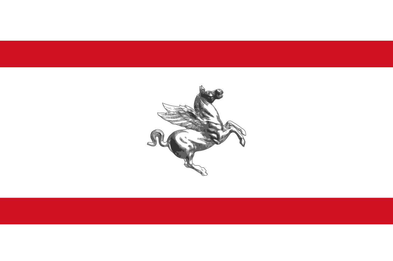 Toscana


亚细亚洲(古希腊语:Ασία;拉丁语:Asia),简称亚洲,面积4457.9万平方公里,约占地球总面积的8.6%(总陆地面积的29.4%);亚洲人口约47亿人,是世界总人口约61%(2019年)[2];是七大洲中面积最大,人口最多的一个洲。
亚洲位于亚欧大陆东部,大部分土地位于东半球和北半球,东面是太平洋、北面是北冰洋,南面则濒临印度洋。亚洲与非洲以苏伊士运河为界限,隔亚丁湾、曼德海峡、红海与非洲相邻。亚洲与欧洲分界线为乌拉尔山脉、乌拉尔河、里海、大高加索山脉、黑海和黑海海峡。亚洲东北部与北美洲大致以白令海峡为界限。亚洲东南部以帝汶海同大洋洲相望。
亚洲大陆(不含离岛)的四至是,最东端为至白令海峡杰日尼奥夫角(西经169度40分,北纬60度5分),最南端为马来西亚丹绒比亚(东经103度31分,北纬1度16分)[3],最西端为土耳其巴巴角(东经26度3分,北纬39度27分),北至最北端为俄罗斯切柳斯金角(东经104度18分,北纬77度43分)。跨越经纬度十分广,东西时差11小时。除大陆外,亚洲岛屿面积约270万平方公里,仅次于北美洲。
亚洲最高峰为世界第一高峰珠穆朗玛峰,最低点为世界陆地最低点死海,最高高原是世界最高高原青藏高原,最长河流是世界第三长度河流长江,最大湖泊是里海,最深湖泊是贝加尔湖,最大沙漠是阿拉伯沙漠。
亚洲是人类文明摇篮之一,是世界三大宗教佛教、伊斯兰教和基督教的发源地,四大文明古国中有三个(古巴比伦、古代印度、古代中国)位于亚洲。
Asien, Teil von Eurasien, ist mit rund 44,615 Millionen Quadratkilometern, etwa einem Drittel der gesamten Landmasse, der flächenmäßig größte Erdteil. Mit über vier Milliarden Menschen, mehr als der Hälfte der Weltbevölkerung, ist dieser Erdteil auch der einwohnerstärkste. Es gibt 47 international anerkannte Staaten Asiens.
Menschheitsgeschichtlich spielte Asien früh eine wichtige Rolle. Hier entstanden bereits um 900 v. Chr. mit dem Neuassyrischen Reich oder 500 v. Chr. mit dem noch größeren Achämenidenreich die ersten Großreiche.
アジア(ラテン語: Asia[注釈 1])は、世界の大州のひとつ。現在では一般的にヨーロッパを除くユーラシア大陸全般を指すが、政治的・経済的な立場の違いにより、様々な定義がなされる場合がある。亜州(あしゅう)。アッシリア語で東を意味する「アス」に語源をもつ。古代では現在の小アジアを指した。
現在ではユーラシア大陸のヨーロッパ以外の地域、つまり、アジア大陸(島嶼・海域を含む)であり、六大州の一つ。ユーラシア大陸の面積の約80%をアジアが占め、人口は世界最多であり世界人口の約60%強がアジアに住んでいるといわれている。世界の都市のうち都市圏人口上位8位まではアジアに属する都市が占めている(世界の都市圏人口の順位を参照)。
アジアとヨーロッパの境界は、地理上の境界とヨーロッパ中心主義的な観点から見た人為的な境界が入り交じっている。地理上の境界は、ウラル山脈-ウラル川-カスピ海-コーカサス山脈-黒海-ボスポラス海峡-マルマラ海-ダーダネルス海峡とすることが多い。なお、アフリカとはスエズ地峡を、オセアニアとはニューギニア島西方の海峡を挟んでいるため、この両地域とは地理的境界と人為的境界が一致している。
アジアは六大州で最も大きな州であり、地理的にも多様で変化に富む。アジアの大半はアジア大陸に属するが、大陸内でも気候や地形に様々な差がある。また、特に大陸東側には環太平洋造山帯の活動によってできた無数の島々が点在しており、日本やフィリピン、インドネシアといった島国に多数の人口を抱える国家が存在する。アジアの東部から南部にかけては降雨が多く肥沃な土壌に恵まれることから人口が古代より非常に多く、現代においても世界最大の人口密集地域となっている。
人種に関して多くはモンゴロイドであるが一部地域ではヨーロッパと隣接しているためその地域ではコーカソイドの特徴がある場合がある。
Asia (/ˈeɪʒə, ˈeɪʃə/ (![]() listen)) is Earth's largest and most populous continent, located primarily in the Eastern and Northern Hemispheres. It shares the continental landmass of Eurasia with the continent of Europe and the continental landmass of Afro-Eurasia with both Europe and Africa. Asia covers an area of 44,579,000 square kilometres (17,212,000 sq mi), about 30% of Earth's total land area and 8.7% of the Earth's total surface area. The continent, which has long been home to the majority of the human population,[5] was the site of many of the first civilizations. Asia is notable for not only its overall large size and population, but also dense and large settlements, as well as vast barely populated regions. Its 4.5 billion people (as of June 2019) constitute roughly 60% of the world's population.[6]
listen)) is Earth's largest and most populous continent, located primarily in the Eastern and Northern Hemispheres. It shares the continental landmass of Eurasia with the continent of Europe and the continental landmass of Afro-Eurasia with both Europe and Africa. Asia covers an area of 44,579,000 square kilometres (17,212,000 sq mi), about 30% of Earth's total land area and 8.7% of the Earth's total surface area. The continent, which has long been home to the majority of the human population,[5] was the site of many of the first civilizations. Asia is notable for not only its overall large size and population, but also dense and large settlements, as well as vast barely populated regions. Its 4.5 billion people (as of June 2019) constitute roughly 60% of the world's population.[6]
In general terms, Asia is bounded on the east by the Pacific Ocean, on the south by the Indian Ocean, and on the north by the Arctic Ocean. The border of Asia with Europe is a historical and cultural construct, as there is no clear physical and geographical separation between them. It is somewhat arbitrary and has moved since its first conception in classical antiquity. The division of Eurasia into two continents reflects East–West cultural, linguistic, and ethnic differences, some of which vary on a spectrum rather than with a sharp dividing line. The most commonly accepted boundaries place Asia to the east of the Suez Canal separating it from Africa; and to the east of the Turkish Straits, the Ural Mountains and Ural River, and to the south of the Caucasus Mountains and the Caspian and Black Seas, separating it from Europe.[7]
China and India alternated in being the largest economies in the world from 1 to 1800 CE. China was a major economic power and attracted many to the east,[8][9][10] and for many the legendary wealth and prosperity of the ancient culture of India personified Asia,[11] attracting European commerce, exploration and colonialism. The accidental discovery of a trans-Atlantic route from Europe to America by Columbus while in search for a route to India demonstrates this deep fascination. The Silk Road became the main east–west trading route in the Asian hinterlands while the Straits of Malacca stood as a major sea route. Asia has exhibited economic dynamism (particularly East Asia) as well as robust population growth during the 20th century, but overall population growth has since fallen.[12] Asia was the birthplace of most of the world's mainstream religions including Hinduism, Zoroastrianism, Judaism, Jainism, Buddhism, Confucianism, Taoism, Christianity, Islam, Sikhism, as well as many other religions.
Given its size and diversity, the concept of Asia—a name dating back to classical antiquity—may actually have more to do with human geography than physical geography.[citation needed] Asia varies greatly across and within its regions with regard to ethnic groups, cultures, environments, economics, historical ties and government systems. It also has a mix of many different climates ranging from the equatorial south via the hot desert in the Middle East, temperate areas in the east and the continental centre to vast subarctic and polar areas in Siberia.
L'Asie est un des sept continents ou une partie des supercontinents Eurasie ou Afro-Eurasie de la Terre. Avec 43 810 582 km2 de terres et 4,3 milliards d'habitants2, l'Asie est le plus grand continent (8,6 % de la surface totale terrestre ou 29,4 % des terres émergées) et le plus peuplé (environ 60 % de la population mondiale). L'Asie est davantage un concept culturel qu'une entité physique homogène.
Ce continent abrite le plus haut sommet du monde, l'Everest, qui culmine à 8 848 mètres, et la plus haute tour du monde, Burj Khalifa, à Dubaï, d'une hauteur de 828 mètres, ainsi que la terre émergée la plus éloignée de tout océan, située à 2 648 km de la côte la plus proche, au nord-ouest de la Chine (46° 17′ N, 86° 40′ E).
L'Asia è una regione geografica del mondo, comunemente considerata un continente, parte del supercontinente euroasiatico, insieme all'Europa, ed una delle tre parti del supercontinente composto da: Africa, Europa ed Asia. È il più vasto dei continenti del mondo, con una superficie di oltre 4,4 volte più grande di quella dell'Europa e pari a circa un terzo di tutte le terre emerse e, con circa 4,4 miliardi di abitanti, è di gran lunga il più popolato.
Asia es el continente más grande y poblado de la Tierra. Con cerca de 45 millones de km², supone el 8,74 % del total de la superficie terrestre y el 29,45 % de las tierras emergidas y, con alrededor de 4.463 millones de habitantes, el 69 % de la población mundial. Se extiende sobre la mitad oriental del hemisferio Norte, desde el océano Glacial Ártico, al norte, hasta el océano Índico, al sur. Limita, al oeste, con los montes Urales, y al este, con el océano Pacífico.
En la división convencional de continentes, de origen europeo, Asia y Europa aparecen como dos entidades diferentes por razones culturales e históricas. En términos geográficos, forman en realidad un único continente, llamado Eurasia. Además, África está unida a Eurasia por el istmo de Suez por lo que también se puede considerar toda la extensión conjunta de Europa, Asia y África como un único supercontinente, ocasionalmente denominado Eurafrasia, o Afro-eurasia.
А́зия — крупнейшая часть света, как по территории, так и по численности населения. Образует вместе с Европой материк Евразию. Площадь (вместе с островами) — около 43,4 млн км²[2]. Население — 4,2 млрд чел. (2012) (60,5 % населения Земли). Азия является ныне крупнейшим развивающимся регионом в мире[3].
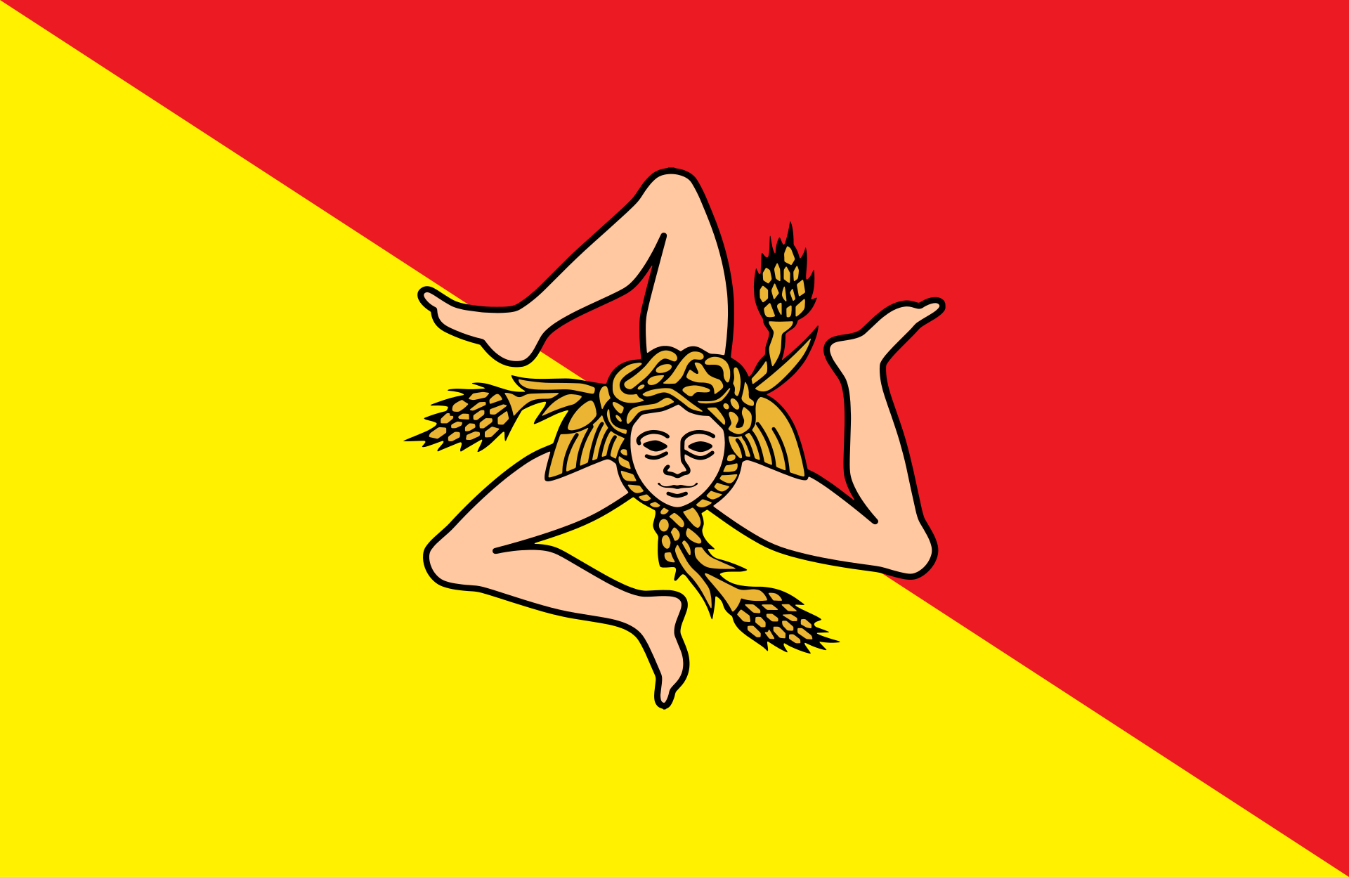 Sicilia


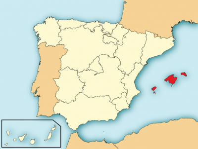
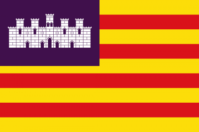
 Balearic Islands


 Traditions