漢德百科全書 | 汉德百科全书
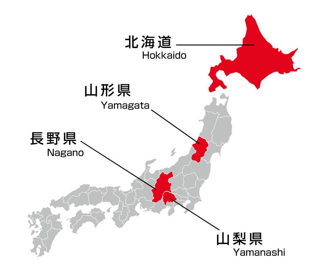
 Hokkaidō
Nobel prize
Hokkaidō
Hokkaidō
Nobel prize
 Nobel Prize in Chemistry
Nobel prize
University/Institute
Top Global University Project
Top Type
Top Global University Project
National universities
Universities in Japan
Nobel Prize in Chemistry
Nobel prize
University/Institute
Top Global University Project
Top Type
Top Global University Project
National universities
Universities in Japan
 Science and technology
*World famous research institutions
Science and technology
*World famous research institutions

 Geography

 Sport
Sport

 Animal world

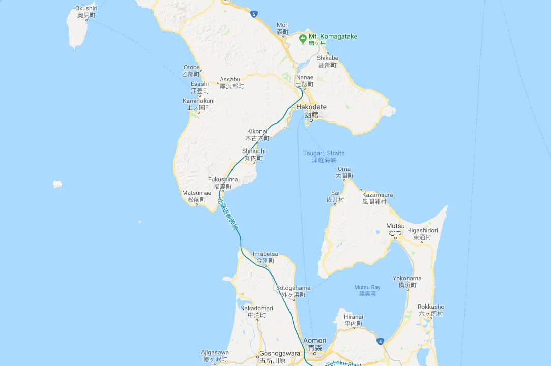

Der Seikan-Tunnel (jap. 青函トンネル, Seikan tonneru) ist ein 53,85 km langer Eisenbahntunnel in Japan. Unter der Tsugaru-Straße hindurch verbindet er die Hauptinsel Honshū mit der nördlich davon gelegenen Insel Hokkaidō. Der unter dem Meer liegende Teil des Tunnels erreicht eine Länge von 23,3 km. Die Bezeichnung Seikan ist nicht von einem geographischen Objekt abgeleitet, sondern von der sinojapanischen Lesung des jeweils ersten Kanji-Schriftzeichens für Aomori (青森) und Hakodate (函館), den nächstgelegenen Großstädten auf Honshū und Hokkaidō.
Nach der seit 2010 entsprechend ausgebauten Linie 3 der chinesischen Guangzhou Metro[1], dem 2016 fertiggestellten Gotthard-Basistunnel in der Schweiz, der 2012 entsprechend ausgebauten Linie 10 der U-Bahn Peking und der 2020 ausgebauten Linie 6 der U-Bahn Chengdu, ist der Seikan-Tunnel zurzeit (Stand: Dezember 2023) der fünftlängste Eisenbahntunnel der Erde; nach dem Eurotunnel zwischen Frankreich und Großbritannien, ist er der längste Unterwassertunnel der Erde. Zum Zeitpunkt seiner Eröffnung am 13. März 1988 stand er weltweit jeweils an der Spitze. Planungen reichen bis ins Jahr 1946 zurück, die Bauarbeiten begannen 1964 und dauerten beinahe 24 Jahre. Die Baukosten betrugen 700 Milliarden Yen, was dem Dreieinhalbfachen der ursprünglichen Schätzungen entspricht. Zunächst waren ausschließlich Gleise in Kapspur (1067 mm) verlegt und der Tunnel ist seither Bestandteil der Kaikyō-Linie. Seit 2016 ermöglichen Dreischienengleise auch die Nutzung durch normalspurige Hochgeschwindigkeitszüge der Hokkaidō-Shinkansen.
青函隧道(日语:青函トンネル/せいかんトンネル Seikan Tonneru、青函隧道/せいかんずいどう Seikan Zuidō)是位于日本津轻海峡的海底铁路隧道,为世界上最长的海底隧道(包含铁路隧道和公路隧道)、以及世界第二长的铁路隧道 (不含地铁隧道),全长53.85公里,其中有23.3公里穿越津轻海峡底部。
其连接日本的本州与北海道两大本岛,隧道南端位于青森县的东津轻郡今别町的滨名、北端则位于北海道上矶郡知内町的汤之里,沿线通过青森县东津轻郡外滨町和北海道松前郡福岛町。目前主要提供新干线与在来线货运列车使用,修整为可同时运行窄轨跟标准轨的三线铁道之隧道。
青函隧道于1966年3月21日动工,1985年3月10日贯通,1987年11月竣工[1],工期逾21年;完工后成为世界最长的隧道达31年之久,至2016年6月1日才被瑞士的圣哥达基线隧道超越。首先启用的在来线部分——海峡线于1988年3月12日通车,新干线部分则在2016年3月26日随着北海道新干线的通车开始营运,海峡线亦于同日起停止行驶定期客运列车。相较于今日以电气化列车行经青函隧道通过津轻海峡所花费的30分钟,从前以铁路渡轮(青函联络船)渡海需时长达4个小时,该隧道启用后,大大缩短了本州与北海道间的交通时间。此外,青函隧道同时铺有光纤线路,使其同时成为本州与北海道间电信通讯的大动脉。
 International cities

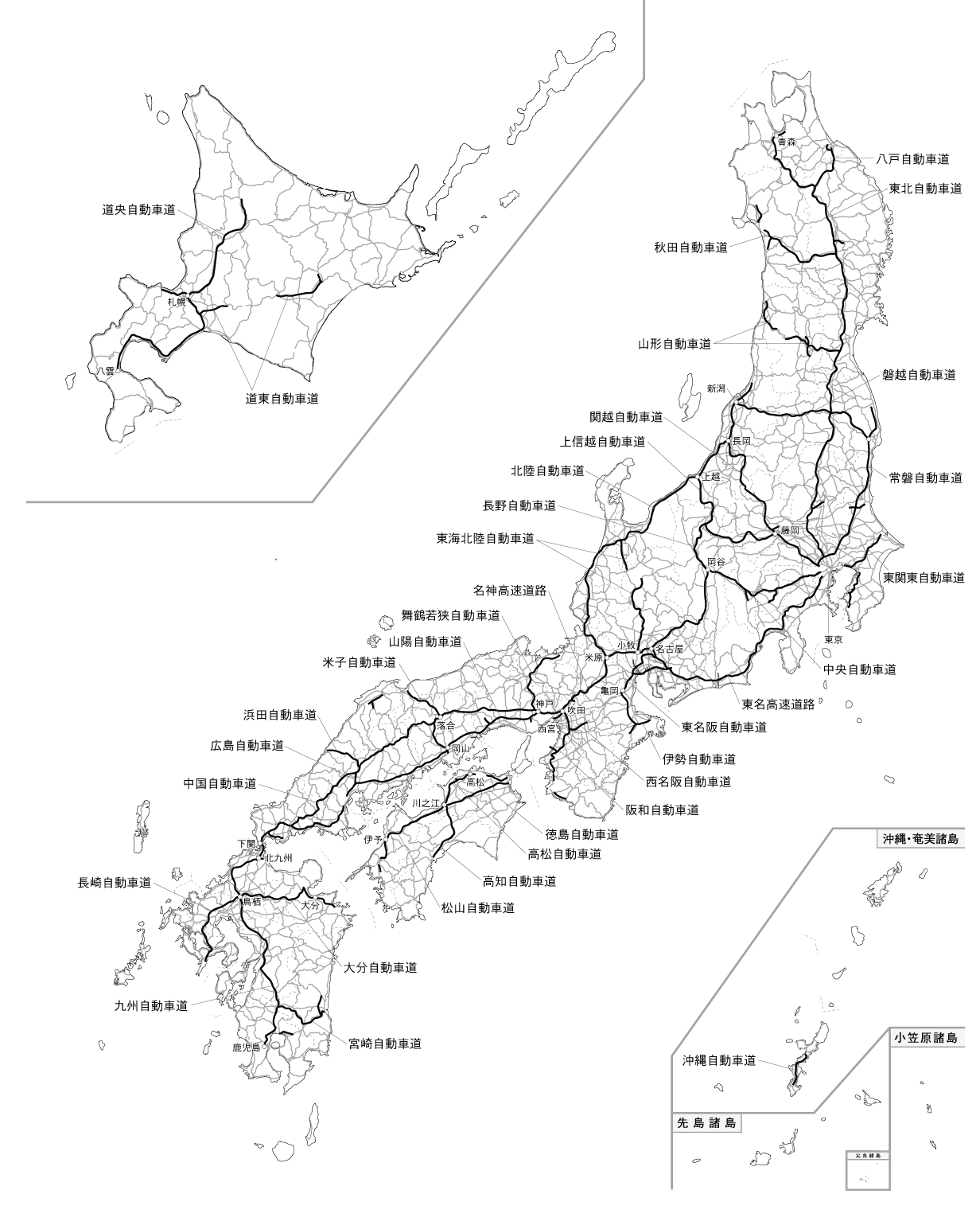
 Transport and traffic
 Chūbu
Chūgoku
Democratic People's Republic of Korea
Hokkaidō
Japan
Kantō
Kinki
Republic of Korea
Russia
Tōhoku
Chūbu
Chūgoku
Democratic People's Republic of Korea
Hokkaidō
Japan
Kantō
Kinki
Republic of Korea
Russia
Tōhoku

 Eat and Drink

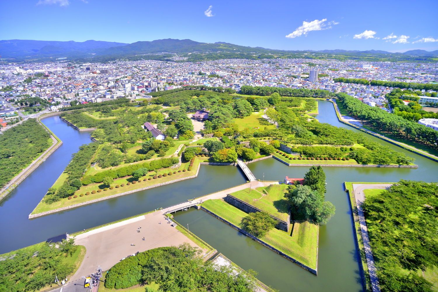
 Architecture