
漢德百科全書 | 汉德百科全书
 Silk road
 Aleksandar Vučić
 Alexis Tsipras
 Aljaksandr Lukaschenka
 Almasbek Atambajew
 Aung San Suu Kyi

 Beijing Shi-BJ
 Belt and Road Forum
 Bounnhang Vorachith
 China
China
 Doris Leuthard
 Dschargaltulgyn Erdenebat
 Generalsekretär der Vereinten Nationen
 António Guterres
 Hailemariam Desalegn

 Hand in Hand
 Hun Sen
 International Renewable Energy Agency,IRENA
 Adnan Z. Amin
 Internationaler Währungsfonds
 Christine Lagarde
 Interpol
 Jürgen Stock
 Joko Widodo
 Li Keqiang
 Mariano Rajoy
 Mauricio Macri
 Michelle Bachelet
 Najib Razak
 Nawaz Sharif
 Nursultan Nasarbajew
 Paolo Gentiloni
 Präsident der Generalversammlung der Vereinten Nationen
 Peter Thomson
 Ranil Wickremesinghe
 Recep Tayyip Erdoğan
 Rodrigo Duterte
 Silk road
 Shavkat Mirziyoyev

 Uhuru Kenyatta
 UNESCO
 Irina Bokowa
 Viktor Orbán
 World Bank
 Jim Yong Kim

 Economy and trade
 Wladimir Wladimirowitsch Putin
 World Economic Forum,WEF
 Klaus Schwab
 World Health Organization, WHO
 Margaret Chan
 World Trade Organization
 Roberto Azevêdo
 Xi Jingping


Islamabad (Urdu اسلام آباد ‚Wohnsitz des Islam‘) ist die Hauptstadt Pakistans. Die erst in den 1960er Jahren gegründete Stadt hat heute 1.014.825 Einwohner.[1] Als geplante Stadt wurde sie an einer klimatisch äußerst vorteilhaften Stelle am Rande des Pothohar-Plateaus, unterhalb der Margalla-Hügel auf einem schachbrettartigen Grundriss angelegt. Islamabad gehört historisch zum Punjab, wurde aber 1970 aus der Provinz ausgegliedert und zu einem eigenständigen Hauptstadtterritorium.
伊斯蘭堡(乌尔都语:اسلام آباد,乌尔都语转写:Islāmābād)是巴基斯坦的首都,位於該國的伊斯兰堡首都区。伊斯兰堡在2011年有两百多万人口[4],并与紧邻着的城市拉瓦尔品第组成一个超過450万人口、位列全国第三的城市群[5]。自城市建立起来就吸引了来自全国的人口,使伊斯兰堡成为巴基斯坦最有世界性和高城市化率的城市。作为国家首都,巴基斯坦政府、巴基斯坦总统府(Aiwan-e-Sadr)驻地于此。巴基斯坦一座国家纪念碑也坐落于这里。伊斯兰堡也是大量外交官、政客和政府员工的接待处。伊斯兰堡的首都開發委員會(CDA)对该城市公共建设工程管理负责。
伊斯兰堡位于巴基斯坦东北的波特瓦尔高原上,海拔540米,属副热带湿润气候。在历史上,这个地区处于一个前往旁遮普和开伯尔-普什图的十字路口处,而马格拉关口则扮演前往两个地区的入口的角色[6]。伊斯兰堡修建于1960年代以取代当时的首都卡拉奇。现在伊斯兰堡是有秩序的国际城市,被认为是巴基斯坦最发达的城市,也被列为Gamma+级的全球城市[7]。南亚最大的清真寺[8]、世界第四大[9][10]的清真寺费萨尔清真寺坐落于伊斯兰堡。在伊斯兰堡有16所承认的大学,包括伊斯兰堡空军大学(AU)、巴基斯坦真纳大学(QAU)以及巴基斯坦国立科技大学(NUST),其中阿拉玛·伊克巴尔开放大学(AIOU)按校友人數排名是世界第四大学校。
イスラマバード(ウルドゥー語: اسلام آباد、英語: Islamabad)は、パキスタンの首都。イスラーマーバードとも呼ばれるが、日本では長母音を無視したイスラマバードの名で広く知られている。
南アジア有数の世界都市であり、2008年にはイギリスのシンクタンク「グローバリゼーションと世界都市研究ネットワーク」によって第3級世界都市と評価された[1]。1951年の人口は約9万4千人であったが[2]、2009年には約120万人となり[3][4]、パキスタンで10番目の人口の都市に成長した[5]。「ラーワルピンディー・イスラマバード都市圏」の人口は297万人(2011年)であり、世界第124位、パキスタン第3位の人口を有する都市圏を形成している[6]。名前は「イスラームの都市」の意味を持つ[7]。
Islamabad (/ɪsˈlɑːməˌbɑːd/; Urdu: اسلام آباد, Islāmābād) is the capital city of Pakistan, and is federally administered as part of the Islamabad Capital Territory. Islamabad is the ninth largest city in Pakistan, while the larger Islamabad-Rawalpindi metropolitan area is the country's fourth largest with a population of about 7.4 million.[5]
Built as a planned city in the 1960s to replace Karachi as Pakistan's capital, Islamabad is noted for its high standards of living,[8] safety,[9] and abundant greenery.[10] The city is the political seat of Pakistan and local government setup is run by the Islamabad Metropolitan Corporation, supported by the Capital Development Authority (CDA).
Islamabad is located in the Pothohar Plateau in the northeastern part of the country, between Rawalpindi District and the Margalla Hills National Park to the north. The region has historically been a part of the crossroads of Punjab and Khyber Pakhtunkhwa with the Margalla Pass acting as the gateway between the two regions.
Islamabad (en ourdou : اسلام آباد, Islāmābād, signifiant « la ville de l'Islam ») est une ville nouvelle et capitale du Pakistan. Située dans le nord du pays, à proximité de la frontière avec l'Inde, elle se trouve dans le Territoire fédéral d'Islamabad et jouxte la ville de Rawalpindi. En 2017, sa population s'établit à un million d'habitants, ce qui en fait la neuvième ville pakistanaise2. Devenue en 1967 la capitale du pays, au détriment de Karachi, Islamabad en constitue le cœur administratif et politique : elle accueille l'Aiwan-e-Sadr (en) (la résidence présidentielle), le siège du gouvernement et le Parlement national. La Mosquée Faisal est en outre l'une des plus grandes mosquées au monde, avec une capacité de plus de 74 000 fidèles.
Islamabad (in urdu اسلام آباد) è una città di 1.014.825 abitanti del Pakistan, capitale dello stato dal 1967. Città di nuova fondazione, si trova nella parte nord-orientale del paese, tra le province del Punjab, a cui apparteneva il suo territorio (a nord-est di Rawalpindi, capitale provvisoria dal 1958 al 1967, con cui forma un unico conglomerato urbano), e di Khyber Pakhtunkhwa; nel 1998 vi era stata censita una popolazione di più di 805.000 abitanti (per due terzi punjabi) su 906 km².
Islamabad (en urdu, اسلام آباد, Islām ābād, que significa: «ciudad del Islam») es la capital de Pakistán, situada en la meseta de Potwar al norte del país, dentro del Territorio Capital de Islamabad. La zona ha sido, históricamente, parte de las encrucijadas del Punjab y la Frontera del Noroeste (el paso de Margalla ha sido una puerta histórica en la Provincia de la Frontera del noroeste). La antigua capital nacional, Rawalpindi, se encuentra a tan sólo 14 km de Islamabad.
Исламаба́д (урду اسلام آباد, англ. Islamabad) — столица Исламской Республики Пакистан. Построен в 1960-х годах как плановый город, чтобы заменить Карачи в качестве столицы Пакистана. Культурный, политический и экономический центр страны. Исламабад известен своим высоким уровнем жизни[2], безопасностью[3] и обильной растительностью[4].
Согласно данным переписи населения 2017 года, население города составляет 1 014 825 человек. Исламабад является 9-м по величине городом Пакистана, в то время как более крупный мегаполис Исламабад-Равалпинди является третьим по величине в стране с населением более четырёх миллионов человек[5][6][7].

 Architecture
 Eurovision Song Contest,ESC

 History

 International cities
 European city

 International cities
 *European Capital of Culture

 Medieval cities in Europe
 Silk road
 Turkey

 Cities founded by the Romans

 World Heritage


Istanbul (türkisch İstanbul, von griechisch εἰς τὴν πόλιν, eis tḕn pólin, „in die Stadt“: siehe unten), früher Konstantinopel, ist die bevölkerungsreichste Stadt der Türkei und deren Zentrum für Kultur, Handel, Finanzen und Medien. Mit rund 14,4 Millionen Einwohnern nahm die Metropolregion 2016 den 15.[5] Platz unter den größten Metropolregionen der Welt ein. Mit jährlich knapp zwölf Millionen Touristen aus dem Ausland ist Istanbul überdies die Stadt mit der achtgrößten Besucherzahl der Welt.[6] Die Stadt liegt am Nordufer des Marmarameeres auf beiden Seiten des Bosporus, also sowohl im europäischen Thrakien als auch im asiatischen Anatolien. Aufgrund ihrer weltweit einzigartigen Transitlage zwischen zwei Kontinenten und zwei Meeresgebieten, dem Schwarzen und dem Mittelmeer, verzeichnet sie einen bedeutenden Schiffsverkehr und verfügt über zwei große Flughäfen sowie zwei zentrale Kopf- und zahlreiche Fernbusbahnhöfe. Das Projekt Marmaray verbindet beide Hälften der Stadt per Eisenbahn und künftig die Kopfbahnhöfe an den Eisenbahnverkehr des jeweils anderen Kontinents. Istanbul ist daher einer der wichtigsten Knotenpunkte für Verkehr und Logistik auf internationaler wie nationaler Ebene.
Im Jahr 660 v. Chr. unter dem Namen Byzantion gegründet, kann die Stadt auf eine 2600-jährige Geschichte zurückblicken. Fast 1600 Jahre lang diente sie nacheinander dem Römischen, dem Byzantinischen und dem Osmanischen Reich als Hauptstadt. Als Sitz des ökumenischen Patriarchen und – bis 1924 – des osmanischen Kalifats war Istanbul zudem jahrhundertelang ein bedeutendes Zentrum des orthodoxen Christentums und des sunnitischen Islams.
Das Stadtbild ist von Bauten der griechisch-römischen Antike, des mittelalterlichen Byzanz sowie der neuzeitlichen und modernen Türkei geprägt. Paläste gehören ebenso dazu wie zahlreiche Moscheen, Cemevleri, Kirchen und Synagogen. Aufgrund ihrer Einzigartigkeit wurde die historische Altstadt von der UNESCO zum Weltkulturerbe erklärt. 2010 war Istanbul Kulturhauptstadt Europas.
伊斯坦布尔(土耳其语:İstanbul [isˈtanbuɫ] ![]() 聆听)是土耳其最大城市,亦是该国的经济、文化和历史中心。它坐落于土耳其西北部的博斯普鲁斯海峡之滨,位于马尔马拉海和黑海之间,横跨欧亚大陆,经济和历史中心位于欧洲一侧,有三分之一人口居住于亚洲一侧[3]。其人口达到1440万,为全欧洲最大的城市群,亦是中东最大和全球第六大城市[2][4]。伊斯坦布尔全市辖区面积5,343平方千米(2,063平方英里),其覆盖范围同伊斯坦布尔省相同,亦是该省的行政中心[c]。亦是世界上唯一横跨两大洲的城市。
聆听)是土耳其最大城市,亦是该国的经济、文化和历史中心。它坐落于土耳其西北部的博斯普鲁斯海峡之滨,位于马尔马拉海和黑海之间,横跨欧亚大陆,经济和历史中心位于欧洲一侧,有三分之一人口居住于亚洲一侧[3]。其人口达到1440万,为全欧洲最大的城市群,亦是中东最大和全球第六大城市[2][4]。伊斯坦布尔全市辖区面积5,343平方千米(2,063平方英里),其覆盖范围同伊斯坦布尔省相同,亦是该省的行政中心[c]。亦是世界上唯一横跨两大洲的城市。
公元前660年左右,该市以“拜占庭”之名建立于萨拉基里奥角,并在此后逐渐发展为历史上最为重要的城市之一。公元330年该市重建为君士坦丁堡([Κωνσταντινούπολις Konstantinoúpolis] 错误:{{lang-xx}}:文本有斜体标记(帮助);拉丁语:Constantinopolis)或新罗马([Νέα Ῥώμη, Nea Romē] 错误:{{lang-xx}}:文本有斜体标记(帮助);拉丁语:Nova Roma),并在此后的近十六个世纪内先后成为罗马帝国(330年–1204年及1261年–1453年)、拉丁帝国(1204年–1261年)和奥斯曼帝国(1453年–1922年)的帝国首都[5]。在罗马和拜占庭帝国时代,它对基督教的发展起到了重要的作用,而在1453年奥斯曼帝国征服该城之后,它成为了伊斯兰教的中心和奥斯曼帝国哈里发的驻地[6]。
伊斯坦布尔是古丝绸之路的途经地[7],也是欧洲和中东的铁路网络之间、黑海和地中海间海路的必经之地,使得伊斯坦布尔的战略地位十分重要,由此也哺育了兼收并蓄的人口和文化,虽然在1923年共和国成立之后这一状况略不如前。在战间期伊斯坦布尔 未能成为新首都,受到忽视,但此后其影响力逐步恢复。自1950年代以来,该市的人口已翻了十倍,来自安那托利亚各地的人口涌入,城市的界限也为此逐渐扩张[8][9]。20世纪末艺术节开始得到兴办,而随着基础设施的改善,复杂的交通网络也由此建立起来。
2012年,在当选欧洲文化之都两年之后,近1160万外国游客造访伊斯坦布尔 ,使其成为世界第五受欢迎的旅游目的地[10]。该市最重要的景点仍是其历史城区,部分被列为联合国教科文组织世界遗产,而位于贝伊奥卢区的天然港金角湾则是其文化和娱乐的中心。伊斯坦布尔还被认为是一个全球城市[11],亦是全球发展速度最快的都市经济区之一[12]。诸多土耳其公司及媒体将总部设于此,全市国内生产总值超过全国的四分之一[13]。伊斯坦布尔希望借助其复苏和快速扩张的契机,在二十年内五次申请举办夏季奥林匹克运动会[14]。
イスタンブール(トルコ語: İstanbul [isˈtanbul]、英語: Istanbul [ˌɪstænˈbuːl]、ラテン語: Constantinopolis コーンスタンティーノポリス、ギリシア語: Κωνσταντινούπολις コーンスタンティヌーポリス /現代ギリシア語 Κωνσταντινούπολι コンスタンディヌーポリ)は、トルコ最大の都市であり、経済・文化・歴史の中心地。トルコ語の発音に準じて「イスタンブル」と表記される場合もある。
Istanbul (UK: /ˌɪstænˈbʊl/, /-ˈbuːl/ or US: /-stɑːn-/ or /ˈɪstənbʊl/;[6][7][8] Turkish: İstanbul [isˈtanbuɫ] ( listen)), historically known as Byzantium and Constantinople, is the most populous city in Turkey and the country's economic, cultural, and historic center. Istanbul is a transcontinental city in Eurasia, straddling the Bosporus strait (which separates Europe and Asia) between the Sea of Marmara and the Black Sea. Its commercial and historical center lies on the European side and about a third of its population lives on the Asian side.[9] The city is the administrative center of the Istanbul Metropolitan Municipality (coterminous with Istanbul Province), both hosting a population of around 15 million residents. [3] Istanbul is one of the world's most populous cities and ranks as the world's 5th-largest city proper and the largest European city. Istanbul is viewed as a bridge between the East and West.
Founded under the name of Byzantion (Βυζάντιον) on the Sarayburnu promontory around 660 BCE, the city grew in size and influence, having become one of the most important cities in history. After its reestablishment as Constantinople in 330 CE, it served as an imperial capital for almost 16 centuries, during the Roman/Byzantine (330–1204 and 1261–1453), the Latin (1204–1261), and the Ottoman (1453–1922) empires.[10] It was instrumental in the advancement of Christianity during Roman and Byzantine times, before the Ottomans conquered the city in 1453 CE and transformed it into an Islamic stronghold and the seat of the Ottoman Caliphate.[11]
Istanbul's strategic position on the historic Silk Road,[12] rail networks to Europe and the Middle East, and the only sea route between the Black Sea and the Mediterranean have produced a cosmopolitan populace. While Ankara was chosen instead as the new Turkish capital after the Turkish War of Independence, the city has maintained its prominence in geopolitical and cultural affairs. The population of the city has increased tenfold since the 1950s, as migrants from across Anatolia have moved in and city limits have expanded to accommodate them.[13][14] Arts, music, film, and cultural festivals were established towards the end of the 20th century and continue to be hosted by the city today. Infrastructure improvements have produced a complex transportation network in the city.
Approximately 12.56 million foreign visitors arrived in Istanbul in 2015, five years after it was named a European Capital of Culture, making the city the world's fifth most popular tourist destination.[15] The city's biggest attraction is its historic center, partially listed as a UNESCO World Heritage Site, and its cultural and entertainment hub can be found across the city's natural harbor, the Golden Horn, in the Beyoğlu district. Considered a global city,[16] Istanbul has one of the fastest-growing metropolitan economies in the world.[17] It hosts the headquarters of many Turkish companies and media outlets and accounts for more than a quarter of the country's gross domestic product.[18] Hoping to capitalize on its revitalization and rapid expansion, Istanbul has bid for the Summer Olympics five times in twenty years.[19]
Istanbul ou Istamboul2 (en turc : İstanbul3), appelé officiellement jusqu'en 1930 et historiquement Constantinople, est la plus grande ville et métropole de Turquie et la préfecture de la province homonyme, dont elle occupe environ 50 % de la superficie mais plus de 97 % de la population. Quatre zones historiques de la ville sont inscrites sur la liste du patrimoine mondial de l'Unesco depuis 1985. Istanbul est le principal centre financier, commercial et industriel de la Turquie mais aussi la capitale culturelle du pays. La population de l'ensemble de l'agglomération stambouliote est évaluée à 15 millions d'habitants en 20144,5 ce qui en fait l'une des plus grandes mégapoles du monde. Forte d'un héritage culturel et historique important, la ville cosmopolite est un haut lieu du tourisme.
Située de part et d’autre du détroit du Bosphore — donc à cheval sur deux continents, l’Europe et l’Asie — Istanbul est généralement considérée comme européenne parce que la ville historique est située sur la rive occidentale du détroit.
Elle est la plus grande agglomération du pays avec plus de 15 millions d'habitants et l'une des plus grandes agglomérations d'Europe. Elle constitue aussi le principal pôle économique de la Turquie.
Appelée officiellement İstanbul depuis le 28 mars 1930, elle a porté d'autres noms durant son histoire (encore parfois utilisés selon les contextes) notamment : « Byzance », au moment de sa fondation ; puis « Constantinople » (à partir du 11 mai 330 en l'honneur de l'empereur romain Constantin Ier).
Appelée aussi la « Deuxième Rome », Istanbul appartint d'abord à la Thrace, puis à l’Empire romain dont elle fut la seconde capitale après 395 (devenu l'Empire romain d'orient et appelé au XVIe siècle « byzantin » par Hieronymus Wolf6), ensuite à l’Empire ottoman depuis le 29 mai 1453, et enfin, juste après la chute de celui-ci le 10 août 1920, à la République de Turquie, dont elle fut capitale jusqu'au 13 octobre 1923, lorsque cette fonction administrative fut transférée à Ankara.
Les anciens noms de la ville, Byzance puis Constantinople, témoignent de cette longue histoire. Seules quelques autres grandes villes ont eu trois noms au cours de leur histoire. Du point de vue historique, il est possible de considérer qu'avec Athènes et Rome, Constantinople (Istanbul) est l'une des trois capitales antiques les plus importantes.
Les habitants de la Byzance antique étaient appelés Byzantiotes et ceux de Constantinople, les Constantinopolitains ou les Politains. Par contre, aucun citoyen de l'Empire romain d'orient ne s'est jamais appelé Byzantin : ils se définissaient comme « Romains » et lorsqu'ils sont devenus sujets de l'Empire ottoman, celui-ci les a organisés dans le milliyet de Rum. Les habitants d’Istanbul sont les Stambouliotes ou les Istanbuliotes7.
La « Sublime Porte » ou simplement « la Porte » étaient les expressions qui désignaient le pouvoir politique ottoman s'il s'agissait du gouvernement ou « le Palais » s'il s'agissait du sultan.
Istanbul (in turco İstanbul, pronuncia [istan'buɫ]), storicamente conosciuta come Bisanzio (in greco antico: Βυζάντιον, Byzàntion; in latino: Byzantium), Costantinopoli (in latino: Constantinopolis; in greco antico: Κωνσταντινούπολις, Konstantinoupolis; in turco ottomano قسطنطينيه Kostantîniyye) o Nuova Roma (in latino: Nova Roma; in greco antico: Νέα Ῥώμη, Néa Rṓmē), è la città capoluogo della provincia omonima e il principale centro industriale, finanziario e culturale della Turchia.
Con una popolazione di circa 15 000 000 di abitanti,[2] Istanbul (considerando però anche i quartieri asiatici) è il secondo centro municipale più popoloso d'Europa (sesto nel mondo) davanti a Londra e dietro Mosca.
Istanbul è una megalopoli situata nel nord-ovest del paese, la quale si estende lungo lo stretto del Bosforo, alla cui estremità meridionale si situa il porto naturale del Corno d'Oro, e lungo la sponda settentrionale del Mar di Marmara. La città, divisa dal Bosforo, si estende sia in Europa (Tracia) sia in Asia (Anatolia), risultando l'unica metropoli al mondo appartenente a due continenti. Istanbul è considerata una città globale.
Nel corso della sua lunga storia, la città (chiamata Bisanzio fino al 330, poi Costantinopoli sino al 1453, Istanbul o Costantinopoli sino al 1930, e da allora in poi solo Istanbul) è stata la capitale:
- dell'Impero romano (330-395);
- dell'Impero bizantino (395-1204 e 1261-1453);
- dell'Impero latino (1204-1261);
- dell'Impero ottomano (1453-1922).
Conosciuta anche con l'appellativo di "seconda Roma", è stata fino alla conquista ottomana nel 1453 una tra le più grandi città della cristianità, divenendo in seguito per quasi cinquecento anni la capitale di uno dei più grandi imperi della storia e crocevia di culture. Quando è stata proclamata la Repubblica di Turchia, il 29 ottobre 1923, Istanbul fu considerata ormai troppo vulnerabile, potendo finire sotto tiro delle marine militari che avevano dimostrato bellamente di poter violare gli stretti durante la Prima guerra mondiale, e così Ankara, che in precedenza aveva servito come quartier generale del movimento cittadino turco durante la guerra d'indipendenza turca, è stata scelta come capitale del nuovo Stato turco.
Nel 2010 Istanbul è stata una delle capitali europee della cultura.[3] Sin dal 1985 le aree storiche di Istanbul fanno parte della lista UNESCO dei patrimoni dell'umanità.[4]
Estambul (en turco, İstanbul, [isˈtanbuɫ]), conocida históricamente como Bizancio y, después, Constantinopla, es la ciudad más poblada de Turquía y el centro histórico, cultural y económico del país. Fue sucesivamente capital de Estados soberanos como el Imperio romano, el Imperio romano de Oriente, el Imperio latino y el Imperio otomano hasta 1923 cuando se terminó en la Ocupación de Constantinopla. Es una ciudad transcontinental, ubicada en el estrecho del Bósforo, que separa Europa y Asia, entre el mar de Mármara y el Mar Negro. Dos tercios de la población viven en la parte europea de la ciudad.2 Con más de 15 millones de habitantes, Estambul es una de las ciudades más pobladas del mundo.3 La mayor parte de la población es de religión musulmana, si bien existen minorías de cristianos (68 000) y de judíos (22 000).
Fue fundada con el nombre de Bizancio (Βυζάντιον) en el promontorio de Sarayburnu alrededor del 660 a. C., y su tamaño e influencia crecieron, y se ha convertido en una de las ciudades más importantes de la historia universal. Desde su refundación bajo el nombre de Constantinopla en 330 d. C., Estambul ha sido la capital del Imperio romano-Imperio bizantino (330-1204 y 1261-1453), del Imperio latino (1204-1261) y del Imperio otomano (1453-1922).4 Fue una de las ciudades en las que floreció el primer cristianismo. Durante el período bizantino, la ciudad estaba habitada por cristianos. Tras la caída de Constantinopla ante los otomanos en 1453, la ciudad se fue transformando en una ciudad musulmana y en la sede del califato otomano.5 Tras la caída
Es también la capital administrativa de la provincia de Estambul (de la que cubre 27 distritos)6 en la llamada Rumelia o Tracia oriental. El nombre de İstanbul, usado de forma no oficial desde hacía varios siglos en el país, fue oficializado el 28 de marzo de 1930 en sustitución de Constantinopla. Aunque la capital política y administrativa es Ankara, Estambul sigue siendo una ciudad que tiene un papel fundamental en la industria, el comercio y la cultura de Turquía. Alberga más de una docena de universidades. Es sede del Patriarcado Ecuménico de Constantinopla, cabeza de la Iglesia ortodoxa.
Con el final de la I Guerra Mundial y la derrota del Imperio otomano, el territorio europeo otomano quedó reducido a unas decenas de kilómetros en torno a Estambul. El 13 de octubre de 1923,7 antes de la promulgación del estado turco sucesor, la República de Turquía, el parlamento turco trasladó legalmente la capitalidad a Ankara.
Las zonas históricas de Estambul fueron declaradas Patrimonio de la Humanidad por la Unesco en el año 1985, por sus importantes monumentos y restos históricos.8
Стамбу́л (тур. İstanbul — [isˈtanbuɫ]), также известный как Константинóполь, и в славянских источниках как Царьгрáд — крупнейший город Турции, главный торговый, промышленный и культурный центр, основной порт страны. Расположен на берегах пролива Босфор, разделяющего его на европейскую (основную) и азиатскую части, соединённые мостами и тоннелями. По численности населения первый город в Европе (при учёте населения, проживающего как в собственно европейской, так и в азиатской частях). Бывшая столица Римской, Византийской, Латинской и Османской империй.
В VII веке до нашей эры колонистами, в основном, выходцами из греческого города Мегары, был основан город Византий[3][4][5]. В 330 году римский император Константин I Великий перенёс столицу Римской империи в Византий, которому было дано название Новый Рим, однако это наименование не прижилось, и вскоре столицу стали называть Константинополем — городом Константина[6][7][8][9]. В XIII веке арабы использовали название Истинполин, которое восходит к греческой фразе греч. εἰς τὴν Πόλι(ν) («ис тин пόли(н)», «ис тим бόли(н)») — в город(е)[10]. Отсюда могло произойти современное название[11][12]. Согласно другой версии, оно происходит от Исламбул (город ислама), что, однако, вызывает сомнения в связи с существованием вышеупомянутого названия Истинполин, созвучного современному, ещё до падения Константинополя в 1453 г.[13] Фирман 1760/1 г., который на практике так и не был реализован, в качестве официального устанавливал встречавшееся уже в документах XV в. название Исламбол, то есть наполненный исламом[14][15]. С конца XVIII в. в европейских странах, в том числе в России, в употребление входит искажённая форма: Стамбул. Формально город после его захвата турками и переноса туда столицы империи не переименовывался: для турок он как был, так и оставался Истанбулом (Стамбулом), а для греков — Константинополем.
До 1930 года официальное, международно принятое название города: Константино́поль (с греч. — «Город Константина»; тур. Konstantiniyye), каковое признавалось Великим национальным собранием Турции: подписи его полномочных представителей стоят под Лозаннским договором, текст которого использует исключительно топоним Константинополь[16]. В официальных русских текстах Константинопольского договора 1724 года, Парижского мирного договора 1856 года, Сан-Стефанского мирного договора 1878 года и Берлинского трактата 1878 года используется принятый тогда в России топоним Константинополь. Другое историческое название, до сих пор используемое в титуле Константинопольского патриарха: Но́вый Рим[17] или Второй Рим (
 Atomic bomb
 BRICS summit
 Commonwealth of Nations

 History
 M 1500 - 2000 AD

 History

 History

 History
 N 2000 - 2100 AD
 History of India
 India
India


 Military, defense and equipment
 Nuclear Weapon

 Party and government
 Group of the twenty most important industrial and emerging countries

 Party and government
 BRICS
BRICS
 Silk road
 Shanghai Cooperation Organization

 States of Asia

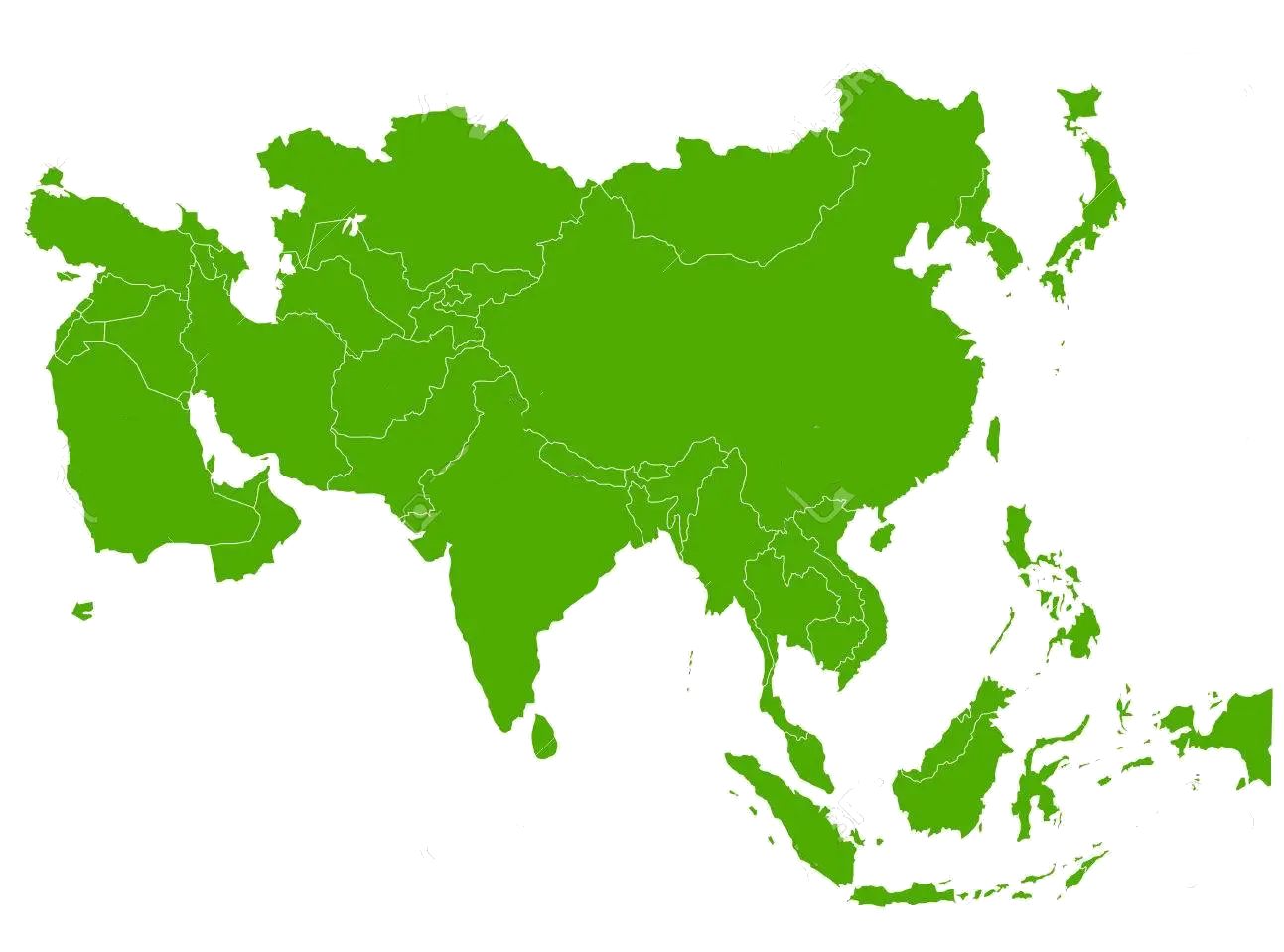
Indien ist ein Staat in Südasien, der den größten Teil des indischen Subkontinents umfasst. Indien ist eine Bundesrepublik, die von 29 Bundesstaaten gebildet wird und außerdem sieben bundesunmittelbare Gebiete umfasst. Der Eigenname der Republik lautet in den beiden landesweit gültigen Amtssprachen Bharat Ganarajya (Hindi) und Republic of India (Englisch). Die moderne demokratische und säkulare indische Republik besteht seit 1949 und seit 1950 gilt die Verfassung Indiens.
Der Himalaya bildet die natürliche Nordgrenze Indiens, im Süden umschließt der Indische Ozean das Staatsgebiet. Indien grenzt an Pakistan, das chinesische Autonome Gebiet Tibet, Nepal, Bhutan, Myanmar (Birma) und Bangladesch. Weitere Nachbarstaaten im Indischen Ozean sind Sri Lanka und die Malediven. Hinsichtlich der Landesfläche ist Indien das flächenmäßig siebtgrößte Land der Erde.
Das Gebiet Indiens ist mindestens seit der bronzezeitlichen Indus-Hochkultur zivilisiert. Der indische Staat ist mit über 1,3 Milliarden Einwohnern (2016)[6] nach der Volksrepublik China (fast 1,4 Mrd.)[7] das zweitbevölkerungsreichste Land der Erde und somit die bevölkerungsreichste Demokratie der Welt.[8] Bei gleichbleibend hohem Bevölkerungswachstum könnte Indien schon im Jahr 2020 China überholen. Durch fortschreitende Modernisierung, Bildung, Wohlstand und Urbanisierung sinkt die Geburtenrate jedoch bereits. Hauptstadt Indiens ist Neu-Delhi, Teil der Metropole Delhi; weitere Ballungsräume sind auch Mumbai, Kalkutta, Chennai, Bangalore, Hyderabad, Ahmedabad und Pune.
Die indische Gesellschaft wird trotz verfassungsmäßiger Religionsfreiheit vom religiösen hierarchischen Kastensystem bestimmt. Die mit Abstand größte Religionsgruppe sind die Hindus, gefolgt von Muslimen, Christen und den historisch aus Indien stammenden Sikhs, Buddhisten und Jaina. Laut Index der menschlichen Entwicklung (HDI) erreicht Indien den Status „mittlere menschliche Entwicklung“ und Platz 131 von 187 weltweit (2016, im Vergleich erreicht die VR China Platz 90).[9] Wirtschaftlich gilt Indien als Schwellenland und gehört zu den O5- und BRICS-Staaten und der Gruppe der zwanzig wichtigsten Industrie- und Schwellenländer (G20). Indien ist trotz seines noch niedrigen Pro-Kopf-Einkommens bereits die drittgrößte bzw. sechstgrößte Wirtschaftsmacht der Welt (kaufkraftbereinigt bzw. nominell) und war 2015 erstmals die am schnellsten wachsende Volkswirtschaft der G20-Gruppe.
印度共和国(印地语:भारत गणराज्य,Bhārat Ganarājya;英语:Republic of India),通称印度(印地语:भारत;英语:India),是位于南亚印度次大陆上的国家,印度面积位列世界第七,印度人口众多,位列世界第二,截至2018年1月印度拥有人口13.4亿,仅次于中国人口的13.8亿,人口成长速度比中国还快,预计近年将交叉。是亚洲第二大也是南亚最大的国家,面积328万平方公里(实际管辖),同时也是世界第三大(购买力平价/PPP)经济体。
印度并非单一民族及文化的国家。印度的民族和种族非常之多,有“民族大熔炉”之称,其中印度斯坦族占印度总人口的大约一半,是印度最大的民族。印度各个民族都拥有各自的语言,仅宪法承认的官方语言就有22种之多,其中印地语和英语被定为印度共和国的联邦官方语言[5],并且法院裁定印度没有国语。[9][10]英语作为共同语言使用在印度非常流行,尤其在南印地位甚至高于印地语,但受限于教育水准,普通民众普遍不精通英语。另外,印度也是一个多宗教多信仰的国家,世界4大宗教其中的佛教和印度教都源自印度。大部分印度人信仰印度教。伊斯兰教在印度也有大量信徒,是印度的第二大宗教,信教者约占印度的14.6%(截至2011年,共有约1亿7千7百万人)。伊斯兰教是在公元8世纪随着阿拉伯帝国的扩张而传播到印度的。公元10世纪后,北印的大多数王朝统治者都是信奉伊斯兰教的,特别是莫卧儿王朝。印度也是众多正式和非正式的多边国际组织的成员,包括世界贸易组织、英联邦、金砖五国、南亚区域合作联盟和不结盟运动等。
以耕种农业、城市手工业、服务业以及其支撑产业为主的部分行业已经相对取得了进展。除了民族文化与北方地形的丰富使印度旅游业颇受欢迎之外,由于时差,大批能说英语的人才也投入外包行业(即是外国企业把客户咨询,电话答录等等服务转移到印度)。另一方面,宝莱坞电影的文化输出在英语圈乃至全球的影响力不亚于世界主流。同时印度还是很多专利过期药物的生产地,以低价格提供可靠的医疗。近年来,印度政府还大力投资本国高等教育,以利于在科学上与国际接轨,例如自主太空研究、南亚半岛生态研究等等。印度最重要的贸易伙伴是美国、欧盟、日本、中国和阿拉伯联合酋长国。
インドは、南アジアに位置し、インド洋の大半とインド亜大陸を領有する連邦共和制国家である。ヒンディー語の正式名称भारत गणराज्य(ラテン文字転写: Bhārat Gaṇarājya、バーラト・ガナラージヤ、英語: Republic of India)を日本語訳したインド共和国とも呼ばれる。
西から時計回りにパキスタン、中華人民共和国、ネパール、ブータン、バングラデシュ、ミャンマー、スリランカ、モルディブ、インドネシアに接しており、アラビア海とベンガル湾の二つの海湾に挟まれて、国内にガンジス川が流れている。首都はニューデリー、最大都市はムンバイ。
1947年にイギリスから独立。インダス文明に遡る古い歴史、世界第二位の人口を持つ。国花は蓮、国樹は印度菩提樹、国獣はベンガルトラ、国鳥はインドクジャク、国の遺産動物はインドゾウである。
インドは南アジア随一の面積と世界第2位の人口を持つ大国である。12億人を超える国民は、多様な民族、言語、宗教によって構成されている。連邦公用語はヒンディー語、他にインド憲法で公認されている言語が21あり主な言語だけで15を超えるため、インドの紙幣には17の言語が印刷されている。議会制民主主義国家であり、有権者数8億人と世界最大である[5]。州政府が一定の独立性を持っているため、各州に中央政府とは別に政府があり大臣がいる。
労働力人口の3分の2が農業に従事する一方、製造業とサービス業が急速に成長している。国民の識字率は74.04%である。ヒンドゥー教徒が最も多く、イスラム教、シーク教がこれに次ぐ。カースト制度による差別は憲法で禁止されているが、今でも農村部では影響は残っている。
アジア開発銀行はインドの中間層が向こう15年間で人口の7割に達するとしている[6]。
India (IAST: Bhārat), also known as the Republic of India (IAST: Bhārat Gaṇarājya),[18][e] is a country in South Asia. It is the seventh largest country by area and with more than 1.3 billion people, it is the second most populous country and the most populous democracy in the world. Bounded by the Indian Ocean on the south, the Arabian Sea on the southwest, and the Bay of Bengal on the southeast, it shares land borders with Pakistan to the west;[f] China, Nepal, and Bhutan to the northeast; and Bangladesh and Myanmar to the east. In the Indian Ocean, India is in the vicinity of Sri Lanka and the Maldives, while its Andaman and Nicobar Islands share a maritime border with Thailand and Indonesia.
The Indian subcontinent was home to the urban Indus Valley Civilisation of the 3rd millennium BCE. In the following millennium, the oldest scriptures associated with Hinduism began to be composed. Social stratification, based on caste, emerged in the first millennium BCE, and Buddhism and Jainism arose. Early political consolidations took place under the Maurya and Gupta empires; later peninsular Middle Kingdoms influenced cultures as far as Southeast Asia. In the medieval era, Judaism, Zoroastrianism, Christianity, and Islam arrived, and Sikhism emerged, all adding to the region's diverse culture. Much of the north fell to the Delhi Sultanate; the south was united under the Vijayanagara Empire. The economy expanded in the 17th century in the Mughal Empire. In the mid-18th century, the subcontinent came under British East India Company rule, and in the mid-19th under British crown rule. A nationalist movement emerged in the late 19th century, which later, under Mahatma Gandhi, was noted for nonviolent resistance and led to India's independence in 1947.
In 2017, the Indian economy was the world's sixth largest by nominal GDP[19] and third largest by purchasing power parity.[15] Following market-based economic reforms in 1991, India became one of the fastest-growing major economies and is considered a newly industrialised country. However, it continues to face the challenges of poverty, corruption, malnutrition, and inadequate public healthcare. A nuclear weapons state and regional power, it has the second largest standing army in the world and ranks fifth in military expenditure among nations. India is a federal republic governed under a parliamentary system and consists of 29 states and 7 union territories. A pluralistic, multilingual and multi-ethnic society, it is also home to a diversity of wildlife in a variety of protected habitats.
L'Inde, officiellement la république de l'Inde4, en hindi : भारत (Bhārat) et भारत गणराज्य (Bhārat Gaṇarājya), est un pays d'Asie du Sud qui occupe la majeure partie du sous-continent indien. Sa capitale est New Delhi. L'Inde est le deuxième pays le plus peuplé et le septième pays le plus grand du monde. Le littoral indien s'étend sur plus de sept mille kilomètres. Le pays a des frontières communes avec le Pakistan à l'ouest, la Chine, le Népal, et le Bhoutan au nord et au nord-est, le Bangladesh et la Birmanie à l'est. Sur l'océan Indien, l'Inde est à proximité des Maldives au sud-ouest, du Sri Lanka et de l'Indonésie au sud-est. L'Inde revendique également une frontière avec l'Afghanistan au nord-ouest. L'Inde dispose de l'arme nucléaire depuis 1974 après avoir fait des essais officiels.
L'Inde est un foyer de civilisations parmi les plus anciennes du monde, la civilisation de la vallée de l'Indus s'y est développée dès 3000 av. J.-C. Le sous-continent indien a abrité de vastes empires et est présent sur les routes commerciales dès l'Antiquité. L'Inde est la terre de naissance de quatre religions majeures — l'hindouisme, le jaïnisme, le bouddhisme et le sikhisme — alors que le zoroastrisme, le christianisme et l'islam s'y sont implantés durant le Ier millénaire. L'Inde est aujourd'hui un pays très divers sur le plan religieux, linguistique et culturel.
Le pays a été progressivement annexé par la Compagnie anglaise des Indes avant de passer sous le contrôle du Royaume-Uni au XIXe siècle. L'Inde devient indépendante en 1947 après une lutte marquée par la résistance non-violente du Mohandas Karamchand Gandhi. Le pays est depuis 1950 une république parlementaire fédérale considérée comme la démocratie la plus peuplée au monde.
En 2017, l'économie indienne est la sixième du monde en PIB nominal et la troisième en PIB à parité de pouvoir d'achat. L'Inde, pays à forte croissance économique, est considéré comme un nouveau pays industrialisé. Cependant certains problèmes comme la pauvreté, l'analphabétisme ou la corruption restent très importants.
L'India (hindi: भारत Bhārat), ufficialmente Repubblica dell'India (hindi: भारत गणराज्य Bhārat Gaṇarājya), è uno Stato federale dell'Asia meridionale, con capitale Nuova Delhi.
È il settimo Stato per estensione geografica al mondo (3 287 263 km²) e il secondo più popolato, con 1 335 250 000 abitanti (censimento 2017).[8] È bagnato dall'oceano Indiano a sud, dal mar Arabico a ovest e dal golfo del Bengala a est. Possiede una linea costiera che si snoda per 7.517 km.[9] Confina con il Pakistan a ovest,[10] Cina, Nepal e Bhutan a nord-est, Bangladesh e Birmania a est. Suoi vicini prossimi, separati dell'oceano Indiano, sono lo Sri Lanka a sud-est e le Maldive a sud-ovest.
Sede della civiltà della valle dell'Indo e regione di rotte commerciali storiche e di vasti imperi, il subcontinente indiano è stato identificato con il suo commercio e la ricchezza culturale per gran parte della sua lunga storia.[11] Quattro grandi religioni del mondo (l'induismo, il buddismo, il giainismo e il sikhismo) sono nate qui, mentre lo zoroastrismo, l'ebraismo, il cristianesimo e l'islam arrivarono entro il I millennio d.C. dando forma nella regione a una grandissima diversità culturale. Gradualmente annessa alla Compagnia britannica delle Indie orientali dai primi decenni del XVIII secolo e colonizzata dal Regno Unito dalla metà del XIX secolo, l'India è diventata un moderno Stato nazionale nel 1947, dopo una lotta per l'indipendenza che è stata caratterizzata da una diffusa resistenza non violenta guidata da Gandhi.
L'India è la dodicesima più grande economia del mondo in termini nominali e la quarta in termini di potere d'acquisto. Riforme economiche hanno trasformato lo Stato nella seconda economia a più rapida crescita[12] (è uno dei cinque Paesi a cui ci si riferisce con l'acronimo BRICS),[13] ma nonostante ciò il Paese soffre ancora di alti livelli di povertà, analfabetismo e malnutrizione, oltre ad avere un sistema sociale basato sulle caste. Società pluralistica, multilingue e multietnica, l'India è inoltre ricca sul piano naturale, con un'ampia diversità di fauna selvatica e di habitat protetti.
La India8 ―oficialmente República de la India (en hindi, भारत गणराज्य, Bhārat Gaṇarājya; en inglés, Republic of India)― es un país soberano ubicado en el sur de Asia. Con sus más de 1240 millones de habitantes, es el segundo país del mundo por población ―después de la República Popular China (con 1395 millones). Su superficie es de 3 287 263 km²,3 lo cual lo ubica en el séptimo lugar entre los países más extensos del planeta. Limita con el océano Índico al sur, con el mar Arábigo al oeste y con el golfo de Bengala al este, a lo largo de una línea costera de más de 7517 kilómetros.9
La India también limita con Pakistán al oeste;10 al norte con China, Nepal y Bután y al este con Bangladés y Birmania. Además, la India se encuentra cerca de las islas de Sri Lanka, Maldivas e Indonesia. Su capital es Nueva Delhi y su ciudad más poblada es Bombay.
Hogar de la cultura del valle del Indo y una región histórica por sus rutas comerciales y grandes imperios, el subcontinente indio fue identificado por su riqueza cultural y comercial en la mayor parte de su larga historia.11 Cuatro de las religiones más importantes del mundo, el hinduismo, el budismo, el jainismo y el sijismo se originaron allí, mientras que otras religiones como el zoroastrismo, el judaísmo, el cristianismo y el islam llegaron durante el I milenio, dando forma a diversas culturas de la región.
Gradualmente anexada por la Compañía Británica de las Indias Orientales desde principios del siglo XVIII y colonizada por el Reino Unido desde mediados del siglo XIX, la India se convirtió en una nación independiente en 1947, tras una lucha por la independencia que estuvo marcada por un movimiento de no violencia.12
La India es una república federal13 compuesta por 29 estados y 7 territorios de la Unión, con un sistema de democracia parlamentaria. En 2017, la economía india es la tercera más grande del mundo y la sexta en términos de PIB nominal. Las reformas económicas de 1991 la han transformado en una de las economías de más rápido crecimiento;14 sin embargo, todavía sufre de problemas como los altos niveles de pobreza, analfabetismo,15 pandemias, malnutrición y constantes violaciones de los derechos de las mujeres. Además de una sociedad plural en lo religioso, multilingüe y multiétnica, la India también alberga una flora y fauna diversas en diferentes hábitats protegidos.
Además, la República de la India es uno de los diez países que posee un arsenal nuclear y no es signataria del Tratado de No Proliferación Nuclear, dado que, en sus actuales términos, no le permitiría mantener su armamento atómico.
И́ндия (хинди भारत Bhārat, англ. India), официальное название — Респу́блика И́ндия (хинди भारत गणराज्य Bhārat Gaṇarājya, англ. Republic of India) — государство в Южной Азии. Население — 1 340 468 000 человек (22 декабря 2017)[6], территория — 3 287 263 км², по обоим этим показателям является крупнейшей страной Южной Азии. Занимает второе место в мире по численности населения и седьмое по территории. Столица — Нью-Дели. Государственные языки — хинди и английский.
Федеративное государство, парламентская республика. Премьер-министр — Нарендра Моди, президент — Рам Натх Ковинд.
Zhanjiang (chinesisch 湛江市, Pinyin Zhànjiāng Shì, Jyutping Zaam3gong1 si5, veralt. französisch Fort Bayard) ist eine bezirksfreie Stadt in der chinesischen Provinz Guangdong. Sie liegt südwestlich der Provinzhauptstadt Guangzhou an der Küste des südchinesischen Meeres bei der Halbinsel Leizhou.
Zhanjiang ist heute mit 6.994.832 Einwohnern (Zensus 2010) die viertgrößte Stadt der südchinesischen Provinz. Sie hat eine Fläche von 12.490 km², die die gesamte Halbinsel Leizhou und einige nördlich davon gelegene Gebiete umfasst. Zhanjiang besteht aus vier Stadtbezirken (zusammen 1.360 km² mehr oder weniger städtisches Siedlungsgebiet), drei kreisfreien Städten (Lianjiang, Leizhou und Wuchuan) und zwei Kreisen.
湛江,旧称“广州湾”,别称“港城”,是广东省辖的地级市,辖3个县级市、5个区和2个县。湛江位于中国大陆最南端雷州半岛上,地处粤桂琼三省区交汇处,南濒南海隔琼州海峡与海南省相望,西临北部湾,背靠大西南,东与茂名市相连。地处北回归线以南的低纬地区,属热带和亚热带季风气候,终年受海洋气候调节,冬无严寒,夏无酷暑。亚热带作物及海产资源丰富,海鲜产品更是闻名全国。

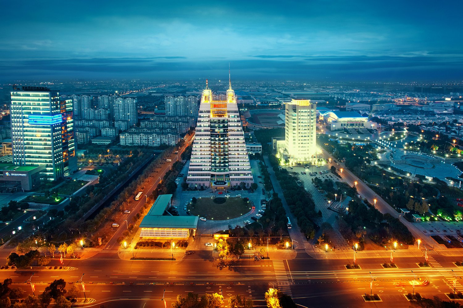
Zhangjiagang liegt an der Kreuz der Kueste Wirtschaftzone und der Yangtse Wirtschaftzone In der naehe befinden wir Shanghai Nanjing Suzhou Wuxi Changzhou usw. Die Flaeche der stadt ist 999 Quadratthousandmeter,120 million Einwohner. .In 2004,die ganze Stadt schaft das Sozialprodukt ueber 57.6 billion RMB(personlich ueber 8 thousand USD). Das Finanz-aufkommen ist 8.5 billion RMB, Rang die vierter in china.
Zhangjiagang ist in der chinesischen Wirtschaft, die entwickelt wird, die meisten hat die Entwicklung Stärke die Yangtze Fluss-Dreiecksökonomische Mitte, hat nicht nur die Yangtze Flußdreiecksindustrieskala-Niveauhöhe, die Marktlage, die gut ist, die Bereitstellung ist genügend und so weiter die gesamte Überlegenheit, außerdem können Kupplungen "die goldene Wasser-Strasse" Yangtze Pharynx des Flusses und Larynx, Spuren der Fluß aber an, direkt nach China und so weiter Westwuhan, Chongqing gehen der strategische Platz; Entlang dem Fluß aber darunter, Echointernationalisierung Hauptstadt Shanghai und der Pudong Entwicklung Zone fahren Verbindungen herauf das Ostporzellan verschiedene Bereiche die Küste entlang und die Weltverschiedenen Häfen, können den ausgedehnten Entwicklung Raum für das Unternehmen zur Verfügung stellen. Zhangjiagang gehört dem subtropics oceanity feuchten Klima, die Ausdauer ist 22 TonnenDas Quadratmeter, im Bereich die glatte Topographie, die durchschnittliche Höhe über Meeresspiegel ist 3.3-3.5 Meter (der gelbes Seeaufzug)
Zhangjiagang steht besonders guenstig fuer den Hafen.Die kuenstenlinie in dem Stadt ist ueber 57 kilometer. In dem gibt es ueber 33 kilometer kann mann 10-thousand-Tonne-Kai bauern. Internationaler Hafen-Zhangjiagang Hafen hat die oeffnung nach aussen bedaft werden in 1982 zhangjiagang Hafen gibt es 33 Ankerplaetz,dass mann ueber 10-thousnd-Tonne Dampfer ankern kann.23 internationale Routen haben aufgeschlosst,inklusive Europa ,North America usw.zhangjiagang Hafen verbindt Ueber 140 Haefen der Welt,es ist eine ganze wichtig Zugang des Einzugsgebiet dem Yangtse.Jaehrlich kann ueber 80 million Tonnen Gueter umschlagen Zhangjiagang Hafen hat der grosster internationaler Hafen am Yangtse Ufer entlang und der grosster Bauholz, sojabohne und schafwolle Import unterwegs umsteig Hafen in china gewesen
(Quelle www.zjgedz.gov.cn/ZJGEDZ/German/Showinfo/MoreInfo.aspx?CategoryNum=015001001001)

Zhangzhou,eine kulturhistorisch bedeutende Stadt,ist reich für Erzeugnisse, und wird deshalb immer als “Stadt der Blumen und Früchte“ beziehungsweise “Kornkammer“ bezeichnet.Es ist reich an Früchte(die Lu-Orange, die Lidschi-Frucht, die Banane, die Drachenauge, die Pampelmuse, die Ananas), Blumen(die Osterglocke, die Kamelie, die Orchidee)und Meeresfrüchte(die Orientalische Geisselgarnele, der Zackendarsch, die Abalone, die Languste, der Rotschnapper, die Seemuschel, die Auster, die Archenmuschel, der Logilo-Tintenfisch).Die Osterglocke mit blühender Schönheit, Pianzaihuang mit Bezeichnung “Arznei als nationale Kunstschätze“ beziehungsweise die Acht-Köstlichkeiten-Stempelpaste mit Bezeichnung“ Star der einheimischen Produkte“ werden als “drei Schätze von Zhangzhou“ behandelt, und haben weltweit guten Ruf.Die Kunsthandwerksproduktionen in Zhangzhou, wie der Holzschnitt, das Perlmuschel-Gemälde,die Jadeschnitzerei der Neun-Drachen-Mauer,u.s.w.,gefällt den Reiser im Inland und Ausland sehr.
Zhangzhou ist bekannte “Qiaoxiang“, das heisst,sie ist die Heimatstadt für zahlreiche Chinesen, die geboren in Zhangzhou sind und danach sich in Taiwan, Hong Kong, Macao oder die Ausländer niederlassen.Dort beträgt etwa 700,000 Chinesen aus Zhangzhou, und Zhangzhou ist die Familienherkunft für 1/3 Bevölkerung von Taiwan. Viele Auslandschinesen beziehungsweise Landesleute in Taiwan gehen infolgedessen nach Zhangzhou zurück,um die Wurzel der Verwandtschaft zu finden.(Quelle:http://de.fjta.com)
Zhangzhou (chinesisch 漳州市, Pinyin Zhāngzhōu shì, veraltet nach Post Changchew) ist die südlichste der neun bezirksfreien Städte der chinesischen Provinz Fujian. Sie ist in China bekannt als Stadt der Narzissen (水仙花, shuixianhua). Zhangzhou hat eine Küstenlinie von 680 Kilometer Länge mit vielen natürlichen Tiefwasserhäfen. Es grenzt an die Nachbarprovinz Guangdong im Südwesten und an die Stadt Xiamen im Nordosten. Außerdem hat es über die Lage an der Taiwanstraße Zugang zum Pazifik. Zhangzhou ist in China bekannt für den Anbau einer Reihe von tropischen Früchten und Blumen.
漳州市(闽南语:Tsiang-tsiu-tshī),简称漳,是中华人民共和国福建省下辖的地级市,位于福建省南部。市境东北临厦门市,北接泉州市,西北界龙岩市,西南连广东省梅州市、潮州市,南滨南海,东隔台湾海峡与台湾南部相望。地处闽东南山地与沿海丘陵平原区,西北有博平岭横亘,北部有戴云山余脉绵延,沿海为漳州平原,是福建省最大平原。九龙江斜贯北部,往东流出厦门港,还有鹿溪、漳江、东溪等沿海诸河。全市总面积12,882.27平方公里,人口505.4328万,市人民政府驻芗城区。漳州为国家历史文化名城,海峡西岸经济区城市,厦深、龙厦、鹰厦等铁路和福厦客运专线交汇于此。
漳州,福建省辖地级市,闽南民系城市之一 ,位于福建最南端,漳州陆域地处北纬23°34’~25°15’,东经116°54’~118°08′之间,陆地面积1.26万平方公里,海域面积1.86万平方公里 。漳州气候属南亚热带海洋季风气候,北有高山阻挡寒流侵袭,南有海洋调节,所处纬度较低。靠近北回归线,气候温暖,雨量充沛,冬无严寒,夏无酷暑。 截至2021年,漳州辖4个市辖区、7个县, 市政府驻芗城区。根据第七次人口普查数据,截至2020年11月1日零时,漳州市常住人口为5054328人。
秦始皇二十五年(前222年),“秦已并天下”后,把闽越故地划为闽中郡,今漳州境时属闽中郡,为正式纳入中央版图之始。 唐垂拱二年(686年)十二月九日,建置漳州,州治在西林,属岭南道,辖漳浦、怀恩2县。
漳州辖区内有228、319、324、355、357、358六条国道、沈海、厦蓉、甬莞漳武、漳永、同招、古平、平梅、漳北连九条高速公路及鹰厦铁路和厦深、龙厦二条高速铁路穿境而过,漳州港可直通东南亚国家,形成铁路、公路、水路立体交通网络。 漳州境内有东山岛、漳州滨海火山公园、南靖土楼、云洞岩等景点。
2020年7月,全国爱卫会确认漳州市为2019年国家卫生城市。 2021年,漳州全市实现地区生产总值5024.4亿元。
 *Changjiang|Yangtze River
 Jiangsu Sheng-JS
 Beijing-Hangzhou Grand Canal
 Silk road

 Vacation and Travel
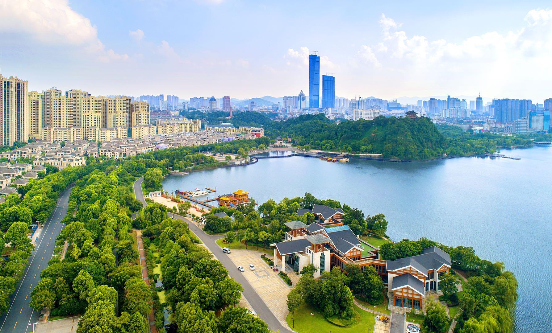
Fast 3.000 Jahre alt ist Zhenjiang, entsprechend viele Mythen ranken sich um die historische chinesische Stadt im Osten der Volksrepublik. Vor allem jedoch ist die Millionenstadt am Fluss Jangtse ein aufstrebender Industriestandort. Eng verbunden ist Zhenjiang mit der Wirtschaftsmetropole Shanghai.
Malerisch sind die Hügel, die sich um Zhenjiangs Stadtzentrum gruppieren, sie tragen bildhafte Namen wie „Goldene Schildkröte“ oder „Fließender Jade-Hügel“. DieAltstadt mit ihren schmalen Straßen und den Kolonialbauten zeichnet sich durch eine besondere Atmosphäre aus. Im Osten der Stadt wiederum befindet sich die wirtschaftlich-technische Sonderentwicklungszone „Zhenjiang New Area“. Ansässig sind viele internationale Unternehmen. Die Universität Jiangsu mit ihren 35.000 Studierenden ist eine wichtige Bildungsstätte der Region. Das ganze Jahr über ist Zhenjiang auch kulturell rege. Das neue Jahr wird feierlich auf dem „Goldenen Hügel“ eingeläutet, im März startet das farbenfrohe Tourismus-Festival. Außerdem gehört Zhenjiangs Küche zu den vier großen Küchen Chinas. Und den Namen „Stadt von süß und sauer“ trägt Zhenjiang, weil hier der beste chinesische Essig erzeugt wird.
Den Partnerschaftsvertrag unterzeichnen die Stadtoberhäupter 2004, zuerst in Mannheim, kurz darauf in Zhenjiang. Dabei geht die Verbindung auf das Jahr 1994 zurück, als Zhenjiangs Oberbürgermeister sein Interesse an einem freundschaftlichen Austausch mit Mannheim bekundet. Nun kommen fast jährlich Delegationen aus Zhenjiang, im Fokus steht das Knüpfen von Wirtschaftskontakten. Der Bau des Duojing-Gartens im Mannheimer Luisenpark beruht ebenso auf der Städteverbindung. Doch auch im schulischen Bereich gibt es Kontakte und einen Austausch.(Quelle:https://www.mannheim.de)
 China
China
 China-Pakistan Economic Corridor

 Hand in Hand
 Pakistan
 Silk road
 Xinjiang Uygur Zizhiqu-XJ
 Xizang Zizhiqu-XZ

 Atomic bomb
 BRICS summit
 China
China

 History
 M 1500 - 2000 AD

 History

 History

 History
 N 2000 - 2100 AD


 Military, defense and equipment
 Nuclear Weapon

 Party and government
 Group of the twenty most important industrial and emerging countries

 Party and government
 BRICS
BRICS
 Silk road
 Shanghai Cooperation Organization

 States of Asia

 United Nations
 United Nations Security Council
 Hydrogen bomb

Die Volksrepublik China (chinesisch 中华人民共和国, Pinyin Zhōnghuá Rénmín Gònghéguó ![]() [tʂʊŋ˥xua˧˥ʐɛn˧˥mɪn˧˥kʊŋ˥˩xə˧˥kuɔ˧˥]), allgemein als China bezeichnet, ist ein am 1. Oktober 1949 gegründeter sozialistischer Staat in Ostasien. Mit rund 1,4 Milliarden Einwohnern stellt China das bevölkerungsreichste und gemessen an seiner Gesamtfläche das viertgrößte Land der Erde dar.[7]
[tʂʊŋ˥xua˧˥ʐɛn˧˥mɪn˧˥kʊŋ˥˩xə˧˥kuɔ˧˥]), allgemein als China bezeichnet, ist ein am 1. Oktober 1949 gegründeter sozialistischer Staat in Ostasien. Mit rund 1,4 Milliarden Einwohnern stellt China das bevölkerungsreichste und gemessen an seiner Gesamtfläche das viertgrößte Land der Erde dar.[7]
Gemäß ihrer Verfassung steht die Volksrepublik China „unter der demokratischen Diktatur des Volkes“, wird jedoch seit 1949 autoritär von der Kommunistischen Partei Chinas (KPCh) regiert. Wirtschaftlich weist China seit vielen Jahren eine hohe Dynamik auf. Auf Grundlage ihrer Reform- und Öffnungspolitik entwickelte sich China beginnend ab 1978 zu einer wirtschaftlichen und technologischen Großmacht.[8] Von der Weltbank wird das Land seit 2016 zu den Staaten mit einem Einkommensniveau im oberen Mittelfeld gerechnet. Seit 2010 ist China der Staat mit der umfangreichsten Warenausfuhr und gemessen an der Kaufkraftparität seit 2016 die größte Volkswirtschaft der Welt. Das jährliche Wirtschaftswachstum lag zwischen 2010 und 2017 im Durchschnitt bei 6,7 Prozent.[9]
Die Volksrepublik China zählt zu den offiziellen Atommächten, ist ständiges Mitglied des Weltsicherheitsrates sowie unter anderem Mitglied der Welthandelsorganisation, Weltbank, APEC, ASEAN, BRICS, UNESCO, Interpol, G20.
中华人民共和国,通称中国[13],是位于东亚的社会主义国家,首都位于北京[14]。中国领土陆地面积约960万平方千米,是世界上纯陆地[注 13]面积第二大、陆地[注 14]面积第三大、总面积第三大或第四大的国家[注 15][15],其分为23个省份[注 16]、5个自治区、4个直辖市和2个特别行政区。被视为亚洲地区重要地域大国,也被视为潜在超级大国[16][17][18]。是世界上人口最多的国家,约有13.9亿人[8],同时也是一个多民族国家,共有已确认的民族56个,其中汉族人口占91.51%[19]。以普通话和规范汉字为国家通用语言文字,少数民族地区可使用自己民族的语言文字。
中国地势西高东低而呈现三级阶梯分布,大部分地区属于温带、副热带季风气候,地理景致与气候型态丰富多样,有冰川、丹霞、黄土、沙漠、喀斯特等多种地貌[20],北方有干草原和荒漠,南方有热带雨林,西部和西南边境则有天山山脉、帕米尔高原、喀喇昆仑山脉和喜马拉雅山脉。东临太平洋,领海由渤海(内海)以及黄海、东海、南海三大边海组成[21],水域面积约470万平方千米,分布有大小岛屿7600个[22]。
科技方面,中国在航天航空、高速铁路、新能源、核技术、超级计算机、量子网络等领域有较强实力,研发经费则位居世界第二[23]。国防预算为世界第二高,拥有世界规模最大的常备部队及三位一体的核打击能力[24][25]。自1986年实行九年义务教育制度,就读公立学校的学生由政府提供其间学费。1978年改革开放后,中国成为经济增长最快的经济体之一[26][27]。当前,中国对外贸易额世界第一,是世界上最大的商品出口国及第二大的进口国,依国内生产总值按购买力平价位列世界第一、而国际汇率则排名世界第二[28]。2017年,中国人均国内生产总值依购买力平价为18,119美元,列全球第76位;依国际汇率则为8,643美元,列全球第72位,均尚低于世界水平[10]。改革开放以来,尽管贫困问题得到极大改善,但收入差距较大,且区域间发展不均——东部沿海地区的经济较中西部及东北地区发达——的问题仍极需解决[29][30]。
1949年中国共产党在内战中取得优势,终结了中国国民党在中国大陆的统治,于同年10月1日建立了中华人民共和国中央人民政府,并与退守台湾地区的中华民国政府形成两岸分治的政治格局。遵循和平共处五项原则的外交政策,在1971年取得在联合国的中国代表权后,成为联合国安全理事会常任理事国并加入了许多国际组织。
中華人民共和国(ちゅうかじんみんきょうわこく、簡体字: 中华人民共和国、繁体字: 中華人民共和國、拼音: 、英語: People's Republic of China, PRC)、通称中国(ちゅうごく、拼音: 、英語: China)は、東アジアに位置する主権国家。首都・北京市を政庁所在地とし、13億8千万人以上の人口で世界一人口が多い国でもある。
中華人民共和国憲法第一条で社会主義国家であることを明言しており、政治は中国共産党が指導的地位を有するヘゲモニー政党制を採用している[4]。
中華人民共和国は、中華民国統治下の中国で1921年に結党された中国共産党が、ソビエト連邦の支援を受けながら国共合作・抗日戦争(八路軍・新四軍)・国共内戦を経て国民政府を台湾島へ放逐[5]し、1949年10月1日に北京市で建国式典(中華人民共和国開国大典)を開催したことで成立した。
同国は国共内戦の延長で1954年に「台湾解放宣言」[6]を出し、第一次台湾海峡危機(1954年~1955年)と金門砲戦(1958年~1979年)を起こしたが武力による台湾占領には至らなかった。同国は2010年代に入ると一つの中国による台湾問題の解決を「(自国の)核心的利益の一つ」と規定するようになり、基本的には九二共識の合意に基づいた平和的な中国統一を目指しているが、一方で人民解放軍の武力による台湾制圧の可能性も指摘されている[7]。
計測方法によるが、同国は陸地面積では世界第2位[8]、総面積では世界第3位又は第4位である。同国の地形は、乾燥した北の森林ステップ、ゴビ砂漠、タクラマカン砂漠から、多湿な南の亜熱帯の森林まで広大かつ多様である。ヒマラヤ山脈、カラコルム山脈、パミール高原、天山山脈により、同国は南及び中央アジアから切り離されている。長さ世界第3位の長江及び同世界第6位の黄河は、チベット高原から人口密度の高い東の沿岸地域に流れ、古代には黄河文明や長江文明を興してきた。同国の太平洋に沿った海岸線は14,500kmの長さで、渤海、黄海、東シナ海、南シナ海に囲まれている。同国の国土は、22省級行政区、5自治区、北京市・天津市・上海市・重慶市の4直轄市、大部分が自治的な香港・マカオの2特別行政区によって構成されている。
中国は、繁栄と衰退の繰り返しだと考えられる過去2000年間の大部分で世界最大かつ最も複雑な経済を有した[9][10]。1978年における改革開放の導入以来、外資流入の勢いが増してゆき、産業構造が政策から転換して、中国は世界で最も成長率が高い主要経済大国の1つになった(#経済)。ソ連の純粋な社会主義体制と距離をとり、「経済面は有限な資本主義、政治面は一党独裁を守る」のような国家形態に変更したのである(中国特色社会主義)。
2016年時点で、同国は名目GDP及び貿易輸入額のいずれにおいても世界第2位であり(2014年には国際通貨基金・世界銀行・CIAワールドファクトブックによると購買力平価は世界最大のGDPとなった[11][12][13])、購買力平価GDPと貿易輸出額は世界一位である[14]。同国は核保有国に認められ、世界第2位の防衛予算で世界最大の常備軍を有する。中華人民共和国は1971年以来国際連合加盟国であり、中華民国の後任として安全保障理事会常任理事国である。中国は多数の公式及び非公式の多国間機構加盟国であり、WTO、APEC、BRICs、上海協力機構、BCIM、G20がこれに該当する。中国はアジアの地域大国であり、多数の解説者により潜在的な超大国として特徴付けられてきた[15][16]。なお2017年7月現在、中華人民共和国の世界遺産はイタリアについで52件ある。国内には文化遺産が22件、自然遺産が4件、複合遺産が4件存在する。
China, officially the People's Republic of China (PRC), is a country in East Asia and the world's most populous country, with a population of around 1.404 billion.[13] Covering approximately 9,600,000 square kilometers (3,700,000 sq mi), it is the third- or fourth-largest country by total area.[k][19] Governed by the Communist Party of China, the state exercises jurisdiction over 22 provinces, five autonomous regions, four direct-controlled municipalities (Beijing, Tianjin, Shanghai, and Chongqing), and the special administrative regions of Hong Kong and Macau.
China emerged as one of the world's earliest civilizations, in the fertile basin of the Yellow River in the North China Plain. For millennia, China's political system was based on hereditary monarchies, or dynasties, beginning with the semi-legendary Xia dynasty in 21st century BCE.[20] Since then, China has expanded, fractured, and re-unified numerous times. In the 3rd century BCE, the Qin reunited core China and established the first Chinese empire. The succeeding Han dynasty, which ruled from 206 BC until 220 AD, saw some of the most advanced technology at that time, including papermaking and the compass,[21] along with agricultural and medical improvements. The invention of gunpowder and movable type in the Tang dynasty (618–907) and Northern Song (960–1127) completed the Four Great Inventions. Tang culture spread widely in Asia, as the new Silk Route brought traders to as far as Mesopotamia and Horn of Africa.[22] Dynastic rule ended in 1912 with the Xinhai Revolution, when a republic replaced the Qing dynasty. The Chinese Civil War resulted in a division of territory in 1949, when the Communist Party of China established the People's Republic of China, a unitary one-party sovereign state on Mainland China, while the Kuomintang-led government retreated to the island of Taiwan. The political status of Taiwan remains disputed.
Since the introduction of economic reforms in 1978, China's economy has been one of the world's fastest-growing with annual growth rates consistently above 6 percent.[23] As of 2016, it is the world's second-largest economy by nominal GDP and largest by purchasing power parity (PPP).[24] China is also the world's largest exporter and second-largest importer of goods.[25] China is a recognized nuclear weapons state and has the world's largest standing army and second-largest defense budget.[26][27] The PRC is a permanent member of the United Nations Security Council as it replaced the ROC in 1971, as well as an active global partner of ASEAN Plus mechanism. China is also a leading member of numerous formal and informal multilateral organizations, including the Shanghai Cooperation Organization (SCO), WTO, APEC, BRICS, the BCIM, and the G20. In recent times, China has been widely characterized as a global superpower.[28][29][30]
La Chined, en forme longue la république populaire de Chine (ou République populaire de Chinee, RPC, chinois simplifié : 中华人民共和国 ; chinois traditionnel : 中華人民共和國 ; pinyin : , prononcé [tʂʊŋ˥xua˧˥ɻən˧˥mɪn˧˥kʊŋ˥˩xə˧˥kuɔ˧˥] Écouter), parfois appelée Chine populaire, est un pays d'Asie de l'Est. Avec près d'1,4 milliard d'habitants, soit environ un sixième de la population mondiale, elle est le pays le plus peuplé du monde6. Elle compte huit agglomérations de plus de dix millions d'habitants, dont la capitale Pékin,
 Anhui Sheng-AH
 Anhui Sheng-AH
 Belarus
 Belarus
 Belgium

 Berlin

 Brandenburg

 Cataluña
 China
China
 Chongqing Shi-CQ
 Germany
 England
 France
 Fujian Sheng-FJ
 Gansu Sheng-GS
 Guangdong Sheng-GD
 Guizhou Sheng-GZ

 Hamburg

 Hand in Hand

 Hauts-de-France
 Hebei Sheng-HE
 Heilongjiang Sheng-HL
 Henan Sheng-HA
 Hubei Sheng-HB
 Hunan Sheng-HN
 Jiangsu Sheng-JS
 Jilin Sheng-JL
 Kasachstan
 Liaoning Sheng-LN

 Madrid

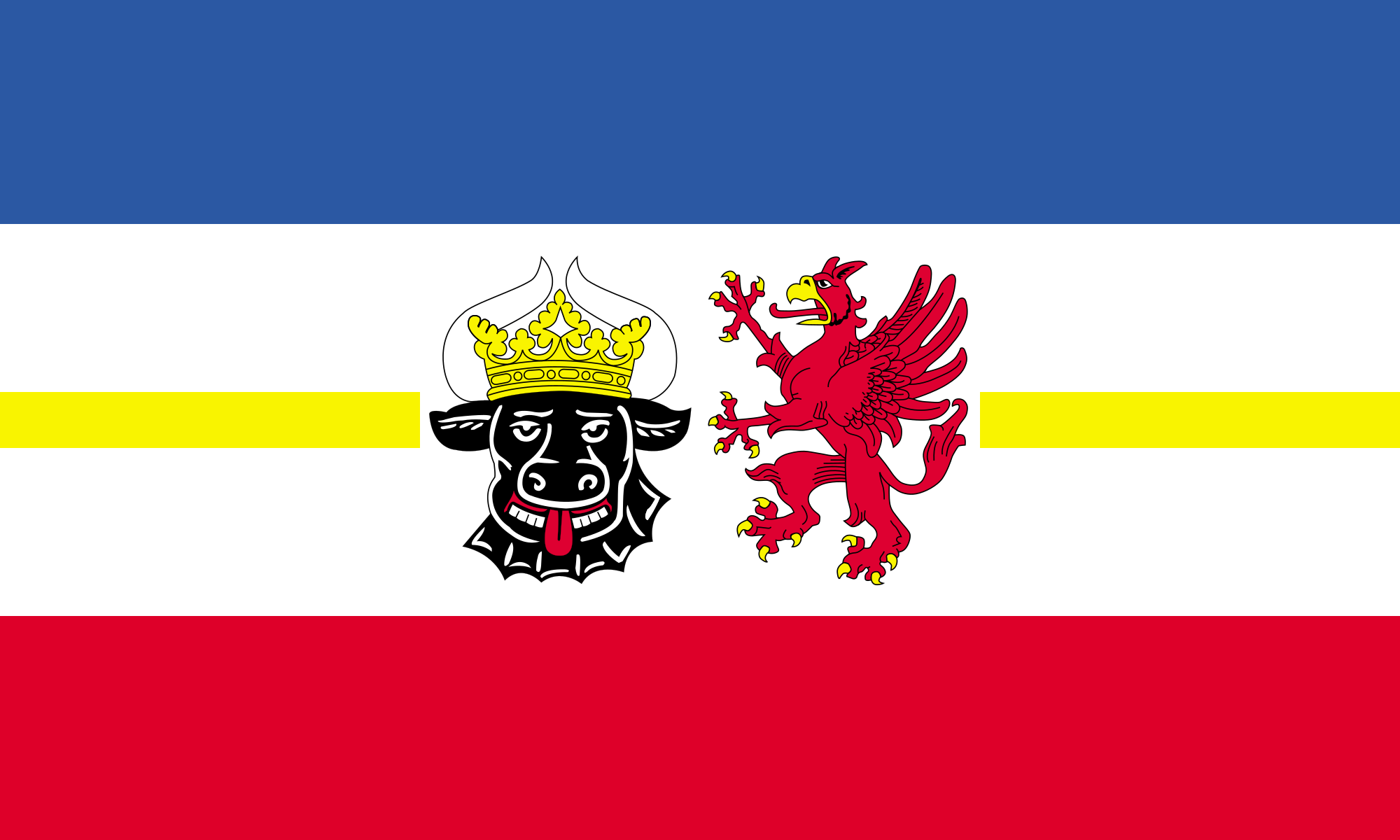 Mecklenburg-Vorpommern
 Nei Mongol Zizhiqu-NM

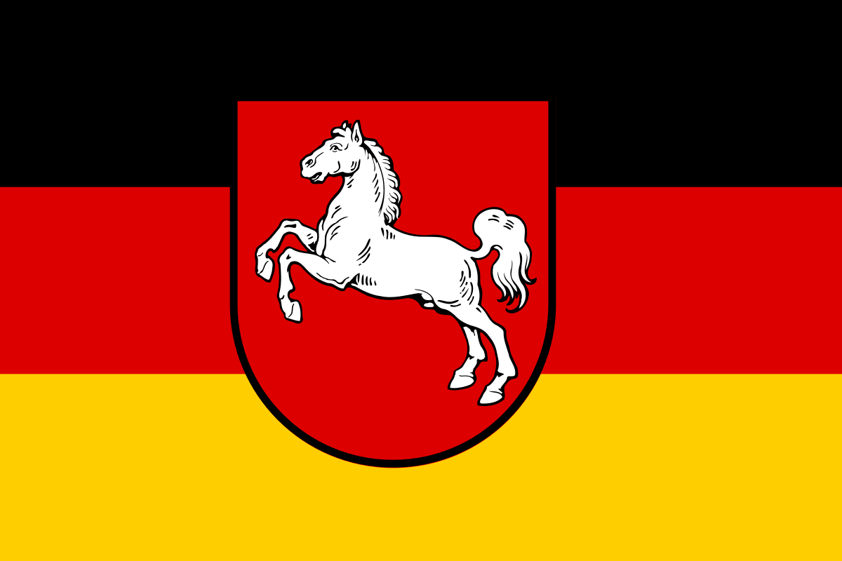 Lower Saxony
 Ningxia Huizu Zizhiqu-NX
 Nord-Pas-de-Calais

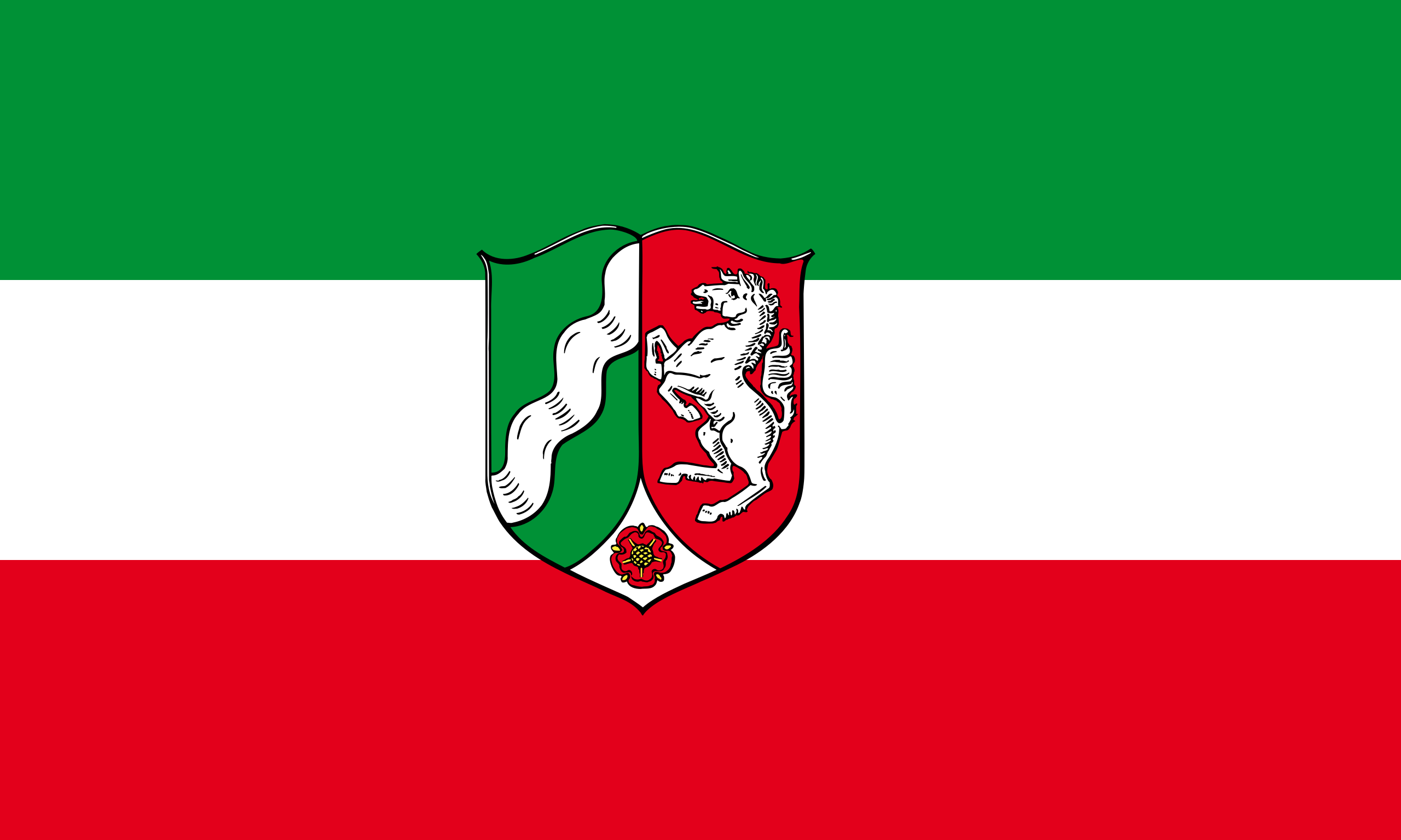 North Rhine-Westphalia
 Poland
 Qinghai Sheng-QH
 Russia

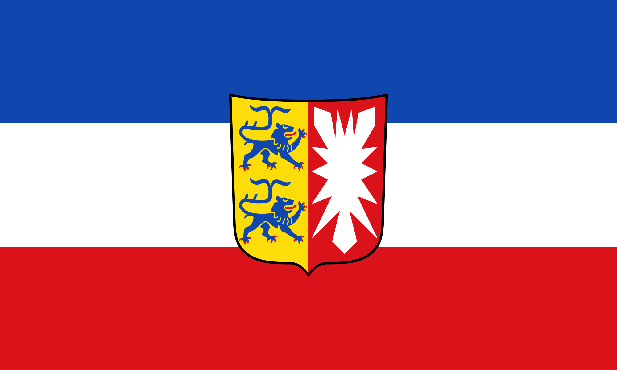 Schleswig-Holstein
 Silk road
 Shaanxi Sheng-SN
 Shandong Sheng-SD
 Sichuan Sheng-SC
 Spain
Spain
 Czech Republic
 Uzbekistan
 United Kingdom
 Xinjiang Uygur Zizhiqu-XJ
 Xizang Zizhiqu-XZ
 Zhejiang Sheng-ZJ
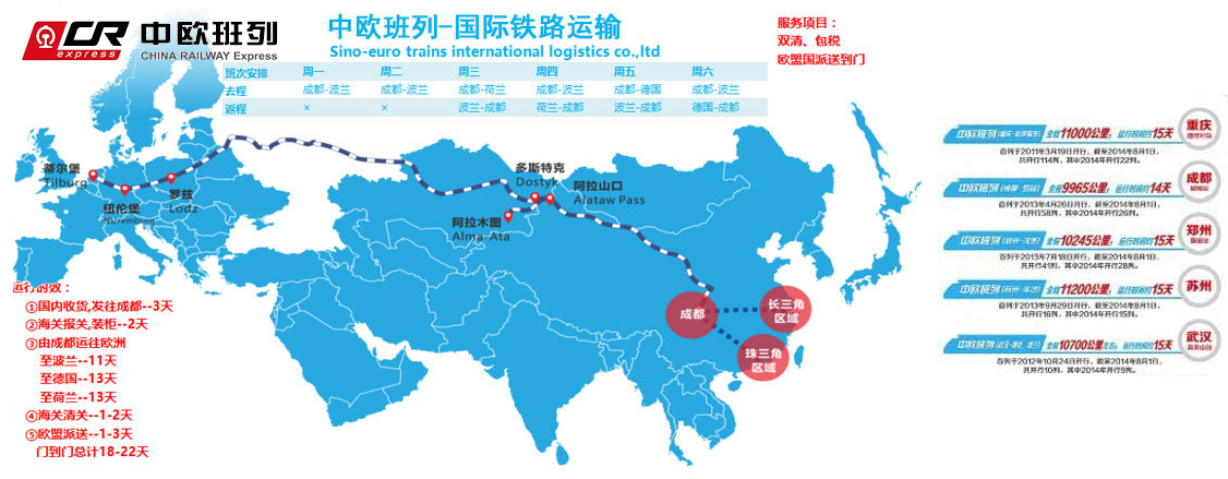
中欧班列(英语译名:China Railway Express 或 China-Europe Railway Express[1][2],简称为 CR express[3])是指按照固定车次、线路、班期和全程运行时刻开行,往来于中国与欧洲以及一带一路沿线各国的集装箱国际铁路联运班列,其中一班是从中国陜西省西安市开往欧洲的火车。[4]为加强与欧洲国家的商业贸易联络,中国政府和中国国家铁路集团与中亚和欧洲各国铁路系统协作,从起初重庆到德国的杜伊斯堡,发展到国内通达城市82个,国外通达欧亚国家的160多个城市,形成了阿拉山口、霍尔果斯、二连浩特、满洲里、绥芬河五大出境口岸,重庆、成都、西安、郑州、乌鲁木齐五大集结中心[5],开行从中国大陆到达最远伦敦、汉堡等地的国际联运列车。[3]
中欧班列也是世界上最长的货运铁路线,连接中国、哈萨克斯坦、俄罗斯、白俄罗斯、波兰、德国、法国、西班牙和伦敦。
Trans-Eurasia Logistics, AKA CHINA RAILWAY Express[1], was a joint venture between German rail company Deutsche Bahn and Russian RZhD, China Railway Corporation from China, Russian Railway Company, Russia operating container freight trains between Germany and China via Russia. The first such train arrived in Hamburg from Xiangtan on 6 October 2008, taking 17 days to make the trip.[2] Intermodal companies Polzug, Kombiverkehr, and TransContainer are also involved in the project.[3]
Container trains travel from China to Germany via the Trans-Mongolian and Trans-Siberian Railways, and then via Belarus and Poland - the route collectively known as the "Eurasian Land Bridge".[3] A break of gauge needs to be crossed when entering Mongolia from China (or Russia directly from China, if traveling via Manzhouli/Zabaykalsk), and then another one when leaving Belarus for Poland.
Trans-Eurasia Logistics operates the Yiwu - Madrid Railway line, which is the longest goods railway line in the world and connects China, Kazakhstan, Russia, Belarus, Poland, Germany, France and Spain. [4]
Trans-Eurasia Logistics est une coentreprise entre la Deutsche Bahn, la Kasachstan Temir Scholy, la China Railway Corporation et la Compagnie des chemins de fer russes, fondée en 20081
Elle permet à des trains de fret entre l'Allemagne et la Chine via la Russie, de réaliser ce trajet en dix-huit jours2.

 Geography
 Important port
 Transport and traffic