
Deutsch-Chinesische Enzyklopädie, 德汉百科
 Nepal
Nepal


 Afghanistan
 Armenia
 Azerbaijan
 Asian Development Bank,ADB
 Asian Development Bank,ADB
 Kimimasa Tarumizu
 Asian Development Bank,ADB
 Haruhiko Kuroda
 Asian Development Bank,ADB
 Masao Fujioka
 Asian Development Bank,ADB
 Masatsugu Asakawa
 Asian Development Bank,ADB
 Mitsuo Sato
 Asian Development Bank,ADB
 Shiro Inoue
 Asian Development Bank,ADB
 Tadao Chino
 Asian Development Bank,ADB
 Takehiko Nakao
 Asian Development Bank,ADB
 Takeshi Watanabe
 Asian Development Bank,ADB
 Taroichi Yoshida
 Australia
 Bangladesh
 Bhutan
 Brunei Darussalam
 China
China
 Denmark
 Germany

 European Union

 Financial
 International Bank for Cooperation
 Finland
 France
 Georgia
 Hongkong Tebiexingzhengqu-HK
 India
India
 Indonesia
 Ireland
 Italy
Italy
 Japan
Japan
 Cambodia
 Canada
 Kasachstan
 Kyrgyzstan
 Laos
Laos
 Luxembourg
 Malaysia

 Mongolei
 Myanmar
 Nepal
Nepal
 New Zealand
 Netherlands
 Austria
 Pakistan
 Papua-Neuguinea
 Philippines
 Portugal
 Republic of Korea
 Salomonen
 Sweden
 Singapore
 Sri Lanka
 Taiwan Sheng-TW
 Takehiko Nakao
 Thailand
 Tonga
Tonga
 Turkey
 Turkmenistan
 Uzbekistan
 United States
 United Kingdom
 Vietnam

 Important International Organizations

 Economy and trade
 Economic and political research


亚洲开发银行(英语:Asian Development Bank,缩写:ADB,简称亚银、亚行、亚开行),香港旧译亚洲发展银行,属于亚太地区的政府之间金融机构,其目的是为了促进亚洲经济与社会的发展。1966年12月19日成立,有31个创始会员国,目前有68个成员体,其中亚太有49个。总部设置于菲律宾马尼拉并在世界各地拥有31个办事处。亚洲开发银行仿照世界银行的股权制度,依照成员体的资本比例,得到相应比例的投票权。2014年以来,亚洲开发银行发布亚太创意生产指数年度报告。[3][4]亚洲开发银行为联合国观察员。
The Asian Development Bank (ADB) is a regional development bank established on 19 December 1966,[4] which is headquartered in the Ortigas Center located in the city of Mandaluyong, Metro Manila, Philippines. The company also maintains 31 field offices around the world[5] to promote social and economic development in Asia. The bank admits the members of the United Nations Economic and Social Commission for Asia and the Pacific (UNESCAP, formerly the Economic Commission for Asia and the Far East or ECAFE) and non-regional developed countries.[6] From 31 members at its establishment, ADB now has 68 members.
The ADB was modeled closely on the World Bank, and has a similar weighted voting system where votes are distributed in proportion with members' capital subscriptions. ADB releases an annual report that summarizes its operations, budget and other materials for review by the public.[7] The ADB-Japan Scholarship Program (ADB-JSP) enrolls about 300 students annually in academic institutions located in 10 countries within the Region. Upon completion of their study programs, scholars are expected to contribute to the economic and social development of their home countries.[8] ADB is an official United Nations Observer.[9]
El Banco Asiático de Desarrollo (BAsD) es una organización financiera para el desarrollo económico de Asia y el Pacífico. Su objetivo principal es la erradicación de la pobreza y facilitar ayudas para mejorar el nivel de vida de la población de la región a través de préstamos y colaboración técnica.
Creado en 1966 por 31 países. Hoy cuenta con 67 miembros (48 regionales y 19 no regionales). Estados Unidos y Japón son sus principales accionistas, con el 15,6% del capital cada uno.
El Banco tiene como su principal objetivo la lucha contra la pobreza. Para ello busca promover el crecimiento económico y la cooperación en la región de Asia-Pacífico, y acelerar el proceso de desarrollo económico de sus países miembros. Las dos terceras partes de personas pobres del mundo (aquellos que viven con menos de dos dólares diarios por persona), cerca de 1.800 millones de pobres, viven en esta región. El BAsD aprobó una nueva Estrategia a Largo Plazo (2008-2020) centrada en un crecimiento económico, medioambientalmente sostenible e integración regional.
Азиа́тский банк разви́тия (англ. Asian Development Bank) — банк, основанный в 1966 году, его главной задачей является стимулировать рост экономики в Азии и на Дальнем Востоке, направляя в эти регионы прямые займы и оказывая техническое содействие.
Штаб-квартира в Маниле (Филиппины). Президентом АБР с 28 апреля 2013 года является японец Такэхико Накао. 17 января 2020 года президентом станет Масацугу Асакава, избранный 2 декабря 2019 года[1].

 Afghanistan
 Egypt
Egypt
 Armenia
 Azerbaijan
 Ethiopia
 Australia
 Bangladesh
 Beijing Shi-BJ
 Brunei Darussalam
 China
China
 Denmark
 Demokratische Republik Timor-Leste
 Germany
 Fidschi

 Financial
 International Bank for Cooperation
 Finland
 France
 Georgia
 Hongkong Tebiexingzhengqu-HK
 India
India
 Indonesia
 Iran
Iran
 Ireland
 Iceland
 Israel
 Italy
Italy
 Jordan
 Cambodia
 Kasachstan
 Katar
Katar
 Kyrgyzstan
 Laos
Laos
 Luxembourg
 Malaysia
 Malediven
 Malta
Malta

 Mongolei
 Myanmar
 Nepal
Nepal
 New Zealand
 Netherlands
 Norwegen
 Oman
Oman
 Austria
 Pakistan
 Philippines
 Poland
 Portugal
 Republic of Korea
 Russia
 Samoa
Samoa
 Saudi Arabia
 Sweden
 Switzerland
 Singapore
 Spain
Spain
 Sri Lanka
 South Africa
 Tajikistan
 Thailand
 Turkey
 Hungary
 Uzbekistan
 United Arab Emirates
 United Kingdom
 Vietnam

 Important International Organizations

 Economy and trade
 Economic and political research
 Cyprus

亚洲基础设施投资银行(英语:Asian Infrastructure Investment Bank,縮寫:AIIB),简称亚投行,是一个愿意向亚洲国家和地區的基础设施建设提供资金支持的政府间性质的亚洲区域多边开发机构,成立的目的是促进亚洲区域的互联互通建设和经济一体化的进程,並且加大中國與其他亚洲國家和地区的合作力度。总部设在中国北京,法定资本为1,000亿美元。[2]
中华人民共和国主席习近平于2013年10月2日在雅加达同印度尼西亚总统苏西洛举行会谈时首次倡议筹建亚投行。[3]2014年10月24日,中国、印度、新加坡等21国在北京正式签署《筹建亚投行备忘录》。[2]2014年11月25日,印度尼西亚签署备忘录,成为亚投行第22个意向创始成员国。[4]
2015年3月12日,英国正式申请作为意向创始成员国加入亚投行,[5]成为正式申请加入亚投行的首个欧洲国家、主要西方国家。[6]随后法国、意大利、德国等西方国家纷纷以意向创始成员国身份申请加入亚投行。[7]接收新意向创始成员国申请截止日期3月31日临近,韩国[8]、俄罗斯[9]、巴西[10]等域内国家和重要新兴经济体也抓紧申请成为亚投行意向创始成员国。
各方商定将于2015年年中完成亚投行章程谈判并签署,年底前完成章程生效程序,正式成立亚投行。[11]
Die Asiatische Infrastrukturinvestmentbank (亞洲基礎設施投資銀行 / 亚洲基础设施投资银行, kurz: 亞投行 / 亚投行, englisch Asian Infrastructure Investment Bank, AIIB) ist eine multilaterale Entwicklungsbank, die 2014 von verschiedenen Staaten gegründet wurde und im Wettbewerb zur Weltbank, zum Internationalen Währungsfonds und zur Asiatischen Entwicklungsbank steht.
Anlass zur Initiative der Gründung war insbesondere die Unzufriedenheit Chinas über eine Dominanz der US-Amerikaner im Internationalen Währungsfonds, der keine faire Verteilung der globalen Machtverhältnisse aus Sicht Chinas widerspiegelte.[2] Da sich die US-Amerikaner strikt weigerten, eine Änderung der Stimmverhältnisse zu implementieren, begann China 2013 mit der Gründung der Initiative. Neben den 21 Gründungsmitgliedern haben im Jahr 2015 auch unter anderem Deutschland, Italien, Frankreich und das Vereinigte Königreich ihr Interesse bekundet, als nicht-regionale Mitglieder die neue Entwicklungsbank zu unterstützen.[3]
Die Gründungsurkunde der AIIB wurde am 29. Juni 2015 von Vertretern aus 57 Ländern in Peking unterzeichnet.[4] Die Bank nahm im Januar 2016 ihre Arbeit ohne Beteiligung der USA und Japan auf.[5]
Joachim von Amsberg ist der "Vizepräsident für Politik und Strategie".
アジアインフラ投資銀行(アジアインフラとうしぎんこう、英: Asian Infrastructure Investment Bank, AIIB、中: 亚洲基础设施投资银行,亞洲基礎設施投資銀行)は、国際開発金融機関のひとつである。
中華人民共和国が2013年秋に提唱し主導する形で発足した[1]。「合計の出資比率が50%以上となる10以上の国が国内手続きを終える」としていた設立協定が発効条件を満たし、2015年12月25日に発足し[2][3]、2016年1月16日に開業式典を行った[1][4]。
57か国を創設メンバーとして発足し[1][5]、2017年3月23日に加盟国は70カ国・地域となってアジア開発銀行の67カ国・地域を超え[6][7]、一方で日本、アメリカ合衆国などは2017年の現時点で参加を見送っている[8]。 創設時の資本金は1000億ドルである[9]。
The Asian Infrastructure Investment Bank (AIIB) is a multilateral development bank that aims to support the building of infrastructure in the Asia-Pacific region. The bank currently has 93 members from around the world [7]. The bank started operation after the agreement entered into force on 25 December 2015, after ratifications were received from 10 member states holding a total number of 50% of the initial subscriptions of the Authorized Capital Stock.[8]
The United Nations has addressed the launch of AIIB as having potential for "scaling up financing for sustainable development"[9] and to improve the global economic governance.[10] The starting capital of the bank was $100 billion, equivalent to 2⁄3 of the capital of the Asian Development Bank and about half that of the World Bank.[11]
The bank was proposed by China in 2013[12] and the initiative was launched at a ceremony in Beijing in October 2014.[13] It received the highest credit ratings from the three biggest rating agencies in the world, and is seen as a potential rival to the World Bank and IMF.[14][15]
La Banque asiatique d'investissement dans les infrastructures (BAII ou AIIB), est une banque d'investissement proposée par la République populaire de Chine dans le but de concurrencer le Fonds monétaire international, la Banque mondiale et la Banque asiatique de développement1 pour répondre au besoin croissant d'infrastructures en Asie du Sud-Est et en Asie centrale. Cette banque s'inscrit dans la stratégie de la nouvelle route de la soie, développée par la Chine.
La Banca Asiatica d'Investimento per le infrastrutture (AIIB), fondata a Pechino nell'ottobre 2014, è un'istituzione finanziaria internazionale proposta dalla Repubblica Popolare Cinese. Si contrappone al Fondo Monetario Internazionale, alla Banca Mondiale e all'Asian Development Bank[1], le quali si trovano sotto il controllo del capitale e delle scelte strategiche dei paesi sviluppati come gli Stati Uniti d'America.[2] Scopo della Banca è fornire e sviluppare progetti di infrastrutture nella regione Asia-Pacifico attraverso la promozione dello sviluppo economico-sociale della regione e contribuendo alla crescita mondiale.
El Banco Asiático de Inversión en Infraestructura (Asian Infrastructure Investment Bank o AIIB) es una institución financiera internacional propuesta por el gobierno de China. El propósito de este banco de desarrollo multilateral es proporcionar la financiación para proyectos de infraestructura en la región de Asia basado en un sistema financiero de préstamo1 y el fomento del sistema de libre mercado en los países asiáticos.
El AIIB está considerado por algunos como una versión continental del FMI y del Banco Mundial, y busca ser un rival por la influencia en la región del Banco de Desarrollo asiático (ADB), el cual esta alineado a los intereses de potencias, tanto regionales (Japón), como globales (Estados Unidos, la Unión Europea).2
El banco fue propuesto por Xi Jinping en 2013 e inaugurado con una ceremonia en Pekín en octubre de 2014. La ONU se a mostrado entusiasta con la propuesta china, a la que a descrito como el FMI del futuro y a señalado como "una gran propuesta para financiar el desarrollo sostenible" y "mejorar la gobernanza económica mundial". La entidad constó inicialmente con 100 mil millones de dolares, es decir, la mitad del dinero de que posee el Banco Mundial.
La entidad a recibido inversión por parte de corporaciones financieras estadounidenses como la Standard & Poor's, Moody's o Fitch Group34. Actualmente la entidad consta de 87 miembros, incluyendo los 57 miembros fundadores. Bélgica, Canadá, y Ucrania están barajando unirse al AIIB. Estados Unidos, Japón y Colombia no tienen intención de participar. China a prohibido a Corea del Norte unirse, instigando además una política de aislamiento contra esta por parte del AIIB.
Азиатский банк инфраструктурных инвестиций (АБИИ) (англ. Asian Infrastructure Investment Bank, AIIB) — международная финансовая организация, создание которой было предложено Китаем. Основные цели, которые преследует АБИИ, — стимулирование финансового сотрудничества в Азиатско-Тихоокеанском регионе, финансирование инфраструктурных проектов в Азии от строительства дорог и аэропортов до антенн связи и жилья экономкласса[1].
По заявлениям вице-премьера России Игоря Шувалова, AБИИ не рассматривается как потенциальный конкурент МВФ, Всемирного банка и Азиатского банка развития (АБР). Однако эксперты рассматривают AIIB как потенциального конкурента базирующихся в США Международного валютного фонда (МВФ) и Всемирного банка. После сообщений об успехах AIIB американский министр финансов США Джейкоб Лью предупредил, что международным финансовым организациям в США, таким как ВБ и МВФ, грозит потеря доверия [2][3].
Китай, Индия и Россия возглавили организацию, оказавшись в тройке крупнейших владельцев голосов. При этом на важнейшие решения КНР имеет фактическое право вето[4].
 China
China
 Italy
Italy
 Japan
Japan
 Legend
 Nepal
Nepal
 New Zealand
 Austria
 Poland
 Switzerland
 United States
 United Kingdom
 Xizang Zizhiqu-XZ
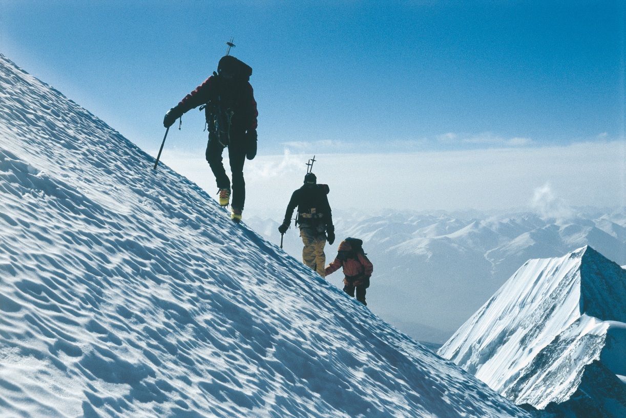

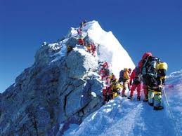

珠穆朗玛峰山体呈巨型金字塔状,威武雄壮昂首天外,地形极端险峻,环境异常复杂。雪线高度:北坡为5800—6200米,南坡为5500—6100米。东北山脊、 东南山脊和西山山脊中间夹着三大陡壁(北壁、东壁和西南壁),在这些山脊 和峭壁之间又分布着548条大陆型冰川,总面积达1457.07平方公里,平均厚度达7260米。冰川的补给主要靠印度洋季风带两大降水带积雪变质形成。冰川上 有千姿百态、瑰丽罕见的冰塔林,又有高达数十米的冰陡崖和步步陷井的明暗 冰裂隙,还有险象环生的冰崩雪崩区。(Quelle:http://news.xinhuanet.com)
珠穆朗玛峰(藏文:ཇོ་མོ་གླང་མ;藏语拼音:qomolangma;威利:jo mo glang ma,香港称珠穆朗玛峰,台湾称圣母峰),中文简称珠峰,尼泊尔名萨加玛塔峰(尼泊尔语:सगरमाथा),英国名埃佛勒斯峰(英语:Mount Everest),为地球第一高峰,属于喜马拉雅山脉,位于中国西藏自治区与尼泊尔萨加玛塔专区边界上。2005年中国国家测绘局测量的岩面高为8,844.43米(29,017.2英尺),尼泊尔则使用传统的雪盖高8,848米(29,029英尺),BBC报道称2010年起两国官方互相承认对方的测量数据[5],中国国家测绘地理信息局则在2018年2月声明否认此说法,仍采用8,844.43米数据至今[6]。它除了是海拔最高的山峰之外,也是距离地心第五远的高峰。[7]它附近的高峰包括8,516米(27,940英尺)的洛子峰、7,855米(25,771英尺)的努子峰和7,580米(24,870英尺)的章子峰。
清朝经过测绘于1719年出版的全国地图上称此峰为“朱姆朗马阿林”,但没有标出高度或用经纬度标出其位置。1856年英属印度测量局首次公布此峰的经纬度及海拔高度,主张此峰8,840米(29,000英尺)是世界第一高峰。1865年英国皇家地理学会接受印度测量局局长安德鲁·史考特·华欧的建议,将此峰命名为“埃佛勒斯峰”,以纪念前任局长乔治·埃佛勒斯。1952年,中国采用“珠穆朗玛峰”为官方名称。
珠穆朗玛峰吸引了许多登山者。主要的攀登路线有两条,一条从尼泊尔东南部出发,经过与洛子峰之间的南坳登顶,称为“标准路线”;另一条则从西藏的北部出发,经过与章子峰之间的北坳登顶。从标准路线登顶对登山技术的挑战不算高,但这条路线的风险包括雪崩、摔落山谷、高山症、冻伤和通过昆布冰瀑的危险。到2016年为止,山上有超过200具尸体,其中一些成为地标。[8][9]
据气象记载,珠穆朗玛峰山顶最低温度为-60°C,最低月平均温度为-35°C,全年平均温度为-29°C,参照北极、南极,因此也被称为“世界第三极”。[10]
Der Mount Everest ist ein Berg im Himalaya und mit einer Höhe von 8848 m der höchste Berg der Erde. Er gehört zu den 14 Achttausendern und zu den Seven Summits. Der Mount Everest ist seit 1856 nach dem britischen Landvermesser George Everest benannt. Auf Nepali heißt der Berg Sagarmatha, auf Tibetisch Qomolangma (deutsche Aussprache „Tschomolangma“; englische Umschrift Chomolungma).
Der Mount Everest befindet sich im Mahalangur Himal in der Region Khumbu in Nepal an der Grenze zu China (Autonomes Gebiet Tibet); der westliche und südöstliche seiner drei Gipfelgrate bilden die Grenze. Auf nepalesischer Seite ist er Teil des Sagarmatha-Nationalparks, der zum UNESCO-Welterbe gehört. Auf der Nordseite gehört er zum Qomolangma National Nature Reserve, das mit dem von der UNESCO ausgewiesenen Qomolangma-Biosphärenreservat korrespondiert.[1]
Edmund Hillary und Tenzing Norgay gelang am 29. Mai 1953 die Erstbesteigung des „dritten Pols“. Am 8. Mai 1978 bestiegen Reinhold Messner und Peter Habeler den Gipfel erstmals ohne zusätzlichen Sauerstoff.
エベレスト、エヴェレスト(英: Everest)、またはチョモランマ(チベット語: ཇོ་མོ་གླང་མ[1] Chomolungma, Qomolangma)、サガルマータ(ネパール語: सगरमाथा Sagarmāthā)は、ヒマラヤ山脈にある世界最高峰である。
エベレストはインド測量局(Survey of India)で長官を務めたジョージ・エベレストにちなんで命名された。
1920年代から長きにわたる挑戦の末、1953年にイギリス探検隊のメンバーでニュージーランド出身の登山家であるエドモンド・ヒラリーとネパール出身のシェルパであるテンジン・ノルゲイによって初登頂がなされた。
エベレストの標高については諸説あり、1954年にインド測量局が周辺12ヶ所で測定しその結果を平均して得られた8,848 mという数値が長年一般に認められてきた。1999年、全米地理学協会はGPSによる測定値が8,850mだったと発表した[2]。厳密には地殻変動などの影響によって標高は年々変動していると考えられている。
エベレストの南麓に位置するネパールのサガルマータ国立公園はユネスコの世界遺産に登録されている。
Mount Everest, known in Nepali as Sagarmatha (सगरमाथा) and in Tibetan as Chomolungma (ཇོ་མོ་གླང་མ), is Earth's highest mountain above sea level, located in the Mahalangur Himal sub-range of the Himalayas. The international border between Nepal (Province No. 1) and China (Tibet Autonomous Region) runs across its summit point.
The current official elevation of 8,848 m (29,029 ft), recognized by China and Nepal, was established by a 1955 Indian survey and subsequently confirmed by a Chinese survey in 1975.[1] In 2005, China remeasured the rock height of the mountain, with a result of 8844.43 m. There followed an argument between China and Nepal as to whether the official height should be the rock height (8,844 m., China) or the snow height (8,848 m., Nepal). In 2010, an agreement was reached by both sides that the height of Everest is 8,848 m, and Nepal recognizes China's claim that the rock height of Everest is 8,844 m.[5]
In 1865, Everest was given its official English name by the Royal Geographical Society, upon a recommendation by Andrew Waugh, the British Surveyor General of India. As there appeared to be several different local names, Waugh chose to name the mountain after his predecessor in the post, Sir George Everest, despite George Everest's objections.[6]
Mount Everest attracts many climbers, some of them highly experienced mountaineers. There are two main climbing routes, one approaching the summit from the southeast in Nepal (known as the "standard route") and the other from the north in Tibet. While not posing substantial technical climbing challenges on the standard route, Everest presents dangers such as altitude sickness, weather, and wind, as well as significant hazards from avalanches and the Khumbu Icefall. As of 2017, nearly 300 people have died on Everest, many of whose bodies remain on the mountain.[7]
The first recorded efforts to reach Everest's summit were made by British mountaineers. As Nepal did not allow foreigners into the country at the time, the British made several attempts on the north ridge route from the Tibetan side. After the first reconnaissance expedition by the British in 1921 reached 7,000 m (22,970 ft) on the North Col, the 1922 expedition pushed the north ridge route up to 8,320 m (27,300 ft), marking the first time a human had climbed above 8,000 m (26,247 ft). Seven porters were killed in an avalanche on the descent from the North Col. The 1924 expedition resulted in one of the greatest mysteries on Everest to this day: George Mallory and Andrew Irvine made a final summit attempt on 8 June but never returned, sparking debate as to whether or not they were the first to reach the top. They had been spotted high on the mountain that day but disappeared in the clouds, never to be seen again, until Mallory's body was found in 1999 at 8,155 m (26,755 ft) on the north face. Tenzing Norgay and Edmund Hillary made the first official ascent of Everest in 1953, using the southeast ridge route. Norgay had reached 8,595 m (28,199 ft) the previous year as a member of the 1952 Swiss expedition. The Chinese mountaineering team of Wang Fuzhou, Gonpo, and Qu Yinhua made the first reported ascent of the peak from the north ridge on 25 May 1960.[8][9]
L’Everest, en tibétain ཇོ་མོ་གླང་མ, Qomolangma ou encore Chomolungma, en népalais सगरमाथा, Sagarmāthā, aussi appelé mont Everest, est une montagne située dans la chaîne de l'Himalaya, à la frontière entre le Népal (province no 1 (en)) et la Chine (Tibet).
Il est aperçu par des Européens pour la première fois en 1847 puis, après quelques années d'observations et de calculs, son altitude est établie à 8 848 mètres et il est identifié comme le plus haut sommet du monde. Cette caractéristique lui vaut d'être baptisé de son nom actuel par les Occidentaux en 1865 et, dès les années 1920, de lui attirer l'intérêt des alpinistes qui se lancent à l'assaut de ses pentes. Plusieurs expéditions, en particulier britanniques, se succèdent depuis le versant nord au Tibet. Toutefois, les conditions climatiques extrêmes font leurs premières victimes, parmi lesquelles George Mallory et Andrew Irvine, en 1924, dont on ne saura probablement jamais avec certitude s'ils ont atteint le sommet. En 1950, le Népal autorise l'accès à la montagne depuis le sud offrant des possibilités d'ascension par l'arête Sud-Est, moins périlleuse. Finalement, trois ans plus tard, Edmund Hillary et Tensing Norgay réussissent à vaincre l'Everest. Dès lors, les exploits en tous genres s'enchaînent, alimentant les fantasmes populaires ; mais, en 1996, une série d'accidents mortels vient rappeler les dangers liés à la montagne, portant de nos jours à plus de 200 le nombre de victimes. Pourtant, le tourisme de masse se popularise, fragilisant le milieu naturel malgré les créations du parc national de Sagarmatha en 1976 et de la réserve naturelle du Qomolangma en 1988. Ainsi, plus de 14 000 alpinistes ont tenté l'ascension depuis 1922 et plus de 4 000 l'ont réussie, bien aidés, pour la majorité d'entre eux, par les porteurs sherpas.
Il monte Everest (pron. /ˈɛverest/[1]) è la vetta più alta del continente asiatico e della Terra con i suoi 8 848 m di altitudine s.l.m., situato nella catena dell'Himalaya assieme ad altri ottomila, al confine fra Cina e Nepal. Rientra dunque nelle cosiddette Sette Vette del Pianeta.
El monte Everest es la montaña más alta del planeta Tierra, con una altitud de 8.848 metros (29 029 pies) sobre el nivel del mar.1 Está localizada en el continente asiático, en la cordillera del Himalaya, concretamente en la subcordillera de Mahalangur Himal; marca la frontera entre China y Nepal, considerada como la frontera más alta del mundo.[cita requerida] El macizo incluye los picos vecinos Lhotse, 8516 m (27 940 pies); Nuptse, 7855 m (25 771 pies) y Changtse, 7580 m (24 870 pies).
 Egypt
Egypt
 Azerbaijan
 Bangladesh
 Belarus
 Chile
Chile
 Columbia
 Cuba
Cuba
 Democratic People's Republic of Korea

 Hand in Hand
 India
India
 Indonesia
 Iraq
Iraq
 Iran
Iran
 Jordan
 Cambodia
 Katar
Katar
 Kenya
Kenya
 Kuwait
 Laos
Laos
 Libanon
 Malaysia
 Morocco

 Mongolei
 Myanmar
 Nepal
Nepal
 Niger
Niger
 Nigeria
 Pakistan
 Palestine

 Party and government
 Peru
Peru
 Philippines
 Saudi Arabia
 Singapore
 Somalia
 Sri Lanka
 South Africa
 Syria
Syria
 Tansania
 Thailand
 Turkmenistan
 Uganda
 Uzbekistan
 Venezuela
 United Arab Emirates
 Vietnam

 Important International Organizations


Afghanistan Ägypten Algerien Angola Antigua und Barbuda Äquatorialguinea Äthiopien Aserbaidschan Bahamas Bahrain Bangladesch Barbados Belarus Belize Benin Bhutan Bolivien Botswana Brunei Burkina Faso Burundi Chile Demokratische Republik Kongo Dominica Dominikanische Republik Dschibuti Ecuador Elfenbeinküste Eritrea Eswatini Fidschi Gabun Gambia Ghana Grenada Guatemala Guinea Guinea-Bissau Guyana Haiti Honduras Indien Indonesien Irak Iran Jamaika Jemen Jordanien Kambodscha Kamerun Kap Verde Katar Kenia Kolumbien Komoren Kuba Kuwait Laos Lesotho Libanon Liberia Libyen Madagaskar Malawi Malaysia Malediven Mali Marokko Mauretanien Mauritius Mongolei Mosambik Myanmar Namibia Nepal Nicaragua Niger Nigeria Nordkorea Oman Osttimor Pakistan Palästina Panama Papua-Neuguinea Peru Philippinen Republik Kongo Ruanda Saint Lucia Sambia São Tomé und Príncipe Saudi-Arabien Senegal Seychellen Sierra Leone Simbabwe Singapur Somalia Sri Lanka St. Kitts und Nevis St. Vincent und die Grenadinen Südafrika Sudan Suriname Syrien Tansania Thailand Togo Trinidad und Tobago Tschad Tunesien Turkmenistan Uganda Usbekistan Vanuatu Venezuela Vereinigte Arabische Emirate Vietnam Zentralafrikanische Republik
Die Bewegung der Blockfreien Staaten (kurz Bewegung der Blockfreien oder Blockfreien-Bewegung, englisch Non-Aligned Movement) ist eine Internationale Organisation von Staaten, deren erklärtes Ziel es war, sich im Ost-West-Konflikt nach dem Zweiten Weltkrieg neutral zu verhalten und keinem der beiden Militärblöcke anzugehören. Die Gründung der Organisation ging auf eine Initiative des jugoslawischen Präsidenten Josip Broz Tito, des ägyptischen Staatschefs Nasser, des indischen Premiers Nehru sowie des indonesischen Präsidenten Sukarno zurück. Die Organisation konstituierte sich 1961 auf ihrer ersten Sitzung in Belgrad.[1] Ihr traten viele ehemalige afrikanische und asiatische Kolonien bei, die sich soeben erst als Staaten konstituiert hatten oder noch um ihre Unabhängigkeit rangen.[2]
Die Organisation verurteilte die Blockbildung in der Zeit des Ost-West-Konfliktes wegen der Gefahr eines Dritten Weltkrieges und setzte sich für die friedliche Koexistenz und Abrüstung ein. Die steigende Zahl der Mitglieder machte es der Organisation jedoch zunehmend schwer, sich auf eine gemeinsame Politik zu einigen. Mit der Auflösung des Warschauer Paktes Anfang der 1990er Jahre verlor sie an Bedeutung. Die heterogene Zusammensetzung der Bewegung machte es schwer, gemeinsame Ziele zu definieren und zu verfolgen.[3] Die Staaten der Blockfreien-Bewegung vertreten 55 Prozent der Weltbevölkerung und halten nahezu zwei Drittel der Sitze in der UN-Generalversammlung.
Das Ziel der Organisation ist die Gleichberechtigung zwischen den Staaten und eine positive wirtschaftliche Entwicklung der Mitgliedstaaten.
不结盟运动(英语:Non-Aligned Movement, NAM)是一个拥有120个成员国和17个观察员国的松散国际组织[3]。它成立于冷战时期,其成员国奉行独立自主的外交政策,不与美苏两个超级大国中的任何一个结盟。联合国中有三分之二的会员是该组织的成员国,全球约55%的人口也生活在不结盟运动国家。不结盟运动定期举行首脑会议,到目前为止已经在前南斯拉夫、埃及、赞比亚、阿尔及利亚、斯里兰卡、古巴、印度、津巴布韦、印尼、哥伦比亚、南非、马来西亚、塞尔维亚、委内瑞拉、阿塞拜疆和乌干达[4]举行会议。
 Australia
 Bangladesh
 Brunei Darussalam
 China
China
 Hainan Sheng-HI
 India
India
 Indonesia
 Iran
Iran
 Israel
 Japan
Japan
 Cambodia
 Kasachstan
 Kyrgyzstan
 Laos
Laos
 Malaysia
 Malediven

 Mongolei
 Myanmar
 Nepal
Nepal
 New Zealand
 Pakistan
 Philippines
 Republic of Korea
 Singapore
 Sri Lanka
 Tajikistan
 Thailand
 Turkmenistan
 Uzbekistan
 Vietnam

ボアオ・アジア・フォーラム(博鰲アジアフォーラム、Boao Forum for Asia、略称BFA、中国語:博鳌亚洲论坛、ピンイン:Bóáo Yàzhōu Lùntán)は、中華人民共和国に本拠を置く国際非営利組織。
スイスのダボスで開催されている世界の政治家・財界人・知識人が集まる国際会議(ダボス会議)を主催する世界経済フォーラムにならい、そのアジア版を目指して、中国政府の全面的支援を受けて構想された。2001年2月27日の設立にはアジアの25カ国とオーストラリアの計26カ国が参加している。
ボアオ・アジア・フォーラム主催の最初の国際会議は2002年4月12日・4月13日に開催され、日本からは小泉純一郎内閣総理大臣が出席して演説を行った[1]。国際会議の会場は、2001年の発足会議以来、中国・海南省の海浜リゾート地・ボアオ(博鰲、海南島東海岸の瓊海市)に固定されている。会議は毎年行われ、各国首脳や大企業経営者、学者、NGO代表など政府・民間のハイレベルの人材が集い、アジアや世界の経済動向、金融政策、経済統合、経済投資、国際協力、社会問題、環境問題などに関する討議が行われる。また多くの経済人や政治家、社会運動家らが直接話し合い、国家間協力や企業提携などのトップ会談が持たれる。 過去の議題には中国の世界貿易機関(WTO)への加入問題、90年代後半のアジア金融危機問題などが取り上げられ、2004年には中国の地政学的な「和平崛起」(平和的台頭)戦略の可否が議題となった。
The Boao Forum for Asia (BFA; Chinese: 博鳌亚洲论坛; pinyin: Bó'áo Yàzhōu Lùntán) is a non-profit organisation that hosts high-level forums for leaders from government, business and academia in Asia and other continents to share their vision on the most pressing issues in this dynamic region and the world at large. BFA is modelled on the World Economic Forum held annually in Davos, Switzerland. Its fixed address is in Bo'ao, Hainan province, China, although the Secretariat is based in Beijing. The forum, sometimes known as the “Asian Davos”, takes its name from the town of Boao, located in China’s southern Hainan province, which has been the permanent venue for its annual conference since 2002.[1]
The Forum is committed to promoting regional economic integration and bringing Asian countries even closer to their development goals. Initiated in 1998 by Fidel V. Ramos, former President of the Philippines, Bob Hawke, former Prime Minister of Australia, and Morihiro Hosokawa, former Prime Minister of Japan, the Boao Forum for Asia was formally inaugurated in February 2001. The founding of the BFA was driven by the People's Republic of China and founded by 26 Asian and Australasian states on 27 February 2001. The organisation held its first meeting from 12–13 April 2002.
Discussions at the BFA focus on economics, integration, cooperation, society and the environment. In the past the forum also addressed China's entry into the World Trade Organization, as well as Southeast Asia's economic crisis during the 1990s. The geopolitical strategy 'China's peaceful rise' was a topic of discussion for the forum in 2004. In addition to its annual meeting, the BFA also sponsors other forums and meetings related to Asian issues.
El Foro de Boao para Asia (en chino: 博鳌亚洲论坛, pinyin: Bó'áo Yàzhōu Lùntán), conocida también por sus siglas en inglés BFA, es una organización no lucrativa que organiza foros de alto nivel para líderes del gobierno, los negocios y la academia en Asia y otros continentes para compartir su visión sobre los asuntos más apremiantes en esta región y en el mundo entero. El Foro Boao es el modelo del Foro Económico Mundial que se celebra anualmente en Davos, Suiza. Tiene su sede en Bo'ao, Hainan, China, aunque la Secretaría se encuentra en Pekín.
El Foro tiene como objetivos promover la integración económica regional y acercar a los países asiáticos hacia sus metas de desarrollo.1 Fue creado en 1998 por Fidel V. Ramos, expresidente de Filipinas, Bob Hawke, ex primer ministro de Autralia y Morihiro Hosokawa, ex primer ministro de Japón.2 El Foro de Boao para Asia fue formalmente inaugurado en febrero de 2001. La creación del foro fue liderado por la República Popular de China y fundada por 26 países de Asia y Australasia el 27 de febrero de 2001. La organización tuvo su primera reunión el 12 y 13 de abril de 2002.
Las discusiones del Foro Boao se centran en economía, cooperación, sociedad y medio ambiente. En e pasado el foro también abordaba el ingreso de China en la Organización Mundial del Comercio, así como la crisis financiera asiática de los años noventa. Además de su reunión anual, el foro también patrocina otros foros y reuniones relacionados con temas asiáticos.
Боаоский Азиатский Форум, БАФ (кит: 博鳌亚洲论坛; пиньинь: Bó'áo Yàzhōu Lùntán, англ: Boao Forum for Asia, аббр: BFA), также известен как «Восточный Давос» — неправительственная и некоммерческая международная организация, имеющая своей целью поддержку и развитие экономического обмена, взаимодействия и сотрудничества как в Азии, так и за её пределами путём проведения ежегодных встреч высокого уровня с участием представителей правительственных, деловых, промышленных и научных кругов и обсуждения актуальных экономических, социальных, экологических и др. проблем.
Учреждён в 2001 году. Ежегодные конференции в Боао проводятся с 2002 года.
Главный офис организации находится в г. Боао, пров. Хайнань, КНР.
В 2018 году Боаоский азиатский форум /БАФ/ пройдет 8-11 апреля. Главными темами мероприятия станут реформы, открытость, инновации и "Пояс и путь"[1].
.jpg)
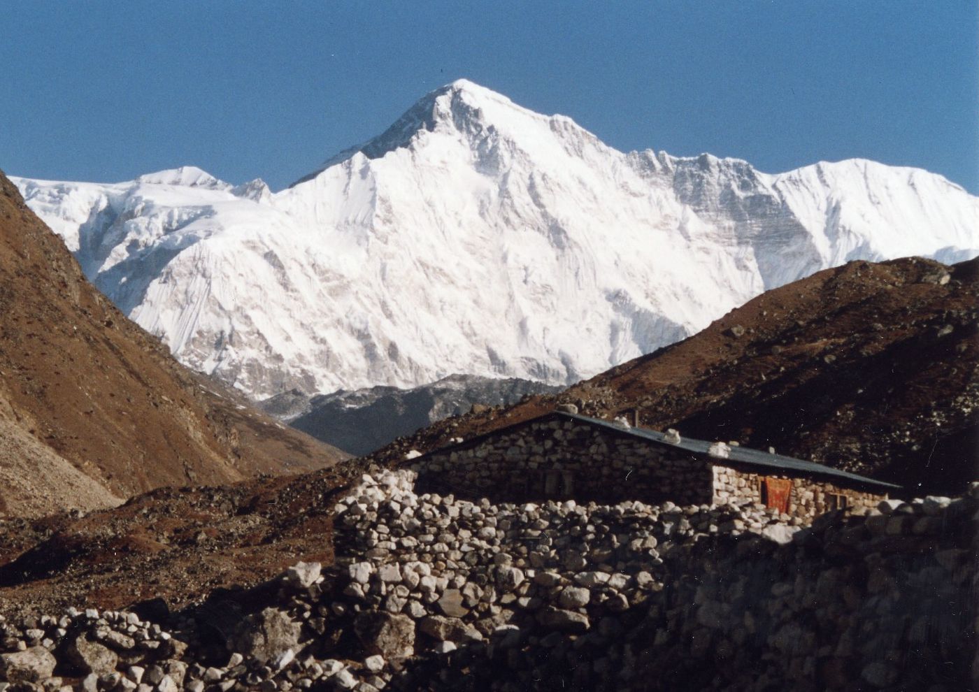
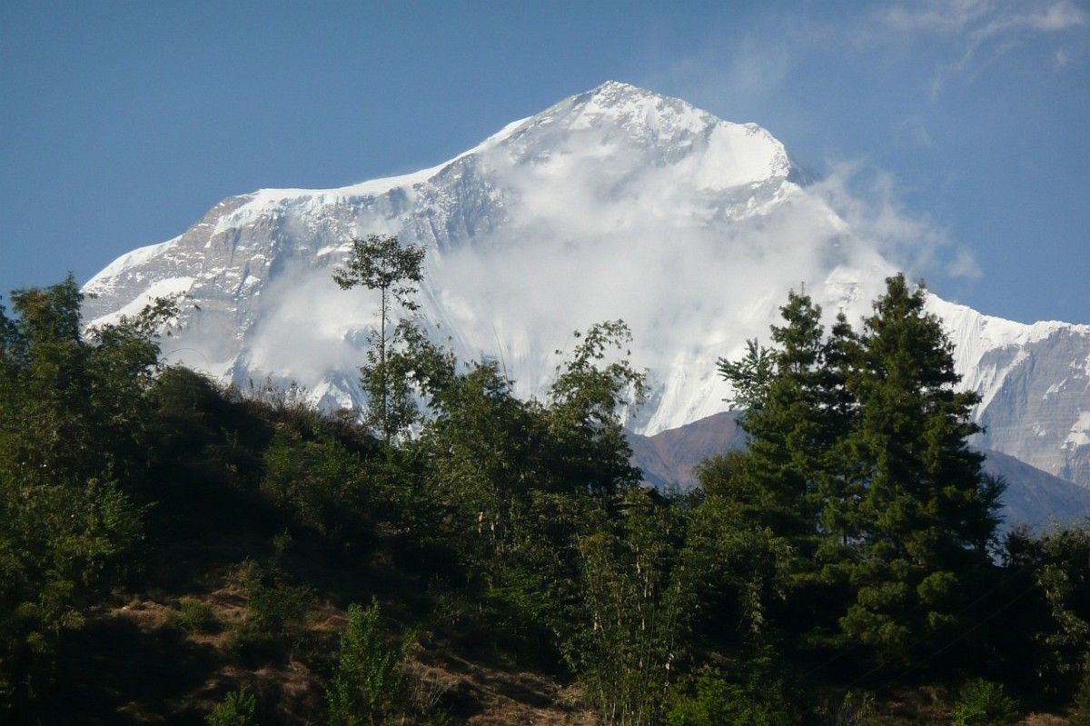

燃灯日(藏语:དགའ་ལྡན་ལྔ་མཆོད།,藏语音译甘丹阿曲,又译甘丹五供),是格鲁派为首的藏传佛教僧众于每年藏历10月25日以甘丹寺为中心、为纪念缅怀宗喀巴示寂涅槃而举行的宗教仪轨。每年的这一天,甘丹寺僧人会在大殿中用彩色矿石粉绘制坛城,用木料、酥油、糌粑塑制出各种神鬼、动物、花果、树木等形象并饰以五彩,供人祭祀和祈祷[1],与此同时,其他格鲁派僧众会在各自寺院内外的佛坛与家中窗台上点燃酥油灯,昼夜不灭[2],举行诵经、磕头、灯供仪式等活动,祈愿宗喀巴赐与善良的人们智慧与福祉[3]。
Galdan Namchot ist ein Fest, das in Tibet, Nepal, der Mongolei und vielen Regionen des Himalaya, insbesondere in Ladakh, Indien, gefeiert wird. Es dient dem Gedenken an die Geburt, das Parinirvana (Tod) und die Buddhaschaft von Je Tsongkhapa (1357-1419 n. Chr.), einem berühmten Gelehrten/Lehrer des tibetischen Buddhismus, dessen Aktivitäten zur Gründung der Gelug-Schule des tibetischen Buddhismus führten. Galdan Namchot markiert auch den Beginn der Neujahrsfeiern in Ladakh.

喜马拉雅山脉(梵语:हिमालय IAST:hīmalaya,“雪(hīma)域(laya)”之意[1];藏文:ཧི་མ་ལ་ཡ,藏语拼音:himalaya,威利:hi ma la ya;尼泊尔语:हिमालय)是世界海拔最高的山脉,位于亚洲的中国西藏自治区与巴基斯坦、印度、尼泊尔、不丹等国边境上。东西长2400多公里,南北宽200至300公里[2]。分布于青藏高原南缘,西起克什米尔的南迦-帕尔巴特峰(北纬35°14'21",东经74°35'24",海拔8125米),东至雅鲁藏布江大拐弯处的南迦巴瓦峰(北纬29°37'51",东经95°03'31",海拔7756米),总面积约594,400平方公里[1]。
中国与尼泊尔边界上的主峰珠穆朗玛峰海拔高度8844.43米,为世界第一高峰。喜马拉雅山脉中还有一百多座高度超过7200米的山峰,而喜马拉雅山脉以外的最高峰是世界第二高峰、位于喀喇昆仑山脉的乔戈里峰,高度8611米。喜马拉雅山脉对南亚文化有许多的影响,许多山脉中的高山是佛教及印度教的圣地。
喜马拉雅山脉也有一些较低而走势平行的山麓,第一山麓在最南边,高约一千米,称为西瓦利克山脉,再往北即是高二千到三千米的小喜马拉雅山带。
喜马拉雅山脉横跨了五个国家:印度、尼泊尔、不丹、中国及巴基斯坦,喜马拉雅山脉主要是在前三个国家的国境内[3]。喜马拉雅山脉的西北方是兴都库什山脉和喀喇昆仑山脉,北边是西藏高原,南边则是印度河-恒河平原。
世界上的主要河川中,印度河、恒河及雅鲁藏布江(下游是布拉马普特拉河)都是发源自喜马拉雅山脉。印度河和雅鲁藏布江发源自冈仁波齐峰附近,而恒河发源自印度的北阿坎德邦。这些河的流域中居住约六亿人。
Der Himalaya (auch Himalaja) (Sanskrit: हिमालय, himālaya, deutsch [hiˈmaːlaɪ̯a] oder [himaˈlaɪ̯a]; von hima ‚Schnee‘ und alaya „Ort, Wohnsitz“) ist ein Hochgebirgssystem in Asien. Es ist das höchste Gebirge der Erde und liegt zwischen dem indischen Subkontinent im Süden und dem Tibetischen Hochland im Norden. Das Gebirge erstreckt sich auf einer Länge von etwa 3000 Kilometern von Pakistan bis Myanmar (Burma) und erreicht eine Breite von bis zu 350 Kilometern. Im Himalaya befinden sich zehn der vierzehn Berge der Erde, deren Gipfel mehr als 8000 Meter hoch sind („Achttausender“), darunter der Mount Everest, der mit 8848 m ü. NHN höchste Berg der Erde. Mit seiner südlichen Lage sowie dem sich im Rückraum des Himalaya als ausgedehntes Hochplateau erhebenden Tibetischen Hochland übt der Himalaya großen Einfluss auf das Klima Süd- und Südostasiens aus. So wird der Indische Sommermonsun erst durch die im Sommer thermisch bedingten Ferrel'schen Druckgebilde in Westindien und Tibet erzeugt. An der Haupterhebung des Himalaya gestaut, liegen hier einige der regenreichsten Orte der Erde sowie die Quellgebiete aller großen Flusssysteme Südasiens.
ヒマラヤ山脈(ヒマラヤさんみゃく、Himalayan Range)は、アジアの山脈で、地球上で最も標高の高い地域である。単にヒマラヤということもある。
ヒマラヤは、インド亜大陸とチベット高原を隔てている無数の山脈から構成される巨大な山脈である。西はパキスタン北部インダス川上流域から、東はブラマプトラ川大屈曲部まで続き、ブータン、中国、インド、ネパール、パキスタンの5つの国にまたがる。いずれも最大級の大河であるインダス川、ガンジス川、ブラマプトラ川、黄河、長江の水源となって数々の古代文明を育み、このヒマラヤ水系には約7億5千万人の人々が生活している(これにはバングラデシュの全人口が含まれる)。ヒマラヤは、広義の意味ではユーラシアプレートとインド・オーストラリアプレートの衝突によって形成された周辺の山脈である、カラコルム山脈、ヒンドゥークシュ山脈、天山山脈、崑崙山脈などを含む。
広義のヒマラヤには、最高峰エベレストを含む、地球上で最も高い14の8,000 m級ピークがあり、7,200 m以上の山が100峰以上存在する。一方で、アジアのこの地域以外には7,000 m以上の山は存在せず、アンデス山脈アコンカグアの6,961 mが最高標高である。以下では狭義のヒマラヤについて解説する。
The Himalayas, or Himalaya (/ˌhɪməˈleɪə, hɪˈmɑːləjə/), form a mountain range in Asia, separating the plains of the Indian subcontinent from the Tibetan Plateau.
The Himalayan range has many of the Earth's highest peaks, including the highest, Mount Everest. The Himalayas include over fifty mountains exceeding 7,200 m (23,600 ft) in elevation, including ten of the fourteen 8,000-metre peaks. By contrast, the highest peak outside Asia (Aconcagua, in the Andes) is 6,961 m (22,838 ft) tall.[1]
Lifted by the subduction of the Indian tectonic plate under the Eurasian Plate, the Himalayan mountain range runs west-northwest to east-southeast in an arc 2,400 km (1,500 mi) long.[2] Its western anchor, Nanga Parbat, lies just south of the northernmost bend of Indus river. Its eastern anchor, Namcha Barwa, is just west of the great bend of the Yarlung Tsangpo River (upper stream of the Brahmaputra River). The Himalayan range is bordered on the northwest by the Karakoram and the Hindu Kush ranges. To the north, the chain is separated from the Tibetan Plateau by a 50–60 km (31–37 mi) wide tectonic valley called the Indus-Tsangpo Suture.[3] Towards the south the arc of the Himalaya is ringed by the very low Indo-Gangetic Plain.[4] The range varies in width from 350 km (220 mi) in the west (Pakistan) to 150 km (93 mi) in the east (Arunachal Pradesh).[5] The Himalayas are distinct from the other great ranges of central Asia, although sometimes the term 'Himalaya' (or 'Greater Himalaya') is loosely used to include the Karakoram and some of the other ranges.
The Himalayas are inhabited by 52.7 million people,[5] and are spread across five countries: Nepal, India, Bhutan, China and Pakistan. Some of the world's major rivers — the Indus, the Ganges and the Tsangpo-Brahmaputra — rise in the Himalayas, and their combined drainage basin is home to roughly 600 million people. The Himalayas have a profound effect on the climate of the region, helping to keep the monsoon rains on the Indian plain and limiting rainfall on the Tibetan plateau. The Himalayas have profoundly shaped the cultures of the Indian subcontinent; many Himalayan peaks are sacred in Hinduism and Buddhism.
L'Himalaya Écouter (sanskrit : हिमालय de hima (neige) et ālaya (demeure), littéralement « demeure des neiges »1, népalais : हिमालय, hindi : हिमालय, ourdou : ہمالیہ), ou chaîne de l'Himalaya, est un ensemble de chaînes de montagnes s'étirant sur plus de 2 400 km de long et large de 250 à 400 km, qui sépare le sous-continent indien du plateau tibétain dans le Sud de l'Asie. Au sens strict, il débute à l'ouest au Nanga Parbat au Pakistan et se termine à l'est au Namche Barwa au Tibet. Cet ensemble montagneux, délimité à l'ouest par la vallée du fleuve Indus et à l'est par la vallée du fleuve Brahmapoutre, couvre une aire d'environ 600 000 km2.
Ainsi, l'Himalaya abrite 10 des 14 sommets qui culminent à plus de 8 000 mètres d'altitude, dont le mont Everest, le plus haut de tous ; les 4 autres se situent dans le Karakoram. Ces hauts sommets ont donné lieu à de nombreuses expéditions d'alpinistes renommés et ont tous été conquis.
La limite supérieure des forêts se situe à 3 900 m et la limite inférieure des neiges éternelles vers 5 000 m2.
L'Himalaya fait partie d'un ensemble montagneux plus vaste encore que l'on désigne par « Aire Hindu Kush-Himalaya » (HKH), laquelle comprend les chaînes du Karakoram, de l'Hindou Kouch et du Pamir. Ce vaste ensemble chevauche huit pays et abrite plus de 140 millions de personnes.
L'Himalaya o Himalaia (pron. /imaˈlaja/, tradizionalmente /iˈmalaja/[1]; in sanscrito हिमालय, "dimora delle nevi", dall'unione di hima, "neve", e ālaya, "dimora"), adattata talvolta in italiano come Imalaia[2][3][4], è un sistema montuoso dell'Asia centrale, il cui nome significa «dimora delle nevi»[5], che si innalza a settentrione del bassopiano Indo-gangetico, e a meridione dell'altopiano del Tibet e che forma un gigantesco arco diretto da nord-ovest a sud-est con la convessità rivolta a sud e compreso all'incirca tra 73° e 95° di long. est e 27° e 36° di lat. nord.
Entro i limiti convenzionali, segnati a nord dalle valli superiori dell'Indo e dell'alto Brahmaputra (o Sang-po), a est e a ovest dalle valli degli stessi fiumi, che con brusco cambiamento di direzione scendono da nord verso sud, e a sud dal margine della pianura, il sistema himalayano si sviluppa per una lunghezza di 2200 km su una larghezza variante da 250 a 350 km. Si tratta di rilievi che hanno la stessa età geologica delle Alpi e rappresentano un sistema a pieghe perfettamente analogo a quello alpino per struttura e per paesaggio, però di ben maggiori proporzioni, soprattutto altimetriche[6].
El Himalaya (del sánscrito हिमालय, himālaya [pr. jimaalaia], donde hima, "nieve", y ālaya, "morada", "lugar") es una cordillera situada en el continente asiático, y se extiende por varios países: Bután, Nepal, China e India.
Es la cordillera más alta de la Tierra, con más de cien cimas que superan los 7000 metros y nueve cimas de más de 8000 metros de altura, entre las cuales se halla el Monte Everest, de 8848 msnm, la montaña más alta del planeta sobre el nivel del mar.
Forma parte de un complejo orográfico mayor: el sistema de los Himalayas, un conjunto compuesto por las cordilleras del Himalaya, Karakórum, donde se encuentran los restantes cinco "ochomiles", Hindú Kush y diversas otras subcordilleras que se extienden a partir del Nudo del Pamir y sus subcordilleras adyacentes.
En el Himalaya nacen algunos de los mayores ríos del mundo: el río Ganges, el río Indo, el río Brahmaputra, río Yamuna y el río Yangtsé, en cuyos cauces viven no menos de 1300 millones de personas. Las montañas del Himalaya han influido profundamente sobre las culturas de Asia del Sur, y muchas de ellas son sagradas para el hinduismo y para el budismo.
Гимала́и (санскр. हिमालयः, himālayaḥ IAST «обитель снегов», хинди हिमालय, непальск. हिमालय, тиб. ཧི་མ་ལ་ཡ, кит. упр. 喜马拉雅山脉, кит. упр. 雪域山脉, урду ہمالیہ, англ. Himalayas) — высочайшая горная система Земли. Гималаи расположены между Тибетским нагорьем (на севере) и Индо-Гангской равниной (на юге)[2]. Резко выражен климатический и природный рубеж между горными пустынями Центральной Азии и тропическими ландшафтами Южной Азии.
Гималаи раскинулись на территории Индии, Непала, Тибетского автономного района Китая, Пакистана и Бутана. Предгорья Гималаев также занимают крайнюю северную часть Бангладеш[3].
Горная система Гималаев на стыке Центральной и Южной Азии имеет свыше 2900 км в длину и около 350 км в ширину. Площадь составляет приблизительно 650 тыс. км²[2]. Средняя высота гребней около 6 км, максимальная 8848 м[4] — гора Джомолунгма (Эверест). Здесь находится 10 восьмитысячников — вершин высотой более 8000 м над уровнем моря. На северо-западе от западной цепи Гималаев находится другая высочайшая горная система — Каракорум.
Население в основном занимается земледелием, хотя климат позволяет выращивать лишь несколько видов злаков, картофель и некоторые другие овощи. Поля расположены на наклонных террасах.
 Geography
 Sport
Sport