
漢德百科全書 | 汉德百科全书
 United Kingdom
 European Union
 Belgium
Bulgaria
Denmark
Germany
Estonia
Finland
France
Greece
Ireland
Iceland
Israel
Italy
Croatia
Latvia
Lithuania
Luxembourg
Malta
Monaco
Montenegro
Netherlands
Nordmazedonien
Norwegen
Austria
Poland
Portugal
Romania
Russia
San Marino
Sweden
Switzerland
Serbia
Slovakia
Slovenia
Spain
Czech Republic
Turkey
Ukraine
Hungary
United Kingdom
Belgium
Bulgaria
Denmark
Germany
Estonia
Finland
France
Greece
Ireland
Iceland
Israel
Italy
Croatia
Latvia
Lithuania
Luxembourg
Malta
Monaco
Montenegro
Netherlands
Nordmazedonien
Norwegen
Austria
Poland
Portugal
Romania
Russia
San Marino
Sweden
Switzerland
Serbia
Slovakia
Slovenia
Spain
Czech Republic
Turkey
Ukraine
Hungary
United Kingdom
 Science and technology
Cyprus
Science and technology
Cyprus
 Companies
 Life and Style

 International cities
 Medieval cities in Europe
 Cities founded by the Romans
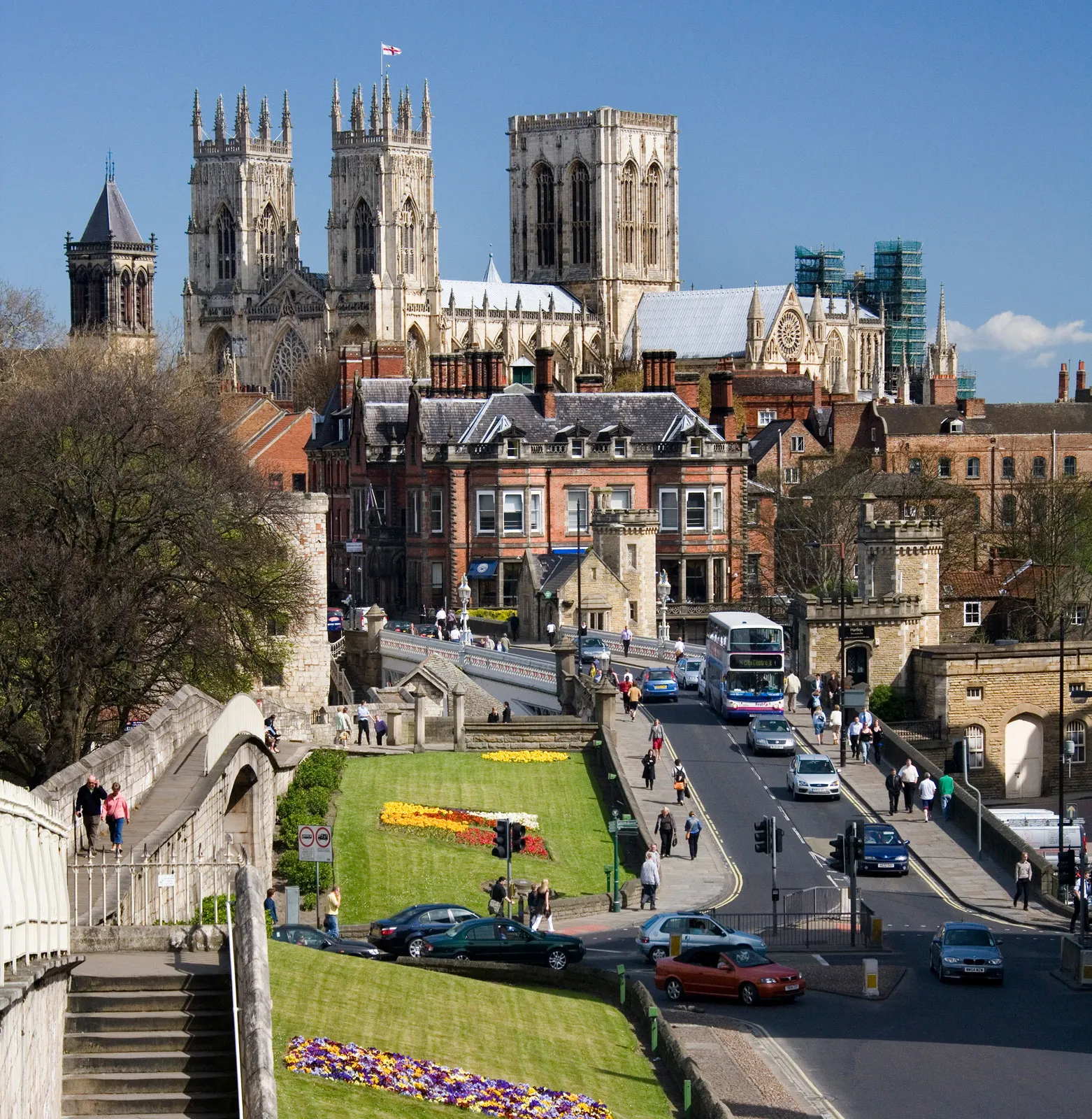
York ist eine Stadt im Norden von England am River Ouse nahe der Mündung des River Foss. York war bereits in der Römerzeit ein bedeutendes Zentrum und später die Residenzstadt der Grafschaft Yorkshire. Heute ist die City of York eine selbständige Verwaltungseinheit (Unitary Authority), die nur zu zeremoniellen Anlässen zur Grafschaft North Yorkshire gehört.
约克(英语:York,当地 ![]() i/ˈjɔːrk/),位于英国英格兰约克郡-亨伯区域北约克郡,英格兰的城市、单一管理区,位于乌斯河畔、利兹东北偏东,起初为盖尔人的居点,后为罗马人、盎格鲁人、丹麦人和诺曼人占领。中世纪该城是繁荣的羊毛市场和教育中心,其大主教地位仅次于坎特伯雷大主教。
i/ˈjɔːrk/),位于英国英格兰约克郡-亨伯区域北约克郡,英格兰的城市、单一管理区,位于乌斯河畔、利兹东北偏东,起初为盖尔人的居点,后为罗马人、盎格鲁人、丹麦人和诺曼人占领。中世纪该城是繁荣的羊毛市场和教育中心,其大主教地位仅次于坎特伯雷大主教。
 Colleges and Universities in Europe

 Art
Art

 Architecture
 Geography

直布罗陀(英语:Gibraltar)是14个英国海外领土之一[1],也是最小的一个,位于伊比利亚半岛的末端,是通往地中海的入口[2][3]。
直布罗陀面积约为6平方公里,北接西班牙安达鲁西亚加的斯省。直布罗陀巨岩是直布罗陀主要的地标之一。直布罗陀的人口集中在该区域的南部,容纳了直布罗陀人和其他民族共三万多人。[4]居民人数包括常住的直布罗陀人,一些常驻的英国人(包括英国军人的妻子和家人,未包括军人本身)和非英国居民。没有包括参观的游客和短暂停留的人士。
ジブラルタル(Gibraltar)は、イベリア半島の南東端に突き出した小半島を占める、イギリスの海外領土。
Gibraltar (/dʒɪˈbrɔːltər/; Spanish pronunciation: [xiβɾalˈtaɾ]) is a British Overseas Territory located at the southern tip of the Iberian Peninsula.[8][9] It has an area of 6.7 km2 (2.6 sq mi) and is bordered to the north by Spain. The landscape is dominated by the Rock of Gibraltar at the foot of which is a densely populated city area, home to over 30,000 people, primarily Gibraltarians.[10] It shares a maritime border with Morocco. Under the Gibraltar constitution of 2006, Gibraltar has limited powers of self-government, with some responsibilities, such as defence and foreign relations, remaining with the British government.
In 1704, Anglo-Dutch forces captured Gibraltar from Spain during the War of the Spanish Succession on behalf of the Habsburg claim to the Spanish throne. The territory was ceded to Great Britain in perpetuity under the Treaty of Utrecht in 1713. During World War II it was an important base for the Royal Navy as it controlled the entrance and exit to the Mediterranean Sea, which is only 8 miles (13 km) wide at this naval "choke point". It remains strategically important, with half the world's seaborne trade passing through the strait.[11][12][13] Today Gibraltar's economy is based largely on tourism, online gambling, financial services and cargo ship refuelling.[14][15][16][17]
The sovereignty of Gibraltar is a point of contention in Anglo-Spanish relations because Spain asserts a claim to the territory.[18][15] Gibraltarians rejected proposals for Spanish sovereignty in a 1967 referendum and, in a 2002 referendum, the idea of shared sovereignty was also rejected.
Gibraltar (de l'arabe « جبل طارق », « Djebel Tariq », « le mont de Tariq » du nom de Tariq ibn Ziyad) est un territoire britannique d'outre-mer3, situé au sud de la péninsule Ibérique, en bordure du détroit de Gibraltar qui relie la Méditerranée à l'océan Atlantique. Il correspond au rocher de Gibraltar et à ses environs immédiats et est séparé de l'Espagne par une frontière de 1,2 kilomètre.
Gibraltar est possession du Royaume-Uni depuis 1704. Les forces armées britanniques y conservent une présence relativement importante. Bien que la majorité de sa population y soit opposée4,5, Gibraltar est revendiqué par l'Espagne. La question de Gibraltar est une cause majeure de dissension dans les relations hispano-britanniques.
Gibraltar fait partie de l'Union européenne (dans le cadre de laquelle il bénéficie d'un statut spécial6) mais pas de l'espace Schengen7. Ce statut est toutefois menacé par la procédure de retrait du Royaume-Uni de l'Union européenne qui a été déclenchée le 29 mars 2017 à la suite du référendum du 23 juin 2016 organisé sur l'ensemble du territoire britannique8. Cependant, les résultats locaux de la consultation dénotent que 96 % des Gibraltariens souhaitent rester au sein de l'UE, tout en espérant obtenir un statut similaire à celui octroyé à Andorre ou au Liechtenstein9.
Les habitants de Gibraltar sont les Gibraltariens et les Gibraltariennes.
Gibilterra (in inglese: Gibraltar, /dʒɨˈbɹɒltə/; come in spagnolo, /xiβɾalˈtaɾ/) è un territorio d'Oltremare del Regno Unito.
Inserita nella lista delle Nazioni Unite dei territori non autonomi, Gibilterra si trova nell'Europa sudoccidentale, sulla costa meridionale della Spagna, all'estremità orientale dello stretto omonimo, che collega l'oceano Atlantico e il mar Mediterraneo. Confina interamente con La Línea de la Concepción, comune spagnolo in provincia di Cadice (Andalusia). Viene considerata dalla Spagna come una vera e propria, nonché ultima, colonia in territorio europeo.
Un tempo nota come Calpe, una delle Colonne d'Ercole, deve il suo nome attuale alla corruzione del nome arabo Jabal Ţāriq (جبل طارق, ossia "Monte di Tariq"), così chiamato in omaggio a Tariq ibn Ziyad, il condottiero berbero che conquistò la Spagna nel 711[2].
Gibraltar (en inglés: Gibraltar, AFI: [dʒɨˈbrɔːltər]) es un territorio británico de ultramar5situado en una pequeña península del extremo sur de la península ibérica, haciendo frontera únicamente con España, país que reclama su soberanía. Para la Organización de las Naciones Unidas, Gibraltar, como colonia,678 es uno de los territorios no autónomos bajo supervisión de su Comité Especial de Descolonización, al igual que otros dieciséis casos más.6
Atendiendo al artículo x del Tratado de Utrecht, «la ciudad y castillos de Gibraltar, juntamente con su puerto, defensas y fortalezas» en 17139 serían una propiedad a perpetuidad de la Corona británica en territorio de jurisdicción española, debiendo retornar a España si el Reino Unido renunciase o enajenase de alguna manera dicha propiedad. El istmo entre el peñón y las otras fortificaciones españolas es para España territorio ocupado, atendiendo a su interpretación del tratado.351011
Gibraltar está situado en el extremo meridional de la península ibérica, al este de la bahía de Algeciras, y se extiende sobre la formación geológica del peñón de Gibraltar (en inglés: the Rock of Gibraltar o también, the Rock), península que domina la orilla norte del estrecho homónimo, comunicando el mar Mediterráneo y el océano Atlántico. Alberga una población de 29 752 habitantes en una superficie de menos de 7 km², con una economía basada en el sector de servicios, principalmente como centro financiero, turístico y puerto franco. Aprovechando su privilegiada posición estratégica, cuenta con una base aeronaval de las Fuerzas Armadas Británicas.
Gibraltar fue conocida en la antigüedad como promontorio o monte Calpe (en latín: Mons Calpe),12 una de las dos míticas columnas de Hércules, y posteriormente renombrada como derivación del árabe Ẏabal Tāriq (جبل طارق), o «montaña de Tariq»,13 en recuerdo del general Táriq ibn Ziyad, quien dirigió el desembarco en este lugar de las fuerzas del Califato Omeya de al-Walid I en 711. Integrada en la Corona de Castilla desde la segunda mitad del siglo XV, fue ocupada en 1704 por una escuadra angloholandesa en apoyo del Archiduque Carlos, pretendiente durante la Guerra de Sucesión Española, al término de la cual, las Coronas británica y la española firmaron el Tratado de Utrecht en 1713. Desde entonces, el devenir político de Gibraltar ha sido objeto de controversia en las relaciones hispano-británicas.
Гибралта́р (англ. Gibraltar [dʒɪˈbrɔːltɚ]) — заморская территория Великобритании, оспариваемая Испанией, на юге Пиренейского полуострова, включающая Гибралтарскую скалу и песчаный перешеек, соединяющий скалу с Пиренейским полуостровом[4].
Занимает стратегическую позицию над Гибралтарским проливом, соединяющим Средиземное море с Атлантическим океаном. Военно-морская база НАТО.
Гибралтар является членом Европейского союза через членство Великобритании. В 1973 году Великобритания присоединилась к ЕС вместе с Гибралтаром (но без Нормандских островов и острова Мэн)[5] в соответствии со статьёй 299 (4) Договора о Европейском сообществе. После ратификации и вступления в силу Лиссабонского договора 2007 года данный Договор стал именоваться Договором о функционировании Европейского союза. На него не распространяется общая сельскохозяйственная политика ЕС, шенгенские соглашения, также он не является общей таможенной территорией ЕС, поэтому здесь нет НДС[6].
C 2004 года жители Гибралтара могут участвовать в выборах в Европейский парламент. Граждане Гибралтара являются гражданами Великобритании и ЕС.
 Transport and traffic
Anhui Sheng-AH
Anhui Sheng-AH
Belarus
Belarus
Belgium
Transport and traffic
Anhui Sheng-AH
Anhui Sheng-AH
Belarus
Belarus
Belgium
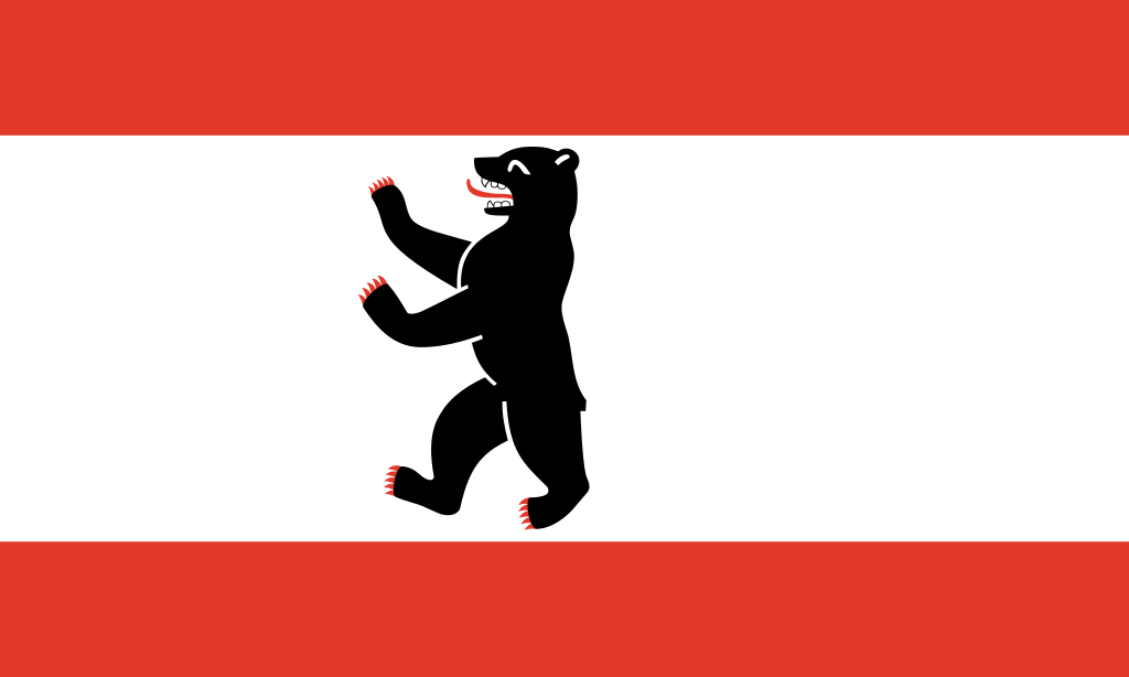 Berlin
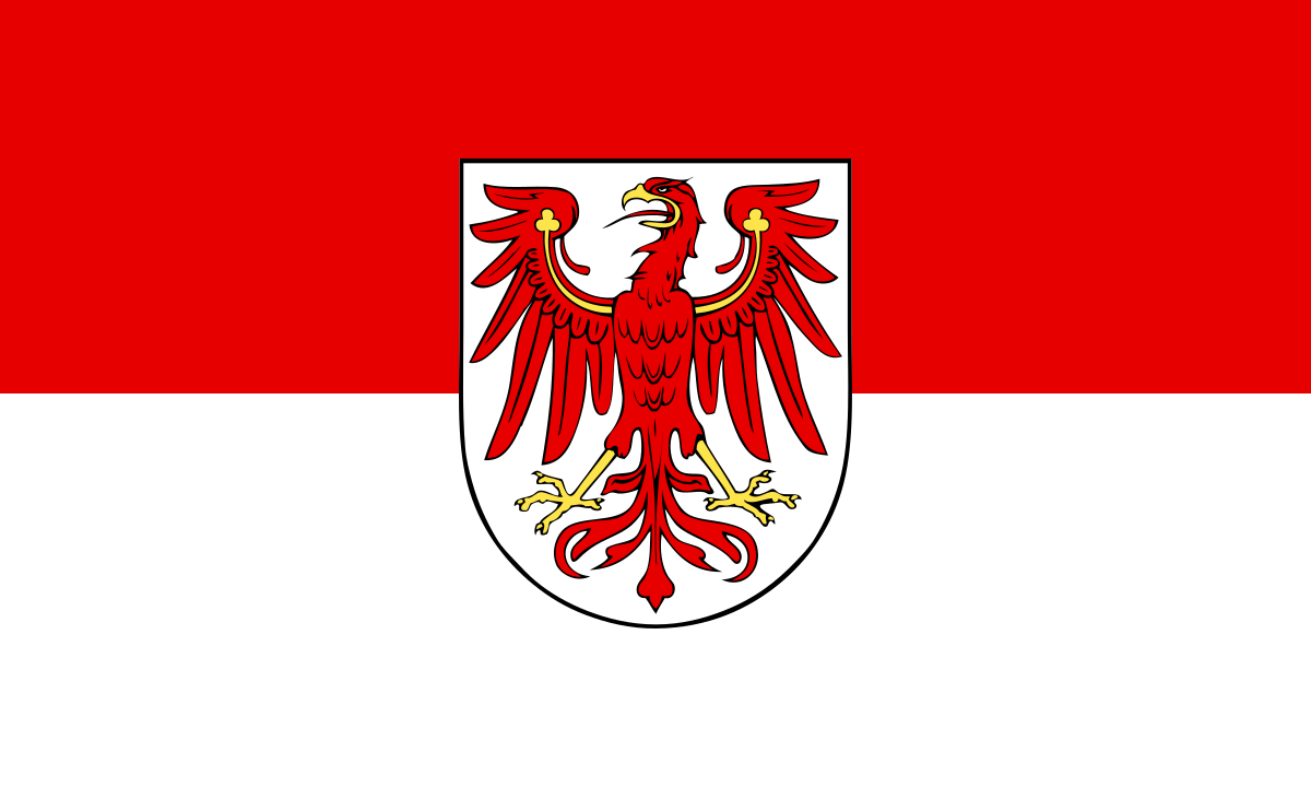 Brandenburg
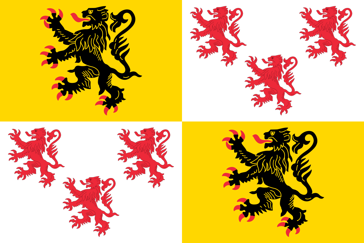
 Cataluña
China
Chongqing Shi-CQ
Germany
England
France
Fujian Sheng-FJ
Gansu Sheng-GS
Guangdong Sheng-GD
Guizhou Sheng-GZ
Cataluña
China
Chongqing Shi-CQ
Germany
England
France
Fujian Sheng-FJ
Gansu Sheng-GS
Guangdong Sheng-GD
Guizhou Sheng-GZ
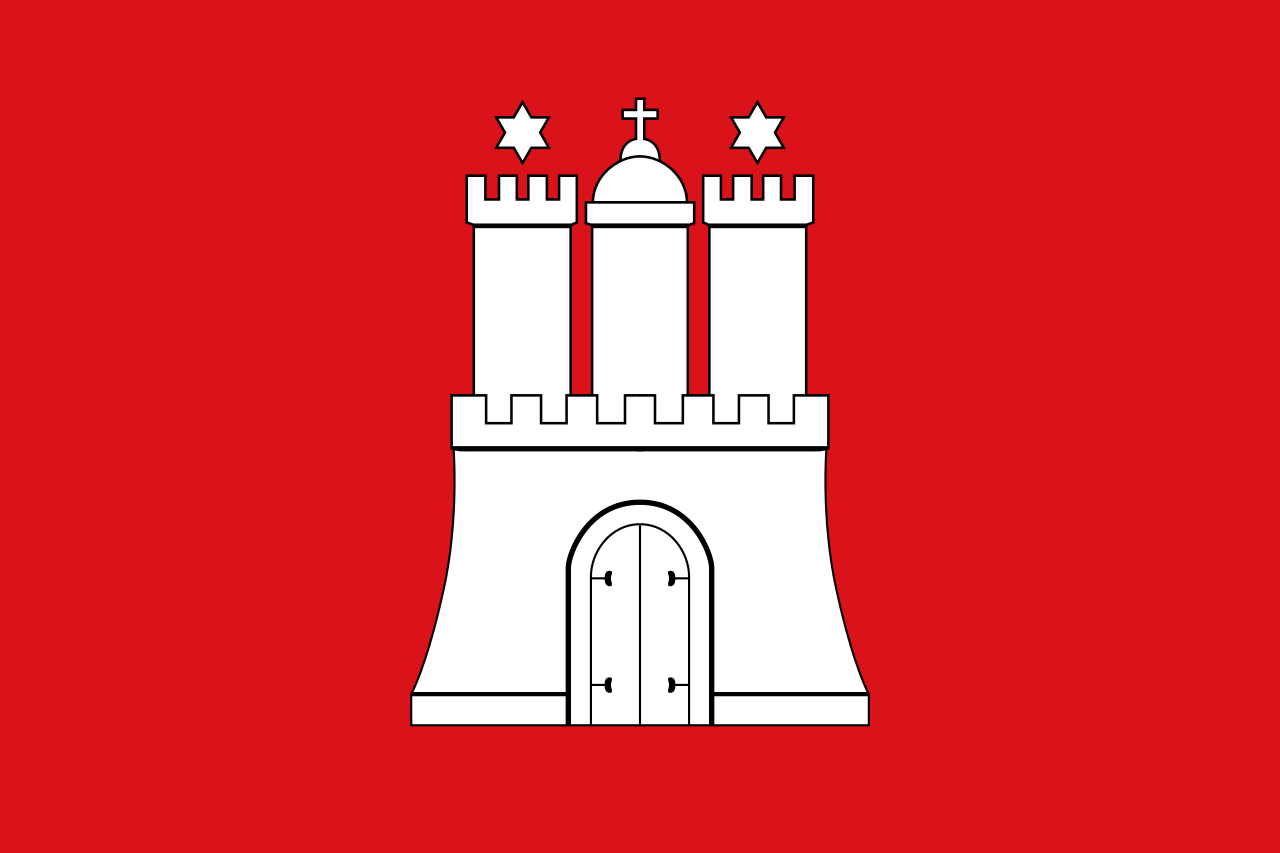 Hamburg
 Hand in Hand
 Hauts-de-France
Hebei Sheng-HE
Heilongjiang Sheng-HL
Henan Sheng-HA
Hubei Sheng-HB
Hunan Sheng-HN
Jiangsu Sheng-JS
Jilin Sheng-JL
Kasachstan
Liaoning Sheng-LN
Hauts-de-France
Hebei Sheng-HE
Heilongjiang Sheng-HL
Henan Sheng-HA
Hubei Sheng-HB
Hunan Sheng-HN
Jiangsu Sheng-JS
Jilin Sheng-JL
Kasachstan
Liaoning Sheng-LN
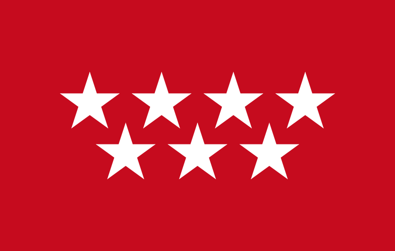 Madrid
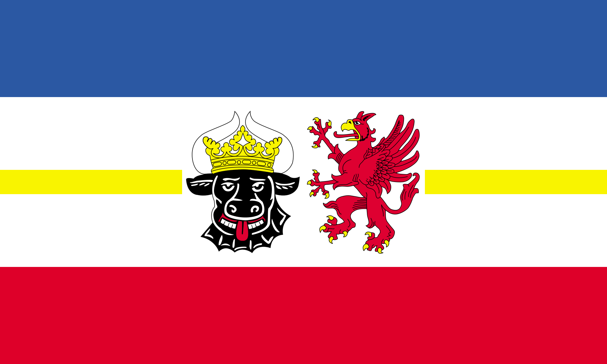 Mecklenburg-Vorpommern
Nei Mongol Zizhiqu-NM
Mecklenburg-Vorpommern
Nei Mongol Zizhiqu-NM
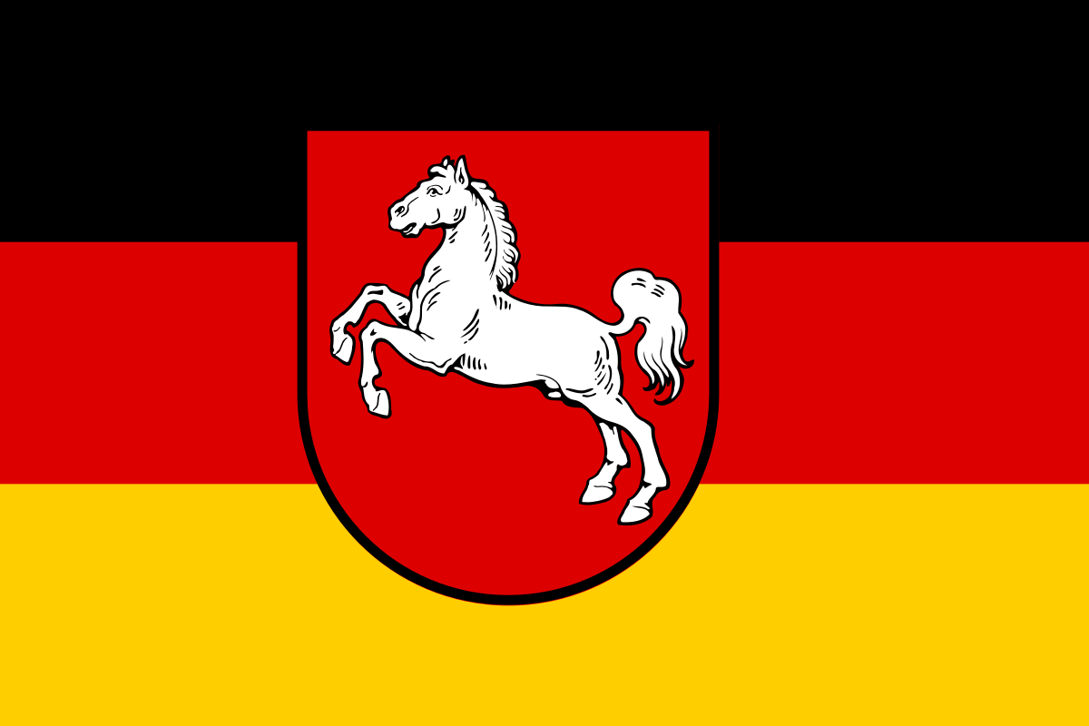 Lower Saxony
Ningxia Huizu Zizhiqu-NX
Nord-Pas-de-Calais
Lower Saxony
Ningxia Huizu Zizhiqu-NX
Nord-Pas-de-Calais
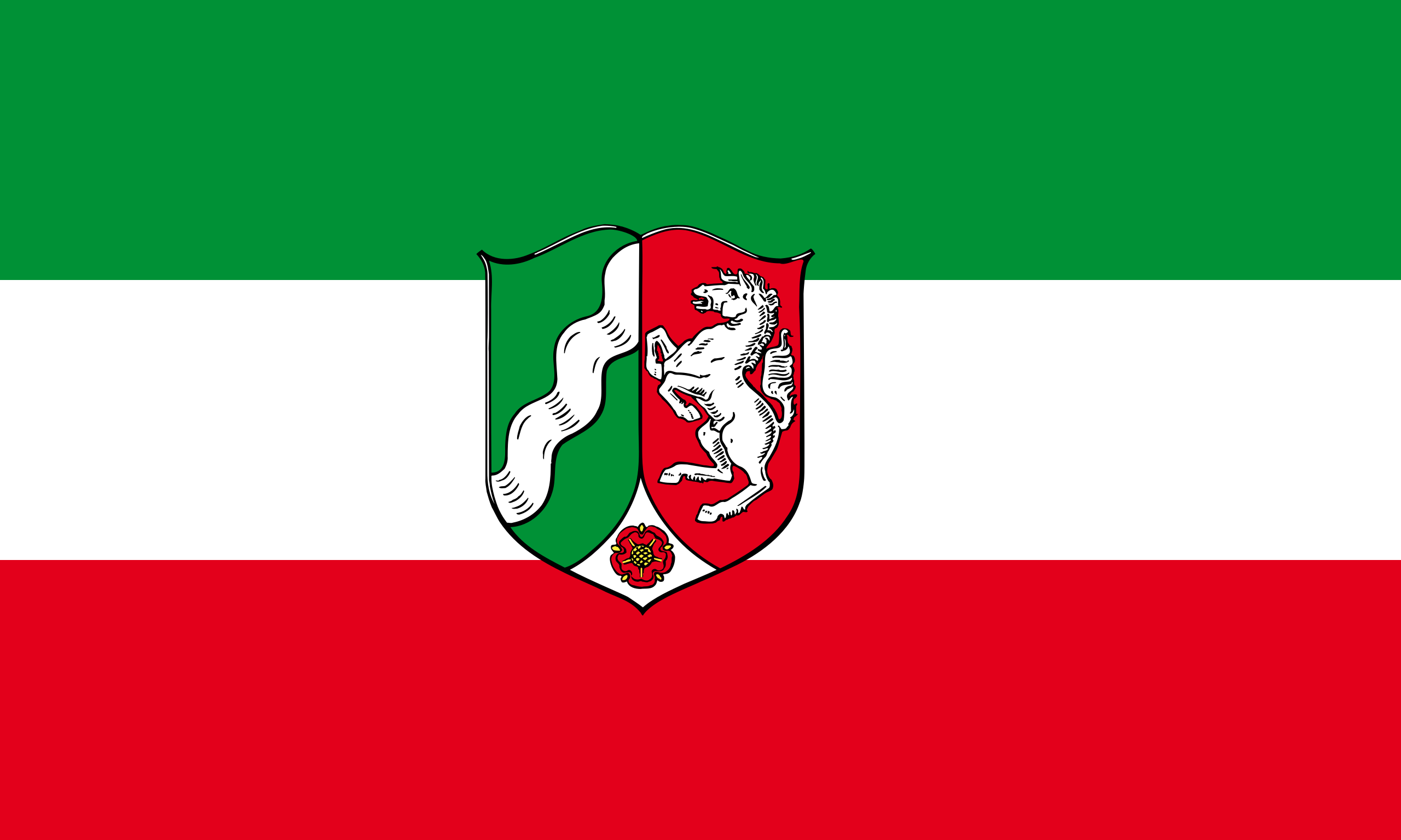 North Rhine-Westphalia
Poland
Qinghai Sheng-QH
Russia
North Rhine-Westphalia
Poland
Qinghai Sheng-QH
Russia
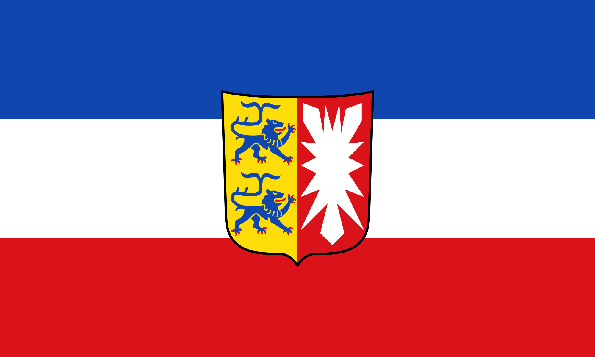 Schleswig-Holstein
Silk road
Shaanxi Sheng-SN
Shandong Sheng-SD
Sichuan Sheng-SC
Spain
Czech Republic
Uzbekistan
United Kingdom
Xinjiang Uygur Zizhiqu-XJ
Xizang Zizhiqu-XZ
Zhejiang Sheng-ZJ
Schleswig-Holstein
Silk road
Shaanxi Sheng-SN
Shandong Sheng-SD
Sichuan Sheng-SC
Spain
Czech Republic
Uzbekistan
United Kingdom
Xinjiang Uygur Zizhiqu-XJ
Xizang Zizhiqu-XZ
Zhejiang Sheng-ZJ
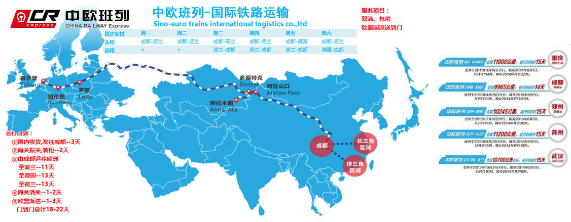
中欧班列(英语译名:China Railway Express 或 China-Europe Railway Express[1][2],简称为 CR express[3])是指按照固定车次、线路、班期和全程运行时刻开行,往来于中国与欧洲以及一带一路沿线各国的集装箱国际铁路联运班列,其中一班是从中国陜西省西安市开往欧洲的火车。[4]为加强与欧洲国家的商业贸易联络,中国政府和中国国家铁路集团与中亚和欧洲各国铁路系统协作,从起初重庆到德国的杜伊斯堡,发展到国内通达城市82个,国外通达欧亚国家的160多个城市,形成了阿拉山口、霍尔果斯、二连浩特、满洲里、绥芬河五大出境口岸,重庆、成都、西安、郑州、乌鲁木齐五大集结中心[5],开行从中国大陆到达最远伦敦、汉堡等地的国际联运列车。[3]
中欧班列也是世界上最长的货运铁路线,连接中国、哈萨克斯坦、俄罗斯、白俄罗斯、波兰、德国、法国、西班牙和伦敦。
Trans-Eurasia Logistics, AKA CHINA RAILWAY Express[1], was a joint venture between German rail company Deutsche Bahn and Russian RZhD, China Railway Corporation from China, Russian Railway Company, Russia operating container freight trains between Germany and China via Russia. The first such train arrived in Hamburg from Xiangtan on 6 October 2008, taking 17 days to make the trip.[2] Intermodal companies Polzug, Kombiverkehr, and TransContainer are also involved in the project.[3]
Container trains travel from China to Germany via the Trans-Mongolian and Trans-Siberian Railways, and then via Belarus and Poland - the route collectively known as the "Eurasian Land Bridge".[3] A break of gauge needs to be crossed when entering Mongolia from China (or Russia directly from China, if traveling via Manzhouli/Zabaykalsk), and then another one when leaving Belarus for Poland.
Trans-Eurasia Logistics operates the Yiwu - Madrid Railway line, which is the longest goods railway line in the world and connects China, Kazakhstan, Russia, Belarus, Poland, Germany, France and Spain. [4]
Trans-Eurasia Logistics est une coentreprise entre la Deutsche Bahn, la Kasachstan Temir Scholy, la China Railway Corporation et la Compagnie des chemins de fer russes, fondée en 20081
Elle permet à des trains de fret entre l'Allemagne et la Chine via la Russie, de réaliser ce trajet en dix-huit jours2.
 Fashion world
 Astronomy
 World Heritage
