
Deutsch-Chinesische Enzyklopädie, 德汉百科
 Democratic People's Republic of Korea


 Egypt
Egypt
 Azerbaijan
 Bangladesh
 Belarus
 Chile
Chile
 Columbia
 Cuba
Cuba
 Democratic People's Republic of Korea

 Hand in Hand
 India
India
 Indonesia
 Iraq
Iraq
 Iran
Iran
 Jordan
 Cambodia
 Katar
Katar
 Kenya
Kenya
 Kuwait
 Laos
Laos
 Libanon
 Malaysia
 Morocco

 Mongolei
 Myanmar
 Nepal
Nepal
 Niger
Niger
 Nigeria
 Pakistan
 Palestine

 Party and government
 Peru
Peru
 Philippines
 Saudi Arabia
 Singapore
 Somalia
 Sri Lanka
 South Africa
 Syria
Syria
 Tansania
 Thailand
 Turkmenistan
 Uganda
 Uzbekistan
 Venezuela
 United Arab Emirates
 Vietnam

 Important International Organizations


Afghanistan Ägypten Algerien Angola Antigua und Barbuda Äquatorialguinea Äthiopien Aserbaidschan Bahamas Bahrain Bangladesch Barbados Belarus Belize Benin Bhutan Bolivien Botswana Brunei Burkina Faso Burundi Chile Demokratische Republik Kongo Dominica Dominikanische Republik Dschibuti Ecuador Elfenbeinküste Eritrea Eswatini Fidschi Gabun Gambia Ghana Grenada Guatemala Guinea Guinea-Bissau Guyana Haiti Honduras Indien Indonesien Irak Iran Jamaika Jemen Jordanien Kambodscha Kamerun Kap Verde Katar Kenia Kolumbien Komoren Kuba Kuwait Laos Lesotho Libanon Liberia Libyen Madagaskar Malawi Malaysia Malediven Mali Marokko Mauretanien Mauritius Mongolei Mosambik Myanmar Namibia Nepal Nicaragua Niger Nigeria Nordkorea Oman Osttimor Pakistan Palästina Panama Papua-Neuguinea Peru Philippinen Republik Kongo Ruanda Saint Lucia Sambia São Tomé und Príncipe Saudi-Arabien Senegal Seychellen Sierra Leone Simbabwe Singapur Somalia Sri Lanka St. Kitts und Nevis St. Vincent und die Grenadinen Südafrika Sudan Suriname Syrien Tansania Thailand Togo Trinidad und Tobago Tschad Tunesien Turkmenistan Uganda Usbekistan Vanuatu Venezuela Vereinigte Arabische Emirate Vietnam Zentralafrikanische Republik
Die Bewegung der Blockfreien Staaten (kurz Bewegung der Blockfreien oder Blockfreien-Bewegung, englisch Non-Aligned Movement) ist eine Internationale Organisation von Staaten, deren erklärtes Ziel es war, sich im Ost-West-Konflikt nach dem Zweiten Weltkrieg neutral zu verhalten und keinem der beiden Militärblöcke anzugehören. Die Gründung der Organisation ging auf eine Initiative des jugoslawischen Präsidenten Josip Broz Tito, des ägyptischen Staatschefs Nasser, des indischen Premiers Nehru sowie des indonesischen Präsidenten Sukarno zurück. Die Organisation konstituierte sich 1961 auf ihrer ersten Sitzung in Belgrad.[1] Ihr traten viele ehemalige afrikanische und asiatische Kolonien bei, die sich soeben erst als Staaten konstituiert hatten oder noch um ihre Unabhängigkeit rangen.[2]
Die Organisation verurteilte die Blockbildung in der Zeit des Ost-West-Konfliktes wegen der Gefahr eines Dritten Weltkrieges und setzte sich für die friedliche Koexistenz und Abrüstung ein. Die steigende Zahl der Mitglieder machte es der Organisation jedoch zunehmend schwer, sich auf eine gemeinsame Politik zu einigen. Mit der Auflösung des Warschauer Paktes Anfang der 1990er Jahre verlor sie an Bedeutung. Die heterogene Zusammensetzung der Bewegung machte es schwer, gemeinsame Ziele zu definieren und zu verfolgen.[3] Die Staaten der Blockfreien-Bewegung vertreten 55 Prozent der Weltbevölkerung und halten nahezu zwei Drittel der Sitze in der UN-Generalversammlung.
Das Ziel der Organisation ist die Gleichberechtigung zwischen den Staaten und eine positive wirtschaftliche Entwicklung der Mitgliedstaaten.
不结盟运动(英语:Non-Aligned Movement, NAM)是一个拥有120个成员国和17个观察员国的松散国际组织[3]。它成立于冷战时期,其成员国奉行独立自主的外交政策,不与美苏两个超级大国中的任何一个结盟。联合国中有三分之二的会员是该组织的成员国,全球约55%的人口也生活在不结盟运动国家。不结盟运动定期举行首脑会议,到目前为止已经在前南斯拉夫、埃及、赞比亚、阿尔及利亚、斯里兰卡、古巴、印度、津巴布韦、印尼、哥伦比亚、南非、马来西亚、塞尔维亚、委内瑞拉、阿塞拜疆和乌干达[4]举行会议。
 China
China
 Democratic People's Republic of Korea

 Geography
 Mountains in Asia

 Geography
 Vulcan
 Heilongjiang Sheng-HL
 Jilin Sheng-JL
 Liaoning Sheng-LN

 Ski vacation
 China
China

长白山(满语:ᡤᠣᠯᠮᡳᠨ
ᡧᠠᠩᡤᡳᠶᠠᠨ
ᠠᠯᡳᠨ,穆麟德:Golmin Šanggiyan Alin,太清:Golmin Xanggiyan Alin),古名不咸山(或为白罗聂·显干之音译)、太白山,在朝鲜半岛称白头山(朝鲜语:백두산/白頭山),是位于中华人民共和国和朝鲜民主主义人民共和国边境的界山。广义的长白山是指一条西南-东北走向绵延上千千米的一系列山脉,横亘于中国吉林、辽宁、黑龙江三省的东部及北朝鲜两江道交界处。狭义上的长白山则单指其主峰长白山,是一座休眠的活火山,在清朝时曾多次喷发。主峰白头峰最高点位于火山臼形成的天池南部的朝鲜民主主义人民共和国境内,天池位于中国和北朝鲜的边界上,在中国部分,分属吉林省白山市抚松县与延边朝鲜族自治州安图县。它实际上是一个相当宽阔的环形火山口(山体相对高度1600米左右,而山体宽度则达十几千米),火山口当中为天池。 由于是中国东北最高峰,长白山在多个中国北方民族的神话传说中都被视为“神山”及朝鲜族的发祥地。长白山是大清龙脉,龙兴之地,是满族祖先世世代代居住的地方,这是一块风水宝地。
Das Gebiet Changbai Shan erstreckt sich über fast 1.000 km entlang der chinesisch – nordkoreanischen Grenze. Ein Großteil dieses Gebirges wurde 1961 zum Naturschutzgebiet erklärt. Die Gipfel erreichen Höhen über 2.500 m, der höchste Berg ist der Baitou Shan, was so viel bedeutet wie Weißkopf-Berg. Sein Gipfel erreicht eine Höhe von 2.744 m. Das Changbai Shan – Gebirge hat mit dem Baitou Shan die höchste Erhebung des ost-asiatischen Kontinents. Das Klima ist hier sehr rau, die Jahresdurchschnittstemperatur liegt gerade mal bei 3 – 7 Grad. Das ehemals vulkanisch aktive Gebiet besitzt einen sehr schönen Kratersee. Durch Ihn verläuft die Grenze zu Nordkorea. Das gesamte Gebiet wurde im Jahre 1980 unter den Schutz der UNESCO gestellt. Zu erreichen ist die Gegend im Norden des Landes am besten mit dem Zug, Endstation der Bahnlinie zum Changbai Chan ist das kleine Dorf Baihe.(Quelle:http://www.reise-ziele-online.de)
Der Paektusan (kor. Weißkopf-Berg), chinesisch Changbai Shan (immerweißer Berg) oder Baitou Shan genannt, ist die höchste Erhebung des Changbai-Gebirges an der Grenze zwischen der Volksrepublik China und Nordkorea. Die Angaben zur Höhe variieren je nach Quelle zwischen 2744 und 2750 Metern.
Der Berg liegt an der Grenze zwischen der nordkoreanischen Provinz Ryanggang-do und der chinesischen Provinz Jilin. Er ist der höchste Berg der Mandschurei, der Koreanischen Halbinsel und Nordkoreas. Auf dem Berg entspringen die Flüsse Songhua, Tumen und Yalu.
白頭山[1](はくとうさん・朝鮮名:ペクトサン)は、朝鮮民主主義人民共和国(北朝鮮)両江道と中華人民共和国(中国)吉林省の国境地帯にある標高2,744mの火山。別名、長白山[2](ちょうはくさん)。
中国吉林省と北朝鮮両江道の国境地帯にあるこの山は、古くは「不咸山」「白山」「太白山」と呼ばれた[要出典]。このうち「白山」「太白山」は中国でも朝鮮でも後世までこの山の別名としても使われた。李氏朝鮮の時代には「太白山」と呼んでいた。現在北朝鮮と大韓民国(韓国)が用いている白頭山という名称の起源は不明である。
満州民族の満州語ではゴルミン・シャンギャン・アリン(満州文字:ᡤᠣᠯᠮᡳᠨ
ᡧᠠᠩᡤᡳᠶᠠᠨ
ᠠᠯᡳᠨ、転写:golmin šanggiyan alin、漢字音写:果勒敏珊延阿林、意は「どこまでも白い山」)と金の時代より使われ始めた。 清朝では長白山(ちょうはくさん。中国語: 簡体字中国語: 长白山; 繁体字: 長白山、チャンパイシャン、Chángbáishān)と漢訳され定着している。
Paektu Mountain (Korean: 백두산, 白頭山), also known as Baekdu Mountain and in China as Changbai Mountain (simplified Chinese: 长白山; traditional Chinese: 長白山), is an active stratovolcano on the Chinese–North Korean border.[3] At 2,744 m (9,003 ft), it is the highest mountain of the Changbai and Baekdudaegan ranges. Koreans assign a mythical quality to the volcano and its caldera lake, considering it to be their country's spiritual home.[4] It is the highest mountain in Korea and Northeast China.[5]
A large crater lake, called Heaven Lake, is in the caldera atop the mountain. The caldera was formed by the VEI 7 "Millennium" or "Tianchi" eruption of 946, which erupted about 100–120 km3 (24–29 cu mi) of tephra. This was one of the largest and most violent eruptions in the last 5,000 years (alongside the Minoan eruption, the Hatepe eruption of Lake Taupo in around AD 180, the 1257 eruption of Mount Samalas near Mount Rinjani and the 1815 eruption of Tambora).
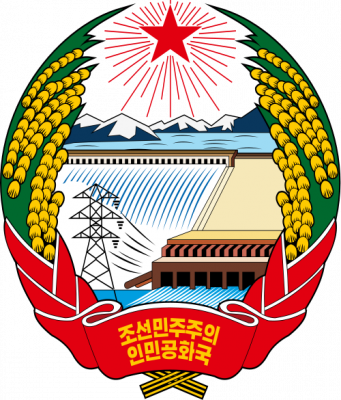
The mountain plays an important mythological and cultural role in the societies and civil religions of both contemporary Korean states. For instance, it is mentioned in both of their national anthems and is depicted on the national emblem of North Korea.
Le mont Paektu ou mont Changbai en Chine est le point culminant de l'ensemble de la Corée, à 2 744 mètres d'altitude. C'était un mont sacré pour les Coréens et les Mandchous. En 946, il a été le théâtre d'une des plus fortes éruptions de notre ère. Sa partie chinoise est protégée par la réserve naturelle du mont Changbai qui a été reconnue réserve de biosphère en 1979, et sa partie nord-coréenne par la réserve naturelle du mont Paektu, réserve de biosphère depuis 1989 (1 320 km2). Situé dans une zone inhospitalière, ses abords sont relativement peu peuplés.
Il Monte Paektu, anche noto come Baitou (in cinese 白頭山T, 白头山S, BáitóushānP) e Baekdu (백두산?, 白頭山?, PaektusanMR), è il picco più alto della penisola coreana (2.744 m), al confine fra la Corea del Nord e la Cina. Il suo nome cinese è Changbai (長白山T, 长白山S, ChángbáishānP), da cui il nome della catena montuosa a cui appartiene, il Changbai Shan.
El monte Paektu (en chosŏn'gŭl, 백두산; en hancha, 白頭山; romanización revisada del coreano, Baektu-san; McCune-Reischauer, Paektu-san), también conocido como montaña Changbai en China, es una montaña volcánica localizada en la frontera entre Corea del Norte y China. Con 2744 m, es la montaña más alta de la montañas Changbai, al norte, y de la cordillera Baekdudaegan, al sur. También es la montaña más alta de la península de Corea y de Manchuria.
Пэктуса́н[2][3], также Байтоушань[2][3] (кор. 백두산) или Чанбайша́нь (кит. 长白山) — потенциально активный вулкан на границе КНДР (провинция Янгандо) и КНР (провинция Цзилинь). Гора имеет высоту 2744 м (2750 м[2]) и является высшей точкой Маньчжуро-Корейских гор, а также всей Маньчжурии и Корейского полуострова[4].
 Atomic bomb
 Democratic People's Republic of Korea



 Military, defense and equipment
 Nuclear Weapon
 Silk road

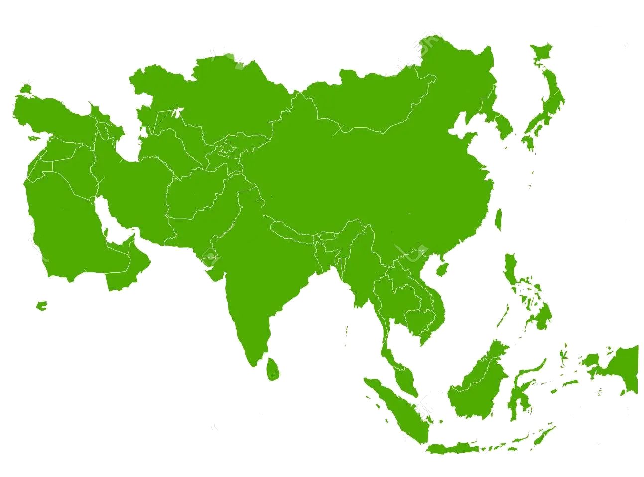 States of Asia


 China
China
 Democratic People's Republic of Korea
 Jiangxi Sheng-JX
 Liaoning Sheng-LN
 Republic of Korea
 Shandong Sheng-SD

Das Gelbe Meer ist ein Teil des Chinesischen Meeres und ein von der Volksrepublik China und der Koreanischen Halbinsel umgebenes Randmeer des Pazifischen Ozeans. Der Golf von Bohai und die Koreabucht im Norden sind Teile des Gelben Meeres. Im Süden schließt sich das Ostchinesische Meer an.
Das Gelbe Meer misst 960 Kilometer von Nord nach Süd und ist 700 Kilometer breit. Die Flächenausdehnung beträgt 380.000 km². Es ist durchschnittlich 44 Meter und maximal 152 Meter tief. Damit ergibt sich ein Wasservolumen von 16.720 km³. Das Gelbe Meer ist ein flaches Meer, vergleichbar mit der Nordsee am anderen Ende des eurasischen Kontinents. Seine Wattflächen sind ein bedeutendes Rastgebiet für Watvögel.
Seine charakteristische Farbe, die zur Namensgebung führte, erhält es von dem nährstoffhaltigen gelben Schwemmsand, dem Löss, den der Gelbe Fluss und andere Flüsse an ihrer Mündung in das Gelbe Meer hineintragen und dort ablagern.
黄海(こうかい、英語:Yellow Sea)は、中国大陸と朝鮮半島の間にある海[1][2]。 黄河から運ばれる黄土により黄濁している部分があることから黄海と呼ばれている。フランスの地図製作者ダンヴィルが1737年に作成した『中国新地図帳』に黄海 (Hoang Hai ou Mer Jaune) と表記したことで国際的にも認知されるようになった。
The Yellow Sea is a marginal sea of the Western Pacific Ocean located between mainland China and the Korean Peninsula, and can be considered the northwestern part of the East China Sea. It is one of four seas named after common colour terms (the others being the Black Sea, the Red Sea and the White Sea), and its name is descriptive of the phenomenon whereby fine sand grains from the Gobi Desert sand storms, that descend annually from the northwest, turn the surface of its waters a golden yellow.
The innermost bay of northwestern Yellow Sea is called the Bohai Sea (previously Pechihli Bay or Chihli Bay), into which flow some of the most important rivers of northern China, such as the Yellow River (through Shandong province and its capital Jinan), the Hai River (through Beijing and Tianjin) and the Liao River (through Liaoning province). Sand and silt carried down by these rivers contribute further to the sea's colour. The northern extension of the Yellow Sea is called the Korea Bay, into which flow the Yalu River, the Chongchon River and the Taedong River.
La mer Jaune est un bras de mer de l'océan Pacifique qui sépare la Chine de la péninsule coréenne. Elle s'ouvre au sud sur la mer de Chine orientale qui la borde. Son nom provient du sable et des sédiments apportés par le vent soufflant depuis le désert de Gobi et par les fleuves, en particulier le fleuve Jaune et le Hai He qui lui donnent une couleur jaune1. En Corée, elle est aussi appelée la mer de l'Ouest. Sa partie septentrionale est appelée golfe de Corée et communique avec le golfe de Bohai qui se trouve de l'autre côté des péninsules du Liaodong et du Shandong. Cette dernière partie est aussi incluse dans la mer Jaune. Celle-ci mesure 960 km du nord au sud et 700 km de l'est à l'ouest pour une superficie de 380 000 km2, le golfe de Bohai non compris2. Reposant sur le plateau continental, c'est une mer peu profonde : la profondeur moyenne est de 44 m pour un maximum de 152 m. Cette mer est récente puisqu'elle a été formée à la fin du dernier âge glaciaire, il y a près de 10 000 ans lorsque le niveau des eaux monta de 120 mètres. Le fond de la mer descend lentement du côté de la Chine et remonte plus rapidement du côté de la Corée. La côte de Corée du Sud est très découpée, comprenant de nombreuses îles telles que celles de Ganghwa, Jeju et Yeonpyeong. Les plus grands fleuves proviennent de Chine et débouchent dans le Bohai (le fleuve Jaune, le Hai He et le Liao). Au niveau de la péninsule coréenne, le Yalou et le Taedong se jettent dans le golfe de Corée tandis que le fleuve Han arrive dans la mer Jaune proprement dite.
Il mar Giallo (in cinese 黄海S, Huáng HǎiP e in coreano: 황해, Hwanghae) è una porzione dell'Oceano Pacifico posta a settentrione del mar Cinese Orientale, tra la costa cinese e la penisola coreana. Copre una superficie di circa 417000 km² e sulle sue acque si affacciano la Cina, la Corea del Nord e la Corea del Sud.
Il mar Giallo è chiamato mare Occidentale nelle due Coree. Il suo nome deriva dai sedimenti di colore giallo che colorano le sue acque, apportati da vari fiumi, in particolare dal fiume Giallo (Huáng Hé).
La parte più interna del mar Giallo è costituita dal golfo di Bohai che è compreso tra le penisole di Liaodong a nord e dello Shandong a sud.
È un mare poco profondo con una profondità massima di 105 metri, ma nonostante ciò è molto trafficato con importanti porti sia sulla costa cinese sia su quella coreana. La parte settentrionale del mare gela in inverno.
El mar Amarillo (en chino simplificado, 黄海; pinyin, huáng hǎi, en coreano, 황해 [Hwang Hae]) es la parte norte del mar de la China Oriental que se convierte en parte del océano Pacífico. Es un amplio mar, ocupando un área de cerca de 417 000 km², aunque es poco profundo, con una profundidad máxima de 105 metros.
Está situado entre la China continental y la península de Corea. Su nombre proviene de las partículas de arena que le dan ese color al agua, originalmente del río Amarillo, Huang he. Se conoce también localmente, en Corea del Sur, con el nombre de mar del Oeste.
La inmensa bahía que forma el fondo del mar Amarillo recibe el nombre de mar de Bohai (conocido anteriormente como bahía de Zhili). En ella desemboca el río Amarillo, después de cruzar la provincia de Shandong y su capital, Jinan, así como el río Hai que cruza Pekín y Tianjin.
La bahía de Corea, entre la provincia china de Liaoning y el noroeste de Corea del Norte, forma parte también del mar Amarillo. El mar de Bohai y la península de Corea están separadas por la península de Liaodong, con la ciudad de Dalian situada en su extremo sur.
Жёлтое мо́ре (кит. упр. 黄海, пиньинь Huánghǎi, кор. 황해 хванхэ, в КНДР известно как 조선서해, 朝鮮西海 чосон-сохэ — «Западно-Корейское море») — мелководное шельфовое полузамкнутое окраинное море Тихого океана у восточного побережья Азии к западу от Корейского полуострова. Название дано по цвету воды, вызванному наносами китайских рек и в меньшей степени пыльными бурями. Весной жёлтые пыльные бури бывают настолько сильны, что судам приходится прекращать движение.
 Transport and traffic
 Companies
 Animal world
 Architecture

 Music charts
 Musical instrument