
漢德百科全書 | 汉德百科全书
 Bangladesh
 Geography

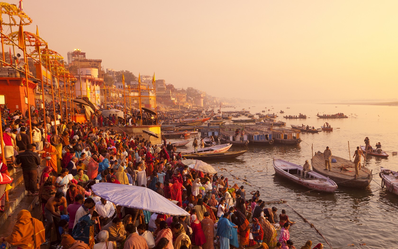
恒河(梵语:गङ्गा,印地语:गंगा,乌尔都语:گنگا(Ganga)国际音标发音:[ˈɡəŋɡaː] ![]() 聆听;泰米尔语:கங்கை,孟加拉语:গঙ্গা Gônga,玄奘译为殑伽河)是南亚的一条主要河流,流经印度北部及孟加拉。恒河源头帕吉勒提河和阿勒格嫩达河发源自印度北阿坎德邦的根戈德里等冰川,它横越北印度平原(即恒河平原),流经北方邦,会合其最大支流亚穆纳河,再流经比哈尔邦、西孟加拉邦,最后它分为多条分流注入孟加拉湾,其中一条是加尔各答附近的胡格利河,另外一条是进入孟加拉国的博多河,博多河进入孟加拉国后,会合布拉马普特拉河(中国境内为雅鲁藏布江)在孟加拉国境内的下游贾木纳河,注入孟加拉湾,其入海河段称为梅格纳河。支流布拉马普特拉河及其以上部分不算在内,恒河长为2,510公里,流域面积91万平方公里,达印度国土面积的三分之一,恒河也为世界河水流量前20大的河流之一[4]。恒河流域为世界上最多人口居住的河流流域,共有4亿以上人口居住于恒河流域,人口密度达每平方英里1000人以上[5]。
聆听;泰米尔语:கங்கை,孟加拉语:গঙ্গা Gônga,玄奘译为殑伽河)是南亚的一条主要河流,流经印度北部及孟加拉。恒河源头帕吉勒提河和阿勒格嫩达河发源自印度北阿坎德邦的根戈德里等冰川,它横越北印度平原(即恒河平原),流经北方邦,会合其最大支流亚穆纳河,再流经比哈尔邦、西孟加拉邦,最后它分为多条分流注入孟加拉湾,其中一条是加尔各答附近的胡格利河,另外一条是进入孟加拉国的博多河,博多河进入孟加拉国后,会合布拉马普特拉河(中国境内为雅鲁藏布江)在孟加拉国境内的下游贾木纳河,注入孟加拉湾,其入海河段称为梅格纳河。支流布拉马普特拉河及其以上部分不算在内,恒河长为2,510公里,流域面积91万平方公里,达印度国土面积的三分之一,恒河也为世界河水流量前20大的河流之一[4]。恒河流域为世界上最多人口居住的河流流域,共有4亿以上人口居住于恒河流域,人口密度达每平方英里1000人以上[5]。
恒河被印度教徒视为圣河,也是河流周边居民维持日常生活所需的命脉[6]。印度教中也有称为“恒河女神”的神祇[7]。许多过去的省会及帝国首都曾设于恒河沿岸,如巴连弗邑[8]、曲女城[8]、瓦拉纳西、安拉阿巴德、穆尔斯希达巴德、蒙格埃尔、巴哈拉姆普尔、加尔各答等。
ガンジス川(ガンジスがわ、英語: Ganges)は、ヒマラヤ山脈の南側、インド亜大陸の北東部を流れる大河である。全長は約2525km[1]、流域面積は約173万km2(ただしブラフマプトラ川水系を除くと約84万km2)。
The Ganges (/ˈɡændʒiːz/ GAN-jeez), or Ganga (Hindustani: [ˈɡəŋɡaː], is a trans-boundary river of the Indian subcontinent which flows through the nations of India and Bangladesh. The 2,525 km (1,569 mi) river rises in the western Himalayas in the Indian state of Uttarakhand, and flows south and east through the Gangetic Plain of North India. After entering West Bengal, it divides into two rivers: the Hooghly and the Padma River. The Hooghly, or Adi Ganga, flows through several districts of West Bengal and into the Bay of Bengal near Sagar Island. The other, the Padma, also flows into and through Bangladesh, and joins the Meghna river which ultimately empties into the Bay of Bengal.
The Ganges is one of the most sacred rivers to Hindus.[4] It is also a lifeline to millions of Indians who live along its course and depend on it for their daily needs. It is worshipped in Hinduism and personified as the goddess Gaṅgā.[5] It has also been important historically, with many former provincial or imperial capitals (such as [6] Kannauj, Kampilya, [6] Kara, Prayag or Allahabad, Kashi, Pataliputra or Patna, Hajipur, Munger, Bhagalpur, Baranagar, Murshidabad, Baharampur, Nabadwip, Saptagram and Kolkata) located on its banks.
Le Gange (hindi : गंगा Gaṅgā, bengali : গঙ্গা Gōnga) est un fleuve de la plaine indo-gangétique, au nord de l'Inde. Sa longueur varie suivant les sources de 2 500 à 3 000 km, son bassin couvre 907 000 km2 et son delta est commun avec celui du Brahmapoutre.
Il Gange (AFI: /ˈɡanʤe/[3]; chiamato localmente Ganga, devanagari गंगा) è un grande fiume del subcontinente indiano che scorre verso oriente attraversando le pianure del nord dell'India e il Bangladesh. Ha una lunghezza di 2.510 km e le sue sorgenti sono localizzate sul ghiacciaio di Gangotri nello stato indiano dell'Uttarakhand, nell'Himalaya centrale. Sfocia nel Golfo del Bengala con un ampio delta nella regione del Sundarbans. Per millenni ha goduto di una posizione preminente nella religione indù in India ed è adorato nella sua forma personificata della dea Ganga.
El río Ganges es un río transfronterizo de Asia que fluye a través de las naciones de India y Bangladesh.
Ганг[1] (хинди गंगा, gaṅgā IAST, [ˈɡəŋɡaː] ![]() слушать, Ганга[2]; англ. Ganges) — одна из самых полноводных (вместе с Брахмапутрой 3-е место в мире по водоносности после Амазонки и Конго[3]) и длинных (2700 км[3]) рек Южной Азии. Берёт своё начало в Западных Гималаях с ледника Ганготри в штате Уттаракханд, протекает на юго-восток, пересекая Индо-Гангскую равнину на севере Индии, и впадает в Бенгальский залив, формируя вместе с реками Брахмапутра и Мегхна дельту Ганга-Брахмапутры (преимущественно на территории Бангладеш), часть которой покрыта лесами Сундарбан. Площадь бассейна реки — 1 060 000 км²[4][5].
слушать, Ганга[2]; англ. Ganges) — одна из самых полноводных (вместе с Брахмапутрой 3-е место в мире по водоносности после Амазонки и Конго[3]) и длинных (2700 км[3]) рек Южной Азии. Берёт своё начало в Западных Гималаях с ледника Ганготри в штате Уттаракханд, протекает на юго-восток, пересекая Индо-Гангскую равнину на севере Индии, и впадает в Бенгальский залив, формируя вместе с реками Брахмапутра и Мегхна дельту Ганга-Брахмапутры (преимущественно на территории Бангладеш), часть которой покрыта лесами Сундарбан. Площадь бассейна реки — 1 060 000 км²[4][5].
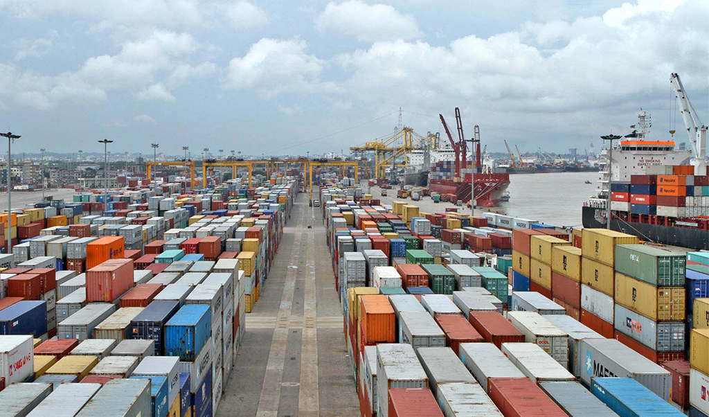
 Important port

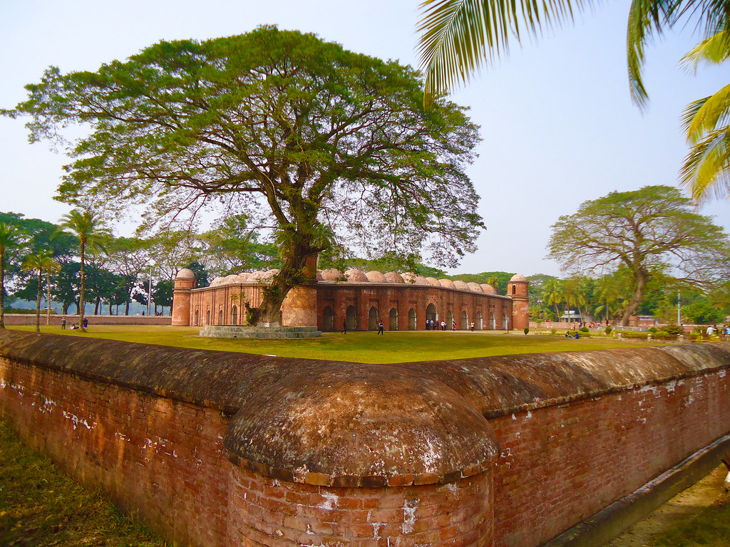
 Architecture

 History
 World Heritage

 Sport
Sport

 Party and government


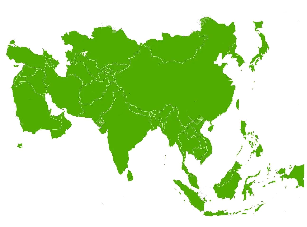 States of Asia


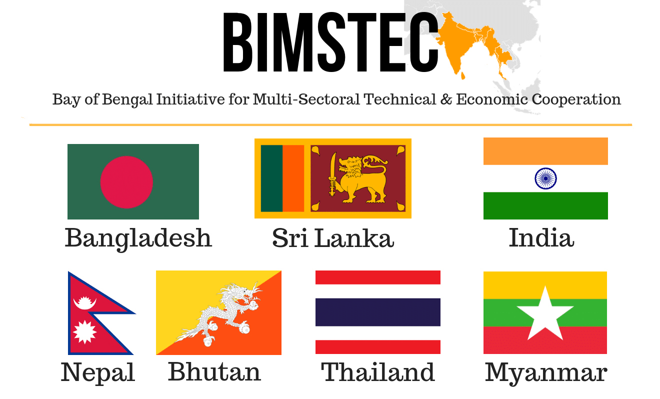
 Hand in Hand

Der Golf von Bengalen (bengalisch বঙ্গোপসাগর baṅgopasāgar; indonesisch Teluk Benggala;malaiisch Teluk Bengal; thailändisch อ่าวเบงกอล; seltene deutsche Bezeichnungen: Bengalischer Golf, Bengalischer Meerbusen, Bai von Bengalen[1][2][3][4]) ist ein nordöstliches Randmeer des Indischen Ozeans mit einer Fläche von rund 2.171.000 km². Er ist 2090 km lang und bis zu 1610 km breit und hat grob gesehen die Form eines Dreiecks. Der Golf ist durchschnittlich 2600 Meter und maximal 4694 Meter tief. Er trennt die Landmasse des indischen Subkontinents von der Halbinsel Hinterindien. Das Klima ist vom Monsun geprägt. Besonderheiten der Region sind insbesondere eine Reihe von Schlammvulkanen sowie die größten Mangrovenwälder der Erde, wie die Sundarbans.
Der Golf von Bengalen wird im Westen von Sri Lanka und Indien, im Norden von der namensgebenden Region Bengalen, bestehend aus dem Staat Bangladesch und dem indischen Bundesstaat Westbengalen sowie im Osten von Myanmar, Thailand und Indonesien begrenzt. Im Süden ist er mit dem Indischen Ozean verbunden. Als ungefähre Abgrenzung des Golfes kann eine gedachte Linie zwischen der Südspitze Sri Lankas und der Nordspitze der zu Indonesien gehörenden Insel Sumatra angenommen werden.
孟加拉湾(印地语:बंगाल की खाड़ी、孟加拉语:বঙ্গোপসাগর、缅甸语:ဘင်္ဂလားပင်လယ်အော်)是印度洋北部的一个海湾,西临印度半岛,东临中南半岛,北临缅甸和孟加拉国,南在斯里兰卡至苏门达腊岛一线与印度洋本体相交,经马六甲海峡与暹罗湾和南海相连。宽约1600公里,面积217万平方公里;水深2000-4000米,南部较深;盐度30-34‰。
沿岸国家有印度、孟加拉国、缅甸、泰国、斯里兰卡、马来西亚和印度尼西亚。
印度和缅甸的一些主要河流均流入孟加拉湾,著名的大河有:恒河、布拉马普特拉河、伊洛瓦底江、萨尔温江、克里希纳河等等。孟加拉湾中著名的岛屿包括斯里兰卡岛、安达曼群岛、尼科巴群岛、普吉岛等。
孟加拉湾沿岸贸易发达,主要港口有:印度的加尔各答、金奈、本地治里、孟加拉国的吉大港、缅甸的仰光、毛淡棉、泰国的普吉、马来西亚的槟榔屿、印度尼西亚的班达亚齐、斯里兰卡的贾夫纳等等。
ベンガル湾(ベンガルわん、Bay of Bengal)は、インド洋の北東部分の湾。湾はほぼ三角形で、南方に開けた形となっている。東にマレー半島、西にインド亜大陸、北に名前の元となったインドの西ベンガル州およびバングラデシュに面している。南端はスリランカとアンダマン・ニコバル諸島連邦直轄地に面している。同諸島の東側の海域はアンダマン海と呼ばれる。
インドやバングラデシュの多くの川がベンガル湾に流れ込んでいる。北からはガンジス川、メグナ川とブラマプトラ川が流れ込み、南西の沿岸であるオリッサ州からはマハナディ川、ゴータヴァリー川、クリシュナ川、カヴェリ川が流れ込んでいる。湾の北端のインド領には、スンダルバンス国立公園があり、豊かなマングローブの林がある。ミャンマーのエーヤワディー川もベンガル湾に流れ込んでいる。
チェンナイ(旧名マドラス)やコルカタ(旧名カルカッタ)といった大都市がベンガル湾に接しており、古くから交易拠点として栄えてきた。
The Bay of Bengal is the northeastern part of the Indian Ocean, bounded on the west and northwest by India, on the north by Bangladesh, and on the east by Myanmar and the Andaman and Nicobar Islands of India. Its southern limit is a line between Sangaman Kanda, Sri Lanka and the north westernmost point of Sumatra (Indonesia). It is the largest water region called a bay in the world. There are countries dependent on the Bay of Bengal in South Asia and Southeast Asia. In ancient India, Bay of Bengal was known as Kalinga Sagar. Later during the British India, it came forth as the Bay of Bengal after the historic Bengal region, as the Port of Kolkata served as the gateway to the Crown rule in India. Cox's Bazar, the longest sea beach in the world and Sundarbans, the largest mangrove forest and the natural habitat of the Bengal tiger, are located along the bay.
The Bay of Bengal occupies an area of 2,600,000 square kilometres (1,000,000 sq mi). A number of large rivers flow into the Bay of Bengal: the Ganges–Hooghly, the Padma, the Brahmaputra–Jamuna, the Barak–Surma–Meghna, the Irrawaddy, the Godavari, the Mahanadi, the Brahmani, the Baitarani, the Krishna and the Kaveri. Among the important ports are Chennai, Ennore, Chittagong, Colombo, Kolkata-Haldia, Mongla, Paradip, Port Blair, Thoothukudi, Visakhapatnam and Dhamra. Among the smaller ports are Gopalpur Port, Kakinada and Payra.
Le golfe du Bengale (bengali : বঙ্গপসাগর, anglais : Bay of Bengal) est une mer qui forme la partie du nord-est de l'océan Indien. Elle a la forme d'un triangle encadré à l'est par les côtes birmanes jusqu'au cap Negrais puis par les archipels Andaman et Nicobar, et à l'ouest par le sous-continent indien. Au nord du golfe, on trouve l'état indien du Bengale-Occidental et le Bangladesh, d'où provient son nom. Ses limites méridionales sont le pont d'Adam puis une ligne ouest-est ayant son origine à la pointe sud de l'île de Sri Lanka, et finissant à la pointe nord de l'île indonésienne de Breueh (Pulau Breueh), non loin de Sumatra.
Il golfo del Bengala (বঙ্গোপসাগর in bengalese, ဘင်္ဂလားပင်လယ်အော် in birmano, बंगाल की खाड़ी in hindi e බෙංගාල බොක්ක in singalese) è l'insenatura più ampia del mondo e, per le sue dimensioni (2.172.000 km² di superficie), al punto che può essere considerato un mare vero e proprio. Di forma approssimativamente triangolare, costituisce la parte nordorientale dell'Oceano Indiano ed è collocato fra il Subcontinente indiano a ovest e l'Indocina ad est.
El Golfo de Bengala es un mar en el área noreste del océano Índico. Su forma se parece a un triángulo. Limita al este con la península de Malaca, al oeste con el subcontinente indio. El extremo norte del golfo limita con el estado indio de Bengala Occidental y con Bangladés. Los extremos del sur están limitados por la isla de Sri Lanka y el territorio indio de las Islas Andamán y Nicobar. Estas últimas islas separan el golfo de Bengala del mar de Andamán (también mar de Birmania).
Muchos de los ríos principales de la India desembocan desde el oeste en la bahía de Bengala: en el norte el río Ganges (o Ganga), el río Meghna y el río Brahmaputra. Al sur el Mahanadi, el Godavari, el Krishna y el Kaveri (también escrito Cauvery). El bosque de mangle llamado los Sundarbans está situado en el delta que forman los ríos Ganges, Brahmaputra y Meghna en el golfo de Bengala.
Los puertos indios más importantes del golfo son Madrás, Vishakhapatnam, Calcuta y Pondicherry.
Бенга́льский зали́в (бенг. বঙ্গোপসাগর, там. வங்காள விரிகுடா, хинди बंगाल की खाड़ी, англ. Bay of Bengal[1]) — морской залив, расположенный в северо-восточной части Индийского океана, омывает берега Индии, Бангладеш, Мьянмы и Шри-Ланки. На западе ограничен полуостровом Индостан, на востоке — побережьем Мьянмы и островными дугами Андаманских и Никобарских островов. У северной оконечности залива располагается историческая область Бенгалия (включающая современную Бангладеш и индийский штат Западная Бенгалия), давшая ему название. Является самым большим заливом в мире, его площадь — 2191 тысяча км²[2] (по другим данным 2173 тысячи км²[1]). Наибольшая глубина — 4519 м[2], средняя — 2600 м[1].
В Бенгальский залив впадают многие крупные реки — Ганг, Брахмапутра и Мегхна (общий эстуарий), Кришна, Годавари, Кавери, Маханади, Иравади.
На северо-восточном побережье залива, у города Кокс-Базар (Бангладеш) расположен самый протяжённый в мире пляж (120 км).
По гидрологическому, гидрохимическому и прочим параметрам Бенгальский залив относится к морям.