
Deutsch-Chinesische Enzyklopädie, 德汉百科
 Erneuerbare Energie
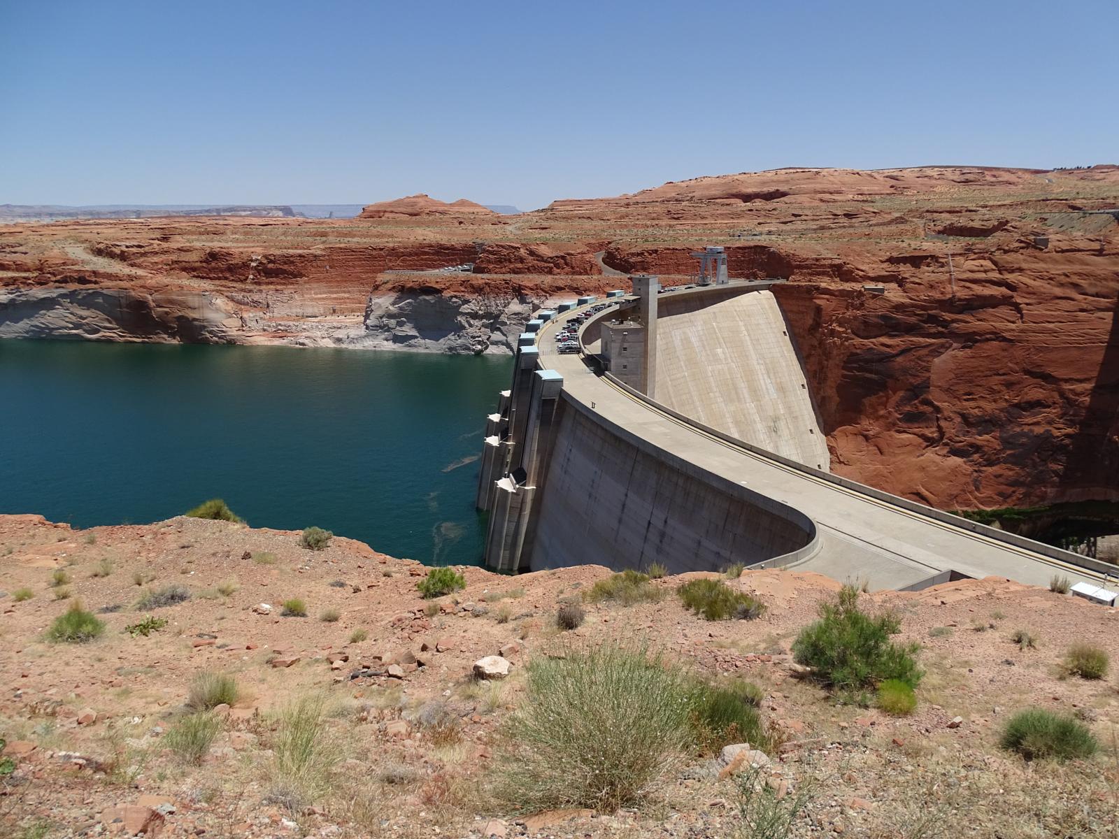
葛兰峡谷水库/葛兰峡谷大坝

 Energy resource

 Energy resource
 *Electrical power

 Energy resource
 Hydroelectric power plants
 Erneuerbare Energie
 Hydropower
 United States

 Washington-WA

 Economy and trade
大古力水壩 大古力水坝/Grand Coulee Dam
Bauzeit: 1933–1941, 1966–1974 Höhe über Gründungssohle: 168 m Bauwerksvolumen: 9 155 942 m³ Kronenlänge: 1 592 m Kraftwerksleistung: 6 809 MW Wasseroberfläche 337 km² Speicherraum 11.582 Mio. m³


 Energy resource

 Energy resource
 *Electrical power

 Energy resource
 Hydroelectric power plants
 Erneuerbare Energie
 Hydropower
 Sichuan Sheng-SC
 Yunnan Sheng-YN
觀音岩水電廠 观音岩水电站
启用 2016 位置 云南华坪-四川攀枝花 水坝类型 重力坝 横跨 金沙江 高度 159米(522英尺) 长度 1,158米(3,799英尺) 溢洪道 3条陡槽式 形成 观音岩水库 总容量 22.72亿立方米 集水面积 256,518平方千米(99,042平方英里) 正常水位 1,134米(3,720英尺) 涡轮机 5 × 600MW 装机容量 3,000MW 年均发电量 约120.68亿千瓦时


 Architecture

 Energy resource

 Energy resource
 *Electrical power

 Energy resource
 Hydroelectric power plants
 Erneuerbare Energie
 Hydropower
 Venezuela

 Economy and trade
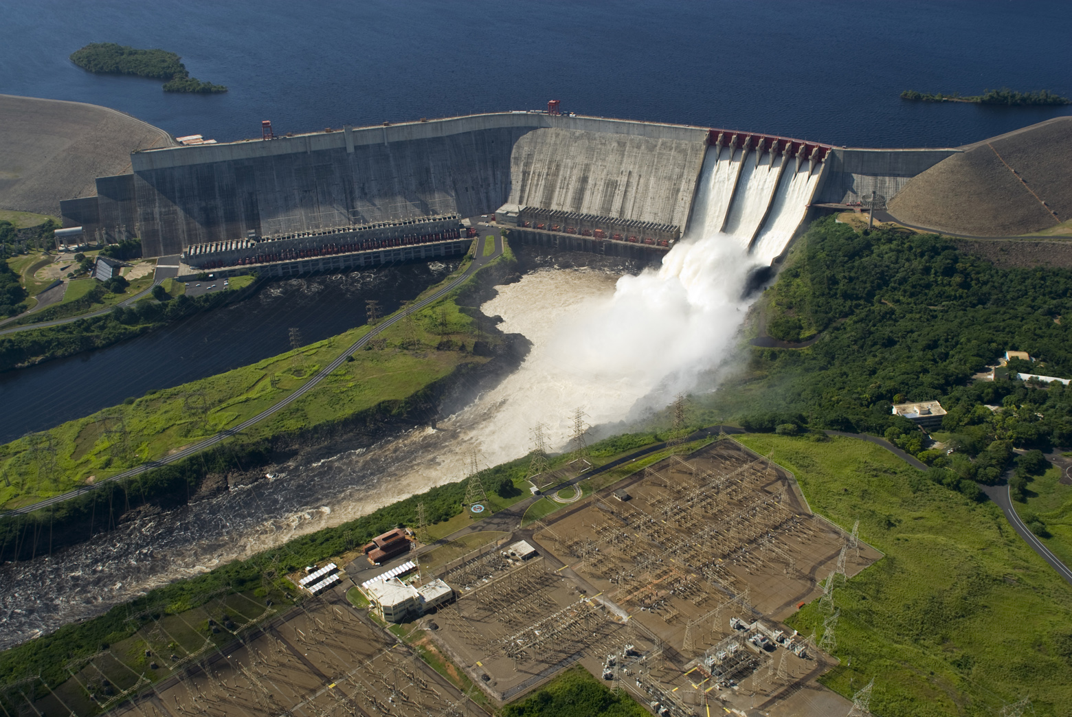
古里水库/古里水坝/Guri Dam
Bauzeit: 1963–1986 Höhe über Gründungssohle: 162 m Bauwerksvolumen: 77,971 Mio. m³ Kronenlänge: 7500 oder 11.409 m Kraftwerksleistung: 8.850 MW Höhenlage (bei Stauziel) 272 m Wasseroberfläche 4250 km² Stauseelänge 175 km Stauseebreite 48 km Speicherraum 138.000 Mio. m³ Bemessungshochwasser: 25.500 m³/s

 Energy resource

 Energy resource
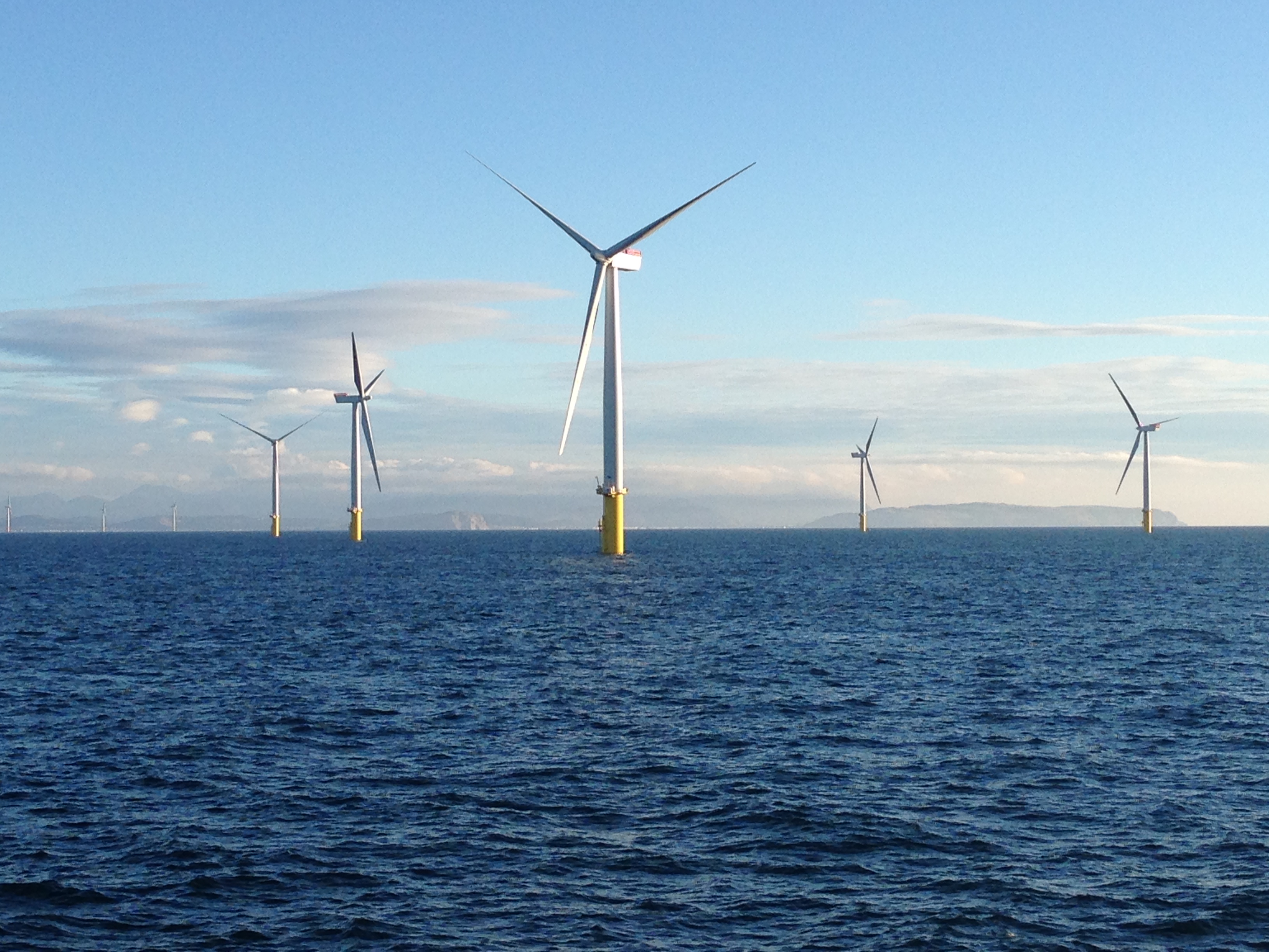
 Onshore and offshore wind farms

 Energy resource
 *Electrical power
 Erneuerbare Energie
 Windenergie
 Wales
Wales

 Energy resource

 Energy resource
 *Electrical power
 Erneuerbare Energie
 Geothermie
 Japan
Japan
 Kyūshū

 Economy and trade
八丁原地熱發電所 八丁原地热发电所
Standort Präfektur Ōita Datum der Inbetriebnahme 1977 Betreibergesellschaft(en) Kyushu Electric Power Company (KEPCO) Typ Doppelblitz, binärer Zyklus Bohrlöcher 30 Max. Bohrlochtiefe 3000 m Nennleistung 112 MW Jährliche Nettoleistung 785 GWh

胡佛水坝/Hoover Dam
Der Hoover Dam (englisch, deutsch Hoover-Damm oder -Staumauer) ist eine Talsperre auf der Grenze zwischen den US-Bundesstaaten Nevada und Arizona, knapp 45 Kilometer ostsüdöstlich von Las Vegas im Black Canyon. Sein Absperrbauwerk staut den Colorado River, der hier die Grenze zwischen Arizona und Nevada bildet, zum Lake Mead auf. Der Hauptzweck der Talsperre ist die kontrollierte Wasserabgabe in Arizona, Nevada und Kalifornien, ein weiterer Zweck ist die Gewinnung elektrischer Energie.

Der Hoover Dam (englisch, deutsch Hoover-Damm oder -Staumauer) ist eine Talsperre auf der Grenze zwischen den US-Bundesstaaten Nevada und Arizona, knapp 45 Kilometer ostsüdöstlich von Las Vegas im Black Canyon. Sein Absperrbauwerk staut den Colorado River, der hier die Grenze zwischen Arizona und Nevada bildet, zum Lake Mead auf. Der Hauptzweck der Talsperre ist die kontrollierte Wasserabgabe in Arizona, Nevada und Kalifornien, ein weiterer Zweck ist die Gewinnung elektrischer Energie. Der Name des Damms bezieht sich auf den US-amerikanischen Präsidenten Herbert Hoover.

 Energy resource

 Energy resource
 *Electrical power

 Energy resource
 Onshore and offshore wind farms
 Erneuerbare Energie
 Windenergie

 Saxony-Anhalt
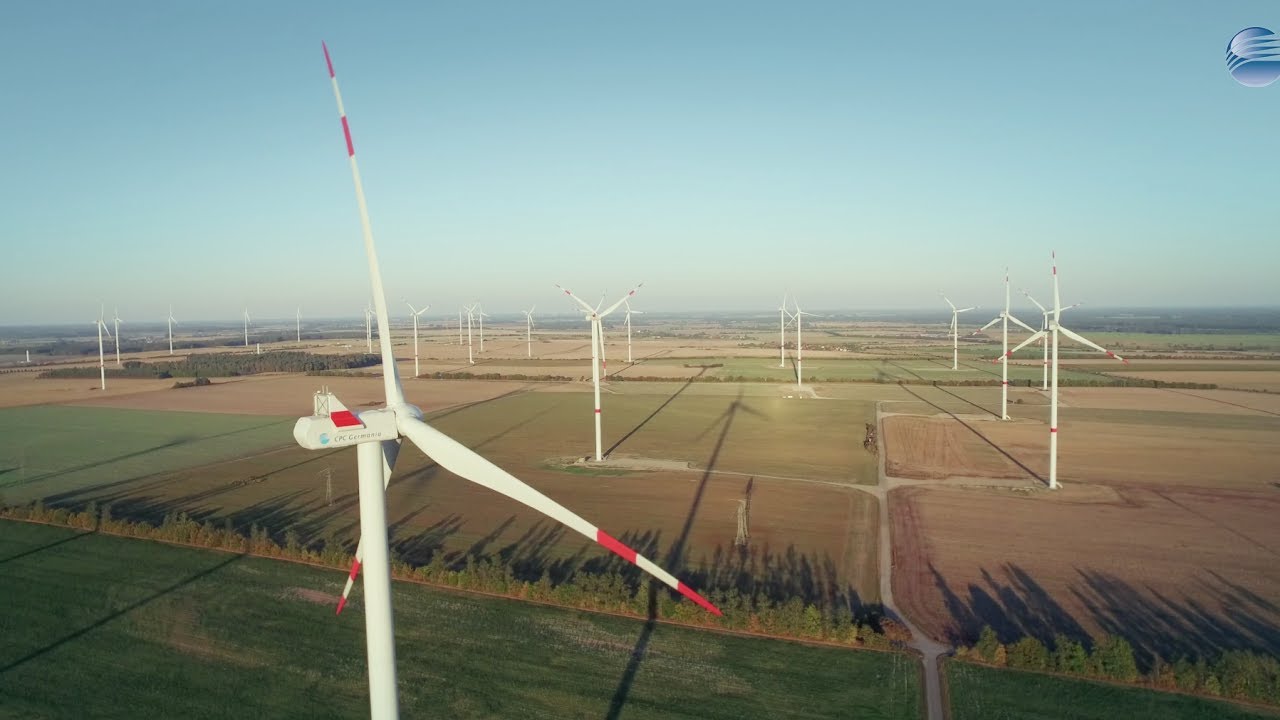
Hüselitz风能园

 Architecture
 Brazil

 Energy resource

 Energy resource
 *Electrical power

 Energy resource
 Hydroelectric power plants
 Erneuerbare Energie
 Hydropower
 Paraguay
 Paraná

 Economy and trade
伊泰普大壩 伊泰普大坝
Bauzeit: 1975–1982 Höhe des Absperrbauwerks: 196 m Bauwerksvolumen: 12,57 Mio. m³ Kronenlänge: 7760 m Kraftwerksleistung: 20 × 700 = 14.000 MW Wasseroberfläche 1350 km² Stauseelänge 170 km Stauseebreite 7–12 km Speicherraum 29.000 Mio. m³ Bemessungshochwasser: 62.200 m³/s

施工期:1975-1982 年 屏障结构高度:196 米 结构体积:1257 万立方米 冠幅长度:7760 米 电站输出功率:20 × 700 = 14,000 兆瓦 水面面积:1350 平方公里 水库长度:170 公里 水库宽度:7-12 公里 蓄水量:29,000 万立方米 设计洪水位:62,200 立方米/秒


 Energy resource

 Energy resource
 *Electrical power

 Energy resource
 Hydroelectric power plants
 Erneuerbare Energie
 Hydropower
 Sichuan Sheng-SC
锦屏一级
位置 中国四川省凉山彝族自治州 始建 2005年 启用 2012年 横跨 雅砻江 高度 305米(1,001英尺) 长度 568米(1,864英尺) 形成 锦屏一级水库 总容量 7,700,000,000立方米(6,200,000英亩·英尺) 集水面积 102,560平方千米(39,600平方英里) 表面积 82平方千米(32平方英里)涡轮机 6 × 600MW 装机容量 3,600 MW 年均发电量 16-18 TWh


 Energy resource

 Energy resource
 *Electrical power

 Energy resource
 Solar power plants
 Erneuerbare Energie
 Solar energy
 India
India
 Tamil Nadu
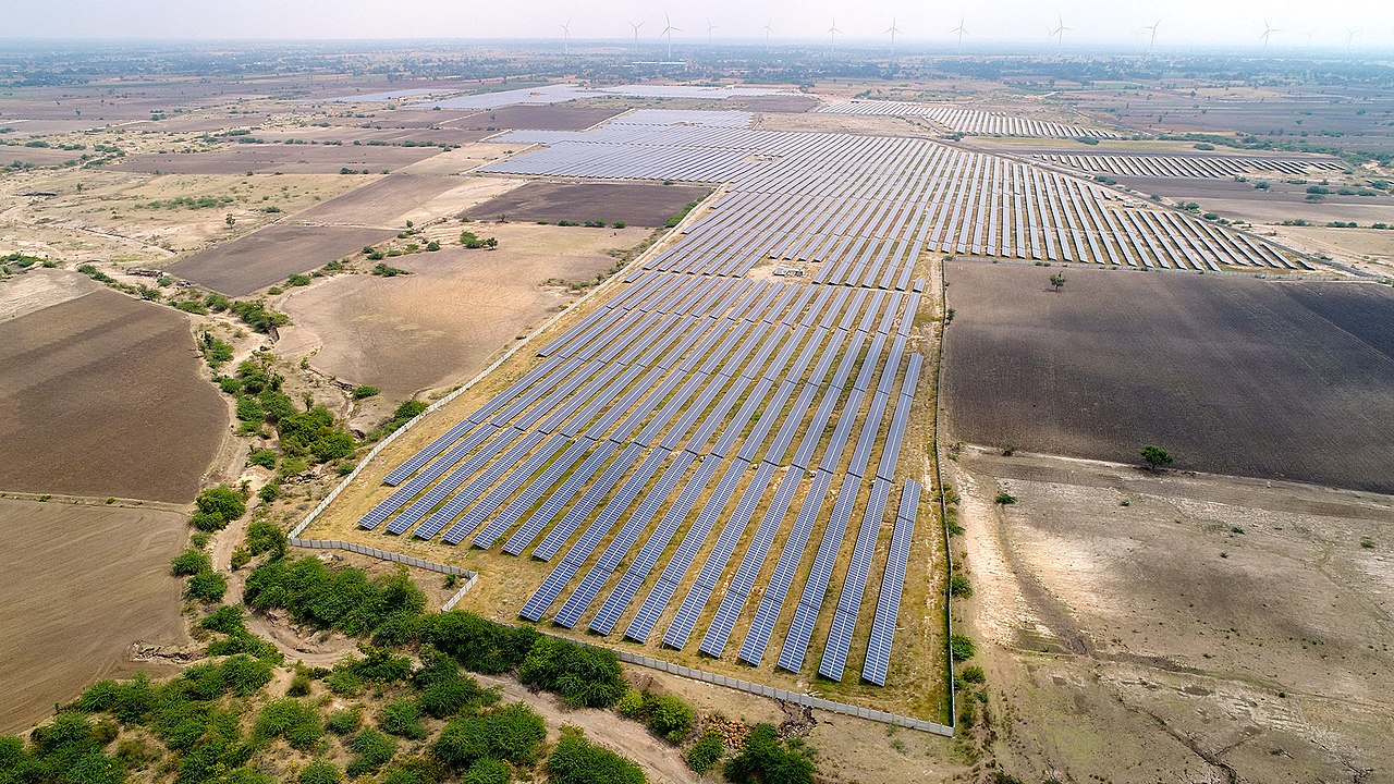
卡姆提光伏项目
Typ Photovoltaikkraftwerk Primärenergie Solarenergie Leistung 648 MW (elektrisch) Eigentümer Adani Group Betriebsaufnahme September 2016 Der Solarpark Kamuthi, zum Teil auch als Solarpark Tamil Nadu bezeichnet, ist eine Photovoltaik-Freiflächenanlage nahe der indischen Stadt Kamuthi im Bundesstaat Tamil Nadu.

 Energy resource
 *Renewable energy

 Energy resource
 *Electrical power

 Energy resource
 Onshore and offshore wind farms
 Erneuerbare Energie
 Windenergie

 Economy and trade
全球风能容量和年增长/Wind power global capacity and annual addition

 Arizona-AZ
 Nevada-NV
 Geography