
Deutsch-Chinesische Enzyklopädie, 德汉百科
 No consumption tax
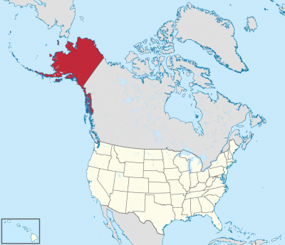
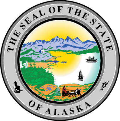
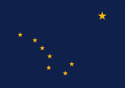
アラスカ州(英: State of Alaska [əˈlæskə] (![]() 音声ファイル))は、アメリカ合衆国最北端にある州。アリューシャン列島を含む。北アメリカ大陸北西の端にあり、合衆国本土とはカナダを挟んで飛地になっている。アラスカでは、合衆国本土を"lower 48"(直訳:南方の48州。アメリカ50州からアラスカ州とハワイ州を除いたもの)と呼ぶことがある[2]。
音声ファイル))は、アメリカ合衆国最北端にある州。アリューシャン列島を含む。北アメリカ大陸北西の端にあり、合衆国本土とはカナダを挟んで飛地になっている。アラスカでは、合衆国本土を"lower 48"(直訳:南方の48州。アメリカ50州からアラスカ州とハワイ州を除いたもの)と呼ぶことがある[2]。
アメリカ合衆国の州の中では面積最大、東はカナダ、北は北極海、西と南は太平洋と接し、西のベーリング海を隔ててロシアとも海上の国境がある。2010年国勢調査による人口は710,231人であり[3]、その約半分はアンカレッジ都市圏に居住。州都はジュノー市で、最大都市はアンカレッジ市である。海港アンカレッジはかつてアジアとアメリカおよびヨーロッパを結ぶ航空路線の寄港地として知られた。アメリカ合衆国の州の中では人口密度が最小の州でもある[4]。
アラスカは1867年3月30日にロシア帝国からアメリカ合衆国が買収した。その後幾つかの管理形態の変遷を経て、1912年5月11日にアラスカ準州、1959年1月3日にアラスカ州となった。
Alaska (/əˈlæskə/ (![]() listen); Aleut: Alax̂sxax̂; Inupiaq: Alaasikaq; Alutiiq: Alas'kaaq; Tlingit: Anáaski; Russian: Аля́ска, romanized: Alyáska) is a U.S. state located on the northwest extremity of the country's West Coast, just across the Bering Strait from Asia. An exclave of the U.S., it borders the Canadian province of British Columbia and territory of Yukon to the east and southeast and has a maritime border with Russia's Chukotka Autonomous Okrug to the west. To the north are the Chukchi and Beaufort seas of the Arctic Ocean, while the Pacific Ocean lies to the south and southwest.
listen); Aleut: Alax̂sxax̂; Inupiaq: Alaasikaq; Alutiiq: Alas'kaaq; Tlingit: Anáaski; Russian: Аля́ска, romanized: Alyáska) is a U.S. state located on the northwest extremity of the country's West Coast, just across the Bering Strait from Asia. An exclave of the U.S., it borders the Canadian province of British Columbia and territory of Yukon to the east and southeast and has a maritime border with Russia's Chukotka Autonomous Okrug to the west. To the north are the Chukchi and Beaufort seas of the Arctic Ocean, while the Pacific Ocean lies to the south and southwest.
Alaska is the largest U.S. state by area and the seventh-largest subnational division in the world. It is the third-least populous and the most sparsely populated state, but by far the continent's most populous territory located mostly north of the 60th parallel, with an estimated population of 738,432 as of 2015—more than quadruple the combined populations of Northern Canada and Greenland.[3] Approximately half of Alaska's residents live within the Anchorage metropolitan area. The state capital of Juneau is the second-largest city in the United States by area, comprising more territory than the states of Rhode Island and Delaware.
Alaska was occupied by various indigenous peoples for thousands of years before the arrival of Europeans. The state is considered the entry point for the settlement of North America by way of the Bering land bridge. The Russians were the first Europeans to settle the area beginning in the 18th century, eventually establishing Russian America, which spanned most of the current state. The expense and difficulty of maintaining this distant possession prompted its sale to the U.S. in 1867 for US$7.2 million, or approximately two cents per acre ($4.74/km2). The area went through several administrative changes before becoming organized as a territory on May 11, 1912. It was admitted as the 49th state of the U.S. on January 3, 1959.[4]
While it has one of the smallest state economies in the country, Alaska's per capita income is among the highest, owing to a diversified economy dominated by fishing, natural gas, and oil, all of which it has in abundance. United States armed forces bases and tourism are also a significant part of the economy; more than half the state is federally owned public land, including a multitude of national forests, parks, and wildlife refuges.
Alaska's indigenous population is proportionally the highest of any U.S. state, at over 15 percent.[5] Close to two dozen native languages are spoken, and Alaskan Natives exercise considerable influence in local and state politics.
L’Alaska (prononcé /a.las.ka/ Écouter (Fr.) en français et /ə.ˈlæs.kə/ Écouter (É.-U.A) en anglais) est le 49e État des États-Unis, dont la capitale est Juneau et la plus grande ville Anchorage, où habite environ 40 % de la population de l'État. Avec une superficie totale de 1 717 854 km2, il est l'État le plus étendu et le plus septentrional du pays, mais l'un des moins peuplés, ne comptant que 731 545 habitants en 20191.
Comme Hawaï, l'Alaska est séparé des États-Unis contigus et se situe au nord-ouest du Canada. Bordé par l'océan Arctique au nord et la mer de Béring et l'océan Pacifique au sud, ce territoire est séparé de l'Asie par le détroit de Béring. En outre, ses divisions administratives ne sont pas des comtés mais des boroughs.
Alaska signifie « grande Terre » ou « continent » en aléoute3. Cette région, que l'on appelait au XIXe siècle l'« Amérique russe », tire son nom d'une longue presqu'île, au nord-ouest du continent américain, à environ 1 000 kilomètres au sud du détroit de Bering, et qui se lie, vers le sud, aux îles Aléoutiennes. Le surnom de l'Alaska est « la dernière frontière » ou « la terre du soleil de minuit ».
Peuplé par des Aléoutes, Esquimaux (notamment Iñupiak et Yupiks) et peut-être d'autres Amérindiens depuis plusieurs millénaires, le territoire est colonisé par des trappeurs russes à la fin du XVIIIe siècle. Les ressources de l'Alaska proviennent alors essentiellement du commerce du bois et de la traite des fourrures. Le 30 mars 1867, les États-Unis l'achètent à la Russie pour la somme de 7,2 millions de dollars (environ 120 millions de dollars actuels), et celui-ci adhère à l'Union le 3 janvier 1959. Les secteurs économiques prédominants aujourd'hui sont la pêche, le tourisme, et surtout la production d'hydrocarbures (pétrole, gaz) depuis la découverte de gisements à Prudhoe Bay dans les années 1970.
Le Denali (6 190 mètres d'altitude), point culminant des États-Unis, se trouve dans la chaîne d'Alaska et constitue le cœur du parc national et réserve du Denali.
Le climat y est de type polaire, et la faune caractéristique des milieux froids (grizzli, caribou, orignal, ours blanc).
Les territoires limitrophes sont le territoire du Yukon et la province de Colombie-Britannique au Canada. Le Kraï du Kamtchatka et le district autonome de Tchoukotka en Russie se trouvent à quelques dizaines de kilomètres, de l'autre côté du détroit de Bering.
Bastion du Parti républicain, l'Alaska est gouverné depuis 2018 par Mike Dunleavy.
L'Alaska (pron. /aˈlaska/[3]; in inglese , /əˈlæskə/), italianizzata in Alasca[4][5] (in aleutino Alax̂sxax̂; in inupiaq Alaasikaq; in alutiiq Alas'kaaq; in tlingit Anáaski; in russo Аляска, Aljaska), è uno Stato federato degli Stati Uniti d'America. Situato nella estremità nordoccidentale del continente nordamericano è separato da qualsiasi altro stato degli USA, confina a est con il Canada ed è bagnato a nord dal Mar Glaciale Artico e a sud dall'oceano Pacifico; a ovest lo stretto di Bering lo separa dalla Čukotka, nella regione storica della Siberia. Con 1717854 km² è lo Stato più grande degli Stati Uniti ma, visto il clima rigido, è scarsamente popolato: nel 2019 la popolazione dello Stato era di 731 545 abitanti[1]; il dato lo rende il 47º stato per popolazione. Circa la metà di questi abitanti vive nell'area metropolitana di Anchorage, centro principale dello Stato. L'economia dell'Alaska è dominata dalle riserve di petrolio, gas naturale e dall'industria della pesca, risorse di cui dispone in abbondanza. Anche il turismo occupa una parte significativa dell'economia.
Anche se era stato occupato per migliaia di anni dalle popolazioni indigene, dal XVIII secolo in poi le potenze europee considerarono il territorio dell'Alaska pronto per essere sfruttato. Gli Stati Uniti acquistarono l'Alaska dalla Russia il 30 marzo 1867, per 7,2 milioni di dollari (120 milioni di dollari al netto dell'inflazione), a circa due centesimi per acro (4,74 $/km²). L'area ha attraversato diversi cambiamenti amministrativi prima di essere organizzata come un territorio l'11 maggio 1912. È stato ammesso come 49º Stato degli Stati Uniti d'America il 3 gennaio 1959.
Il toponimo Alaska è derivato dalla parola alaxsxaq che ha come significato «grande paese» o «terraferma» nella lingua degli Aleutini o Unangan (come essi si chiamavano nella propria lingua)[6].
Il soprannome dell'Alaska è The Last Frontier (usato anche nelle targhe automobilistiche), e l'animale scelto come simbolo dello Stato è l'alce.
Alaska es uno de los cincuenta estados que forman los Estados Unidos de América. Su capital es Juneau y su ciudad más poblada es Anchorage. Está ubicado en el extremo noroeste de América del Norte, en la región Oeste del país, división Pacífico. Limita al norte con el océano Ártico, al este con Canadá, al sur con el océano Pacífico y al oeste con el mar de Bering (océano Pacífico). Con 1 717 856 km² es el estado más extenso del país y la séptima entidad subnacional más grande del mundo, por detrás de la república de Sajá (Rusia), Australia Occidental, Krai de Krasnoyarsk (Rusia), Groenlandia (Dinamarca), Nunavut (Canadá) y Queensland (Australia); con 710 231 habs. en 2010, el cuarto menos poblado —por delante de Dakota del Norte, Vermont y Wyoming, el menos poblado— y con 0,41 hab/km², el menos densamente poblado. Fue el penúltimo en ser admitido en la Unión, el 3 de enero de 1959, como el estado número 49, solo antes que Hawái. Es el estado con mayor proporción de empleados públicos respecto de la población.4
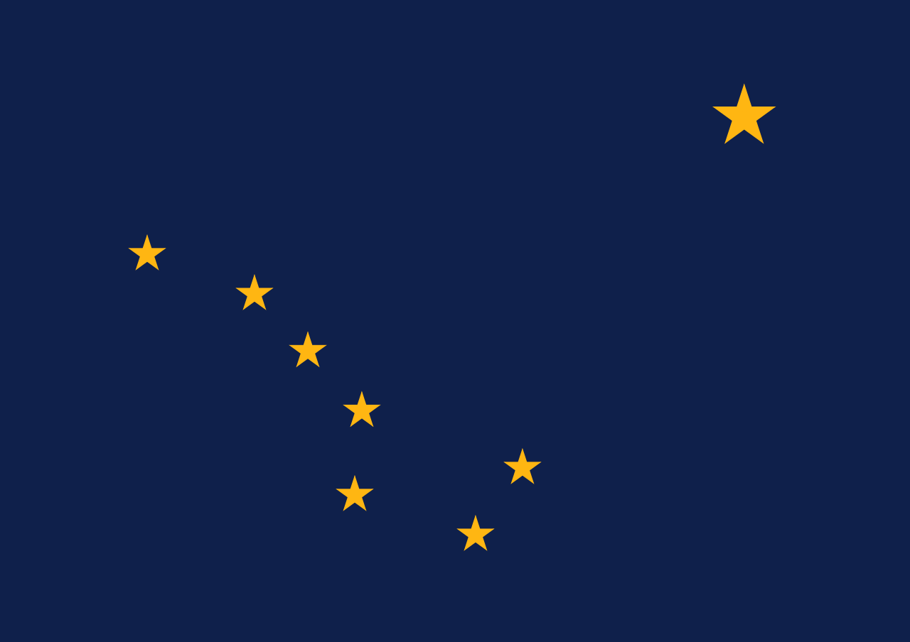
Alaska recibe el nombre del vocablo aleutiano alyeska o alaxsxaq, que significa «tierra grande», o más literalmente, «el objeto contra el que la acción del mar es dirigida».5 La bandera de Alaska representa, sobre fondo azul, las estrellas que forman la constelación de la Osa Mayor y, en la esquina superior derecha, la estrella polar.
El 30 de marzo de 1867, Estados Unidos compró Alaska del Imperio ruso, por 7 200 000 dólares.6 Estados Unidos trató, durante las primeras décadas del siglo XX, de mejorar las comunicaciones (sobre todo para conectar Alaska con el resto de los Estados Unidos por ferrocarril), y promover la colonización del valle de Matanuska. Sin embargo, la Segunda Guerra Mundial y las batallas navales en las islas Aleutianas con Japón cambiaron el rumbo de la política de los EE. UU. en los asuntos de Alaska. Así, en 1942, se construyó en meses una carretera de comunicación (la Autopista Alaska) para garantizar la defensa del Territorio de Alaska, a la vez que establecieron nuevas bases militares (por ejemplo, de radares) y se promovieron asentamientos civiles. El final de la guerra mundial y el comienzo de la Guerra Fría aceleraron la necesidad de integrar este territorio a la Unión. En 1959, Alaska fue finalmente aceptada como el 49.º estado de los Estados Unidos de América.
El descubrimiento de yacimientos petrolíferos ha permitido un enorme crecimiento económico en Alaska durante las últimas décadas, pese al aislamiento geográfico y a las duras condiciones de vida. El mayor hito de su desarrollo ha sido la construcción, a partir de 1974, del Trans-Alaska Pipeline, un oleoducto de 1269 km que une la Bahía Prudhoe con el puerto de Valdez. Pero el petróleo también ha sido el origen de ciertos desastres, como el accidente ocurrido en 1989 cuando el superpetrolero Exxon Valdez encalló en las aguas de Alaska y provocó una marea negra que ha sido calificada como uno los mayores desastres ecológicos de la historia, el desastre del Exxon Valdez.
Аля́ска[2][3] (англ. Alaska [əˈlæskə], эским. Alaskaq, Aqłuq) — самый северный и крупнейший по территории штат[4] США; расположен на северо-западе Северной Америки. В Беринговом проливе имеет морскую границу с Россией.
Включает территорию Северной Америки западнее 141-го меридиана западной долготы, в том числе одноимённый полуостров с прилегающими островами, Алеутские острова и собственно территорию Северной Америки к северу от полуострова, а также узкую полосу тихоокеанского побережья вместе с островами архипелага Александра вдоль западной границы Канады.
Площадь территории — 1 717 854 км², из которых 236 507 км² приходится на водную поверхность. Население — 737 438[1] чел. (2018). Столица штата — город Джуно.
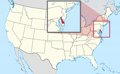
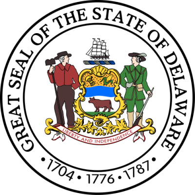
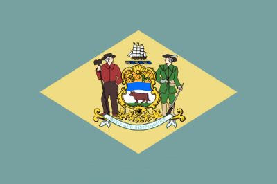
デラウェア州(英: State of Delaware、[ˈdɛləwɛər] (![]() 音声ファイル) DEL-ə-wair)は、アメリカ合衆国大西洋岸中部に位置する[1]州の1つである。デルマーバ半島の北東部を占め、南と西はメリーランド州に、北東はニュージャージー州に、北はペンシルベニア州に接している。アメリカ合衆国憲法を1787年12月7日に批准したが、建国に関わった13植民地のうちで最初に批准した州であることから、「First State」としても知られている。ロードアイランド州に次いで2番目に面積が小さく、人口では45番目だが人口密度では6番目の州である。
音声ファイル) DEL-ə-wair)は、アメリカ合衆国大西洋岸中部に位置する[1]州の1つである。デルマーバ半島の北東部を占め、南と西はメリーランド州に、北東はニュージャージー州に、北はペンシルベニア州に接している。アメリカ合衆国憲法を1787年12月7日に批准したが、建国に関わった13植民地のうちで最初に批准した州であることから、「First State」としても知られている。ロードアイランド州に次いで2番目に面積が小さく、人口では45番目だが人口密度では6番目の州である。
1900年代初頭から独自の会社法と裁判制度により法人の設立に最適な州として知られ[2]、米国上場企業の50%、フォーチュン500企業の64%、会社数で100万社に及ぶ企業が設立準拠地ないし本社を置く[3][4]。州内は北からニューキャッスル郡、ケント郡、サセックス郡に分割されており、3という郡の数は50州の中で最も少ない。南2郡は昔から農業が盛んであり、ニューキャッスル郡は工業化が進んでいる。
Delaware (/ˈdɛləwɛər/ (![]() listen))[9] is one of the 50 states of the United States and is located in the Mid-Atlantic region.[a] It is bordered to the south and west by Maryland, north by Pennsylvania, and east by New Jersey and the Atlantic Ocean. The state takes its name from the nearby Delaware River (which has its river mouth in the state), itself named after Thomas West, 3rd Baron De La Warr, an English nobleman and Virginia's first colonial governor.[10]
listen))[9] is one of the 50 states of the United States and is located in the Mid-Atlantic region.[a] It is bordered to the south and west by Maryland, north by Pennsylvania, and east by New Jersey and the Atlantic Ocean. The state takes its name from the nearby Delaware River (which has its river mouth in the state), itself named after Thomas West, 3rd Baron De La Warr, an English nobleman and Virginia's first colonial governor.[10]
Delaware occupies the northeastern portion of the Delmarva Peninsula and some islands and territory within the Delaware River. It is the second smallest and sixth least populous state, but also the sixth most densely populated. Delaware's largest city is Wilmington, while the state capital is Dover, the second-largest city in the state. The state is divided into three counties, having the lowest number of any state. From north to south, they are New Castle County, Kent County, and Sussex County. While the southern two counties have historically been predominantly agricultural, New Castle County is more urbanized.
Before its coastline was explored by Europeans in the 16th century, Delaware was inhabited by several groups of Native Americans, including the Lenape in the north and Nanticoke in the south. It was initially colonized by Dutch traders at Zwaanendael, near the present town of Lewes, in 1631. Delaware was one of the 13 colonies participating in the American Revolution. On December 7, 1787, Delaware became the first state to ratify the Constitution of the United States, and has since been known as "The First State".[11]
Since the turn of the 20th century, Delaware is also a de facto onshore corporate haven, in which by virtue of its corporate laws, the state is the domicile of over 50% of all NYSE-listed business and 60% of the Fortune 500.
Le Delaware (/də.la.wɛʁ/2 ; /ˈdɛləwɛəɹ/3) est un État de la côte est des États-Unis, bordé à l'ouest et au sud par le Maryland, au nord par la Pennsylvanie, à l'est par le New Jersey et l'océan Atlantique. Le Delaware est souvent surnommé « le premier État » puisqu'il est le premier à avoir ratifié la constitution des États-Unis le 7 décembre 1787. Il est le deuxième plus petit État américain et a la sixième plus petite population du pays. Le Delaware est souvent décrit comme un paradis fiscal en raison de ses lois favorables aux entreprises et de ses faibles taxes. Environ 50 % des entreprises américaines cotées en bourse à New York ont leur siège au Delaware, fournissant environ un cinquième du revenu de l’État. En 2019, sa population s'élève à 973 764 habitants4.
Il Delaware (in inglese , /ˈdɛləwɛər/) è uno Stato federato degli Stati Uniti d'America situato sulla East Coast e fa parte degli Stati del Medio Atlantico[2]. Confina a sud e ad ovest con il Maryland, a nord-est con il New Jersey e a nord con la Pennsylvania[2]. Lo stato prende il suo nome da Thomas West, III barone De La Warr, nobile inglese e primo governatore coloniale della Virginia, a cui è dedicato quello che oggi è chiamato Capo Henlopen[3].
Il Delaware è situato nella parte nordorientale della penisola Delmarva, ed è il secondo stato più piccolo, il sesto meno popoloso ma il sesto più densamente popolato dei 50 Stati Uniti. Il Delaware è diviso in tre contee, che sono (da nord a sud) New Castle, Kent e Sussex. Le due contee meridionali sono storicamente a predominanza agricola, mentre la Contea di New Castle è più industrializzata.
Prima che la sua costa fosse esplorata dagli europei nel XVI secolo, il Delaware era abitato da diversi gruppi di nativi americani, tra cui i Lenape a nord e i Nanticoke a sud. Fu inizialmente colonizzato dagli olandesi con la Colonia Zwaanendael, situata presso l'attuale città di Lewes, nel 1631[4]. Il Delaware è stato una delle tredici colonie a partecipare alla rivoluzione americana ed il 7 dicembre 1787 fu il primo stato a ratificare la Costituzione degli Stati Uniti d'America, divenendo pertanto conosciuto come Il Primo Stato.
La capitale dello stato è Dover.
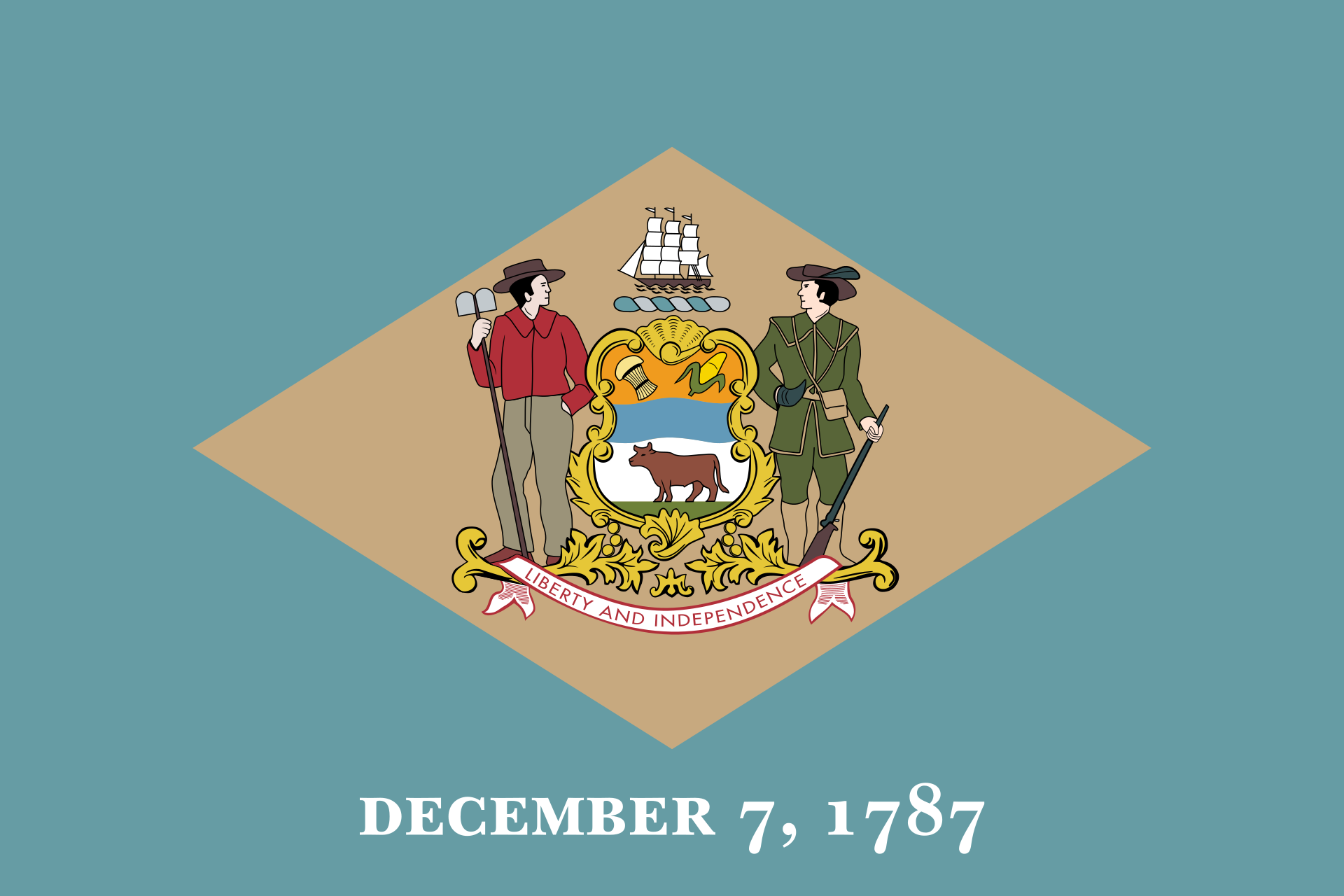
Delaware (pronunciación en inglés: /ˈdɛləwɛəɹ/ (![]() escuchar)) es uno de los cincuenta estados que, junto con Washington D. C., forman los Estados Unidos de América. Su capital es Dover y su ciudad más poblada, Wilmington. Está ubicado en la región Nordeste del país, división Atlántico Medio, limitando al norte con Pensilvania, al noreste con la bahía de Delaware que lo separa de Nueva Jersey, al este con el océano Atlántico y al sur con Maryland. Con 6447 km² es el segundo estado menos extenso —por delante de Rhode Island—, con 897 934 habs. en 2010, el sexto menos poblado —por delante de Dakota del Sur, Alaska, Dakota del Norte, Vermont y Wyoming—, y con 139 hab/km², el sexto más densamente poblado, por detrás de Nueva Jersey, Rhode Island, Connecticut, Massachusetts y Maryland. Fue el primer estado admitido en la Unión, el 7 de diciembre de 1787, como se puede leer en su bandera.
escuchar)) es uno de los cincuenta estados que, junto con Washington D. C., forman los Estados Unidos de América. Su capital es Dover y su ciudad más poblada, Wilmington. Está ubicado en la región Nordeste del país, división Atlántico Medio, limitando al norte con Pensilvania, al noreste con la bahía de Delaware que lo separa de Nueva Jersey, al este con el océano Atlántico y al sur con Maryland. Con 6447 km² es el segundo estado menos extenso —por delante de Rhode Island—, con 897 934 habs. en 2010, el sexto menos poblado —por delante de Dakota del Sur, Alaska, Dakota del Norte, Vermont y Wyoming—, y con 139 hab/km², el sexto más densamente poblado, por detrás de Nueva Jersey, Rhode Island, Connecticut, Massachusetts y Maryland. Fue el primer estado admitido en la Unión, el 7 de diciembre de 1787, como se puede leer en su bandera.
A pesar de su pequeña extensión, Delaware es un gran centro financiero. Más de 200 mil empresas tienen su sede en el estado. Esto sucede gracias a las leyes estatales que conceden beneficios fiscales a las compañías que deciden instalar sus sedes en el estado, atrayendo incluso a muchas que operan principalmente fuera de él. Este hecho dio al estado el apodo de The Land of Free-Tax Shopping. Por ello, este estado es también uno de los mayores centros bancarios de Estados Unidos. También posee una fuerte industria petroquímica.
Delaware fue inicialmente colonizado por los neerlandeses y por los suecos. Era también una de las Trece Colonias del Reino Unido. Después de la Guerra de Independencia de los Estados Unidos, fue el primer estado estadounidense en ratificar la Constitución de los Estados Unidos de América, el 7 de diciembre de 1787. Por ello, el estado es conocido nacionalmente como The First State (El Primer Estado). El nombre del estado proviene del río Delaware, pues se localiza a los márgenes de este río y su estuario, la bahía de Delaware. El origen del nombre Delaware, por su parte, proviene de Thomas West Tercero, Barón de La Warr, que fue gobernador de Virginia entre 1610 y 1618.
Де́лавэр[1][2] [ Д э́ л а в э р ][3] (англ. Delaware, американское произношение: [ˈdɛləwɛər] (![]() слушать)) — штат США[4], один из Средне-Атлантических штатов США. Расположен в северо-восточной части полуострова Делмарва. На западе граничит со штатом Мэриленд, на севере — с Пенсильванией, на северо-востоке — с Нью-Джерси.
слушать)) — штат США[4], один из Средне-Атлантических штатов США. Расположен в северо-восточной части полуострова Делмарва. На западе граничит со штатом Мэриленд, на севере — с Пенсильванией, на северо-востоке — с Нью-Джерси.
Является вторым среди наименьших по площади штатов и шестым по малочисленности населения, но занимает шестое место по его плотности. Разделён на три расположенных с севера на юг округа: Нью-Касл, Кент и Сассекс. Столица штата — город Довер.
Название штата происходит от титула Томаса Уэста, 3-го барона де ла Варра, первого колониального губернатора Виргинии. Делавэр известен как «Первый штат», поскольку 7 декабря 1787 года первым из 13 колоний ратифицировал Конституцию США.

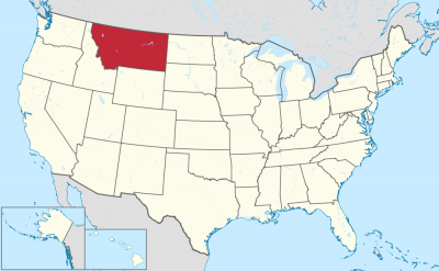
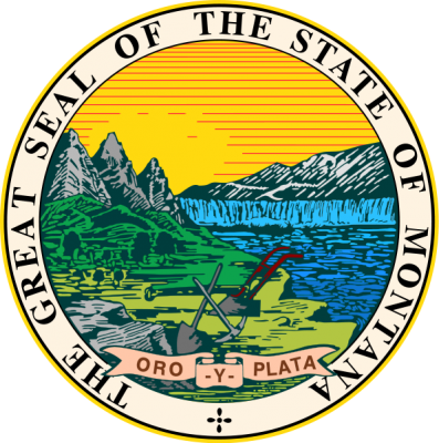
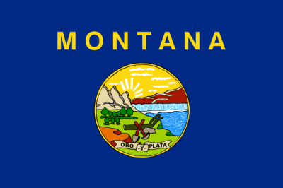
蒙大拿州(英语:State of Montana)是美国西北部的一州,州名来自于西班牙语的“montaña”(山),此州的面积在美国名列第四大,然而相对之下,人口相当稀少,人口密度也相当低,经济上以农牧为主,作物主要有燕麦、大麦和甜菜,亦有重要的采矿和伐木业。
此州的西边有三分之一都是山脉,在东边则有三分之二还属于美国大平原的范围。原居民是美国原住民,在1864年成为了蒙大拿领地,1889年加入美国联邦,为排名第41顺次的州。该州也是第一个选出女性国会议员——珍奈特·雷金的州。在种族上,蒙大拿州有相当多的白人(89.5%),美国原住民则占有6.2%。尽管该州在政治上以共和党员占绝大多数,但州长史提夫·布洛克(Steve Bullock)却是民主党人。
Montana (engl. Aussprache [mɑnˈtʰænə]) ist ein Bundesstaat im Nordwesten der Vereinigten Staaten. Der Name „Montana“ leitet sich wahrscheinlich von dem spanischen Wort montaña, vielleicht aber auch vom lateinischen montanus (beides zu Deutsch: „Berg-“, „bergig“, „gebirgig“) ab.
Mit 380.838 km² ist Montana nach Alaska, Texas und Kalifornien der viertgrößte Bundesstaat der USA und geringfügig größer als Deutschland. Dort leben aber mit knapp über einer Million Einwohnern[2][3] nur etwa 0,3 % der Gesamtbevölkerung. Dünner besiedelt sind in den Vereinigten Staaten nur Wyoming und Alaska. Montana zählt zu den sogenannten Mountain States, die von den Rocky Mountains durchzogen werden. Die Hauptstadt von Montana ist Helena. Sein Spitzname Treasure State („Staat der Schätze“) begründet sich durch die Vielzahl an Bodenschätzen (Erdöl, Kohle, Kupfer, Silber und Gold).
モンタナ州(英: State of Montana [mɒnˈtænə] (![]() 音声ファイル))は、アメリカ合衆国の北西部の州である。アメリカ合衆国には41番目に加盟した。州都はヘレナ市である。
音声ファイル))は、アメリカ合衆国の北西部の州である。アメリカ合衆国には41番目に加盟した。州都はヘレナ市である。
東西の長さが1,040 km、南北が410 km と東西に長い矩形をしており、西側3分の1には多くの山脈が走っている。中央3分の1には小型の孤立型山脈が見られ、これらがロッキー山脈の名前が付けられている77の山脈に入っている。この地形的特徴により、スペイン語の montaña (山、mountain)に由来して、州の名前が付けられた。モンタナ州には幾つかニックネームがあるが、どれも公式のものではない[1]。例えば「大きな空の邦」や「宝の州」であり、またスローガンでは「輝く山脈の地」、さらに最近では「最後の最良の地」がある[2]。陸地面積では全米第4位であるが、人口では少ない方から第7位、人口密度では小さい方から第3位である。経済は主にサービス業に基づいており、東部では牧畜業、小麦農業、石油と石炭の採掘、西部では林業、観光業および岩石採掘業が盛んである[3]。毎年多くの観光客がグレイシャー国立公園、リトルビッグホーン戦場跡国定保護区、およびイエローストーン国立公園を訪れている。ワイオミング州にもかかるイエローストーン国立公園には州内に3か所の入り口がある[4]。
Montana (/mɒnˈtænə/ (![]() listen)) is a state in the Northwestern United States. It is bordered by the Canadian provinces of Alberta, British Columbia, and Saskatchewan to the north; Idaho to the west; North Dakota and South Dakota to the east; and Wyoming to the south. It is the fourth largest state by area, the eighth least populous state, and the third least densely populated state. The western half of Montana contains numerous mountain ranges, while the eastern half is characterized by western prairie terrain and badlands, with more (albeit smaller) mountain ranges found throughout the state. In all, 77 named ranges are part of the Rocky Mountains.
listen)) is a state in the Northwestern United States. It is bordered by the Canadian provinces of Alberta, British Columbia, and Saskatchewan to the north; Idaho to the west; North Dakota and South Dakota to the east; and Wyoming to the south. It is the fourth largest state by area, the eighth least populous state, and the third least densely populated state. The western half of Montana contains numerous mountain ranges, while the eastern half is characterized by western prairie terrain and badlands, with more (albeit smaller) mountain ranges found throughout the state. In all, 77 named ranges are part of the Rocky Mountains.
Montana has no official nickname and several unofficial ones,[6] most notably "Big Sky Country", "The Treasure State", "Land of the Shining Mountains", and "The Last Best Place".[7] The economy is primarily based on agriculture, including ranching and cereal grain farming. Other significant economic resources include oil, gas, coal, mining, and lumber. The health care, service, and government sectors also are significant to the state's economy. Montana's fastest-growing sector is tourism; nearly 13 million annual tourists visit Glacier National Park, Yellowstone National Park, Beartooth Highway, Flathead Lake, Big Sky Resort, and other attractions.[8]
Le Montana (prononcé en anglais : /mɑnˈtæ.nə/2) est un État du nord-ouest des États-Unis, dont la capitale est Helena et la plus grande ville Billings. D'une superficie de 381 156 km2, le Montana est peuplé de 998 199 habitants en 2010, ce qui en fait le quatrième plus grand et le septième moins peuplé des États des États-Unis et l'un de ceux ayant la plus faible densité de population avec l'Alaska et le Wyoming (2,39 hab./km2). Il est divisé en 56 comtés. Bordé à l'ouest par l'Idaho, à l'est par le Dakota du Sud et le Dakota du Nord, et au sud par le Wyoming, il est frontalier du Canada au nord en touchant les provinces de la Colombie-Britannique, de l'Alberta et de la Saskatchewan. Territoire rural au climat continental, ses paysages alternent entre larges vallées dominées par les imposants sommets des Rocheuses à l'ouest, et vastes plaines fertiles à l'est. Son réseau hydrographique est très important : plusieurs affluents du Missouri (la Yellowstone, la Milk, la Musselshell) traversent l'État de part en part, formant de nombreux canyons et cascades.
La région est peuplée par plusieurs peuples amérindiens (Sioux, Nez-Percés, Kootenays, Pikunis et Cheyennes notamment) avant l'arrivée des Européens. Parcourue par divers trappeurs européens au cours du XVIIIe siècle, elle fait partie du territoire de la Louisiane et est donc vendue avec elle aux États-Unis, en 1803. Elle est en partie explorée par l'expédition Lewis et Clark en 1805 et 1806. La découverte de gisements d'or dans les années 1850 et 1860 provoque une immigration massive de prospecteurs et de colons. En 1864, le Montana est déclaré territoire, et intègre l'Union le 8 novembre 1889, devenant le quarante et unième État américain. La construction d'une voie ferrée entraîne le peuplement et le développement de l'économie de l'État, multipliant la population par dix de 1880 à 1910. L'accroissement démographique demeure fort tout au long du siècle. Le Montana est l'un des États les plus homogènes sur le plan ethnique (86 % de blancs non hispaniques), bien qu'il compte une importante population amérindienne qui vit en partie dans les huit réserves de l’État.
L'économie du Montana repose depuis sa création sur l'extraction minière (cuivre, or, argent, phosphates) et les hydrocarbures, mais également sur l'agriculture céréalière et l'exploitation forestière, essentiellement pratiquées dans les vallées des Rocheuses. Les industries reposent surtout sur le traitement et la transformation des matières premières agricoles et minérales. Le Montana possède plusieurs sites touristiques majeurs : le parc national de Glacier, à la frontière canadienne ; une petite partie du parc national de Yellowstone ; des stations de sports d'hiver ; et le site historique de la bataille de Little Bighorn, où les Sioux de Sitting Bull ont provoqué la défaite du général Custer en 1876. De tendance conservatrice et républicaine au niveau national, le Montana est cependant plus partagé au niveau local.
Il Montana (in inglese , [mɒnˈtænə]) è uno Stato federato degli Stati Uniti d'America, classificato tra gli stati occidentali.
Il nome Montana deriva dalla parola spagnola montaña che significa montagna, infatti il terzo occidentale dello Stato contiene numerose catene montuose, ma nel Montana si trovano anche catene montuose minori, per un totale di 77 catene che fanno parte delle Montagne Rocciose. Il Montana ha diversi soprannomi, nessuno dei quali ufficiale, tra cui Big Sky Country (lo Stato del grande cielo), e The Treasure State (lo Stato del tesoro), e slogan che comprendono Land of the Shining Mountains (terra delle montagne che brillano) e, più recentemente, The Last Best Place (l'ultimo posto migliore).
Lo Stato risulta essere il 4º stato più esteso, ma solo il 44° per popolazione, e il 48° più densamente popolato (quindi tra i meno popolati), tra tutti i 50 Stati uniti. L'economia si basa principalmente sull'agricoltura, incluso il ranch, del grano duro e di altre coltivazioni di grano. Le altre attività economiche principali sono il petrolio, il gas, il carbone e l'estrazione mineraria, il legname e infine il settore con la più ampia crescita, il turismo. Milioni di turisti visitano ogni anno il Parco nazionale dei ghiacciai, il monumento alla battaglia del Little Bighorn Tre dei cinque ingressi del Parco nazionale di Yellowstone sono dal Montana. Nel Montana vi è la più grande concentrazione di orsi grizzly degli USA, dopo l'Alaska; qui inoltre si trova uno dei fiumi più brevi del mondo, il Roe.
Il suo codice postale è MT.
Montana es uno de los cincuenta estados que, junto con Washington D. C. forman los Estados Unidos de América. Su capital es Helena y su ciudad más poblada, Billings. Está ubicado en la región Oeste del país, división Montañas Rocosas. Limita al norte con Canadá, al este con Dakota del Norte y Dakota del Sur, al sur con Wyoming y al oeste con Idaho. Con 380 838 km² es el cuarto estado más extenso —por detrás de Alaska, Texas y California—, con 989 415 habs. en 2010, el séptimo menos poblado —por delante de Delaware, Dakota del Sur, Alaska, Dakota del Norte, Vermont y Wyoming, el menos poblado— y con 2,60 hab/km², el tercero menos densamente poblado, por delante de Wyoming y Alaska, el menos densamente poblado. Fue admitido en la Unión el 8 de noviembre de 1889, como el estado número 41.
El tercio centro-oeste es recorrido por montañas (aproximadamente 77 nombradas) de la cadena montañosa de las Rocosas; así se explica su nombre, derivado de la palabra española "montaña". El apodo del estado es el "Estado de tesoro" (Treasure State). Otros apodos son "Tierra de montañas brillantes" (Land of Shining Mountains), "País del Gran Cielo" (Big Sky Country) y el lema "El último mejor lugar" (the last best place). En el ranking de estados aparece cuarto en cuanto a superficie, pero tan solo el 44º en población, y, por lo tanto, tiene la tercera densidad más baja de los Estados Unidos. La economía se basa principalmente en la agricultura y en la extracción de madera y minerales. El turismo es también un factor importante en su economía, con millones de visitantes al año al parque nacional de los Glaciares, al lugar de la batalla de Little Big Horn y al parque nacional de Yellowstone.
Монта́на[1][2] (англ. Montana [mɒnˈtænə]) — штат[3] на северо-западе США, 41-й штат, присоединившийся к союзу. На севере граничит с Канадой. Столица — Хелена, крупнейший город — Биллингс. Население — 1 015 165 человек (44-е место в США, данные 2013 г.). Официальное прозвище — «Штат сокровищ».
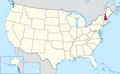
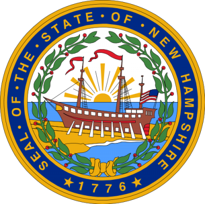
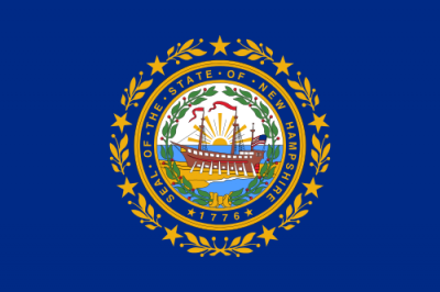
新罕布什尔州(英语:State of New Hampshire),是位于美国东北部新英格兰地区的一个州,南接马萨诸塞州,西接佛蒙特州,东接缅因州及大西洋,北接加拿大魁北克省。州土地面积排名倒数第五,在五十个州中人口数量排名倒数第十。
州首府为康科德市,最大城市为曼彻斯特市,曼彻斯特市同时是新英格兰地区北部包括佛蒙特州及缅因州区域最大的城市。州实行免消费税,个人收入除利息及股息外也不在州或地方一级征税。新罕布什尔州是美国总统选举中第一个举行初选的州。州车牌印有该州格言:“不自由,毋宁死”。该州盛产花岗岩,因而得名州绰号“花岗岩州”。州花为紫丁香,州鸟为紫红朱雀,州树为白桦树。[11]
新罕布什尔州于1776年1月成为第一个独立于大不列颠政府的北美殖民地,其也是第一个制定自己宪法的殖民地。六个月后,新罕布什尔州及其他十二个州组成了美利坚合众国,在1788年6月新罕布什尔州正式批准了美利坚合众国宪法,为第九个加入合众国的州。
新罕布什尔州曾是美国纺织业、制鞋业及造纸业的主要中心,设立在曼彻斯特的阿莫斯克亚格制造公司曾是世界上最大的纺织厂。同一时期许多造纸厂分布在该州的各条河流上,尤其是梅里马克河和康涅狄格河。许多法裔加拿大人在十九世纪末二十世纪初时移居到新罕布什尔州从事制造业工作。目前新罕布什尔州仍有第二高的法裔血统人口比例,高达24.5%的人口为法裔美国人。
曼彻斯特、纳舒厄和柏林等新罕布什尔州制造业中心在20世纪30年代至40年代遭受重创,在此期间制造业逐渐离开新英格兰地区并向美国南部及海外迁移。 在20世纪50年代和60年代,国防承包商逐渐搬入了许多空置的前工厂中。新罕布什尔州南部的人口从20世纪80年代开始飙升,在此期间高速公路将州南部连接到大波士顿地区,在州内形成了多个睡城。
新罕布什尔州拥有美国东岸一些最大的滑雪区域,周内主要休闲活动包括滑雪、雪上摩托车、远足、登山运动及其他冬季运动。在该州西南部的蒙纳德诺克山是全美攀登人数最多的山脉之一。秋季观赏红叶,夏季在湖泊及海岸线边的小屋度假,及六月份在维尔斯海滩举办的摩托车活动周也是该州出名的活动。白山山脉国家森林将阿巴拉契亚山脉连接至佛蒙特州和缅因州,游客可以驾车前往华盛顿山海拔6,288英尺(1,917米)的山顶。
来自新罕布什尔州的名人包括美国开国元勋尼古拉斯·吉尔曼、参议员丹尼尔·韦伯斯特、美国独立战争英雄约翰·史塔克、编辑霍勒斯·格里利、基督科学教会创始人玛丽·贝克·艾迪、诗人罗伯特·弗罗斯特、太空人艾伦·谢泼德、摇滚歌星罗尼·詹姆斯·迪欧、作家丹·布朗、演员亚当·山德勒、发明家狄恩·卡门、喜剧演员莎拉·席尔蔓和塞斯·梅耶斯、连锁快餐店创建人麦当劳兄弟以及美国总统富兰克林·皮尔斯。
New Hampshire ( [nuː ˈhæmpʃɚ] AE / [njuː ˈhæmpʃə] BE) ist ein Bundesstaat der Vereinigten Staaten in der Region Neuengland. Im Westen grenzt er an den Bundesstaat Vermont, im Osten an Maine, im Süden an Massachusetts und im Norden an die kanadische Provinz Québec. Bei einer Fläche von 24.216 km² zählt der Bundesstaat etwa 1,3 Mio. Einwohner. Der überwiegende Teil der Bevölkerung lebt im Süden des Bundesstaats, der Norden ist von Mittelgebirgen geprägt. Die Hauptstadt ist Concord mit fast 43.000 Einwohnern[1], die größte Stadt ist jedoch Manchester mit 110.000.
Die ersten Spuren menschlicher Besiedlung reichen über 10.000 Jahre zurück. Die große Mehrheit der Bevölkerung ist europäischer Abstammung, Indianer gibt es seit den 1740er Jahren nicht mehr. Kontakte mit Europäern führten ab den 1630er Jahren zu starken Bevölkerungsverlusten unter den Ureinwohnern, vor allem durch Pockenepidemien, schließlich trieben Kämpfe mit Irokesen und Engländern die Überlebenden nach Maine und Kanada.
Seit 1629 trat England als Kolonialmacht auf, die Kolonie wurde nach dem englischen Hampshire benannt. Nach den Grundsätzen des englischen Feudalismus wurde das Land vergeben und Siedler angesetzt. In den Jahren von 1641 bis 1679 gehörte New Hampshire zu Massachusetts, unterstand darauf für zwei Jahrzehnte dem König unmittelbar und kam von 1691 bis 1741 erneut zu Massachusetts, dessen Gouverneure für den nördlichen Nachbarn zuständig wurden.
Im Jahr 1776 gründete New Hampshire als erste Kolonie eine Regierung und verabschiedete eine Verfassung, wurde mit den neu gegründeten Vereinigten Staaten unabhängig. Im Jahr 1808 wurde Concord seine Hauptstadt. In den Jahren von 1832 bis 1835 bestand eine unabhängige Republik an der kanadischen Grenze, Großbritannien gab seine Ansprüche erst 1836 auf. Von der Industrialisierung und dem Bürgerkrieg profitierte der Bundesstaat ökonomisch, doch mit der Weltwirtschaftskrise brachen wesentliche Industriezweige zusammen. Erst die Anbindung an den Wirtschaftsraum Boston brachte neue Industriezweige vor allem in den Süden von New Hampshire.
Der Bundesstaat wird wegen seiner Steinbrüche auch The Granite State („Granit-Staat“) genannt. Zugleich spiegelt der Spitzname auch die Bewahrung von Traditionen und die Geschichte einer sparsamen Regierung wider. Es gibt keine allgemeinen Mehrwert- oder Einkommensteuern, was dem Staatsmotto „Frei leben oder sterben“ entspricht.
ニューハンプシャー州(英: State of New Hampshire、アメリカ: [nuːˈhæmpʃər] (![]() 音声ファイル))は、アメリカ合衆国北東部、ニューイングランド地方に位置する州である。州名はイングランド南部のハンプシャーから採られた。南はマサチューセッツ州、西はバーモント州、東はメイン州と大西洋に接し、また北はカナダのケベック州との国境である。アメリカ合衆国50州の中で、陸地面積では第46位、人口では第42位である。
音声ファイル))は、アメリカ合衆国北東部、ニューイングランド地方に位置する州である。州名はイングランド南部のハンプシャーから採られた。南はマサチューセッツ州、西はバーモント州、東はメイン州と大西洋に接し、また北はカナダのケベック州との国境である。アメリカ合衆国50州の中で、陸地面積では第46位、人口では第42位である。
1776年1月にイギリスと訣別したイギリス領北アメリカ植民地として最初のものとなり、その6か月後には独立宣言を発して、アメリカ合衆国を構成した13植民地の1つとなった。1788年6月21日、アメリカ合衆国憲法を批准した9番目の州となり、憲法成立に必要な州の数を満たしたことで、憲法が効力を発揮した。ニューハンプシャー州は独自の州憲法を持った州としても最初のものだった。
アメリカ合衆国大統領の予備選挙が最初に行われる州として知られている。州都はコンコード市、人口最大の都市はマンチェスター市である。州のレベルでも地方のレベルでも消費税や所得税が課されていないという特徴がある[1]。
州のニックネームは花崗岩の州であり、州内に広範な花崗岩の層と採石場があることから来ている[2]。州のモットーは「自由に生きる、もしくは死を("Live Free or Die")」であり、自動車のナンバープレートにも表示されている。
ニューハンプシャー州出身の著名人として、アメリカ合衆国建国の父の1人ニコラス・ギルマン、上院議員のダニエル・ウェブスター、独立戦争の英雄ジョン・スターク、新聞編集者のホレス・グリーリー、クリスチャン・サイエンスの創設者メリー・ベーカー・エディ、詩人のロバート・フロスト、宇宙飛行士のアラン・シェパード、作家のダン・ブラウンがいる。フランクリン・ピアース大統領も州の出身者である。
New Hampshire (/ˈhæmpʃər/) is a state in the New England region of the northeastern United States. It is bordered by Massachusetts to the south, Vermont to the west, Maine and the Atlantic Ocean to the east, and the Canadian province of Quebec to the north. New Hampshire is the 5th smallest by area and the 10th least populous U.S. state.
Concord is the state capital, while Manchester is the largest city. New Hampshire has no general sales tax, nor income tax other than on interest and dividends. The New Hampshire primary is the first primary in the U.S. presidential election cycle. Its license plates carry the state motto, "Live Free or Die". The state's nickname, "The Granite State", refers to its extensive granite formations and quarries.[12]
In January 1776, it became the first of the British North American colonies to establish a government independent of the Kingdom of Great Britain's authority, and it was the first to establish its own state constitution. Six months later, it became one of the original 13 colonies that signed the United States Declaration of Independence, and in June 1788 it was the ninth state to ratify the United States Constitution, bringing that document into effect.
Historically, New Hampshire was a major center for textile manufacturing, shoemaking, and papermaking, with Amoskeag Manufacturing Company in Manchester at one time being the largest cotton textile plant in the world. Numerous mills were located along various rivers in the state, especially the Merrimack and Connecticut rivers. Many French Canadians migrated to New Hampshire to work the mills in the late 19th and early 20th century; New Hampshire still ranks second among states by percentage of people claiming French American ancestry, with 24.5% of the state identifying as such.
Manufacturing centers such as Manchester, Nashua, and Berlin were hit hard in the 1930s–1940s as major manufacturing industries left New England and moved to the southern United States or overseas, reflecting nationwide trends. In the 1950s and 1960s, defense contractors moved into many of the former mills, such as Sanders Associates in Nashua, and the population of southern New Hampshire surged beginning in the 1980s as major highways connected the region to Greater Boston and established several bedroom communities in the state.
With some of the highest ski mountains on the East Coast, New Hampshire's major recreational attractions include skiing, snowmobiling, and other winter sports, hiking and mountaineering (Mount Monadnock in the state's southwestern corner is among the most climbed mountains in the U.S.), observing the fall foliage, summer cottages along many lakes and the seacoast, motor sports at the New Hampshire Motor Speedway, and Motorcycle Week, a popular motorcycle rally held in Weirs Beach in Laconia in June. The White Mountain National Forest links the Vermont and Maine portions of the Appalachian Trail, and has the Mount Washington Auto Road, where visitors may drive to the top of 6,288-foot (1,917 m) Mount Washington.
Among prominent individuals from New Hampshire are founding father Nicholas Gilman, Senator Daniel Webster, Revolutionary War hero John Stark, editor Horace Greeley, founder of the Christian Science religion Mary Baker Eddy, poet Robert Frost, astronaut Alan Shepard, rock musician Ronnie James Dio, author Dan Brown, actor Adam Sandler, inventor Dean Kamen, comedians Sarah Silverman and Seth Meyers, restaurateurs Richard and Maurice McDonald, and President of the United States Franklin Pierce.
Le New Hampshirea (/n̪ju.ɑ̃p.ʃœʁ/, prononcé en anglais /nuˈhæmpʃɚ/b Écouter) est un État des États-Unis situé dans la région de la Nouvelle-Angleterre, au nord-est du pays. Il est bordé à l'ouest par le Vermont, au nord par le Québec, à l'est par le Maine et l'océan Atlantique et au sud par le Massachusetts. Le nom « New Hampshire » provient de celui du comté du Hampshire, dans le Sud de l'Angleterre. Parmi les États américains, le New Hampshire se classe 44e pour ce qui est de la superficie de terres, 46e pour la superficie totale et 42e pour la population. Le fleuve Connecticut sert de frontière entre le New Hampshire et le Vermont. En 2019, sa population s'élève à 1 359 711 habitants2.
En janvier 1776, la province du New Hampshire devint la première colonie de l'Amérique du Nord britannique à former un gouvernement indépendant de l'autorité de la Grande-Bretagne, sans pour autant avoir déclaré son indépendance à ce moment-là. Six mois plus tard, le 4 juillet, elle devint une des Treize Colonies qui firent sécession ensemble. En juin 1788, il devint le neuvième État à ratifier la Constitution des États-Unis et permit ainsi au document de prendre effet. Le New Hampshire fut le premier État américain à avoir sa propre constitution. Il est connu pour avoir la première élection primaire dans l'élection présidentielle américaine. L'Iowa qui le précède dans le processus de sélection a lui des caucus.
Concord est la capitale de l'État, tandis que Manchester est la plus grande ville. Il n'y a ni taxe sur la vente ni impôt sur le revenu au niveau de l'État ou au niveau municipal. Ses plaques d'immatriculation portent la devise « Live Free or Die » (« Vivre libre ou mourir », en français). Le surnom de l'État est « l'État du granite », qui fait référence à sa géologie, et il est parfois représenté sous les traits de « the Old Man of the Mountain » (« le Vieil homme de la Montagne »), un ancien détail topographique trouvé dans les montagnes Blanches qui ressemble à un visage en granite.
Les attractions de loisir principales sont le ski, la motoneige et d'autres sports d'hiver, les randonnées et l'alpinisme, l'observation du feuillage automnal, les chalets près des lacs et au bord de la mer, les sports automobiles au New Hampshire Motor Speedway et la semaine motocycliste de Laconia en juin. Le sentier des Appalaches traverse l'État dans la forêt nationale de White Mountain.
Il New Hampshire (in inglese: , /njuːˈhæmpʃər/, in italiano letteralmente Nuovo Hampshire) è uno dei cinquanta Stati federati che compongono gli Stati Uniti d'America, situato nella regione della Nuova Inghilterra.
Confina a sud con il Massachusetts, a ovest con il Vermont, a est con il Maine e l'oceano Atlantico e a nord con la provincia canadese del Québec. Il New Hampshire è il quinto Stato più piccolo e il nono meno popoloso della federazione. È diventata la prima delle colonie britanniche nordamericane a scindersi dalla Gran Bretagna nel gennaio 1776 e sei mesi dopo fu uno dei tredici Stati che fondarono gli Stati Uniti d'America. Nel giugno 1788 è diventato il nono Stato a ratificare la Costituzione degli Stati Uniti d'America, portando tale documento in vigore. Il New Hampshire è stato il primo Stato statunitense ad avere una propria Costituzione nazionale. La capitale dello Stato è Concord, mentre la città più grande è Manchester. Si estende su un territorio di 24 032 km² suddiviso in dieci contee e la popolazione stimata nel 2014 è di 1 326 813 abitanti.
Le sue targhe portano il motto dello Stato: «Live Free or Die» («Vivere liberi o morire»). Il soprannome dello Stato «The Granite State» («Lo Stato del granito») rimanda alle sue ampie formazioni e cave di granito. Con alcune delle più grandi aree sciistiche della costa orientale, le principali attrazioni ricreative del New Hampshire includono lo sci, motoslitta e altri sport invernali, trekking e alpinismo, case vacanze estive lungo la costa e i numerosi laghi, sport motoristici al New Hampshire Motor Speedway e la settimana del motociclo, un famoso motoraduno tenutosi a Weirs Beach nel mese di giugno.
Nuevo Hampshire (en inglés, New Hampshire) es uno de los cincuenta estados de los Estados Unidos de América. Su capital es Concord y su ciudad más poblada, Manchester. Está ubicado en la región noreste del país, en Nueva Inglaterra, limitando al norte con Canadá, al este con Maine, al sureste con el golfo de Maine (océano Atlántico), al sur con Massachusetts y al oeste con el río Connecticut que lo separa de Vermont. Con 24.216 km² es el quinto estado menos extenso —por detrás de Nueva Jersey, Connecticut, Delaware y Rhode Island— y, con 1.316.470 habitantes en 2010, el noveno menos poblado, por detrás de Rhode Island, Montana, Delaware, Dakota del Sur, Alaska, Dakota del Norte, Vermont y Wyoming. Fue admitido en la Unión el 21 de junio de 1788, como el estado número 9.
Es conocido internacionalmente por ser el primer estado en el que se celebran las elecciones primarias para la presidencia de EE. UU. Estas elecciones atraen la atención de la opinión pública y de los observadores políticos, ya que son un indicador del favor de los electores hacia los candidatos presentados.
Las matrículas de los vehículos tienen escrito el lema del estado: "Vive libre o muere". El apodo del estado es "el Estado de Granito" (the Granite State), pues hace referencia a su geología y a su tradicional autosuficiencia. El estado posee otros apodos, pero raramente se usan.1 Personajes famosos relacionados con el estado fueron: el senador Daniel Webster, el editor Horace Greeley, la fundadora de la Iglesia de la Ciencia Cristiana Mary Baker Eddy, y el comediante Adam Sandler. Franklin Pierce, 14º presidente de los EE. UU., nació aquí. Las atracciones turísticas son variadas, desde el esquí y otros deportes de invierno, a la observación de sus espectaculares paisajes otoñales en los bosques, las casitas cerca de los lagos, y el óvalo de carreras de deporte motor New Hampshire International Speedway, el más importante de Nueva Inglaterra.
Нью-Гэ́мпшир[2][3], неофициально также Нью-Хэмпшир[4] (англ. New Hampshire) — небольшой штат[5] в регионе Новая Англия на северо-востоке США. Население 1 318 194 (2011 г.). Неофициальное название — «Гранитный штат». Столица штата — город Конкорд, крупнейший город — Манчестер. Первый штат в стране, провозгласивший независимость от Великобритании. Девиз штата: «Живи свободным или умри» (англ. Live free or die).
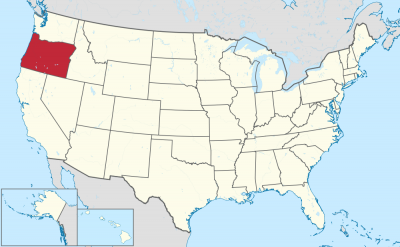
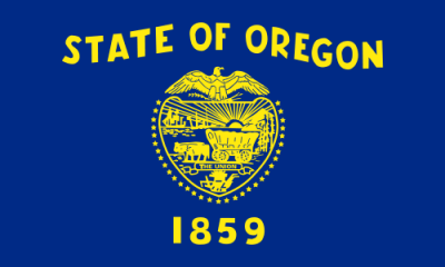
Oregon (engl. Aussprache [ˈɔrɪɡən]) ist ein Bundesstaat der Vereinigten Staaten von Amerika. Er liegt im Westen der Vereinigten Staaten in der Region Pazifischer Nordwesten und wurde im Jahr 1859 als 33. Bundesstaat aufgenommen.
Flächenmäßig ist Oregon der neuntgrößte Bundesstaat, mit einer Bevölkerung von knapp über 3,8 Millionen (2010) liegt er unter den Bundesstaaten hingegen nur an 27. Stelle. Ein Großteil der Bevölkerung konzentriert sich im Willamette Valley im Nordwesten des Staates. Dort liegen mit Portland, Eugene und der Hauptstadt Salem auch die drei größten Städte Oregons.
オレゴン州(英: State of Oregon)は、北米西海岸に位置する、アメリカ合衆国33番目の州である。太平洋に沿って北にワシントン州、南にカリフォルニア州と接し、内陸の南東はネバダ州、東はアイダホ州である。北はコロンビア川、東はスネーク川が州境の大半を形作っている。1843年にオレゴン・カントリーの自治的な政府を樹立した交易業者、探検家および開拓者が訪れるまでは、アメリカ・インディアンの多くの部族が住んでいた。1848年にオレゴン準州が設立され、1859年2月14日にアメリカ合衆国33番目の州に昇格した。
ワシントン州、カリフォルニア州と共にリベラルな気風で、保守的な中西部に対して「レッドウッド・カーテンの向こう側」と称される。
現代の先進国では珍しい直接民主制によって作られ、州、郡からも独立した地域政府メトロを擁する。
セイラムが州都であり、人口では州内第3位である。人口最多の都市はポートランドである。2010年国勢調査による州人口は380万人以上であり、2000年から12%増加した[1]。ポートランドの人口は同年で583,776人であり、全米第29位である。その都市圏人口は2,241,841人(2009年推計)で全米第23位である。州西部、ウィラメット川のあるバレーに人口が集中しており、州内の人口上位10都市のうち8都市がこのバレーに入っている。
州内には多様な景観がある。風に吹き曝される太平洋岸、カスケード山脈のゴツゴツして氷河に侵食された火山、マルトノマ滝など多くの滝、深い常緑樹の森、また州東部の大半でグレートベースンまで拡がる高原型砂漠などである。雨の多い州西部海岸にある背の高いダグラスファーやセコイアの木は、州東半分を覆う火を着けやすい松やジュニパー(セイヨウネズ)の疎らに生えた林と対照的である。州中央から東には半乾燥の灌木地、プレーリー、砂漠、ステップおよび牧草地が拡がっている。標高11,249フィート (3,429 m) のフッド山が州内最高地点である。クレーターレイク国立公園が州内唯一の国立公園である。
Oregon (/ˈɒr(ɪ)ɡən/ (![]() listen) ORR-(ih)-gən)[7] is a state in the Pacific Northwest region on the West Coast of the United States. The Columbia River delineates much of Oregon's northern boundary with Washington, while the Snake River delineates much of its eastern boundary with Idaho. The 42° north parallel delineates the southern boundary with California and Nevada.
listen) ORR-(ih)-gən)[7] is a state in the Pacific Northwest region on the West Coast of the United States. The Columbia River delineates much of Oregon's northern boundary with Washington, while the Snake River delineates much of its eastern boundary with Idaho. The 42° north parallel delineates the southern boundary with California and Nevada.
Oregon has been home to many Indigenous nations for thousands of years. The first European traders, explorers, and settlers began exploring what is now Oregon's Pacific coast in the early-mid 1500s. As early as 1565, the Spanish began sending vessels northeast from the Philippines, riding the Kuroshio Current in a sweeping circular route across the northern part of the Pacific. In 1592, Juan de Fuca undertook detailed mapping and studies of ocean currents in the Pacific Northwest, including the Oregon coast as well as the strait now bearing his name. Spanish ships – 250 in as many years – would typically not land before reaching Cape Mendocino in California, but some landed or wrecked in what is now Oregon. Nehalem tales recount strangers and the discovery of items like chunks of beeswax and a lidded silver vase, likely connected to the 1707 wreck of the San Francisco Xavier.[8]
In 1843, an autonomous government was formed in the Oregon Country, and the Oregon Territory was created in 1848. Oregon became the 33rd state of the U.S. on February 14, 1859. Today, with 4 million people over 98,000 square miles (250,000 km2), Oregon is the ninth largest and 27th most populous U.S. state. The capital, Salem, is the second-most populous city in Oregon, with 169,798 residents. Portland, with 647,805, ranks as the 26th among U.S. cities. The Portland metropolitan area, which also includes the city of Vancouver, Washington, to the north, ranks the 25th largest metro area in the nation, with a population of 2,453,168.
Oregon is one of the most geographically diverse states in the U.S.,[9] marked by volcanoes, abundant bodies of water, dense evergreen and mixed forests, as well as high deserts and semi-arid shrublands. At 11,249 feet (3,429 m), Mount Hood, a stratovolcano, is the state's highest point. Oregon's only national park, Crater Lake National Park, comprises the caldera surrounding Crater Lake, the deepest lake in the United States. The state is also home to the single largest organism in the world, Armillaria ostoyae, a fungus that runs beneath 2,200 acres (8.9 km2) of the Malheur National Forest.[10]
Because of its diverse landscapes and waterways, Oregon's economy is largely powered by various forms of agriculture, fishing, and hydroelectric power. Oregon is also the top timber producer of the contiguous United States, and the timber industry dominated the state's economy in the 20th century.[11] Technology is another one of Oregon's major economic forces, beginning in the 1970s with the establishment of the Silicon Forest and the expansion of Tektronix and Intel. Sportswear company Nike, Inc., headquartered in Beaverton, is the state's largest public corporation with an annual revenue of $30.6 billion.[12]
L’Oregon /ɔ.ʁe.ɡɔ̃/2 (en anglais : /ˈɔɹɨɡən/3 Écouter) est un État du Nord-Ouest des États-Unis, situé sur la côte Pacifique entre les États de Washington au nord, de Californie au sud, du Nevada au sud-est, et de l'Idaho à l'est. Ses frontières au nord et à l'est suivent pour l'essentiel les cours du fleuve Columbia et de la rivière Snake. Le territoire est intégralement traversé par la chaîne des Cascades qui forme une importante barrière climatique : l'ouest de l'État, de climat océanique, est recouvert par la forêt tempérée humide tandis que sa partie est, semi-aride, est occupée par le Haut désert de l'Oregon. Le parc national de Crater Lake se trouve dans le sud de l'État. La réserve indienne de Warm Springs s'étend sur 2 640,2 km2 dans le nord de l'État, sur le versant Est de la chaîne des Cascades.
L'actuel territoire de l'Oregon était occupé par les peuples amérindiens Bannocks, Chinook, Klamaths et Nez-Percé, il est atteint par l'expédition Lewis et Clark en 1805. À partir des années 1830, la piste de l'Oregon est empruntée par les pionniers dont le nombre supplante rapidement celui des autochtones. Le traité de l'Oregon, signé le 15 juin 1846, fixe la frontière américano-canadienne et aboutit à la création du territoire de l'Oregon dont la partie sud-ouest qui forme l'Oregon actuel est admise le 14 février 1859 comme 33e État de l'Union.
Entre 1902 et 1908, les efforts de la Direct Legislation League font de l'Oregon un précurseur en matière de démocratie directe (référendum, initiative populaire, révocation populaire des élus4,5) par l'instauration de l'Oregon System6,4 qui s'étendra par la suite à d'autres États. L'Oregon est un État traditionnellement démocrate7. Il est surnommé « L’État du castor » et ses habitants sont appelés Orégonais et Orégonaises.
L'Oregon a pour capitale Salem tandis que la ville la plus peuplée est Portland. Cette dernière s'étend au nord de la vallée de la Willamette qui regroupe 70 % de la population orégonaise8. L'ouest de Portland est occupé par le technopole de Silicon Forest qui accueille les principaux centres de recherche d'Intel, l'Oregon est également le berceau de Nike et de Columbia Sportswear Company.
L'Oregon (AFI: /ˈɔreɡon/[2]; in inglese: /ˈɔɹɪgən/) è uno Stato federato degli Stati Uniti d'America situato nella regione del Pacifico nord-occidentale. Confina ad ovest con l'Oceano Pacifico, a nord con lo stato di Washington, a sud con la California, ad est con l'Idaho e a sud-est con il Nevada. Il fiume Columbia delinea gran parte del confine settentrionale dello stato, e il fiume Snake costituisce gran parte del confine orientale. Il 42º parallelo nord segna invece il confine meridionale con California e Nevada. L'Oregon è uno dei tre stati degli Stati Uniti d'America continentali ad avere una costa sull'Oceano Pacifico, e la prossimità con l'oceano influenza significativamente il clima invernale mite dello stato, nonostante la latitudine.
L'Oregon fu abitato da molte tribù indigene prima dell'arrivo dell'insediamento dei commercianti ed esploratori occidentali. Nel 1843 si costituì un governo autonomo nell'Oregon Country, e il Territorio dell'Oregon fu creato nel 1848; l'Oregon divenne il 33º stato degli USA il 14 febbraio 1859. Attualmente, con i suoi 255.000 km², lo stato è il nono stato per superficie e, con una popolazione di 4 milioni di abitanti, è il 27º stato più popolato degli USA. La capitale è Salem, che è la seconda città più popolata dello stato, con 173.442 residenti (dato del 2018). Portland è invece la città più popolata, con 653.115 abitanti (dato del 2018), che si posiziona 26ª nella lista delle città più popolate degli Stati Uniti. L'area metropolitana di Portland conta 2.389.228 abitanti, e si posiziona 23ª tra le maggiori aree metropolitane della nazione; la Willamette Valley, nell'Oregon occidentale, rappresenta la parte dello stato più densamente popolata, dove vi sono otto delle dieci città più popolose.
Il panorama dell'Oregon è diversificato, con una costa ventosa, una Catena delle Cascate costellata di vulcani, una moltitudine di laghi sulle cascate e ad ovest, foreste pluviali temperate, temperate e decidue alle più basse altitudini, e un High Desert che si estende per gran parte dell'area orientale dello stato, fino al Gran Bacino. Le alte conifere, principalmente abeti di Douglas che si trovano sulla costa occidentale molto piovosa, contrastano con i più leggeri pini che ricoprono le porzioni orientali dell'Oregon. Gli abbondanti ontani nell'ovest fissano l'azoto per le conifere. Spostandosi verso est dell'Oregon centrale vi sono sterpaglie, praterie, deserti, steppe e prati. Con i suoi 3.429 metri di altitudine, il Monte Hood è il punto più alto dello stato. Lo Stato è coperto per circa il 60% della sua estensione da foreste e ospita diversi parchi nazionali. Il Parco nazionale del lago Crater, comprende la caldera che circonda il Lago Crater, il più profondo degli Stati Uniti. Il soprannome dello Stato è Beaver State, ossia "lo Stato dei castori", animali molto diffusi nella regione.
Oregón2 (en inglés, Oregon) es uno de los cincuenta estados que, junto con Washington D. C., forman los Estados Unidos de América. Su capital es Salem y su ciudad más poblada, Portland. Se ubica en la región Oeste del país, división Pacífico y limita al norte con el estado de Washington, al este con Idaho —gran parte de esta frontera la forma el río Snake—, al sureste con Nevada, al sur y suroeste con California y al oeste con el océano Pacífico. Con 254 805 km² es el noveno estado más extenso, por detrás de Alaska, Texas, California, Montana, Nuevo México, Arizona, Nevada y Colorado. Fue admitido en la Unión el 14 de febrero de 1859, como el estado número 33.
Los ríos Columbia y Snake forman la mayor parte de sus fronteras al norte y este, respectivamente. El valle del río Willamette en el oeste de Oregón es la región más densamente poblada y en la que la agricultura es más productiva. La zona fue habitada por muchas tribus indígenas antes de la llegada de los comerciantes, exploradores y colonos que formaron el gobierno autónomo de Oregon Country en 1843. El territorio de Oregón fue creado en 1848 y se convirtió en el estado de Oregón el 14 de febrero de 1859.
Oregón tiene uno de los paisajes más diversos que incluye la ventosa costa del Pacífico, con volcanes, glaciares y montañas escarpadas de la cordillera de las Cascadas. Se conoce por sus bosques altos y densos que cubren un tercio del norte del estado y la mitad del sur. Otras áreas incluyen llanuras y desiertos que cubren aproximadamente la mitad del estado en el este y el norte central, y bosques menos densos de pinos en el noreste.
Monte Hood (3.429 m) es el punto más alto del estado. El parque nacional Crater Lake es el único parque nacional en Oregón.
Орегон[1] (англ. Oregon [ˈɔrɪɡən]) (варианты ударения: О́регон[2] и Орего́н[3]) — штат[4] на северо-западе США, один из так называемых Тихоокеанских штатов. Население — 4 142 776 человека (27-е место среди штатов; данные 2017 года). Столица — Сейлем, крупнейший город — Портленд. Другие крупные города — Юджин, Грешем, Бивертон, Медфорд, Корваллис, Спрингфилд, Астория.
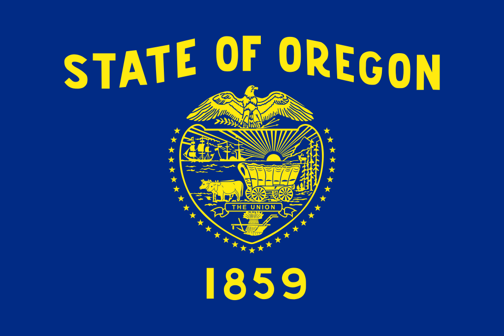
Официальный девиз штата — «Летит на собственных крыльях» (лат. Alis Volat Propriis). Официальное прозвище — «Бобровый штат» или «Штат бобра» (англ. Beaver State). Орегон — единственный штат США, имеющий двухсторонний флаг[5]. На одной стороне изображена печать штата, а на оборотной стороне — бобр.
 Alaska-AK
 Geography
 Delaware-DE
 Economy and trade
 Montana-MT
 New hampshire-NH
 Oregon-OR