漢德百科全書 | 汉德百科全书
 Greece
 Australia
 Belgium
 Chile
Chile
 Denmark
 Germany
 Estonia
 Finland
 France
 Greece
 Ireland
 Iceland
 Israel
 Italy
Italy
 Japan
Japan
 Canada
 Luxembourg
 Mexico
 New Zealand
 Netherlands
 Norwegen
 OECD
OECD
 Emiel van Lennep
 OECD
OECD
 Don Johnston
 OECD
OECD
 Jean-Claude Paye
 OECD
OECD
 José Ángel Gurría
 OECD
OECD
 Staffan Sohlman
 OECD
OECD
 Thorkil Kristensen
 Austria
 Poland
 Portugal
 Republic of Korea
 Sweden
 Switzerland
 Slovakia
 Slovenia
 Spain
Spain
 Czech Republic
 Turkey
 Hungary
 United States
 United Kingdom

 Important International Organizations

経済協力開発機構(けいざいきょうりょくかいはつきこう)は、国際経済全般について協議することを目的とした国際機関。公用語の正式名称は、英語では"Organisation[1] for Economic Co-operation and Development"(イギリス英語表記)、フランス語では"Organisation de Coopération et de Développement Economiques"。略称は英語ではOECD、フランス語ではOCDE。
本部事務局はパリ16区の旧ラ・ミュエット宮殿に置かれている。事務総長はアンヘル・グリア。
The Organisation for Economic Co-operation and Development (OECD; French: Organisation de Coopération et de Développement Économiques, OCDE) is an intergovernmental economic organisation with 37 member countries,[1] founded in 1961 to stimulate economic progress and world trade. It is a forum of countries describing themselves as committed to democracy and the market economy, providing a platform to compare policy experiences, seek answers to common problems, identify good practices and coordinate domestic and international policies of its members. Generally, OECD members are high-income economies with a very high Human Development Index (HDI) and are regarded as developed countries. As of 2017, the OECD member countries collectively comprised 62.2% of global nominal GDP (US$49.6 trillion)[3] and 42.8% of global GDP (Int$54.2 trillion) at purchasing power parity.[4] The OECD is an official United Nations observer.[5]
In 1948, the OECD originated as the Organisation for European Economic Co-operation (OEEC),[6] led by Robert Marjolin of France, to help administer the Marshall Plan (which was rejected by the Soviet Union and its satellite states).[7] This would be achieved by allocating United States financial aid and implementing economic programs for the reconstruction of Europe after World War II. (Similar reconstruction aid was sent to the war-torn Republic of China and post-war Korea, but not under the name "Marshall Plan".)[8]
In 1961, the OEEC was reformed into the Organisation for Economic Co-operation and Development by the Convention on the Organisation for Economic Co-operation and Development and membership was extended to non-European states.[9][10] The OECD's headquarters are at the Château de la Muette in Paris, France.[11] The OECD is funded by contributions from member countries at varying rates and had a total budget of €386 million in 2019.[2]
Although OECD does not have a power to enforce its decisions, which further require unanimous vote from its members, it is recognized as highly influential publisher of mostly economic data through publications as well as annual evaluations and rankings of members countries.[12]
L'Organisation de coopération et de développement économiques (OCDE) est une organisation internationale d'études économiques, dont les pays membres — des pays développés pour la plupart — ont en commun un système de gouvernement démocratique et une économie de marché. Elle joue essentiellement un rôle d'assemblée consultative1.
L'OCDE a succédé à l'Organisation européenne de coopération économique (OECE) issue du plan Marshall et de la Conférence des Seize (Conférence de coopération économique européenne) qui a existé de 1948 à 1960. Son but était l'établissement d'une organisation permanente chargée en premier lieu d'assurer la mise en œuvre du programme de relèvement commun (le plan Marshall), et, en particulier, d'en superviser la répartition2.
En 2020, l'OCDE compte 37 pays membres et regroupe plusieurs centaines d'experts. Elle publie fréquemment des études économiques et sociales — analyses, prévisions et recommandations de politique économique — et des statistiques, principalement concernant ses pays membres.
Le siège de l'OCDE se situe à Paris (16e), au château de la Muette. L'organisation possède également des bureaux dans plusieurs autres métropoles, notamment à Berlin, Mexico, Tokyo et Washington.
L'Organizzazione per la cooperazione e lo sviluppo economico (OCSE) – in inglese Organization for Economic Co-operation and Development (OECD), e in francese Organisation de coopération et de développement économiques (OCDE) – è un'organizzazione internazionale di studi economici per i paesi membri, paesi sviluppati aventi in comune un'economia di mercato.
L'organizzazione svolge prevalentemente un ruolo di assemblea consultiva che consente un'occasione di confronto delle esperienze politiche, per la risoluzione dei problemi comuni, l'identificazione di pratiche commerciali e il coordinamento delle politiche locali e internazionali dei paesi membri[1]. Ha sede a Parigi nello Château de la Muette[2].
Gli ultimi paesi ad aver aderito all'OCSE sono la Colombia (28 aprile 2020),la Lettonia (1º luglio 2016) e la Lituania (5 luglio 2018), per un totale di 36 paesi membri.
La Organización para la Cooperación y el Desarrollo Económico1 (OCDE) es un organismo de cooperación internacional, compuesto por 37 estados,34 cuyo objetivo es coordinar sus políticas económicas y sociales. La OCDE fue fundada en 1961 y su sede central se encuentra en el Château de la Muette en París (Francia). Los idiomas oficiales de la entidad son el francés y el inglés.2
En la OCDE, los representantes de los países miembros se reúnen para intercambiar información y armonizar políticas con el objetivo de maximizar su crecimiento económico y colaborar a su desarrollo y al de los países no miembros.
Conocida como «club de los países ricos»,56 a partir de 2017, sus países miembros comprendieron colectivamente el 62,2 % del PIB nominal global (US$49,6 billones) y el 42,8 % del PIB global (Int US$54,2 billones).7
Организа́ция экономи́ческого сотру́дничества и разви́тия (сокр. ОЭСР, англ. Organisation for Economic Co-operation and Development, OECD) — международная экономическая организация развитых стран, признающих принципы представительной демократии и свободной рыночной экономики.
Создана в 1948 году под названием Организа́ция европе́йского экономи́ческого сотру́дничества (англ. Organisation for European Economic Co-operation, OEEC) для координации проектов экономической реконструкции Европы в рамках плана Маршалла.
Штаб-квартира организации располагается в Шато де ла Мюетт, в Париже. Генеральный секретарь (с 2006 года) — Хосе Анхель Гурриа Тревиньо (Мексика). Руководящим органом ОЭСР является совет представителей стран — членов организации. Все решения в нём принимаются на основе консенсуса.
По данным на 2011 год, в странах ОЭСР проживало 18 % населения мира[2].

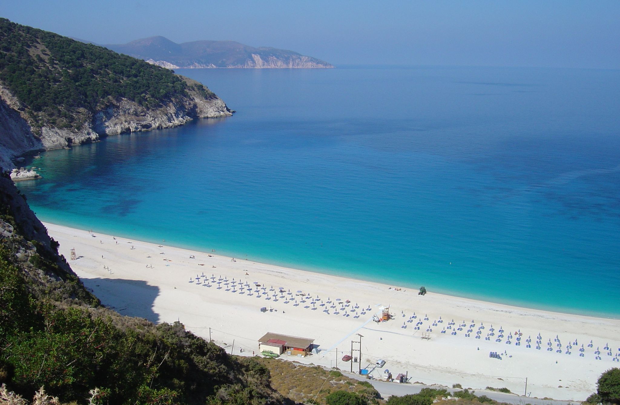
Kefalonia (neugriechisch Κεφαλονιά [kʲɛfalɔˈnja], altgriechisch Κεφαλληνία, Kephallēnía, italienisch Cefalonia und früher teilweise Cefalogna) ist eine griechische Insel am Ausgang des Golfs von Patras. Sie ist Teil der Präfektur Kefallinia und mit 734,014 km²[1] die größte der Ionischen Inseln. Kefalonia hatte nach vielen Jahren der Landflucht von 1991 bis 2001 eine starke Bevölkerungszunahme (mit 21,9 % zweithöchster Wert in Griechenland) durch Zuwanderung zu verzeichnen. Heute leben zirka 40.000 Einwohner auf der Insel.[2] Im heimischen Sprachgebrauch wird die Insel meist Kefalliniá (Κεφαλληνιά) genannt.
Der wichtigste Ort ist Argostoli an der Südwestküste, gefolgt von Lixouri. Die höchste Erhebung ist der Berg Enos mit 1.628 m über dem Meeresspiegel. Kefalonia ist touristisch gut erschlossen und wird im Sommer hauptsächlich von Briten besucht. Viele Italiener nutzen die Gewässer um die buchtenreiche Insel als Bootsrevier. Von Juni bis September sind die Übernachtungszahlen am höchsten, ab Oktober sind vor allem Athener zu Gast.
凯法洛尼亚岛[1](希腊语:Κεφαλονιά,罗马化:Kefaloniá),又名凯法利尼亚岛(希腊语:Κεφαλληνία,罗马化:Kefallinía),位于爱奥尼亚海上,为伊奥尼亚群岛中最大的岛屿。这个岛屿的名称据信来自于古希腊神话英雄刻法罗斯(Κέφαλος)。岛屿以荷马史诗中奥德修斯的故乡而著名,在《奥德赛》中荷马称其为“凯法利尼亚人的国王”。畅销小说及同名电影《柯莱利上尉的曼陀林》(又译《战地情人》)的故事背景也设在二次大战中被德军占领的该岛上。今天,岛上美丽的沙滩和洞穴每年吸引众多游客消夏,岛屿亦因为接近意大利本土而成为许多意大利人的热门旅游地点。
除了旅游业外,橄榄油制造亦是岛上经济的重要组成部分,岛上有超过100万棵橄榄树,覆盖了岛屿55%的面积。


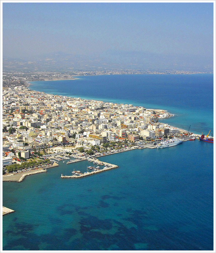
Korinth (griechisch Κόρινθος Kórinthos [ˈkɔrinθɔs] (f. sg.)) ist eine griechische Stadt mit über 30.000 Einwohnern (2011) am Isthmus von Korinth, also dem Isthmus, einer Landenge, welche die Peloponnes und das griechische Festland verbindet. Westlich dieser Landenge befindet sich der Golf von Korinth und östlich davon der Saronische Golf. Die antike Stadt Korinth liegt etwa 6 km südwestlich des Stadtzentrums der heutigen Stadt. Korinth ist nach Patras und Kalamata die drittgrößte Stadt der Peloponnes und war bis 2010 Verwaltungssitz der Präfektur Korinthia (Κορινθία Korinthía). Die Stadt wird von der Küstenebene Vocha im Westen, den Gerania-Bergen im Osten, und den Oneia-Bergen im Süden umgeben. Erdbeben haben die Stadt wiederholt zerstört.
Korinth liegt etwa 70 km westlich von Athen. Der Isthmus wurde in der Antike mit Schiffen überquert, indem sie auf Schiffskarren in vorgefertigten Spurrillen über die felsige Landenge geschleppt wurden. Die Trasse dazu ist unter dem Namen Diolkos bekannt. Seit Ende des 19. Jahrhunderts befindet sich hier jedoch der Kanal von Korinth.
科林斯(希腊语:Κόρινθος,发音 [ˈkorinθos] (ⓘ)),在新约圣经中又译哥林多或格林多,是希腊的历史名城之一,位于连接欧洲大陆及伯罗奔尼撒半岛的科林斯地峡上,西面是科林斯湾、东面是萨罗尼科斯湾,距离首都雅典约78公里。现今为科林西亚州的首府,人口38,132人(2011年)。
环绕该城的其他小镇,依顺时针方向次序,是位于海岸的Lechaio、Isthmia、Kechries及位于内陆的Examilia及科林斯古城。地理上环绕该城的是沿海狭窄的沃恰(Vocha)平原、科林斯湾、科林斯运河、萨罗尼科斯湾、奥涅亚山(Oneia),和建有中世纪卫城的独石“科林斯卫城”。


Kreta (griechisch Κρήτη Kriti (f. sg); schon im mykenischen Griechisch belegt im Wort ke-re-si-jo we-ke = Krēsio-wergēs (transkribiert aus der Linearschrift B); türkisch Girit, früher auch italienisch Candia (von arabisch Khandaq = Graben)) ist die größte griechische Insel und mit 8261,183 Quadratkilometern Fläche sowie 1066 Kilometern Küstenlinie die fünftgrößte Insel im Mittelmeer.[2] Die Region Kreta umfasst 8336 Quadratkilometer und schließt einige umliegende Inseln mit ein, von denen das, vor der kretischen Südküste gelegene, bewohnte Gavdos den südlichsten Punkt Europas markiert.
Die Insel hat insgesamt 625.000 Einwohner (Stand 2012). Verwaltungs- und Wirtschaftszentrum Kretas ist Iraklio, mit etwa 173.993 Einwohnern gleichzeitig die größte Stadt Kretas.
克里特岛[2](希腊语:Κρήτη,罗马化:Kriti / Crete;古希腊语:Κρήτη,罗马化:Krḗtē;土耳其语:Girit;圣书体:?????,转写:keftiu),旧译革哩底,圣经中又称迦斐托(古希伯来文:כפתור,转写:caphtor),位于地中海北部,是希腊第一大岛,地中海第五大岛,东西长244公里,最宽处56公里,总面积8,300平方公里。行政上属于克里特大区,中部为高山,最高峰海拔为2740公尺,南部山势陡峻,特别是西南部,全为峭壁,难以开辟公路,北部较平缓,居民多集中北岸。岛上主要为地中海气候。
克里特岛拥有漫长的文明史,是希腊乃至西方文明的源头。古时林木茂盛,农产丰富,人民善于航海和贸易,据荷马史诗所记说,“在深红葡萄酒色的海中,是一片美丽,富庶的土地,四面环水,岛上的人多得数不清,城市有九十个”。岛屿地处埃及、希腊、意大利及腓尼基之间,自古为战略要冲和贸易重镇,岛上有米诺斯王宫等遗迹。
克里特岛(Κρήτη;Crete),位于地中海北部,是希腊的第一大岛,总面积8,300平方公里。行政上属于克里特大区。米诺斯时期
克里特是最古老的欧洲文明──米诺斯文明的中心(也就是说,这里文明早于欧洲和希腊,而不是来自欧洲和希腊)。这种文明的起源几乎不为人所知(与小亚细亚地区的古老文明有关但与欧洲无关)。该文明留下的文字记录并不多,而且它们使用的是一种称作“线性文字A”的人们至今无法解读的文字。不过,该文明留下了大量精美的宫殿、房屋、道路、绘画以及雕塑。尽管早期克里特历史只留在荷马史诗之类的神话故事中(如米诺斯、铁修斯、弥诺陶洛斯、代达罗斯和伊卡洛斯的神话故事),史学家和诗人似乎传达给我们了人类在克里特岛上定居的悠久历史。最早的定居点可追溯到无陶新石器时代,人们养殖牛、羊、猪、狗等动物,并种植谷物、豆角等作物。 公元前1450年左右,克里特岛的宫殿遭到人为破坏,可能是由于巴尔干半岛希腊人(多利安人)的入侵。从这时起希腊人成了克里特岛的主宰,并逐渐与当地原有居民融合,克里特文明亦随之结束。
罗马时期
在罗马共和国时期,克里特因被罗马人怀疑暗中加入米特里达梯六世的阵营而卷入米特里达梯战争。罗马人派出马克·安东尼·克里提库斯于公元前71年攻打克里特却被击败,接着,昆图斯·卡埃基利乌斯·梅特鲁斯·克雷提库斯率领3个军团的兵力,经过3年苦战,才在公元前69年征服了克里特,梅特鲁斯本人还获得了“克里提库斯”(克里特的)的称号。之后,格尔蒂成为一个包括昔兰尼加的克里特省的首府。
拜占廷—鄂图曼时期
这段时期是克里特的动荡时期。克里特很长一段时间都是东罗马帝国(拜占廷)的属地,维持着安宁以及依然落后的文明,直到公元824年落入阿拉伯人之手,被建成了酋长国。960年,尼基福鲁斯·福卡斯让拜占廷重新接管了克里特一直到1204年在第四次十字军东征期间易主威尼斯。1669年,奥斯曼土耳其人从威尼斯人手中夺走了克里特岛。
1204年,君士坦丁堡沦陷,拜占庭帝国被瓜分后,克里特就归属威尼斯。在威尼斯人统治下,克里特的希腊人被文艺复兴的气氛熏陶着。到了17世纪,奥斯曼帝国击败威尼斯而占据克里特后,大部分岛屿在有名的坎迪亚大包围(1648–1669)中沦为奥斯曼的领地。
现代:隶属希腊
众多克里特人参加了开始于1821年的希腊独立战争。这场基督徒组织的暴动遭到了奥斯曼政权的激烈对抗,战争中处死了一些身为暴动头目的主教。1821—1828年间,该岛都是战争的中心。现在估算当时约有45%的岛民是穆斯林,其中又有一些是皈依基督教的秘密基督徒。许多人因动乱而逃离该岛。到了1900年,只有11%的岛民仍为穆斯林。他们常被称做“土耳其人”,即使他们之间语言、文化甚至祖先都不相同。这些剩下的穆斯林在1924年的希腊—土耳其人口交换事件中被迫离开。
在二战时期,克里特岛在1941年5月的克里特岛战役中成为关键。德国侵略者,特别是伞兵部队,夺取了英联邦伯纳德·弗赖伯格少将对岛的控制权,也夺走了地中海东部和爱琴海的制海权。
クレタ島(ギリシア語: Κρήτη / Kriti ; 英語: Crete)は、ギリシャ共和国南方の地中海に浮かぶ同国最大の島。古代ミノア文明が栄えた土地で、クノッソス宮殿をはじめとする多くの遺跡を持つ。また、温暖な気候や自然景観から地中海の代表的な観光地でもある。
クレタ島は島全体で、ギリシャ共和国の広域自治体であるペリフェリア(地方)を構成する。首府はイラクリオ(イラクリオン)。
Crete (Greek: Κρήτη, Kríti ['kriti]; Ancient Greek: Κρήτη, Krḗtē) is the largest and most populous of the Greek islands, the 88th largest island in the world and the fifth largest island in the Mediterranean Sea, after Sicily, Sardinia, Cyprus, and Corsica. Crete and a number of surrounding islands and islets constitute the region of Crete (Greek: Περιφέρεια Κρήτης), one of the 13 top-level administrative units of Greece. The capital and the largest city is Heraklion. As of 2011, the region had a population of 623,065.
Crete forms a significant part of the economy and cultural heritage of Greece, while retaining its own local cultural traits (such as its own poetry and music). It was once the centre of the Minoan civilisation (c. 2700–1420 BC), which is the earliest known civilisation in Europe. The palace of Knossos lies in Crete.[1]
La Crète, en grec Κρήτη, en grec ancien Krḗtē, grec moderne Kríti, est une île grecque, autrefois appelée « île de Candie ». Plus grande des îles grecques et cinquième île de la mer Méditerranée en superficie, elle est rattachée en 1913 à la Grèce, dont elle constitue, avec d'autres petites îles, l'une des treize périphéries (région administrative), ainsi que l'un des sept diocèses décentralisés créés par le programme Kallikratis en janvier 2011.
La Crète est le berceau de la civilisation minoenne, dont Knossos est le cœur et le site archéologique le plus important.
Creta (AFI: /ˈkrɛta/; in passato anche Creti, /ˈkrɛti/[1]; in greco Κρήτη, Kríti) è un'isola della Grecia, la maggiore e più popolosa del Paese e la quinta per estensione (8 261 km²) tra quelle del Mediterraneo dopo la Sicilia, la Sardegna, Cipro e la Corsica. Assieme agli isolotti contigui costituisce la periferia di Creta (in greco Περιφέρεια Κρήτης, Periféria Krítis), una delle province greche, e la diocesi decentralizzata di Creta (in greco Αποκεντρωμένη Διοίκηση Κρήτης, Αpokentroméni Diíkisi Krítis), una delle prefetture greche, due distinte seppur coestensive autorità con 623 065 abitanti e capoluogo Candia[2].
Tra il III e il II millennio a.C. l'isola fu il fulcro della civiltà minoica, una delle più antiche civiltà avanzate d'Europa, che aveva in Cnosso, Cidonia e Festo i suoi centri principali. Nel corso dei secoli fu conquistata e abitata da micenei, greci, romani, bizantini, musulmani andalusi, veneziani e turchi ottomani fino alla definitiva unificazione con lo stato greco nel 1913.
Creta è tra le principali mete turistiche della Grecia per via dei numerosi siti archeologici e naturalistici e per il particolare patrimonio culturale di cui dispone, espresso attraverso specificità linguistiche, letterarie, musicali e gastronomiche.
Creta (en griego: Κρήτη [Kriti]) es la isla más grande de Grecia y la quinta en tamaño del mar Mediterráneo. El archipiélago cretense conforma una de las trece periferias y una de las siete administraciones descentralizadas de Grecia. Hasta principios del siglo XX también se la conoció con el nombre de Candía, topónimo que deriva del latín candidus («blanco») y que le aplicaron los marinos y comerciantes italianos del Medievo. Posee una superficie de 8300 km2, una costa de 1040 kilómetros de longitud y una población de unos 620 000 habitantes. Su capital es Heraclión.
Creta fue antiguamente el centro de la civilización minoica (2700-1420 a. C.), considerada la más antigua civilización de la que se tienen registros en Europa.1
Крит[1][2] (греч. Κρήτη) — самый большой греческий остров, пятый по величине остров в Средиземном море. Расположен в 110 км от Европы, в 175 км от Азии и в 300 км от Африки. Географически относится к Европе. Крит омывается тремя морями — Критским на севере, Ливийским на юге и Ионическим на западе. Административный центр — город Ираклион.
Площадь острова составляет 8261,183 квадратных километров[3] (вместе с островами Гавдос и Дия — 8312,635 квадратных километров[3]), протяжённость береговой линии — 1066 километров[4].
Периферия Крит составляет одну из тринадцати периферий Греции и является одним из крупнейших экономических и культурных центров страны.
Туристическая инфраструктура Крита лучше, чем на других островах, — Крит считается одним из самых популярных европейских курортов. Туристические достопримечательности Крита включают археологические раскопки в Кноссе, Малии, Фесте, Гортине и т. д., венецианскую крепость Фортецца в Ретимноне, Самарийское ущелье, плато Ласити и Диктейскую пещеру, остров Имери-Грамвуса с бухтой Балос, а также уникальное в своем роде пресноводное озеро Курна.
В древности Крит был центром минойской цивилизации, процветавшей на острове приблизительно с 2600 по 1400 годы до н. э. и считающейся древнейшей в Европе.


克诺索斯(希腊语:Κνωσός)是克里特岛上的一座米诺斯文明遗迹,被认为是传说中米诺斯王的王宫。它位于克里特岛的北面,海岸线的中点,是米诺斯时代已发现最为宏伟壮观的遗址,可能是整个文明的政治和文化中心。克诺索斯遗址是由英国考古学家阿瑟·伊文思于1878年进行了最早的完整发掘,发现了大批米诺斯遗迹,和许多刻有使用线形文字A的文本的泥板,揭示了米诺斯文明的存在。其中最为辉煌的米诺斯王宫始建于约前2100年至前1800年,后几经扩建,占地约一万三千平方米,围绕着一个1200平方米的中心院落展开成四个翼,上下五层楼,共有一千多间房间。
克里特岛(Crete)位于希腊半岛南边,地理位置与埃及相近,以宫殿为中心发展[3]。荷马记录说克里特岛有90个城市,米诺斯原址是最重要的一个。几千年来,如果克诺索斯没有那个神话传说,它基本上就是一个默默无闻的边缘地带。伊文斯发现的不仅仅是一座废墟,而是古老的克里特文明。这一发现将使古希腊的文明史向前推进了将近一千年。虽然创造的文明已成为遗迹,但是希腊伯罗奔尼撒半岛的迈锡尼继承了米诺斯的文明,成为新的爱琴文明中心,欧洲文明于是得以此基础进步发展[4][5]。
Knossos (griechisch Κνω(σ)σός Knōs(s)os (f. sg.), lateinisch Cnossus oder Cnosus, ägyptisch Kunuša, mykenisch ??? Ko-no-so in Linearschrift B)[1] war ein antiker Ort auf Kreta, etwa fünf Kilometer südlich von Iraklio. Bekannt ist er vor allem durch den Palast von Knossos, der neben den Palästen von Malia, Phaistos und Kato Zakros der größte minoische Palast auf Kreta ist und von Griechenland mit dem Europäischen Kulturerbe-Siegel ausgezeichnet wurde. Knossos blieb auch nach Zerstörung des Palastes bis in die byzantinische Zeit besiedelt.

Die Transadriatische Pipeline (auch Trans-Adria-Pipeline), offizieller englischer Name Trans Adriatic Pipeline (TAP), ist eine 878 Kilometer lange Erdgaspipeline. Seit dem 31. Dezember 2020 leitet sie aserbaidschanisches Gas durch Griechenland, Albanien und das Adriatische Meer nach Süditalien. Die TAP ist in Kipoi an der türkisch-griechischen Grenze mit der Transanatolischen Pipeline (TANAP) verbunden, die Erdgas aus dem kaspischen Raum durch die Türkei nach Westen transportiert. Mit dem Bau der TAP ist 2015 begonnen worden.
跨亚得里亚海管道 (英语:Trans Adriatic Pipeline,TAP,阿尔巴尼亚语:Gazsjellësi Trans-Adriatik,希腊语:Διαδριατικός Αγωγός Φυσικού Αερίου - Diadriatikós Agogós Fysikoú Aeríou,意大利语:Gasdotto Trans-Adriatico) 是2003年倡议的天然气管道,于2016年开始兴建,2020年开始运营,从里海的阿塞拜疆一路经过欧洲的希腊、阿尔巴尼亚到达亚得里亚海的意大利。


 Economy and trade
 Geography
 History
 Energy resource
 Companies
 Puglia
 Ships and Nautics