漢德百科全書 | 汉德百科全书
 泰国
泰国

Der Golf von Bengalen (bengalisch বঙ্গোপসাগর baṅgopasāgar; indonesisch Teluk Benggala;malaiisch Teluk Bengal; thailändisch อ่าวเบงกอล; seltene deutsche Bezeichnungen: Bengalischer Golf, Bengalischer Meerbusen, Bai von Bengalen[1][2][3][4]) ist ein nordöstliches Randmeer des Indischen Ozeans mit einer Fläche von rund 2.171.000 km². Er ist 2090 km lang und bis zu 1610 km breit und hat grob gesehen die Form eines Dreiecks. Der Golf ist durchschnittlich 2600 Meter und maximal 4694 Meter tief. Er trennt die Landmasse des indischen Subkontinents von der Halbinsel Hinterindien. Das Klima ist vom Monsun geprägt. Besonderheiten der Region sind insbesondere eine Reihe von Schlammvulkanen sowie die größten Mangrovenwälder der Erde, wie die Sundarbans.
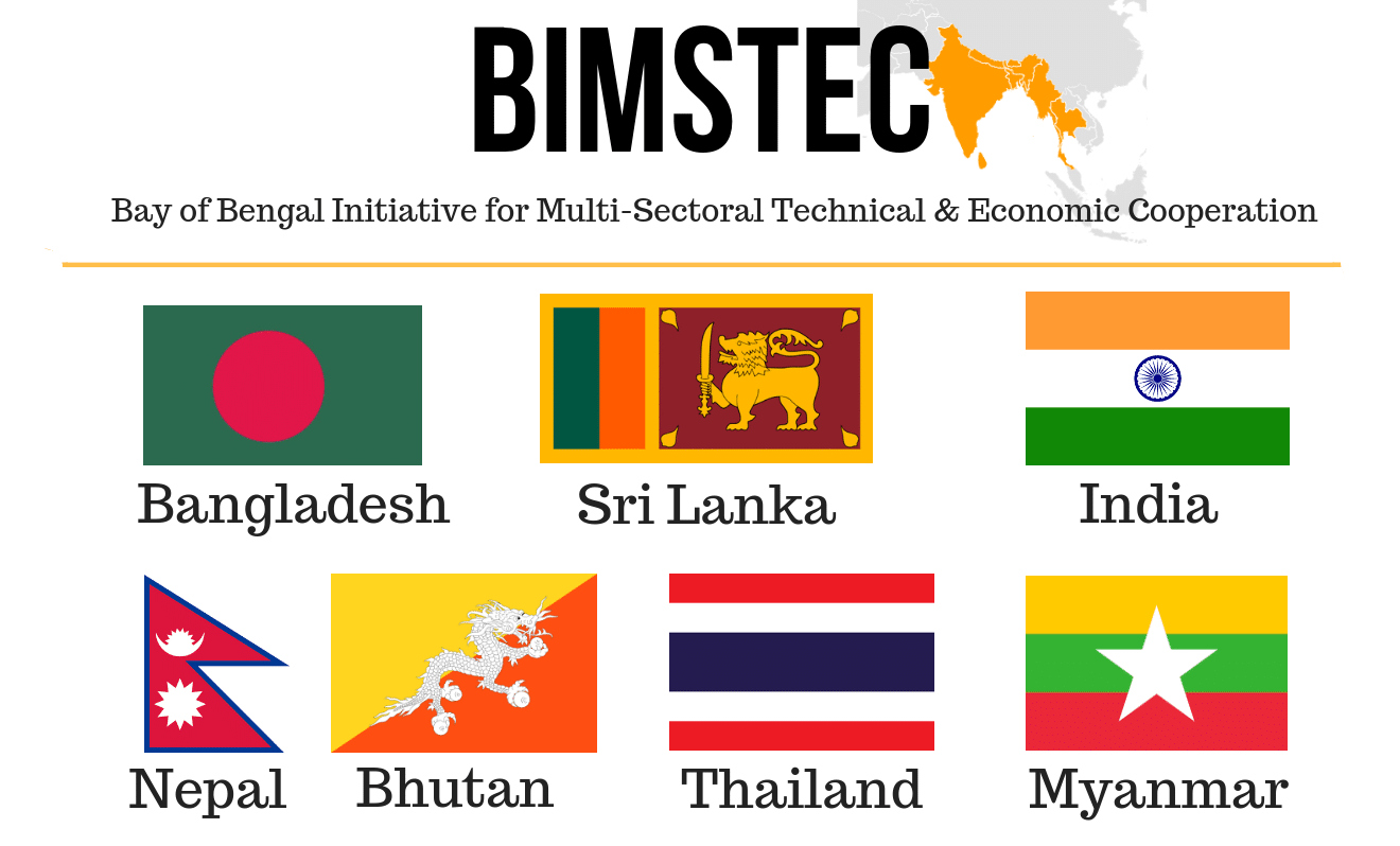
Der Golf von Bengalen wird im Westen von Sri Lanka und Indien, im Norden von der namensgebenden Region Bengalen, bestehend aus dem Staat Bangladesch und dem indischen Bundesstaat Westbengalen sowie im Osten von Myanmar, Thailand und Indonesien begrenzt. Im Süden ist er mit dem Indischen Ozean verbunden. Als ungefähre Abgrenzung des Golfes kann eine gedachte Linie zwischen der Südspitze Sri Lankas und der Nordspitze der zu Indonesien gehörenden Insel Sumatra angenommen werden.
孟加拉湾(印地语:बंगाल की खाड़ी、孟加拉语:বঙ্গোপসাগর、缅甸语:ဘင်္ဂလားပင်လယ်အော်)是印度洋北部的一个海湾,西临印度半岛,东临中南半岛,北临缅甸和孟加拉国,南在斯里兰卡至苏门达腊岛一线与印度洋本体相交,经马六甲海峡与暹罗湾和南海相连。宽约1600公里,面积217万平方公里;水深2000-4000米,南部较深;盐度30-34‰。
沿岸国家有印度、孟加拉国、缅甸、泰国、斯里兰卡、马来西亚和印度尼西亚。
印度和缅甸的一些主要河流均流入孟加拉湾,著名的大河有:恒河、布拉马普特拉河、伊洛瓦底江、萨尔温江、克里希纳河等等。孟加拉湾中著名的岛屿包括斯里兰卡岛、安达曼群岛、尼科巴群岛、普吉岛等。
孟加拉湾沿岸贸易发达,主要港口有:印度的加尔各答、金奈、本地治里、孟加拉国的吉大港、缅甸的仰光、毛淡棉、泰国的普吉、马来西亚的槟榔屿、印度尼西亚的班达亚齐、斯里兰卡的贾夫纳等等。
ベンガル湾(ベンガルわん、Bay of Bengal)は、インド洋の北東部分の湾。湾はほぼ三角形で、南方に開けた形となっている。東にマレー半島、西にインド亜大陸、北に名前の元となったインドの西ベンガル州およびバングラデシュに面している。南端はスリランカとアンダマン・ニコバル諸島連邦直轄地に面している。同諸島の東側の海域はアンダマン海と呼ばれる。
インドやバングラデシュの多くの川がベンガル湾に流れ込んでいる。北からはガンジス川、メグナ川とブラマプトラ川が流れ込み、南西の沿岸であるオリッサ州からはマハナディ川、ゴータヴァリー川、クリシュナ川、カヴェリ川が流れ込んでいる。湾の北端のインド領には、スンダルバンス国立公園があり、豊かなマングローブの林がある。ミャンマーのエーヤワディー川もベンガル湾に流れ込んでいる。
チェンナイ(旧名マドラス)やコルカタ(旧名カルカッタ)といった大都市がベンガル湾に接しており、古くから交易拠点として栄えてきた。
The Bay of Bengal is the northeastern part of the Indian Ocean, bounded on the west and northwest by India, on the north by Bangladesh, and on the east by Myanmar and the Andaman and Nicobar Islands of India. Its southern limit is a line between Sangaman Kanda, Sri Lanka and the north westernmost point of Sumatra (Indonesia). It is the largest water region called a bay in the world. There are countries dependent on the Bay of Bengal in South Asia and Southeast Asia. In ancient India, Bay of Bengal was known as Kalinga Sagar. Later during the British India, it came forth as the Bay of Bengal after the historic Bengal region, as the Port of Kolkata served as the gateway to the Crown rule in India. Cox's Bazar, the longest sea beach in the world and Sundarbans, the largest mangrove forest and the natural habitat of the Bengal tiger, are located along the bay.
The Bay of Bengal occupies an area of 2,600,000 square kilometres (1,000,000 sq mi). A number of large rivers flow into the Bay of Bengal: the Ganges–Hooghly, the Padma, the Brahmaputra–Jamuna, the Barak–Surma–Meghna, the Irrawaddy, the Godavari, the Mahanadi, the Brahmani, the Baitarani, the Krishna and the Kaveri. Among the important ports are Chennai, Ennore, Chittagong, Colombo, Kolkata-Haldia, Mongla, Paradip, Port Blair, Thoothukudi, Visakhapatnam and Dhamra. Among the smaller ports are Gopalpur Port, Kakinada and Payra.
Le golfe du Bengale (bengali : বঙ্গপসাগর, anglais : Bay of Bengal) est une mer qui forme la partie du nord-est de l'océan Indien. Elle a la forme d'un triangle encadré à l'est par les côtes birmanes jusqu'au cap Negrais puis par les archipels Andaman et Nicobar, et à l'ouest par le sous-continent indien. Au nord du golfe, on trouve l'état indien du Bengale-Occidental et le Bangladesh, d'où provient son nom. Ses limites méridionales sont le pont d'Adam puis une ligne ouest-est ayant son origine à la pointe sud de l'île de Sri Lanka, et finissant à la pointe nord de l'île indonésienne de Breueh (Pulau Breueh), non loin de Sumatra.
Il golfo del Bengala (বঙ্গোপসাগর in bengalese, ဘင်္ဂလားပင်လယ်အော် in birmano, बंगाल की खाड़ी in hindi e බෙංගාල බොක්ක in singalese) è l'insenatura più ampia del mondo e, per le sue dimensioni (2.172.000 km² di superficie), al punto che può essere considerato un mare vero e proprio. Di forma approssimativamente triangolare, costituisce la parte nordorientale dell'Oceano Indiano ed è collocato fra il Subcontinente indiano a ovest e l'Indocina ad est.
El Golfo de Bengala es un mar en el área noreste del océano Índico. Su forma se parece a un triángulo. Limita al este con la península de Malaca, al oeste con el subcontinente indio. El extremo norte del golfo limita con el estado indio de Bengala Occidental y con Bangladés. Los extremos del sur están limitados por la isla de Sri Lanka y el territorio indio de las Islas Andamán y Nicobar. Estas últimas islas separan el golfo de Bengala del mar de Andamán (también mar de Birmania).
Muchos de los ríos principales de la India desembocan desde el oeste en la bahía de Bengala: en el norte el río Ganges (o Ganga), el río Meghna y el río Brahmaputra. Al sur el Mahanadi, el Godavari, el Krishna y el Kaveri (también escrito Cauvery). El bosque de mangle llamado los Sundarbans está situado en el delta que forman los ríos Ganges, Brahmaputra y Meghna en el golfo de Bengala.
Los puertos indios más importantes del golfo son Madrás, Vishakhapatnam, Calcuta y Pondicherry.
Бенга́льский зали́в (бенг. বঙ্গোপসাগর, там. வங்காள விரிகுடா, хинди बंगाल की खाड़ी, англ. Bay of Bengal[1]) — морской залив, расположенный в северо-восточной части Индийского океана, омывает берега Индии, Бангладеш, Мьянмы и Шри-Ланки. На западе ограничен полуостровом Индостан, на востоке — побережьем Мьянмы и островными дугами Андаманских и Никобарских островов. У северной оконечности залива располагается историческая область Бенгалия (включающая современную Бангладеш и индийский штат Западная Бенгалия), давшая ему название. Является самым большим заливом в мире, его площадь — 2191 тысяча км²[2] (по другим данным 2173 тысячи км²[1]). Наибольшая глубина — 4519 м[2], средняя — 2600 м[1].
В Бенгальский залив впадают многие крупные реки — Ганг, Брахмапутра и Мегхна (общий эстуарий), Кришна, Годавари, Кавери, Маханади, Иравади.
На северо-восточном побережье залива, у города Кокс-Базар (Бангладеш) расположен самый протяжённый в мире пляж (120 км).
По гидрологическому, гидрохимическому и прочим параметрам Бенгальский залив относится к морям.

Der Saluen (chinesisch 怒江, Pinyin Nù Jiāng) entspringt im Hochland von Tibet (Volksrepublik China) als Nag-Tschu. Dort liegt seine Quelle in 5450 m ü. NN Höhe in einem (variablen) Gletschertor zwischen dem nördlichen (5881 m ü. NN) und dem südlichen Chrebet-Peak (5722 m ü. NN) im östlichen Tanggula Shan (34 km südöstlich des nördlichen Tanggula-Passes, 5231 m ü. NN). Der Gletscher schmilzt stark zurück. Der Nag-Tschu verläuft in südöstlicher Richtung durch die chinesische Provinz Yunnan. In Myanmar (ehemals Birma) durchschneidet er das Shan-Hochland dort, wo er die Grenze von China und Myanmar bildet. In dieser Gegend fließen nur wenig weiter östlich der Mekong und der Jangtsekiang in ebenfalls tief eingeschnittenen Tälern. In seinem Unterlauf bildet er auf einer kurzen Strecke die Grenze zwischen Myanmar und Thailand und mündet schließlich beim Hafen von Mawlamyine an der Küste von Myanmar in das Andamanische Meer, ein Teil des Indischen Ozeans.
Der Saluen ist aufgrund seiner zahlreichen Stromschnellen nur auf etwa 120 km oberhalb der Mündung schiffbar, flussaufwärts verkehren jedoch kleinere Motorboote und Frachtkähne. Der Fluss ist bis ins Jahr 2005 noch relativ naturbelassen.
Der Saluen ist durch die menschlichen Entwaldungen erheblichen Gefahren für Hangrutschungen (Muren) ausgesetzt. Hierdurch hat sich die Sedimentfracht deutlich erhöht.
怒江(藏文:རྒྱལ་མོ་རྔུལ་ཆུ་,威利:rgyal mo rngul chu),是萨尔温江上游中国境内河段的名称,发源于西藏自治区那曲市安多县境内唐古拉山南麓的将美尔岗尕楼冰川,流经西藏自治区、云南省,流入缅甸后改称萨尔温江。干流长度2,013公里,流域面积12.48万平方公里。[1][2]。
怒江上游因江水深黑,中国最早的地理著作《禹贡》把它称为黑水河;藏语名为那曲(藏文:ནག་ཆུ་,威利:nag chu),义同。怒江在当地的怒族中被称为阿怒日美,“阿怒”是怒族人的自称,“日美”在汉语中译为江,“阿怒日美”就是怒族人居住区域的江,故名怒江。流入缅甸后改称萨尔温江(缅甸语:သံလွင်မြစ်,[θàɴlwɪ̀ɴ mjɪʔ])。 怒江上游为那曲,发源于西藏自治区那曲市安多县境内唐古拉山南麓的将美尔岗尕楼冰川,源流区河段名为将美尔曲[2]。它先向南转西再转西南流,汇集左侧支流后改称朵尔丁曲。它向南以“S”形流,汇集右侧支流仲朵曲后改称朵果尔曲[3]。该曲流至帮美附近纳左侧支流后,改称桑曲,随后河道转向西南流,穿越青藏铁路后注入错那湖[4]。干流由错那湖南端流出后,始称那曲[5]。
怒江是中国西南地区的大河之一,又称潞江,上游藏语叫“那曲河”,发源于青藏高原的唐古拉山南麓的吉热拍格。它深入青藏高原内部,由怒江第一湾西北向东南斜贯西藏东部的平浅谷地,入云南省折向南流,经怒江僳僳族自治州、保山市和德宏傣族景颇族自治州,流入缅甸后改称萨尔温江,最后注入印度洋的安达曼海。从河源至入海口全长3240公里,中国部分2013公里,云南段长650公里;总流域面积32.5万平方公里,中国部分13.78万平方公里;径流总量约700亿立方米,省内流域面积3.35万平方公里,占云南省面积8.7%。
サルウィン川(ビルマ語: သံလွင်မြစ်; sam lwang mrac; モン語:သာန်လာန်; san lon; チベット語: རྒྱལ་མོ་རྔུལ་ཆུ།; ワイリー方式:rgyal mo rngul chu; 蔵文拼音:Gyalmo Ngulchu; 中国語: 怒江[1])はチベットを源流とし、中国雲南省を流れ、ミャンマー(ビルマ)北東部のシャン台地にあるカヤー州・カレン州を南下してマルタバン湾(アンダマン海)に注ぐ川。一部ミャンマーとタイの国境を成す。長さは2,815kmにおよぶ。
急流が多く、しばしばこの流域は “中国のグランドキャニオン”、“アジアの大地溝帯” などとよばれ、河口から119kmの地点までしか船が入れない。そのため経済的には流域の殆どの地域で役に立っておらず、ミャンマーの一部地域で木材の搬出に利用されている程度である。
その一方、流域には7,000種を超える植物と、80種の希少種および絶滅危惧種の動物と魚が暮らす。ユネスコはこの流域を「世界で最も多様性に富む温帯生態系かもしれない」とし、2003年、上流域を世界遺産に登録した。(→三江併流)ヌー族(怒族)は中華人民共和国が公的に認知している56の少数民族の一つで、この民族名はこの川の中国名 怒江から名づけられた。
The Salween or, officially, Thanlwin[2] River (Phlone ကၟံင့်ယှောတ်ခၠေါဟ်; Burmese: သံလွင်မြစ်; MLCTS: sam lwang mrac; IPA: [θàɴlwɪ̀ɴ mjɪʔ]; Thai: แม่น้ำสาละวิน Mae Nam Salawin; IPA: [mɛ̂ː náːm sǎːləwin]),[a] known in China as the Nu River (Chinese: 怒江; pinyin: Nù Jiāng[b]), is a river about 2,815 kilometres (1,749 mi) long that flows from the Tibetan Plateau into the Andaman Sea in Southeast Asia.
It drains a narrow and mountainous watershed of 324,000 square kilometres (125,000 sq mi) that extends into the countries of China, Burma and Thailand. Steep canyon walls line the swift, powerful and undammed Salween, one of the longest free-flowing rivers in the world.[4][5] Its extensive drainage basin supports a biodiversity comparable with the Mekong and is home to about 7 million people. In 2003, key parts of the mid-region watershed of the river were included within the Three Parallel Rivers of Yunnan Protected Areas, a UNESCO World Heritage Site.[6]
The people who live on the Salween are relatively isolated from the rest of the world. The river is only navigable up to 90 kilometres (56 mi) from the mouth, and only in the rainy season.
The Burma Road was constructed between 1937 and 1938 during the Second Sino-Japanese War and crossed the river at the Huitong bridge. The Huitong bridge was blown by the retreating Chinese army and the river became the frontline from 1942 to 1944. The Salween Campaign of World War II, was launched in order to liberate occupied China and open the Burma Road again and connect it to the Ledo Road.
Logging began on the mountains surrounding the Salween in the late 20th century, and has damaged the river's ecology. In recent years, there have been a number of proposals to dam the Salween River, both upstream in China and downstream in Myanmar, which have prompted social and environmental concerns as well as widespread opposition.[4][7] Construction of at least one upstream dam on a tributary of the Salween is currently underway in China's Yunnan province, with many more expected to follow.
La Salouen (tibétain : རྒྱ་མོ་དངུལ་ཆུ་, Wylie : rGya mo dNGul chu ; chinois : 怒江 ; pinyin : , Birman : Thanlwin Myit, Thaï : สาละวิน (Saalawin), en français fleuve nu ou fleuve en colère) est un fleuve de Chine et de Birmanie, dont le bassin s'étend également sur la Thaïlandenotes 1, le deuxième par sa longueur en Asie du Sud-Est après le Mékong, mais devant l'Irrawaddy. Son bassin, étroit et peu peuplé, est surtout caractérisé par une très riche biodiversité aujourd'hui menacée par les projets de construction de nombreux barrages hydroélectriques perturbant l'écosystème.
Il Saluen (in inglese: Salween; in tibetano: རྒྱལ་མོ་རྔུལཆུ།, Wylie: rGyl mo rNGul chu o Gyalmo Ngulchu; in cinese: 怒江S, NùjiāngP, in birmano: သံလွင်မြစ်, birmano traslitterato: Thanlwin; in shan: ၼမ်ႉၶူင်း, shan traslitterato: Nam Kong; in thai: สาละวิน, RTGS: Salawin; in mon: သာန်လာန်, mon traslitterato: San Lon) è un fiume asiatico che nasce nel Tibet centro orientale e sfocia nel golfo di Martaban, che fa parte del mare delle Andamane, nella Birmania meridionale. Con i suoi 2.815 km di lunghezza,[1] poco meno del Danubio, è il fiume più lungo dell'Indocina dopo il Mekong.
El río Salween (también transliterado Saluén o Salawi) (en chino, Nù Jiāng) es un largo río que discurre por el Sureste Asiático.
Nace en el este del Tíbet, fluyendo generalmente hacia el sur durante casi 2400 km a través de la provincia de Yunnan, China, y al este de Birmania, desembocando en el golfo de Martaban del mar de Andamán en Mawlamyaing.
En su curso inferior delimita la frontera entre Birmania y Tailandia por cerca de 130 km. Es el segundo río más largo de Birmania, después del río Irawadi. Solamente es navegable en embarcaciones pequeñas en ciertos tramos, ya que hay zonas de peligrosos rápidos que impiden su uso como vía navegable.
China planea construir en los próximos años una gran cantidad de represas en la región, sin coordinación ni acuerdo previo alguno con las otras dos naciones que se encuentran río abajo. Está considerado como el segundo río más contaminado del mundo, detrás del río Citarum.
Салуи́н[1] (бирм. သံလွင်မြစ် — Танлуин[2], на тер. Китая — Наг-Чу[3] (тиб. ནག་ཆུ) и Нуцзя́н[4] (кит. 怒江)) — река в Китае, Мьянме и Таиланде. Длина 2400 км (по другой оценке — около 3200 км), площадь бассейна 325 тыс. км².[источник не указан 759 дней] Также носит названия Нам-Конг[5], Кагчу[6], Акчу[7].
Салуин берёт начало в Тибетском автономном районе Китая, на высоте около 4547 м, из озера Цлацо[7]. Течёт на юго-восток, затем через провинцию Юньнань — почти строго на юг, сохраняя это направление практически до самого устья. В нижнем течении русло реки проходит вдоль восточных границ Мьянмы, на отрезке длиной порядка 100 км Салуин образует границу между Мьянмой и Таиландом. Река впадает в залив Моутама Андаманского моря (часть Индийского океана).


 汽车
汽车

 展览会
展览会

 建筑艺术
建筑艺术

 运输和交通
运输和交通

 企业
企业

 国际城市
国际城市

 医疗、制药、 康复

 宗教
宗教

 体育
体育

 手拉手
手拉手

 地理
地理
