
Deutsch-Chinesische Enzyklopädie, 德汉百科
 Jiangxi Sheng-JX





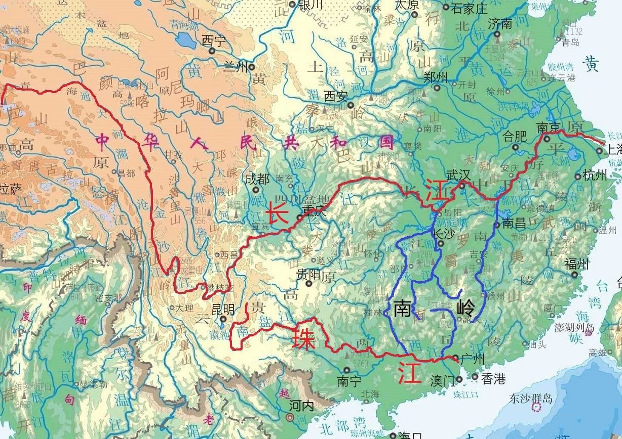
Das Nan Ling auch Nanling-Gebirge (南嶺山脈 / 南岭山脉, Nánlǐng Shānmài), kurz auch Nan Ling bzw. Nanling (南嶺 / 南岭, Nánlǐng – „Südliches Gebirge“) genannt, ist ein Gebirge in Südchina, das sich an der Grenze der Provinzen Hunan, Jiangxi, Guangdong und des Autonomen Gebiets Guangxi hinzieht.
Es bildet die Wasserscheide zwischen dem Jangtsekiang und dem Perlfluss eine natürliche Grenzlinie Südchinas. Auf einer Länge von ca. 600 Kilometern verläuft es in Westost-Richtung, es ist ca. 200 km breit. Ein weiterer Name für das Gebirge ist Wuling-Gebirge (五嶺山脈 / 五岭山脉, Wǔlǐng Shānmài), auch als Wu Ling bzw. Wuling (五嶺 / 五岭, Wǔ Lǐng – „Fünf Gebirge“) bekannt, da es aus den fünf großen Gebirgsketten Yuecheng (越城嶺 / 越城岭, Yuèchéng Lǐng), Dupang (都龐嶺 / 都庞岭, Dōupáng Lǐng), Mengzhu (萌渚嶺 / 萌渚岭, Méngzhǔ Lǐng), Qitian (騎田嶺 / 骑田岭, Qítián Lǐng) und Dayu (大庾嶺 / 大庾岭, Dàyǔ Lǐng) besteht. Auch das Jiulian-Gebirge (九連山 / 九连山, Jiǔlián Shān) an der Grenze zwischen Jiangxi und Guangdong zählt dazu. Im Gebiet südlich des Gebirges herrscht tropisches Klima.
南岭(南岭山脉;五岭、五岭山脉),由越城岭、都庞岭、萌渚岭、骑田岭、大庾岭五座山组成,故又称“五岭”。地处广东、广西、湖南、江西四省区交界处,是中国江南最大的横向构造带山脉,是长江和珠江二大流域的分水岭。长期以来,是天然屏障,先秦时期南岭山脉阻碍了岭南地区与中原的交通与经济联系,使岭南百越地区的经济、文化体系隔绝于中原地区以外。唐朝朝廷于张九龄倡议下在大庾岭开凿梅关古道,改善进出岭南交通,岭南与中原交流日益频繁,促进岭南开发。古代的统治者总是利用南岭作为划分行政区界的地物标志,所以南岭也是诸省区的边缘。南岭将建设成为广东省首个国家公园。
 Anhui Sheng-AH
 Beijing Shi-BJ
 Chongqing Shi-CQ
 Fujian Sheng-FJ
 Guangdong Sheng-GD
 Hebei Sheng-HE
 Hubei Sheng-HB
 Hunan Sheng-HN
 Jiangsu Sheng-JS
 Jiangxi Sheng-JX
 Jilin Sheng-JL
 Liaoning Sheng-LN
 Nei Mongol Zizhiqu-NM
 Shaanxi Sheng-SN
 Shandong Sheng-SD
 Shanghai Shi-SH
 Sichuan Sheng-SC
 Tianjin Shi-TJ
 Zhejiang Sheng-ZJ
 Music
Music


 Military, defense and equipment
 Architecture
 Sport
Sport
 Theme park
 Geography
 Economy and trade