
漢德百科全書 | 汉德百科全书
 Mexico

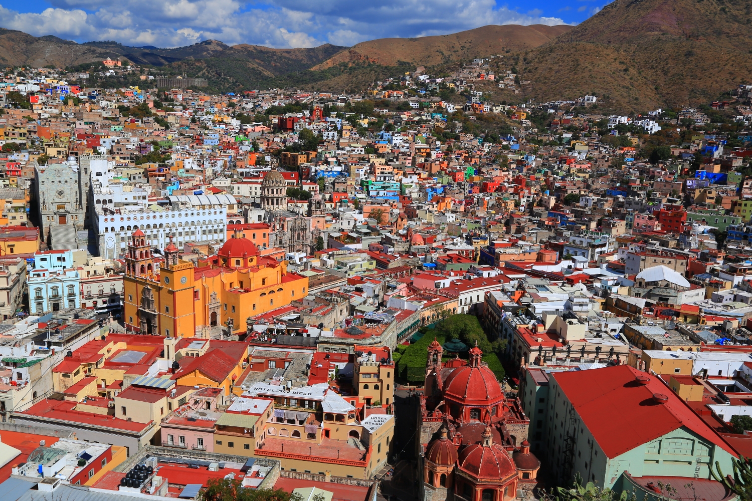
Guadalajara spanisch [gwaðalaˈxaɾa] ist die Hauptstadt des Bundesstaates Jalisco und mit ca. 1,9 Mio. Einwohnern (Stadt) und ca. 5 Mio. (Metropolitanregion) die zweitgrößte Stadt in Mexiko. Die Stadt ist Sitz eines Erzbischofs und ist auch bekannt unter dem Namen Perla del Occidente (spanisch für „Perle des Westens“). Die Einwohner der Stadt werden als tapatíos bezeichnet. Die Stadt ist Ausgangspunkt vieler mexikanischer Traditionen wie der Musik der Mariachi und des Tanzes Jarabe Tapatío. Guadalajara liegt im Westen des zentralmexikanischen Hochlandes, etwa 550 km (Fahrtstrecke) nordwestlich der Hauptstadt Mexiko-Stadt in einer Höhe von ca. 1590 m. Das Klima ist gemäßigt bis warm; Regen (ca. 940 mm/Jahr) fällt überwiegend im Sommerhalbjahr.
瓜达拉哈拉市(西班牙语:Guadalajara、纳瓦特尔语:Atemaxac)是墨西哥哈利斯科州的首府,也是瓜达拉哈拉大都市区的首府、墨西哥第二大城市。瓜达拉哈拉市地处墨西哥西太平洋区,在哈里斯科州的中心,建立于1542年,面积187.91平方公里,海拔高度1560米。
瓜达拉哈拉是墨西哥的文化、工业和经济重镇,市内设有轻轨系统。因其传统、文化休闲的魅力和烹饪而闻名于世,有西方之珠(Pearl of the Occident )的称号[1]。大街上富有殖民时期传统特色的建筑也显现出城市四个半世纪的文化底蕴。墨西哥是世界上唯一酿造龙舌兰酒(tequila,因出产该酒的小镇而得名)的国家,而龙舌兰酒原产地即为哈里斯科州,目前该酒原产地权由墨西哥政府持有。
 Australia
 China
China
 Germany
 France
 ITU World Championship Series
 Japan
Japan
 Canada
 Kasachstan
 Mexico
 New Zealand
 Netherlands
 Austria
 Portugal
 Republic of Korea
 Sweden
 Switzerland
 Spain
Spain
 South Africa
 Hungary
 United Arab Emirates
 United States
 United Kingdom
 United Kingdom
 Bermuda


 Argentina
 Australia
 Belgium
 Brazil
 China
China
 Denmark
 Germany

 Financial
 International Bank for Cooperation
 France
 India
India
 Indonesia
 Internationaler Währungsfonds
 Camille Gutt
 Internationaler Währungsfonds
 Christine Lagarde
 Internationaler Währungsfonds
 Dominique Strauss-Kahn
 Internationaler Währungsfonds
 Horst Köhler
 Internationaler Währungsfonds
 Ivar Rooth
 Internationaler Währungsfonds
 Jacques de Larosière
 Internationaler Währungsfonds
 Johan Witteveen
 Internationaler Währungsfonds
 Michel Camdessus
 Internationaler Währungsfonds
 Per Jacobsson
 Internationaler Währungsfonds
 Pierre-Paul Schweitzer
 Internationaler Währungsfonds
 Rodrigo Rato
 Internationaler Währungsfonds
 Kristalina Georgiewa
 Italy
Italy
 Japan
Japan
 Canada
 Malaysia
 Mexico
 Netherlands
 Nigeria
 Norwegen
 Austria
 Poland
 Republic of Korea
 Russia
 Saudi Arabia
 Sweden
 Switzerland
 Spain
Spain
 South Africa
 Venezuela
 United States
 United Kingdom

 Washington, D.C.

 Important International Organizations

 Economy and trade
 Economic and political research

Der Internationale Währungsfonds (IWF; englisch International Monetary Fund, IMF; auch bekannt als Weltwährungsfonds) ist eine rechtlich, organisatorisch und finanziell selbständige Sonderorganisation der Vereinten Nationen mit Sitz in Washington, D.C., USA.
Hauptaufgabe des IWF ist die Vergabe von Krediten an Länder ohne ausreichende Währungsreserven, die in Zahlungsbilanzschwierigkeiten geraten sind. Weitere Tätigkeitsfelder sind die Förderung der internationalen Zusammenarbeit in der Währungspolitik, Ausweitung des Welthandels, Stabilisierung von Wechselkursen, Überwachung der Geldpolitik und technische Hilfe.
Der IWF und seine Schwesterorganisation Weltbank haben ihren Ursprung im 1944 geschaffenen Bretton-Woods-System fester Wechselkurse, das auf der damals mit Gold gedeckten Leitwährung US-Dollar beruhte. Sie waren als internationale Steuerungsinstrumente geplant, mit denen eine Wiederholung der Währungsturbulenzen der Zwischenkriegszeit und der Fehler des Goldstandards aus den 1920er Jahren verhindert werden sollte. Beide Organisationen werden daher als Bretton-Woods-Institution bezeichnet. Die Kreditvergabe des IWF ist an wirtschaftspolitische Auflagen geknüpft, die die Rückzahlung der Kredite sichern sollen. Anders als der IWF vergibt die Weltbank auch Kredite für spezielle Projekte.
Der IWF hat zurzeit (Stand April 2020) 189 Mitgliedstaaten, deren Stimmrecht sich an ihrem Kapitalanteil orientiert. Die Mitgliedstaaten mit den größten Stimmanteilen sind: USA 16,51 %, Japan 6,15 %, China 6,08 %, Deutschland 5,32 %, Frankreich 4,03 %, Vereinigtes Königreich 4,03 % und Italien 3,02 %. Von den deutschsprachigen Ländern haben außerdem Luxemburg 0,29 %, Österreich 0,81 % und die Schweiz 1,18 % Stimmenanteile.[4]
Beschlüsse müssen im IWF mit einer Mehrheit von 85 % getroffen werden. Dadurch verfügen jeweils die USA allein und die EU-Staaten gemeinsam de facto über eine Sperrminorität.[5]
国际货币基金组织(法语:Fonds Monétaire International,缩写:FMI;英语:International Monetary Fund,缩写:IMF)于1945年12月27日成立,与世界银行同为世界两大金融机构,由189个国家组成,致力于促进全球货币合作,确保金融稳定,促进国际贸易。职责是监察货币汇率和各国贸易情况、提供技术和资金协助[3][4][5],确保全球金融制度运作正常;其总部设置于美国华盛顿特区。
国際通貨基金(こくさいつうかききん、英語: International Monetary Fund, IMF)は、国際金融、並びに、為替相場の安定化を目的として設立された国際連合(国連)の専門機関である。本部は、アメリカ合衆国の首都ワシントンD.C.にある。2018年現在、加盟国は189か国である[2]。
加盟国の経常収支が著しく悪化した場合などに融資などを実施することで、国際貿易の促進、加盟国の高水準の雇用と国民所得の増大、為替の安定、などに寄与する事を目的としている。 また、為替相場の安定のために、経常収支が悪化した国への融資や、為替相場と各国の為替政策の監視などを行っている。各国の中央銀行の取りまとめ役のような役割を負う。世界銀行と共に、国際金融秩序の根幹を成す。
The International Monetary Fund (IMF) is an international organization headquartered in Washington, D.C., consisting of 189 countries working to foster global monetary cooperation, secure financial stability, facilitate international trade, promote high employment and sustainable economic growth, and reduce poverty around the world while periodically depending on the World Bank for its resources.[1] Formed in 1944 at the Bretton Woods Conference primarily by the ideas of Harry Dexter White and John Maynard Keynes,[6] it came into formal existence in 1945 with 29 member countries and the goal of reconstructing the international payment system. It now plays a central role in the management of balance of payments difficulties and international financial crises.[7] Countries contribute funds to a pool through a quota system from which countries experiencing balance of payments problems can borrow money. As of 2016, the fund had XDR 477 billion (about US$ 667 billion).[8]
Through the fund and other activities such as the gathering of statistics and analysis, surveillance of its members' economies, and the demand for particular policies,[9] the IMF works to improve the economies of its member countries.[10] The organization's objectives stated in the Articles of Agreement are:[11] to promote international monetary co-operation, international trade, high employment, exchange-rate stability, sustainable economic growth, and making resources available to member countries in financial difficulty.[12] IMF funds come from two major sources: quotas and loans. Quotas, which are pooled funds of member nations, generate most IMF funds. The size of a member's quota depends on its economic and financial importance in the world. Nations with larger economic importance have larger quotas. The quotas are increased periodically as a means of boosting the IMF's resources in the form of special drawing rights.[13]
The current Managing Director (MD) and Chairwoman of the IMF is Bulgarian Economist Kristalina Georgieva, who has held the post since October 1, 2019.[14]
Gita Gopinath was appointed as Chief Economist of IMF from 1 October 2018. She received her PhD in economics from Princeton University. Prior to her IMF appointment she was economic adviser to the Chief Minister of Kerala, India.[15]
Le Fonds monétaire international (FMI) est une institution internationale regroupant 189 pays, dont le but est de promouvoir la coopération monétaire internationale, garantir la stabilité financière, faciliter les échanges internationaux, contribuer à un niveau élevé d’emploi, à la stabilité économique et faire reculer la pauvreté2.
Le FMI a ainsi pour fonction d'assurer la stabilité du système monétaire international (SMI) et la gestion des crises monétaires et financières. Pour cela, il fournit des crédits aux pays qui connaissent des difficultés financières mettant en péril l'organisation gouvernementale du pays, la stabilité de son système financier (banques, marchés financiers) ou les flux d'échanges de commerce international avec les autres pays.
Lors d'une crise financière, pour éviter qu’un pays ne fasse « défaut » (c’est-à-dire que ce pays ne puisse plus rembourser ses créanciers, voire ne plus payer ses dépenses courantes), le FMI lui prête de l’argent le temps que la confiance des agents économiques revienne. Le FMI conditionne l’obtention de prêts à la mise en place de certaines réformes économiques visant en principe à réguler la gestion des finances publiques (ingérence financière) et à établir une croissance économique équilibrée à long terme.
L'institution a été créée le 27 décembre 1945 et devait à l'origine garantir la stabilité du système monétaire international, dont l'écroulement après le krach de 1929 avait eu des effets catastrophiques sur l'économie mondiale. Après 1976 et la disparition d’un système de change fixe, le FMI perd l'essentiel de sa raison d'être et hérite d'un nouveau rôle face aux problèmes d'endettement des pays en développement et à certaines crises financières.
Il Fondo Monetario Internazionale (in sigla FMI; in inglese International Monetary Fund, IMF) è un'organizzazione internazionale pubblica[1] a carattere universale composta dai governi nazionali di 189 Paesi e insieme al gruppo della Banca Mondiale fa parte delle organizzazioni internazionali dette di Bretton Woods, dal nome della località in cui si tenne la famosa conferenza che ne sancì la creazione. L'FMI è stato formalmente istituito il 27 dicembre 1945, quando i primi 44 stati firmarono l'accordo istitutivo e l'organizzazione nacque nel maggio del 1946. Attualmente gli Stati membri sono 189.
El Fondo Monetario Internacional o FMI (en inglés: International Monetary Fund, IMF) es una organización financiera internacional con sede en Washington D. C., Estados Unidos. Nace como idea el 22 de julio de 1944 en los acuerdos de Bretton Woods, una reunión de 730 delegados de 44 países aliados de la Segunda Guerra Mundial, entrando en vigor oficialmente el 27 de diciembre de 1945. Después de 1976 y de la desaparición del sistema de cambio fijo, el FMI toma un papel preponderante ante países en desarrollo y crisis financieras internacionales. En 2010, durante la 14ª revisión general de cuotas los fondos financieros disponibles del FMI se situaban en 755 700 millones de U.S.dólares.1
A través del fondo y otras actividades como la recolección de estadísticas y datos, monitoreo de las actividades económicas de los países miembros, y la demanda de políticas concretas,2 el FMI trabaja para mejorar la economía de sus países miembros.3 Los objetivos proclamados por la organización son:4 promover la cooperación monetaria internacional, comercio internacional, reducir la desocupación, conseguir tasas de cambio sustentables, lograr crecimiento económico, y otorgar razonablemente recursos a países miembros en dificultades económicas.5 El FMI se financia con dos grandes herramientas: cuotas y préstamo. Las cuotas son aportes realizados por los países miembros al fondo común de la organización. Las mayores economías hacen aportes proporcionales mayores que las economías más pequeñas. Además, las obligaciones de cuotas aumentan periódicamente como forma de aumentar los recursos de los que puede disponer el FMI en forma de derechos especiales de giro.6
Esta organización ha sido fuertemente criticada en las últimas décadas. Las principales críticas se centran en el papel dominante que tienen los países desarrollados dentro del organismo, lo que causa que el FMI oriente sus políticas globales al fomento de un capitalismo que suele denominarse neoliberal,7 a causa de haber impuesto a los países en vías de desarrollo —y más recientemente a algunos países europeos— sus programas económicos basados en el Consenso de Washington que consisten en la reducción del déficit y del gasto público y consecuentemente de servicios y prestaciones sociales, con fundamento en las políticas y teorías monetaristas y en el principio de libre mercado,8 que deben llevarse a cabo como condiciones de los préstamos realizados y que según sus críticos ha provocado un aumento de la brecha entre ricos y pobres y un empeoramiento de los servicios públicos, como la sanidad.9 También está acusada por haber apoyado y financiado a las dictaduras militares en Latinoamérica y Africa,10 y se le han criticado puntualmente sus políticas sobre medio ambiente11 y alimentación.12
Международный валютный фонд, (МВФ) (англ. International Monetary Fund, IMF) — специализированное учреждение (валютный фонд) Организации объединённых наций (ООН) с главным офисом в городе Вашингтон, США.
189 стран являются членами МВФ, в его структурах работают 2500 человек из 133 государств мира. МВФ предоставляет кратко- и среднесрочные кредиты при дефиците платёжного баланса государства. Предоставление кредитов обычно сопровождается набором определённых условий и рекомендаций. Политика и рекомендации МВФ в отношении развивающихся стран неоднократно подвергались критике, суть которой состоит в том, что выполнение рекомендаций и условий, в итоге, направлено не на повышение самостоятельности, стабильности и развитие национальной экономики государства, а лишь на привязывание её к международным финансовым потокам.
В отличие от Всемирного банка, деятельность МВФ сосредоточена на относительно кратковременных макроэкономических кризисах. Всемирный банк предоставляет кредиты только бедным странам, МВФ может давать кредиты любой из своих стран-членов, которая испытывает нехватку иностранной валюты для покрытия краткосрочных финансовых обязательств.
 Argentina
 Brazil
 Brazil
 Brazil
 Brazil
 Denmark
 FIFA-Konföderationen-Pokal 2013
 FIFA-Konföderationen-Pokal 2017
 France
 France
 Mexico
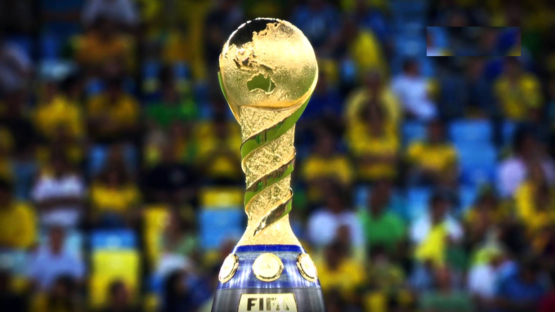
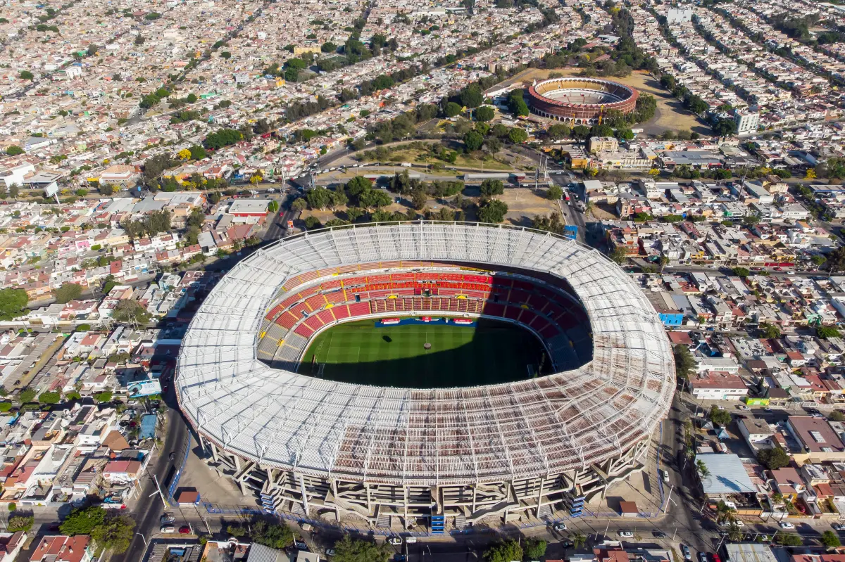
Veranstaltungen Finalrückspiel im CONCACAF Champions’ Cup 1962 Fußball-Weltmeisterschaft 1970 Junioren-Fußballweltmeisterschaft 1983 Fußball-Weltmeisterschaft 1986 Konföderationen-Pokal 1999 Finalhinspiel im CONCACAF Champions’ Cup 2007

 Antigua and Barbuda
 Bahamas
 Barbados
 Belize
 Columbia
 Costa Rica
 Cuba
Cuba
 Dominica
 Dominikanische Republik
 Grenada
 Guatemala
 Guyana
 Honduras
 Jamaika
 Mexico
 Nicaragua
 Panama
 Republik El Salvador
 Republik Haiti
 Saint Kitts and Nevis
 St. Lucia
 St. Vincent and the Grenadines
 Suriname
 Trinidad und Tobago
 Venezuela

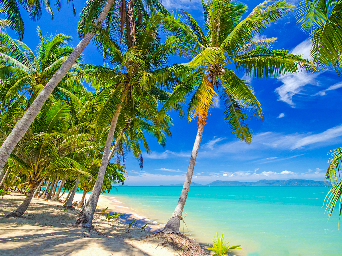


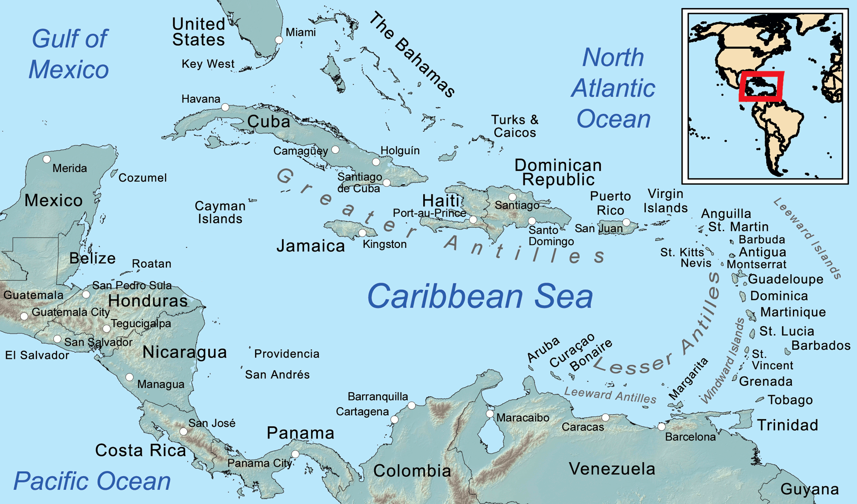
Die Karibik ist eine Region im westlichen, tropischen Teil des Atlantischen Ozeans nördlich des Äquators. Als Teil des mittelamerikanischen Subkontinents besteht sie aus den am und im Karibischen Meer gelegenen Inseln und Inselgruppen und dem Meeresgebiet zwischen ihnen. Am Westende reicht die Karibik in den Golf von Mexiko.
Die Karibik ist nach dem Volk der Kariben benannt, das die spanischen Eroberer auf den Kleinen Antillen (lat. ante ilium, „vorgelagerte Inseln“) vorgefunden haben. Sie wurde bzw. wird auch Westindien genannt, da man sich bei ihrer Entdeckung auf direktem Seeweg nach Indien glaubte.
若依照联合国地理分区里的地理亚区来判定,加勒比地区的范围为加勒比海上的诸岛—西印度群岛,国家与地区包含安圭拉、安提瓜和巴布达、阿鲁巴、巴哈马、巴巴多斯、博奈尔、圣尤斯特歇斯和萨巴、英属维尔京群岛、开曼群岛、古巴、库拉索、多米尼克、多米尼加、格林纳达、瓜德罗普、海地、牙买加、马提尼克、蒙特塞拉特、波多黎各、圣巴泰勒米、圣基茨和尼维斯、圣卢西亚、法属圣马丁、圣文森特和格林纳丁斯、荷属圣马丁、特立尼达和多巴哥、特克斯和凯科斯群岛、美属维尔京群岛。
カリブ海地域(カリブかいちいき、英語: The Caribbean、スペイン語: Caribe、オランダ語: ![]() Caraïben、カリブ・ヒンドゥスターニー語: कैरिबियन (Kairibiyana); フランス語: Caraïbe ないし Antilles)は、カリブ海と、その海域の島々(カリブ海域内の島々や、カリブ海と北大西洋の境界を成す島々)、周辺海域から構成されている。カリブ海地域はメキシコ湾と北アメリカ大陸の南東、中央アメリカの東、南アメリカ大陸の北に位置している。日本語ではカリブ地域、あるいはこの地域にある国を総称してカリブ諸国とも呼ばれる。
Caraïben、カリブ・ヒンドゥスターニー語: कैरिबियन (Kairibiyana); フランス語: Caraïbe ないし Antilles)は、カリブ海と、その海域の島々(カリブ海域内の島々や、カリブ海と北大西洋の境界を成す島々)、周辺海域から構成されている。カリブ海地域はメキシコ湾と北アメリカ大陸の南東、中央アメリカの東、南アメリカ大陸の北に位置している。日本語ではカリブ地域、あるいはこの地域にある国を総称してカリブ諸国とも呼ばれる。
この地方の大部分はカリブプレート上にあり、域内には700以上の島嶼、岩礁、キー(サンゴ礁上の低い島)などがある(カリブ海地域の島の一覧)。島々の多くは島弧を形成して、カリブ海のと東渕と北縁となっている[3]。カリブ海地域の島々は、北側の大アンティル諸島と、南および東側の小アンティル諸島(リーワード・アンティル諸島を含む) から成り、大アンティル諸島やカリブ海より北に位置するバハマ諸島(バハマからタークス・カイコス諸島に至る範囲)をも含んだ、より広い範囲を指す表現としての西インド諸島の一部となっている。広い意味では、大陸の一部であるベリーズ、ベネズエラ、ガイアナ、スリナム、フランス領ギアナもカリブ海地域に含める場合がある。
地政学的には、カリブ海地域の島々は北アメリカの下位区分 (subregion) と見なされることが多く[4][5][6][7][8]、合わせて30の主権国家、海外県、属領から成っている。1954年12月15日から2010年10月10日まで、5つの統治体から成るオランダ領アンティルと称されたオランダ属領があった[9]。また、1958年1月3日から1962年5月31日まで、イギリス属領であった英語圏の領域が構成した、西インド連邦と称された短命な自治国が存在していた。クリケット西インド諸島代表は、その後も、これら諸国の多くを代表して編成され続けている。
The Caribbean (/ˌkærɪˈbiːən, kəˈrɪbiən/, locally /ˈkærɪbiæn/;[4] Spanish: El Caribe; French: les Caraïbes; Haitian Creole: Karayib; Dutch: De Caraïben; Papiamento: Karibe) is a region of the Americas that consists of the Caribbean Sea, its islands (some surrounded by the Caribbean Sea[5] and some bordering both the Caribbean Sea and the North Atlantic Ocean)[6] and the surrounding coasts. The region is southeast of the Gulf of Mexico and the North American mainland, east of Central America, and north of South America.
Situated largely on the Caribbean Plate, the region has more than 700 islands, islets, reefs and cays (see the list of Caribbean islands). Island arcs delineate the eastern and northern edges of the Caribbean Sea:[7] the Greater Antilles on the north and the Lesser Antilles on the south and east (which includes the Leeward Antilles). They form the West Indies with the nearby Lucayan Archipelago (The Bahamas and the Turks and Caicos Islands), which are sometimes considered to be a part of the Caribbean despite not bordering the Caribbean Sea. On the mainland, Belize, Nicaragua, the Caribbean region of Colombia, Cozumel, the Yucatán Peninsula, Margarita Island, and The Guianas (Guyana, Suriname, French Guiana, Guayana Region in Venezuela, and Amapá in Brazil) are often included due to their political and cultural ties with the region.[8]
A mostly tropical geography, the climates are greatly shaped by sea temperatures and precipitation, with the hurricane season regularly leading to natural disasters. Because of its tropical climate and low-lying island geography, the Caribbean is vulnerable to a number of climate change effects, including increased storm intensity, saltwater intrusion, sea-level rise and coastal erosion, and precipitation variability.[9] These weather changes will greatly change the economies of the islands, and especially the major industries of agricultural and tourism.[9]
The Caribbean was occupied by indigenous people since at least 3600 BC. When European colonization followed the arrival of Columbus, the population was quickly decimated by brutal labor practices, enslavement and disease and on many islands, Europeans supplanted the native populations with enslaved Africans. Following the independence of Haiti from France in the early 19th century and the decline of slavery in the 19th century, island nations in the Caribbean gradually gained independence, with a wave of new states during the 1950s and 60s. Because of the proximity to the United States, there is also a long history of United States intervention in the region.
The islands of the Caribbean (the West Indies) are often regarded as a subregion of North America, though sometimes they are included in Middle America or then left as a subregion of their own[10][11] and are organized into 30 territories including sovereign states, overseas departments, and dependencies. From December 15, 1954, to October 10, 2010, there was a country known as the Netherlands Antilles composed of five states, all of which were Dutch dependencies.[12] From January 3, 1958, to May 31, 1962, there was also a short-lived political union called the West Indies Federation composed of ten English-speaking Caribbean territories, all of which were then British dependencies.
Les Caraïbes, (également nommées la Caraïbe, l'espace caraïbe, ou encore l'espace des Caraïbes) sont une région des Amériques qui comprend la mer des Caraïbes, ses îles (certaines entourées par la mer des Caraïbes et d'autres bordant à la fois la mer des Caraïbes et l'océan Atlantique Nord) et les côtes environnantes. La région est située au sud-est du golfe du Mexique et du continent nord-américain, à l'est de l'Amérique centrale et au nord de l'Amérique du Sud.
Située en grande partie sur la plaque des Caraïbes, la région compte plus de 700 îles, îlots, récifs et cayes. Les arcs insulaires délimitent les bords est et nord de la mer des Caraïbes : les Grandes Antilles au nord et les Petites Antilles au sud et à l'est (qui comprennent les îles sous le vent). Elles forment les Antilles avec l'archipel voisin de Lucayan (les Bahamas et les Îles Turques-et-Caïques), qui sont parfois considérées comme faisant partie des Caraïbes bien qu'elles ne bordent pas la mer des Caraïbes. Sur le continent, le Belize, le Nicaragua, la région caribéenne de Colombie, Cozumel, la péninsule du Yucatán, l'île de Margarita et les Guyanes (Guyane, Suriname, Guyane française, région de Guayana au Venezuela et Amapá au Brésil) sont souvent inclus en raison de leurs liens politiques et culturels avec la région.
La géographie est essentiellement tropicale et le climat est fortement influencé par la température de la mer et les précipitations, la saison des ouragans entraînant régulièrement des catastrophes naturelles. En raison de leur climat tropical et de leur géographie insulaire de basse altitude, les Caraïbes sont vulnérables à un certain nombre d'effets du changement climatique, notamment l'augmentation de l'intensité des tempêtes, l'intrusion d'eau salée, l'élévation du niveau de la mer et l'érosion côtière, ainsi que la variabilité des précipitations.
Les Caraïbes ont été occupées par des peuples indigènes depuis au moins 3600 avant J.-C. Lorsque la colonisation européenne a suivi l'arrivée de Christophe Colomb, la population a été rapidement décimée par des pratiques de travail brutales, l'esclavage et la maladie et sur de nombreuses îles, les Européens ont supplanté les populations indigènes par des Africains réduits en esclavage. Après l'indépendance d'Haïti par rapport à la France au début du XIXe siècle et le déclin de l'esclavage, les nations insulaires ont progressivement acquis leur indépendance, avec une vague de nouveaux États au cours des années 1950 et 1960. En raison de la proximité des États-Unis, il existe également une longue histoire d'intervention américaine dans la région.
Les Antilles sont souvent considérées comme une sous-région de l'Amérique du Nord, bien qu'elles soient parfois incluses dans l'Amérique centrale ou alors laissées comme une sous-région à part entière et sont organisées en 30 territoires comprenant des États souverains, des Département et région d'outre-mer et des dépendances. Du 15 décembre 1954 au 10 octobre 2010, il y avait un pays appelé Antilles néerlandaises composé de cinq États, tous dépendants des Pays-Bas. Du 3 janvier 1958 au 31 mai 1962, il y a également eu une union politique de courte durée, la Fédération des Indes occidentales, composée de dix territoires caribéens anglophones, tous dépendants des Britanniques à l'époque.
I Caraibi sono una vasta regione geografica delle Americhe che comprende tutti i paesi bagnati dal Mare Caraibico, cioè tutte le isole delle Antille e i litorali di alcuni paesi continentali del centro e sud America che si affacciano su di questo mare. L'area caraibica è costituita dalle numerose isole che separano il Golfo del Messico dal mar dei Caraibi e quest'ultimo dall'Oceano Atlantico.
El Caribe es una región conformada por el mar Caribe, sus islas y las costas que rodean a este mar. La región se localiza al sureste de América del Norte, al este de América Central, al oeste de América Insular y al norte de América del Sur.
Анти́льские острова́ (также Карибы или Карибские острова) — острова в Карибском море и Мексиканском заливе, расположенные между Северной Америкой и Южной Америкой. Вместе взятые, образуют площадь в 228 662 км² с населением примерно 42 млн чел. (на начало XXI века).
Впервые название «Антильские» встречается в 1493 году у Петра Мартира д’Ангиера, современника Христофора Колумба, придворного Фердинанда Арагонского и Изабеллы Кастильской. Предположительно, были названы по полумифическому острову или архипелагу Антилия, изображавшемуся на средневековых картах.
Подразделяются на две главные группы: Большие Антильские и Малые Антильские острова:
К первым относятся 4 острова: Куба, Гаити, Ямайка и Пуэрто-Рико; из них первые два и последний (самый малый) образуют почти прямую линию, направленную западным углом Кубы к полуострову Юкатан.[1]
Острова материкового и вулканического происхождения. Большая часть их поверхности гориста; равнинные участки главным образом на Кубе и на Юго-Восточном Гаити, а также на Виргинских и Подветренных островах. Горные сооружения Больших Антильских островов высотой до 3098 м (на острове Гаити) являются продолжением структур Центральной Америки. Климат тропический, пассатный, жаркий, преимущественно летне-влажный. Осадков 1200—2000 мм в год. Характерны сильные ураганы в конце лета. Естественная растительность — саванны, летне-зеленые и листопадно-вечнозелёные тропические леса и кустарники — сохранилась мало. На наветренных склонах гор уцелели вечнозелёные леса.[2]
 International cities
 FIFA Fussball-Weltmeisterschaft 2026
 World Heritage
 Sport
Sport
 Party and government
 United Nations
 Architecture
 Geography
 Music
Music