
Deutsch-Chinesische Enzyklopädie, 德汉百科
 Puglia
 *Mediterranean Sea

 Abruzzo
 Albania
 Amber Road
 Bosnia Herzegovina

 Emilia-Romagna

 Friuli-Venezia Giulia
 Italy
Italy
 Croatia

 Marche

 Molise
 Montenegro

 Puglia
 Slovenia

 Veneto
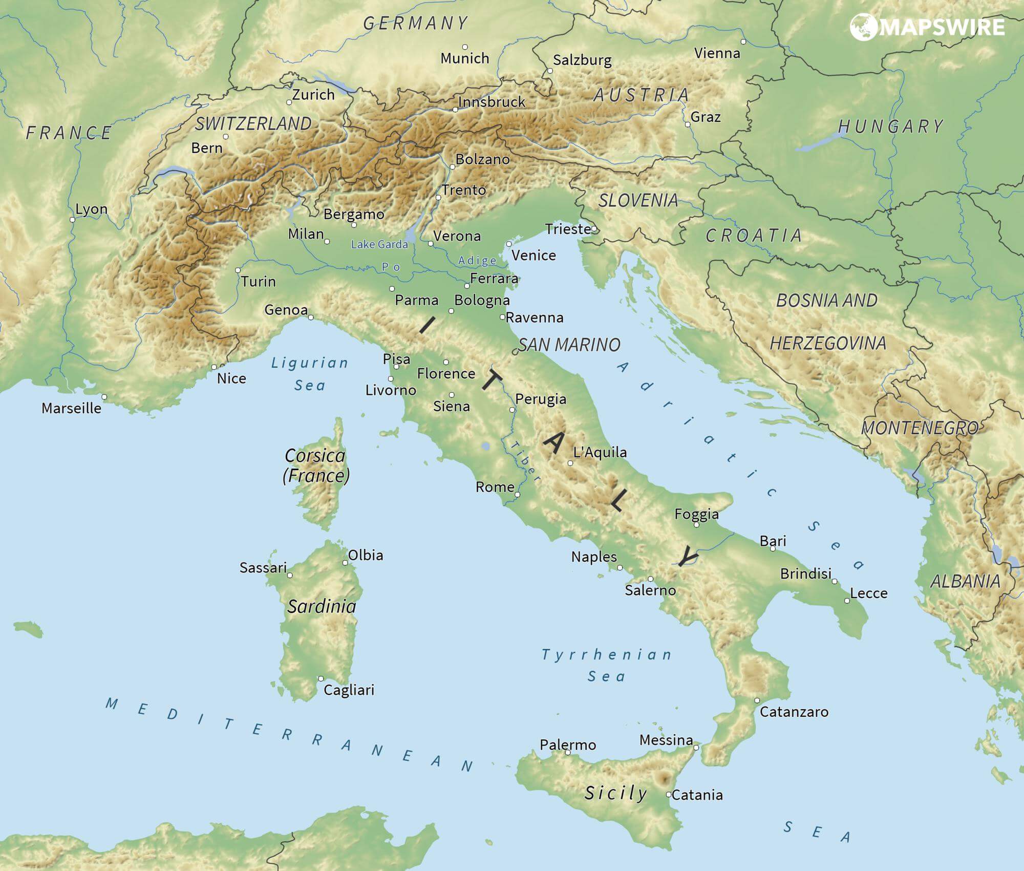
亚得里亚海(意大利语:Mar Adriatico,斯洛文尼亚语:Jadransko morje,克罗地亚语:Jadransko more,阿尔巴尼亚语:Deti Adriatik),是地中海的一部分水域,分隔了意大利半岛(亚平宁半岛)和巴尔干半岛,也分隔了亚平宁山脉与狄那里克阿尔卑斯山脉及其临近地区。亚得里亚海西岸属于意大利,东岸则分别属于斯洛文尼亚、克罗地亚、波斯尼亚和黑塞哥维那、黑山和阿尔巴尼亚。亚得里亚海透过位于其南部的奥特朗托海峡与爱奥尼亚海相连。波河、阿迪杰河、奥凡托河等河流流入亚得里亚海;海中有近1200个岛屿,其中只有69个有人居住。
Das Adriatische Meer, kurz auch die Adria (lateinisch Mare Adriaticum; italienisch Mare Adriatico; bosnisch, kroatisch und serbisch Jadransko more oder kurz Jadran; slowenisch Jadransko morje; albanisch Deti Adriatik oder kurz Adriatiku), ist das lang gestreckte nördliche Seitenbecken des Mittelmeeres zwischen der Apenninhalbinsel und Balkanhalbinsel. Es ist nach der Stadt Adria in Italien (Provinz Rovigo) benannt. Zum Adriatischen Meer wird alles gerechnet, was nördlich der Straße von Otranto liegt.
アドリア海(アドリアかい、英: Adriatic Sea ; イタリア語: Mar Adriatico ; クロアチア語: Jadransko more)は、地中海の海域の一つ。イタリア半島とバルカン半島に挟まれている。
The Adriatic Sea (/ˌeɪdriˈætɪk/) is a body of water separating the Italian Peninsula from the Balkans. The Adriatic is the northernmost arm of the Mediterranean Sea, extending from the Strait of Otranto (where it connects to the Ionian Sea) to the northwest and the Po Valley. The countries with coasts on the Adriatic are Albania, Bosnia and Herzegovina, Croatia, Italy, Montenegro and Slovenia. The Adriatic contains over 1,300 islands, mostly located along the Croatian part of its eastern coast. It is divided into three basins, the northern being the shallowest and the southern being the deepest, with a maximum depth of 1,233 metres (4,045 ft). The Otranto Sill, an underwater ridge, is located at the border between the Adriatic and Ionian Seas. The prevailing currents flow counterclockwise from the Strait of Otranto, along the eastern coast and back to the strait along the western (Italian) coast. Tidal movements in the Adriatic are slight, although larger amplitudes are known to occur occasionally. The Adriatic's salinity is lower than the Mediterranean's because the Adriatic collects a third of the fresh water flowing into the Mediterranean, acting as a dilution basin. The surface water temperatures generally range from 30 °C (86 °F) in summer to 12 °C (54 °F) in winter, significantly moderating the Adriatic Basin's climate.
The Adriatic Sea sits on the Apulian or Adriatic Microplate, which separated from the African Plate in the Mesozoic era. The plate's movement contributed to the formation of the surrounding mountain chains and Apennine tectonic uplift after its collision with the Eurasian plate. In the Late Oligocene, the Apennine Peninsula first formed, separating the Adriatic Basin from the rest of the Mediterranean. All types of sediment are found in the Adriatic, with the bulk of the material transported by the Po and other rivers on the western coast. The western coast is alluvial or terraced, while the eastern coast is highly indented with pronounced karstification. There are dozens of marine protected areas in the Adriatic, designed to protect the sea's karst habitats and biodiversity. The sea is abundant in flora and fauna—more than 7,000 species are identified as native to the Adriatic, many of them endemic, rare and threatened ones.
The Adriatic's shores are populated by more than 3.5 million people; the largest cities are Bari, Venice, Trieste and Split. The earliest settlements on the Adriatic shores were Etruscan, Illyrian, and Greek. By the 2nd century BC, the shores were under Rome's control. In the Middle Ages, the Adriatic shores and the sea itself were controlled, to a varying extent, by a series of states—most notably the Byzantine Empire, the Croatian Kingdom, the Republic of Venice, the Habsburg Monarchy and the Ottoman Empire. The Napoleonic Wars resulted in the First French Empire gaining coastal control and the British effort to counter the French in the area, ultimately securing most of the eastern Adriatic shore and the Po Valley for Austria. Following Italian unification, the Kingdom of Italy started an eastward expansion that lasted until the 20th century. Following World War I and the collapse of Austria-Hungary and the Ottoman Empire, the eastern coast's control passed to Yugoslavia and Albania. The former disintegrated during the 1990s, resulting in four new states on the Adriatic coast. Italy and Yugoslavia agreed on their maritime boundaries by 1975 and this boundary is recognised by Yugoslavia's successor states, but the maritime boundaries between Slovenia, Croatia, Bosnia-Herzegovina, and Montenegro are still disputed. Italy and Albania agreed on their maritime boundary in 1992.
Fisheries and tourism are significant sources of income all along the Adriatic coast. Adriatic Croatia's tourism industry has grown faster economically than the rest of the Adriatic Basin's. Maritime transport is also a significant branch of the area's economy—there are 19 seaports in the Adriatic that each handle more than a million tonnes of cargo per year. The largest Adriatic seaport by annual cargo turnover is the Port of Trieste, while the Port of Split is the largest Adriatic seaport by passengers served per year.
La mer Adriatique (du latin : Mare Hadriaticum ou Mare Adriaticum) est une mer séparant la péninsule italienne de la péninsule balkanique. L'Adriatique est le bras de la Méditerranée situé le plus au nord en s'étendant du canal d'Otrante (où elle rejoint la mer Ionienne) jusqu'aux villes de Venise et de Trieste et à l'embouchure du Pô. Les pays côtiers sont l'Italie, la Slovénie, la Croatie, la Bosnie-Herzégovine, le Monténégro et l'Albanie, ainsi que la Grèce par l'île de Corfou.
Il mare Adriatico è l'articolazione del mar Mediterraneo orientale situata tra la penisola italiana e la penisola balcanica; suddiviso in Alto Adriatico, Medio Adriatico e Basso Adriatico, bagna sei Paesi: Italia, Slovenia, Croazia, Bosnia ed Erzegovina, Montenegro e Albania, confinando a sud-est con il Mar Ionio.
El mar Adriático (del latín, Mare Hadriaticum) es un golfo estrecho y alargado que forma parte del mar Mediterráneo. Se encuentra situado entre la península Itálica, al oeste, y la península de los Balcanes, al este, con una anchura máxima de unos 200 km, y una longitud de unos 800 km. Su extremo meridional limita con el mar Jónico, del que lo separa el canal de Otranto. Su superficie total es de, aproximadamente, 160 000 km².
Las costas occidental, septentrional, y parte de la oriental corresponden a Italia (60% de la longitud de costa del Adriático), mientras que el resto de la costa oriental corresponde a Croacia, Eslovenia, Bosnia y Herzegovina, Montenegro y Albania. Algunos de los ríos que desembocan en el Adriático son el Reno, el Po, el Adigio, el Brenta, el Piave y el Neretva.
La costa del Adriático concentra un gran número de centros turísticos, como Venecia, que recibe el nombre de «Reina del Adriático». Tras la división de Yugoslavia, la costa croata se ha convertido también en un destino turístico muy popular.
Sus aguas sostienen industria pesquera, y se llevan a cabo prospecciones petrolíferas en este mar. Durante los años 1990, varias investigaciones revelaron que sus niveles de contaminación son muy altos.
En las últimas décadas el gobierno de Italia ha intentado hacer de él una barrera contra la inmigración ilegal, en su mayor parte proveniente de Albania.
Адриати́ческое мо́ре (итал. mare Adriatico, эмил.-ром. Mèr Adriâtic, вен. Mar Adriàtico, неап. Mar Adriateco, словен. Jadransko morje, сербохорв. Jadransko more/Јадранско море, алб. Deti Adriatik, лат. mare Hadriaticum), также Адриатика — полузамкнутое море, часть Средиземного моря между Апеннинским и Балканским полуостровами. Омывает берега Италии (более 1000 км), Словении (47 км), Хорватии (1777 км), Боснии и Герцеговины (20 км), Черногории (200 км), Албании (472 км).

展品范围
粮食作物产业链: 土地耕作机械,播种机械,除草机,防虫机械,收割机,用于清洁、贮藏、碾磨的机械设备,面包生产设备
果蔬生产链: 土地耕作及移植机械,灌溉机械及设备,作物保护机械,收割机,用于处理果蔬产品的冷藏设备及系统,用于即食产品的机械和设备
非食用能源作物生产链: 收成切割机械和修剪残余物运输设备,烘干设备、碾碎设备、方块切割设备,用于燃烧有机物的专业锅炉,光电板以及用于农业企业和农工业的能源分配系统,用于非食用能源作物的风力发动机
葡萄园及葡萄酒酿造产业链: 用于经营葡萄园的机械和产品,葡萄采集及挤压设备,葡萄酒酿造机械和产品,酒窑、水槽、酒桶和橡木桶设备,酿酒实验室用的分析设备及产品,酿酒用品及辅助用品,装瓶及包装用材和机器
橄榄油产业链: 园圃、橄榄园装置、枝叶修剪,用于经营橄榄园的机械及产品,采摘机械及修剪残余碾碎机械,机械化收获、彩摘网、塑料箱,橄榄油萃取流水线,橄榄处理机械:枝叶去除机、清洗机、碾压机、去核机、搅拌机、细颈盛水瓶、分离器、固体运输机、泵和阀,段生产线的萃取设备,仓库和不锈钢容器、橄榄油渣子仓库、装瓶设备
农业机械: 农业机械和设备类,零配件类 园林机械: 拖拉机类、收获机类,各类农机具类、场上作业机械类、耕整种植机械类、植保机械类,发动机组类、发电机组类、节水灌溉设备类,园艺园林设备与用品类 农业灌溉: 农作物运输设备类,畜牧机械类,青饲料机械类,奶产品加工机械类,农副产品加工机械类,温室工程与设施类,植物保护和化肥类,杀虫剂类,除草剂机械设备与产品类;灌溉和排水系统类

 Abruzzo

 Basilicata

 Calabria

 Campania

 Emilia-Romagna
 Italy
Italy

 Lazio
Lazio

 Liguria

 Lombardia

 Marche

 Molise

 Piemonte

 Puglia

 Sicilia

 Toscana

 Umbria
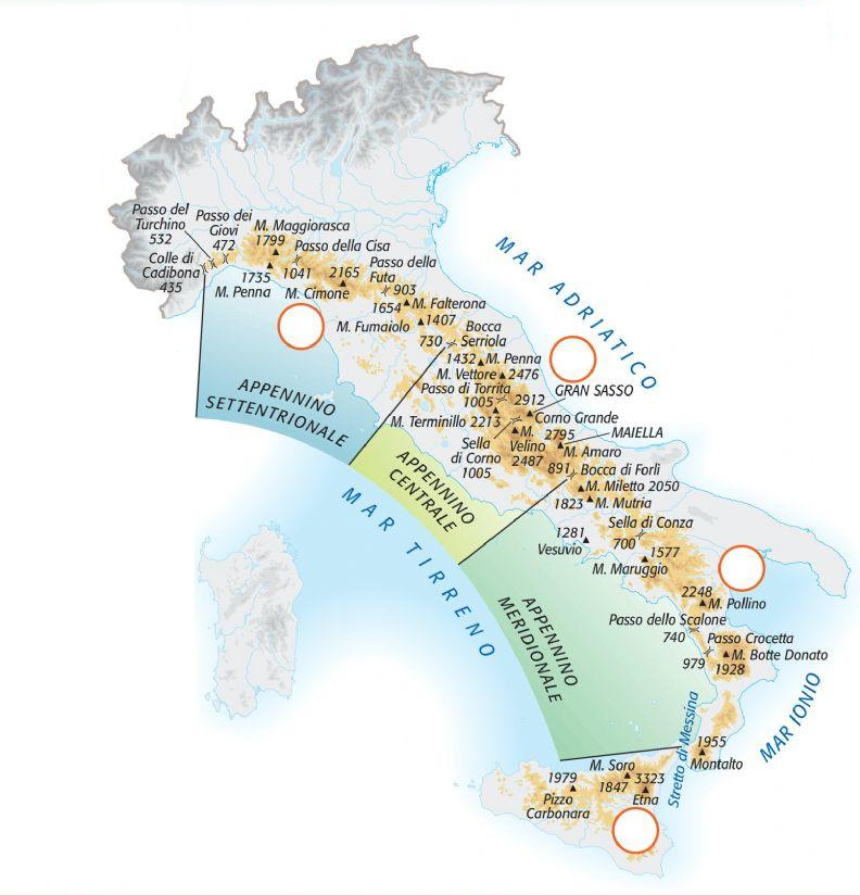
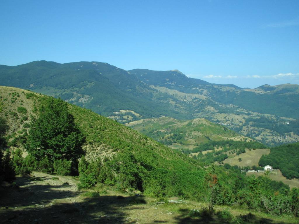
Der Apennin beginnt im Nordwesten Italiens und bildet im Ligurischen Apennin die Fortsetzung der Ligurischen Alpen. Die Grenze zwischen Alpen und Apennin bildet der Col di Cadibona (436 m). Von dort reicht der Apennin Richtung Osten über die Apuanischen Alpen bis zur Adriaküste, wo er sich nach Süden wendet und im Abruzzischen Apennin mit dem Massiv des Gran Sasso d’Italia (2912 m) seine größte Höhe erreicht.
Weiter südwärts teilt sich der Apennin in einzelne kleinere Gebirgsteile wie die Sila und den Aspromonte auf und findet seine Fortsetzung in den Gebirgen Nordsiziliens.
Im Apennin herrscht typisches Gebirgsklima mit niedrigen Temperaturen, jedoch starken Temperaturschwankungen und hohen Niederschlägen. Im Hügelland und den Vorgebirgen ist das Klima mediterran beeinflusst, mit Niederschlagsmengen von etwa 800 mm und einer deutlichen Sommertrockenheit. In den subalpinen Regionen steigt die Niederschlagsmenge auf über 1300 mm, wobei ein deutlicher West-Ost-Unterschied besteht.
 Italy
Italy

 Art
Art

 Art
Art
 *Greco-Roman Art

 Art
Art
 *Greek epoch

 Art
Art
 WB - Western art 15th century BC - 5th century AD

 Art
Art
 *Europe's ceramics and porcelain

 Puglia

 Abruzzo

 Basilicata

 Calabria

 Campania

 Emilia-Romagna

 Friuli-Venezia Giulia
 Italy
Italy

 Lazio
Lazio

 Liguria

 Lombardia

 Marche

 Molise

 Piemonte

 Puglia

 Sardegna

 Sicilia

 Toscana

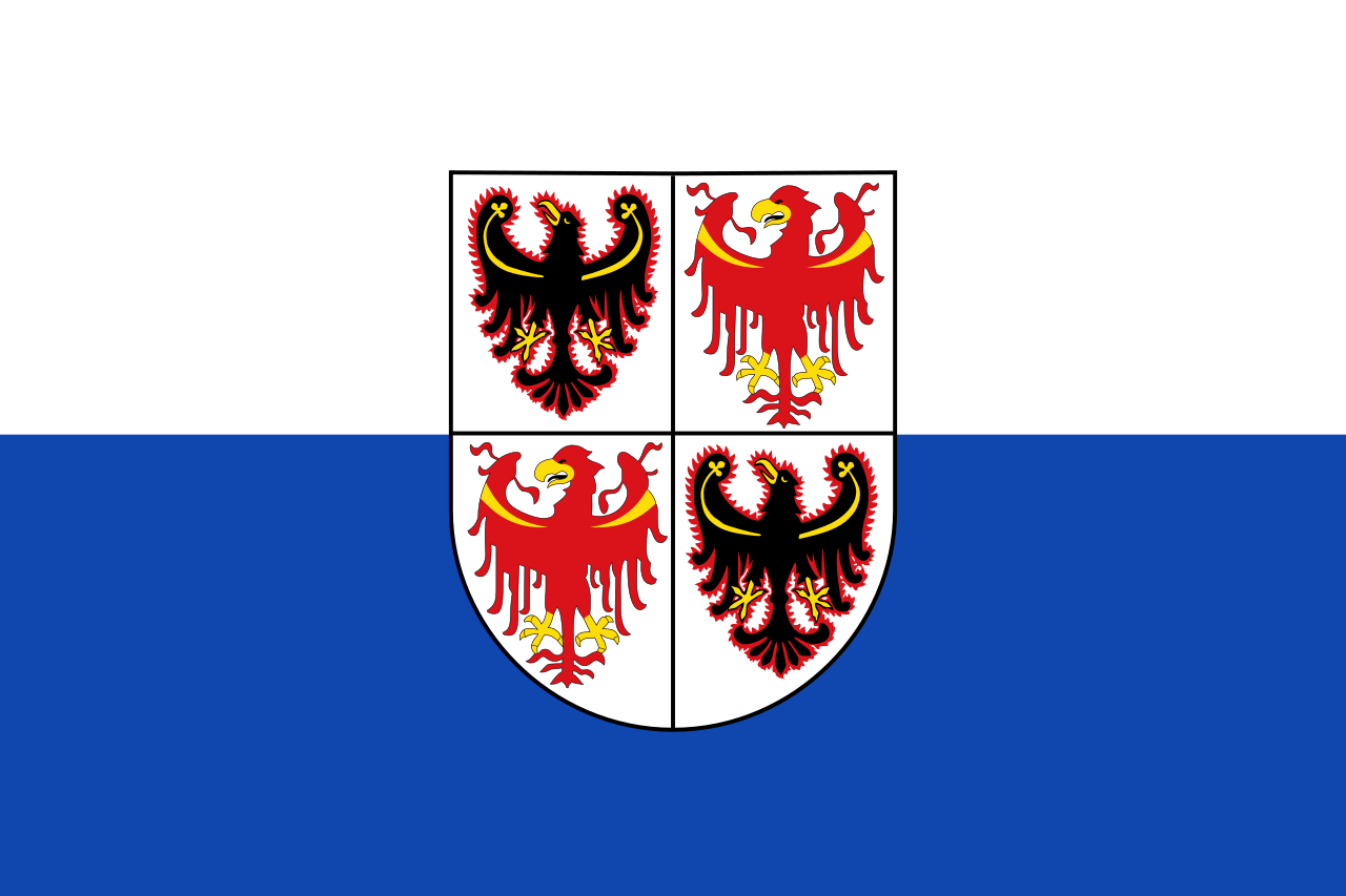 Trentino-Alto Adige

 Umbria

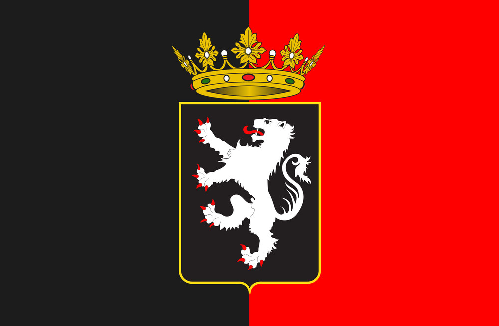 Valle d´Aosta

 Veneto


 Abruzzo

 Basilicata

 Calabria

 Campania

 Emilia-Romagna

 Friuli-Venezia Giulia
 Italy
Italy

 Lazio
Lazio

 Liguria

 Lombardia

 Marche

 Molise

 Piemonte

 Puglia

 Sardegna

 Sicilia

 Toscana

 Trentino-Alto Adige

 Umbria
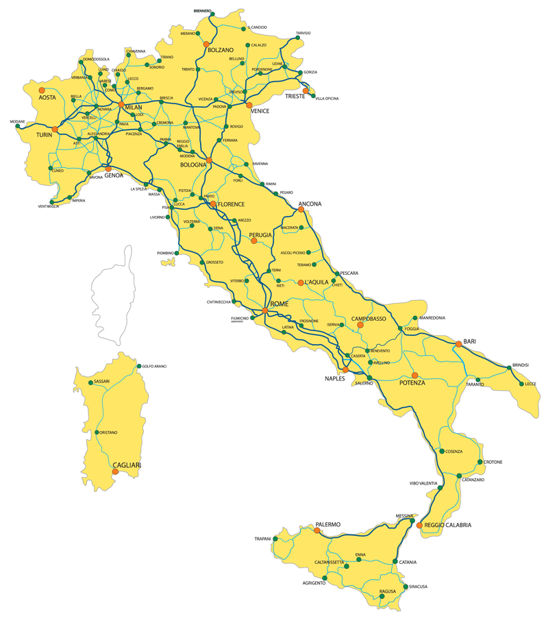


巴里(意大利语:Bari)是意大利南部第二大城市,面积116平方公里,人口326,201人(2001年)。巴里是普利亚大区首府,位处亚得里亚海,也是巴里省的首府。1990年代,巴里的人口发展和国家总趋势一致,不断减少,这有利于城域圈的发展。当时很有必要研究城区:现在这个项目正在进行,有12个市镇选择参与其中,约600,000居民。 城镇包括三个部分:半岛北部建筑密集的老城区市,现在主要的夜生活街区之一,其中有著名的圣尼各老圣殿、圣撒比诺主教座堂(1035年 - 1171年)和斯瓦比亚城堡。 巴里的历史可追溯至古罗马帝国时代。其时巴里位处古罗马交通要道上,属一个交汇点。中世纪时巴里屡受战火破坏,更一度被伊斯兰人入侵占据达二十年。文艺复兴时代,巴里为那不勒斯王国之一部分,后来在十九世纪成为意大利王国之一部分。
Bari ist eine italienische Gemeinde, Hauptstadt der Region Apulien sowie Zentrum der Metropolitanstadt Bari und eine bedeutende Hafen- und Universitätsstadt an der Adria.
Bari war bereits während der mittleren Bronzezeit bewohnt. Siedlungsspuren von der mittleren Bronze- (ca. 1700–1350 v. Chr.) bis zur frühen Eisenzeit (ab ca. 950 v. Chr.) fand man an mehreren Stellen der heutigen Altstadt: um die Kirchen St.-Peter, S. Scolastica und S. Maria del Buonconsiglio. Zu den Funden gehören auch Fragmente mykenischer Tongefäße aus dem Späthelladikum III B und III C (spätes 14. bis 12./11. Jahrhundert v. Chr.), die auf Handel mit Griechenland deuten.[2] Im dritten Jahrhundert v. Chr. wurde Bari von Griechen besiedelt, die die Stadt Barion nannten. Als Teil des Römischen Reiches wurde Bari (Barium) zum municipium cum suffragio. In dieser Zeit konnte die Stadt eigene Gesetze erlassen und eigene Münzen prägen. Zwischen 476 und 840 war Bari Teil der Germanenreiche in Italien. Seit dem 4. Jahrhundert ist der Ort Sitz eines Bistums, des heutigen Erzbistums Bari-Bitonto.
Im Jahr 847 eroberte eine Flotte der Sarazenen die Stadt, die dort ein islamisches Emirat in Italien gründeten. 871 wurde Bari wieder vom Byzantinischen Reich eingenommen, das dort das Zentrum seiner italienischen Territorien errichtete.[3] Noch 1002 wurde Bari erneut von Arabern erobert und von der Byzantinischen Armee rasch zurückerobert. Gegen die Byzantiner aber erhob sich der Barenser Melus (Melo) 1009 und 1017; als Ismahel (Ismail) ist er auf dem goldbestickten Sternenmantel verewigt, den er dem deutschen Kaiser Heinrich II. geschenkt hatte.
Am 15. April 1071 eroberten nach dreijähriger Belagerung die Normannen unter Robert Guiskard die Stadt, den zu dieser Zeit letzten Besitz von Byzanz in Italien. 1087 wurden die Gebeine des heiligen Nikolaus von Myra nach Bari gebracht. Der Heilige ist seither in Italien auch als Nicola di Bari bekannt. 1155 rebellierten die Bewohner der Stadt gegen die Normannen. Als Vergeltungsaktion ließ Wilhelm I „der Böse“ im Juni des folgenden Jahres die Stadt bis auf die Kathedrale und die Basilica St. Nicola zerstören und vertrieb die Bewohner.
Unter Friedrich II. erlebte Bari eine Blütezeit. Dieser kam 1221 erstmals in die Stadt. Bei seiner Rückkehr von seinem Kreuzzug nach 1229 waren die Tore der Stadt verschlossen, so dass er sich gewaltsam Zutritt verschaffen musste. Daher ließ er vermutlich das Kastell bauen, um die Stadt in Schach zu halten. Andererseits gewährte er der Stadt großzügige Handelsprivilegien und beließ ihr die führende Rolle in der Region. Umso härter traf Bari die Bevorzugung fremder Kaufleute und Bankiers unter den Anjou. Nach zahlreichen Wirren und Machtkämpfen unter dem Adel begann erst 1813 unter Joachim Murat, dem zum König von Neapel aufgestiegenen Schwager Napoleons, der Bau der Neustadt.
バーリ(伊: Bari (![]() 音声ファイル))は、イタリア共和国南部の都市で、その周辺地域を含む人口約32万人の基礎自治体(コムーネ)。プッリャ州の州都であり、バーリ県の県都である。
音声ファイル))は、イタリア共和国南部の都市で、その周辺地域を含む人口約32万人の基礎自治体(コムーネ)。プッリャ州の州都であり、バーリ県の県都である。
アドリア海に面した港湾都市であり、東地中海の国々と広範囲な貿易をおこなう商業の一大中心地である。サンタクロースのもととなった聖人ニコラオス(聖ニコラ)ゆかりの地として巡礼地ともなっている。
Bari (Italian pronunciation: [ˈbaːri] ( listen); Barese: Bare [ˈbæːrə]; Latin: Barium; Ancient Greek: Βάριον, translit. Bárion) is the capital city of the Metropolitan City of Bari and of the Apulia region, on the Adriatic Sea, in southern Italy. It is the second most important economic centre of mainland Southern Italy after Naples and Palermo, a port and university city, as well as the city of Saint Nicholas. The city itself has a population of 326,799, as of 2015, over 116 square kilometres (45 sq mi), while the urban area has 700,000 inhabitants. The metropolitan area has 1.3 million inhabitants.
Bari is made up of four different urban sections. To the north is the closely built old town on the peninsula between two modern harbours, with the Basilica of Saint Nicholas, the Cathedral of San Sabino (1035–1171) and the Hohenstaufen Castle built for Frederick II, which is now also a major nightlife district. To the south is the Murat quarter (erected by Joachim Murat), the modern heart of the city, which is laid out on a rectangular grid-plan with a promenade on the sea and the major shopping district (the via Sparano and via Argiro).
Modern residential zones surrounding the centre of Bari were built during the 1960s and 1970s replacing the old suburbs that had developed along roads splaying outwards from gates in the city walls. In addition, the outer suburbs developed rapidly during the 1990s. The city has a redeveloped airport named after Pope John Paul II, Karol Wojtyła Airport, with connections to several European cities.
Bari écoutez (Bari en italien, ['baːri], Bàre en dialecte, Vare dans l'ancien dialecte3, Barium en latin, Barion en grec) est une ville italienne de plus de 325 000 habitants, chef-lieu de la ville métropolitaine de Bari et de la région des Pouilles, sur la côte adriatique.
Bari est la ville principale d'une agglomération urbaine de plus de 700 000 habitants. Pour l'ensemble de la surface urbanisée, ce chiffre s'élève à environ 1 300 000 habitants4.
Bari est la neuvième ville italienne par sa population, la troisième du Sud de l'Italie et la première de la région. La ville est l'une des quinze métropoles italiennes5.
Bari est connu pour être la ville où se trouvent les reliques de saint Nicolas. Ce privilège a fait de Bari et de la basilique de la ville l'un des centres importants de l'Église orthodoxe en Occident6. Bari a une forte tradition marchande et est depuis toujours un centre névralgique du commerce et des échanges politico-culturels avec l'Europe et le Moyen-Orient. Son port est actuellement le plus grand port de passagers de la mer Adriatique. Depuis 1930, la Fiera del Levante se tient à Bari et, plus récemment, la ville est devenue le siège du secrétariat du Corridor paneuropéen VIII7.
Le centre historique appelé Bari Vecchia est empreint d'une histoire millénaire et contraste avec le Quartier Murat datant du XVIIIe siècle dont le nom est issu du général Murat. Le quartier est organisé en damier et représente le mieux la tradition commerciale de la ville. Après la Seconde Guerre mondiale, l'urbanisation rapide et souvent incontrôlée a rendu moins régulière la partie moderne de la ville qui s'est développée au-delà du quartier murattiano8.
Bari (ascolta[?·info], AFI: ['baːri]; Bare - ['baːrə] - in dialetto barese, fino al 1931 Bari delle Puglie[3]) è un comune italiano di 321.222 abitanti capoluogo della regione Puglia.
È il nono comune italiano per popolazione, terzo del Mezzogiorno dopo Napoli e Palermo. La sua area metropolitana è la sesta d'Italia con quasi 1 300 000 abitanti[4].
È nota anche per essere la città nella quale riposano le reliquie di San Nicola. Tale condizione ha reso Bari e la sua basilica uno dei centri prediletti dalla Chiesa ortodossa in Occidente e anche un importante centro di comunicazione interconfessionale tra l'Ortodossia e il Cattolicesimo.
Bari ha una solida tradizione mercantile - imprenditoriale e da sempre è punto nevralgico nell'ambito del commercio e dei contatti politico-culturali con il Medio Oriente. Il suo porto è il maggiore scalo passeggeri del mare Adriatico. Dal 1930 si tiene a Bari la Fiera del Levante, tra le principali esposizioni fieristiche d'Italia. Più recentemente la città è diventata sede del segretariato per il Corridoio pan-europeo 8.
Bari (Bare IPA: ['ba:rə] en dialecto barese, Vare IPA: ['bε:rə] en el antiguo dialecto barese) es una ciudad de Italia, capital de la Ciudad metropolitana homónima y de la región de Apulia. Es la tercera principal ciudad de la Italia meridional tras Nápoles y Palermo. Se localiza en la costa del mar Adriático y su provincia (Ciudad metropolitana desde el 1/1/2015) es la quinta en extensión del país. Cuenta con 327.361 habitantes (31-12-2014), 750.000 en el área urbana y 1.266.000 en el área metropolitana. Limita con las comunas Adelfia, Bitonto, Bitritto, Capurso, Giovinazzo, Modugno, Mola di Bari, Noicattaro, Triggiano y Valenzano.
Ба́ри (итал. Bari, тарант. Bare, др.-греч. Βάριον, лат. Barium) — город-порт на юге Италии. Столица региона Апулия и административный центр одноимённой провинции[2].
Покровителем города считается Николай Чудотворец, чьи мощи хранятся в местной одноименной базилике. Праздник города — 9 мая.

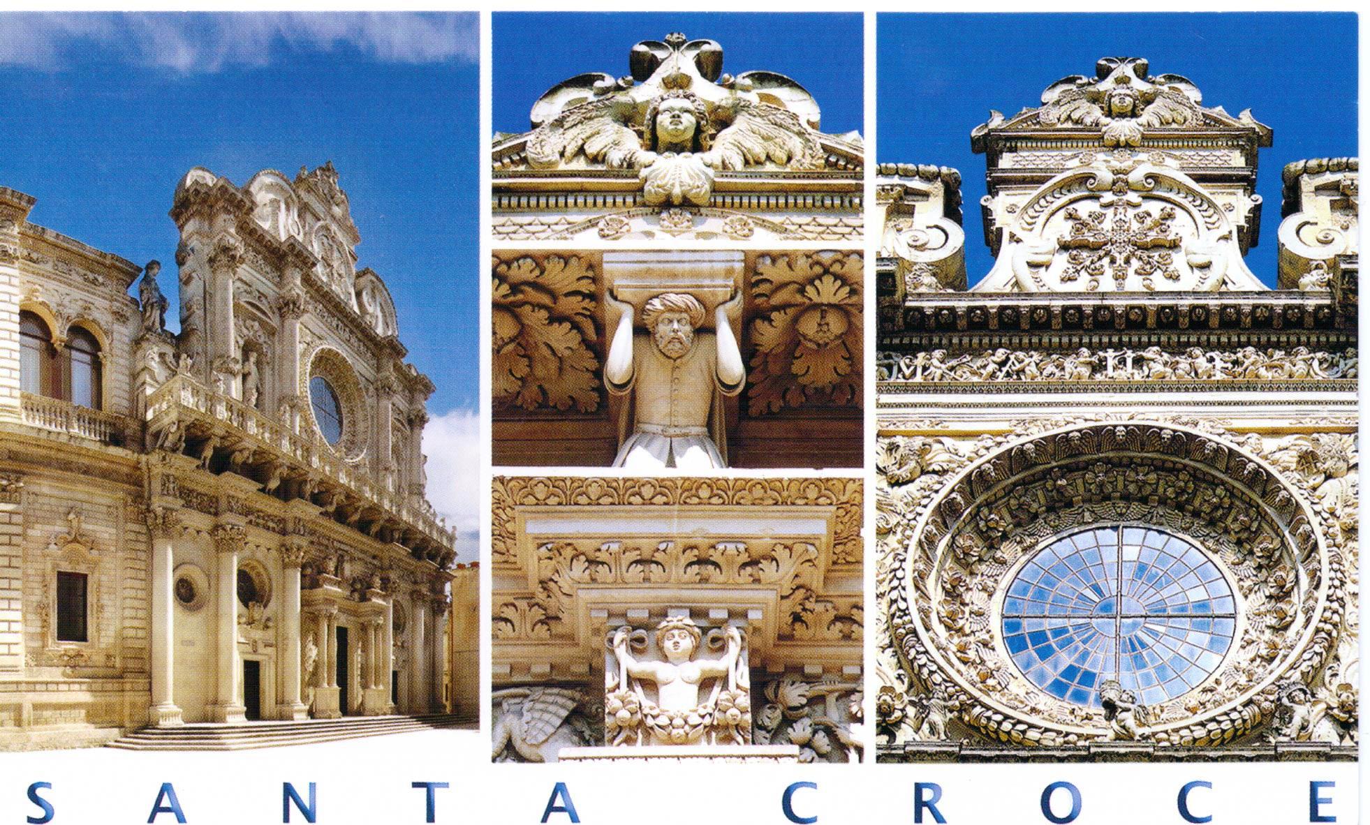


Burrata ist ein italienischer Frischkäse vom Typ Filata.
Burrata ist eine Sonderform des Mozzarella, wird aber überwiegend aus Kuhmilch (seltener aus Büffelmilch) hergestellt und hat etwa 44 % oder 60 % Fett i. Tr. Sie hat die Form eines kleinen Säckchens, das einem Mozzarella ähnlich ist, und in dessen Innerem sich eine Masse aus Sahne und Mozzarellasträngen (praktisch nicht zu Kugeln geformte Mozzarellamasse) befindet; die Füllung ähnelt der Stracciatella di bufala.
 Geography
 Exhibition
 Agriculture, forestry, livestock, fishing


 History

 Energy resource
 Transport and traffic
 International cities
 Architecture
 Religion
 Eat and Drink
 Holidays