Deutsch-Chinesische Enzyklopädie, 德汉百科

       
German — Chinese
Catalog *Yellow river

天下黄河九十九道湾/99 Bends in the Yellow River
This image, video or audio may be copyrighted. It is used for educational purposes only. If you find it, please notify us byand we will remove it immediately.
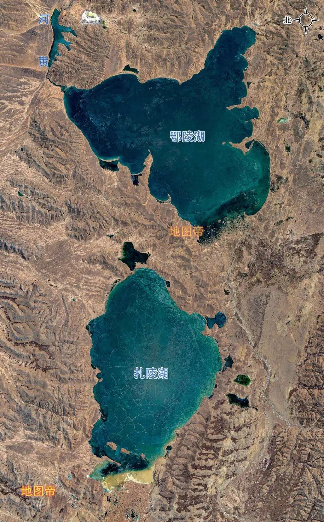
鄂陵湖/Ngoring Lake
鄂陵湖是黄河上游的大型高原淡水湖,又称鄂灵海,古称柏海,藏语意为蓝色长湖。位于中国青海省玛多县西部的凹地内,西距扎陵湖15公里,与扎陵湖并称为"黄河源头的姊妹湖"。湖面海拔4272米,南北长约32.3公里,东西宽约31.6公里,湖面面积610平方公里,平均水深17.6米,湖心偏北处最深达30.7米,蓄水量107亿立方米。

This image, video or audio may be copyrighted. It is used for educational purposes only. If you find it, please notify us byand we will remove it immediately.
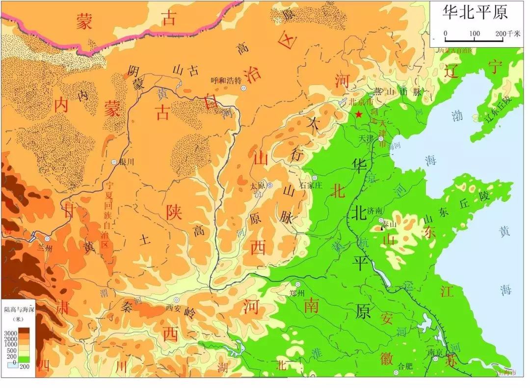
华北平原
This image, video or audio may be copyrighted. It is used for educational purposes only. If you find it, please notify us byand we will remove it immediately.
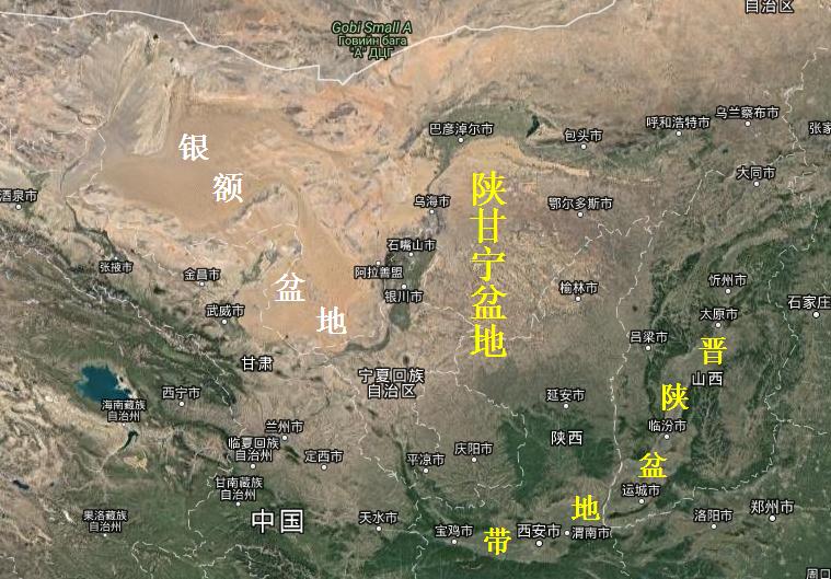
陝甘寧盆地 陕甘宁盆地/鄂尔多斯盆地
陕甘宁盆地,在地质学上称鄂尔多斯盆地:北起阴山、大青山,南抵陇山、黄龙山、桥山,西至贺兰山、六盘山,东达吕梁山、太行山,总面积37万平方公里,是中国第二大沉积盆地。 鄂尔多斯盆地包括宁夏大部,甘肃陇东地区庆阳市、平凉市,陕北地区延安市、榆林市,关中地区的北山山系以北区域,内蒙黄河以南鄂尔多斯高原的鄂尔多斯市(原名伊克昭盟) 。 鄂尔多斯盆地,北至黄河大拐弯的伊盟隆起;南至渭北高原,即关中的北山,从黄龙山经铜川背斜、永寿梁、崔木梁、岭山(凤翔区北端)至宝鸡,地质上属祁吕贺山字型构造体系的前面弧;东至秦晋交界的黄河谷地,包括吕梁山以东;西包石嘴山-银川-固原大向斜,贺兰山-六盘山以东,属于祁吕贺山字型构造体的东侧盾地。
This image, video or audio may be copyrighted. It is used for educational purposes only. If you find it, please notify us byand we will remove it immediately.
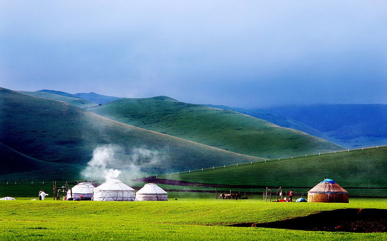
内蒙古高原
内蒙古高原是中国四大高原中的第二大高原,为蒙古高原的一部分,又称北部高原,狭义上的内蒙古高原位于阴山山脉之北,大兴安岭以西,北至国界,西至东经106°附近。介于北纬40°20′~50°50′,东经106°~121°40′。面积约34万平方千米。广义的内蒙古高原还包括阴山以南的鄂尔多斯高原和贺兰山以西的阿拉善高原,面积约70万平方千米。内蒙古高原是中国重要的牧场,草原面积约占高原面积的80%,属欧亚温带草原区的一部分,是中国最大的绵羊及山羊放牧区和中国骆驼主要产区之一。内蒙古高原平均每平方千米仅3人,为蒙古族、达斡尔族、鄂温克族、鄂伦春族和汉族等各族人民长期从事畜牧业生产活动的地区。
 http://www.net4info.de/photos/cpg/albums/userpics/10001/Nei20Meng20Gu20Gao20Yuan20.jpg

Das Plateau der Inneren Mongolei (內蒙古高原, Nei Menggu gaoyuan) ist ein sich quer über den Norden Chinas erstreckendes Hochland. Zusammen mit seiner west- und nördlichen Fortsetzung (Mongolisches Plateau) ist es das zweitgrößte Hochland Chinas nach dem Qinghai-Tibet-Plateau. Es reicht im Osten vom Großen Hinggan-Gebirge bis im Westen zum Mazu-Gebirge (馬鬃山 Mazu Shan) und Sukexielu Shan 苏克斜鲁山, im Süden entlang der Großen Mauer und im Norden grenzt es an die Mongolische Volksrepublik.

Das Plateau der Inneren Mongolei umfasst das gesamte Gebiet der Inneren Mongolei und einen Teil von Gansu, Ningxia und Hebei. Von West nach Ost ist es über 2000 Kilometer lang und von Nord nach Süd ca. 500 Kilometer. Das Plateau ist im Allgemeinen 1000 bis 1400 m hoch. Im Osten ist es niederschlagsreicher als im Westen.

Den Südteil des Plateaus bilden das Ordos-Plateau (鄂爾多斯高原) und die schmale fruchtbare Hetao-Ebene (河套平原, Hetao pingyuan). Im Ostteil und Nordteil liegen das Hulun-Buir-Plateau (呼倫貝爾高原), das Ujumqin-Becken (乌珠穆沁盆地, Wuzhumuqin pendi), das Xilin-Gol-Plateau (錫林郭勒高原) und das Ulanqab-Plateau (烏蘭察布高原), im Westen das Bayan-Nur-Plateau (巴彥淖爾高原) und das Alxa-Plateau (阿拉善高原). Das in Ostwest-Richtung verlaufende Yinshan-Gebirge (阴山, Yin Shan) liegt in seiner Mitte.


This image, video or audio may be copyrighted. It is used for educational purposes only. If you find it, please notify us byand we will remove it immediately.
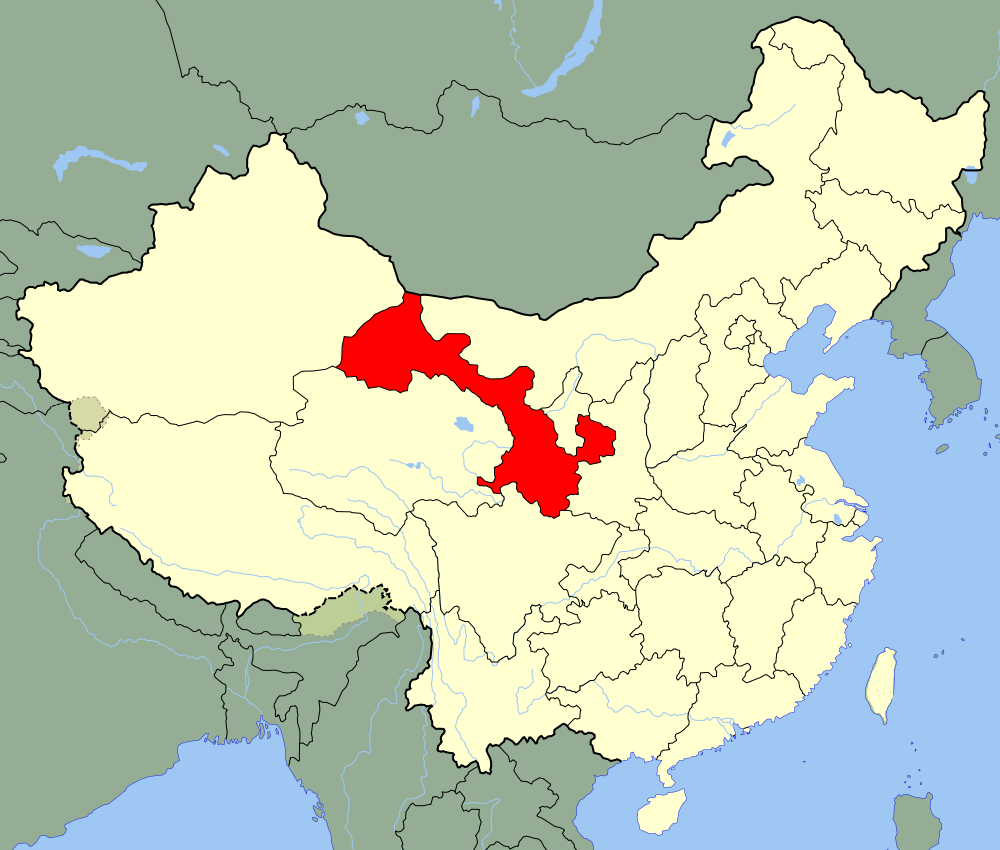
甘肃省
/assets/contentimages/Gan20Su20Sheng20.png
This image, video or audio may be copyrighted. It is used for educational purposes only. If you find it, please notify us byand we will remove it immediately.
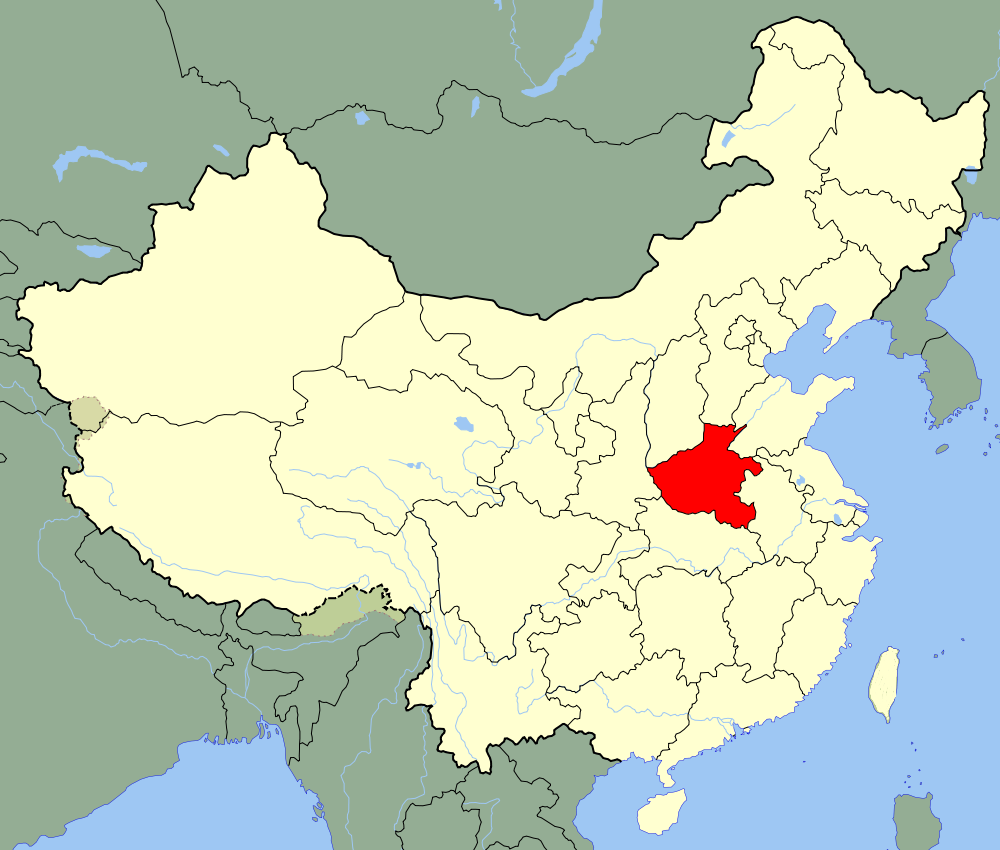
河南省
河南省,简称“豫”,中华人民共和国省级行政区,省会郑州,是全国农产品主产区和重要的矿产资源大省、人口大省、重要的综合交通枢纽和人流、物流、信息流中心、全国农业大省和粮食转化加工大省。 河南省位于中国中东部、黄河中下游,东接安徽、山东,北接河北、山西,西连陕西,南临湖北,总面积16.7万平方千米。河南省地势呈望北向南、承东启西之势,地势西高东低,由平原和盆地、山地、丘陵、水面构成;地跨海河、黄河、淮河、长江四大流域。河南省是中华民族和华夏文明的重要发祥地, 是夏、商、周三代文明的核心区,三代文明奠定了中华文明绵延不断发展的基础,在河洛之间凝聚为成熟的文明形态,形成以王都为中心的辐射性统治格局。河南历史代表文化为“中原文化”。
/assets/contentimages/He20Nan20Sheng20.png
This image, video or audio may be copyrighted. It is used for educational purposes only. If you find it, please notify us byand we will remove it immediately.
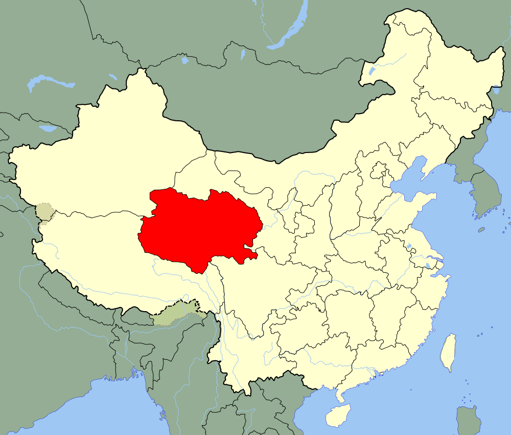
青海省
/assets/contentimages/Qing20Hai20Sheng20.png
This image, video or audio may be copyrighted. It is used for educational purposes only. If you find it, please notify us byand we will remove it immediately.
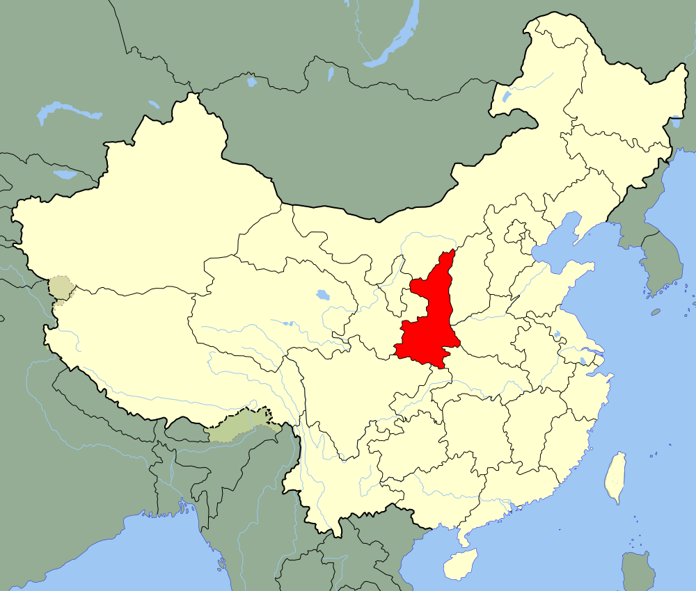
陕西省
/assets/contentimages/Shan20Xi20Sheng20.png
This image, video or audio may be copyrighted. It is used for educational purposes only. If you find it, please notify us byand we will remove it immediately.
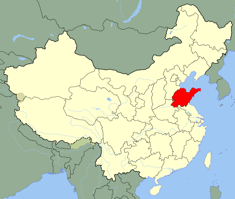
山东省
山东省(Shandong),简称“鲁”,别称“齐鲁”,是中华人民共和国省级行政区,省会济南市,地处中国华东地区的沿海,濒临渤海和黄海,自北而南与河北、河南、安徽、江苏4省接壤。“山东”一词最初主要指崤山、华山或太行山以东的黄河流域广大地区。因西周封邦建国时,今山东境内曾存有齐、鲁、曹、滕、卫诸国,周公旦封于鲁,故山东简称“鲁” ,山东历史代表文化为“齐鲁文化” 。山东省是工业大省,拥有41个工业大类,中国重要的工业基地和北方地区经济发展的战略支点。
/assets/contentimages/Shan20Dong20Sheng20.png
This image, video or audio may be copyrighted. It is used for educational purposes only. If you find it, please notify us byand we will remove it immediately.
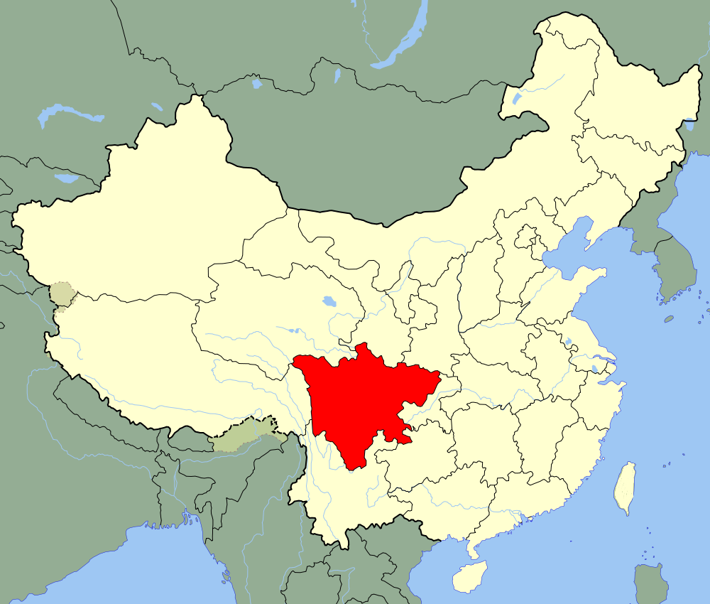
四川省
/assets/contentimages/Si20Chuan20Sheng20.png
This image, video or audio may be copyrighted. It is used for educational purposes only. If you find it, please notify us byand we will remove it immediately.
祁家黄河大桥
http://www.net4info.de/photos/cpg/albums/userpics/10001/Qi20Jia20Du20Kou20Huang20He20Da20Qiao20.JPG
国道213线祁家黄河大桥是我省建的第一座上承式钢管混凝土拱桥和单跨度最大的公路桥梁。
  祁家黄河大桥于2006年8月9日开工建设,2009年9月19日建成通车,完成投资4200万元。项目起于永靖县刘家峡镇,止于东乡县董岭乡祁家村,全长828米,其中桥长248米,设计速度为40公里/小时,桥宽12米,桥梁设计荷载为公路-Ⅰ级。
  祁家黄河大桥是我省国道干线公路上最后一座渡改桥工程,它的建成通车彻底结束了祁家黄河渡口摆渡带来的各种不便与安全隐患,使黄河两岸的永靖县和东乡县通车时间缩短了近1小时,大大提高了国道213线的通行水平和安全保障能力。
This image, video or audio may be copyrighted. It is used for educational purposes only. If you find it, please notify us byand we will remove it immediately.