
Deutsch-Chinesische Enzyklopädie, 德汉百科
 Vltava


波希米亚林山(德语:Böhmerwald;英语:Bohemian Forest),又依捷克语译作舒马瓦山(捷克语:Šumava),是位于中欧的一个浅山地带。该山区从捷克境内的南波西米亚地区一直延伸至奥地利与德国的巴伐利亚地区。这片山脉形成了捷克与德国、奥地利的天然边界。
Der Böhmerwald, tschechisch Šumava (ausgesprochen Schumawa, anhörenⓘ/?), ist eine etwa 120 km lange und bis zu 50 km breite Bergkette, die sich entlang der tschechisch-deutsch-österreichischen Grenze erstreckt. Er ist nach Riesengebirge (1603 m) und Altvatergebirge (1491 m) das dritthöchste Rumpfgebirge der Böhmischen Masse. Der höchste Berg des Böhmerwaldes ist mit 1456 m der Große Arber. Der Asteroid des mittleren Hauptgürtels (2403) Šumava wurde nach dem Gebirge benannt.


 Brandenburg
 Germany
 Elbe
Elbe

 Hamburg

 Mecklenburg-Vorpommern
 Vltava

 Lower Saxony
 Kiel Canal
 Austria
 Poland

 Saxony

 Saxony-Anhalt

 Schleswig-Holstein
 Czech Republic

 Vacation and Travel
易北河发源于捷克和波兰交接的苏台德山脉,向南进入捷克,再流成一个弧形转向西北流入德国,经汉堡流入北海。
易北河(德语:Elbe)在捷克语和波兰语中称为“拉贝河”(Labe,Łaba),都是由古斯堪的纳维亚语的“河流”一词演变来的。易北河发源于捷克和波兰交接的苏台德山脉,向南进入捷克,再流成一个弧形转向西北流入德国,经汉堡流入北海,是中欧地区的主要航运河道。
易北河从河源到德国的德累斯顿为上游,在山地中河流湍急,由许多小支流汇合而成,在接近德捷边境时河宽达140米,然后穿越一个狭窄的峡谷进入德国的平原地区。河宽达430米,到了汉堡以下为下游,河流宽达14.5公里,海轮可以经过宽阔的河道航行109公里直接到达汉堡,通过中德运河向西到达鲁尔工业区,向东到达柏林。700吨的货轮可以上溯到捷克,较小的船可以经由其支流到达布拉格。
易北河的年平均流量变化较大,1926年到1965年期间,最大流量达3617秒立方米,最小只有145秒立方米,因此给航运带来一定的不利影响。由于下游水位低,海潮可以直接到达汉堡,当有风暴时,洪水可以淹没汉堡部分市区。易北河的沿岸分布着许多欧洲重要的城市。
Die (niederdeutsch Elv, tschechisch Labe, lateinisch Albis) ist ein mitteleuropäischer Strom, der in Tschechien entspringt, durch Deutschland fließt und in die Nordsee mündet. Sie ist der einzige Fluss, der das von Mittelgebirgen umschlossene Böhmen zur Nordsee hin entwässert. Zu den bekanntesten Gewässern ihres Einzugsgebietes gehören die Moldau, die Saale, die Havel mit der Spree und die Elde mit der Müritz. Im Oberlauf durch die Mittelgebirge geprägt, folgt sie im weiteren Verlauf zwei Urstromtälern des Norddeutschen Tieflandes.
Gemessen an der Größe ihres Einzugsgebietes von 148.300 km² liegt sie für Mitteleuropa gemäß Liste der Flüsse in Europa an vierter Stelle hinter der Donau, der Weichsel und dem Rhein, gefolgt von Oder und Memel.[6]
エルベ川(エルベがわ、ポーランド語: Łaba、チェコ語: Labe、ドイツ語: Die Elbe、低ザクセン語: De Elv)は、チェコ北部およびドイツ東部を流れ北海へと注ぐ国際河川である。全長約1,091kmはヨーロッパでは14番目に長く、このうち727kmがドイツ国内を占める。
ポーランド、チェコ国境地帯のズデーテン山地に源を発し、チェコ北部、ドイツ東部を北へ流れ、ハンブルク付近で北海に注ぐ。
ハンブルク南東付近にはエルベ・リューベック運河が延び、バルト海南西部リューベック湾との間を結んでいる。河口付近にはキール運河があり、バルト海のキール湾に接続している。
The Elbe (/ˈɛlbə/; Czech: ![]() Labe (help·info) [ˈlabɛ]; German: Elbe [ˈɛlbə]; Low German: Elv, historically in English also Elve[1][2][3]) is one of the major rivers of Central Europe. It rises in the Krkonoše Mountains of the northern Czech Republic before traversing much of Bohemia (Czech Republic), then Germany and flowing into the North Sea at Cuxhaven, 110 km (68 mi) northwest of Hamburg. Its total length is 1,094 kilometres (680 mi).[4]
Labe (help·info) [ˈlabɛ]; German: Elbe [ˈɛlbə]; Low German: Elv, historically in English also Elve[1][2][3]) is one of the major rivers of Central Europe. It rises in the Krkonoše Mountains of the northern Czech Republic before traversing much of Bohemia (Czech Republic), then Germany and flowing into the North Sea at Cuxhaven, 110 km (68 mi) northwest of Hamburg. Its total length is 1,094 kilometres (680 mi).[4]
The Elbe's major tributaries include the rivers Vltava, Saale, Havel, Mulde, Schwarze Elster, and Ohře.[4]
The Elbe river basin, comprising the Elbe and its tributaries, has a catchment area of 148,268 square kilometres (57,247 sq mi), the fourth largest in Europe. The basin spans four countries, with its largest parts in Germany (65.5%) and the Czech Republic (33.7%). Much smaller parts lie in Austria (0.6%) and Poland (0.2%). The basin is inhabited by 24.4 million people.[4]
L'Elbe (allemand Elbe, tchèque Labe, sorabe Łobjo) est un fleuve d'Europe centrale qui prend sa source en République tchèque dans les monts des Géants et, après un parcours situé en majeure partie en Allemagne, se jette dans la mer du Nord par un long estuaire d'une centaine de kilomètres sur lequel se trouve Hambourg, premier port d'Allemagne. La longueur de ce fleuve est de 1 091 kilomètres.
L'Elba (in tedesco: Elbe, in ceco: Labe) è uno dei fiumi più lunghi dell'Europa centrale (1165 Km). Nasce nel nord della Repubblica Ceca, nella catena montuosa dei Monti Sudeti, a circa 1 400 m di altezza. Attraversa quindi la Germania per sfociare poi nel Mare del Nord. La sua lunghezza totale è di 1 165 km.
El río Elba (en checo, Labe; en alemán, Elbe; en bajo alemán Elv; en latín, Albis) es uno de los principales ríos de la Europa central, el segundo más largo de los que desembocan en el mar del Norte, tras el Rin. Tiene una longitud de 1165 km (15.º más largo de Europa) y drena una cuenca de 148 268 km² (12.ª cuenca europea y 2.ª del mar del Norte) que corresponde a Alemania (65,5%), República Checa (33,7%), Austria (0,6%) y Polonia (0,2%). El sistema fluvial más largo de la cuenca corresponde al Elba–Moldava, con 1231 km.
El Elba nace en el norte de la República Checa, a 1386 m de altitud, en la vertiente meridional de los montañas de los Gigantes, y tras discurrir primero en dirección sureste y virar al noroeste, desemboca no lejos de Hamburgo en el mar del Norte.
Administrativamente, el río discurre por cuatro de las trece regiones de la República Checa —Hradec Králové, Bohemia Central, Pardubice y Ústí nad Labem— y cinco de los 16 estados federados de Alemania —Sajonia, Sajonia-Anhalt, Baja Sajonia, Schleswig-Holstein y Hamburgo—.
Las ciudades más importantes en su curso son las checas Hradec Králové (93 035 hab.), Pardubice (89 467 hab.), Ústí nad Labem (93 747 hab.) y Děčín (50 289 hab.) y las alemanas Dresde (525 105 hab.), Dessau (85 488 hab.), Magdeburgo (229 924 hab.), Hamburgo (1 734 272 hab.) y Cuxhaven (50 846 hab.).
Sus principales afluentes son los ríos Moldava (434 km), Saale (413 km), Havel (413 km), Ohře (316 km), Elster Negro (181 km) y Mulda (147 km).1
La cuenca del Elba está habitada por 24,5 millones de personas.1
Э́льба (нем. Elbe, н.-нем. Elv, лат. Albis) или Ла́ба (чеш. Labe, в.-луж. и н.-луж. Łobjo) — река бассейна Северного моря. Берёт начало в Чехии, основное течение на территории Германии. Длина реки — 1165 км[1]. Площадь водосборного бассейна — 148 000 км²[1]. Среднемноголетний расход воды при впадении в море — 861 м³/с[1].
Дрезденская долина Эльбы со знаменитой террасой Брюля в силу своей редкой живописности в 2004—2009 входила в список Всемирного наследия человечества.

 Architecture
 Gothic architecture

 Architecture
 Baroque / Rococo architecture

 History
 L 1000 - 1500 AD
 Vltava
 Czech Republic


查理大桥(捷克语:Karlův most ![]() listen 帮助·信息)是捷克共和国首都布拉格市内,一座跨越伏尔塔瓦河的著名的历史桥梁。精确定位:
listen 帮助·信息)是捷克共和国首都布拉格市内,一座跨越伏尔塔瓦河的著名的历史桥梁。精确定位: 50°5′11.21″N 14°24′42.68″E。它由查理四世始建于1357年,完成于15世纪初。直到1841年,作为跨越伏尔塔瓦河的唯一桥梁,查理大桥是联接老城与布拉格城堡及邻近地区最重要的通道,也使得布拉格成为东西欧之间重要的贸易通道。该桥最初称为“石桥”(Kamenný most)或“布拉格桥”(Pražský most),直到1870年才命名为“查理大桥”。
查理大桥长516米,宽约10米,16个桥拱,两端有3座桥塔,其中两座位于布拉格小城一侧,一座位于布拉格老城一侧。老城桥塔经常被认为是世界上最令人惊讶的世俗哥特式建筑之一。该桥上安放有30座雕塑,其中多数为巴洛克风格,竖立于1700年前后。
在夜间,查理大桥是一个非常宁静的地方。但是在日间,却摇身一变,成为一个热闹的地点,无数的游客经过此桥,身旁是画家、商亭主人和其他商贩。
カレル橋(カレルばし、チェコ語: Karlův most)はチェコ共和国の首都、プラハを流れるヴルタヴァ川に架かる橋である。
神聖ローマ皇帝カール4世の治世下1357年に建設が始まり1402年に完成した[1]。建築家ペトル・パルレーの設計による。1841年までプラハ旧市街とその周囲をつなぐ唯一の橋であった。また、西欧と東欧の交易ルートとしてプラハが重要な地位を占めるようになった。最初は単に石橋、プラハ橋と呼ばれていたが1870年よりカレル橋と呼ばれるようになった。
橋の長さは515.7メートル、幅は9.5メートル。15のアーチの上に、砂岩の切石の橋桁が渡されている。また橋を守るために3つの橋塔が建てられており、とくに旧市街側の橋塔はゴシック様式の建築として名高い。橋の欄干には15体ずつ、合計30体の彫刻が並んでいる[2]。その多くはバロック様式である。最も古いものは「十字架像」で1361年の文書に登場する。その後ボヘミア王イジー・ス・ポジェブラト騎馬像やライオン像などが据えられていたと考えられているが、三十年戦争の間に十字架像を除いて全て破壊されたとされる[3]。その後1683年、ヤン・ネポムツキー像が新たに据えられた[4]。その後1714年までの間に合計28体の彫像が製作され据付けられた[4][3]。これらの彫像の中で著名なものは「十字架像(ゴルゴダの丘で磔にされたキリスト像,Crucifix and Calvary)」、「ブルンツヴィーク像(Bruncvík column)」と「聖人ヤン・ネポムツキー像(St. John of Nepomuk)」である[5]。この聖人ヤン・ネポムツキー像の基部にあるネポムツキーのレリーフに触れると幸運が訪れるといわれ多くの人に触られたためつるつるになっている。また、最も古くから存在した十字架像のオリジナルはプラハ国立博物館に保管され、現在橋に設置されているものは1629年に製作[3]されたものである。
昼間のカレル橋は観光客で賑わい、橋の上には多くの露店が並ぶ。また、大道芸、見世物、ジャズ演奏なども行なわれる。夜になるとプラハ城やカレル橋がライトアップされ、夜の散歩を楽しむ人々の通りになる。
Charles Bridge (Czech: Karlův most [ˈkarluːf ˈmost] (![]() listen)) is a historic bridge that crosses the Vltava river in Prague, Czech Republic. Its construction started in 1357 under the auspices of King Charles IV, and finished in the beginning of the 15th century.[2] The bridge replaced the old Judith Bridge built 1158–1172 that had been badly damaged by a flood in 1342. This new bridge was originally called Stone Bridge (Kamenný most) or Prague Bridge (Pražský most) but has been "Charles Bridge" since 1870.[2] As the only means of crossing the river Vltava (Moldau) until 1841, Charles Bridge was the most important connection between Prague Castle and the city's Old Town and adjacent areas. This "solid-land" connection made Prague important as a trade route between Eastern and Western Europe.
listen)) is a historic bridge that crosses the Vltava river in Prague, Czech Republic. Its construction started in 1357 under the auspices of King Charles IV, and finished in the beginning of the 15th century.[2] The bridge replaced the old Judith Bridge built 1158–1172 that had been badly damaged by a flood in 1342. This new bridge was originally called Stone Bridge (Kamenný most) or Prague Bridge (Pražský most) but has been "Charles Bridge" since 1870.[2] As the only means of crossing the river Vltava (Moldau) until 1841, Charles Bridge was the most important connection between Prague Castle and the city's Old Town and adjacent areas. This "solid-land" connection made Prague important as a trade route between Eastern and Western Europe.
The bridge is 621 metres (2,037 ft) long and nearly 10 metres (33 ft) wide, following the example of the Stone Bridge in Regensburg, it was built as a bow bridge with 16 arches shielded by ice guards.[2] It is protected by three bridge towers, two on the Lesser Quarter side (including the Malá Strana Bridge Tower) and one on the Old Town side, the Old Town Bridge Tower. The bridge is decorated by a continuous alley of 30 statues and statuaries, most of them baroque-style, originally erected around 1700 but now all replaced by replicas.
Repairs are scheduled to start in late 2019, they should take around 20 years.
Le pont Charles (en tchèque : Karlův most Prononciation tchèque ) est un pont qui relie la Vieille-Ville de Prague (Staré Město en tchèque) au quartier de Malá Strana. Construit au XIVe siècle, il sera le seul pont sur la Vltava (la Moldau) jusqu'en 1741.
Symbole de la ville, incontournable pour les touristes, il est envahi de musiciens, d'artistes divers, de bonimenteurs et de camelots. Son nom fait référence au roi Charles IV qui n'eut de cesse d'embellir Prague. Sa construction a servi à remplacer l'ancien pont Judith édifié quelques mètres en amont et emporté par la Vltava en crue en 1342.
Il ponte Carlo (in ceco Karlův most) è uno storico ponte in pietra sulla Moldava, situato nella città di Praga, e collega la Città Vecchia al quartiere di Malá Strana: è (forse) il più famoso monumento della capitale della Repubblica Ceca. Misura 515 metri di lunghezza e 20 metri di larghezza Il ponte è una delle più grandi attrazioni turistiche della città, ed è molto frequentato dagli artisti di strada, dai musicisti e dai venditori di "souvenir" durante tutto l'anno.
El puente de Carlos (en checo, Karlův most) es el puente más viejo de Praga, y atraviesa el río Moldava de la Ciudad Vieja a la Ciudad Pequeña. Es el segundo puente más antiguo existente en la República Checa.
Su construcción comenzó en 1357 con el visto bueno del rey Carlos IV, y fue finalizado en 1402. Dado que en ese entonces constituía la única forma de cruzar el río, el Puente de Carlos se transformó en la vía de comunicación más importante entre la Ciudad Vieja, el Castillo de Praga y las zonas adyacentes hasta 1841. El puente fue también una conexión importante para el comercio entre la Europa Oriental y la Occidental.
Originalmente esta vía de comunicación se llamaba Puente de Piedra (Kamenný most) o Puente de Praga (Pražský most), pero lleva su denominación actual desde 1870.
El puente tiene una longitud de 516 metros y la anchura es de casi 10 metros, al tiempo que se encuentra apoyado en 16 arcos. Está protegido por 3 torres distribuidas entre sus dos cabeceras, dos de ellas en Malá Strana y la restante en el extremo ubicado en la Ciudad Vieja. La torre localizada en la cabecera de la Ciudad Vieja es considerada por muchos como una de las construcciones más impresionantes de la arquitectura gótica en el mundo. El puente está decorado por 30 estatuas situadas a ambos lados del mismo, la mayor parte de las cuales son de estilo barroco y fueron esculpidas alrededor del 1700.
Durante las noches, el Puente de Carlos es un testigo silencioso de los tiempos medievales. Pero durante el día, su cara cambia completamente y se transforma en un sitio muy transitado. Artistas y comerciantes tratan de hacer dinero a expensas del importante flujo de turistas que todos los días visitan el lugar.

František Xaver Sandmann (1805–1856)
Composer: Bedřich Smetana Artists: Janáček Philharmonic Orchestra, Theodore Kuchar (conductor) Bedřich Smetana was a forerunner of the Nationalist music movement in 19th-century Czechoslovakia, and played a large part in developing the country’s musical identity. This disc comprises Smetana’s most renowned work, the inimitable Má vlast (My Homeland), a series of six tone poems – composed over five years – that depict different elements of the landscape of the composer’s native country. Vyšehrad, or The High Castle, is the first movement, based on the castle in Prague – the residence of early Czech kings. It opens with arpeggios played by a duo of harps, and later a military element is portrayed with the help of a march theme. The second movement Vltava (The Moldau), depicts the route of the river from the mountains to its end. Šárka, the third movement, explores the Czech folklore centred on the Bohemian Amazon maiden of the same name. This is followed by Z českých luhů a hájů (From Bohemia’s Meadows and Fields); a depiction of a beautiful landscape on a sunny day. These first four movements were intended to complete the work, but after a gap of four years Smetana composed another two: Tábor, portraying the Hussite warriors who founded and defended the city of Tábor in 1420, and Blaník, named after the mountain in central Bohemia. This, the final movement, begins with the same driving rhythms as Tábor and later relents into a joyful hymn. It is easy to see how this work paved the way for Smetana to be heralded as one of Czechoslovakia’s greatest composers and patriots. The works are performed by the Janáček Philharmonic Orchestra under the baton of Theodore Kuchar. Tracklist 00:00:00 Bedrich Smetana: Má Vlast, JB 1:112: I. Vyšehrad 00:14:57 Bedrich Smetana: Má Vlast, JB 1:112: II. Vltava (The Moldau) 00:26:36 Bedrich Smetana: Má Vlast, JB 1:112: III. Šárka 00:36:16 Bedrich Smetana: Má Vlast, JB 1:112: IV. From Bohemia’s Meadows and Forests 00:48:43 Bedrich Smetana: Má Vlast, JB 1:112: V. Tábor 01:00:16 Bedrich Smetana: Má Vlast, JB 1:112: VI. Blaník Thanks for watching! Feel free to subscribe and visit our channel for the best classical music from the greatest composers like: Bach, Satie, Mozart, Tchaikovsky, Beethoven, Chopin, Haydn, Ravel, Debussy, Verdi, Vivaldi, Handel, Brahms, Liszt, Schubert, Mendelssohn, Rachmaninoff, Wagner, Strauss, Handel, Dvorak, Schubert and many more! We upload complete albums, music for relaxing, working, studying, meditating, concentrating, instrumental music, opera, violin, classical piano music, sonatas and more!

 Architecture

 History

 International cities
 *European Capital of Culture

 Medieval cities in Europe
 Vltava
 Silk road
 Czech Republic

 World Heritage


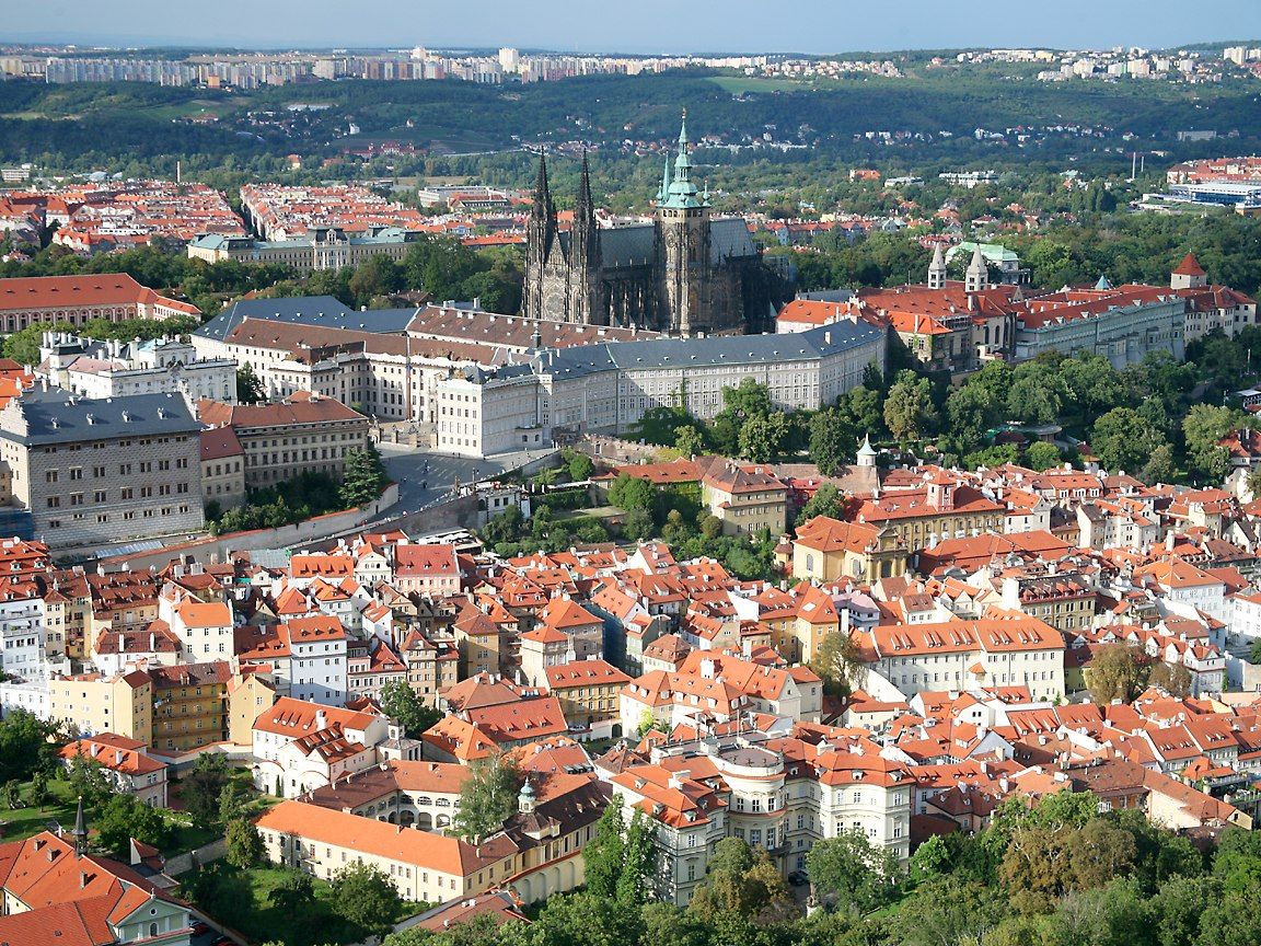
Prag (tschechisch Praha [ˈpraɦa]; ) ist die Hauptstadt und zugleich bevölkerungsreichste Stadt der Tschechischen Republik. Mit über 1,2 Millionen Einwohnern belegt Prag den vierzehnten Rang der größten Städte der Europäischen Union. Die Hauptstadt Prag ist eine der 14 Regionen Tschechiens und eine der reichsten Regionen Europas[2].
Prag ist die historische Hauptstadt Böhmens und war eine bedeutende königliche und kaiserliche Residenzstadt im Heiligen Römischen Reich, besonders unter den Přemysliden, Luxemburgern und Habsburgern. Um 1230 wurde die seit der Frühgeschichte bewohnte Siedlung zu einer königlichen Stadt erhoben und im 14. Jahrhundert als Residenzstadt Karls IV. zu einem politisch-kulturellen Zentrum in Europa. Mit der Karls-Universität wurde in Prag 1348 die erste Universität in Mitteleuropa gegründet. Auch das Konservatorium und die Technische Universität gehören zu den ältesten ihrer Art in Europa. Über Jahrhunderte hinweg war Prag eine Stadt, in der sich tschechische, deutsche und jüdische Kultur begegneten.
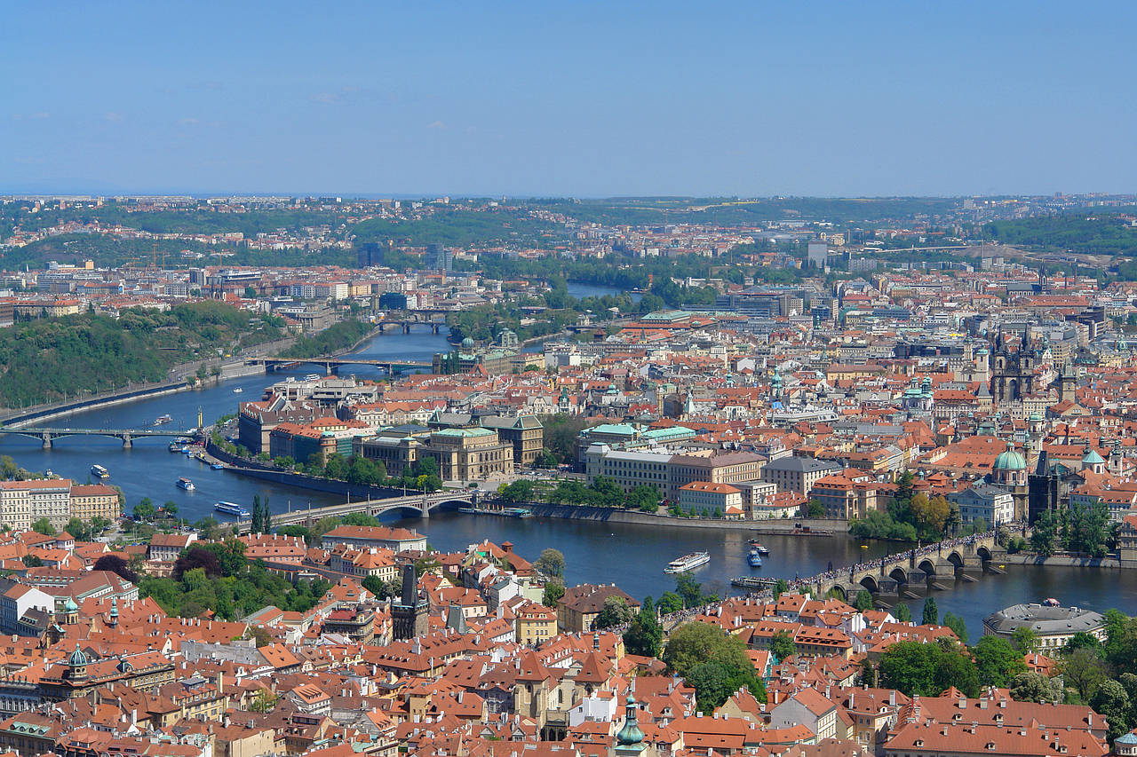
Prague (/prɑːɡ/; Czech: Praha [ˈpraɦa] (![]() listen), German: Prag) is the capital and largest city in the Czech Republic, the 14th largest city in the European Union[9] and the historical capital of Bohemia. Situated in the north-west of the country on the Vltava river, the city is home to about 1.3 million people, while its larger urban zone is estimated to have a population of 2.6 million.[10] The city has a temperate climate, with warm summers and chilly winters.
listen), German: Prag) is the capital and largest city in the Czech Republic, the 14th largest city in the European Union[9] and the historical capital of Bohemia. Situated in the north-west of the country on the Vltava river, the city is home to about 1.3 million people, while its larger urban zone is estimated to have a population of 2.6 million.[10] The city has a temperate climate, with warm summers and chilly winters.
Prague has been a political, cultural and economic centre of central Europe complete with a rich history. Founded during the Romanesque and flourishing by the Gothic, Renaissance and Baroque eras, Prague was the capital of the kingdom of Bohemia and the main residence of several Holy Roman Emperors, most notably of Charles IV (r. 1346–1378).[11] It was an important city to the Habsburg Monarchy and its Austro-Hungarian Empire. The city played major roles in the Bohemian and Protestant Reformation, the Thirty Years' War and in 20th-century history as the capital of Czechoslovakia, during both World Wars and the post-war Communist era.[12]
Prague is home to a number of famous cultural attractions, many of which survived the violence and destruction of 20th-century Europe. Main attractions include the Prague Castle, the Charles Bridge, Old Town Square with the Prague astronomical clock, the Jewish Quarter, Petřín hill and Vyšehrad. Since 1992, the extensive historic centre of Prague has been included in the UNESCO list of World Heritage Sites.
The city has more than ten major museums, along with numerous theatres, galleries, cinemas and other historical exhibits. An extensive modern public transportation system connects the city. Also, it is home to a wide range of public and private schools, including Charles University in Prague, the oldest university in Central Europe.[13]
Prague is classified as a "Beta+" global city according to GaWC studies[14] and ranked sixth in the Tripadvisor world list of best destinations in 2016.[15] Its rich history makes it a popular tourist destination and as of 2014, the city receives more than 6.4 million international visitors annually. Prague is the fifth most visited European city after London, Paris, Istanbul and Rome.[16]
Prague (prononcé [pʁag] ; en tchèque Praha [ˈpra.ɦa]) est la capitale et la plus grande ville de la République tchèque. Elle est à la fois l’une des quatorze régions du pays, le chef-lieu de la région administrative de Bohême-Centrale2,3 et la capitale de la région historique de Bohême. Elle est traversée par la Vltava (Moldau en allemand) et compte 1 280 508 habitants en 20164.
Prague est située en plein cœur de l'Europe centrale. Elle fut par le passé capitale du royaume de Bohême, du Saint-Empire romain germanique et de la Tchécoslovaquie (ČSR, ČSSR et enfin ČSFR). La ville aux mille tours et mille clochers (qui est encore la caractéristique architecturale de la ville) a miraculeusement échappé aux destructions de la Seconde Guerre mondiale et offre une architecture mêlant les styles préroman, roman, gothique, baroque, rococo, Art nouveau et cubiste. En 1968, le Printemps de Prague et l'écrasement du « socialisme à visage humain » par les troupes de l'URSS et du Pacte de Varsovie ont profondément marqué les Praguois et inspiré la culture des années 1960-1980. Depuis 1992, le centre ville historique est inscrit sur la liste du patrimoine mondial par l'UNESCO.
Prague est la sixième région urbaine la plus riche de l'Union européenne en termes de PIB par habitant PPA5, derrière la région urbaine de Hambourg mais devant l'Île-de-France6, la progression est continue ces dernières années. En 2015, selon Eurostat, le chômage était de 2,8 % dans la région de Prague7. Le contexte économique national est également plutôt favorable car la République tchèque est, avec les Pays-Bas, le pays où le taux de pauvreté est le plus bas d'Europe : il s'établit à 10 % de la population8, contre 16 % de moyenne pour l'Union européenne. Prague fait partie des villes mondiales Alpha - (villes globales) d'après le classement GaWC9 de l'université de Loughborough.
Praga (en checo, Praha ![]() [ˈpraɦa] (?·i)) es la capital de la República Checa, tal y como recoge la Constitución del país.1 Antes fue capital del Reino de Bohemia y de Checoslovaquia. También es la capital de la región de Bohemia.
[ˈpraɦa] (?·i)) es la capital de la República Checa, tal y como recoge la Constitución del país.1 Antes fue capital del Reino de Bohemia y de Checoslovaquia. También es la capital de la región de Bohemia.
Situada a orillas del río Moldava, tiene aproximadamente 1,2 millones de habitantes, lo que la convierte en la ciudad más poblada del país y la séptima de Europa Central. El área metropolitana de Praga cuenta con una población de 1,9 millones de habitantes.2
Desde 1992 el casco histórico de la ciudad es Patrimonio de la Humanidad.34 Su belleza y patrimonio histórico la convierten en una de las veinte ciudades más visitadas del mundo.5
Praga se ha desarrollado desde el siglo IX, convirtiéndose en una de las capitales más importantes de Europa en los siglos XVIII y XIX. Sin embargo, en el siglo XX sufrió las dos guerras mundiales y, principalmente, la dictadura nazi. Tras la segunda guerra, quedó dentro de la esfera de influencia soviética. Tras la Revolución de terciopelo y la caída del Muro de Berlín la ciudad se ha ido adaptando a la economía de mercado.
Пра́га (чеш. Praha [ˈpraɦa]) — статутный город и столица Чешской Республики, административный центр Среднечешского края и двух его районов: Прага-Восток и Прага-Запад. Образует самостоятельную административно-территориальную единицу страны.
Население: 1,3 млн человек (2018 год). Четырнадцатый по величине город в Евросоюзе. Расположена на берегах реки Влтавы в сорока километрах от её впадения в Лабу.
Главный политический, экономический и культурный центр Чехии. Крупный туристический центр Европы. Количество туристов в 2012 году превысило 5,4 млн человек[3].
С X века столица Чешского государства; в 1526—1918 годы главный город Богемии под властью Габсбургов; с 1918 по 1992 год столица Чехословакии; с 1993 года — Чешской Республики. Исторический центр внесён в список Всемирного наследия ЮНЕСКО.
 Geography
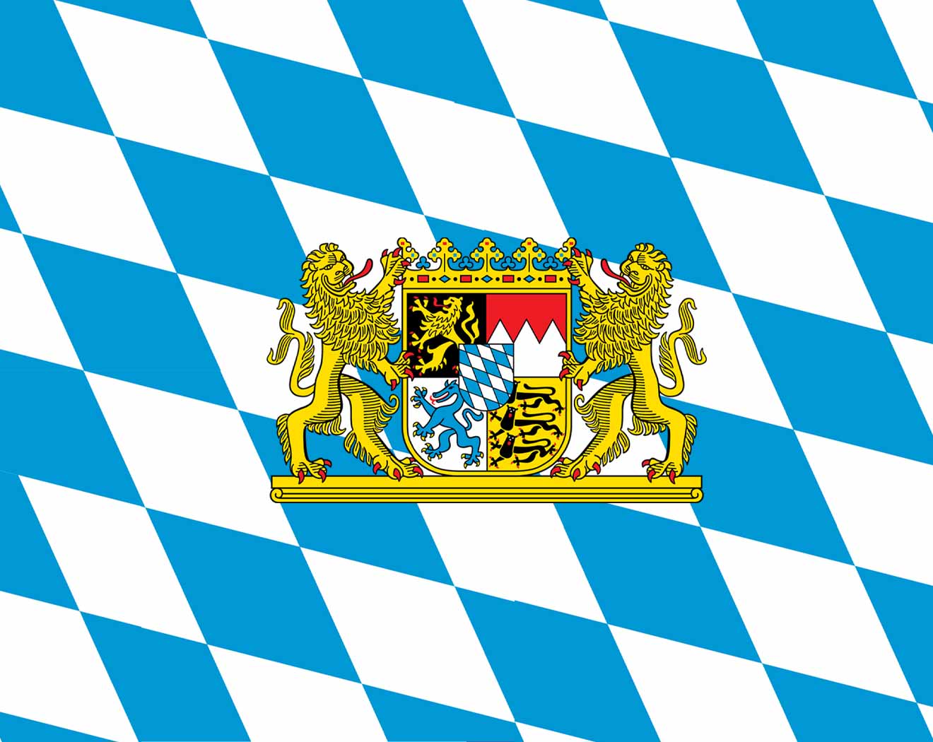 Bavaria
 Music
Music
 Review