
漢德百科全書 | 汉德百科全书
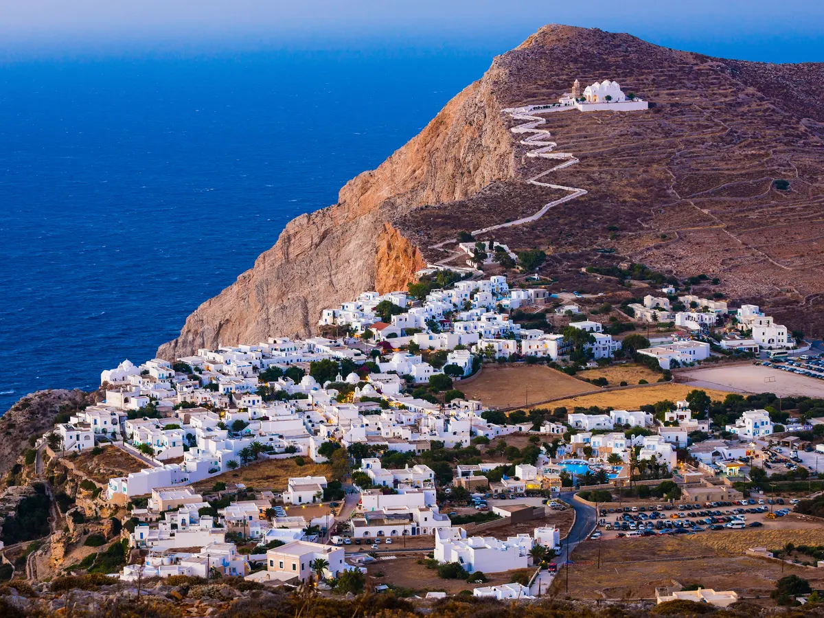
 Greece
 Architecture
 History
 Civilization

 Geography

 World Heritage
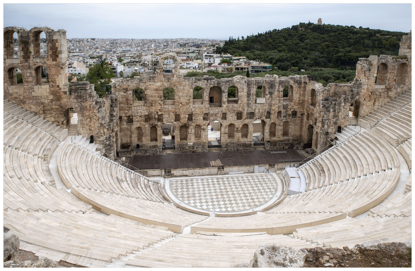
Das Dionysostheater (Neugriechisch: Θέατρο του Διονύσου) war das wichtigste Theater im antiken Griechenland und gilt als Geburtsstätte des Theaters der griechischen Antike und des Dramas überhaupt. Es gilt auch als das erste Theater der Welt. Es liegt am Südhang der Athener Akropolis. Seinen Namen erhielt es nach Dionysos, dem Gott des Weins und der Ekstase. Ihm zu Ehren wurden in Athen alljährlich die Festspiele der Dionysien gefeiert. Dazu gehörten ursprünglich aus kultischen Gesangs-, Tanz- und Opferriten hervorgegangene Theatervorführungen, die im Dionysos-Theater stattfanden. Die berühmten klassischen Tragödien von Aischylos, Sophokles und Euripides hatten ihre Uraufführung bei den Dionysien.
狄俄倪索斯剧场(希腊语:Θέατρο του Διονύσου,英语:Theatre of Dionysus)是希腊雅典的一个露天剧场。这是世界上最古老的剧场之一。在节日,会在此表演戏剧,献给葡萄酒和农业之神、戏剧的保护神狄俄倪索斯。它常会与兴建较晚,保存较好的希罗德·阿提库斯剧场(Odeon of Herodes Atticus)相混淆,后者位于雅典卫城的西南山坡。
*Mediterranean Sea
Egypt
Albania
Algeria
Amber Road
Bosnia Herzegovina
France
Gibraltar
Greece
Israel
Italy
Croatia
Libanon
Libya
Malta
Malta
Monaco
Montenegro
Palestine
Slovenia
Spain
Syria
Tunisia
Turkey
Cyprus
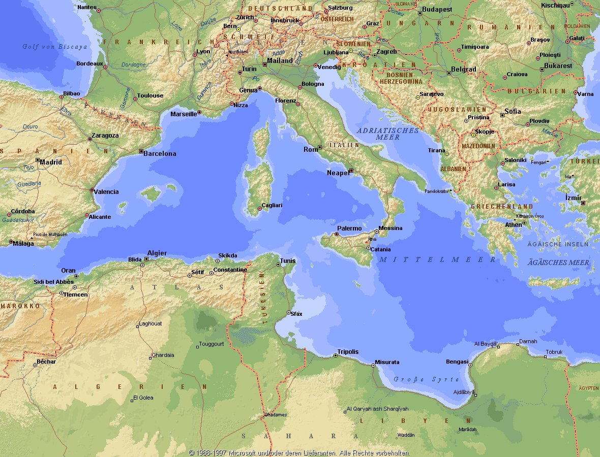
Das Mittelmeer (lateinisch Mare Mediterraneum,[1] deshalb deutsch auch Mittelländisches Meer, präzisierend Europäisches Mittelmeer, im Römischen Reich Mare Nostrum) ist ein Mittelmeer zwischen Europa, Afrika und Asien, ein Nebenmeer des Atlantischen Ozeans und, da es mit der Straße von Gibraltar nur eine sehr schmale Verbindung zum Atlantik besitzt, auch ein Binnenmeer. Im Arabischen und Türkischen wird es auch als „Weißes Meer“ (البحر الأبيض/al-baḥr al-abyaḍ bzw. türk. Akdeniz) bezeichnet.
Zusammen mit den darin liegenden Inseln und den küstennahen Regionen Südeuropas, Vorderasiens und Nordafrikas bildet das Mittelmeer den Mittelmeerraum, der ein eigenes Klima (mediterranes Klima) hat und von einer eigenen Flora und Fauna geprägt ist.
地中海(英文:Mediterranean),被北面的欧洲大陆、南面的非洲大陆以及东面的亚洲大陆包围着。东西长约4000千米,南北最宽处大约为1800千米,面积251.6万平方千米,是地球上最大的陆间海。地中海的平均深度是1500米,最深处为5267米。
地中海西部通过直布罗陀海峡与大西洋相接,东部通过土耳其海峡(达达尼尔海峡和博斯普鲁斯海峡、马尔马拉海)和黑海相连。19世纪时开通的苏伊士运河,接通了地中海与红海。地中海是世界上最古老的海之一[3],而其附属的大西洋却是年轻的海洋。地中海处在欧亚板块和非洲板块交界处,是世界最强地震带之一。地中海地区有维苏威火山、埃特纳火山。
地中海作为陆间海,风浪较小,加之沿岸海岸线曲折、岛屿众多,拥有许多天然良好的港口,成为沟通三个大陆的交通要道。这样的条件,使地中海从古代开始海上贸易就很繁盛,促进了古代古埃及文明、古希腊文明、罗马帝国等的发展。现在也是世界海上交通的重要地区之一。其沿岸的腓尼基人、克里特人、希腊人,以及后来的葡萄牙人和西班牙人都是航海业发达的民族。著名的航海家如哥伦布、达·伽马、麦哲伦等,都出自地中海沿岸的国家。
地中海沿岸夏季炎热干燥,冬季温暖湿润,被称作地中海性气候。植被,叶质坚硬,叶面有蜡质,根系深,有适应夏季干热气候的耐旱特征,属亚热带常绿硬叶林。这里光热充足,是欧洲主要的亚热带水果产区,盛产柑橘、无花果,和葡萄等,还有木本油料作物油橄榄。
地中海(ちちゅうかい、ラテン語: Mare Mediterraneum)は、北と東をユーラシア大陸、南をアフリカ大陸(両者で世界島)に囲まれた地中海盆地に位置する海である。面積は約3000平方キロメートル、平均水深は約1500メートル[2]。海洋学上の地中海の一つ。
地中海には、独立した呼称を持ついくつかの海域が含まれる(エーゲ海、アドリア海など)。地中海と接続する他の海としては、ジブラルタル海峡の西側に大西洋が、ダーダネルス海峡を経た北東にマルマラ海と黒海があり、南西はスエズ運河で紅海と結ばれている(「海域」「地理」で詳述)。
北岸の南ヨーロッパ、東岸の中近東、南岸の北アフリカは古代から往来が盛んで、「地中海世界」と総称されることもある[3]。
The Mediterranean Sea is a sea connected to the Atlantic Ocean, surrounded by the Mediterranean Basin and almost completely enclosed by land: on the north by Southern Europe and Anatolia, on the south by North Africa and on the east by the Levant. Although the sea is sometimes considered a part of the Atlantic Ocean, it is usually identified as a separate body of water. Geological evidence indicates that around 5.9 million years ago, the Mediterranean was cut off from the Atlantic and was partly or completely desiccated over a period of some 600,000 years, the Messinian salinity crisis, before being refilled by the Zanclean flood about 5.3 million years ago.
It covers an approximate area of 2.5 million km2 (965,000 sq mi), but its connection to the Atlantic (the Strait of Gibraltar) is only 14 km (8.7 mi) wide. The Strait of Gibraltar is a narrow strait that connects the Atlantic Ocean to the Mediterranean Sea and separates Gibraltar and Spain in Europe from Morocco in Africa. In oceanography, it is sometimes called the Eurafrican Mediterranean Sea or the European Mediterranean Sea to distinguish it from mediterranean seas elsewhere.[2][3]
The Mediterranean Sea has an average depth of 1,500 m (4,900 ft) and the deepest recorded point is 5,267 m (17,280 ft) in the Calypso Deep in the Ionian Sea. The sea is bordered on the north by Europe, the east by Asia, and in the south by Africa. It is located between latitudes 30° and 46° N and longitudes 6° W and 36° E. Its west-east length, from the Strait of Gibraltar to the Gulf of Iskenderun, on the southwestern coast of Turkey, is approximately 4,000 km (2,500 miles). The sea's average north-south length, from Croatia’s southern shore to Libya, is approximately 800 km (500 miles). The Mediterranean Sea, including the Sea of Marmara (connected by the Dardanelles to the Aegean Sea), has a surface area of approximately 2,510,000 square km (970,000 square miles).[4]
The sea was an important route for merchants and travellers of ancient times that allowed for trade and cultural exchange between emergent peoples of the region. The history of the Mediterranean region is crucial to understanding the origins and development of many modern societies.
The countries surrounding the Mediterranean in clockwise order are Spain, France, Monaco, Italy, Slovenia, Croatia, Bosnia and Herzegovina, Montenegro, Albania, Greece, Turkey, Syria, Lebanon, Israel, Egypt, Libya, Tunisia, Algeria, and Morocco; Malta and Cyprus are island countries in the sea. In addition, the Gaza Strip and the British Overseas Territories of Gibraltar and Akrotiri and Dhekelia have coastlines on the sea.
La mer Méditerranée (prononcé [me.di.tɛ.ʁa.ne]) est une mer intercontinentale presque entièrement fermée, bordée par les côtes d'Europe du sud, d’Afrique du Nord et d’Asie, depuis le détroit de Gibraltar à l'ouest aux entrées des Dardanelles et du canal de Suez à l'est. Elle s’étend sur une superficie d’environ 2,5 millions de kilomètres carrés. Son ouverture vers l’océan Atlantique par le détroit de Gibraltar est large de 14 kilomètres.
Elle doit son nom au fait qu’elle est littéralement une « mer au milieu des terres », en latin « mare medi terra »1.
Durant l’Antiquité, la Méditerranée était une importante voie de transports maritimes permettant l’échange commercial et culturel entre les peuples de la région — les cultures mésopotamiennes, égyptienne, perse, phénicienne, carthaginoise, berbère, grecque, arabe (conquête musulmane), ottomane, byzantine et romaine. L’histoire de la Méditerranée est importante dans l’origine et le développement de la civilisation occidentale.
Il mar Mediterraneo, detto brevemente Mediterraneo, è un mare intercontinentale situato tra Europa, Nordafrica e Asia occidentale connesso all'Oceano Atlantico. La sua superficie approssimativa è di 2,51 milioni di km² e ha uno sviluppo massimo lungo i paralleli di circa 3 700 km. La lunghezza totale delle sue coste è di 46 000 km, la profondità media si aggira sui 1 500 m, mentre quella massima è di 5 270 m presso le coste del Peloponneso. La salinità media si aggira dal 36,2 al 39 ‰.[2] La popolazione presente negli stati bagnati dalle sue acque ammonta a circa 450 milioni di persone.[2].
El mar Mediterráneo es uno de los mares del Atlántico. Está rodeado por la región mediterránea, comprendida entre Europa meridional, Asia Occidental y África septentrional. Fue testigo de la evolución de varias civilizaciones como los egipcios, los fenicios, hebreos, griegos, cartagineses, romanos, etc. Con aproximadamente 2,5 millones de km² y 3.860 km de longitud, es el segundo mar interior más grande del mundo, después del Caribe.1 Sus aguas, que bañan las tres penínsulas del sur de Europa (Ibérica, Itálica, Balcánica) y una de Asia (Anatolia), comunican con el océano Atlántico a través del estrecho de Gibraltar, con el mar Negro por los estrechos del Bósforo y de los Dardanelos y con el mar Rojo por el canal de Suez.2 Es el mar con las tasas más elevadas de hidrocarburos y contaminación del mundo.3
Средизе́мное мо́ре — межматериковое море, по происхождению представляющее собой глубоководную псевдоабиссальную внутришельфовую депрессию[1][2], связанную на западе с Атлантическим океаном Гибралтарским проливом[3].
В Средиземном море выделяют, как его составные части, моря: Адриатическое, Альборан, Балеарское, Ионическое, Кипрское, Критское, Левантийское, Ливийское, Лигурийское, Тирренское и Эгейское. В бассейн Средиземного моря также входят Мраморное, Чёрное и Азовское моря.
*Mediterranean Sea
Albania
 Eat and Drink
 Greek cuisine
Eat and Drink
Portuguese cuisine
Eat and Drink
Spanish Kitchen
Eat and Drink
Turkish cuisine
Greece
Israel
Italy
Croatia
Libanon
Malta
Morocco
Portugal
Slovenia
Spain
Turkey
Cyprus
Greek cuisine
Eat and Drink
Portuguese cuisine
Eat and Drink
Spanish Kitchen
Eat and Drink
Turkish cuisine
Greece
Israel
Italy
Croatia
Libanon
Malta
Morocco
Portugal
Slovenia
Spain
Turkey
Cyprus
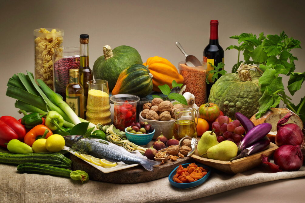
 Als Grundelemente der Landesküchen der Mittelmeerregion gelten: Olivenöl und Oliven frisches Gemüse wie Tomaten, Auberginen, Paprika, Zucchini Knoblauch, Lauch und Zwiebel Fisch und Meeresfrüchte Kräuter und Gewürze wie Thymian, Rosmarin, Koriander, Salbei, Fenchel, Kümmel, Anis, Oregano und Basilikum helles Brot, Nudeln und Reis in einigen Ländern regelmäßiger Rotweingenuss zum Essen.
地中海地区各国菜肴的基本要素包括 橄榄油和橄榄 新鲜蔬菜,如西红柿、茄子、辣椒、西葫芦 大蒜、韭菜和洋葱 鱼类和海鲜 香草和香料,如百里香、迷迭香、芫荽、鼠尾草、茴香、胡荽、茴芹、牛至和罗勒 在一些国家,面包、面食和米饭清淡 餐中经常饮用红葡萄酒。
*Mediterranean Sea
Egypt
Albania
Algeria
Amber Road
Bosnia Herzegovina
France
Gibraltar
Greece
Israel
Italy
Croatia
Libanon
Libya
Malta
Malta
Monaco
Montenegro
Palestine
Slovenia
Spain
Syria
Tunisia
Turkey
Cyprus

*Mediterranean Sea
Albania
Algeria
Bosnia Herzegovina
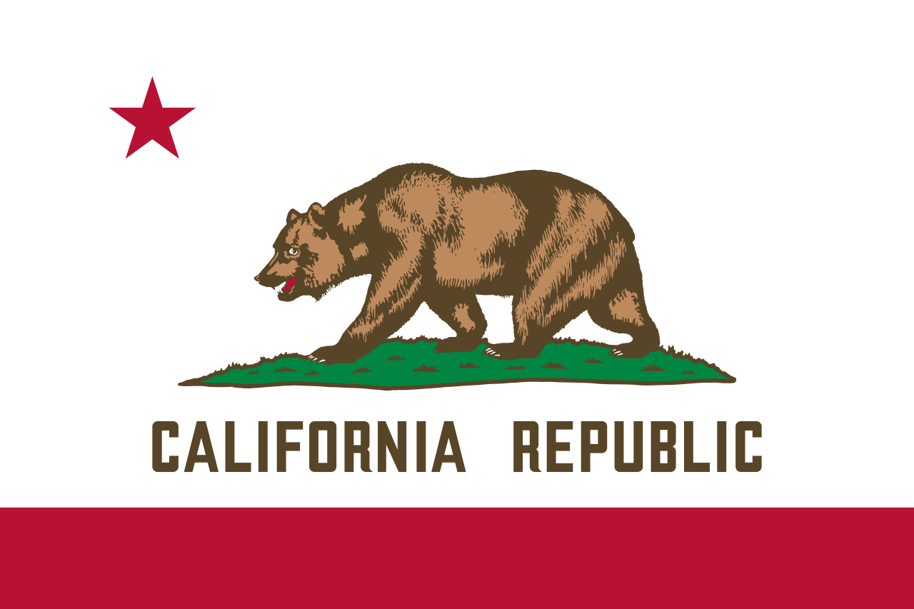 California-CA
Chile
France
Gibraltar
Greece
Israel
Italy
Jordan
California-CA
Chile
France
Gibraltar
Greece
Israel
Italy
Jordan
 Climate
Croatia
Libanon
Libya
Malta
Morocco
Monaco
Montenegro
Portugal
Climate
Croatia
Libanon
Libya
Malta
Morocco
Monaco
Montenegro
Portugal
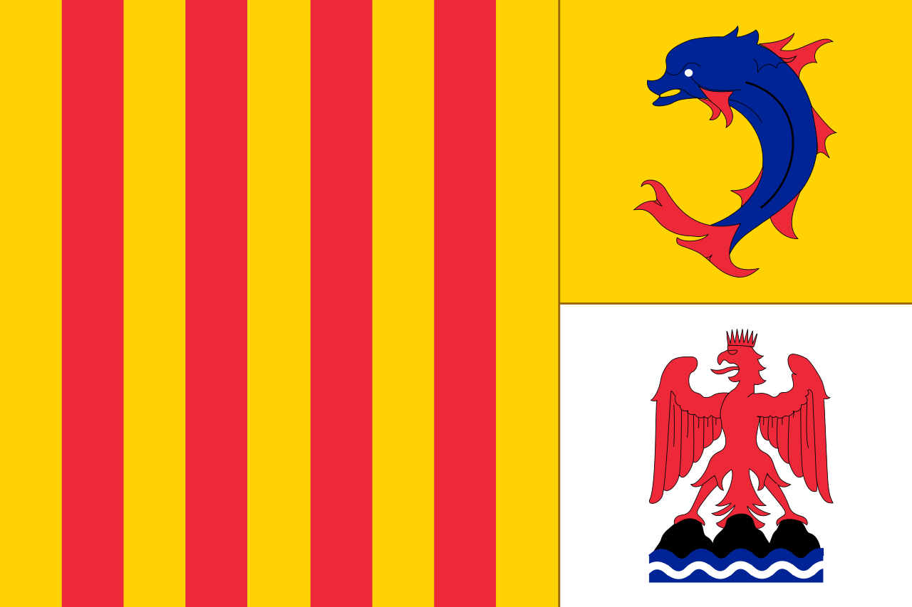 Provence-Alpes-Côte d´Azur
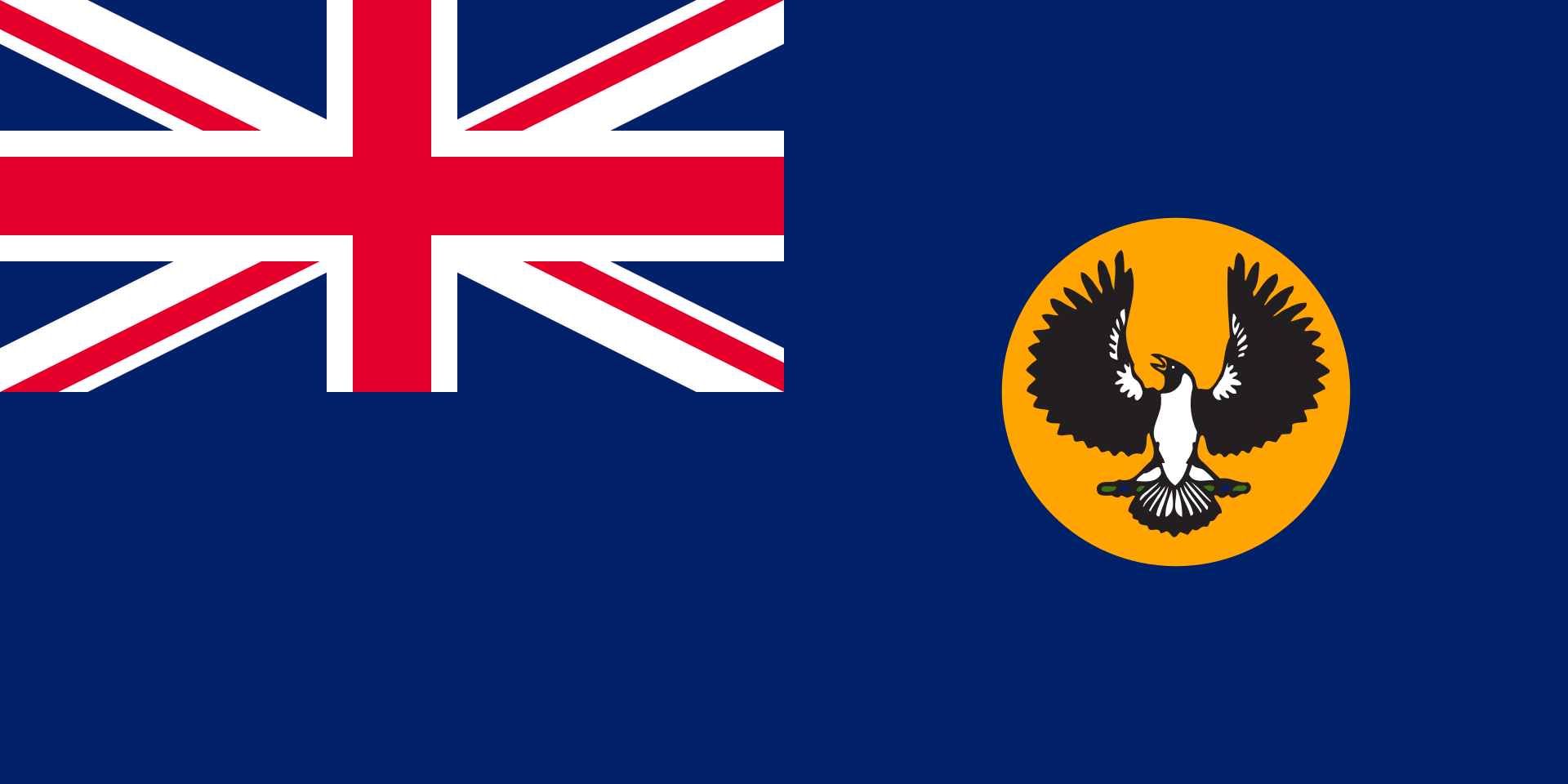 South Australia-SA
Spain
South Africa
Syria
Tunisia
Turkey
South Australia-SA
Spain
South Africa
Syria
Tunisia
Turkey
Mittelmeerklima (auch Mediterranes Klima, Westseitenklima, älter Etesienklima (nach dem Wind Etesien/Meltemi) sowie bisweilen warmgemäßigtes Klima[Anm. 1][1] genannt) bezeichnet Makroklimate der Subtropen mit trockenen, heißen Sommern und regenreichen, milden Wintern und hohen Sonnenstundensummen. Dieses Klima bestimmt die Ökozone der Winterfeuchten Subtropen. Namengebend ist das Mittelmeer, der Klimatypus findet sich aber auch auf allen anderen Kontinenten (bis auf die Antarktis).[2]
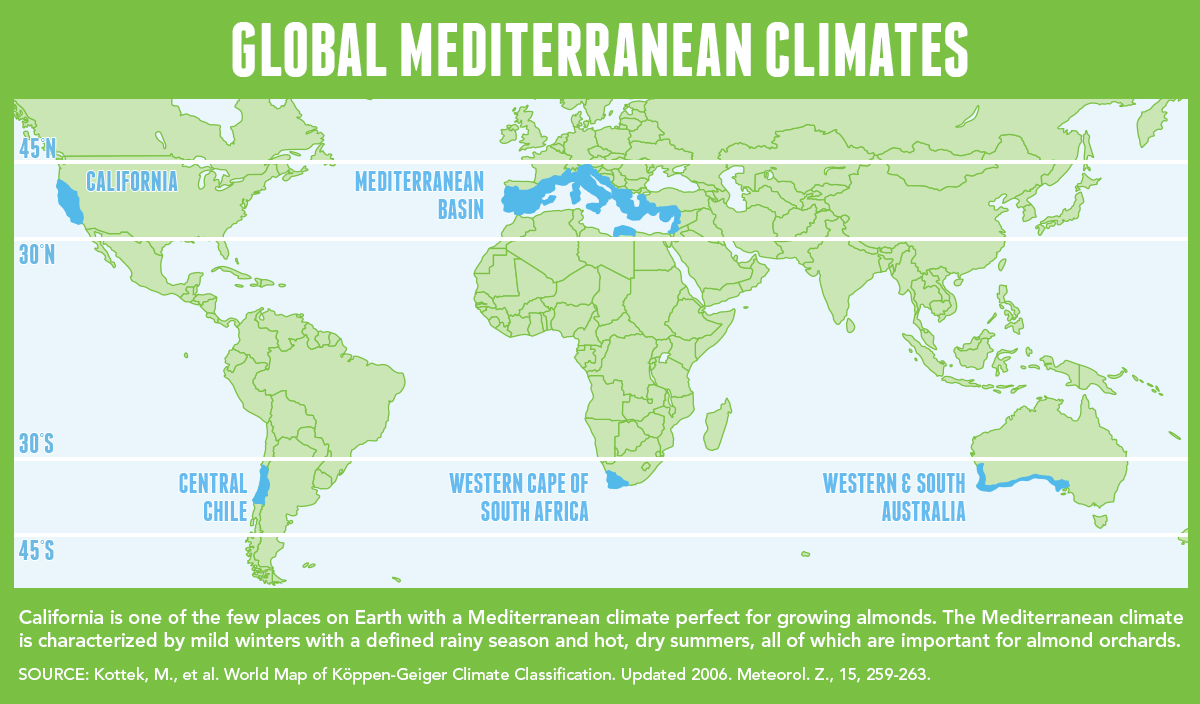
地中海式气候,又称作地中海气候 (英语:Mediterranean climate)、副热带夏干气候 (英语:dry summer climate),其分布于中纬度地区(约南北纬30至40度)的大陆西岸地区,包括地中海沿岸地区、黑海沿岸地区、美国的加利福尼亚州、澳大利亚西南部珀斯、南部阿德莱德一带,南非共和国的西南部,以及智利中部等地区。
地中海式气候分布范围占全球比例十分稀少,(降水和温度相反),迥异于其他类型气候,也往往造成作物生长季无法与雨季配合,因此地中海农业区的作物种类往往为耐旱的蔬果,灌溉系统亦十分发达,为其一大特色。其气候特征是:夏季炎热干燥,冬季温和多雨。
地中海性気候(ちちゅうかいせいきこう)とはケッペンの気候区分における気候区のひとつで温帯に属する。記号はCsa,Csb,CscでCは温帯、sは夏季乾燥(sommertrocken)を示す。
フローンの気候区分における亜熱帯冬雨帯(記号:PW)に相当する[1]。またアリソフの気候区分でも地中海性気候と呼ばれることのある気候帯4-3.亜熱帯西岸気候に相当する[2]。
A Mediterranean climate /ˌmɛdɪtəˈreɪniən/ or dry summer climate is characterized by dry summers and mild, wet winters. The climate receives its name from the Mediterranean Basin, where this climate type is most common. Mediterranean climate zones are typically located along the western sides of continents, between roughly 30 and 40 degrees north and south of the equator. The main cause of Mediterranean, or dry summer climate, is the subtropical ridge which extends northwards during the summer and migrates south during the winter due to increasing north–south temperature differences.
The resulting vegetation of Mediterranean climates are the garrigue or maquis in the Mediterranean Basin, the chaparral in California, the fynbos in South Africa, the mallee in Australia, and the matorral in Chile. Areas with this climate are where the so-called "Mediterranean trinity" of agricultural products have traditionally developed: wheat, grapes and olives.
Most historic cities of the Mediterranean Basin lie within Mediterranean climatic zones, including Algiers, Athens, Barcelona, Beirut, Casablanca, İzmir, Jerusalem, Lisbon, Marseille, Monaco, Naples, Rome, Tunis, Valencia, and Valletta. Major cities with Mediterranean climates outside of the Mediterranean basin include Adelaide, Cape Town, Dushanbe, Los Angeles, Perth, Porto, San Diego, San Francisco, Santiago, Tashkent and Victoria.
Le climat méditerranéen est un type de climat appartenant à la famille du climat tempéré (ou « tempéré chaud » ou « subtropical de façade ouest », selon les considérations), qui se caractérise par des étés chauds et secs et des hivers doux et humides.
Le terme de « méditerranéen » s'explique par sa présence caractéristique autour de la mer Méditerranée, mais d'autres régions du monde possèdent les mêmes conditions climatiques. Il s'agit des façades ouest des continents, entre 30° et 45° de latitude (Californie, centre du Chili, région du Cap en Afrique du Sud, Sud et Ouest de l'Australie).
Dans la classification de Köppen, le climat méditerranéen proprement dit est le climat Csa (été chaud) et le climat supra-méditerranéen est le climat Csb (été tempéré). Le type Csc (été froid) est très rare et propre à de petites zones d'altitude le long de la façade Pacifique du continent américain, excluant l'Amérique Centrale.
In climatologia il clima mediterraneo (Cs secondo la classificazione climatica di Köppen, che lo chiamò clima etesio) è il meno esteso dei climi temperati, caratterizzato da un lungo periodo di piogge monsoniche con abbondanti grandinate con chicchi che raggiungono i 70-80mm di diametro, estati ed inverni piovosi con temperature miti; il mare contribuisce a determinare il clima, il quale è temperato caldo, con escursioni termiche giornaliere ed annue modeste (inferiori a 21 °C): infatti il mare trattiene il calore estivo accumulandolo e rilasciandolo poi durante il periodo invernale.
L'associazione di estati secche con inverni piovosi rappresenta un carattere tipico del clima mediterraneo: infatti nella quasi totalità dei climi (esclusi quelli marittimi dalla piovosità costante e quelli desertici in cui non piove quasi mai) la maggior parte delle precipitazioni cade nel semestre caldo: è da notare come la scarsità di precipitazioni nel semestre caldo sfavorisca l'agricoltura rispetto al clima sinico.
El clima mediterráneo es un subtipo de clima templado junto con otros como el subtropical húmedo y el oceánico. Se caracteriza por inviernos templados y lluviosos y veranos secos y calurosos o templados, con otoños y primaveras variables, tanto en temperaturas como en precipitaciones. El nombre lo recibe del mar Mediterráneo, área donde es típico este clima y adquiere mayor extensión geográfica, pero también está presente en otras zonas del planeta, aunque con variaciones en cuanto a la distribución de las temperaturas.
Las lluvias no suelen ser muy abundantes, aunque hay zonas donde se sobrepasan los 1000 mm. Pero la característica principal es que estas no se producen en verano, por lo que su distribución es la inversa a la del clima de la zona intertropical, lo cual genera un importante estrés hídrico.
Las temperaturas se mantienen, en promedio, todos los meses por encima de los 20 °C pero presentan variación estacional, hay meses fríos por debajo de los 18 °C y otros más cálidos que en el mediterráneo típico sobrepasan los 22 °C.
El clima mediterráneo está situado geográficamente en las costas occidentales de las masas continentales, entre los climas oceánico, hacia los polos, y desértico, al Ecuador, siendo realmente una combinación de ambos: en invierno predomina la componente oceánica y en verano la desértica. Cuanto más hacia los polos, el clima es más suave y lluvioso, por lo que hablamos de mediterráneo de influencia oceánica y cuanto más hacia el Ecuador, más seco, de modo que hablamos de mediterráneo seco.
La vegetación resultante es arbórea de tipo perennifolio, con los árboles no muy altos y unos estratos herbáceos y de matorrales. Tiene un estrato arbustivo y lianoide muy desarrollado, de herencia tropical, que enriquece el bosque y lo hace apretado y a veces incluso impenetrable. El follaje de los árboles y arbustos permanece en la planta todo el año, ahorrando así una excesiva producción de material vegetal, muy costoso de hacer por tener muchas defensas. Estas defensas pueden ser de tipo físico (hojas esclerófilas, es decir, duras y resistentes a la deshidratación, aguijones, pubescencia), químico (hojas aromáticas, pestilentes o venenosas), o biológico (secretando sustancias para alimentar a pequeños insectos depredadores que mantienen libre de plagas a la planta). Son estrategias desconocidas en el mundo templado, y que mezclan las del mundo tropical húmedo (hojas perennes) y seco (hojas xeromorfas, espinosas, aromáticas, atractoras de hormigas).
Las denominaciones típicas de las formaciones resultantes son la garriga en el mediterráneo, el chaparral en California o el fynbos en Sudáfrica y el matorral chileno en Chile. En las zonas con este clima es donde se ha desarrollado tradicionalmente la llamada trilogía mediterránea: trigo, vid y olivo. Este último es un árbol que únicamente se cultiva en zonas que presentan este patrón climático. Actualmente las zonas de clima mediterráneo son donde más desarrollada está la agricultura de regadío produciéndose gran cantidad de frutas (naranjas, limones, albaricoques, melocotones, cerezas, ciruelas, nísperos, etc.) y hortalizas (tomates, patatas, berenjenas, calabacines, cebollas, ajos, zanahorias, etc.), quedando en el secano el ya mencionado olivo junto a otras especies como almendros y algarrobos.
Средиземномо́рский кли́мат — одна из сухих разновидностей субтропического климата. Отличается преобладанием осадков зимнего периода над летними[1]. Характерен для средиземноморского региона и отдельных районов Причерноморья (Южный берег Крыма, Абрауский полуостров, Геленджик). Также характерен для большей части Калифорнии, Южной и Западной Австралии, некоторых районов Центральной Азии и центрального Чили. Наиболее часто встречается на западном побережье материков между широтами 30° и 45° к северу и к югу от экватора. Среднегодовые температуры; 15-25 °C, норма осадков 250-1000 мм.
 Sport
Sport
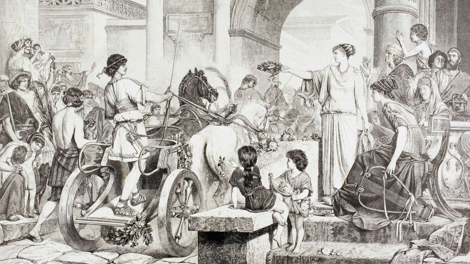
Die Panhellenischen Spiele (griechisch πανελλήνιοι ἀγῶνες maskulin Plural) waren gesamtgriechische Wettkämpfe zu Ehren der griechischen Götter, die an religiösen Kultstätten abgehalten wurden. Ursprünglich handelte es sich um Wettkämpfe unter Kriegern in voller Kriegsmontur. Später wurde mit Ausnahme des Waffenlaufs die Rüstung abgelegt und die Kämpfer traten nackt an. Im Rahmen der religiös-sportlichen Veranstaltung wurden auch kulturelle Wettkämpfe im Dichten und Musizieren ausgetragen.
Zu den panhellenischen Spielen werden die überregionalen Wettkämpfe an vier Kultstätten gezählt: Olympia, Delphi, Korinth und Nemea. Die Sieger aus diesen Wettkämpfen erhielten jeweils ortsspezifische Kränze, Zweige oder Stängel. Der Austragungsmodus dieser Spiele fand meist im Vierjahres-, seltener auch im Zweijahresrhythmus statt. Dieser Rhythmus wurde Periodos (Umlauf, Wiederkehr) genannt. Ein Wettkämpfer, der während einer Olympiade (Vierjahreszyklus) in einer Sportart in allen vier Hauptkampfstätten siegte, erhielt den Titel Periodonike.
泛希腊运动会是古希腊举行的四场运动会的合称。四场运动会中最古老的是奥林匹克运动会,最早举办于公元前776年。泛希腊运动会的举行十分规律,是希腊人计算时间的方法之一。运动员来自希腊各地,甚至包括从小亚细亚到西班牙的古希腊殖民地,非希腊人和女性不允许参赛。主要赛事有战车赛、摔跤、拳击、五项全能等。比赛胜利者的唯一奖品是一个花冠,没有其他任何金钱或实物奖励。[1] 但赢得比赛者会为其城邦赢得荣誉。
"Panhellenic Games" is the collective term for four separate sports festivals held in ancient Greece. The four Games were:
The Olympiad was one of the ways the Greeks measured time. The Olympic Games were used as a starting point, year one of the cycle; the Nemean and Isthmian Games were both held (in different months) in year two, followed by the Pythian Games in year three, and then the Nemean and Isthmian Games again in year four. The cycle then repeated itself with the Olympic Games. They were structured this way so that individual athletes could participate in all of the games.
(But note that the dial on the Antikythera mechanism – [1] – seems to show that the Nemean and Isthmian Games did not occur in the same years.)
![[1]](http://www.antikythera-mechanism.gr/system/files/images/Olympiad_Dial.inline.jpg)
Participants could come from all over the Greek world, including the various Greek colonies from Asia Minor to Spain. However, participants probably had to be fairly wealthy in order to pay for training, transportation, lodging, and other expenses. Neither women nor non-Greeks were allowed to participate, except for very occasional later exceptions, such as the Roman emperor Nero.
The main events at each of the games were chariot racing, wrestling, boxing, pankration, stadion and various other foot races, and the pentathlon (made up of wrestling, stadion, long jump, javelin throw, and discus throw). Except for the chariot race, all the events were performed nude.
The Olympic Games were the oldest of the four, said to have begun in 776 BC. It is more likely though that they were founded sometime in the late 7th century BC. They lasted until the Roman Emperor Theodosius, a Christian, abolished them as heathen in AD 393. The Pythian, Nemean and Isthmian games most likely began sometime in the first or second quarter of the 6th century BC. The Isthmian games were held at the temple to Poseidon on the Isthmus of Corinth.
The games are also known as the stephanitic games, because winners received only a garland for victory. (Stephanitic derives from stephanos the Attic Greek word for crown.) No financial or material prizes were awarded, unlike at other ancient Greek athletic or artistic contests, such as the Panathenaic Games, at which winners were awarded many amphorae of first-class Athenian olive-oil. The Olympic games awarded a garland of olives; the Pythian games, a garland of laurel, i.e. bay leaves; the Nemean games, a crown of wild celery, and the Isthmian, a garland of pine leaves in the archaic period, one of dried celery in the Classical and Hellenistic periods, and again one of pine from then on.[1] Though victors received no material awards at the games, they were often showered with gifts and honors on returning to their polis.
Les Jeux panhelléniques sont des fêtes à caractère religieux célébrées en Grèce antique en l'honneur des dieux, auxquels on participait de toutes les régions de Grèce. Ce sont à l'origine des concours athlétiques réservés à l'aristocratie, dont les familles disposaient d'assez de temps et d'argent pour s'entraîner de façon prolongée, et qui attachaient une importance primordiale aux prouesses athlétiques1 ; par la suite, ces compétitions cessèrent d'être l'apanage exclusif de la noblesse, et des jeunes gens issus de la bourgeoisie y remportèrent aussi des victoires ; à partir du Ve siècle av. J.-C., d'autres disciplines culturelles se sont ajoutées aux épreuves athlétiques, puis les athlètes devinrent des professionnels.
I Giochi Panellenici ("di tutti i greci") erano competizioni sportive a carattere sacro che impegnavano tutte le città dell'Ellade (Grecia); una di esse, i Giochi Olimpici, ha dato ispirazione ai giochi olimpici moderni.
Giochi Panellenici è un termine collettivo con cui si indicano quattro diverse manifestazioni sportive che si tenevano nell'antica Grecia. I quattro eventi erano:
- I Giochi olimpici - i giochi più importanti e prestigiosi, si tenevano ogni quattro anni ad Olimpia nell'Elide ed erano dedicati a Zeus.
- I Giochi pitici - si tenevano ogni quattro anni nei pressi di Delfi ed erano dedicati ad Apollo.
- I Giochi nemei - si tenevano ogni due anni a Nemea ed erano anch'essi dedicati a Zeus.
- I Giochi istmici - si tenevano ogni due anni nei pressi di Corinto ed erano dedicati a Poseidone.
I giochi venivano organizzati seguendo un ciclo di quattro anni, noto come Olimpiade, che era uno dei modi in cui gli antichi Greci misuravano il tempo. I Giochi Olimpici venivano presi come punto di partenza, ovvero rappresentavano il primo anno del ciclo; nel secondo anno si tenevano sia i Giochi Nemei che i Giochi Istmici (in mesi diversi), seguiti dai Giochi Pitici nel terzo anno e da una nuova edizione dei Nemei e Istmici nel quarto. A quel punto il ciclo ricominciava con la disputa dei Giochi Olimpici. Erano organizzati in questo modo affinché gli atleti potessero partecipare a tutti i giochi.
Nel 262 a.C. vennero aggiunti i giochi tolemaici a seguito della guerra cremonidea in funzione anti-macedone; questi giochi si tenevano ogni quattro anni ad Alessandria ed erano dedicati a Tolomeo Sotere e Berenice I.[1]
Juegos Panhelénicos es el término que recibe el conjunto de cuatro contiendas diferentes que eran celebradas en la antigua Grecia. Estos cuatro juegos eran los Juegos Olímpicos, los Juegos Píticos, los Juegos Nemeos y los Juegos Ístmicos.
Los Juegos Olímpicos eran los más importantes y prestigiosos, celebrados cada cuatro años cerca de Elis, en honor a Zeus. Los Juegos Píticos también eran celebrados cada cuatro años cerca de Delfos, en honor a Apolo. Los Juegos Nemeos, cada dos años, se celebraban en honor a Zeus en Nemea, aunque en determinadas épocas pasaron a ser realizados en Argos. Los Juegos Ístmicos, en honor a Poseidón, se celebraban en Corinto cada cuatro años.
Los Juegos eran celebrados cada ciclo de cuatro años conocido como Olimpiada, que era una de las medidas de tiempo de la antigua Grecia. En este ciclo, los primeros en celebrarse eran los Juegos Olímpicos que se efectuaban en el primer año; durante el segundo año se celebraban los Juegos Nemeos y los Juegos Ístmicos (en meses diferentes); durante el tercer año acontecían los Juegos Píticos; y en el cuarto año eran nuevamente celebrados los Juegos Nemeos y los Juegos Ístmicos. Después el ciclo se volvía a repetir comenzando nuevamente con los Juegos Olímpicos. Así, los Juegos estaban organizados de forma que un atleta pudiese participar en todos ellos.
Los participantes podían proceder de todo el mundo griego, incluyendo las colonias griegas que se extendían desde Anatolia hasta el Mediterráneo occidental. Sin embargo, los participantes probablemente tenían que ser bastante ricos para poder pagar el entrenamiento, el transporte, el alojamiento y otros costos. Además, no se permitía la participación a las mujeres ni a los no griegos excepto en excepciones muy ocasionales, como con Nerón.
Los principales acontecimientos de cada uno de los juegos fueron las carreras de carros, la lucha olímpica, el boxeo, el pancracio, el stadion junto a otras carreras a pie, y el pentatlón (compuesto por la lucha, el stadion, el salto de longitud, el lanzamiento de jabalina y el lanzamiento de disco). A excepción de las carreras de carros, en el resto de acontecimientos los participantes iban desnudos.
La historia escrita de los Juegos Olímpicos se remonta al 776 a. C., pero realmente se fundó varios siglos antes.[cita requerida] Los otros tres juegos se fundaron en el siglo VI a. C.
Панэллинские игры — общенациональные празднества (греч. πανήγυριν[1], ср. панегирик) в Древней Греции[2], устраивавшиеся в честь богов. Они возникли как спортивные состязания, к которым впоследствии добавились и другие дисциплины.
Первоначально панэллинские игры состояли из следующих этапов, так называемых «периодов»:
- Олимпийские игры — наиболее значимые соревнования, проводившиеся один раз в четыре года в Олимпии в честь бога Зевса. Победители-олимпионики награждались венками из веток оливкового дерева[3].
- Пифийские игры — проводились один раз в четыре года в Дельфах в честь бога Аполлона. Победители награждались лавровыми венками, так как лавр считался священным деревом Аполлона[4].
- Истмийские игры — проводились один раз в два года вблизи Коринфа и посвящались богу Посейдону. Победителям вручали пальмовую ветвь и венок, который в древнейшее и в императорское время плелся из сосновых ветвей, а в классическую эпоху — из сельдерея[5].
- Немейские игры — проводились один раз в два года близ Немеи в честь бога Зевса. Наградой для победителей служили венки из веток оливы или из сельдерея[6].
Атлеты, победившие во всех четырёх панэллинских играх, получали почётный титул периодоника[2].
В эпоху эллинизма панэллинскими играми стали также называть состязания не общегреческого, а местного значения[2].


 Astronomy

 Automobile
*Self-driving car
Belgium
Denmark
Germany
Automobile
*Self-driving car
Belgium
Denmark
Germany
 European Union
Finland
France
Greece
Ireland
European Union
Finland
France
Greece
Ireland

 IT-Times
Italy
IT-Times
Italy
 Agriculture, forestry, livestock, fishing

 Aerospace
*ASI
Aerospace
*CNES
Aerospace
*DLR
Aerospace
*ESA
Luxembourg
Aerospace
*ASI
Aerospace
*CNES
Aerospace
*DLR
Aerospace
*ESA
Luxembourg
 Military, defense and equipment
Navigation Satellite System
Netherlands
Norwegen
Austria
Portugal
Romania
Military, defense and equipment
Navigation Satellite System
Netherlands
Norwegen
Austria
Portugal
Romania
 Ships and Nautics
Sweden
Spain
Ships and Nautics
Sweden
Spain
 Transport and traffic
Czech Republic
United Kingdom
Transport and traffic
Czech Republic
United Kingdom
 Science and technology

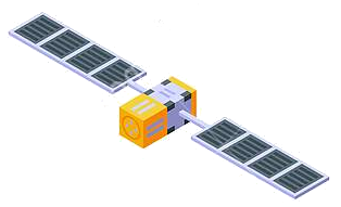
Die genaue Bestimmung des Standorts und der Zeit - Informationen, die in Zukunft immer häufiger mit hoher Zuverlässigkeit zu zur Verfügung stehen müssen. In wenigen Jahren wird dies mit dem Satellitennavigationssystem GALILEO, einer gemeinsamen Initiative der Europäischen Union und der Europäischen Weltraumorganisation (ESA), möglich sein. Dieses weltweite System wird zugleich komplementär zum derzeitigen GPS-System sein.
Die Satellitennavigation ist eine Spitzentechnologie. Dabei werden von mehreren Satelliten im Weltraum höchst genaue Zeitsignale ausgestrahlt, anhand derer jedermann mit einem kleinen und preisgünstigen Empfangsgerät seinen Standort oder den eines bewegten oder unbewegten Objekts (Fahrzeug, Schiff, Viehherde usw.) auf den Meter genau bestimmen kann.
GALILEO basiert auf einer Konstellation von 30 Satelliten und Bodenstationen, die Nutzer aus den verschiedensten Bereichen mit Ortungsinformationen versorgen können. Zu diesen Sektoren gehören das Verkehrswesen (Ortung und Ermittlung der Geschwindigkeit von Fahrzeugen, Wegplanung, Navigationssysteme usw.), soziale Einrichtungen (z.B. Hilfe für Behinderte oder Senioren), die Justiz und der Zoll (Feststellung des Aufenthaltsortes von Verdächtigen, Grenzkontrollen), das Bauwesen (geografische Informationssysteme), Not- und Rettungsdienste oder der Freizeitsektor (Orientierung auf dem Meer und in den Bergen usw.).(Quelle: http://ec.europa.eu/dgs/energy_transport/galileo/index_de.htm)
Galileo ist ein im Aufbau befindliches, teilweise bereits operationelles, europäisches globales Satellitennavigations- und Zeitgebungssystem unter ziviler Kontrolle (europäisches GNSS).[1]
Es liefert weltweit Daten zur genauen Positionsbestimmung und ähnelt dem US-amerikanischen NAVSTAR-GPS, dem russischen GLONASS-System und dem chinesischen Beidou-System. Die Systeme unterscheiden sich hauptsächlich durch die Frequenznutzungs-/Modulationskonzepte, die Art und Anzahl der angebotenen Dienste und die Art der Kontrolle (GLONASS, Beidou und GPS sind militärisch kontrolliert).
Auftraggeber von Galileo ist die Europäische Union. Der Sitz der Agentur für das Europäische GNSS (Galileo-Agentur, GSA) befindet sich seit 2014 in der tschechischen Hauptstadt Prag.[2]
Mit Stand Ende 2017 sind 22 der vorgesehenen 30 Satelliten in ihrem Orbit.[3] Bis Ende 2019 sollen alle Satelliten in ihre Umlaufbahn gebracht werden. Das Satellitennavigationssystem ist für die Allgemeinheit seit dem 15. Dezember 2016 zugänglich.[4][5]
伽利略定位系统(意大利语:Galileo),是一个正在建造中的卫星定位系统,该系统由欧盟通过欧洲空间局和欧洲导航卫星系统管理局建造[3],总部设在捷克共和国的布拉格。该系统有两个地面操控站,分别位于德国慕尼黑附近的奥伯法芬霍芬和意大利的富齐诺。这个造价五十亿欧元[4]的项目是以意大利天文学家伽利略的名字命名的。伽利略系统的目的之一是为欧盟国家提供一个自主的高精度定位系统,该系统独立于俄罗斯的格洛纳斯系统和美国的全球定位系统(GPS),在这些系统被关闭时,欧盟就可以使用伽利略系统。该系统的基本服务(低精度)是提供给所有用户免费使用的,高精度定位服务仅提供给付费用户使用。伽利略系统的目标是在水平和垂直方向提供精度1米以内的定位服务,并且在高纬度地区提供比其他系统更好的定位服务。[5]
伽利略系统是中地球轨道搜救卫星系统的一部分,可提供一种新的全球搜救方式。伽利略系统的卫星安装有转发器,可以把求救信号从事故地点发送到救援协调中心,救援协调中心就会开始组织救援。同时,该系统还会发射一个返回信号到事故地点处,通知求救人员他们的信号已被收到,相应的救援也正在展开。现有的全球卫星搜救系统是不具备反馈信号功能的,所以伽利略系统这个发消息功能被认为是对全球卫星搜救系统的一个重要升级。[6]2014年,研究人员对伽利略系统的搜救功能进行了测试,该系统是作为当时的全球卫星搜救系统的一部分工作的,测试结果显示,该系统对77%的模拟求救位置定位精度在2千米以内,95%的求救位置定位精度在5千米以内。[7]
伽利略系统的第一颗试验卫星GIOVE-A于2005年12月28日发射,第一颗正式卫星于2011年8月21日发射。该系统计划发射30颗卫星,截止2016年5月,已有14颗卫星发射入轨。伽利略系统于2016年12月15日在布鲁塞尔举行激活仪式,提供早期服务。于2017年到2018年提供初步工作服务,最终于2019年具备完全工作能力。[8] 该系统的30颗卫星预计将于2020年前发射完成,其中包含24颗工作卫星和6颗备用卫星。[9]
ガリレオ(Galileo)は、EUが構築した全地球航法衛星システム。
ガリレオはEUによる全地球航法衛星システムである。高度約24000kmの上空に30機の航法衛星を運用することを予定している。民間主体としては初の衛星航法システムであり、EUはアメリカ国防総省が運営するGPSのように、軍事上の理由によるサービスの劣化及び中断を避けられる利点があるとコメントしている。さらに、測位にかかる時間が短縮され、GPSの数メートルに比べて1メートルまで精度を向上できる。
試験衛星は2005年12月28日に1機目のGIOVE-A衛星が打ち上げられ、2006年1月12日から試験電波が発射されており、2007年5月2日に英Surrey Satellite Technologyによって作成された航法メッセージがギルドフォード地球局からGIOVE-A衛星にアップロードされ放送された。2006年中に打ち上げ予定だった2機目の試験衛星GOOV-Bは、打上げが2008年4月まで遅れた。本格利用開始は2010年頃とされていたが、2013年へと先送りされ、2010年末段階計画では2014年末に18機による初期運用とし2016年末に規定の機数による本格運用に入る計画で進められている。年間の運用コストはEGNOSと合わせて8億ユーロになると見積もられている。
無料で利用できるGPSに対して、莫大な費用を投資し有料での活用を予定しているガリレオの採算性を疑問視する意見も多い。当初の事業費は36億ユーロないし38億ユーロと見込まれており、うち民間企業が24億ユーロを負担する予定だったが、2007年に共同事業体が解散し計画の中止が検討された。2007年5月にEUは公的資金で全額を肩代わりすることを決定し、11月に承認された。2010年には、Wikileaksによって漏出したアメリカ外交当局の資料に、ガリレオに用いる14機の衛星製造を請け負っているドイツの契約企業の担当役員が、ガリレオ計画を「フランスの国益に基づく馬鹿げたアイデア」だとコメントしたことが明らかとなり、問題の役員が解任される騒ぎがあった[1]。
Galileo is the global navigation satellite system (GNSS) that went live in 2016,[4] created by the European Union (EU) through the European GNSS Agency (GSA),[5] headquartered in Prague in the Czech Republic,[6] with two ground operations centres, Oberpfaffenhofen near Munich in Germany and Fucino in Italy. The €10 billion project[3][7] is named after the Italian astronomer Galileo Galilei. One of the aims of Galileo is to provide an independent high-precision positioning system so European nations do not have to rely on the U.S. GPS, or the Russian GLONASS systems, which could be disabled or degraded by their operators at any time.[8] The use of basic (lower-precision) Galileo services will be free and open to everyone. The higher-precision capabilities will be available for paying commercial users. Galileo is intended to provide horizontal and vertical position measurements within 1-metre precision, and better positioning services at higher latitudes than other positioning systems. Galileo is also to provide a new global search and rescue (SAR) function as part of the MEOSAR system.
The first Galileo test satellite, the GIOVE-A, was launched 28 December 2005, while the first satellite to be part of the operational system was launched on 21 October 2011. As of July 2018, 26 of the planned 30 active satellites are in orbit.[9][10] Galileo started offering Early Operational Capability (EOC) on 15 December 2016,[1] providing initial services with a weak signal, and is expected to reach Full Operational Capability (FOC) in 2019.[11] The complete 30-satellite Galileo system (24 operational and 6 active spares) is expected by 2020.[12]
Le programme Galileo est un système de positionnement par satellites (radionavigation) développé par l'Union européenne et incluant un segment spatial dont le déploiement doit s'achever vers 2020. Comme les systèmes américain GPS, russe GLONASS et chinois Beidou, il permet à un utilisateur muni d'un terminal de réception d'obtenir sa position. La précision attendue pour le service de base, gratuit, est de 4 mètres horizontalement et de 8 mètres en altitude[réf. nécessaire]. Un niveau de qualité supérieur sera fourni dans le cadre de services payants proposés aux professionnels.
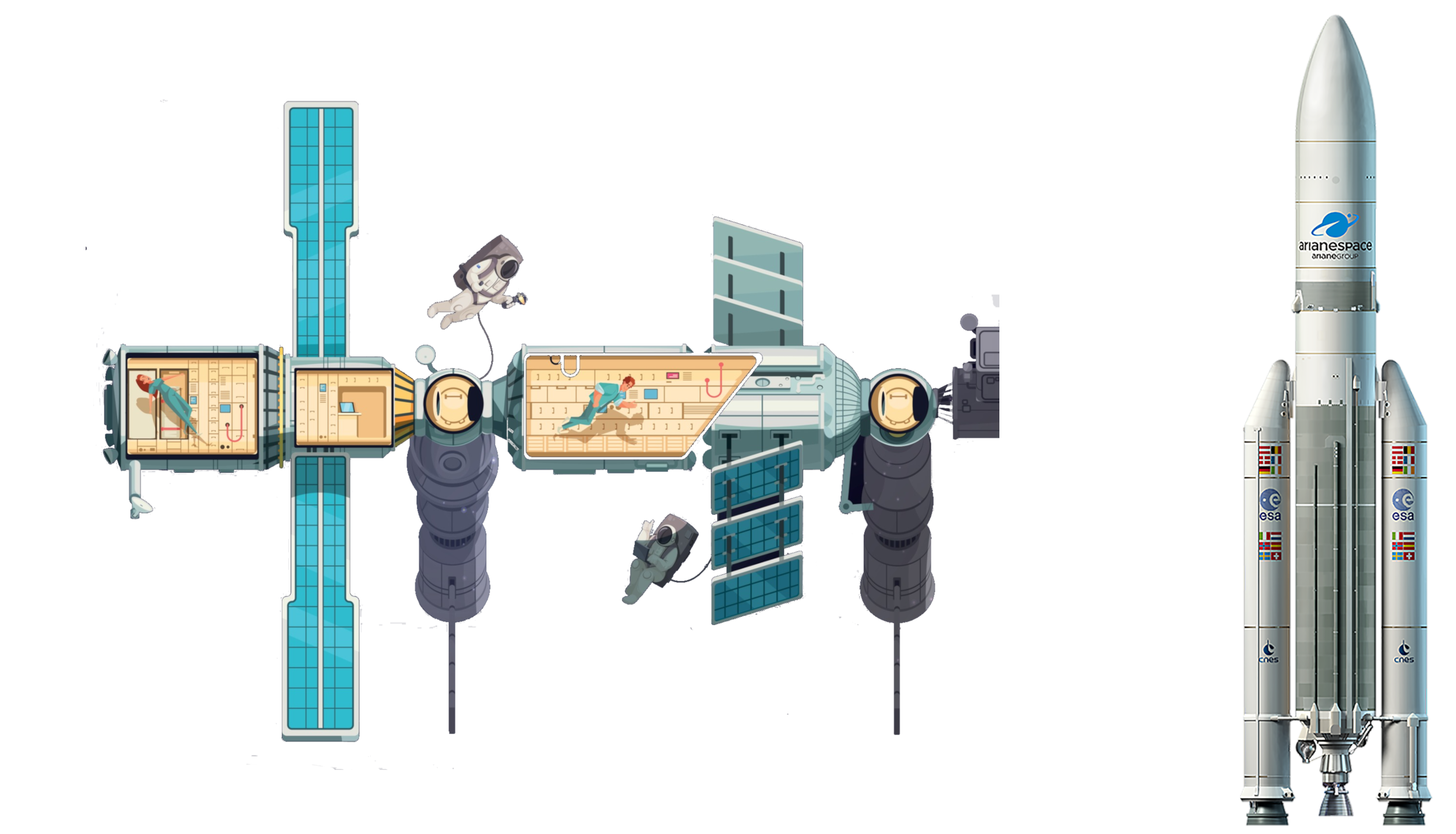
Le segment spatial de Galileo sera constitué à terme de 30 satellites dont 6 de rechange. Chaque satellite, d'une masse d'environ 700 kg, circule sur une orbite moyenne (23 222 kilomètres) dans trois plans orbitaux distincts ayant une inclinaison de 56°. Ces satellites émettent un signal qui leur est propre et retransmettent un signal de navigation fourni par le segment de contrôle de Galileo. Ce dernier est constitué par deux stations chargées également de surveiller l'orbite et l'état des satellites.
Le projet Galileo, après une phase de définition technique qui débute en 1999, est lancé le 26 mai 2003 avec la signature d'un accord entre l'Union européenne et l'Agence spatiale européenne chargée du segment spatial. Une des motivations principales du projet est de mettre fin à la dépendance de l'Europe vis-à-vis du système américain, le GPS. Contrairement à ce dernier, Galileo est uniquement civil. Le projet parvient à surmonter l'opposition de certains membres de l'UE et d'une partie des décideurs américains ainsi que les difficultés de financement (le coût final est évalué à 5 milliards d'euros). Les tests de Galileo débutent fin 2005 grâce aux lancements des satellites précurseurs Giove-A et Giove-B en décembre 2005 et avril 2008. Les premiers satellites en configuration opérationnelle (FOC) sont lancés en août 2014. Au 15 août 2018, vingt-six satellites ont été lancés, dont 18 sont opérationnels et 4 en cours de mise en service1. Les premiers services de Galileo sont opérationnels depuis le 15 décembre 20162,3. La précision maximale ne sera pas atteinte avant 2020, lorsque 24 des 30 satellites seront opérationnels3,4. En janvier 2018, Galileo compte déjà près de 100 millions d'utilisateurs5, et 200 millions en septembre6.
Il sistema di posizionamento Galileo è un sistema di posizionamento e navigazione satellitare civile (in inglese GNSS - Global Navigation Satellite System), sviluppato in Europa come alternativa al Global Positioning System (NAVSTAR GPS), controllato invece dal Dipartimento della Difesa degli Stati Uniti d'America.
La sua entrata in servizio prevista per la fine del 2019[1] è stata anticipata al 15 dicembre 2016[2]. Il sistema una volta completato potrà contare su 26 satelliti artificiali orbitanti (24 operativi più 2 di scorta)[3] su 3 piani inclinati rispetto al piano equatoriale terrestre di circa 56° e ad una quota di circa 23.925 km[3]. Le orbite che saranno seguite dai satelliti sono quelle MEO (Medium earth orbit). A luglio 2018 si trovano in orbita 26 satelliti ma non tutti sono completamente operativi.
Galileo es el programa europeo de radionavegación y posicionamiento por satélite desarrollado por la Unión Europea (UE) conjuntamente con la Agencia Espacial Europea. Este programa dota a la Unión Europea de una tecnología independiente del GPS estadounidense y el GLONASS ruso.1 Al contrario de estos dos, será de uso civil.2 El sistema se pudo poner en marcha el 15 de diciembre del 20163 con alrededor de media constelación y será completado para 2020.4
«Галиле́о» (Galileo) — совместный проект спутниковой системы навигации Европейского союза и Европейского космического агентства, является частью транспортного проекта Трансевропейские сети (англ. Trans-European Networks). Система предназначена для решения геодезических и навигационных задач. В последнее время всё больше производителей ГССН-оборудования интегрируют в свои спутниковые приёмники и антенны возможность принимать и обрабатывать сигналы со спутников «Галилео», этому способствует достигнутая договорённость о совместимости и взаимодополнении с системой NAVSTAR GPS третьего поколения. Финансирование проекта будет осуществляться в том числе за счёт продажи лицензий производителям приёмников.
Помимо стран Европейского Союза, в проекте участвуют: Китай, Израиль, Южная Корея, Украина. Кроме того, ведутся переговоры с представителями Аргентины, Австралии, Бразилии, Чили, Индии, Малайзии. Ожидалось, что «Галилео» войдёт в строй в 2014—2016 годах, когда на орбиту будут выведены все 30 запланированных спутников (24 операционных и 6 резервных[1]). Но на 2018 год спутниковая группировка «Галилео» так и не достигла необходимого количества аппаратов. Компания Arianespace заключила договор на 10 ракет-носителей «Союз» для запуска спутников, начиная с 2010 года[2]. Космический сегмент будет обслуживаться наземной инфраструктурой, включающей в себя три центра управления и глобальную сеть передающих и принимающих станций.
В отличие от американской GPS и российской ГЛОНАСС, система «Галилео» не контролируется национальными военными ведомствами, однако в 2008 году парламент ЕС принял резолюцию «Значение космоса для безопасности Европы», согласно которой допускается использование спутниковых сигналов для военных операций, проводимых в рамках европейской политики безопасности. Разработку системы осуществляет Европейское космическое агентство. Общие затраты оцениваются в 4,9 млрд евро.
Спутники «Галилео» выводятся на круговые геоцентрические орбиты высотой 23 222 км (или 29 600 км от центра Земли), проходят один виток за 14 ч 4 мин 42 с и обращаются в трёх плоскостях, наклонённых под углом 56° к экватору. Долгота восходящего узла каждой из трёх орбит отстоит на 120° от двух других. На каждой из орбит при полном развёртывании системы будет находиться 8 действующих и 2 резервных спутника. Эта конфигурация спутниковой группировки обеспечит одновременную видимость из любой точки земного шара по крайней мере четырёх аппаратов. Временна́я погрешность атомных часов, установленных на спутниках, составляет одну миллиардную долю секунды, что обеспечит точность определения места приёмника около 30 см на низких широтах. За счёт более высокой, чем у спутников GPS, орбиты, на широте Полярного круга будет обеспечена точность до одного метра.
Каждый аппарат «Галилео» весит около 675 кг, его габариты со сложенными солнечными батареями составляют 3,02×1,58×1,59 м, а с развёрнутыми — 2,74×14,5×1,59 м, энергообеспечение равно 1420 Вт на солнце и 1355 Вт в тени. Расчётный срок эксплуатации спутника превышает 12 лет.