
Deutsch-Chinesische Enzyklopädie, 德汉百科
 World Heritage


Bodhgaya (Hindi बोधगया IAST Bodhgayā, wörtlich „Ort der Erleuchtung“, von: bodhi = Erleuchtung) ist eine kleinere Stadt, die etwa 96 km von Patna entfernt im nordindischen Bundesstaat Bihar liegt. Sie liegt im Distrikt Gaya.
In der Antike hieß die Stadt Uruvela (Pali) bzw. Urubilva (Sanskrit). Sie lag im Königreich Magadha, rund 90 km südlich von Pataliputra, wo Siddhartha Gautama um das Jahr 534 v. Chr. unter einer Pappel-Feige (Bodhi-Baum) die Erleuchtung (bodhi) erlangte. In Bodhgaya befindet sich eine der heiligsten Stätten des Buddhismus, der Mahabodhi-Tempel, wo der Mahabodhi wächst, der nach der Überlieferung ein Abkömmling jenes Baumes ist. Im kleinen anliegenden Muchalinda Teich steht eine Skulptur, die Buddha auf einer Lotosblüte sitzend darstellt, überragt von einer Königskobra. Die riesigen Welse im Teich gelten als heilig.
Auffassungen des Mahayana-Buddhismus zufolge sollen im aktuellen Weltzeitalter (Kalpa) 1000 Buddhas erscheinen, die alle in Bodhgaya Erleuchtung erlangen. Der historische Buddha Shakyamuni war der 4. Buddha in dieser Reihe. Bodhgaya wird im Mahayana-Buddhismus auch Vajrasana, der „Diamantene Thron“ genannt.
Bodhgaya ist seit 1953 ein internationales buddhistisches Pilgerzentrum. Buddhisten aus Sri Lanka, Bangladesch, Thailand, Burma, Tibet, Bhutan, Vietnam, Taiwan, Korea und Japan errichteten in Bodhgaya bisher 45 Klöster und Tempel. Eine riesengroße Statue des Buddha in Meditationshaltung und lebensgroße Statuen seiner Schüler (aufrecht stehend) aus grauem Stein befinden sich ebenfalls in Bodhgaya. Die Statue wurde im Jahr 1989 vom Dalai Lama enthüllt. 2002 wurde der Ort in die Liste des Weltkulturerbes der UNESCO aufgenommen.
1964 gründete der muslimische Gelehrte Mawlānā Muhammad Schahīr ad-Dīn in der Nähe des Mahabodhi-Tempels die islamische Schule Madrasat Diyāʾ al-ʿUlūm, die zur Bewegung der Deobandis gehört. Sie war ursprünglich in einer kleinen Moschee untergebracht, wurde aber in den 1980er Jahren auf einem Grundstück, das ursprünglich für touristische Zwecke vorgesehen war, erweitert. 2002 hatte die Schule ungefähr 154 Studenten, zehn Lehrer und sechs weitere Angestellte.[2]
Am 7. Juli 2013 explodierten nach Drohungen islamistischer Gruppen mehrere Bomben mit geringer Sprengkraft auf dem Gelände des Mahabodhi-Tempels.[3]
In der Nähe der Stadt befindet sich der Flughafen von Gaya.
菩提伽耶(梵語:Buddha-gayā;印地語:बोधगया,羅馬化:Bodh-gayā),又稱佛陀伽耶,位于今印度比哈爾邦巴特那(Patna)城南约150公里处,是释迦牟尼的悟道成佛处。已成为佛教徒心中的圣地,也是佛教四大圣地之一。中国古代高僧法显和玄奘先后记载了菩提伽耶的历史。菩提伽耶的摩訶菩提寺2002年被列为世界遗产[1]。
释迦牟尼的诞生地蓝毗尼园、悟道之处菩提伽耶、第一次五比丘讲说佛法的鹿野苑以及涅槃之地的拘尸那羅合称为四大圣地。菩提伽耶是四大圣地中最具重要意义的圣地,位于印度巴特那城南150公里处,由寺和塔组成。相传佛教创始人释迦牟尼在此修行获得觉悟,故该地被佛教徒尊为朝拜圣地。
菩提伽耶金刚宝座塔的主塔高约50米,形如金字塔,底部为边长15米的正方形,向上逐渐收缩,顶部呈圆柱形,上立一铜制螺旋形圆顶。塔底一层四角竖有4个与大塔营式相同的小金字塔。大塔东门两旁辟有佛龛,立贴金佛像数座。其余三面为高2米的石栏杆,共60根,係公元前5-公元2世纪的作品,现藏于各地博物馆,只有复制品放在野外、塔西侧是著名的大菩提树,据说佛陀即在此树下得道成佛,故受到佛教徒敬仰,其枝也曾多次被折,代表佛陀送往世界各地的佛寺供养,繁衍滋生。原树已在1870年被大风刮倒,现在的树据说是原树的「曾孙」。现树下立有红砂石板金刚座,以指示佛陀成道处和表示佛的智慧。围绕大塔还有百塔、牧女善生供奉乳糜和释迦牟尼影窟等遗址,以及各国僧侣在此修建的泰国寺、缅甸寺、斯里兰卡寺、日本寺、中国汉式和藏式等不同风格的寺院,展现了各国建筑艺术的风姿,是世界佛教建筑的苦学之地。
 FIFA Fussball-Weltmeisterschaft 1998
 France
 UEFA European Championship 2016

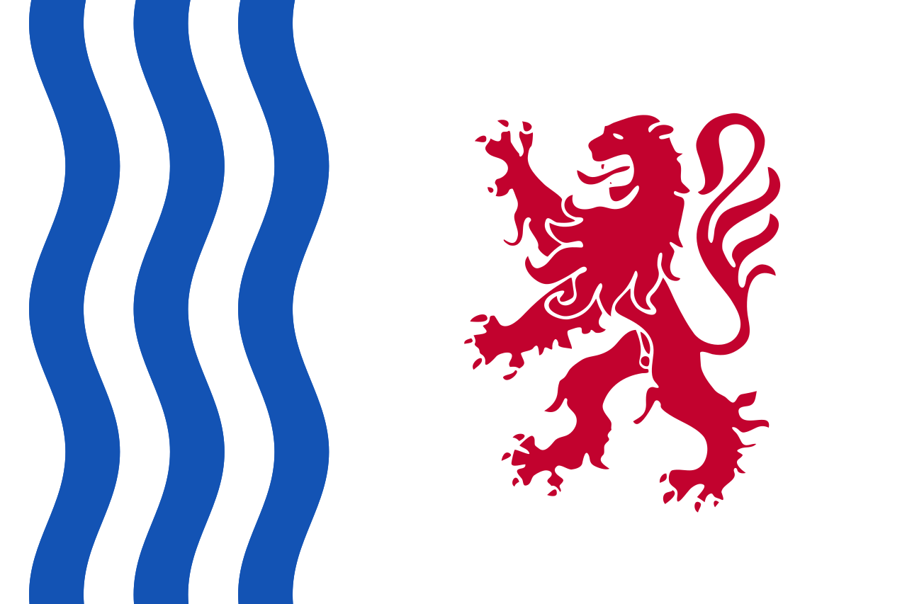 Nouvelle-Aquitaine

 World Heritage

波尔多(法语:Bordeaux;法语:[bɔʁ.do] ![]() 聆听);加斯科:Bordèu;巴斯克语:Bordele) 是位于法国西南的港口城市,市区人口24万(2013年)。[2]大波尔多人口达117万,是法国第五大城市群。它是新阿基坦大区和吉伦特省的首府。历史上曾是法国旧省吉耶纳的首府。
聆听);加斯科:Bordèu;巴斯克语:Bordele) 是位于法国西南的港口城市,市区人口24万(2013年)。[2]大波尔多人口达117万,是法国第五大城市群。它是新阿基坦大区和吉伦特省的首府。历史上曾是法国旧省吉耶纳的首府。
波尔多是欧洲的军事、航天和航空的研究与制造中心之一,集中了如欧洲航空防务与航天公司、泰勒斯集团等很多公司的研发机构,以及赛峰集团空中客车和达梭航太等航空巨子下属的飞机制造厂等。它还是法国战略核弹研究和物理实验的核心,拥有原子能研究中心和兆焦激光计划等许多高端技术机构,此外还有新材料和纳米技术方面的研究机构。
波尔多的大学学生数超过7万人。除了两所综合性大学之外,还有波尔多政治研究学院、通信与新闻学院和法律学校。法国国立法官学校也在波尔多,是法国法官的摇篮。
波尔多旅游资源丰富,号称“睡美人”,有众多的博物馆和古迹,城区内文物保护单位的数量,在法国仅次于巴黎。2007年,老城区大部(又称“月亮港”)被联合国教科文组织列入世界文化遗产名单。[5]18世纪以来尤以盛产优质葡萄酒享誉世界。波尔多因此也被称为世界葡萄酒中心,波尔多葡萄酒也有着“葡萄酒皇后”的美称。每两年一度,波尔多葡萄酒行业协会举办盛大的国际酒展-Vinexpo。
Bordeaux [bɔʀˈdo]; französisch  Bordeaux?/i; (okzitanisch Bordèu) ist Universitätsstadt und politisches, wirtschaftliches und geistiges Zentrum des französischen Südwestens.
Ihre Einwohner nennen sich Bordelais. Berühmtheit hat die Stadt insbesondere durch den Bordeauxwein und ihre Küche erlangt, aber auch durch ihr bauliches und kulturelles Erbe. Bordeaux ist Sitz der Präfektur des Départements Gironde und Hauptstadt der Region Nouvelle-Aquitaine, ferner Sitz eines Erzbischofs und eines deutschen Generalkonsulats. Die Stadt hat auf Grund der vielen Museen, die sich dort befinden, als auch auf Grund der Tatsache, dass während der Invasionen Deutschlands nach Frankreich 1870/71, 1914, 1940 regelmäßig zeitweise der Regierungssitz von Paris nach Bordeaux verlegt wurde, den Ruf einer heimlichen Hauptstadt Frankreichs.
Bordeaux selbst hat 252.040 Einwohner (Stand: 1. Januar 2016). Der engere Ballungsraum Bordeaux kommt jedoch auf etwa 773.542 Einwohner und umfasst auch 26 umliegende Kommunen, die im Kommunalverband Bordeaux Métropole organisiert sind. Die Fläche ist 578,3 km² und die Bevölkerungsdichte 1338 Einwohner/km².[1] Dieser Verband ist wiederum Teil einer Agglomeration (Aire urbaine de Bordeaux), die den weiteren Einzugsbereich mit insgesamt 51 Kommunen umfasst und so auf 1.215.769 Einwohner kommt, die auf 5.613,4 km² wohnt was auf eine Bevölkerungsdichte von 216 Einwohner/km² kommt.[2] Bordeaux ist damit die größte Stadt im Département Gironde und der Region Aquitanien und die neuntgrößte Stadt Frankreichs. Die Agglomeration rangiert in Frankreich an sechster Stelle. Von Bordeaux aus wird auch das gleichnamige Arrondissement verwaltet, das aus 21 Kantonen besteht.
ボルドー(Bordeaux)は、フランス南西部の中心的な都市で、ヌーヴェル=アキテーヌ地域圏の首府、ジロンド県の県庁所在地である[1]。アキテーヌ公国の首府だった。
ボルドーは、ガロンヌ川に面した港町で、市街地は川の湾曲部にそって三日月形に形成され、月の港と呼ばれる。河口にも近い。ボルドーワインの産地として世界的に有名。中心部から北側にかけては、都市計画による大通りがある。市の南側は18世紀に建設されたが、狭くてまがった通りのある古い一画である。
2007年にボルドーの市街区域1810ヘクタールが世界遺産に登録された。18〜19世紀の都市計画によって生まれた調和のある街並みと、近年のガロンヌ河岸の歩行者空間と一体となった歴史的な再開発が評価された。
Bordeaux (French pronunciation: [bɔʁdo] ( listen); Gascon Occitan: Bordèu [buɾˈðɛw]) is a port city on the Garonne in the Gironde department in Southwestern France.
The municipality (commune) of Bordeaux proper has a population of 252,040 (2016). Together with its suburbs and satellite towns, Bordeaux is the centre of the Bordeaux Métropole. With 1,195,335 in the metropolitan area, it is the sixth-largest in France, after Paris, Marseille, Lyon, Toulouse, and Lille. It is the capital of the Nouvelle-Aquitaine region, as well as the prefecture of the Gironde department. Its inhabitants are called "Bordelais" (for men) or "Bordelaises" (women). The term "Bordelais" may also refer to the city and its surrounding region.
Being at the center of a major wine-growing and wine-producing region, Bordeaux remains a prominent powerhouse and exercises significant influence on the world wine industry although no wine production is conducted within the city limits. It is home to the world's main wine fair, Vinexpo,[6] and the wine economy in the metro area takes in 14.5 billion euros each year. Bordeaux wine has been produced in the region since the 8th century. The historic part of the city is on the UNESCO World Heritage List as "an outstanding urban and architectural ensemble" of the 18th century.[7] After Paris, Bordeaux has the highest number of preserved historical buildings of any city in France.[8]
Bordeaux (prononcé [bɔʁ.ˈd̪o] ; Écouter), en gascon Bordeu1, est une commune du Sud-Ouest de la France, préfecture du département de la Gironde et chef-lieu de la région Nouvelle-Aquitaine.
Capitale de l'ancienne Guyenne et partie intégrante de la Gascogne culturelle et linguistique, Bordeaux se situe en bordure des Landes de Gascogne. La ville est connue dans le monde entier pour les vins de Bordeaux et les vignobles du Bordelais, surtout depuis le XVIIIe siècle.
En 2015, la commune est la neuvième commune de France par sa population avec 249 712 habitants, mais son agglomération est classée septième avec 904 359 habitants en 20152 après celles de Paris, Lyon, Marseille - Aix, Lille, Toulouse et Nice et devant Nantes et Toulon. L'aire urbaine de Bordeaux compte quant à elle 1 215 769 habitants en 20153, ce qui en fait la cinquième aire urbaine de France. Bordeaux est par ailleurs la principale commune de la métropole « Bordeaux Métropole », qui rassemble 28 communes et 760 956 habitants4 en 2014.
En 1957, Bordeaux est récompensée du prix de l'Europe, conjointement avec Turin. En juin 2007, une partie de la ville, le port de la Lune, est inscrite par le Comité du patrimoine mondial, désigné par l'assemblée générale de l’UNESCO, sur la Liste du patrimoine mondial.
Bordeaux (pronuncia /borˈdo/ o /borˈdɔ/[2]; in passato italianizzata come Bordò, Bordea[3], Bordello o Bordella[4] o in latino Burdigala; in francese [bɔʁˈdo]; in guascone Bordèu, pron. [burˈdew]) è un comune francese di 246 586 abitanti, capoluogo del dipartimento della Gironda e della regione della Nuova Aquitania. L'area metropolitana è la sesta più popolosa del paese e conta 1 178 225 abitanti. La città, attraversata dalla Garonna, fa parte della Guascogna ed è nota in tutto il mondo per l'omonimo vino rosso, il Bordeaux.
Nel 2007 l'UNESCO ha definito il centro storico della città[5] un patrimonio dell'umanità, per un totale di 347 edifici. Il nome deriva dall'antica città romana di Burdigala, al bordo della Gallia.
Burdeos (en francés: Bordeaux, pronunciado /bɔʁˈdo/; en gascón: Bordeu) es una ciudad portuaria del sudoeste de Francia, capital de la región de Nueva Aquitania y la prefectura del departamento de Gironda. Con una población de 239 157 habitantes4 en la ciudad y 719 489 en la Communauté urbaine de Bordeaux, es la sexta ciudad más importante de Francia, después de París, Marsella, Lyon, Lille y Toulouse. Su área metropolitana, llamada aire urbaine de Bordeaux cuenta con 1 114 857 habitantes5 en una conurbación Bordeaux-Libourne-Arcachon.
Burdeos es a menudo llamada "la perla de Aquitania", pero todavía arrastra el apodo de "La Bella Durmiente", en referencia a su centro histórico y sus monumentos que antes no estaban suficientemente resaltados. Sin embargo, Burdeos está "despierta" desde hace varios años, y en junio de 2007, una parte de la ciudad, Puerto de la Luna, fue registrada como Patrimonio Mundial de la Humanidad por la Unesco por el conjunto urbano excepcional que representa. Sin embargo, no merece su apodo porque su área urbana es una de las más atractivas de Francia, con un incremento de alrededor de 200 000 habitantes en nueve años (1999-2008).
La ciudad es conocida mundialmente por sus viñedos, sobre todo desde el siglo XVIII, que fue una edad de oro. Antigua capital de Guyena, Burdeos es parte de Gascuña y está situada en el borde de las Landas de Gascuña.En 1957, Burdeos recibió el Premio Europa, junto con Turín.
Бордо́ (фр. Bordeaux [bɔʁ.ˈd̪o]  слушать, окс. Bordèu, баск. Bordele) — город и коммуна на юго-западе Франции, центр исторической области Аквитания и современного департамента Жиронда[2]. Расположен на берегах Гаронны, известных своими традициями и успехами в области виноделия.

巴西利亚(葡萄牙语:Brasília),又译巴西里亚,是巴西的首都,位于海拔1158米的巴西高原上,亦为联合国教科文组织所列的世界遗产。巴西利亚是全世界最大的20世纪后期建城的城市。
截至2010年,巴西利亚人口已达到2,562,963人,是巴西的第四大城市,拉美的第六大城市,经济总量居巴西第三位、拉美第五位,是拉美大城市中人均国民生产总值最高的,为25,500美元(巴西全国平均水平的近三倍)。[1]
巴西利亚建城于1956年至1960年,以新市镇、城市规划方式规划兴建,其也以大胆设计的建筑物及快速增长的人口而著名,1960年4月21日时,巴西为了加快内陆的开发,将当时的首都里约热内卢迁至巴西利亚。
Brasília [bɾaˈziljɐ] ist die Hauptstadt Brasiliens. Sie liegt im Distrito Federal do Brasil (Bundesdistrikt), der 3 Millionen Einwohner (2017)[1] auf einer Fläche von 5.802 Quadratkilometern hat.
Der Distrito Federal besteht aus einer einzigen Gemeinde (município), Brasília, wobei Gemeinde und Bundesdistrikt rechtlich identisch sind. Der Bundesdistrikt stellt jedoch kein zusammenhängendes Stadtgebiet dar, sondern ist – mit seiner recht geringen Bevölkerungsdichte und den dominierenden Agrarflächen – eher mit einem kleinen Bundesstaat vergleichbar.
Die Kernstadt (Verwaltungsregion Plano Piloto) hatte 205.030 Einwohner (2010) und eine Fläche von 472,12 Quadratkilometern. In der Metropolregion Brasília, die bis in die Bundesstaaten Goiás und Minas Gerais hineinreicht, leben rund 4,29 Millionen Menschen (Schätzung 2016) auf einer Fläche von 55.570 Quadratkilometern.[2]
Das Zentrum von Brasilia ist seit 1987 ein Weltkulturerbe der UNESCO.[3]
ブラジリア(ポルトガル語: Brasília)は、ブラジルの首都で連邦直轄地区。中部の標高約1,100mの高原地帯に建設された、計画都市である。市域の人口は、2016年7月1日で約298万人。同国3位の人口規模を誇る都市でもある。
ブラジル高原の荒涼とした未開の大地(セハード)に建設された計画都市。ブラジル人建築家ルシオ・コスタの設計により建設された計画都市地域は、人造湖であるパラノア湖のほとりに飛行機が翼を広げた形をしており、飛行機の機首の部分に国会議事堂や行政庁舎、最高裁判所が並び、翼の部分には高層住宅や各国の大使館がある。
国会議事堂や大聖堂などの主要建造物は、いずれもモダニズムの流れを受けた未来的なデザインで作られている。これらの公共建築の主任建築家は、ニューヨーク市の国際連合本部ビルの設計も担当したブラジル人建築家オスカー・ニーマイヤーである。
Brasília (/brəˈzɪljə/; Portuguese: [bɾaˈziljɐ]) is the federal capital of Brazil and seat of government of the Federal District. The city is located atop the Brazilian highlands in the country's center-western region. It was founded on April 21, 1960, to serve as the new national capital. Brasília is estimated to be Brazil's 3rd most populous city.[1] Among major Latin American cities, Brasília has the highest GDP per capita. [3]
Brasília was planned and developed by Lúcio Costa, Oscar Niemeyer and Joaquim Cardozo in 1956 to move the capital from Rio de Janeiro to a more central location. The landscape architect was Roberto Burle Marx.[4][5] The city's design divides it into numbered blocks as well as sectors for specified activities, such as the Hotel Sector, the Banking Sector and the Embassy Sector. Brasília was chosen as a UNESCO World Heritage Site due to its modernist architecture and uniquely artistic urban planning.[6] It has also been named "City of Design" by UNESCO in October 2017 and has been part of the Creative Cities Network since then.[7]
All three branches of Brazil's federal government are centered in the city: executive, legislative, and judiciary. Brasília also hosts 124 foreign embassies.[8] The city's international airport connects it to all other major Brazilian cities and many international destinations, and is the third busiest airport in Brazil. Brasília is the most populous Portuguese-speaking capital city. It was one of the main host cities of the 2014 FIFA World Cup and hosted some of the football matches during the 2016 Summer Olympic Games; it also hosted the 2013 FIFA Confederations Cup.
The city has a unique status in Brazil, as it is an administrative division rather than a legal municipality like other cities in Brazil. Although Brasília is used as a synonym for the Federal District through synecdoche, the Federal District is composed of 31 administrative regions, only one of which is the area of the originally planned city, also called Plano Piloto. The rest of the Federal District is considered by IBGE to make up Brasília's metro area.[1]
Brasilia (Brasília en portugais) est la capitale fédérale du Brésil et le siège du gouvernement du District fédéral. Selon un recensement effectué par l'IBGE (Instituto Brasileiro de Geografia e Estatística), sa population en 2010 est de 2 562 963 habitants, faisant d'elle la quatrième ville la plus peuplée du Brésil. Sa construction, à un rythme soutenu, sous l'impulsion du président Juscelino Kubitschek qui souhaitait une meilleure répartition de l’activité économique alors concentrée sur les côtes, date des années 1960.
Brasilia est membre de l'Organisation des villes du patrimoine mondial (OVPM).
Brasilia (AFI: /braˈzilja/[2]; in portoghese Brasília /bɾaˈziljɐ/) è la capitale del Brasile.
È una città pianificata e una delle capitali mondiali edificate e designate più recentemente, essendo stata costruita tra il 1956 ed il 1960 ed essendo capitale dal 21 aprile 1960; in precedenza la capitale del Brasile era Rio de Janeiro. La città è ancora in costruzione, seguendo sempre il progetto iniziale. L'UNESCO ha dichiarato Brasilia Patrimonio dell'umanità.
Brasilia (en portugués Brasília) es la capital federal del Brasil y la sede de gobierno del Distrito Federal, localizada en la región Centro-Oeste del país. Tiene una población de 2 977 216 habs. según estimaciones de 2016 del Instituto Brasileño de Geografía y Estadística,1 lo que la convierte en la tercera ciudad del país por población, además tiene una población de 4 284 676 en la zona metropolitana.2 Es sede del gobierno federal, conformado por el presidente —quien trabaja en el Palacio de Planalto—, el Supremo Tribunal Federal de Brasil y el Congreso Nacional de Brasil.
Брази́лиа[4], или Брази́лия[5] (порт. Brasília [bɾaˈziʎɐ]), — столица Федеративной Республики Бразилии и резиденция правительства Федерального округа[6][7]. Согласно данным переписи населения, проведённой Бразильским институтом географии и статистики в 2010 году, население города составляет 2 562 963 человека, по этому показателю является четвёртым крупнейшим городом страны[~ 1][8]. По количеству ВВП на душу населения Бразилиа находится на втором месте (40 696 реалов), уступая только Витории (60 592 реалов)[9]. Вместе с Анаполисом (139 км) и Гоянией (209 км), составляет ось «Бразилия — Анаполис — Гояния», которая является наиболее развитой областью Центрально-западного региона.
21 апреля 1960 года президентом Жуселину Кубичеком ди Оливейрой столица Бразилии была перенесена в город Бразилиа, ставший третьей по счёту столицей страны после Салвадора и Рио-де-Жанейро. Переезд органов федеральной администрации в новую столицу привёл к тому, что Бразилиа стала центром сосредоточения исполнительной, законодательной и судебной власти.
Проект строительства новой столицы, получивший название «пилотный план» (порт. Plano Piloto), был разработан архитектором Лусио Костой. С учётом рельефа местности и зоны затопления водохранилища Параноа «пилотный план» фактически является адаптацией аналогичного проекта, предложенного Луисом Крулсом (порт.)русск. в 1893 году[10]. Большинство административных и общественных зданий в городе построено по проекту известного бразильского архитектора Оскара Нимейера.
В 1987 году город включён в Список Всемирного наследия ЮНЕСКО.

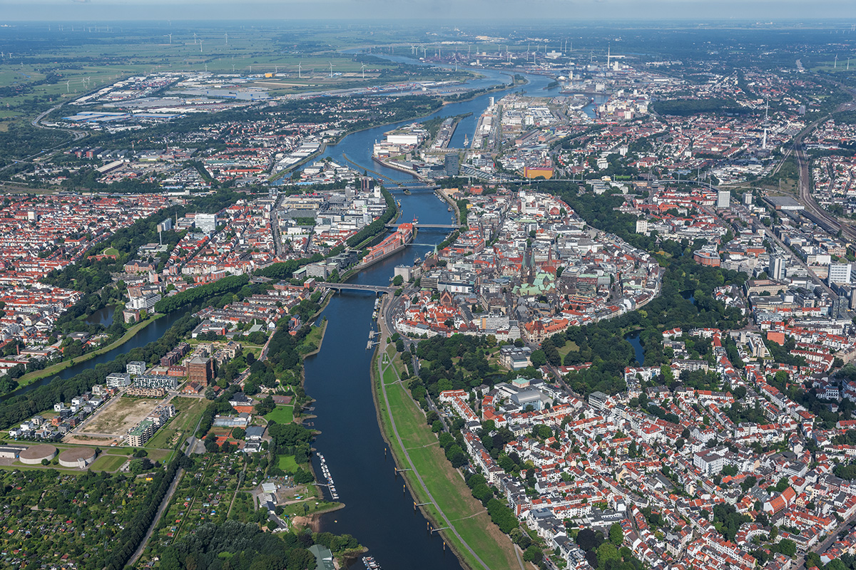
不来梅(德语:Bremen,国际音标:[ˈbʁeːmən](![]() 发音)),是德国最小的联邦州不来梅州的州府、德国第二大港口城市和第五大工业城市。不来梅的支柱性产业包括食品加工、航天航空、航运物流、汽车制造、贸易、新能源等行业。[1]
发音)),是德国最小的联邦州不来梅州的州府、德国第二大港口城市和第五大工业城市。不来梅的支柱性产业包括食品加工、航天航空、航运物流、汽车制造、贸易、新能源等行业。[1]
不来梅州由不来梅和往北60公里以外的不来梅哈芬两个城市组成。不来梅在不来梅-奥尔登堡大都市圈内,德国有欧盟认定的11个大都市圈。不来梅哈芬市的远洋港区实际上被划归不来梅市,它是不来梅市的一块飞地。
德国北部城市不来梅具有悠久的历史,早在公元8世纪,不来梅即已建城。1260年不来梅加入汉萨同盟,中世纪后期与汉堡、吕贝克等几个重要的汉萨城市控制着北海和波罗的海沿岸的商业通道 。1646年不来梅成为自由帝国城市,不属于任何领主,由帝国直辖,因此不来梅全称为“自由汉萨城市不来梅”。
现在,不来梅人口66万,它是德国不来梅州的州府、第二大港口城市、第五大工业城市和西北部的中心。不来梅的优势产业包括汽车汽配、食品加工、航天航空、航运物流、贸易、新能源等行业。 不来梅州的另一座城市不来梅哈芬(即不来梅港市)位于威悉河入海口,建于1827年,它与不来梅市相距约60公里。
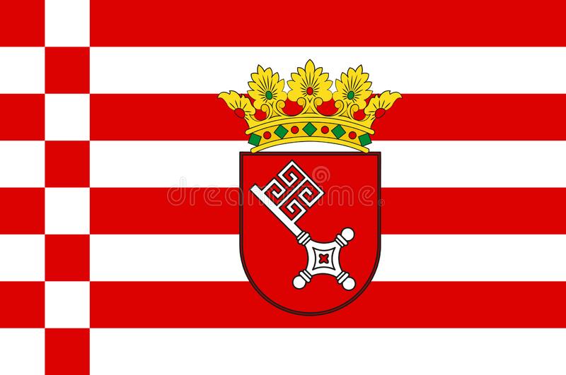
Die Stadtgemeinde Bremen ist die Hauptstadt des Landes Freie Hansestadt Bremen (kurz ebenfalls „Bremen“,  Aussprache?/i). Zu dem Zwei-Städte-Staat gehört neben Bremen noch das 53 km[2] nördlich gelegene Bremerhaven. Die Stadtgemeinde Bremen ist mit rund 566.000 Einwohnern die elftgrößte Stadt in Deutschland. Bremen gehört zur Europäischen Metropolregion Bremen/Oldenburg mit gut 2,7 Mio. Einwohnern, einer von insgesamt elf Europäischen Metropolregionen in Deutschland.
Das Stadtbremische Überseehafengebiet Bremerhaven ist eine Exklave der Stadt Bremen innerhalb von Bremerhaven.
ブレーメン(Bremen)は、ドイツの大都市で、自由ハンザ都市ブレーメン(通常ブレーメン州と呼ばれる)の州都。ドイツに11あるヨーロッパ大都市圏の1つであるブレーメン/オルデンブルク大都市圏に属している。 ブレーメンはヴェーザー川の両岸に位置している。ヴェーザー川が北海に注ぐ河口の位置するブレーマーハーフェン(ブレーメン州に属する)から上流に約60km遡った地点に位置する。ブレーメン旧市街の上方でヴェーザー川は中流から下流に変わる。オクトゥム川が合流する付近からのウンターヴェーザー左岸一帯をヴェーザーマルシュと称する。同じくヴェーザー川下流の右岸はエルベ=ヴェーザー=ドライエックに属す。ヴュンメ川とハンメ川が合流してできたレーズム川、シェーネベッカー川、ブルーメンターラー・アウエがここから下流側の支流である。
市域は川沿いに長さ約38km, 幅約16kmである。市境の全長は136.5kmである。ブレーメンは広さでドイツ10位、人口で11位の都市であるが、北ドイツではハンブルクに次いで2番目、北西ドイツでは最大の都市である。これはヨーロッパで74番目、EU加盟国中では44番目にあたる。
ブレーメンはオルデンブルクの東約50km, ハンブルクの南西110km, ハノーファーの北西120km, ミンデンの北100km, オスナブリュックの北東105kmにあたる。
The City Municipality of Bremen (German: Stadtgemeinde Bremen, IPA: [ˌʃtatɡəmaɪndə ˈbʁeːmən] ( listen)) is a Hanseatic city in northwestern Germany, which belongs to the Free Hanseatic City of Bremen (also called just "Bremen" for short), a federal state of Germany.
As a commercial and industrial city with a major port on the River Weser, Bremen is part of the Bremen/Oldenburg Metropolitan Region, with 2.5 million people. Bremen is the most populous city in Northern Germany and eleventh in Germany.[3]
Bremen is a major cultural and economic hub in the northern regions of Germany. Bremen is home to dozens of historical galleries and museums, ranging from historical sculptures to major art museums, such as the Übersee-Museum Bremen.[4] Bremen has a reputation as a working-class city.[5] Bremen is home to a large number of multinational companies and manufacturing centers. Companies headquartered in Bremen include the Hachez chocolate company and Vector Foiltec.[6] Four-time German football champions Werder Bremen are also based in the city. Weder Bremen share long feuds with the rival team in the neighbouring city of Hamburg, HSV with brawls at almost every match.
Bremen is some 60 km (37 mi) south of the mouth of the Weser on the North Sea. Bremen and Bremerhaven (at the mouth of the Weser) together comprise the state of the Free Hanseatic City of Bremen (official German name: Freie Hansestadt Bremen).
Brême (en allemand : Bremen [ˈbʁeːmən] Écouter), ou en forme longue Municipalité de Brême (Stadtgemeinde Bremen), est une ville hanséatique de 550 000 habitants du Nord-Ouest de l'Allemagne. C'est une ville portuaire située le long du fleuve Weser, à environ 60 km au sud de son estuaire en mer du Nord. Brême constitue l'une des deux villes enclavées dans le Land de Basse-Saxe appartenant à celui de Brême (nom officiel : Freie Hansestadt Bremen, c'est-à-dire « ville hanséatique libre de Brême », qui rappelle l'adhésion de la ville à la Ligue hanséatique, l'autre étant Bremerhaven. En 2005, on estimait la population de la ville à 545 983 habitants, l'aire métropolitaine de Brême ayant une population de 1 184 407 habitants (source datapopulation).
Brema (in tedesco Bremen, pronunciato /'bʁe:mən/) è una città situata nel Nord della Germania.
La città di Brema è la capitale dello Stato di Brema al quale appartiene anche la cittadina di Bremerhaven (55 km circa a Nord di Brema) ed è sede della maggior parte degli organi governativi ed amministrativi dello stato omonimo.
Ufficialmente, Brema si fregia del titolo di "comune urbano" (Stadtgemeinde Bremen), mentre il titolo "Libera Città Anseatica di Brema" (in tedesco Freie Hansestadt Bremen) invece si associa all'insieme dei due comuni cioè allo Stato di Brema (art. 64 della Costituzione dello Stato di Brema). Tale distinzione è tuttavia in gran parte solo formale, poiché le autorità del comune e dello Stato spesso coincidono. Cambiano invece la composizione del consiglio comunale e del Parlamento dello Stato di Brema, in quanto quest'ultimo comprende anche i deputati provenienti dal comune di Bremerhaven. Da quando i cittadini di paesi UE residenti nello Stato di Brema hanno diritto di voto alle elezioni comunali, a loro, a seconda della loro residenza, è permesso soltanto l'elezione dei consiglieri della città-comune di Brema o di quelli del comune di Bremerhaven, mentre non possono eleggere i deputati del parlamento dello Stato di Brema.
Bremen ( [ˈbʁeːmən] (?·i); tradicionalmente en español Brema), ciudad en el noroeste de Alemania, forma junto con el puerto de Bremen o Bremerhaven (60 km al NO) la Ciudad Libre Hanseática de Bremen o Estado de Bremen, uno de los 16 estados federados que forman la República Federal de Alemania, del cual es la capital. La ciudad alberga unos 550.000 habitantes, mientras que el área urbana tiene unos 900.000 habitantes. El área metropolitana Bremen-Oldenburg tiene alrededor de 2,3 millones de habitantes. El nombre tradicional en castellano es Brema, pero hoy en día está en desuso.
Бре́мен (нем. Bremen [ˈbʁeːmən]), (произношение (инф.)) — город на северо-западе Германии. Вместе с Бремерхафеном входит в состав земли Вольный ганзейский город Бремен. Бремен с населением 551 767 жителей (2015 год) является десятым по величине городом Германии.

 Architecture

 Architecture
 Brick Gothic architecture

 Bremen
 Germany

 Vacation and Travel

 World Heritage

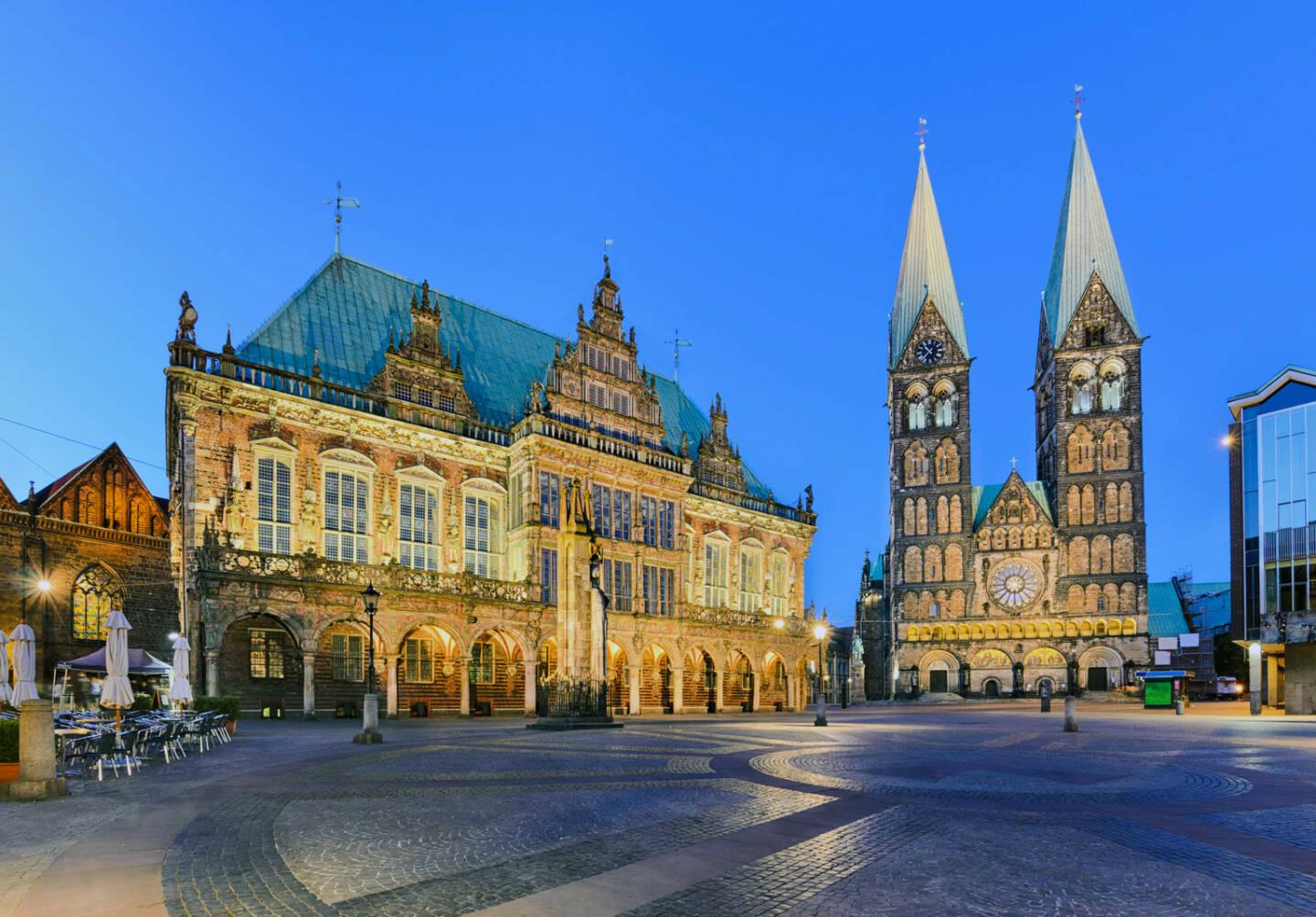
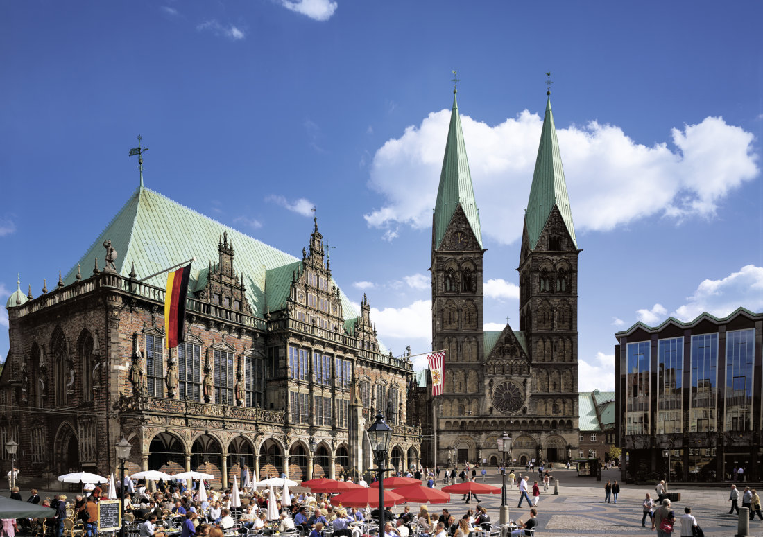
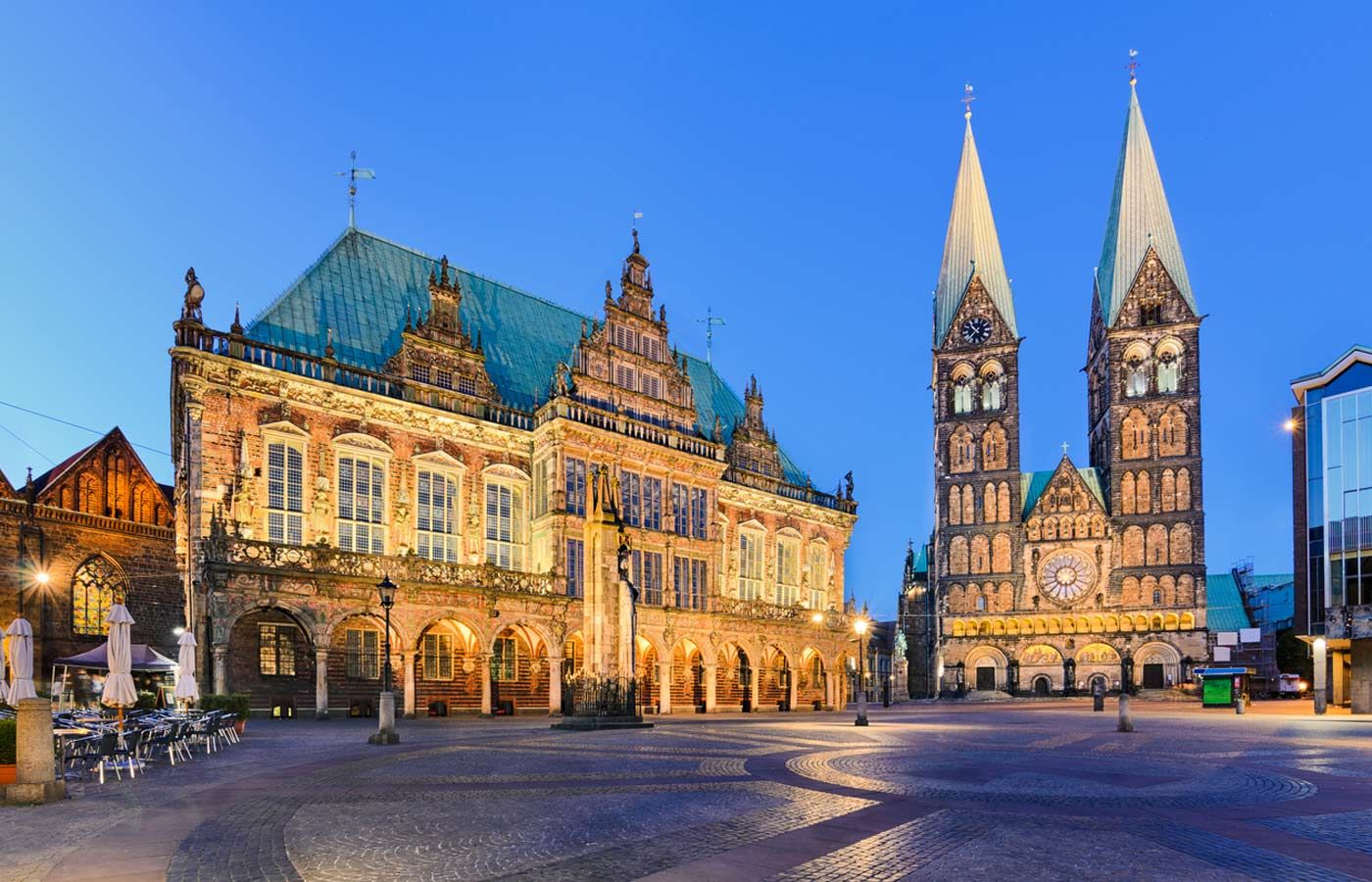
Das Bremer Rathaus ist eines der bedeutendsten Bauwerke der Backsteingotik und der Weserrenaissance in Europa. Seit 1917 steht es unter Denkmalschutz.[1] Im Juli 2004 wurde es zusammen mit dem Bremer Roland von der UNESCO zum Weltkulturerbe der Menschheit erklärt.[2]
Das Gebäude ist Sitz des Senats und des Bürgermeisters (in Personalunion Senatspräsident) der Freien Hansestadt Bremen.
不来梅市政厅(德語:Bremer Rathaus),是德国不来梅市的市政厅,是欧洲最重要的哥特式建筑之一,2004年它同不来梅罗兰像一起入选联合国教科文组织的世界文化遗产名录。不来梅市政厅建筑现在是不来梅市市长和议会主席的驻地。

位于德国西北部不来梅市的市政厅和罗兰骑士雕像是伴随欧洲神圣罗马帝国发展起来的公民自治权利和贸易自由权利的象征。不来梅市政厅,这座哥特式砖结构的市政厅建于1405年,迄今已有近600年的历史。为哥特式建筑的风格。不来梅市政厅前罗兰骑士雕像,这座高5.5 米的罗兰骑士雕像建于1404年,迄今已有600年的历史。

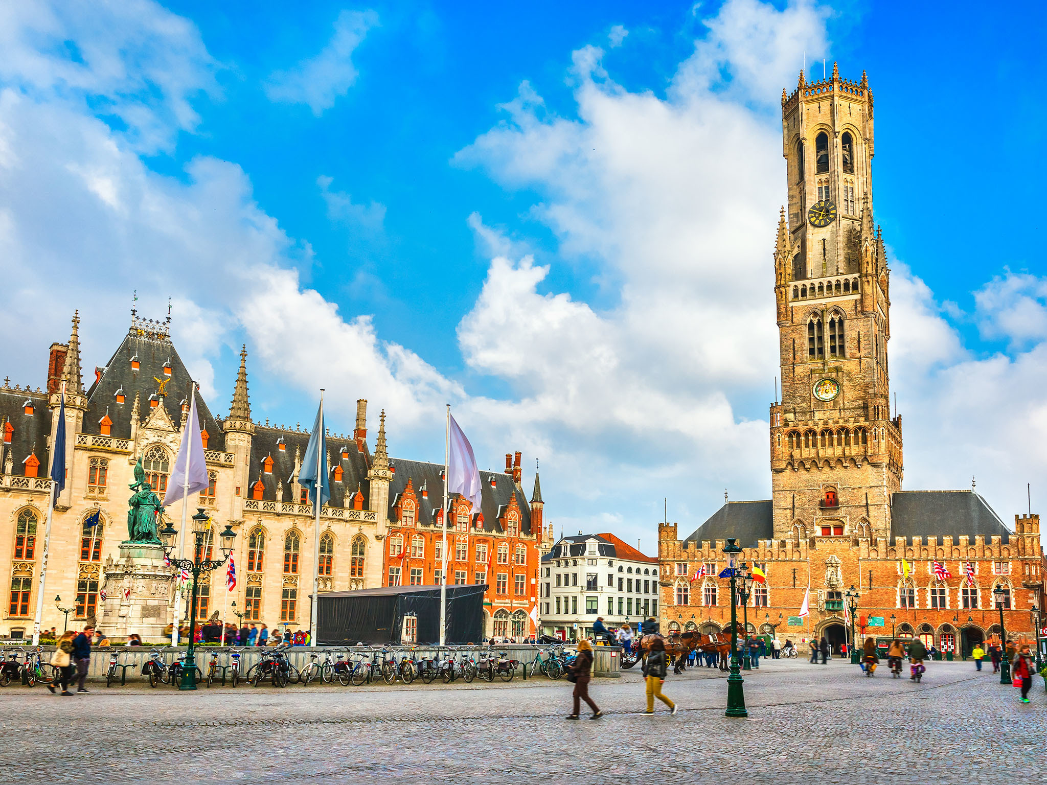
Brügge (niederländisch Brugge, französisch Bruges) ist die Hauptstadt und mit 118.284 Einwohnern (Stand 1. Januar 2018) die größte Stadt der Provinz Westflandern in Belgien. Außerdem ist Brügge Bischofssitz der katholischen Kirche für das Bistum Brügge.
Im Spätmittelalter war die niederländische Region um Brügge eines der Zentren der Textilindustrie und des Fernhandels in Europa und damit eine der Geburtsstätten des Frühkapitalismus. In der Stadt residierten zeitweise die Herzöge von Burgund, unter deren Herrschaft Brügge zu einer der wirtschaftlich und kulturell reichsten Städte im damaligen Europa wurde.
Die Altstadt ist von Wallanlagen, auf denen Windmühlen stehen, und Kanälen umgeben. Da Brügge nie durch Kriege oder großflächige Brände zerstört wurde, sind mittelalterliches Stadtbild und historische Gebäude sehr gut erhalten. Die Stadt ist sowohl zu Fuß als auch per Bootstour erkundbar. Die Kanäle, die die Stadt durchziehen, nennen die Einheimischen Reien nach dem im Mittelalter vollständig kanalisierten Flüsschen Reie, über das Brügge direkt mit der Nordsee verbunden war.
Der mittelalterliche Stadtkern wurde im Jahr 2000 von der UNESCO zum Weltkulturerbe erklärt. Im Jahr 2002 war Brügge Europäische Kulturhauptstadt.
Brügge beherbergt das renommierte Europakolleg (College of Europe) und verfügt über einen wichtigen Seehafen im Teilort Zeebrugge.
ブルッヘまたはブリュッヘ、ブルグ、ブラヘなど(フラマン語(オランダ語):Brugge[ˈbrʏʝə] 発音例)、ブリュージュ(仏語:Bruges[ˈbʁyːʒ] 発音例)、ブルージュ(英語:Bruges[ˈbruːʒ] 発音例)は、ベルギー北西部、フランデレン地域の都市で、ウェスト=フランデレン州の州都。ベルギーの代表的な観光都市の一つであり、2002年には、スペインのサラマンカとともに欧州文化首都に選定された。
日本の百科事典や地名事典では「ブルッヘ」ないし「ブリュッヘ」が用いられることが多いが、観光業などの分野では「ブルージュ」や「ブリュージュ」も多く用いられている。なお、地名の由来は「橋」であり、市内に張り巡らされた運河に架かる無数の橋に因んでいる。
Bruges (/bruːʒ/; Dutch: Brugge [ˈbrʏɣə]; French: Bruges [bʁyːʒ]; German: Brügge) is the capital and largest city of the province of West Flanders in the Flemish Region of Belgium, in the northwest of the country.
The area of the whole city amounts to more than 13,840 hectares (138.4 sq km; 53.44 sq miles), including 1,075 hectares off the coast, at Zeebrugge (from Brugge aan zee,[2] meaning "Bruges by the Sea").[3] The historic city centre is a prominent World Heritage Site of UNESCO. It is oval in shape and about 430 hectares in size. The city's total population is 117,073 (1 January 2008),[4] of whom around 20,000 live in the city centre. The metropolitan area, including the outer commuter zone, covers an area of 616 km2 (238 sq mi) and has a total of 255,844 inhabitants as of 1 January 2008.[5]
Along with a few other canal-based northern cities, such as Amsterdam, it is sometimes referred to as the Venice of the North. Bruges has a significant economic importance, thanks to its port, and was once one of the world's chief commercial cities.[6][7] Bruges is well known as the seat of the College of Europe, a university institute for European studies.[8]
Bruges (prononcé /bʁyʒ/; en néerlandais Brugge, [ˈbrʏɣə]) est une ville de Belgique située en Région flamande, chef-lieu et plus grande ville de la province de Flandre-Occidentale.
Bruges apparaît au Xe siècle en tant que place forte du comté de Flandre. En 1134, un raz-de-marée a pour conséquence bénéfique d'ouvrir un bras de mer, le Zwin, donnant un accès direct à la mer pour la ville, ce qui entraîne un développement urbain spectaculaire entre le XIIe et le XVe siècle, avec le creusement de nombreux canaux. Forte de son indépendance communale symbolisée par son beffroi, Bruges devient une plaque tournante portuaire, commerciale et financière centrale dans l'Europe du Moyen Âge, reliant les pays de la mer du Nord et de la Baltique à la Méditerranée. Les riches marchands brugeois traitaient avec ceux de toute l'Europe. La première bourse de valeurs de l'histoire est née à Bruges au XIIIe siècle. Au XVe siècle elle est la première place financière d'Europe. Cet essor économique entraîne également une floraison culturelle et artistique. Elle a été le centre le plus important pour les peintres primitifs flamands, qui ont révolutionné la peinture occidentale, et dont les œuvres sont aujourd'hui dispersées dans les grands musées du monde entier. Mais le Zwin s'ensabla peu à peu aux XVe et XVIe siècles, éloignant progressivement la ville de son accès à la mer, ce qui provoqua un déclin économique irrémédiable au profit de sa voisine, Anvers. Bruges est alors tombée au rang de simple ville provinciale.
Ce n'est qu'au XXe siècle que la ville connaît un nouveau développement grâce à la création du vaste port de Bruges-Zeebruges, qui fait aujourd'hui partie intégrante du Range nord-européen. La longue période de torpeur qu'a connu la ville après la Renaissance a permis à l'essentiel de son tissu urbain médiéval et à une bonne partie de ses monuments anciens de rester préservés. La « belle endormie » est alors apparue aux XIXe et XXe siècles comme l'un des joyaux du patrimoine européen. Ce patrimoine ancien a été méticuleusement restauré et mis en valeur. Une architecture néogothique de qualité s'est aussi développée parallèlement, faisant véritablement renaître le style local et redonnant au centre historique un aspect médiéval plus complet. Comme d'autres villes, elle est parfois surnommée la « Venise du Nord » du fait de ses canaux qui encerclent ou traversent la vieille ville dans un cadre pittoresque. Bruges est ainsi devenue la ville la plus touristique de Belgique. Elle héberge aussi le Collège d'Europe.
Elle est membre de l'Organisation des villes du patrimoine mondial depuis l'an 2000. La ville a même la particularité de figurer trois fois sur la liste du Patrimoine mondial de l'UNESCO. Pour son centre historique, pour son béguinage faisant partie des béguinages flamands et pour son beffroi comptant parmi les beffrois de Belgique et de France. En outre, elle est aussi reprise comme Patrimoine culturel immatériel de l'humanité de l'UNESCO pour sa procession du Saint-Sang. Elle fut également la capitale européenne de la culture en 2002, en même temps que la ville espagnole de Salamanque.
Bruges[1][2] (in francese, pron. /bʀyʒ/) o Brugge (in nederlandese, pron. /'brʏɣə/; nella variante fiamminga pronunciato /'brʏʝə/; Brügge in tedesco), in italiano in passato Bruggia[3], è una città del Belgio, capoluogo e maggiore città delle Fiandre Occidentali, nella Comunità fiamminga.
Sede permanente del Collegio d'Europa e di una diocesi cattolica, il centro storico medievale è stato proclamato nel 2000 patrimonio dell'umanità dall'UNESCO. Nel 2002 la città è stata capitale europea della cultura insieme alla città spagnola di Salamanca.
Brujas (en neerlandés Brugge [ˈbrʏɣə]; en francés, Bruges [bʁyːʒ]; en alemán Brügge ['bʁygə]) es una ciudad belga. Es la capital de la provincia de Flandes Occidental. Situada en el extremo noroeste de Bélgica a 90 kilómetros de la capital Bruselas, cuenta en su núcleo urbano con una población de 117.000 habitantes.
Su nombre proviene del germánico occidental "Bryggia" ("puentes", "muelles", "atracaderos"). Es interesante destacar que, en el neerlandés, «brug» significa «puente», y que esta ciudad ostenta como nombre el plural de esta palabra, debido a la gran cantidad de puentes que en ella existen.
El mayor atractivo de Brujas es su casco histórico, declarado Patrimonio de la Humanidad por la Unesco en el 2000.1 Aunque en gran parte ha sido reconstruido, dicho centro urbano es uno de los más grandes atractivos europeos, ya que mantiene intactas las estructuras arquitectónicas medievales. Al igual que Ámsterdam, Gotemburgo y Hamburgo, entre otras, Brujas es conocida como «la Venecia del norte», debido a la gran cantidad de canales que atraviesan la ciudad y a la belleza de los mismos.
Брю́гге (нидерл. Brugge [ˈbrʏʝə], фр. Bruges, нем. Brügge) — город в Бельгии, центр провинции Западная Фландрия. Один из самых живописных городов Европы [источник не указан 1036 дней]. Население — 117 172 человек (2013). Экономический и культурный расцвет Брюгге связывают с эпохой высокого и позднего Средневековья (XII—XV вв.).
 Berlin
 Museum
 Religion
 History
 International cities
 Important port
 Lombardia
 Civilization
 Medieval cities in Europe