
Deutsch-Chinesische Enzyklopädie, 德汉百科
 Nei Mongol Zizhiqu-NM

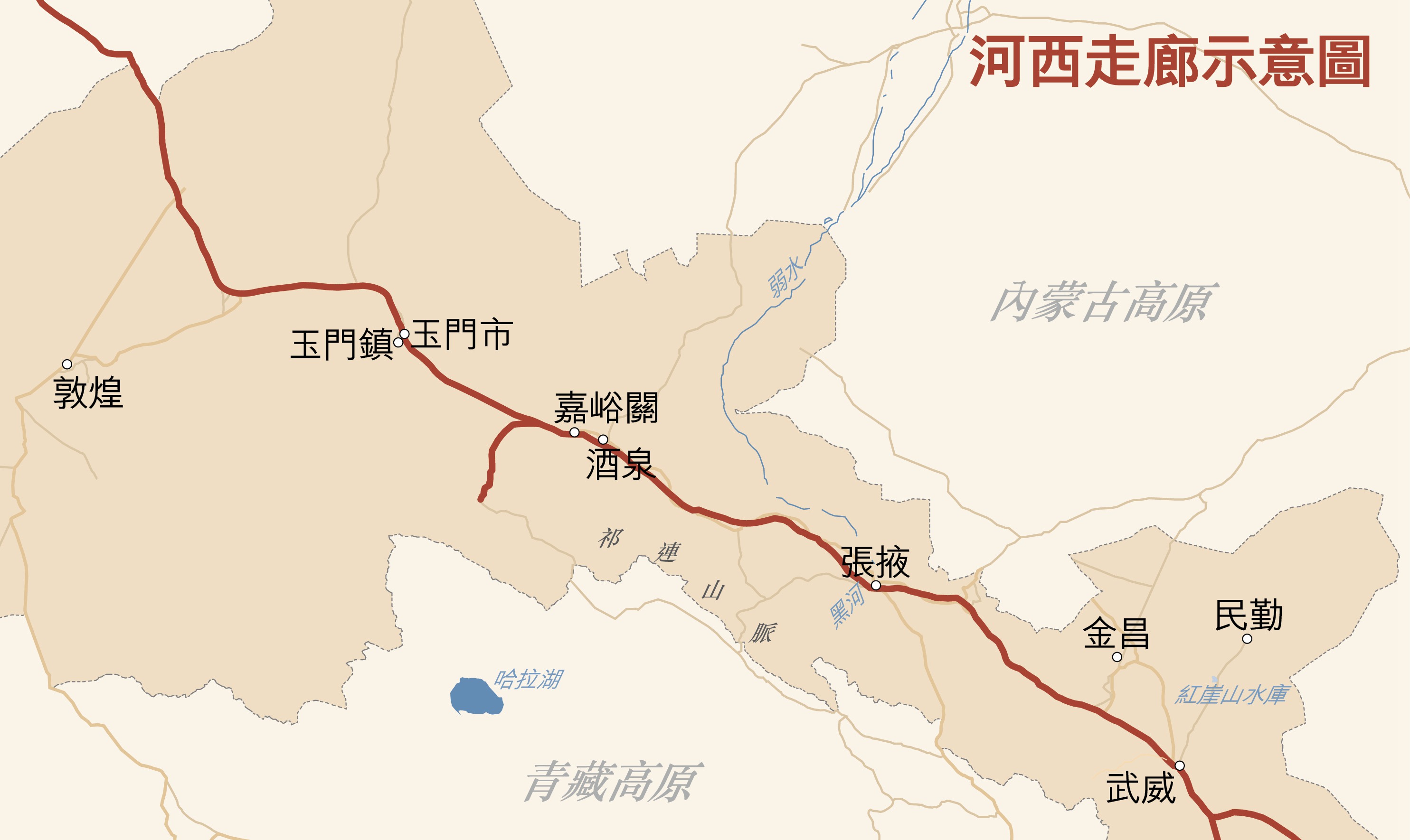
河西走廊,勒拉中国西北面,黄河西面、罗布泊搭吐鲁番盆地东面、祁连山搭巴丹吉林沙漠当中,是個西北—东南走向个,连拉塔里木盆地搭陇西个狭长状平原。伊东西长毛1000千米,南北顶阔个地方有将近200公里,顶狭个地方只有几公里。河西走廊自古以来就是沟通中国中原地区搭西域个重要通道,是丝绸之路个重要组成部分,也是多民族弗断融合个核心区域。
Der Hexi-Korridor (chinesisch 河西走廊, Pinyin Héxī Zǒuláng) oder Gansu-Korridor (甘肅走廊 / 甘肃走廊, Gānsù Zǒuláng) liegt in der Provinz Gansu in China. Er umfasst ein Gebiet von etwa 215.000 km². Als Teil der Seidenstraße im alten China ist er der bedeutendste Durchgang nach Xinjiang und Zentralasien.


县、1旗,2017年末常住人口为311.5万人,市区常住人口215.2万人。
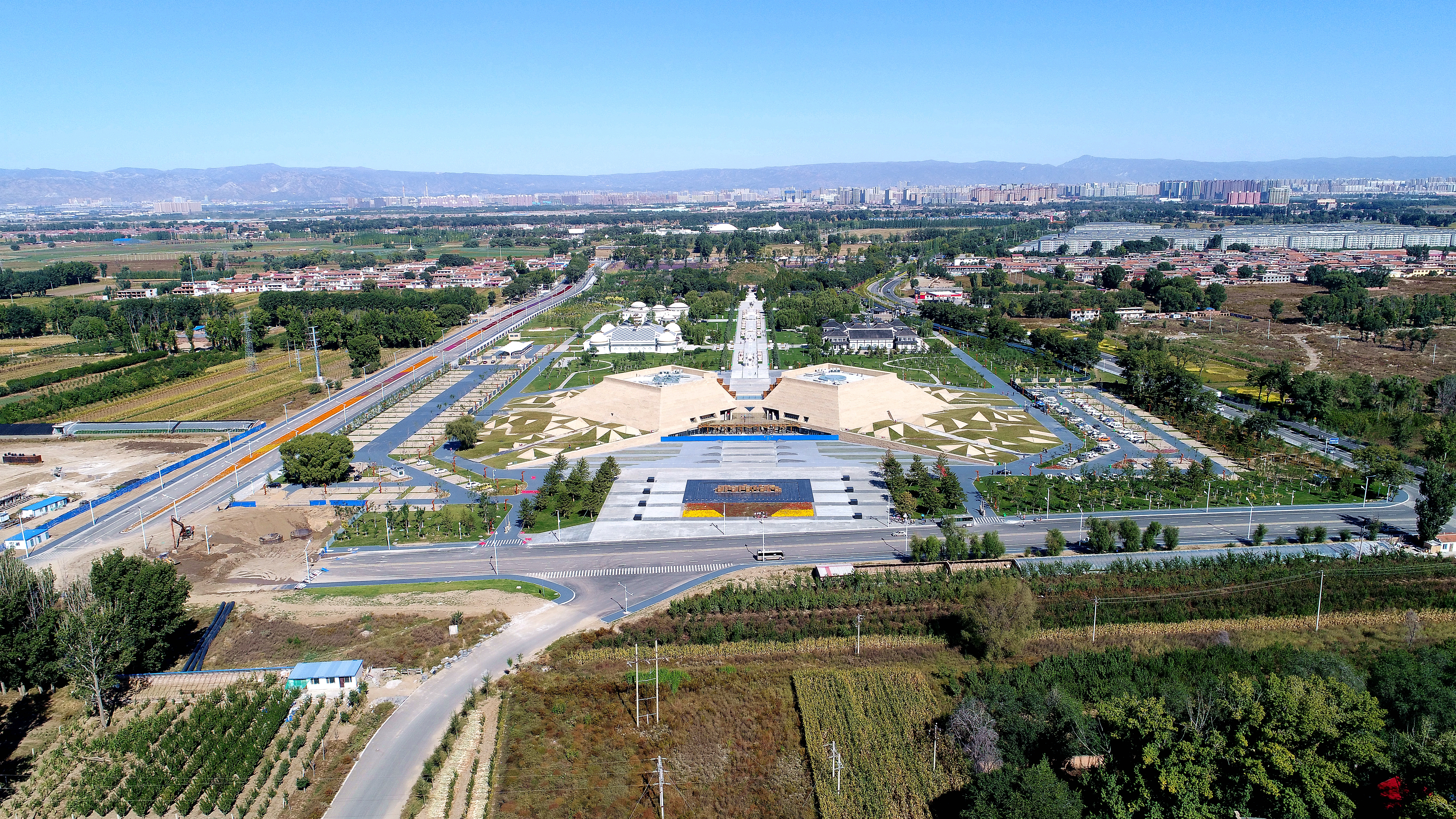
呼和浩特市(蒙古语:ᠬᠥᠬᠡᠬᠣᠲᠠ,汉语拼音字母:Hohhôt,鲍培转写:Kökeqota,西里尔字母:Хөх хот,意为“青色的城”)[注 1],通称呼市,旧称归绥,别称青城、召城[注 2],是中华人民共和国内蒙古自治区的首府,位于内蒙古中南部。市境西南接鄂尔多斯市,西北邻包头市,东北界乌兰察布市,东南达山西省忻州市、朔州市。地处蒙古高原南缘,阴山山脉南麓,北部为大青山,东南为蛮汉山,西南为土默川平原。黄河流经西南边界,大黑河从东北流向西南穿过城区并注入黄河。全市汉族人口约占87%,蒙古族人口约占10%。市政府驻新城区新华东街1号。呼和浩特主城区是由归化、绥远两座城在清末民初合并而成,故旧称“归绥”。呼和浩特处于农牧文化交界地带,自古即处于中原王朝与渗透王朝、征服王朝的交替控制中,故文化交融性较强,除汉文化外,蒙古族文化、新疆(西域)的伊斯兰文化、西藏藏传佛教文化亦对其有较重影响。
Hohhot ist die Hauptstadt des Autonomen Gebietes Innere Mongolei in der Volksrepublik China. Der Name der Stadt ist mongolisch und bedeutet „Blaue Stadt“; die chinesische Übersetzung (青城 = "blaue/grüne/azurne/reine Stadt") läßt jedoch auch andere Farben zu, daher erklärt sich die teilweise genutzte Bezeichnung "Grüne Stadt" seitens der Chinesen.[1]
Das Verwaltungsgebiet der Stadt Hohhot hat eine Gesamtfläche von 17.271 km² und 2,14 Millionen Einwohner (Ende 2004). Daraus ergibt sich eine Bevölkerungsdichte von 124 Einwohnern je km².
Die Stadt wurde um 1580 von Altan Khan gegründet und wurde später Hauptstadt der chinesischen Provinz Suiyuan. Die Chinesen nannten sie bis 1954 Guisui (歸綏 Guīsuī), ein Akronym, das sich aus den Anfangszeichen der beiden Stadtteile Guihua (歸化) und Suiyuan (綏遠) zusammensetzte.(Quelle:http://de.wikipedia.org/wiki/Hohhot)
フフホト市(フフホトし、中国語:呼和浩特市、モンゴル語:![]() 、英語:Hohhot)は、16世紀にアルタン・ハーンによって築かれた南モンゴルの古都フフホトと、近隣の4つの県、1つの旗(ホショー)によって構成された中華人民共和国の地級市のひとつであり、内モンゴル自治区の省都、直轄市(シュード・ハリヤ・ホト、siγd qariya qota)。
、英語:Hohhot)は、16世紀にアルタン・ハーンによって築かれた南モンゴルの古都フフホトと、近隣の4つの県、1つの旗(ホショー)によって構成された中華人民共和国の地級市のひとつであり、内モンゴル自治区の省都、直轄市(シュード・ハリヤ・ホト、siγd qariya qota)。
Hohhot (Mongolian: Mongolian script: ![]() Kökeqota, Mongolian Cyrillic: Хөх хот Höh hot /xɵxˈxɔtʰ/; Chinese: 呼和浩特; pinyin: Hūhéhàotè), abbreviated Hushi (Chinese: 呼市; pinyin: Hūshì), formerly known as Kweisui (traditional Chinese: 歸綏; simplified Chinese: 归绥; pinyin: PRC Standard Mandarin: Guīsuí, ROC Standard Mandarin: Guīsuī), is the capital of Inner Mongolia in the north of the People's Republic of China,[5][6] serving as the region's administrative, economic and cultural center.[7] Its population was 2,866,615 inhabitants at the 2010 census, of whom 1,980,774 lived in the built-up (or metro) area made up of 4 urban districts.[8]
Kökeqota, Mongolian Cyrillic: Хөх хот Höh hot /xɵxˈxɔtʰ/; Chinese: 呼和浩特; pinyin: Hūhéhàotè), abbreviated Hushi (Chinese: 呼市; pinyin: Hūshì), formerly known as Kweisui (traditional Chinese: 歸綏; simplified Chinese: 归绥; pinyin: PRC Standard Mandarin: Guīsuí, ROC Standard Mandarin: Guīsuī), is the capital of Inner Mongolia in the north of the People's Republic of China,[5][6] serving as the region's administrative, economic and cultural center.[7] Its population was 2,866,615 inhabitants at the 2010 census, of whom 1,980,774 lived in the built-up (or metro) area made up of 4 urban districts.[8]
The name of the city in Mongolian means "Blue City", although it is also wrongly referred to as the "Green City."[9] The color blue in Mongol culture is associated with the sky, eternity and purity. In Chinese, the name can be translated as Qīng Chéng (Chinese: 青城; literally: 'Blue/Green City')[10] The name has also been variously romanized as Kokotan, Kokutan, Kuku-hoton, Huhohaot'e, Huhehot, Huhot, or Köke qota.[6]
Hohhot (mongol bichig : ![]() ; translittération VPMC : Kökeqota ; mongol cyrillique : Хөх хот, translittération : Khökh khot (la ville bleue), en chinois : 呼和浩特 ; pinyin : (transcription phonétique du mongol)), est la capitale de la région autonome de Mongolie-Intérieure de la République populaire de Chine.
; translittération VPMC : Kökeqota ; mongol cyrillique : Хөх хот, translittération : Khökh khot (la ville bleue), en chinois : 呼和浩特 ; pinyin : (transcription phonétique du mongol)), est la capitale de la région autonome de Mongolie-Intérieure de la République populaire de Chine.
Hohhot (in mongolo Хөххот, trascrizione ufficiale Khökhkhot, pronuncia ca. "huhhòt", lett. "città azzurra"; in scrittura mongola ![]() , in cinese: 呼和浩特S, HūhéhàotèP) è una città del nord della Cina, capitale della regione autonoma della Mongolia Interna.
, in cinese: 呼和浩特S, HūhéhàotèP) è una città del nord della Cina, capitale della regione autonoma della Mongolia Interna.
La città fu fondata dal sovrano mongolo Altan Khan nel tardo XVI secolo. Venne scelta come il centro amministrativo della regione nel 1952, in sostituzione della città di Ulanhot.
È servita dall'Aeroporto di Hohhot-Baita che si trova 14 chilometri ad est della città e nei cui pressi si erge la Baita, o Pagoda bianca (in cinese: 白塔S, Bái tǎP, letteralmente "pagoda bianca") eretta nell'XI secolo durante la Dinastia Liao su pianta ottagonale e che si sviluppa su sette piani.[1]
Hohhot (mongol: ![]() , chino: 呼和浩特, pinyin: Hūhéhàotè), a veces escrito Huhehot o Huhhot, es la capital de la región autónoma de Mongolia Interior de la República Popular China. Su nombre en mongol significa «Ciudad azul».2
, chino: 呼和浩特, pinyin: Hūhéhàotè), a veces escrito Huhehot o Huhhot, es la capital de la región autónoma de Mongolia Interior de la República Popular China. Su nombre en mongol significa «Ciudad azul».2
Хух-Хо́то (кит. упр. 呼和浩特, пиньинь: Hūhéhàotè, трансл.: Хухэхаотэ, монг. ![]() (Хөх хот, Kökeqota) — «синий город») — городской округ в Автономном районе Внутренняя Монголия (КНР), административный центр Автономного района Внутренняя Монголия, экономический и культурный центр региона.
(Хөх хот, Kökeqota) — «синий город») — городской округ в Автономном районе Внутренняя Монголия (КНР), административный центр Автономного района Внутренняя Монголия, экономический и культурный центр региона.

 Anhui Sheng-AH
 Beijing Shi-BJ
 Gansu Sheng-GS
 Hebei Sheng-HE
 Henan Sheng-HA
 Liaoning Sheng-LN
 Nei Mongol Zizhiqu-NM
 Ningxia Huizu Zizhiqu-NX
 Shandong Sheng-SD
 Xinjiang Uygur Zizhiqu-XJ
 Yunnan Sheng-YN
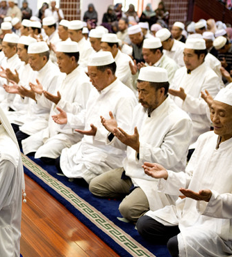
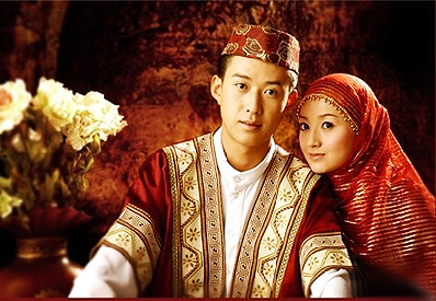

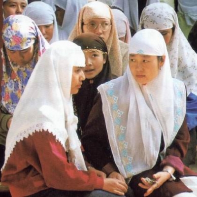
回族是中国人口较多的一个少数民族,中国的31个省、自治区、直辖市均有分布。宁夏回族自治区是其主要聚居区,宁夏回族自治区拥有回族人口186.25万,占全国回族总人口的18.9%。另外,回族人口在20万以上的地区还有:北京、河北、内蒙古、辽宁、安徽、山东、河南、云南、甘肃和新疆等。
回族的族源可以追溯到唐代,学术界一般认为回族大致形成于明代,而元代是回族形成的准备时期,明代是回族最终形成的时期。各地回族还以不同的形式参加反抗帝国主义侵略的斗争,五四运动和中国共产党成立,为回族人民的彻底解放指明了方向。
不论在政治、经济、文化上,回回民族在历史上都涌现过不少杰出的人物,对当时人民生活和生产建设都作出了积极的贡献。
根据《中国统计年鉴-2021》,中国(不包括台湾省)境内回族的人口数为11377914人。

呼伦贝尔市(蒙古语:ᠬᠥᠯᠦᠨ
ᠪᠦᠢᠷ
ᠬᠣᠲᠠ,汉语拼音字母:Holonbûir hôt(标准音)、Huluunbûir hôtô(巴尔虎布里亚特),鲍培转写:Kölön buyir qota)是中华人民共和国内蒙古自治区下辖的地级市,位于内蒙古自治区东部。原名呼伦贝尔盟,以境内呼伦湖和贝尔湖得名;清朝时称呼伦布雨尔,首府海拉尔。市境南接兴安盟、黑龙江省齐齐哈尔市,东邻黑龙江省黑河市,北界黑龙江省大兴安岭地区,西与俄罗斯及蒙古国相邻。地处内蒙古高原东北部,大兴安岭纵贯市境,将市境分为三大部分,西部为呼伦贝尔草原,中部为大兴安岭林区,东部为低山丘陵及河谷平原。西缘额尔古纳河为中俄界河,于市境北端与石勒喀河交汇后称黑龙江,东缘嫩江为与黑龙江省的界河。全市总面积25.28万平方公里,其中汉族人口占80.1%,蒙古族人口占10.59%。市政府驻海拉尔区。呼伦贝尔市曾经是名义上全世界陆地面积最大的地级市行政单位[注 1]。这一纪录被2018年新成立的地级市那曲市打破[4]。
呼伦贝尔市现辖2个市辖区、4个旗、3个自治旗,代管5个县级市。 市辖区:海拉尔区、扎赉诺尔区 县级市:满洲里市、牙克石市、扎兰屯市、额尔古纳市、根河市 旗:阿荣旗、陈巴尔虎旗、新巴尔虎左旗、新巴尔虎右旗 自治旗:莫力达瓦达斡尔族自治旗、鄂伦春自治旗、鄂温克族自治旗
Hulun Buir ist eine bezirksfreie Stadt in der Volksrepublik China. Sie ist hervorgegangen aus dem Hulun-Buir-Bund (呼伦贝尔盟) und erstreckt sich über den äußersten Nordosten des Autonomen Gebietes Innere Mongolei der Volksrepublik China.

Der Hulun-See (mongolisch: Hulun Nur oder auch Dalai nuur (Далай нуур), chinesisch 呼倫湖, Pinyin Hūlún Hú) ist ein großer Süßwasser-Binnensee im Nordosten Chinas, im äußersten Nordosten des Autonomen Gebietes Innere Mongolei, im Hulun Buir-Grasland, auf der Barga-Hochebene. Der See ist meist ohne Abfluss. Bei hohem Wasserpegel im See fließt er in den Fluss Argun ab.
Mit 2315 km² (nach anderen Angaben 1100 km²) ist der Hulun Nur der größte See der Inneren Mongolei und der fünftgrößte Chinas. Der – je nach Niederschlagsmenge – nur sechs bis neun Meter tiefe See liegt auf einer Höhe von 539 m. Die Ufer sind relativ flach und bestehen sowohl aus steinigen, als auch aus sandigen Abschnitten.
Abhängig von seinem Zufluss ist er bis zu 93 km lang und 32 km breit. An seinem Südwestufer wird er vom Cherlen und an seinem Ostufer vom Orxon gespeist.
Mindestens 30 Fischarten haben sich im See angesiedelt, über 200 Vogelarten bevölkern nicht nur seine Ufer; dazu gehören Kraniche wie der überaus seltene Mandschurenkranich, Schwäne, Wildgänse, Wildenten sowie Zugvögel, die den See und seine Ufer als Rast- und Brutplatz und Ort der Nahrungssuche aufsuchen. Als erstaunlich sauberer See in China entwickelt sich der See immer mehr zu einem recht beliebten Reiseziel mit Urlaubs- und Kurorten. Im Winter ist der See oftmals zugefroren.
Der See liegt 150 km östlich des Stadtbezirks Hailar im Verwaltungsgebiet der bezirksfreien Stadt Hulun Buir.


 Eat and Drink

 Geography
 International cities
 Music
Music