
Deutsch-Chinesische Enzyklopädie, 德汉百科
 International cities


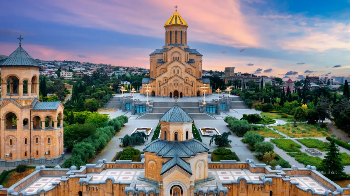

トビリシ(グルジア語: თბილისი, Tbilisi [tʰb̥ilisi] (![]() 音声ファイル)、略称TBS)は、ジョージア国(グルジア)の首都。ときにティフリス(Tiflis)とも呼ばれる。トビリシとは「あたたかい」を意味するトビリに由来し、温泉と関係あるとされている。元史には梯弗里斯とも呼ばれる。人口は約110万人。
音声ファイル)、略称TBS)は、ジョージア国(グルジア)の首都。ときにティフリス(Tiflis)とも呼ばれる。トビリシとは「あたたかい」を意味するトビリに由来し、温泉と関係あるとされている。元史には梯弗里斯とも呼ばれる。人口は約110万人。
ジョージア国東部、クラ川の河畔に広がる。三方を山や小高い丘に囲まれている。
Tbilisi (English: /təbɪˈliːsi, təˈbɪlɪsi/ tə-bih-LEE-see, tə-BIL-ih-see;[6] Georgian: თბილისი [tʰbilisi] (![]() listen)), in some countries also still known by its pre-1936 international designation Tiflis[7] (/ˈtɪflɪs/ TIF-lis),[6] is the capital and the largest city of Georgia, lying on the banks of the Kura River with a population of approximately 1.5 million people. Founded in the 5th century AD by Vakhtang I of Iberia, since then Tbilisi served as the capital of various Georgian kingdoms and republics. Between 1801 and 1917, then part of the Russian Empire, Tbilisi was the seat of the Imperial Viceroy, governing both Southern and Northern Caucasus.
listen)), in some countries also still known by its pre-1936 international designation Tiflis[7] (/ˈtɪflɪs/ TIF-lis),[6] is the capital and the largest city of Georgia, lying on the banks of the Kura River with a population of approximately 1.5 million people. Founded in the 5th century AD by Vakhtang I of Iberia, since then Tbilisi served as the capital of various Georgian kingdoms and republics. Between 1801 and 1917, then part of the Russian Empire, Tbilisi was the seat of the Imperial Viceroy, governing both Southern and Northern Caucasus.
Because of its location on the crossroads between Europe and Asia, and its proximity to the lucrative Silk Road, throughout history Tbilisi was a point of contention among various global powers. The city's location to this day ensures its position as an important transit route for various energy and trade projects. Tbilisi's diverse history is reflected in its architecture, which is a mix of medieval, neoclassical, Beaux Arts, Art Nouveau, Stalinist and the Modern structures.
Historically, Tbilisi has been home to people of multiple cultural, ethnic, and religious backgrounds, though it is currently overwhelmingly Eastern Orthodox Christian. Its notable tourist destinations include cathedrals Sameba and Sioni, Freedom Square, Rustaveli Avenue and Agmashenebeli Avenue, medieval Narikala Fortress, the pseudo-Moorish Opera Theater, and the Georgian National Museum.
Tbilissi (en géorgien თბილისი, t'bi-li-si) est la capitale de la République de Géorgie, sur les rives de la rivière Koura (ou Mt'kvari).
Son nom dérive de l'ancien géorgien Tp'ilisi ((source) chaude). Appelée traditionnellement Tiflis dans la plupart des langues (la terminaison -i est une marque de la langue géorgienne), son nom local s'est répandu par la volonté de Staline à partir de 1935. La ville couvre une superficie de 726 km2 et abrite 1 113 000 habitants au 1er janvier 2016 selon l'Office national des statistiques de Géorgie1.
Tbilisi (in georgiano: თბილისი?) è la capitale e la maggiore città della Georgia, già capitale della RSS Georgiana e della RSSF Transcaucasica. Il nome è talvolta scritto nelle forme Tiflis, Tiblisi o anche Tbilissi. La città copre un'area di 726 km² e ha 1 118 035 abitanti.
Tiflis1 (en georgiano თბილისი Tbilisi) es la capital de Georgia y la mayor ciudad del país. Está a orillas del río Kurá (მტკვარი, Mt'k'vari) y tiene 1 345 000 habitantes y una superficie de 726 km².
Fundada en el siglo V por Vakhtang Gorgasali, el monarca de la antigua región de Iberia caucásica, también conocida como Kartli, Tiflis ha sido, con algunas interrupciones, la capital de Georgia. La historia de la ciudad puede ser vista por su arquitectura: el estilo de la avenida Rustaveli, diseñada por el barón Haussmann, y el del centro, están mezclados con el de las estrechas calles del distrito medieval de Narikala. Tiflis es un importante centro industrial, social y cultural. La ciudad es una importante ruta de tránsito de la energía mundial y el comercio. Localizada estratégicamente entre Europa y Asia y antiguamente situada en la Ruta de la Seda, Tiflis ha sido a menudo un punto clave en las relaciones de imperios rivales.
La demografía de la ciudad es diversa e históricamente ha sido hogar de gente de diferentes etnias, religión y cultura. Recientemente, Tiflis ha sido conocida por la pacífica Revolución de las rosas, que tuvo lugar en la plaza de la Libertad y lugares cercanos. A consecuencia de ello, el entonces presidente, Eduard Shevardnadze, fue desplazado del poder.
El gentilicio es teflisense o teflitano, de conformidad con el nombre latino de la diócesis que existió en los siglos XV y XVI.2
La ciudad cuenta con un aeropuerto internacional. Sus principales lugares turísticos son la catedral de Sameba, la plaza de la Libertad, la catedral de Sioni, Metekhi, Narikala, el Parlamento de Georgia, la avenida Rustaveli, el Teatro de la Ópera y el Ballet, la basílica de Anchiskhati, la montaña de Mtatsminda y la iglesia de Kashveti, cerca de la cual se encuentran el Museo nacional de Georgia, el Museo Histórico y numerosas galerías de arte. La ciudad fue inmortalizada por los pintores Niko Pirosmani y Lado Gudiashvili.
Тбили́си (груз. თბილისი tʰ'biliˌsi Tbilisi.ogg [7][8] — «тёплый источник», старое название — Тифлис) — столица[9] и крупнейший город Грузии, расположенный на берегу реки Куры с населением около 1,1 миллиона человек. Город был основан в V веке. Стратегическое расположение на перекрёстке между Европой и Азией неоднократно делало Тбилиси яблоком раздора между различными силами на Кавказе. Многоликую историю города можно изучать по его архитектуре: начиная с просторных проспектов Руставели и Агмашенебели, и заканчивая узкими улицами сохранившегося с раннего Средневековья района Нарикала.
Составляет приравненный к краю муниципалитет Тбилиси, который занимает площадь 726 км²[1] с населением 1 113 000 человек (по оценке на 2016 год)[4] или 1 108 717 человек (по переписи 2014 года), в том числе в собственно городе проживает 1 062 282 человек (2014 год), в 4 посёлках городского типа — 16 015 человек (2014 год), в 22 сельских населённых пунктах — 30 420 человек (2014 год)[10][11]. По оценке на 2016 год численность населения города (с учётом 4 пгт) составила 1 082 400 человек.[2]
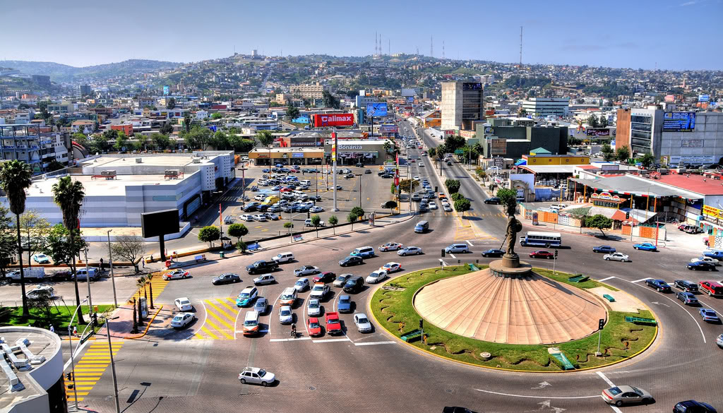


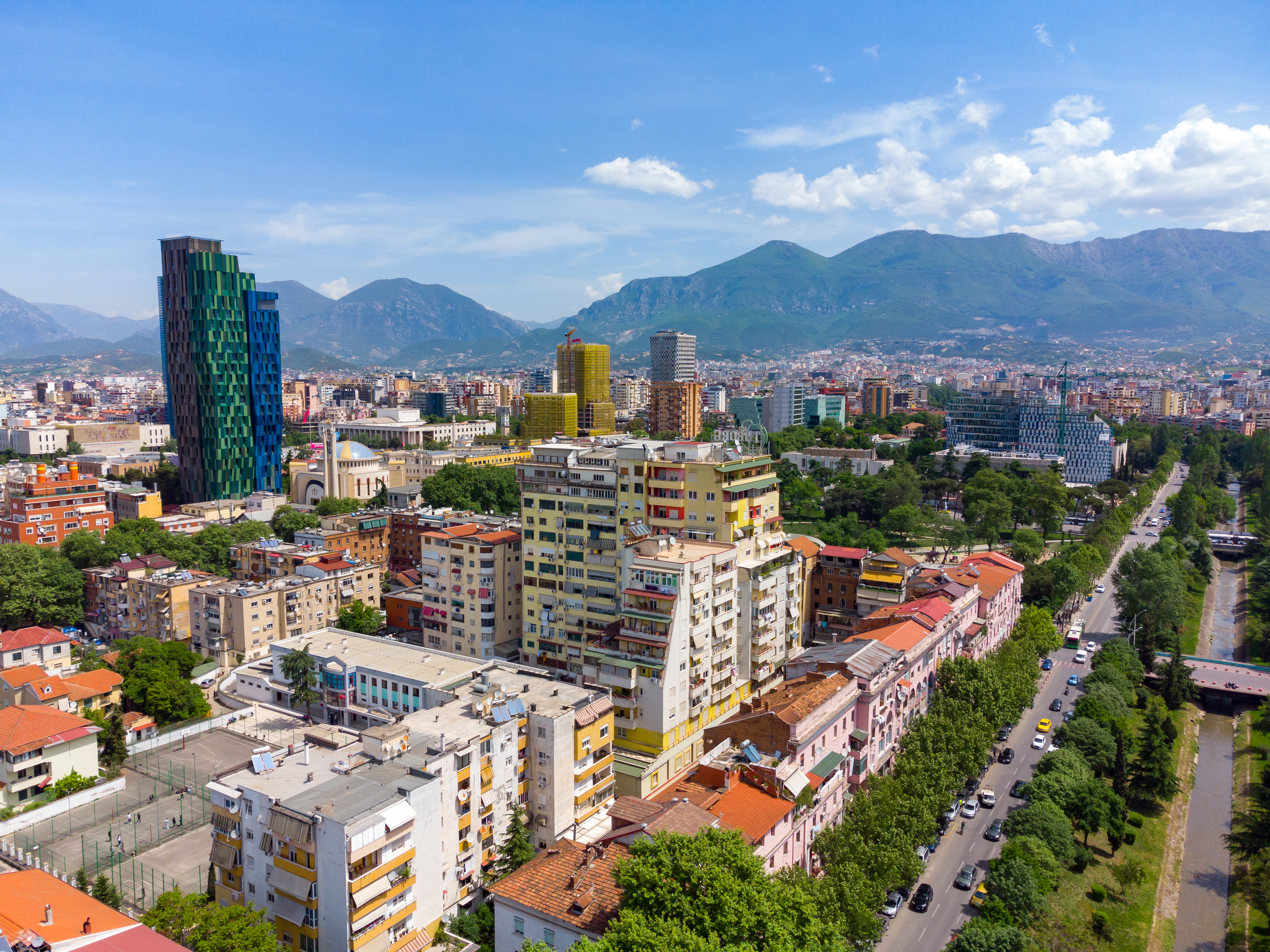
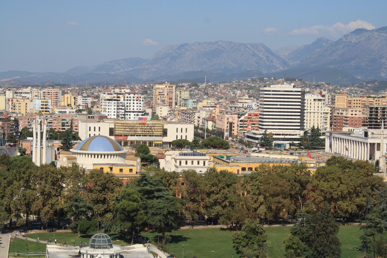
地拉那(阿尔巴尼亚语:Tirana[tiˈɾana](定)/ Tiranë(不定)、地拉那方言:Tirona(定)/ Tironë(不定)[5]),阿尔巴尼亚的首都和第一大城市,整个地拉那位于阿尔巴尼亚中部达埃蒂山和埃尔曾河西侧的内陆盆地,阿尔巴尼亚著名的拉纳河流经地拉那市中心地带。而地拉那是阿尔巴尼亚全国的政治、经济、文化中心。全市人口有862,361人(2017年)。[6]
早在公元前1至3万年地拉那就已经有人居住,并且在古罗马、古希腊、奥图曼统治时期融合了不少古希腊及土耳其文化。地拉那在1614年始建城镇。在1920年被阿尔巴尼亚亲王国定为阿国首都,并一直维持首都地位至今。第二次世界大战期间曾被意、德的法西斯轴心国所占领,并把阿尔巴尼亚建立为傀儡国家。到了1944年被南斯拉夫军队和阿尔巴尼亚劳动党领导人恩维尔·霍查解放。而在90年代初的东欧剧变运动中地拉那是阿尔巴尼亚民主化运动的主要示威地点之一。
地拉那是巴尔干半岛国家中第7名最多人口居住的城市,2017年人口普查显示达到86万人之多。虽然阿尔巴尼亚人口受出生率持续下降以及人口外迁至西欧美国的影响,在1990年起由330万左右开始缓慢下降至2023年约278万人左右水平,然而地拉那市区人口却不断增加,地拉那的近郊地区(如卡姆扎)也是如此,其主要原因包括愈来愈多来自国内其他城市的阿尔巴尼亚人搬往这里寻找更好的就业机会、学府、交通配套完善等。另外地拉那更是阿尔巴尼亚国内面积最大城市以及全球最庞大阿尔巴尼亚语使用者的城市,当中居住的阿尔巴尼亚人占超过6成,另外还包括少数民族的希腊人、马其顿人、黑山人等,以及来自全球不同国家的外来移民。此外地拉那受温带地中海气候影响,尽管地拉那冬季时有暴风雨甚至偶然还会在近郊录得降雪记录,但夏季晴天干燥的日子较大部分欧洲城市还要多(情况类似西班牙南部),使地拉那成为欧洲十大最多日照的城市之一,全年日照时间达到2554小时。
Tirana [tiˈɾana] (bestimmte Namensform, unbestimmte: Tiranë [tiˈɹan]; im lokalen gegischen Dialekt Tirona [tiˈɹɔna] bzw. Tiron [tiˈɹɔn]) ist die Hauptstadt Albaniens und der Gemeinde Tirana (Bashkia e Tiranës). Bei der Volkszählung 2011 wurden für die Stadt 418.495 Einwohner und für die heutige Gemeinde 557.422 Einwohner erhoben.[1] Nach eigenen Angaben hat Tirana deutlich mehr, rund 625.000 Einwohner (2009), während die Agglomeration 895.042 Einwohner zählt (2008).[2] Mit Durrës und einigen Vorstädten bildet Tirana eine Metropolregion, wo auch der größte Flughafen und der größte Hafen Albaniens liegen.
Tirana ist der kulturelle, politische und wirtschaftliche Mittelpunkt eines zentralistisch organisierten Staates und Sitz mehrerer Einrichtungen, Organisationen und Parteien. So befinden sich dort das Parlament und die Regierung des Landes. Tirana ist Hauptstadt des gleichnamigen Qarks und war bis zu dessen Auflösung auch Hauptstadt eines Kreises, von dem ein Großteil heute zum Gebiet der Gemeinde zählt.

 Financial
 M 1500 - 2000 AD

 Financial
 ***Global Financial Center

 Geography

 Geography
 *World's Most Livable Cities

 History
 N 2000 - 2100 AD

 History
 M 1500 - 2000 AD

 International cities
 ***Global Urban Economic Competitiveness
 Japan
Japan
 Kantō
Kantō
 Olympic Summer Games
 1964 Summer Olympics
 2020 Summer Olympics
 Silk road

 Important port

东京(日语:東京/とうきょう Tōkyō)是位于日本关东地方的都市,狭义上指东京都、或东京都区部(即东京市区),亦可泛指东京都及周边卫星都市群相连而成的“首都圈”(东京都会区)。目前(2017年8月)东京都区部人口数达946万,首都圈的人口数则达3千6百万,是目前全球规模最大的都会区[1],亦为亚洲最重要的世界级城市。东京是传统上的全球四大世界级城市[2]之一,在2016年GDP达9472.7亿美元,超越纽约(9006.8亿)成为全球第一,同时全球城市指数排名中排名第三。
东京古称江户,自德川幕府时代以来开始成为日本主要都市之一,明治维新时期改为现名后,更发展为日本政治、经济、文化、交通等众多领域的枢纽中心。经过二战后的继续发展,东京不仅成为世界商业金融、流行文化与时尚重镇,亦为世界经济发展度与富裕程度最高的都市之一。此外,东京还有目前全球最复杂、最密集的城市轨道交通系统,其中单就计算东京的地铁系统管辖区段每日平均运量达880万人次,繁忙程度居全球地铁第三位(如含地铁直通运转路线、私铁通勤路线及JR东日本通勤路线,则每日平均运量位居世界城市轨道交通运输系统第一位)。
在正式的行政区划定义上,东京仅限于东京都,与道、府、县同为日本的一级行政区,辖区包含东京都区部、多摩地方与伊豆群岛、小笠原群岛等离岛;其中,东京都区部为日本中央政府所在地。东京都同时也囊括了日本最南端(冲之鸟礁)和最东端(南鸟岛)等地理极点,拥有日本各都道府县中最多的人口数,同时也是日本人口密度最高的都道府县。
Tokio (auch Tokyo, japanisch 東京 Tōkyō  [to̞ːkjo̞ː]) ist eine Weltstadt[3] in der Kantō-Region im Osten der japanischen Hauptinsel Honshū. Mit 9.508.776 Einwohnern ist sie nicht nur die bevölkerungsreichste Metropole des Landes, sondern als Sitz der japanischen Regierung und des Tennō auch die Hauptstadt Japans. Sie umfasst die 23 Bezirke auf dem Gebiet der 1943 als Verwaltungseinheit abgeschafften Stadt Tokio und ist damit keine eigene Gebietskörperschaft mehr; stattdessen bilden die Bezirke zusammen mit den Städten und Gemeinden der westlich gelegenen Tama-Region und den südlichen Izu- und Ogasawara-Inseln die Präfektur Tokio. Diese bildet wiederum das Zentrum der Metropolregion Tokio-Yokohama, in der mehr als 37 Millionen Menschen leben (Stand 2014), was die Region zum größten Ballungsraum der Welt macht.
Die Stadtgeschichte beginnt im Jahr 1446, als Ōta Dōkan in einem Sumpfgebiet am Nordufer der heutigen Bucht von Tokio mit dem Bau der Burg Edo begann, umgeben von einigen Fischerdörfern. 1590 ging diese Burg an Tokugawa Ieyasu, der hier nach seinem Sieg in der Schlacht von Sekigahara sein neues Shōgunat und damit die Edo-Zeit begründete. Edo wurde neben Kyōto zum politischen und kulturellen Zentrum des Landes. Mit der Meiji-Restauration 1868 wurde das Shōgunat abgeschafft und der Sitz des Tennō nach Edo verlegt, die Burg wurde zum Kaiserpalast und Edo bekam seinen neuen Namen Tokio, der „Östliche Hauptstadt“ bedeutet. Von da an wuchs auch die Bevölkerung der Stadt, die bereits um 1910 mit rund zwei Millionen Einwohnern zu den größten der Welt zählte. Im Zweiten Weltkrieg war Tokio zahlreichen Luftangriffen durch die USA ausgesetzt, bei denen rund die Hälfte der Stadtfläche zerstört wurde. Nach dem Ende der amerikanischen Besatzungszeit folgte ein rasanter wirtschaftlicher Aufschwung, einhergehend mit einem erneuten Bevölkerungszuwachs.
Tokio ist heute das Industrie-, Handels-, Bildungs- und Kulturzentrum Japans mit zahlreichen Universitäten, Hochschulen, Forschungsinstituten, Theatern und Museen. Mit den Flughäfen Narita und Haneda und als Ausgangspunkt der meisten Shinkansen-Linien ist es auch das Verkehrszentrum des Landes. Der Finanzplatz Tokio ist nicht nur der größte Japans, sondern zählt neben London, New York und Hongkong auch zu den fünf größten der Welt. Zudem weist die Stadt ein hohes Preisniveau auf und lag in einer Studie 2014 auf Platz 9 der teuersten Städte weltweit.[4][5] Neben modernen Sehenswürdigkeiten wie dem Tokyo Tower oder Tokyo Skytree bietet sie auch historische Anlagen wie die Kaiserlichen Gärten in Chiyoda, den Ueno-Park oder den Asakusa-Kannon-Tempel. In den vergangenen Jahren wurde Tokio zu einem zunehmend beliebten Tourismusziel und befindet sich mit jährlich bis zu acht Millionen Besuchern aus dem Ausland unter den 20 meistbesuchten Städten.[6] In einer Rangliste der Städte nach ihrer Lebensqualität belegte Tokio im Jahre 2018 den 50. Platz unter 231 untersuchten Städten weltweit.[7]
東京(とうきょう、英: Tokyo)は、日本の関東平野中央部に位置し、東京湾に面する都市。日本の首都である[1][注 1]。現在、その域内には23特別区・26市・5町・8村の基礎自治体がある[2]。
日本における政治・経済・文化の中心である。政治面では、日本政府が本拠地としている。立法府である国会の議事堂、司法府の頂点である最高裁判所、行政府の長である内閣総理大臣の官邸、中央省庁街(「霞が関」)などは、いずれも東京の中心部である東京23区にある。経済面では、日本の株式上場企業の本社のほとんどが東京に集中し、(東京圏では)購買力平価(PPP)を基にしても東京都市圏のGDPは1兆5369億ドル(2014年)であり[3]、世界的な経済都市であり、大消費地でもある。文化面では、たとえば現在では(東京都内に)千数百におよぶ劇場・ホール・ライブハウス類があり[4]多数のアーティストたちが活動する場であり、ポップカルチャーなどの新しい文化の発信地でもあり、ミシュランガイドの星つきの飲食店の数は世界最多で[5]食文化が華開いている場所でもある。
東京には、日本国内からだけでなく近隣の様々な国や世界各国から外国人が観光に訪れるようになった他、東京に移住した外国人が移民街を形成している。関東大震災や東京大空襲で焼け野原となったが、戦後の発展により現在は世界最大級のメトロポリス・世界都市となっている。東京は明治期にも課題が山積みの都市であったが(#明治維新後の課題と都市政策を参照)、現在もさまざまな課題を抱えている都市である(#近年の東京が都市としてかかえる課題を参照)。 東京都(とうきょうと、英: Tokyo Metropolis)は、日本の首都[注 1]。関東地方に位置する広域地方公共団体(都道府県)のひとつ。都庁所在地は新宿区[注 2]。最大の都市は世田谷区[注 3]。 管轄する領域は東京都区部(東京23区)、多摩地域(26市[注 4]と西多摩郡3町1村)および東京都島嶼部(大島、三宅、八丈、小笠原)の4支庁(2町7村)からなっている。東京都区部(東京23区)は、一つの都市として「東京」とも呼ばれる。沖ノ鳥島、南鳥島を含む小笠原諸島を含むため、日本最南端および最東端に位置する都道府県でもある。都公認の「東京都」の英語表記はTokyo Metropolis(Tokyo Met.)。他には Tokyo Prefecture と Tokyo Metropolitan Prefecture がある。
Tokyo (東京 Tōkyō, /ˈtoʊkioʊ/;[7] Japanese: [toːkʲoː] ( listen)), officially Tokyo Metropolis (東京都 Tōkyō-to), is one of the 47 prefectures of Japan and has been the capital since 1869.[8][9] The Greater Tokyo Area is the most populous metropolitan area in the world.[10] It is the seat of the Emperor of Japan, the Japanese government and the National Diet. Tokyo is in the Kantō region on the southeastern side of the main island Honshu and includes the Izu Islands and Ogasawara Islands.[11] Tokyo was formerly named Edo when Shōgun Tokugawa Ieyasu made the city as his headquarters in 1603. It became the capital after Emperor Meiji moved his seat to the city from Kyoto in 1868; at that time Edo was renamed Tokyo. Tokyo Metropolis was formed in 1943 from the merger of the former Tokyo Prefecture (東京府 Tōkyō-fu) and the city of Tokyo (東京市 Tōkyō-shi).
Tokyo has 39 million residents, 50% more people than any other urban area, with a $2.5 trillion economy larger than that of any other city; if it were a country, Tokyo would be the 8th largest economy in the world. Tokyo is often referred to as a city, but is officially known and governed as a "metropolitan prefecture", which differs from and combines elements of a city and a prefecture, a characteristic unique to Tokyo. The Tokyo Metropolitan Government administers the 23 Special Wards of Tokyo (each governed as an individual city), which cover the area that was the city of Tokyo before it merged and became the metropolitan prefecture in 1943, the 30 municipalities in the western part of the prefecture, and the two outlying island chains. The population of the special wards is over 9 million people, with the total population of the prefecture exceeding 13 million. The prefecture is part of the world's most populous metropolitan area with upwards of 37.8 million people and the world's largest urban agglomeration economy. In 2011, the city hosted 51 of the Fortune Global 500 companies, the highest number of any city in the world at that time.[12] Tokyo ranked third (twice) in the International Financial Centres Development Index. The city is also home to various television networks such as Fuji TV, Tokyo MX, TV Tokyo, TV Asahi, Nippon Television, NHK and the Tokyo Broadcasting System.
Tokyo is ranked first in the Global Economic Power Index and third in the Global Cities Index. The city is considered an alpha+ world city – as listed by the GaWC's 2008 inventory[13] – and in 2014, Tokyo was ranked first in the "Best overall experience" category of TripAdvisor's World City Survey (the city also ranked first in the following categories: "helpfulness of locals", "nightlife", "shopping", "local public transportation" and "cleanliness of streets").[14] In 2015, Tokyo was ranked as the 11th most expensive city for expatriates, according to the Mercer consulting firm,[15] and also the world's 11th most expensive city, according to the Economist Intelligence Unit's cost-of-living survey.[16] In 2015, Tokyo was named the Most Liveable City in the world by the magazine Monocle.[17] The Michelin Guide has awarded Tokyo by far the most Michelin stars of any city in the world.[18][19] Tokyo was ranked first out of all sixty cities in the 2017 Safe Cities Index.[20] The QS Best Student Cities ranked Tokyo as the 3rd-best city in the world to be a university student in 2016[21] and 2nd in 2018.[22] Tokyo hosted the 1964 Summer Olympics, the 1979 G-7 summit, the 1986 G-7 summit, and the 1993 G-7 summit, and will host the 2019 Rugby World Cup, the 2020 Summer Olympics and the 2020 Summer Paralympics.
Tokyo (東京(とうきょう), Tōkyō?, littéralement « Capitale de l'est »), anciennement Edo (江戸(えど)?), officiellement la préfecture métropolitaine de Tokyo (東京都(とうきょうと), Tōkyō-to?), est la capitale actuelle du Japon. Elle est la plus peuplée des préfectures du Japon, avec plus de 13 831 421 habitants intra-muros en 2018 et 42 794 714 dans l'agglomération2, et forme l'aire urbaine la plus peuplée au monde. Située sur la côte est de l'île principale de l'archipel japonais, Honshū, Tokyo est l'une des quarante-sept préfectures du Japon. Principal centre politique de l'archipel depuis le XVIIe siècle, la ville accueille la plupart des institutions du pays : la résidence de l'empereur du Japon, du Premier ministre, le siège de la Diète (le parlement japonais), du Cabinet, les ministères qui le constituent ainsi que toutes les ambassades étrangères.
À l'origine, Tokyo était un petit village de pêcheurs nommé Edo (« l'estuaire »). Fortifié au XVe siècle, Edo devient la base militaire du shogun Tokugawa Ieyasu à la fin du XVIe siècle, puis la capitale de son gouvernement. Durant l’époque d'Edo (1603-1868), la ville se développe et devient l'une des plus peuplées au monde à la fin du XVIIIe siècle, avec une population de près d'un million d'habitants. Avec la restauration de l'Empire en 1868, elle est confortée dans son rôle de cœur politique du Japon : le château d'Edo devient la résidence de l'empereur Meiji (Kōkyo), et la ville acquiert son nom actuel par opposition à Kyoto, l'ancienne capitale. Elle est ravagée en 1923 par un séisme de magnitude 7,9 qui fait plus de 100 000 morts. Durant la Seconde Guerre mondiale, elle est détruite pour moitié par des bombardements aériens américains, mais est rapidement reconstruite. Dans la seconde moitié du XXe siècle, Tokyo devient une métropole de rang mondial grâce à un fort développement industriel — notamment dans l'électronique —, et voit sa population multipliée par dix en cinquante ans.
Principal centre économique et financier du Japon, Tokyo est l'une des principales places financières asiatiques et mondiales. Elle est la première ville mondiale en termes de produits urbains bruts. Le dynamique arrondissement de Shinjuku comporte de nombreux gratte-ciels, dont la mairie de la ville, et plusieurs grands magasins du Japon. Minato-ku accueille les sièges sociaux de nombreuses entreprises japonaises et étrangères, ainsi qu'une cinquantaine d'ambassades. Chiyoda concentre quant à lui les institutions politiques japonaises. Enfin, Shibuya est réputé être l'un des quartiers les plus animés de la ville, grâce à la présence de grands centres commerciaux comme le 109. Malgré la modernité de son architecture, dont témoigne la tour Tokyo Skytree, de nombreux sanctuaires shinto et temples bouddhistes ont été préservés ou reconstruits après les bombardements, comme le Sensō-ji, le sanctuaire Yasukuni, le Zōjō-ji ou les portes Hōzōmon.
Située au fond de la baie de Tokyo, la commune de Tokyo dispose d'un statut administratif particulier parmi les préfectures du Japon, la ville de Tokyo ayant été supprimée en tant qu'entité politique ou administrative en 1943. L'agglomération de Tokyo, qui s'étend bien au-delà des limites de la préfecture, s'étend sur une large frange de la baie de Tokyo ainsi que sur la région du Kantō. Elle constitue en outre un des pôles de la mégalopole japonaise, avec notamment Ōsaka et Nagoya. La préfecture a organisé les Jeux olympiques d'été de 1964, et les accueillera à nouveau en 2020.
Tokio (東京都 Tōkyō-to?, lit. ‘capital del este’; pronunciación japonesa:  [toːkʲoː] (?·i)) es la capital de facto6 de Japón, localizada en el centro-este de la isla de Honshu, concretamente en la región de Kanto. En conjunto forma una de las 47 prefecturas de Japón, aunque su denominación oficial es metrópolis o capital (都 -to). La ciudad es el centro de la política, economía, educación, comunicación y cultura popular del país. Cuenta también con la mayor concentración de sedes corporativas, instituciones financieras, universidades y colegios, museos, teatros, y establecimientos comerciales y de entretenimiento de todo Japón.
Con una población que supera los 13 millones de habitantes, se subdivide en 23 barrios (区 -ku); 26 ciudades (市 -shi); un distrito (郡 -gun) subdividido en tres pueblos (町 -chō o -machi) y una villa (村 -son o -mura); y cuatro subprefecturas (支庁 -shichō) subdivididas en dos pueblos y siete villas, que representan a varias pequeñas islas al sur de Honshu que se extienden más allá de 1800 km de Shinjuku, capital de la metrópoli y sede de la gobernación. El centro de Tokio, con sus 23 barrios, ocupa un tercio de la metrópoli, con una población cercana a los 13,23 millones de habitantes; esta área es lo que se conoce internacionalmente como la ciudad de Tokio. En su área metropolitana viven más de 37 millones de habitantes, lo que la convierte en la mayor aglomeración urbana del mundo.
A pesar de que Tokyo es la romanización más común del nombre en japonés, el nombre de la ciudad es Tokio en español y otros idiomas —entre ellos el alemán y el neerlandés—. En inglés y otros idiomas se escribe Tokyo, aunque antiguamente también se escribía Tokio. En el pasado, la ciudad se denominaba como Tokei, Edo o Yedo. El gentilicio de Tokio es tokiota.
Tokio fue sede de los Juegos Olímpicos de 1964 y será sede de los Juegos Olímpicos de 2020.7
То́кио (яп. 東京 То:кё: (инф.), «Восточная столица»[4][5]) — столица Японии, её административный, финансовый, промышленный и политический центр. Крупнейшая городская экономика мира[6]. Расположен в юго-восточной части острова Хонсю, на равнине Канто в бухте Токийского залива Тихого океана.
Помимо столицы, Токио также является одной из сорока семи префектур страны. Площадь префектуры составляет 2188,67 км²[7], население — 13 742 906 человек (1 октября 2017)[8], плотность населения — 6279,11 чел./км². По состоянию на 1 мая 2020 года население Токио составляло 14 002 973 человека, что делает Токио префектурой с самым большим населением в Японии.[9] Большой Токио является городской территорией с самым большим населением в мире, с населением по состоянию на 2016 год в 38 140 000 человек.[2]
Токийский столичный округ — административная единица Японии, включающая в себя специальные районы Токио, область Тама и островные территории Токийского столичного округа (острова Идзу и Огасавара).


Toledo (spanisch [toˈleðo]) ist die Hauptstadt der spanischen Provinz Toledo sowie der autonomen Region Kastilien-La Mancha und liegt 65 km südsüdwestlich von Madrid am Fluss Tajo. Die Stadt hatte am 1. Januar 2017 83.741 Einwohner und ist Sitz des Erzbistums Toledo. Zusammen mit Segovia und Ávila gehört sie zu den drei historischen Metropolen in der Umgebung der spanischen Hauptstadt Madrid.
托莱多(西班牙语:Toledo,西班牙语:[toˈleðo]),又称杜丽多,是西班牙中部的一个自治市,位于马德里西南约70公里。托莱多是托莱多省的首府,也是其所在的卡斯蒂利亚-拉曼恰自治区的首府。该市2017年人口83,741人[1]。
托莱多始于罗马时期,在腓力二世前为卡斯蒂利亚王国(后西班牙王国)首都。它因其保存完好的基督教、伊斯兰教和犹太教建筑而在1986年被评为世界文化遗产,有哥特式、摩尔式、巴洛克式和新古典式各类教堂、寺院、修道院、王宫、城墙、博物馆等古建筑70多处。
トレド(Toledo)はスペイン・カスティーリャ=ラ・マンチャ州のムニシピオ(基礎自治体)。カスティーリャ=ラ・マンチャ州の州都であり、トレド県(人口約60万人)の県都である。マドリードから南に71kmの距離で、タホ川に面する。
かつての西ゴート王国の首都であり、中世にはイスラム教・ユダヤ教・キリスト教の文化が交錯した地である。「町全体が博物館」と言われ、タホ川に囲まれた旧市街は世界遺産に登録されている[3]。また、ルネサンス期のスペインを代表するギリシア人画家のエル・グレコが活躍した町としても有名。金銀細工の伝統工芸品「ダマスキナード」がある[4]。
Toledo (Spanish: [toˈleðo]) is a city and municipality located in central Spain; it is the capital of the province of Toledo and the autonomous community of Castile–La Mancha. Toledo was declared a World Heritage Site by UNESCO in 1986 for its extensive monumental and cultural heritage.
Toledo is known as the "Imperial City" for having been the main venue of the court of Charles V, Holy Roman Emperor, and as the "City of the Three Cultures" for the cultural influences of Christians, Muslims and Jews reflected in its history. It was also the capital from 542 to 725 AD of the ancient Visigothic kingdom, which followed the fall of the Roman Empire, and the location of historic events such as the Visigothic Councils of Toledo. Toledo has a long history in the production of bladed weapons, which are now popular souvenirs of the city.
People who were born or have lived in Toledo include Brunhilda of Austrasia, Al-Zarqali, Garcilaso de la Vega, Eleanor of Toledo, Alfonso X, Israeli ben Joseph, Halevi and El Greco. As of 2015, the city had a population of 83,226.[1] and an area of 232.1 km2 (89.6 sq mi).
Tolède (en espagnol Toledo) est une ville du centre de l’Espagne, capitale de la province du même nom et de la communauté autonome de Castille-La Manche.
Toledo (85.000 abitanti circa, toledani, in spagnolo toledanos) è una città situata nel centro-sud della Spagna, appartenuta all'antico Regno di Castiglia che aveva come capitale la città di Burgos. Attualmente è capoluogo dell'omonima provincia e della Comunità Autonoma di Castiglia-La Mancia. Per tradizione l'arcidiocesi di Toledo, la più importante del Paese, è sede primaziale, cioè all'arcivescovo di Toledo spetta il titolo di Primate di Spagna.
Toledo es un municipio y ciudad de España, capital de la provincia homónima y de la comunidad autónoma de Castilla-La Mancha. Es conocida como «La ciudad Imperial» por haber sido la sede principal de la corte de Carlos I5 y también como «la ciudad de las tres culturas», por haber estado poblada durante siglos por cristianos, judíos y musulmanes. Toledo, con 83 741 habitantes (INE 2017), es el municipio más poblado de la provincia y el tercero de la comunidad autónoma de Castilla La Mancha , tras Albacete y Guadalajara.
El casco histórico está situado en la margen derecha del Tajo, en una colina de cien metros de altura sobre el río, el cual la ciñe por su base, formando un pronunciado meandro conocido como «Torno del Tajo». El municipio cuenta con barrios muy separados del núcleo principal: el de Azucaica, en la orilla derecha del río, que tiene su origen en una antigua pedanía de la ciudad, dista unos 7 km del centro de la ciudad, mientras que el de Santa María de Benquerencia, situado prácticamente enfrente del anterior en la margen izquierda del Tajo, sitúa su centro a unos 8 km del de la ciudad. El municipio es considerado individualmente como una comarca en la división realizada por la Diputación Provincial,6 aunque desde un punto de vista estrictamente de geografía física la ciudad es puerta de la comarca natural de La Sagra, que tradicionalmente se ha considerado que comenzaba en la propia puerta de Bisagra.7
La historia de la ciudad se remonta a la Edad del Bronce. Fue un importante centro carpetano hasta su conquista romana en 193 a. C. y quedan diversos restos de la actividad romana en la ciudad, como el acueducto o el circo. Tras las invasiones germánicas, la ciudad se convertiría con Leovigildo en capital y, posteriormente, en principal sede eclesiástica del Reino visigodo. En el año 711, después de una resistencia moderada, Toledo fue conquistada por los musulmanes dirigidos por Táriq ibn Ziyad. Durante el dominio musulmán, la antigua capital visigoda se caracterizó por su oposición e individualismo, concretado en la Taifa de Toledo. Alfonso VI reconquistó la ciudad en 1085. Durante la Edad Moderna la ciudad destacó como sede de los Reyes Católicos y por su participación en la guerra de las Comunidades de Castilla. Al trasladarse la corte a Madrid en 1561 la ciudad entró en decadencia, acentuada por la crisis económica del momento. Ya en época contemporánea, su alcázar se convirtió en un símbolo de la Guerra Civil debido a su asedio y defensa. En 1983 se convirtió en capital de Castilla-La Mancha, manteniendo la capitalidad de la provincia de Toledo.
Tradicionalmente, la industria metalúrgica ha sido la base económica, sobre todo por la fabricación de espadas y cuchillos. En la actualidad la gran mayoría de la población se dedica al sector servicios, que también refleja el mayor número de parados. En cuanto a infraestructuras, la ciudad cuenta con diversas carreteras, incluida una autopista de peaje. Existe una línea de ferrocarril AVANT (Renfe) que conecta Toledo-Madrid en 33 minutos. Cuenta además con diversas infraestructuras sanitarias, incluido un Hospital Nacional de Parapléjicos, deportivas y militares, como la Academia de Infantería.
Toledo es Patrimonio de la Humanidad desde 1986 y entre sus edificios se destacan la catedral de Santa María, de estilo gótico del siglo XIII, y el monasterio de San Juan de los Reyes, gótico isabelino del siglo XV. La ciudad ha sido lugar de nacimiento o residencia de artistas como Garcilaso de la Vega o el Greco.
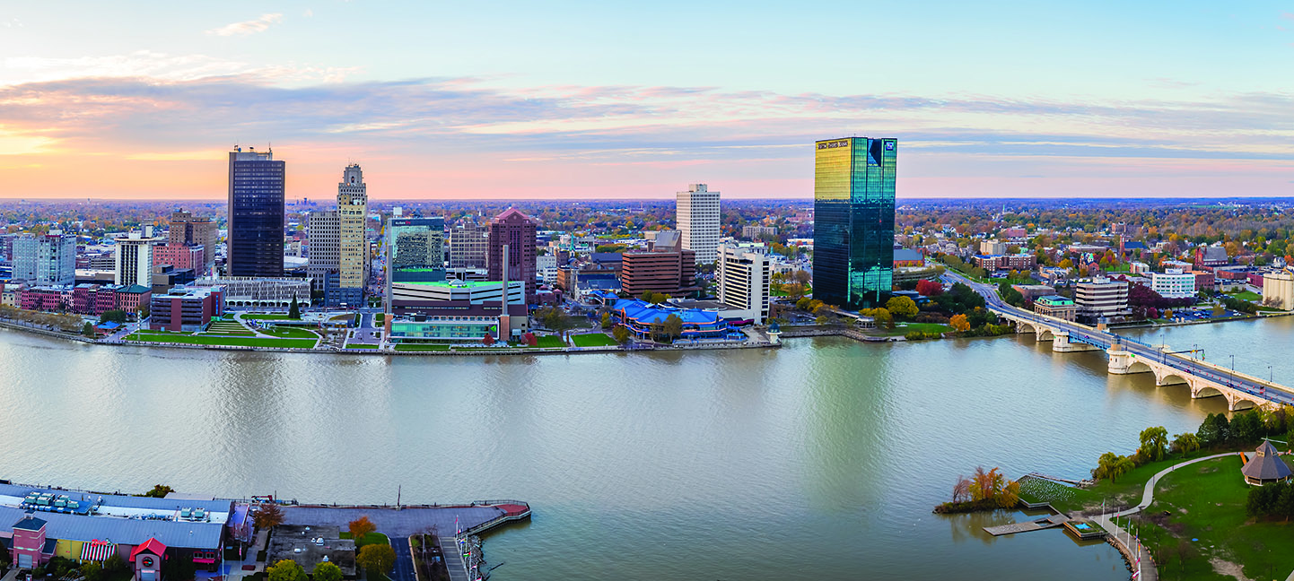

通厄伦(荷兰语:Tongeren,荷兰语发音:[ˈtɔŋərə(n)] (ⓘ);法语:Tongres,法语发音:[tɔ̃ɡʁ];德语:Tongern,德语发音:[ˈtɔŋɐn];林堡语:Tóngere,林堡语发音: [ˈtoŋəʀə])是比利时弗拉芒大区林堡省的一座城市,南与瓦隆大区列日省接壤,通行荷兰语,是弗拉芒社群的一部分,面积87.56平方千米,人口31,142人(2020年1月1日)。
Tongern (niederländisch Tongeren, limburgisch Tóngere, französisch Tongres) ist eine Stadt in der belgischen Provinz Limburg und der niederländischsprachigen Region Flandern. Sie ist die älteste Stadt Belgiens (gegründet um 15 v. Chr.), entstanden aus der römischen Siedlung Aduatuca Tungrorum, die an der Römerstraße von Köln nach Bavay lag, die heute Via Belgica genannt wird und weiter bis nach Bononia führte.
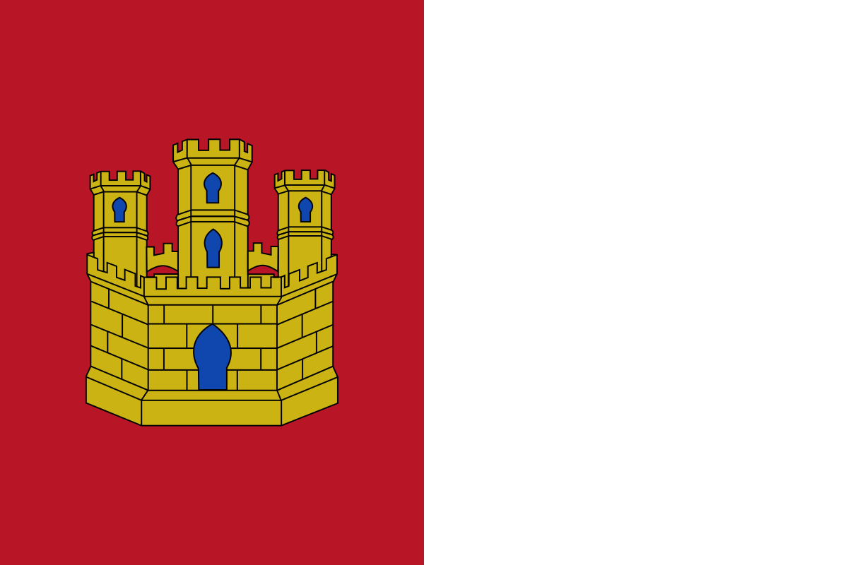 Castilla-La Mancha
 Medieval cities in Europe
 World Heritage
 Ohio-OH
 Kansas-KS