漢德百科全書 | 汉德百科全书
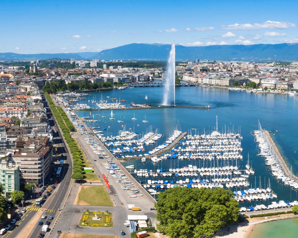
 Switzerland
 Colleges and Universities in Europe
Nobel prize
Colleges and Universities in Europe
Nobel prize
 Nobel Prize in Chemistry
Nobel prize
Nobel Peace Prize
Nobel prize
Nobel Prize in Physics
Nobel prize
Nobel Prize in Physics
Nobel prize
University/Institute
Universities in Switzerland
Nobel Prize in Chemistry
Nobel prize
Nobel Peace Prize
Nobel prize
Nobel Prize in Physics
Nobel prize
Nobel Prize in Physics
Nobel prize
University/Institute
Universities in Switzerland
 Music
Music
 Architecture
 Switzerland
 Sport
(F)UEFA Champions League
UEFA Champions League 2018/19
Group H
UEFA Europa League 2017/18
Group B
UEFA Europa League 2019/20
Group G
Sport
(F)UEFA Champions League
UEFA Champions League 2018/19
Group H
UEFA Europa League 2017/18
Group B
UEFA Europa League 2019/20
Group G

 Religion

 International cities
 Medieval cities in Europe
 World Heritage


Bern 
![]() [bɛrn] (französisch Berne [bɛʁn], italienisch Berna [ˈbɛrna], rätoromanisch Berna?/i, berndeutsch Bärn [b̥æːrn]) ist eine politische Gemeinde in der Schweiz und als Bundesstadt de facto deren Hauptstadt (siehe auch Hauptstadtfrage der Schweiz). Bern ist Hauptort des gleichnamigen Kantons und liegt im Verwaltungskreis Bern-Mittelland dieses Kantons. Die Stadt ist nicht nur Sitz der städtischen und kantonalen, sondern als Bundesstadt auch der eidgenössischen Verwaltung und damit das grösste Verwaltungszentrum der Schweiz.
[bɛrn] (französisch Berne [bɛʁn], italienisch Berna [ˈbɛrna], rätoromanisch Berna?/i, berndeutsch Bärn [b̥æːrn]) ist eine politische Gemeinde in der Schweiz und als Bundesstadt de facto deren Hauptstadt (siehe auch Hauptstadtfrage der Schweiz). Bern ist Hauptort des gleichnamigen Kantons und liegt im Verwaltungskreis Bern-Mittelland dieses Kantons. Die Stadt ist nicht nur Sitz der städtischen und kantonalen, sondern als Bundesstadt auch der eidgenössischen Verwaltung und damit das grösste Verwaltungszentrum der Schweiz.
Die 1191 gegründete Zähringerstadt ist mit ihren charakteristischen Lauben teilweise in ihrer ursprünglichen Form erhalten. Seit 1218 Freie Reichsstadt, trat Bern 1353 der Eidgenossenschaft bei und entwickelte sich bis ins 16. Jahrhundert zum grössten Stadtstaat nördlich der Alpen. 1983 wurde die Berner Altstadt in die Liste des UNESCO-Welterbes aufgenommen.[6]
Die Stadt Bern verfügt über eine Gesamtbevölkerung von 134'794 Einwohnern (Stand 31. Dezember 2020). Nach Zürich, Genf, Basel und Lausanne sowie vor Winterthur gehört sie zu den einwohnerreichsten Gemeinden der Schweiz. In der Agglomeration Bern, zu der 70 Gemeinden gehören, beträgt die ständige Wohnbevölkerung 419'983 Personen (Stand: 2018).[7][8]
Seit Jahren wird Bern mit Zürich und Genf als eine der Städte mit den weltweit höchsten Lebenshaltungskosten gelistet.[9][10]
Die Stadt Bern ist Zentrum der Verwaltungsregion Bern-Mittelland und der Regionalkonferenz Bern-Mittelland mit seiner Teilkonferenz Wirtschaftsraum Bern. Seit längerem bestehen ausserdem Bestrebungen, die Stadt und die Agglomeration als Hauptstadtregion Schweiz noch deutlicher zu positionieren. Mitglieder dort sind die Kantone Bern, Freiburg, Wallis, Neuenburg und Solothurn sowie Städte, Gemeinden und Regionalorganisationen.
伯恩(德语:Bern,[bɛrn] (ⓘ);阿勒曼尼语:Bärn,[b̥æːrn];法语:Berne,[bɛʁn] (ⓘ);义大利语:Berna,[ˈbɛrna];罗曼什语:Berna,[ˈbɛrnɐ] (ⓘ))位于瑞士西半部领土中央偏北之处,为仅次于苏黎世、日内瓦、巴塞尔和洛桑的第五大城,德语区第三大城市,是伯恩州首府,亦是瑞士事实上的中央政府所在地。其旧城区今日已成为联合国教科文组织核定的世界遗产。
伯尔尼(Berne)是瑞士的首都,伯尔尼州首府,位于瑞士高原中央山地,莱茵河支流阿勒河在这里流成一个回环。联邦政府与议会设在此处,各国大使馆及一些国际机构聚集于此。伯 尔尼旧城就建在河曲半岛上,现已扩大到河的两岸,有7座桥梁把两岸旧城区与东岸新城区连接起来。伯尔尼现有人口 15万。气候温和湿润,冬暖夏凉。
伯尔尼更多程度上只能被称为是一座“玲珑的城市”,而不像其他许多国家的首都那样气势辉煌、规模庞大。作为中立国的瑞士处处让人感受到静谧和安详,而伯尔尼则是这种静谧的最佳体现。精 简的结构反映出纯朴的精神,温暖的乡村气息中萦绕着挥之不去的贵族化的高雅韵味,可以说伯尔尼是世界上最美丽的国都,整个城市就是一件玲珑的艺术品。经过了历代巧匠精心制作,那些堂皇的建筑物(中古式、哥德式、巴 罗克式)都神妙的彼此依托,恍若一体,非其他任何地方所能企及。
伯尔尼还是瑞士传统钟表业的中心,许多世界名品都诞生于此,这里是欧洲最大的具有中世纪特色的购物区。
伯尔尼历史
伯尔尼于公元1191年建城,1848年成为瑞士首都。初建伯尔尼的时候,统治者贝尔托德公爵(Berthodv)突发奇想,决定出城去打猎用猎获的第一只野兽作为城名。结果他首先打到了一头熊,从 此伯尔尼的州徽、市徽皆以熊为图案,因而伯尔尼至今仍被称为“熊之城”。它具有中世纪风貌,旧城建筑古朴,街道狭窄。高耸的塔楼、带有走廊的商店和街心竖立的彩色石刻喷泉等都吸引着游客。这座保护完好的古城,已 被联合国教科文组织列为世界文化遗产。(Quelle: trip.sotrip.com)
 Life and Style
 Companies

 Geography
 Auvergne-Rhône-Alpes
 Valle d´Aosta
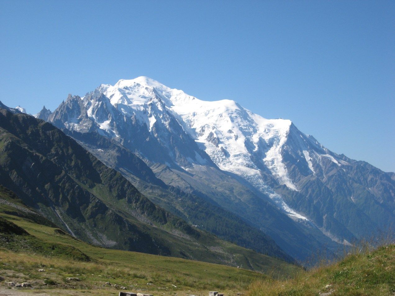
勃朗峰(法语:Mont Blanc,意大利语:Monte Bianco,意为“白色山峰”[1]),是阿尔卑斯山的最高峰,位于法国的上萨瓦省和意大利的瓦莱达奥斯塔大区的交界处。勃朗峰是西欧与欧盟境内的最高峰[2],海拔为4,808.73米[3][4]。勃朗峰于1786年8月8日首次被人类征服。勃朗峰有时也被称为“白色少女”(法语:La Dame blanche)或“白色山峰”(意大利语:Il Bianco)。
勃朗峰附近最有名的两个城镇是意大利瓦莱达奥斯塔大区的库马约尔与法国罗讷-阿尔卑斯大区上萨瓦省的霞慕尼(Chamonix),这里也是第一届冬季奥运会的举办地区。游客可以搭乘缆车上山,路线会经过库尔马耶乌尔与霞慕尼。
白山隧道于1957年开始建造,于1965年完成,连接着法国的霞慕尼及意大利的库马约尔,全长11.6公里,是穿越阿尔卑斯山主要的交通路线。
モンブラン(仏: Mont Blanc 伊: Monte Bianco)は、フランスとイタリアの国境に位置する、ヨーロッパアルプスの最高峰。標高4810.9m。ヨーロッパではロシアのエルブルス山に次ぎ高い山であり、西ヨーロッパでは最高峰である。
Mont Blanc (French: [mɔ̃ blɑ̃]; Italian: Monte Bianco [ˈmonte ˈbjaŋko]; meaning "White Mountain") is the second-highest mountain in Europe after Mount Elbrus. It is the highest mountain in the Alps, rising 4,808 m (15,774 ft) above sea level. It is the eleventh-most prominent peak in the world.[3] The mountain stands in a range called the Graian Alps, between the regions of Aosta Valley, Italy, and Savoie and Haute-Savoie, France. The location of the summit is on the watershed line between the valleys of Ferret and Veny in Italy and the valleys of Montjoie, and Arve in France, on the border between the two countries.
The Mont Blanc massif is popular for outdoor activities like hiking, climbing, trail running and winter sports like skiing, and snowboarding. The most popular route is the Goûter Route, which typically takes two days.
The three towns and their communes which surround Mont Blanc are Courmayeur in Aosta Valley, Italy; and Saint-Gervais-les-Bains and Chamonix in Haute-Savoie, France. The latter town was the site of the first Winter Olympics. A cable car ascends and crosses the mountain range from Courmayeur to Chamonix, through the Col du Géant. The 11.6 km (7 1⁄4-mile) Mont Blanc Tunnel, constructed between 1957 and 1965, runs beneath the mountain and is a major trans-Alpine transport route.
Le mont Blanc (en italien : Monte Bianco), dans le massif du Mont-Blanc, est le point culminant de la chaîne des Alpes. Avec une altitude de 4 809 mètres, il est le plus haut sommet d'Europe occidentale et le sixième sur le plan continental en prenant en compte les montagnes du Caucase, dont l'Elbrouz (5 642 mètres) est le plus haut sommet. Il se situe sur la frontière franco-italienne, entre le département de la Haute-Savoie (en France) et la Vallée d'Aoste (en Italie) ; cette frontière est l'objet d'un litige entre les deux pays.
Le sommet, objet de fascination dans de nombreuses œuvres culturelles, a depuis plusieurs siècles représenté un objectif pour toutes sortes d'aventuriers, depuis sa première ascension en 1786. De nombreux itinéraires fréquentés permettent désormais de le gravir avec une préparation sérieuse. Afin de déterminer son altitude précise et quantifier l'évolution de celle-ci, des géomètres experts font l'ascension périodiquement. La dernière mesure connue (2017) est de 4 808,72 mètres.
Il Monte Bianco (Mont Blanc in francese e in arpitano) è la montagna più alta delle Alpi, d'Italia, di Francia, con i suoi 4.808,72 m di altitudine (ultima misura ufficiale il 13 settembre 2017)[1], e secondo alcune convenzioni, dell'Europa[2][3], da cui il soprannome, a volte usato, di Re delle Alpi[4], condividendo assieme al monte Elbrus nel Caucaso un posto tra le cosiddette Sette Vette del Pianeta.
Posta nel settore delle Alpi Nord-occidentali, lungo la sezione alpina delle Alpi Graie, sulla linea spartiacque tra la Valle d'Aosta (val Veny e val Ferret in Italia) e l'Alta Savoia (valle dell'Arve in Francia), nei territori comunali di Courmayeur[5] e Chamonix, dà il nome all'omonimo massiccio, appartenente alla sottosezione delle Alpi del Monte Bianco. Prevalentemente di natura granitica, irta di guglie e di creste, intagliata da profondi valloni nei quali scorrono numerosi ghiacciai, è considerata una montagna di grande richiamo per l'alpinismo internazionale[6] e, dal punto di vista della storiografia alpinistica, la nascita dell'alpinismo stesso coincide con la data della sua prima ascensione: l'8 agosto 1786[7].
El Mont Blanc o Monte Bianco —orónimo en francés e italiano, respectivamente; traducido al español como ‘Monte Blanco’— es la montaña granítica culminante de los Alpes, con una altitud oficial de 4810 m s. n. m. (metros sobre el nivel del mar) según la última medición de septiembre de 2013.1 Es el punto más elevado de la Unión Europea y uno de los más altos del resto de Europa, superado solo por varias montañas de Rusia y Georgia como el Elbrús (5642 m s. n. m.).3
Rodeado de valles con numerosos glaciares, el Mont Blanc forma parte del macizo homónimo que se extiende entre las demarcaciones del valle de Aosta, en Italia, y de Alta Saboya, en Francia. Las ciudades más pobladas cercanas al Mont Blanc son Chamonix-Mont-Blanc y Saint-Gervais-les-Bains, situadas en Francia, y Courmayeur en Italia.45
La situación de la cima es compartida entre Italia y Francia por un tratado internacional de 1860, aunque desde entonces se mantiene cierta controversia y diferentes fuentes cartográficas atribuyen enteramente la ubicación a uno de los dos países. Así, los mapas del Instituto Geográfico Nacional de Francia incluyen toda la cumbre dentro de las propias fronteras, lo que contrasta con el mapa geográfico del Archivo de Estado de Turín, según el cual la cima es íntegramente italiana.6
Numerosos glaciares se encuentran a su alrededor: al sur los glaciares de Freney, de La Brenva, de Miage, del Mont Blanc y de Brouillard, y al norte, los glaciares de Bossons y de Taconnaz. En 1957 se inició la construcción del túnel de Mont Blanc (se terminó en 1965), que tiene 11,6 km de largo y es una de las mayores rutas de transporte transalpino, ya que une a Italia y Francia.7 El macizo del Mont Blanc es la cuna del alpinismo, cuyas expediciones empezaron hacia el siglo xviii, siendo un destino de referencia en Europa para la práctica del senderismo, el esquí y el snowboarding.
Монбла́н (фр. Mont Blanc, итал. Monte Bianco, букв. «белая гора») — кристаллический массив, высота которого достигает 4810 м (самая высокая точка Европы при условии проведения границы Европы и Азии по северной границе Кавказа). Расположен в Западных Альпах, входящих в горную систему Альпы. Находится на границе Франции и Италии в районах Верхняя Савойя и Курмайор. Высшая точка Альп и Европы, без учёта кавказских пиков. Протяжённость — около 50 км. Площадь оледенения свыше 200 км², крупный ледник Мер-де-Глас. Центр альпинизма, а также горного туризма — вокруг Монблана проходит популярный в Европе пеший туристический маршрут Tour du Mont Blanc.
Под Монбланом проложен автомобильный тоннель длиной в 11,6 км, соединяющий Францию и Италию. Проезд через тоннель платный. Стоимость проезда зависит от стороны въезда, типа транспортного средства и количества поездок.
У западного подножья Монблана, на французской стороне расположен известный горнолыжный курорт Шамони. У южного, на итальянской стороне — Курмайор.
 Eat and Drink
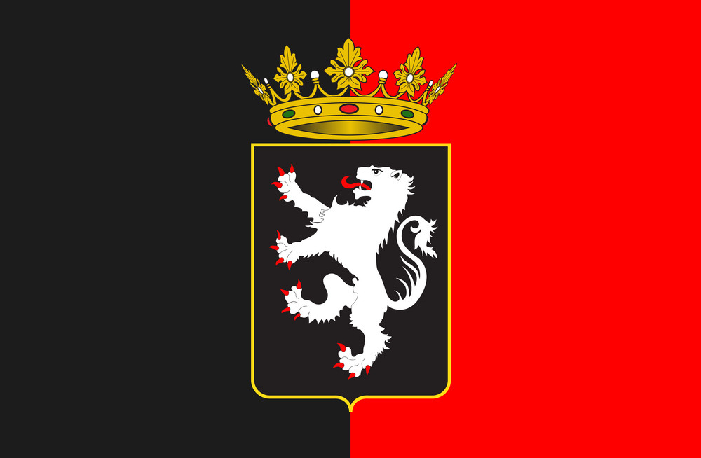
 Baden-Wuerttemberg
 Vorarlberg
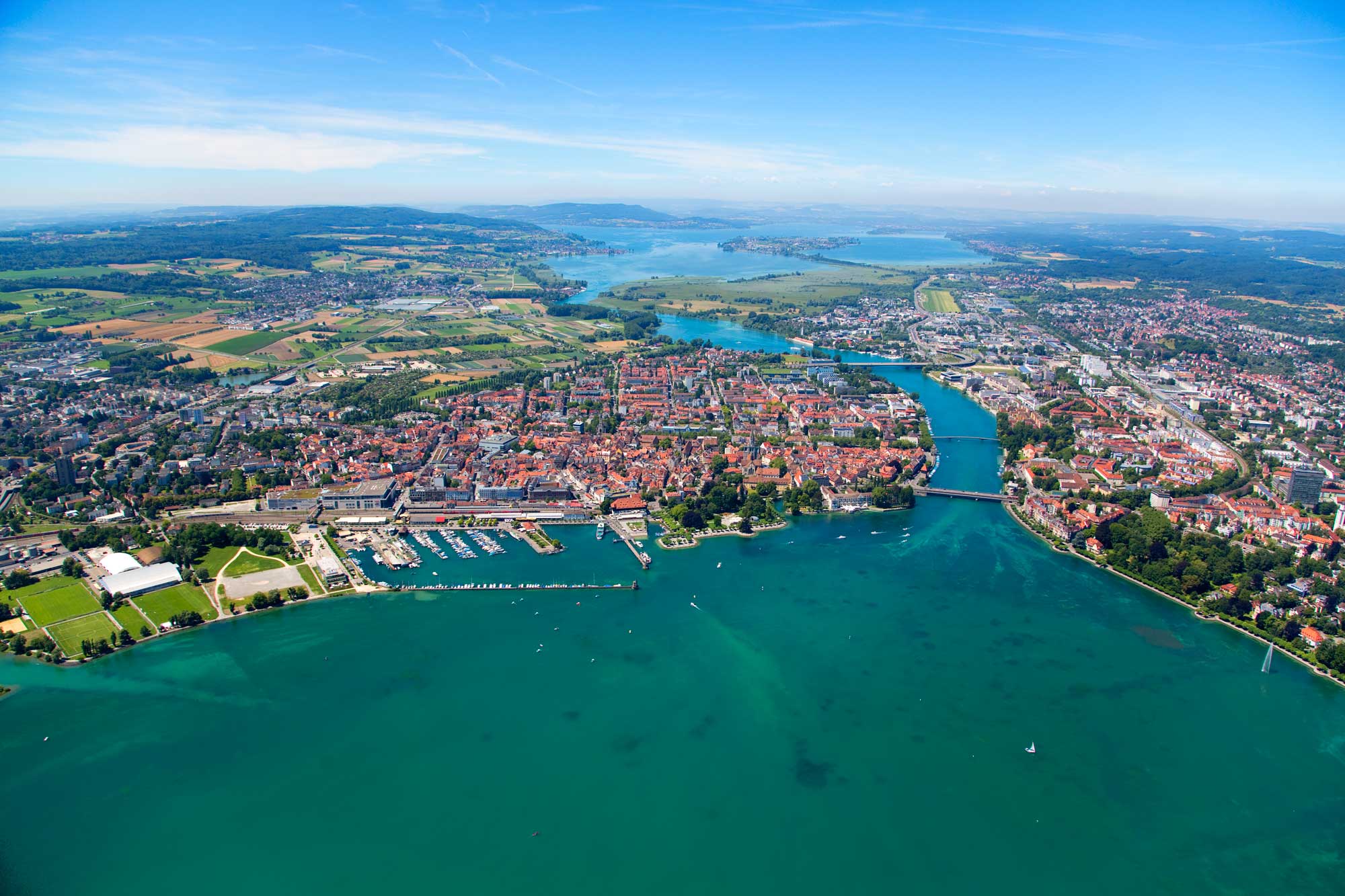

Die Bezeichnung Bodensee steht für zwei Seen und einen sie verbindenden Flussabschnitt des Rheins, nämlich den Obersee (auch alleine Bodensee genannt), den Seerhein und den Untersee. Der Bodensee liegt im Bodenseebecken, das Teil des nördlichen Alpenvorlandes ist, und wird vom Rhein durchflossen.
Dieser Artikel behandelt neben dem Bodensee selbst auch die umgebende Bodenseeregion, die sich je nach räumlicher Definition weit ins Hinterland erstreckt.
Drei Staaten haben Anteil an Bodensee und Bodenseeregion: Deutschland, Österreich und die Schweiz. Während es im Untersee eine anerkannte Grenzziehung zwischen Deutschland und der Schweiz gibt, wurde von den Anrainerstaaten des Obersees nie einvernehmlich eine Grenze festgelegt.
博登湖地处瑞士、奥地利、德三国交界处,是德国境内最大的湖泊,也是风景优美的旅游地。 旅游者可从岛城林道出发游览博登湖。在林道你首先看到的是残堡曼格塔。哥特式建筑旧市政厅,罗马式建筑圣彼得教堂、富藏美术作品的卡瓦尚之屋等。在距林道不远的奥地利城市布雷根茨,每年7,8月间的歌剧节非常有名。在与瑞士交界处的罗尔沙赫,当年玉米市场的遗迹赫然在目。圣加仑大修道院藏有丰富的图书。康斯坦茨有博登湖畔大学城之称,其尼德堡老区街道窄小曲折又错综复杂,如同迷宫。沿莱茵河南下到博登湖西岸,可以欣赏莱茵河道从150米渐次降低 21米的壮观景象。湖中赖谢瑙岛有堤与德国本土相连,是德国最重要的园艺中心。梅尔斯堡是德国境内保存最完善的中世纪城市,这里有德国最古老的城堡之一古堡,还有以壮丽堂皇的楼梯而闻名的新堡。
博登湖(德语:Bodensee),也称康斯坦茨湖(英语:Lake Constance),位于瑞士、奥地利和德国三国交界处,由三国共同管理,湖区景色优美,风景迷人。博登湖由三部分:上湖(Obersee)、下湖(Untersee)和Seerhein组成。
ボーデン湖(ドイツ語: Bodensee)はドイツ、オーストリア、スイスの国境に位置する湖。コンスタンツ湖とも称される[1]。アルプス地方ではレマン湖についで第二の規模で、面積は約536平方キロ[2]。ボーデン湖の湖畔には、コンスタンツ、フリードリヒスハーフェン、リンダウ(以上はドイツ)や、ブレゲンツ(オーストリア)などが位置しており、多くの観光客を集めている。湖畔でブドウが栽培されており、沿岸地域ではワイン生産が盛んである。ボーデン湖にはライン川が流れ込んでおり、ここからさらにドイツへと流出していく。ボーデン湖を出て間もなく激流となり、ライン滝へと一気に流れ込む。ライン川への流出とは別に、ボーデン湖の水はドイツで有効に活用されている。パイプラインを通じてシュトゥットガルトなどの工業都市へと運ばれ、工業用水などに用いられる。
湖にうかぶ島、マイナウ島は島全体が庭園となっており、花の島ともよばれる。マイナウ城や様々な庭園が観光地となっている。同じく湖に浮かぶライヒェナウ島は世界遺産に登録されている。
Lake Constance (German: Bodensee) is a lake on the Rhine at the northern foot of the Alps, and consists of three bodies of water: the Obersee or Upper Lake Constance, the Untersee or Lower Lake Constance, and a connecting stretch of the Rhine, called the Seerhein. These waterbodies lie within the Lake Constance Basin (Bodenseebecken), which is part of the Alpine Foreland and through which the Rhine flows.[2][3]
The lake is situated where Germany, Switzerland, and Austria meet. Its shorelines lie in the German states of Bavaria and Baden-Württemberg, the Swiss cantons of St. Gallen, Thurgau, and Schaffhausen, and the Austrian state of Vorarlberg. The Rhine flows into the lake from the south, with its original course forming the Austro-Swiss border, and has its outflow on the "Lower Lake" where — except for Schaffhausen — it forms the German-Swiss border until the city of Basel.[4][5]
The most populous cities on the lake are Constance (German: Konstanz), Friedrichshafen, Radolfzell am Bodensee, Bregenz, and Lindau (Bodensee). The largest islands are Reichenau in the Lower Lake, and Lindau and Mainau in the Upper Lake.
Le lac de Constance (Bodensee en allemand) est un ensemble de plusieurs plans d'eau situés au nord des Alpes, à la frontière entre l'Allemagne, la Suisse et l'Autriche, alimenté principalement par le Rhin.
Il lago di Costanza, o lago Bodanico, (in tedesco Bodensee, conosciuto anche come Schwäbisches Meer, Lacus Venetus per i Romani) è un lago sul fiume Reno, posto al confine tra Germania, Svizzera e Austria.
El lago de Constanza (en alemán, Bodensee) está rodeado por Alemania, Austria y Suiza. Su superficie es de 536 km² y el nivel medio está a 395 m de altitud. El río Rin entra en el lago por el sureste cerca de Bregenz (Austria) y sale del lago por el oeste en Stein am Rhein (Suiza).1
En su área de influencia viven alrededor de 2,5 millones de personas, mayoritariamente de habla alemana. Constanza es la ciudad más grande, a orillas del lago y con más de 83 000 habitantes. Atravesando esta ciudad, el Rin sale del lago, dirigiéndose al mar del Norte. Algunos lugares destacados en sus alrededores son Friedrichshafen, Bregenz, Lindau y Meersburg. En el Lago de Constanza termina la ruta turística arquitectónica Ruta alemana de arquitectura de entramados.
Бо́денское о́зеро (нем. Bodensee; устар. Констанцское озеро[4]) — озеро, находящееся в Предальпах на границе Германии, Швейцарии и Австрии[5]. Говоря о Боденском озере, имеют в виду три водоёма: Верхнее озеро (нем. Obersee), Нижнее озеро (Untersee) и Рейн (Seerhein), который соединяет два этих водоёма.
 Ski vacation

Die Landschaft Davos ([daˈfoːs][2] oder [daˈvoːs][3], in der walserdeutschen Ortsmundart Tafaas [taˈfaːs],[4][5] auch Tafaa [taˈfaː],[6] rätoromanisch Tavau?/i, italienisch Tavate[7]) umfasst beinah das gesamte Landwassertal im Schweizer Kanton Graubünden. Die politische Gemeinde mit zahlreichen Siedlungen besteht aus den sechs Fraktionsgemeinden Davos Dorf, Davos Platz, Davos Frauenkirch, Davos Glaris, Davos Monstein und Davos Wiesen der Region Prättigau/Davos. Seit Mitte des 19. Jahrhunderts entwickelte sich Davos zu einem bekannten Luftkurort und Wintersportgebiet; die Bevölkerung stieg von 1680 Einwohnern im Jahr 1850 auf über 11'000 im Jahr 1930 an.
达沃斯位于海拔1560米的高处,作为欧洲最高的度假胜地及会议中心,而名闻遐迩。她座落在一片未受过污染,未遭遇破环的休闲度假区的中央,兼具有纯净的自然,如画的风光,乡村的风味和城市的生趣。在达沃斯,各种活动不受冬季或是夏季的限制。
冬 季度假者去那儿,保证有极佳的积雪,有七个质量与条件均无与伦比的滑雪场区供您选择。 交通便捷。班车频繁,在达沃斯与克洛斯特尔斯Klostets两个度假区之闲穿梭运客。帕塞恩Parsenn雪场的滑雪道在海拔3000米以上,自是享誉 世界,应是所有滑雪场区中的极品场地。越野滑雪,单板滑雪,传统溜冰,花样滑冰等是最令人畅快的冬季活动,即使仅仅在达沃斯周围溜达,呼吸著新鲜洁净的空 气,也已够舒心畅怀了。在夏季,您可以在达沃斯四周的山闲漫步,骑自行车漫游,打高尔夫球,或者,在这儿,在欧洲最美妙迷人的山区湖泊中作水中运动。明亮 舒适的山地火车与索道车带您到海拔2844米高的威斯弗卢峰Weissfluhch,或者带您到雅各伯霍仑峰Jakobshorn,力纳霍仑峰 Rinerhorn,匹萨峰 Pischa,玛德利萨峰Madrisa,与高契纳峰Gotschna。所有这些峰峦山脉组合成一个庄丽恢宏的大景观,一幅 群峰争比高的全景图。舒适雅致的山闲餐馆向您提供地方风味的特色餐饮,令您大饱口福。达沃斯也是一个疗养胜地。当然,现今那些疗养院,其专业内容已不再是 肺痨病了,而是长于治疗和对付那些过敏症,呼吸道疾病,或皮肤科病患。(Quelle:http://www.trip8848.com/)
达沃斯 (德语、法语:Davos;意大利语:Tavate;罗曼什语:Tavau)是瑞士东部的一个城镇,隶属格劳宾登州。2003年12月人口为10,998人。以冬季运动和每年在那里召开的达沃斯论坛知名。达沃斯(Davos)位于瑞士东南部格里松斯地区,靠近奥地利边境。这个小镇举世闻名,倒不全是因为它是个滑雪胜地,而是因为一年一度的世界经济论坛在这里举行,相形之下,“欧洲最大的高山滑雪场”的头衔就不那么引人注目了。达沃斯(Davos)的滑雪场分为七个部分,其中帕森地区(Parsenn)是最大也是最受欢迎的滑雪场;毗邻的克罗斯特滑雪场(Klosters)是英国皇室的最爱。
ダボス(ダヴォス[2]、ダヴォース[3][4]、ドイツ語: Davos [daˈvoːs, daˈfoːs]、ヴァリス語: Tafaas, Tafaa [taˈfaːs, taˈfaː]、ロマンシュ語: Tavau、ロンバルド語: Tavo、イタリア語旧称: Tavate)は、スイス・グラウビュンデン州にある基礎自治体である。国際的に著名な企業人、政治家、学者などが一堂に会し世界の諸問題を討議する「世界経済フォーラム」(通称「ダボス会議」)が毎年開催されることで有名な、山麓のリゾート・タウンである[5]。人口は11,109人(2015年12月)[1]、面積は283.98平方キロメートル、標高は1560メートル。
Davos (German pronunciation [daˈfoːs][3] or [daˈvoːs];[4] Romansh:  Tavau (help·info), archaic Italian: Tavate) is an Alpine town, and a municipality in the Prättigau/Davos Region in the canton of Graubünden, Switzerland. It has a permanent population of 11,060 (2016).[2] Davos is located on the river Landwasser, in the Rhaetian Alps, between the Plessur and Albula Range at 1,560 m (5,120 ft) above sea level.
The former Alpine resort village consists of two parts: Davos Dorf (lit.: "village") to the northeast towards Klosters and further down through the Prättigau to Landquart, and Davos Platz (lit.: "place") to the southwest, which opens into the valley of the Landwasser and eventually leads to Filisur. During summer season the Flüela Pass leads south-east into the Lower Engadine.
Davos is host to the World Economic Forum (WEF), an annual meeting of global political and business elites (often referred to simply as Davos) and the home of one of Switzerland's biggest ski resorts. At the end of every year it serves as the site of the annual Spengler Cup ice hockey tournament, hosted by the HC Davos local hockey team.
Davos (prononcé en allemand : [daˈvoːs]3, walser dialecte local : Tafaas [ta'fas], romanche : Tavau, italien : Tavate) est une commune du canton des Grisons, située dans la haute vallée de la rivière Landwasser dans la région de Prättigau/Davos, dans l'est de la Suisse. La ville est connue pour accueillir chaque année le forum économique mondial (World Economic Forum, WEF), réunion des dirigeants de la planète et des élites économiques. Davos est aussi connue en tant que station de sports d'hiver, et organise des événements tels que la Coupe Spengler en hockey sur glace, à laquelle l'équipe locale, le HC Davos participe.
Davos (toponimo tedesco, pronuncia [daˈvoːs][1]; localmente Tafaas[senza fonte], in romancio Tavau, in italiano Tavate[2], desueto) è un comune svizzero di 11.060 abitanti del Canton Grigioni, nella regione Prettigovia/Davos. Il 1º gennaio 2009 ha inglobato il comune soppresso di Wiesen, diventando il più esteso del cantone e il secondo per estensione di tutta la Svizzera[3]; ha lo status di città.
La località è nota in tutto il mondo perché ospita l'annuale Forum economico mondiale, un incontro fra i principali dirigenti politici e i principali esponenti economici, ed è rinomata per gli sport invernali.
Davos (en alemán se pronuncia Davós [código AFI: da ˈvoːs]; toponimia en romanche: Tavau, en italiano: Tavate) es una ciudad y comuna Suiza del cantón de los Grisones, situada en el distrito de Prettigovia/Davos, círculo de Davos.
La localidad es conocida por ser la sede del Foro Económico Mundial (World Economic Forum), también llamado 'Foro de Davos', en el que se reúnen desde 1991 los principales líderes empresariales, así como líderes políticos internacionales, periodistas e intelectuales selectos, a efectos de analizar los problemas más apremiantes que afronta el mundo, y entre ellos, la salud y el medio ambiente.
Este lugar también es muy conocido por su estación de esquí.
Даво́с (на местном диалекте — алем. Tafaas, нем. и фр. Davos, итал. Davos, редко — Tavate, ромш. Tavau) — город в восточной Швейцарии, в кантоне Граубюнден, на реке Ландвассер. История города началась с того, что ещё в XIX веке доктора признали микроклимат высокогорной долины полезным для больных лёгочными заболеваниями. Лечившийся здесь Роберт Луис Стивенсон написал в Давосе роман «Остров сокровищ». Также город является местом действия романа «Волшебная гора» немецкого писателя Томаса Манна.
 Energy resource